IntrepidXJ
ADVENTR
- Joined
- Jan 17, 2012
- Messages
- 3,493
September 10-11, 2011
The Original Trip Report on ADVENTR.CO
The White Rim Trail seems to be the one I just can’t complete. I’ve been wanting to for years, but it just never seems to happen. The first big issue for me is getting a permit to camp along the trail (yes, I know I could probably get around the full trail in a day if I wanted, but I would prefer to enjoy it and not rush through it). I dislike planning my weekend trips too far in advance, so in the past I have always just never bothered to try to get a permit. Finally, last year I decided I really was going to try and get a permit so that I could drive the trail near the end of the year. Unfortunately, a storm managed to wash out the Mineral Bottom switchbacks making a complete loop impossible for a while. Once they repaired the switchbacks earlier this year I actually managed to reserve a permit for September. Who knew that the Green River would flood for much of the spring and summer and the road would again be closed? I was hoping Canyonlands would open the road right before our trip this last weekend, but thanks to another storm causing some damage to the switchbacks again on Friday, it just wasn’t in the cards this time. We decided to drive to our campsite at Murphy Hogback on Saturday and then drive back out the same way on Sunday. Even though we didn’t get to complete the full loop, we had a great time and am glad we still went. I guess there’s always next year to try again! On a side note, the park opened up the complete loop again on Tuesday…..we were just a few days too early….oh well!
Maybe you’ll be pleasantly surprised to find out that there is not going to be any rock art photos in this trip report! It was actually kind of nice to get back into taking photos of the landscape and my Jeep. Enjoy the photos!
A few of the switchbacks on the Shafer Trail that take you down to the White Rim from the Island in the Sky.
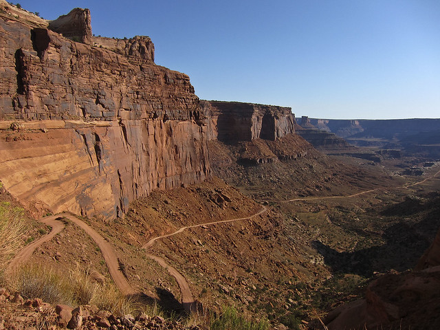
Shafer Trail by IntrepidXJ, on Flickr
We stopped at the Colorado River Overlook across from the The Gooseneck.
Colorado River Overlook by IntrepidXJ, on Flickr
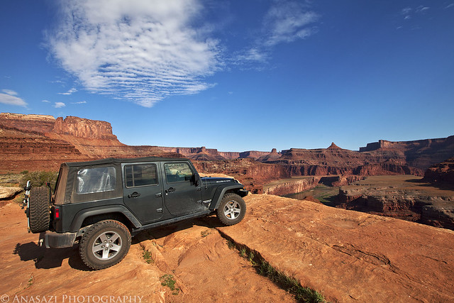
My Jeep on the White Rim Trail headed towards the Island in the Sky.
White Rim Trail by IntrepidXJ, on Flickr
Following the road down towards Airport Tower.
Descending Towards the Airport by IntrepidXJ, on Flickr
This road would be much shorter if it didn’t have to avoid many deep canyons along the route. Here it loops around the head of Lathrop Canyon.
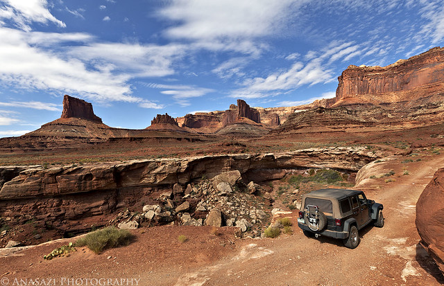
Head of Lathrop by IntrepidXJ, on Flickr
We took the side trip down Lathrop Canyon to the Colorado River. We saw no one on the river while we were there. I’d love to float this section of the river in the future!
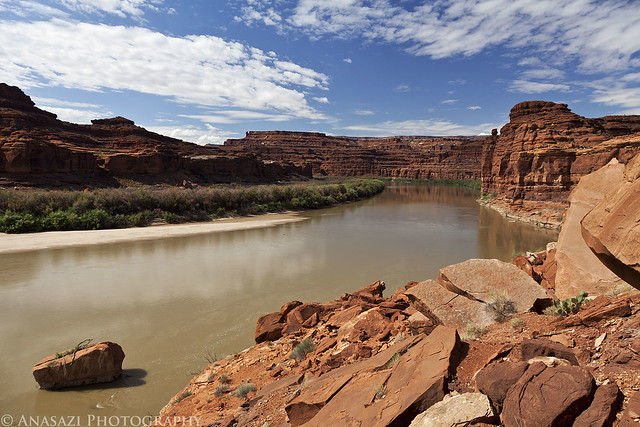
Colorado River by IntrepidXJ, on Flickr
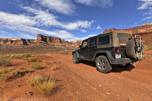
Back at the signed intersection for Lathrop Canyon and the White Rim.
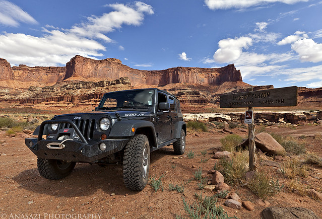
Lathrop Canyon Intersection by IntrepidXJ, on Flickr
Skirting around another deep canyon cut into the White Rim. Washer Woman Arch and Monster Tower can be seen in the distance. We also spotted Mesa Arch from the trail (not visible in any photos I have posted) which looked tiny from below.
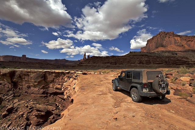
On the Edge by IntrepidXJ, on Flickr
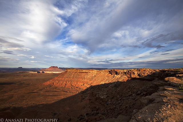
View down into a deep chasm with the Island in the Sky in the background.
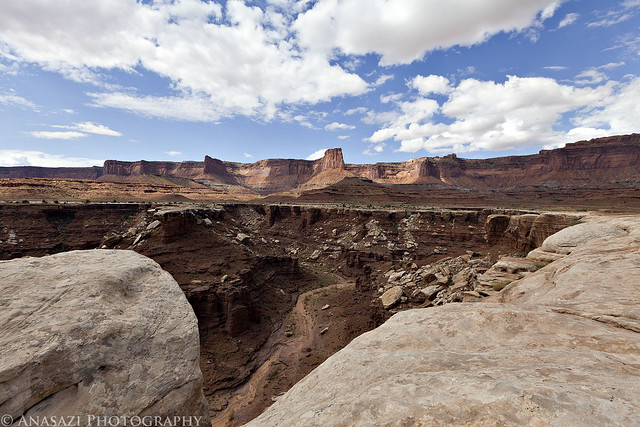
White Rim View by IntrepidXJ, on Flickr
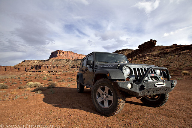
After we got up to our campsite on Murphy Hogback and setup camp we still had plenty of daylight left, so we decided to continue driving to the Candlestick campsite and then turned around. Looking ahead in this photo you can see the top of the Turks Head which is in a meander of the Green River.
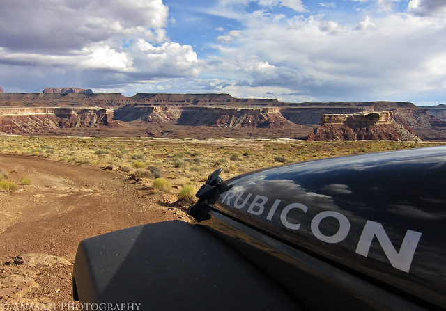
Rubicon by IntrepidXJ, on Flickr
On our way back to camp again. Nice lighting on the Island in the Sky in the background.
Island in the Sky by IntrepidXJ, on Flickr
How do you know when you’ve found a great campsite?
Great Campsite by IntrepidXJ, on Flickr
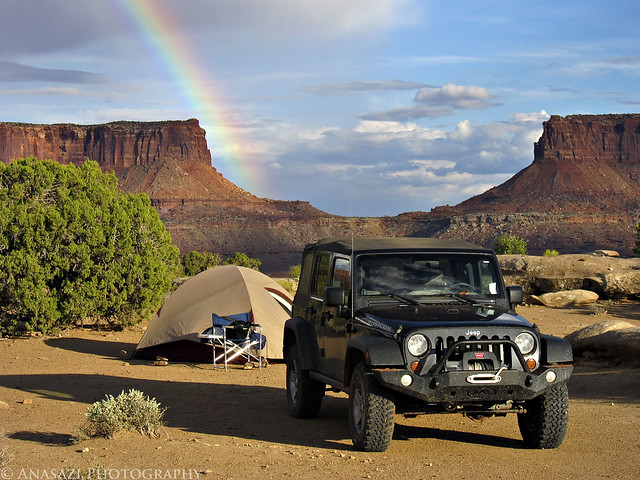
Another view of the rainbow over the Island in the Sky.
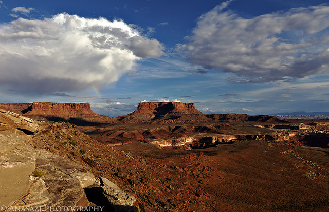
Rainbow Over the Island by IntrepidXJ, on Flickr
A view from Murphy Hogback from near our campsite.
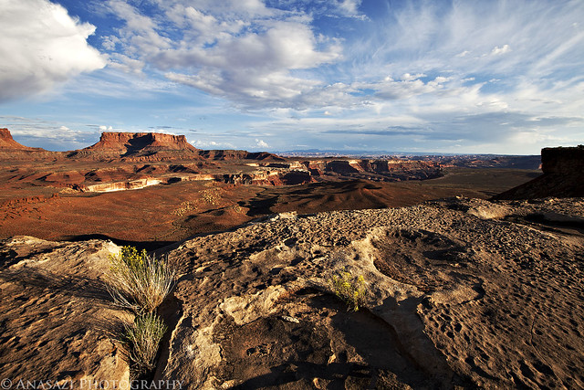
Murphy View by IntrepidXJ, on Flickr
A view of the Green River peeking out from between the canyon walls as the sun sets.
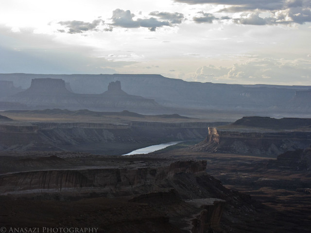
Green River View by IntrepidXJ, on Flickr
The sun dips below the horizon over the Green River.
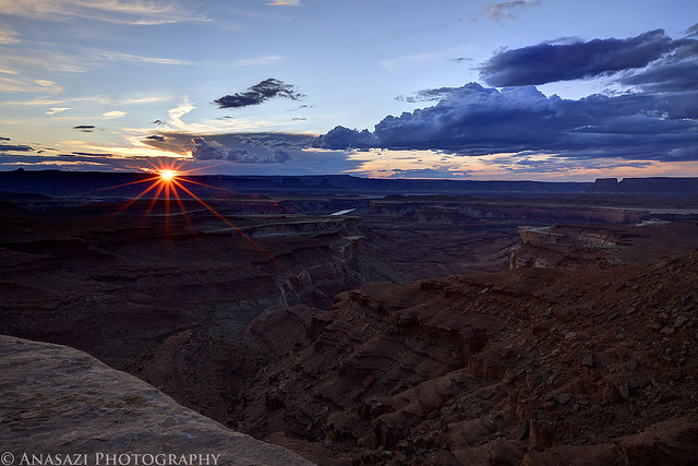
Green River Sunset by IntrepidXJ, on Flickr
The weather was perfect overnight. I slept great! The following morning I got up just in time to catch the sun rise over the Island in the Sky.

White Rim Sunrise by IntrepidXJ, on Flickr
The Murphy Hogback in early morning light. The Maze in the distance. We were able to see Standing Rock and Chimney Rock over in the Maze District which reminded me of our great trip in April over there. I need to get back soon!
Murphy Hogback by IntrepidXJ, on Flickr
Heading down off the hogback and starting our way back home.
Off the Hogback by IntrepidXJ, on Flickr
The intersection that heads to the White Crack. We had driven out there on Saturday and hiked out to the end.
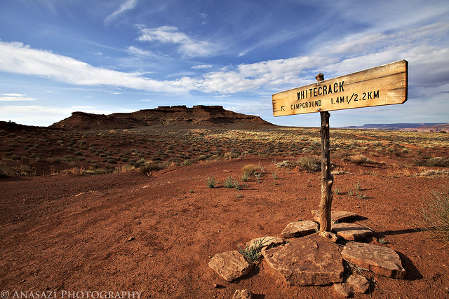
White Crack by IntrepidXJ, on Flickr
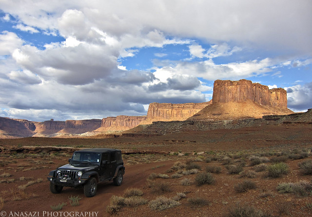
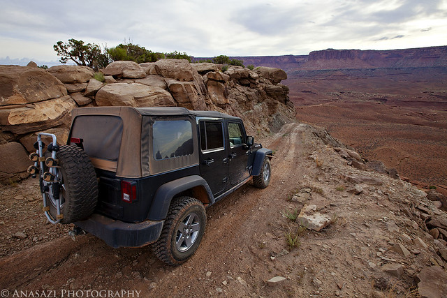
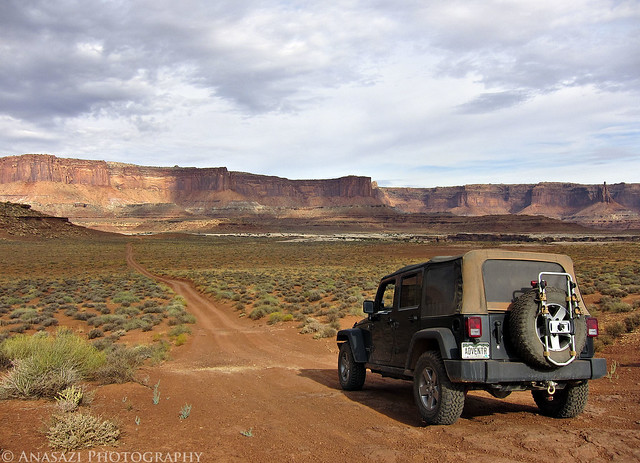
Just another photo of my Jeep on the White Rim.
Jeep On the White Rim by IntrepidXJ, on Flickr
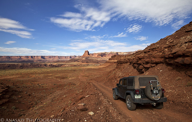
The long road back home.
Headed Back by IntrepidXJ, on Flickr
>> Half the White Rim Trail Photo Gallery
The Original Trip Report on ADVENTR.CO
The White Rim Trail seems to be the one I just can’t complete. I’ve been wanting to for years, but it just never seems to happen. The first big issue for me is getting a permit to camp along the trail (yes, I know I could probably get around the full trail in a day if I wanted, but I would prefer to enjoy it and not rush through it). I dislike planning my weekend trips too far in advance, so in the past I have always just never bothered to try to get a permit. Finally, last year I decided I really was going to try and get a permit so that I could drive the trail near the end of the year. Unfortunately, a storm managed to wash out the Mineral Bottom switchbacks making a complete loop impossible for a while. Once they repaired the switchbacks earlier this year I actually managed to reserve a permit for September. Who knew that the Green River would flood for much of the spring and summer and the road would again be closed? I was hoping Canyonlands would open the road right before our trip this last weekend, but thanks to another storm causing some damage to the switchbacks again on Friday, it just wasn’t in the cards this time. We decided to drive to our campsite at Murphy Hogback on Saturday and then drive back out the same way on Sunday. Even though we didn’t get to complete the full loop, we had a great time and am glad we still went. I guess there’s always next year to try again! On a side note, the park opened up the complete loop again on Tuesday…..we were just a few days too early….oh well!
Maybe you’ll be pleasantly surprised to find out that there is not going to be any rock art photos in this trip report! It was actually kind of nice to get back into taking photos of the landscape and my Jeep. Enjoy the photos!
A few of the switchbacks on the Shafer Trail that take you down to the White Rim from the Island in the Sky.
Shafer Trail by IntrepidXJ, on Flickr
We stopped at the Colorado River Overlook across from the The Gooseneck.
Colorado River Overlook by IntrepidXJ, on Flickr
My Jeep on the White Rim Trail headed towards the Island in the Sky.
White Rim Trail by IntrepidXJ, on Flickr
Following the road down towards Airport Tower.
Descending Towards the Airport by IntrepidXJ, on Flickr
This road would be much shorter if it didn’t have to avoid many deep canyons along the route. Here it loops around the head of Lathrop Canyon.
Head of Lathrop by IntrepidXJ, on Flickr
We took the side trip down Lathrop Canyon to the Colorado River. We saw no one on the river while we were there. I’d love to float this section of the river in the future!
Colorado River by IntrepidXJ, on Flickr
Back at the signed intersection for Lathrop Canyon and the White Rim.
Lathrop Canyon Intersection by IntrepidXJ, on Flickr
Skirting around another deep canyon cut into the White Rim. Washer Woman Arch and Monster Tower can be seen in the distance. We also spotted Mesa Arch from the trail (not visible in any photos I have posted) which looked tiny from below.
On the Edge by IntrepidXJ, on Flickr
View down into a deep chasm with the Island in the Sky in the background.
White Rim View by IntrepidXJ, on Flickr
After we got up to our campsite on Murphy Hogback and setup camp we still had plenty of daylight left, so we decided to continue driving to the Candlestick campsite and then turned around. Looking ahead in this photo you can see the top of the Turks Head which is in a meander of the Green River.
Rubicon by IntrepidXJ, on Flickr
On our way back to camp again. Nice lighting on the Island in the Sky in the background.
Island in the Sky by IntrepidXJ, on Flickr
How do you know when you’ve found a great campsite?
Great Campsite by IntrepidXJ, on Flickr
Another view of the rainbow over the Island in the Sky.
Rainbow Over the Island by IntrepidXJ, on Flickr
A view from Murphy Hogback from near our campsite.
Murphy View by IntrepidXJ, on Flickr
A view of the Green River peeking out from between the canyon walls as the sun sets.
Green River View by IntrepidXJ, on Flickr
The sun dips below the horizon over the Green River.
Green River Sunset by IntrepidXJ, on Flickr
The weather was perfect overnight. I slept great! The following morning I got up just in time to catch the sun rise over the Island in the Sky.
White Rim Sunrise by IntrepidXJ, on Flickr
The Murphy Hogback in early morning light. The Maze in the distance. We were able to see Standing Rock and Chimney Rock over in the Maze District which reminded me of our great trip in April over there. I need to get back soon!
Murphy Hogback by IntrepidXJ, on Flickr
Heading down off the hogback and starting our way back home.
Off the Hogback by IntrepidXJ, on Flickr
The intersection that heads to the White Crack. We had driven out there on Saturday and hiked out to the end.
White Crack by IntrepidXJ, on Flickr
Just another photo of my Jeep on the White Rim.
Jeep On the White Rim by IntrepidXJ, on Flickr
The long road back home.
Headed Back by IntrepidXJ, on Flickr
>> Half the White Rim Trail Photo Gallery
")