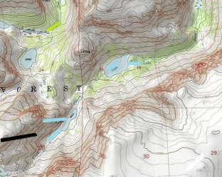
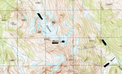
Guess the spot: Maps Edition

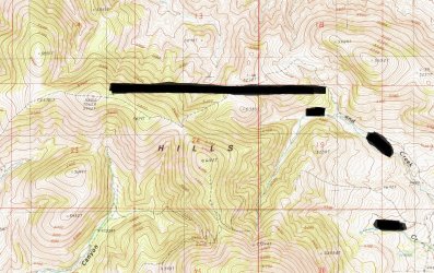
Looks like Steer Creek and Snake River in northern NE.
You got it. There's some interesting hiking in the public areas near that confluence. Very much different than what you usually see on a site like this, but a very fascinating environment.
 
You got it. There's some interesting hiking in the public areas near that confluence. Very much different than what you usually see on a site like this, but a very fascinating environment.
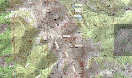
The aerial view of this location looked very different from what I was expecting, based on the topo.

Name one of the prominent peaks shown near the middle.Screenshot 2023-12-08 14.23.59.png
 
Ruby Dome. The Rubies are something I always plan to do, but never actually end up doing.

Because I'm a dorky hiker, I'm obligated to point out that the Ruby Crest Trail is a National Recreation Trail, not a National Scenic Trail. NST's are individually designated by an act of Congress and there are only 11 of them (AT, PCT, CDT, Pacific Northwest, Arizona, Florida, Natchez Trace, New England, Ice Age, North Country, Potomac Heritage).

By contrast, the Secretary of the Interior has the authority to designate National Recreation Trails. There are dozens (hundreds?) of them.
Apologies, you’re correct this is adjacent to a National Recreation Trail rather than a NST. The Rubys are an amazing range, but not quite what I was looking for.
 
A hint: North of Nebraska
 
Bumping this one.... I had to go re-find my spot because I forgot what it was. Between Nebraska and Canada.
 
Similar threads
Thread starter Title Forum Replies Date
Outdoor_Fool The value of the various Guess the Spot threads General Discussion 6
wsp_scott NYTimes article: Guess the spot saves someone's life General Discussion 1
C Guess the Spot: somewhere in Southern Utah General Discussion 4
JDWalters Guess the Spot: Eastern US Edition General Discussion 515
LarryBoy Guess the Spot: Trip Reports Edition Hiking & Camping 5
balzaccom Guess the Spot--DIY version General Discussion 33
Ben Guess the spot: Utah Edition General Discussion 6324
Artemus Guess the Spot: International Edition General Discussion 283
Jammer Guess the Spot (not where you think) General Discussion 10
Backcountry Post Guess the spot General Discussion 7683
Perry Can You Guess Where The Uintas Are? General Discussion 5
J Identify the spot Utah: I don't know where it is General Discussion 2
Happyidiot Looking for camping spot close to Denver. General Discussion 2
Jammer Havasu Falls Extra Spot General Discussion 3
Nick Spot X Gear 27
SKLund Sticking with SPOT Gear 0
Ross Unofficial Where’s The Spot General Discussion 0
Perry Good Deal on a Spot Gen 3 Gear 5
Jammer Spot/InReach for May? Trip Planning 7
Bridgette Good camping spot in the Uintas with 4WD Trip Planning 0
jonmessina Spot Tracker Rental? Trip Planning 1
uintahiker The bloodiest spot in Arizona Hiking & Camping 0
Jammer InReach vs Spot Messenger 2013 Gear 32
wnorton Do you use Spot Connect or DeLorme InReach? Gear 6
Nurrgle Good car camping spot in the Uintas General Discussion 9
Nick SPOT Connect Gear 2
F Maps for the Bob Marshall Wilderness Resource Discussions 3
U Funny experience with Maps on iPad Everything Else 1
westy NW Wyoming Maps Trip Planning 13
T Findings while searching Google maps General Discussion 9
TrektheWorld Gazetteer Maps Gear 4
Mike Jones Who uses paper maps? General Discussion 42
Wanderlust073 Black Ridge Canyons Wilderness / Rattlesnake Canyon maps Trip Planning 6
Jackson Google Maps 3D Detail General Discussion 4
isleroyaleguy White Clouds maps? Trip Planning 4
Mike Jones Built a Custom Map Board for protecting my maps while hiking Gear 9
Bob Create Maps/Routes for Android Resource Discussions 1
Backcountry Post Embedding CalTopo Maps Questions, Suggestions & Support 23
andyjaggy Printing Maps General Discussion 13
Mike K Maps on your phone (cheap or free) General Discussion 25
Absarokanaut NOAA June, July, and August Seasonal Outlook Maps General Discussion 16
steve Google Maps Engine Question on windows 8.1 laptop with USB gps General Discussion 0
uintahiker Google Maps vs KML file embed General Discussion 2
Nick New Google Maps Engine SUCKS General Discussion 12
baltocharlie Maps for Spring trip Trip Planning 17
Waynee-ack Maps? General Discussion 4
Backcountry Post Embedding Maps Questions, Suggestions & Support 32
Nick Embedding Google Maps Questions, Suggestions & Support 0

Similar threads

Back
Top