- Joined
- Feb 15, 2020
- Messages
- 580
After returning from Idaho/Wyoming with the family after Memorial Day weekend, we passed through the Gros Ventre Wilderness and stopped for a picnic/playtime for the boys. It reminded me of a trip I'd planned for last year, but ended up replacing with a local option. I'd always intended it for an early season trip and I had a weekend available, so I decided I'd give it a shot this year. I posted a thread on the Meet Up forum and was fortunate to have @travel2walk join me. It's always a bit interesting meeting a hiking partner for the first time at the trailhead, but I thought it was a great fit and had a blast hiking with him. He has more/better pictures than me, so if he posts a trip report definitely check it out.
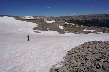
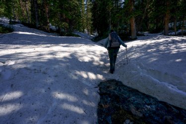
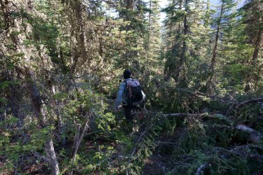
Being an early season trip, there were some associated challenges. There was a decent amount of snow at higher elevations, but - outside of the forested areas - it was high quality and easy to traverse. The far more significant challenge was the significant number of large blowdowns - compounded by persistent snow - throughout the northeastern side of our route. I'd known going in that at this time of year route-finding would be challenging in some places and was not disappointed on that account, though some areas proved easier and some proved more difficult than expected. We were fortunate to have phenomenal weather overall - my only complaint being that the sun was quite punishing during the exposed portions of the final day.
When I initially decided to take the trip and picked the dates I wasn't sure if conditions would cooperate to complete the loop, but based on weather and recent photos I was pretty optimistic by the time we set out. The planned route was ~32 miles over 3 days/2 nights.
Day 1: Granite Creek
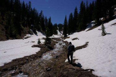
The first day was a breeze - after meeting at the trailhead we made great time along the beautiful Granite Creek trail. We camped along Granite Creek just below the start of the following day's ascent. Weather was beautiful - as it would be throughout the trip.
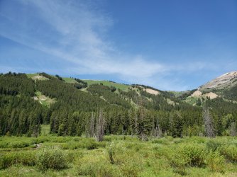
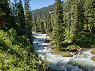
We spotted a cow moose with a very young calf - she watched us for a minute and then shuttled her calf across the creek. The calf struggled for a few moments, but mom was able to help out. (Somewhat hard to make out in the below.)
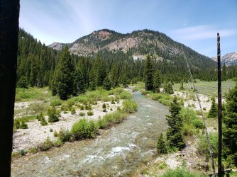
Day 2: Granite Creek to Crystal Creek
Our second day out was a mix of highs and lows. The early morning climb started slow, but picked up quickly as our legs "woke up". The initial ascent and crossing of the upper Flat Creek drainage was pretty, but not particularly notable.
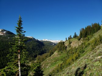
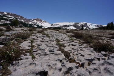
Even at almost 10,000', this side of the range was mostly snow-free - except in areas of persistent shade. (Based on satellite photos, this area was still predominantly covered in snow only a week prior.)
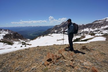
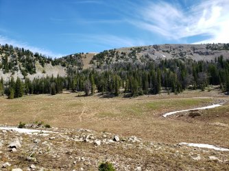 From our high point for the day (10,827') we could see into the Teton, Wind River, and Absaroka ranges simultaneously - it was quite spectacular. We also got our first look at the more snowy side of "our" range.
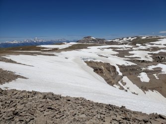
The remainder of the day was spent descending through the west fork of Crystal Creek. We passed some beautiful ponds/lakes, but spent a lot of time navigating through dense forest. It was definitely exhausting and we were very happy to make camp a little earlier than planned.
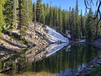
Day 3: Crystal Creek to Swift Creek
After stopping a little short on our second day, this final day would be a long one. There were definitely some tough sections, but they were also incredibly rewarding - much more so than the prior day's bushwhacking. The day did start out a with bit "more of the same" in regards to the dense forest and large number of blowdowns, but quickly improved as we began our hike up the main fork of Crystal Creek. While not quite as smooth as the trail up Granite Creek, this trail was predominantly clear up until just beyond "The Meadows".
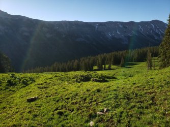
As we entered "The Meadows" we were able to see a pretty large herd of elk grazing in the distance - as we approached they took notice and retreated to the nearby treeline. We waited patiently and watched as many of the cows had to retrieve their stashed calves before retreating themselves.
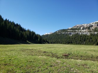
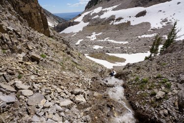
As we got beyond the meadows, the trail again weakened and disappeared under snow and through densely grown vegetation - we elected to predominantly follow the drainage directly up to the basin. I'm not sure this was any easier, but it was a welcome change from bushwhacking and the route-finding was simple.
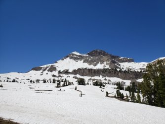
Our first look at the basin revealed less snow than anticipated and a magnificent view of the 11,204' peak.
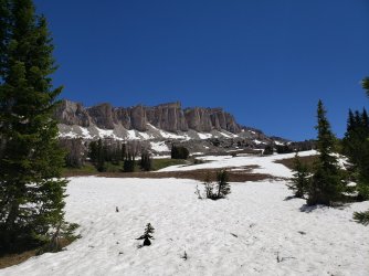
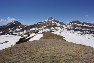
On the opposing side of the basin was the also impressive 11,414' Antoinette Peak - our original target was the far western portion of the saddle (left on the picture below), but we pretty quickly determined that this summer route was not the best option for us. We would instead target the ~10,800' high point between the unnamed peak and Antoinette and work our way down the ridge.
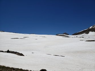
On the other side - along Swift Creek - the views were also spectacular, but I didn't grab too many photos. I'm bad about taking pictures to begin with and at that point I had visions of bacon cheeseburgers dancing in my head.
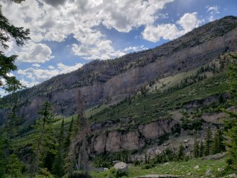
This area burned pretty extensively in 2016, so after spending much of the day exposed we didn't get much reprieve from the afternoon sun down here either.
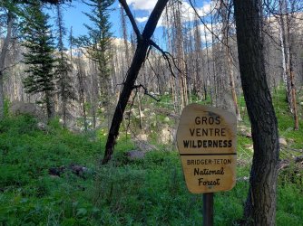
Altogether it was a fantastic trip and a great experience meeting @travel2walk. I hope we're able to meet for more trips in the future. This was a pretty challenging early season trip, but later in the year I imagine it would be much milder - especially if the Forest Service is able to clear the more significant sections of blowdowns.
Click here to view on CalTopo
Being an early season trip, there were some associated challenges. There was a decent amount of snow at higher elevations, but - outside of the forested areas - it was high quality and easy to traverse. The far more significant challenge was the significant number of large blowdowns - compounded by persistent snow - throughout the northeastern side of our route. I'd known going in that at this time of year route-finding would be challenging in some places and was not disappointed on that account, though some areas proved easier and some proved more difficult than expected. We were fortunate to have phenomenal weather overall - my only complaint being that the sun was quite punishing during the exposed portions of the final day.
When I initially decided to take the trip and picked the dates I wasn't sure if conditions would cooperate to complete the loop, but based on weather and recent photos I was pretty optimistic by the time we set out. The planned route was ~32 miles over 3 days/2 nights.
Day 1: Granite Creek
The first day was a breeze - after meeting at the trailhead we made great time along the beautiful Granite Creek trail. We camped along Granite Creek just below the start of the following day's ascent. Weather was beautiful - as it would be throughout the trip.


We spotted a cow moose with a very young calf - she watched us for a minute and then shuttled her calf across the creek. The calf struggled for a few moments, but mom was able to help out. (Somewhat hard to make out in the below.)

Day 2: Granite Creek to Crystal Creek
Our second day out was a mix of highs and lows. The early morning climb started slow, but picked up quickly as our legs "woke up". The initial ascent and crossing of the upper Flat Creek drainage was pretty, but not particularly notable.

Even at almost 10,000', this side of the range was mostly snow-free - except in areas of persistent shade. (Based on satellite photos, this area was still predominantly covered in snow only a week prior.)
 From our high point for the day (10,827') we could see into the Teton, Wind River, and Absaroka ranges simultaneously - it was quite spectacular. We also got our first look at the more snowy side of "our" range.
The remainder of the day was spent descending through the west fork of Crystal Creek. We passed some beautiful ponds/lakes, but spent a lot of time navigating through dense forest. It was definitely exhausting and we were very happy to make camp a little earlier than planned.

Day 3: Crystal Creek to Swift Creek
After stopping a little short on our second day, this final day would be a long one. There were definitely some tough sections, but they were also incredibly rewarding - much more so than the prior day's bushwhacking. The day did start out a with bit "more of the same" in regards to the dense forest and large number of blowdowns, but quickly improved as we began our hike up the main fork of Crystal Creek. While not quite as smooth as the trail up Granite Creek, this trail was predominantly clear up until just beyond "The Meadows".

As we entered "The Meadows" we were able to see a pretty large herd of elk grazing in the distance - as we approached they took notice and retreated to the nearby treeline. We waited patiently and watched as many of the cows had to retrieve their stashed calves before retreating themselves.

As we got beyond the meadows, the trail again weakened and disappeared under snow and through densely grown vegetation - we elected to predominantly follow the drainage directly up to the basin. I'm not sure this was any easier, but it was a welcome change from bushwhacking and the route-finding was simple.
Our first look at the basin revealed less snow than anticipated and a magnificent view of the 11,204' peak.

On the opposing side of the basin was the also impressive 11,414' Antoinette Peak - our original target was the far western portion of the saddle (left on the picture below), but we pretty quickly determined that this summer route was not the best option for us. We would instead target the ~10,800' high point between the unnamed peak and Antoinette and work our way down the ridge.


On the other side - along Swift Creek - the views were also spectacular, but I didn't grab too many photos. I'm bad about taking pictures to begin with and at that point I had visions of bacon cheeseburgers dancing in my head.

This area burned pretty extensively in 2016, so after spending much of the day exposed we didn't get much reprieve from the afternoon sun down here either.

Altogether it was a fantastic trip and a great experience meeting @travel2walk. I hope we're able to meet for more trips in the future. This was a pretty challenging early season trip, but later in the year I imagine it would be much milder - especially if the Forest Service is able to clear the more significant sections of blowdowns.
Click here to view on CalTopo
Last edited:

