- Joined
- Aug 9, 2007
- Messages
- 12,960
As with many of my trips, I started dreaming about this one during the cold winter months of 2012. Laid up with a bad knee from a surgery gone terribly wrong, unable to even walk without crutches, I poured over maps and scoured the internet making plans. I'd been into the Winds a handful of times now but never anything more than a few days. It was great and I loved all of those trips, but it always left me thinking that I need to stay longer and see more. So much of the 'goods' in the Wind Rivers are 2+ days of hiking just to get in. And so back in December I picked some random dates off the calendar in August and waited.
Eventually August rolled around. My knee was a bit of a roller coaster ride throughout the year, taking so much longer to heal than expected and forcing the cancellation countless trips as a result. I was determined not to let it ruin this one though. On the morning of August 10th, I woke up early to hit the road. I hadn't hiked in nearly two weeks - plenty of time for the knee to catch a break. But strangely, that morning I woke up to unusually bad knee pain. Worse than I'd had in probably a month or two. Just the kind of thing you want as you're heading out on a 50-mile hike! But it wasn't going to stop me. I tossed in some extra ibuprofen and hit the road. First stop was to pickup @slc_dan downtown, then @Ndheiner in Park City and then on to Kemmerer, Wyoming where we met up with my old friend @Smokey. Our 4-man crew was now complete.
The drive to Pinedale was nice. Nate and I kept mentioning how much more we like it than driving to the southern Winds. So much more to see along the way. Or maybe there are just more curves in the road. Who knows. We made it into Pinedale around 11am and went to the Great Outdoor Shop to drop off a set of keys to my truck. We hired them to run the shuttle for us but instead of shuttling us, they were just going to come pick up my truck and move it to Elkhart Park half way through the trip. Very convenient and highly recommended!
After getting everything arranged, we were headed north and made it to the Green River Lakes trailhead early in the afternoon. We were a little worried about access because of the 'Green Fire' which had exploded in size just days earlier and as burning just northeast of the trailhead but it turned out to be a non-issue for us. The smoke wasn't even that bad! And how about that water, eh? Beautiful! This shot is along the first of the two Green River Lakes.
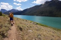
Within a couple miles I started feeling some hotspots on my heels. I pretty much never get blisters so I think I tried to ignore it at first. By the time I stopped to take a look, I already had blisters, not even 2 miles into a 50 mile hike. What the hell. I was in a fairly new pair of boots but they were the same type I've worn for the last 6 or 8 pairs I've owned and I've never had issues breaking them in. I threw on some mole skin and tape and we kept moving. The skies were decidedly less friendly looking than when we started down the shore of this lake.
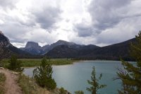
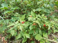
One of the best things about the first 12-14 miles of this trip - LOTS of raspberries! We stopped to forage frequently. Sorry Yogi.
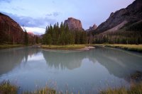
We setup camp that night a short 6.5 miles in from the trailhead at a nice bend on the Green River, above the upper Green River Lake. The views of Square Top were sublime and those two big bull moose in the field were pretty sweet too.
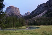
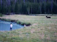
You can see the moose off to the side in this shot as well.
Poor quality zoom on my point and shoot of @slc_dan chilling with Bullwinkle and friend.
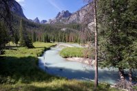
The next morning we continued up the Green River drainage. The Green River part of the hike totally surpassed my expectations. It's really an incredibly beautiful drainage to walk through and that ghostly green water doesn't hurt either.
Going for a swim - little did we know a storm would be on us well before we would dry out.
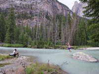
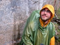
We got slammed by some pretty good thunderstorms that afternoon. We sheltered for some of it and hiked through much of it. Here's @slc_dan giving me his contemplative pose when I told him to flaunt that sweet GoLite rain gear.
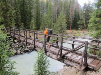
Sweet backcountry bridge!
The sun starting to break through after a couple hours of stormy weather.
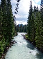
After the weather cleared out, the rest of the day was great. We cruised on up through Three Forks Park and started the switchbacks up and out of the Green River drainage. The views were encouraging.
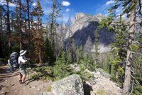
We were thinking maybe camping in Trail Park or near Vista Pass but didn't really have a solid plan. When we got to Trail Park, we weren't very impressed with the amenities so we decided to keep going despite being very tired. After much debate, we decided to go up towards Summit Lake, skipping the more dramatic route over Vista Pass and opting for what appeared to be better camping and fishing on the map.
Approaching Green River Pass with some nice late afternoon light.
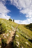
Green River Pass was cool. It was just rolling field of grass as far as the eye could see. Finally we made it to Summit Lake. It was a long 12+ miles on the trail and we were all glad to get our packs off for a while.
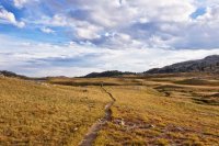
After getting tens setup, we all went down to the lake. Taylor and Dan fished while Nate and I cooked. At one point I looked over to see this big buck just standing on the ridge nearby staring at us. A few minutes later it went walking by about 100 feet away.
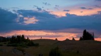
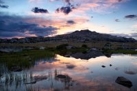
A nice sunset at Summit Lake. And by the way, the fishing at Summit was spectacular. I didn't fish it but Taylor and Dan killed it for nice, large Cutthroats. I bet Dan will post some pics when he does his trip report.
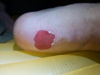
When I got into the tent that night, I did some foot inspection on my blisters from the first day and it was not good. The one on my left foot wasn't much of a problem but the right was bad. This is what I had to deal with for nearly 50 miles. I'll leave this as a thumbnail so you don't have to see the nastiness unless you want to click on it.
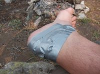
The next day we woke up and continued on. The fish were boiling in Summit Lake and I so badly wanted to stay and fish for a while but we had a lot of ground still to cover so off we went. The trail winds through a handful of small lakes before arriving at our next break point - Elbow Lake. The skies were threatening but it made for nice hiking.
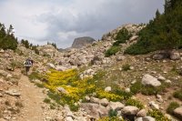
Our first good view of the Continental Divide and Titcomb Basin in the distance.
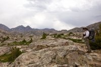
One of many little arms of Elbow Lake. We stopped here for a long lunch break and fished. We didn't have any luck at all but someone had left some fish remains near where we stopped. A nice large jaw bone indicated there must be something in there. I'd heard they might be big goldens - no wonder we weren't having any luck...
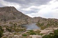
Within 10 minutes of packing up and moving on, a storm rolled in. There was absolutely nothing around to use as shelter. I suppose we could have setup tents right there but we didn't, we kept hiking. It was downright terrifying for a few moments as we literally saw and felt lightning crash down right in front of us, just a couple hundred yards further down the trail from when I took this photo. One of the scariest lightning experiences of my life.
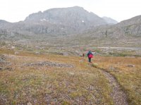
We eventually found a boulder that would provide us with a little shelter.
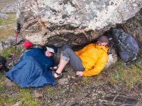
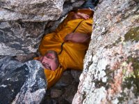
@slc_dan found his own little pocket and crawled in while we waited out the last of the storm.
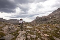
Nate up on the next little pass before we start the descent towards the Jean Lakes.
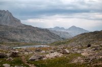
Looking down towards the Jean Lakes. That first one is just an unnamed lake.
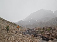
Just as we reached the shore of Upper Jean, another storm was on us. We poncho'd up and kept on hiking. We were hoping to find treeline near Lower Jean but we weren't sure what we would find. While this storm lacked the near-fatal lightning strikes, it didn't lack anything in duration or strength. I had my GoLite poncho on like usual but the hail was coming in sideways from behind me, hitting me so hard in the calves that it felt like little darts. I turned around and snapped this pic of Dan and Taylor in the middle of it.
We made it to Lower Jean and wouldn't you know it - no trees! There was a little bit on a ledge above the lake and it was still a torrential downpour so we hiked up to it to see if there might be a place to camp. There wasn't really, but after sitting in the bushes for a few minutes, we decided it was time to erect Taylor's trusty 'circus tent'. It was hailing again at this point as you can see by the accumulation on his tent in that short amount of time it took to spread it out.
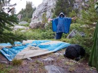
The circus tent saved us! We spent the rest of the day in there eating and drinking and wondering if this storm was going to give us a break before dark. There weren't any other obvious tent spots nearby so we were really hoping for at least a short clearing so we could get our own gear setup.
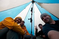
The pace of the rain drops on the circus tent slowed down a bit and so we decided to poke our heads out. Is that sunshine!?
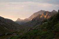
A rainbow starts to appear behind Dan as we admire the light filtering through.
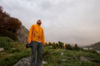
A pot of gold must have been hiding on the other side of Upper Jean Lake.
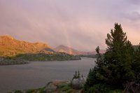
The storm cleared out and we were able to find tent spots and cook dinner and let things dry out a bit. We were very grateful. Our 3rd day was in the books and we still had three more to go. To be continued....
Continue reading in Part 2: Island Lake to Elkhart Park
Featured image for home page:
Eventually August rolled around. My knee was a bit of a roller coaster ride throughout the year, taking so much longer to heal than expected and forcing the cancellation countless trips as a result. I was determined not to let it ruin this one though. On the morning of August 10th, I woke up early to hit the road. I hadn't hiked in nearly two weeks - plenty of time for the knee to catch a break. But strangely, that morning I woke up to unusually bad knee pain. Worse than I'd had in probably a month or two. Just the kind of thing you want as you're heading out on a 50-mile hike! But it wasn't going to stop me. I tossed in some extra ibuprofen and hit the road. First stop was to pickup @slc_dan downtown, then @Ndheiner in Park City and then on to Kemmerer, Wyoming where we met up with my old friend @Smokey. Our 4-man crew was now complete.
The drive to Pinedale was nice. Nate and I kept mentioning how much more we like it than driving to the southern Winds. So much more to see along the way. Or maybe there are just more curves in the road. Who knows. We made it into Pinedale around 11am and went to the Great Outdoor Shop to drop off a set of keys to my truck. We hired them to run the shuttle for us but instead of shuttling us, they were just going to come pick up my truck and move it to Elkhart Park half way through the trip. Very convenient and highly recommended!
After getting everything arranged, we were headed north and made it to the Green River Lakes trailhead early in the afternoon. We were a little worried about access because of the 'Green Fire' which had exploded in size just days earlier and as burning just northeast of the trailhead but it turned out to be a non-issue for us. The smoke wasn't even that bad! And how about that water, eh? Beautiful! This shot is along the first of the two Green River Lakes.

Within a couple miles I started feeling some hotspots on my heels. I pretty much never get blisters so I think I tried to ignore it at first. By the time I stopped to take a look, I already had blisters, not even 2 miles into a 50 mile hike. What the hell. I was in a fairly new pair of boots but they were the same type I've worn for the last 6 or 8 pairs I've owned and I've never had issues breaking them in. I threw on some mole skin and tape and we kept moving. The skies were decidedly less friendly looking than when we started down the shore of this lake.

One of the best things about the first 12-14 miles of this trip - LOTS of raspberries! We stopped to forage frequently. Sorry Yogi.

We setup camp that night a short 6.5 miles in from the trailhead at a nice bend on the Green River, above the upper Green River Lake. The views of Square Top were sublime and those two big bull moose in the field were pretty sweet too.

You can see the moose off to the side in this shot as well.


Poor quality zoom on my point and shoot of @slc_dan chilling with Bullwinkle and friend.

The next morning we continued up the Green River drainage. The Green River part of the hike totally surpassed my expectations. It's really an incredibly beautiful drainage to walk through and that ghostly green water doesn't hurt either.

Going for a swim - little did we know a storm would be on us well before we would dry out.

We got slammed by some pretty good thunderstorms that afternoon. We sheltered for some of it and hiked through much of it. Here's @slc_dan giving me his contemplative pose when I told him to flaunt that sweet GoLite rain gear.

Sweet backcountry bridge!

The sun starting to break through after a couple hours of stormy weather.

After the weather cleared out, the rest of the day was great. We cruised on up through Three Forks Park and started the switchbacks up and out of the Green River drainage. The views were encouraging.

We were thinking maybe camping in Trail Park or near Vista Pass but didn't really have a solid plan. When we got to Trail Park, we weren't very impressed with the amenities so we decided to keep going despite being very tired. After much debate, we decided to go up towards Summit Lake, skipping the more dramatic route over Vista Pass and opting for what appeared to be better camping and fishing on the map.
Approaching Green River Pass with some nice late afternoon light.

Green River Pass was cool. It was just rolling field of grass as far as the eye could see. Finally we made it to Summit Lake. It was a long 12+ miles on the trail and we were all glad to get our packs off for a while.

After getting tens setup, we all went down to the lake. Taylor and Dan fished while Nate and I cooked. At one point I looked over to see this big buck just standing on the ridge nearby staring at us. A few minutes later it went walking by about 100 feet away.

A nice sunset at Summit Lake. And by the way, the fishing at Summit was spectacular. I didn't fish it but Taylor and Dan killed it for nice, large Cutthroats. I bet Dan will post some pics when he does his trip report.

When I got into the tent that night, I did some foot inspection on my blisters from the first day and it was not good. The one on my left foot wasn't much of a problem but the right was bad. This is what I had to deal with for nearly 50 miles. I'll leave this as a thumbnail so you don't have to see the nastiness unless you want to click on it.


The next day we woke up and continued on. The fish were boiling in Summit Lake and I so badly wanted to stay and fish for a while but we had a lot of ground still to cover so off we went. The trail winds through a handful of small lakes before arriving at our next break point - Elbow Lake. The skies were threatening but it made for nice hiking.

Our first good view of the Continental Divide and Titcomb Basin in the distance.

One of many little arms of Elbow Lake. We stopped here for a long lunch break and fished. We didn't have any luck at all but someone had left some fish remains near where we stopped. A nice large jaw bone indicated there must be something in there. I'd heard they might be big goldens - no wonder we weren't having any luck...

Within 10 minutes of packing up and moving on, a storm rolled in. There was absolutely nothing around to use as shelter. I suppose we could have setup tents right there but we didn't, we kept hiking. It was downright terrifying for a few moments as we literally saw and felt lightning crash down right in front of us, just a couple hundred yards further down the trail from when I took this photo. One of the scariest lightning experiences of my life.

We eventually found a boulder that would provide us with a little shelter.

@slc_dan found his own little pocket and crawled in while we waited out the last of the storm.

Nate up on the next little pass before we start the descent towards the Jean Lakes.

Looking down towards the Jean Lakes. That first one is just an unnamed lake.

Just as we reached the shore of Upper Jean, another storm was on us. We poncho'd up and kept on hiking. We were hoping to find treeline near Lower Jean but we weren't sure what we would find. While this storm lacked the near-fatal lightning strikes, it didn't lack anything in duration or strength. I had my GoLite poncho on like usual but the hail was coming in sideways from behind me, hitting me so hard in the calves that it felt like little darts. I turned around and snapped this pic of Dan and Taylor in the middle of it.

We made it to Lower Jean and wouldn't you know it - no trees! There was a little bit on a ledge above the lake and it was still a torrential downpour so we hiked up to it to see if there might be a place to camp. There wasn't really, but after sitting in the bushes for a few minutes, we decided it was time to erect Taylor's trusty 'circus tent'. It was hailing again at this point as you can see by the accumulation on his tent in that short amount of time it took to spread it out.

The circus tent saved us! We spent the rest of the day in there eating and drinking and wondering if this storm was going to give us a break before dark. There weren't any other obvious tent spots nearby so we were really hoping for at least a short clearing so we could get our own gear setup.

The pace of the rain drops on the circus tent slowed down a bit and so we decided to poke our heads out. Is that sunshine!?

A rainbow starts to appear behind Dan as we admire the light filtering through.

A pot of gold must have been hiding on the other side of Upper Jean Lake.

The storm cleared out and we were able to find tent spots and cook dinner and let things dry out a bit. We were very grateful. Our 3rd day was in the books and we still had three more to go. To be continued....
Continue reading in Part 2: Island Lake to Elkhart Park
Featured image for home page:

