chandlerwest
Member
- Joined
- Feb 7, 2015
- Messages
- 550
I hadn't planned on doing a trip report but it looks like it has been 4 years since a Great Basin report was done on BCP. Created in 1986 it is just a baby in the park system. At 167,000 visitors it is among the least visited. At 77,000 acres it is fairly small. Its gateway city, of Baker, doesn't even try to cater to anyone. The only fuel pump I saw was an unmanned island. It's Latte Shack is the only sign of acknowledging visitors. (Let me convey that I consider this a positive.) Ely, NV is 70 miles away so it doesn't easily play into making it easy for visitors. It doesn't have anything that can't be found in many other places........except for the Holmgren Buckwheat plant. To appreciate the park you need to consider THE GREAT BASIN itself. It covers most of Nevada and Western Utah. Simply put, its water does not leave. Snow, rain, springs, stay there. Water's only aspiration is to soak into the ground or sit in shallow lakes to dry up in the sun. It is such a wondrous quirky environment. To drive thru it from North to South is sort of boring. Just flat with mountains on the left and right. But to drive thru it from East to West is a roller coaster ride as you go up and over continuous mountain ranges divided by 10-15 mile wide grass lands. I remember seeing that Nevada has 200 mountain ranges. The mountains of THE Great Basin are islands in this perceived desert. Once you consider the unique vastness of THE Great Basin, then, consider that it has been honored with this small area that sits almost in its center....then this gives power to Great Basin National Park. I know that in a day and a half it did a decent job of kicking my butt and filling up my camera. Before I get into the meat of my trip I want to tell you a story of what happened on my trip to the park. I left St. George, for the 200 mile drive, at 5:00 AM. I am cruising across this 11 mile stretch of pencil straight highway at dusk. I see something just off the road to the left, ahead. It looks like branches on a tree, but there aren't such trees out here. It was an Elk. A HUGE friggin' elk. Did I say that its antlers instantly registered as a tree!!!? It was in a depression and it still was taller than my car. I gave a thought at stepping on the brakes and turning around, but I knew that since it was trotting away and there wasn't a lot of light it would be a wasted effort. Awhile later I told myself that it was good that I hadn't gone get back to it. It probably would have looked much smaller. While now I can proclaim with enthusiasm and 100% accuracy that I saw the Babe the Blue Ox of elk.
I hit the 10,160 ft. Wheeler Peak trailhead at 8:30 AM. Pretty darn high for a desert! The highest mountain in Glacier National Park is 10,466 ft. for Pete's sake.
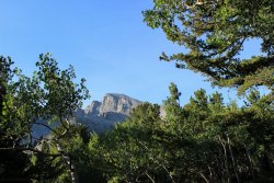
First view of Wheeler Peak 13,063 Ft.
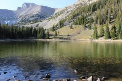
Stella Lake
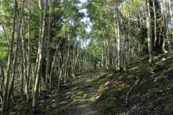
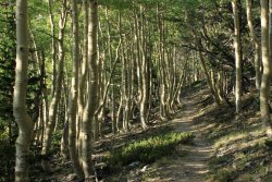
The trail works its way thru the aspen forest, then meadow, then up to the ridgeline where it begins its trudge up to the summit.
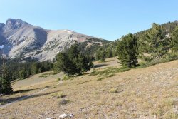
My main concern about the hike/climb was the weather on the exposed ridge. Wind is probably a certainty and being mid Sept. it could have a bit of a nip to it. It was all of that!!!! Damn it was cold. On the positive, when you are fighting the cold wind constantly it distracts from the pitch that the "trail" is taking.
The lower half was rather pleasant.....pitch-wise. Friggin relentless wind though.
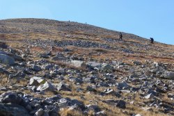
The pitch is gonna kick up a notch.
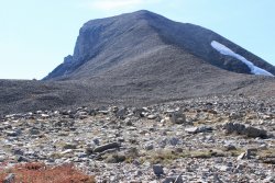
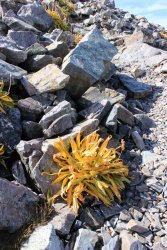
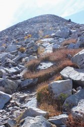
I want to say that convicts built this trail. Tons of rock had to have been manipulated by hand. You would have to be some frightening volunteer to condemn yourself to this task. Another weird mental thing to share. I am trudging myself up the "trail" seemingly fine. Sure I seldom let a good sittin-rock go by without using it but I felt I did that just as much to try to get a break from the wind as from the physical strain. This other man and myself were keeping in visual touch getting up the spine. So.....here I am keeping my head down. Trying not to have my glasses blew off my face. I see this guy taking out his phone for the first time. I shout up to him "you must be seeing something!!!" I get to him and we have our first view to the south...........
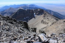
.......we chat for a bit Then I finally look to my left. We are at the summit. It was so strange feeling as if I just plopped down onto a summit that I had spent so much time trudging up. No anticipatory "almost there".
Why don't I just take you on a 10 photo clockwise circle of the view from the summit. Starting towards the east.
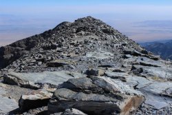
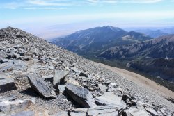
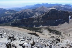
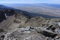
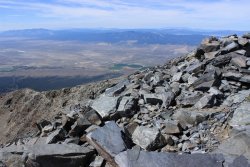
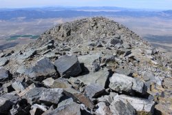
Wheeler Peak is 13,063 Ft. The desert floor is 5,300 ft. This looks back down the ridge I climbed up.
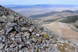
Stella Lake is the left of the two lakes. Those two lakes are reached on the Alpine Lakes Loop Trail
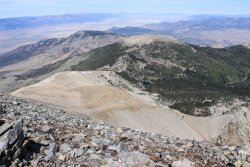
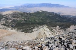
The Bristlecone Pine and Rock Glacier area is in this shot
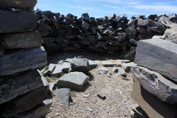
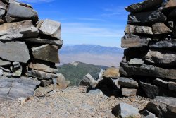
On the summit and lower down on the ridge there were "forts" built. Of varying size and quality. All in an attempt to provide a break from the wind.
This one was on the summit. It would have made the ancient peoples proud.
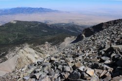
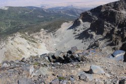
This is a better view down into the Bristlecone Pine and Rock Glacier area. Jeff Davis Peak on the right.
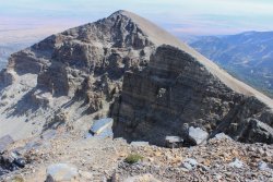
I was concerned about going down. Going up I felt glued to the ground (wonderful thing gravity) but going down I don't trust any step. Especially on all this rock. (horrible thing gravity). I still had wind going down but it had to have been 20 degrees warming so......yeah!
Can see a fellow hiker just going out of sight.
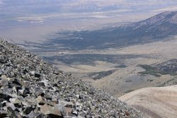
Can see two groups heading towards the ridgeline.
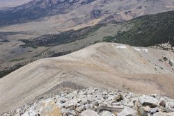
These type of shots crack me up. They make it appear that what you just did was so stupidly awful. Mainly, they scare the crap out my family back east.
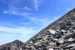
There was some color up here.
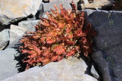
The "trail"
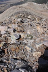
Jeff Davis Peak....peeking with Wheeler Peak
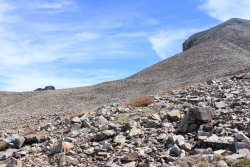
Back down to the forest. The Wheeler Peak Trail was 8.6 miles round trip with 2,900 of elevation gain. Most of that probably in the last mile plus.
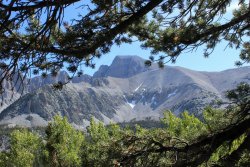
I then went to check out the Bristlecone Pines and (maybe) the rock glacier. This would be a 4.6 mile round trip.
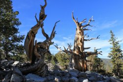
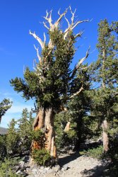
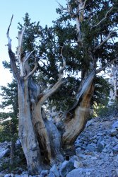
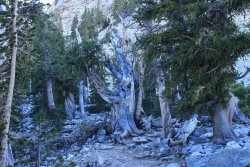
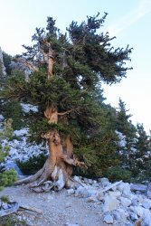
This grove had trees up to 3,000 plus years old. The park service messed with me, by pointing out that the grove was both Limber Pine and Bristlecone Pine, then tried to describe the visual difference between the two. It was too much for my tired mind to wrap itself around. So....I just took picture of cool trees.
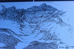
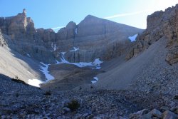
I was debating if I wanted to bother with their "rock glacier." I know enough about them to know that they present themselves at piles of rocks. But I got to a point where it appeared that it wouldn't be much more elevation gain and "when in Paris." I'm glad I pushed it.
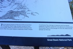
I took a picture of the display so I wouldn't have to attempt to explain "rock glacier"
It has been a long day. Time to head back down to the desert. The park has 4 campgrounds along the main road. I had my sites on car camping on the BLM.
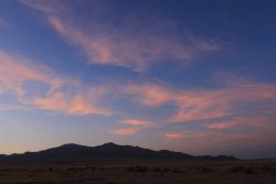
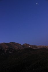
Sunset from where I ended up.
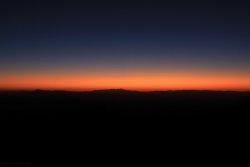
Let me make a long story short. I didn't get much sleep. I woke up from my last catnap at 4:00 A.M. and I was in agony as my upper back/lower neck was fused together. I spent a couple hours doing anything to loosen up. But the show must go on so back into the park for sunrise.
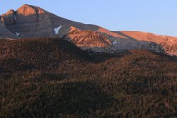
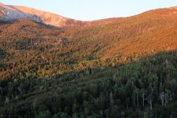
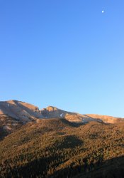
To my knowledge this was the first time I have ever been around Mountain Mahogany Trees. In the backcountry section of the park map it says "bushwhacking through Mountain
Mahogany can be tough or impossible."
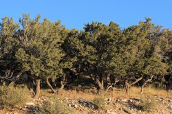
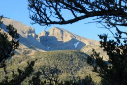
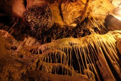
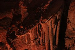
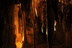
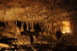
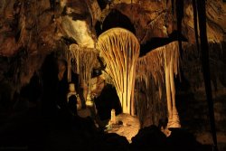
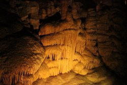
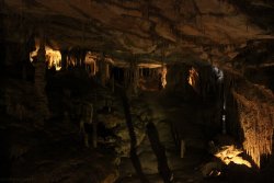
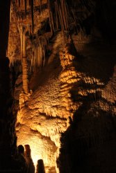
Having never taken my current camera into a cave I was looking forward to getting into Lehman Caves. I cranked up the ISO and took dozens of shots. Not sure if I was getting what I wanted or whether it would be all crap. I was very pleased!
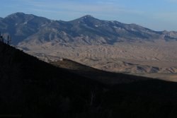
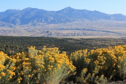
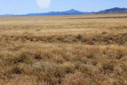
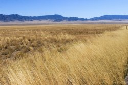
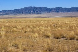
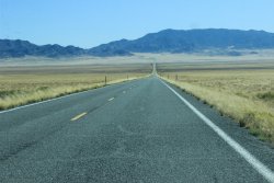
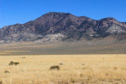
Usually when I am driving on the highway I just admire where I am but just cruise on through. But this time I took a few shots trying to capture THE Great Basin. The mountains, the grasslands, the dried up lakes, the pencil straight highways.
It is a small park but there does appear to be backcountry. Three dirt road access remote areas on the east side of the park. I can't vouch for what experience you get up in there but my guess, it would involve bushwhacking through Mountain Mahogany Trees and all the rugged terrain you could hope for.
I hit the 10,160 ft. Wheeler Peak trailhead at 8:30 AM. Pretty darn high for a desert! The highest mountain in Glacier National Park is 10,466 ft. for Pete's sake.

First view of Wheeler Peak 13,063 Ft.


Stella Lake

The trail works its way thru the aspen forest, then meadow, then up to the ridgeline where it begins its trudge up to the summit.

My main concern about the hike/climb was the weather on the exposed ridge. Wind is probably a certainty and being mid Sept. it could have a bit of a nip to it. It was all of that!!!! Damn it was cold. On the positive, when you are fighting the cold wind constantly it distracts from the pitch that the "trail" is taking.
The lower half was rather pleasant.....pitch-wise. Friggin relentless wind though.

The pitch is gonna kick up a notch.


I want to say that convicts built this trail. Tons of rock had to have been manipulated by hand. You would have to be some frightening volunteer to condemn yourself to this task. Another weird mental thing to share. I am trudging myself up the "trail" seemingly fine. Sure I seldom let a good sittin-rock go by without using it but I felt I did that just as much to try to get a break from the wind as from the physical strain. This other man and myself were keeping in visual touch getting up the spine. So.....here I am keeping my head down. Trying not to have my glasses blew off my face. I see this guy taking out his phone for the first time. I shout up to him "you must be seeing something!!!" I get to him and we have our first view to the south...........

.......we chat for a bit Then I finally look to my left. We are at the summit. It was so strange feeling as if I just plopped down onto a summit that I had spent so much time trudging up. No anticipatory "almost there".
Why don't I just take you on a 10 photo clockwise circle of the view from the summit. Starting towards the east.


Wheeler Peak is 13,063 Ft. The desert floor is 5,300 ft. This looks back down the ridge I climbed up.

Stella Lake is the left of the two lakes. Those two lakes are reached on the Alpine Lakes Loop Trail


The Bristlecone Pine and Rock Glacier area is in this shot

On the summit and lower down on the ridge there were "forts" built. Of varying size and quality. All in an attempt to provide a break from the wind.
This one was on the summit. It would have made the ancient peoples proud.


This is a better view down into the Bristlecone Pine and Rock Glacier area. Jeff Davis Peak on the right.


I was concerned about going down. Going up I felt glued to the ground (wonderful thing gravity) but going down I don't trust any step. Especially on all this rock. (horrible thing gravity). I still had wind going down but it had to have been 20 degrees warming so......yeah!
Can see a fellow hiker just going out of sight.

Can see two groups heading towards the ridgeline.

These type of shots crack me up. They make it appear that what you just did was so stupidly awful. Mainly, they scare the crap out my family back east.

There was some color up here.

The "trail"

Jeff Davis Peak....peeking with Wheeler Peak

Back down to the forest. The Wheeler Peak Trail was 8.6 miles round trip with 2,900 of elevation gain. Most of that probably in the last mile plus.

I then went to check out the Bristlecone Pines and (maybe) the rock glacier. This would be a 4.6 mile round trip.

This grove had trees up to 3,000 plus years old. The park service messed with me, by pointing out that the grove was both Limber Pine and Bristlecone Pine, then tried to describe the visual difference between the two. It was too much for my tired mind to wrap itself around. So....I just took picture of cool trees.


I was debating if I wanted to bother with their "rock glacier." I know enough about them to know that they present themselves at piles of rocks. But I got to a point where it appeared that it wouldn't be much more elevation gain and "when in Paris." I'm glad I pushed it.
I took a picture of the display so I wouldn't have to attempt to explain "rock glacier"


It has been a long day. Time to head back down to the desert. The park has 4 campgrounds along the main road. I had my sites on car camping on the BLM.

Sunset from where I ended up.

Let me make a long story short. I didn't get much sleep. I woke up from my last catnap at 4:00 A.M. and I was in agony as my upper back/lower neck was fused together. I spent a couple hours doing anything to loosen up. But the show must go on so back into the park for sunrise.


To my knowledge this was the first time I have ever been around Mountain Mahogany Trees. In the backcountry section of the park map it says "bushwhacking through Mountain
Mahogany can be tough or impossible."


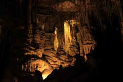
Having never taken my current camera into a cave I was looking forward to getting into Lehman Caves. I cranked up the ISO and took dozens of shots. Not sure if I was getting what I wanted or whether it would be all crap. I was very pleased!


Usually when I am driving on the highway I just admire where I am but just cruise on through. But this time I took a few shots trying to capture THE Great Basin. The mountains, the grasslands, the dried up lakes, the pencil straight highways.


It is a small park but there does appear to be backcountry. Three dirt road access remote areas on the east side of the park. I can't vouch for what experience you get up in there but my guess, it would involve bushwhacking through Mountain Mahogany Trees and all the rugged terrain you could hope for.
Last edited:
