IntrepidXJ
ADVENTR
- Joined
- Jan 17, 2012
- Messages
- 3,493
Saturday & Sunday, June 16-17, 2012
The Original Trip Report on ADVENTR.CO
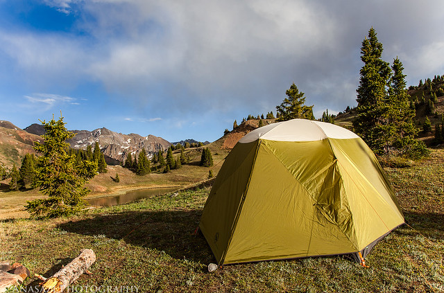
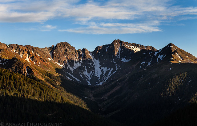
Amanda has been wanting to get back into the mountains for a while, so that's where we went this weekend. Saturday morning we left the heat of the Grand Valley behind and drove up into the San Juan Mountains. Back in 2009 I visited an area called Gray Copper Gulch situated between the Red Mountains and Brown Mountain. I have wanted to get back up there again to take some new photos and figured this weekend would be a great time. After driving through Ouray we drove over Corkscrew Pass and then into Gray Copper Gulch. We found a nice campsite between a few of the ponds that I wanted to photograph.
When we arrived in Gray Copper Gulch, clouds were rolling in and the wind was blowing pretty good, as you can tell from the ripples in the water.
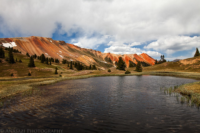
Ripples & Clouds by IntrepidXJ, on Flickr
Camp setup with Red Mountain #1 in the background.
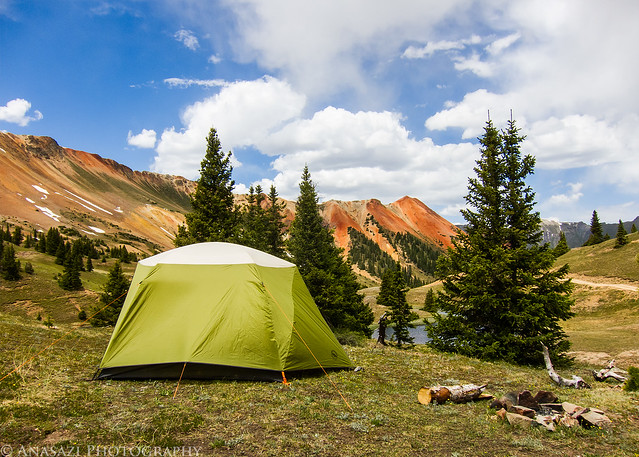
Home for the Night by IntrepidXJ, on Flickr
Once our camp was setup we left Gray Copper Gulch to drive a few of the high passes in the area.
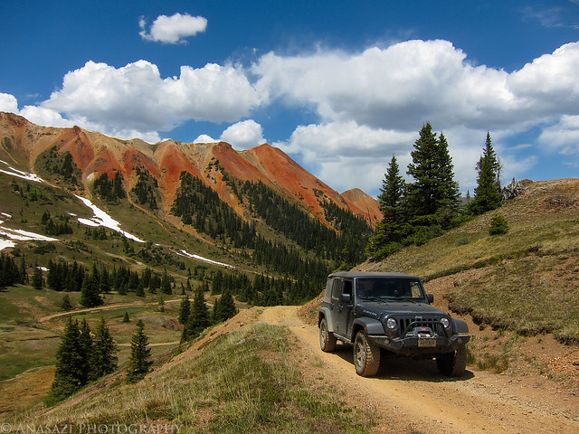
Leaving Gray Copper Gulch by IntrepidXJ, on Flickr
Headed up the road to Hurricane Pass.
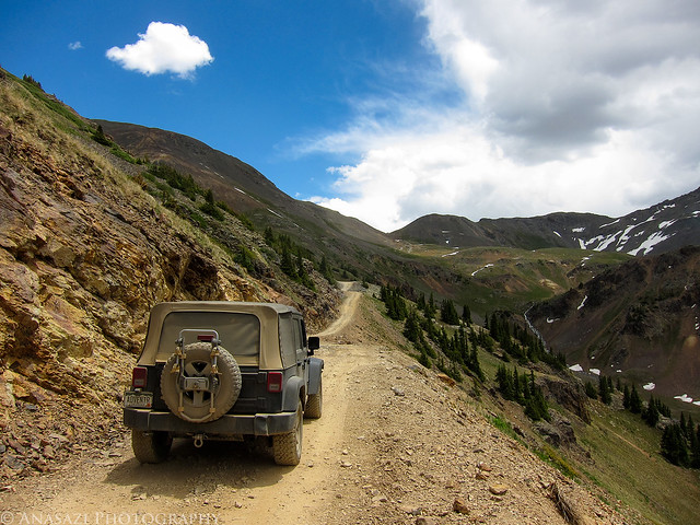
To Hurricane Pass by IntrepidXJ, on Flickr
Hurricane Pass, Elevation 12,730 feet.
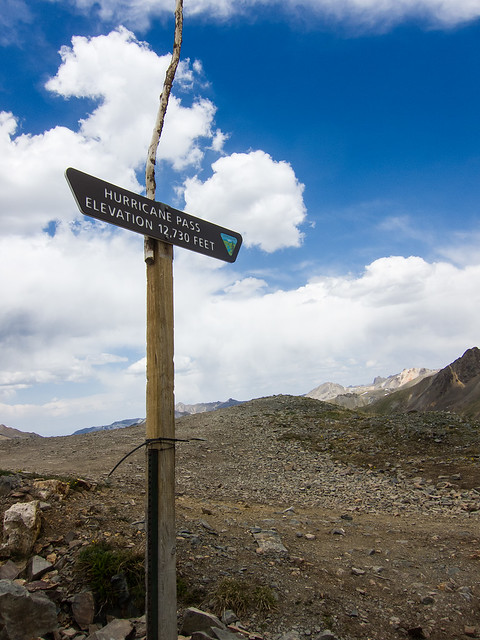
Hurricane Pass by IntrepidXJ, on Flickr
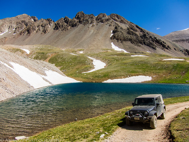
A view down on Lake Como on the other side of Hurricane Pass.
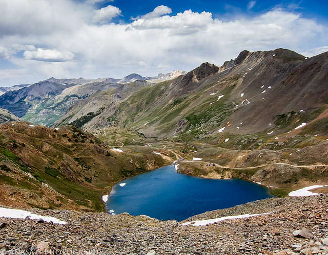
Lake Como by IntrepidXJ, on Flickr
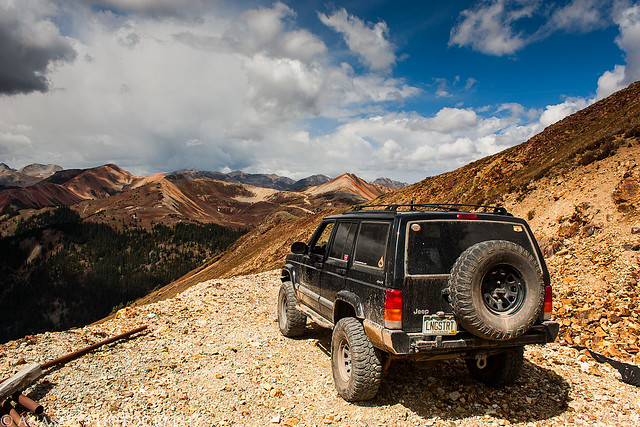
After dropping down a little ways from Hurricane Pass, we quickly started climbing back up to California Pass. My Jeep parked at California Pass, elevation 12,960 feet.
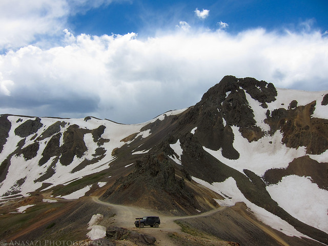
California Pass by IntrepidXJ, on Flickr
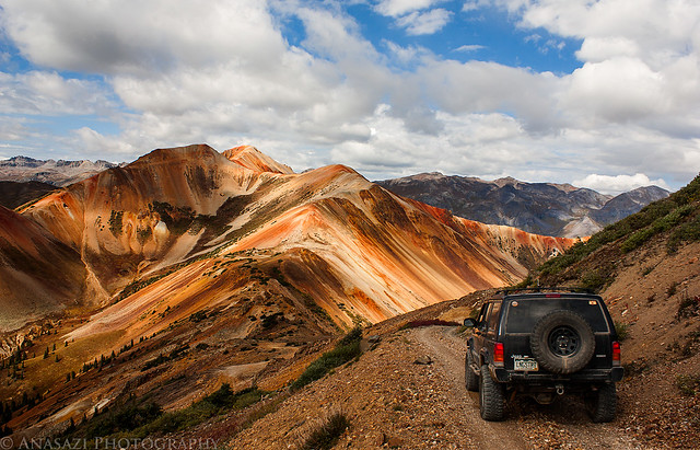
The view down into California Gulch from the pass.
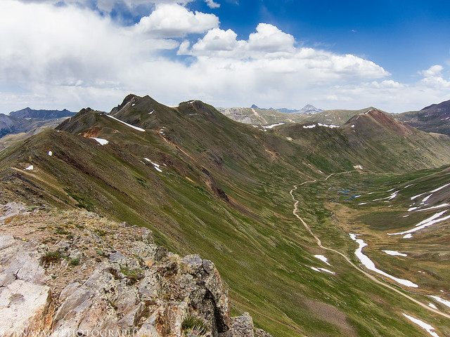
California Gulch by IntrepidXJ, on Flickr
I stopped to photograph this old mining relic as we dropped down into California Gulch.
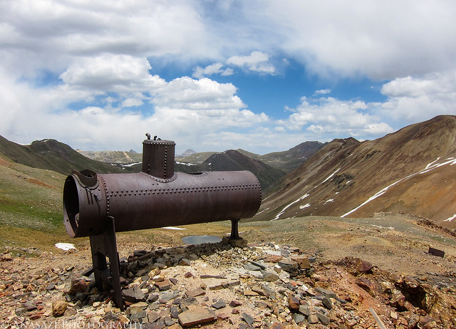
California View by IntrepidXJ, on Flickr
There were patches of Columbines along the road as we got closer to the ghost town of Animas Forks. Since the sky was completely overcast when we reached Animas Forks we didn't stick around long and continued on to Silverton.
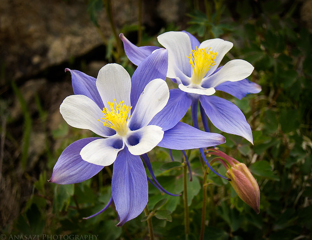
Columbines by IntrepidXJ, on Flickr
A view out the rear window of an old abandoned car along the road.
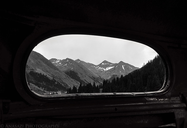
Rear View by IntrepidXJ, on Flickr
After a nice dinner at Handlebars in Silverton, we drove up Cement Creek Gulch to reach our campsite again. The late afternoon light was much nicer when we arrived.
Gray Copper Camp by IntrepidXJ, on Flickr
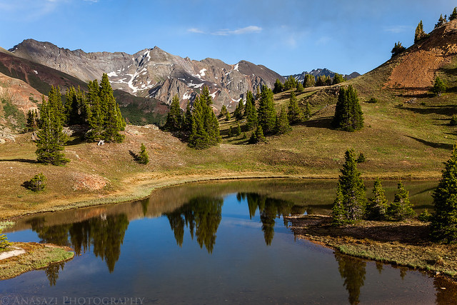
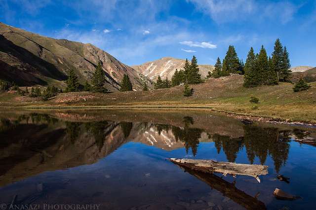
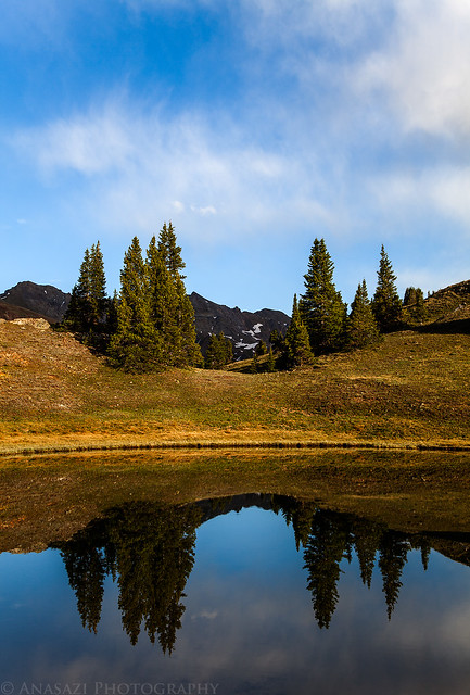
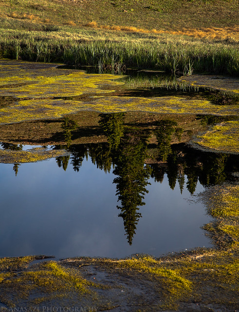
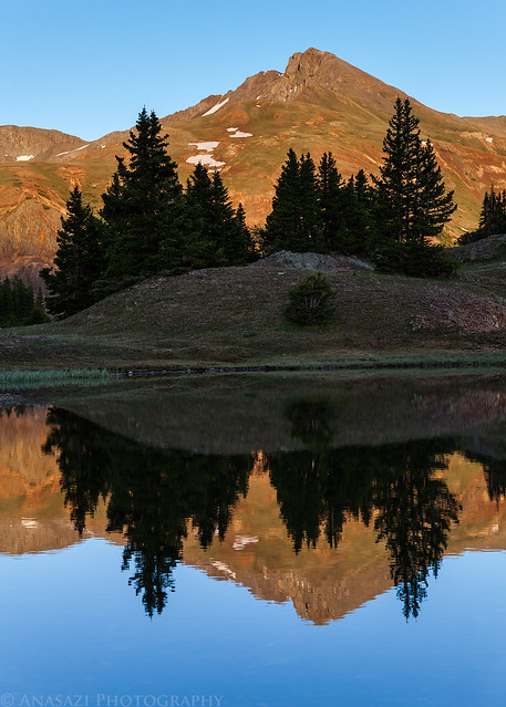
Since the clouds had finally started to clear out and it was getting close to sunset, I spent the rest of the evening hiking around Gray Copper Gulch taking photos. There are a bunch of little ponds here that are great for reflections.
Beautiful view near our campsite in Gray Copper Gulch.
Evening View by IntrepidXJ, on Flickr
Hurricane Peak in the distance.
Reflecting Pond by IntrepidXJ, on Flickr
Evening Reflection by IntrepidXJ, on Flickr
Tree Reflections by IntrepidXJ, on Flickr
A nice view into Velocity Basin.
Velocity Basin Sunset by IntrepidXJ, on Flickr
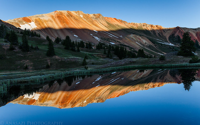
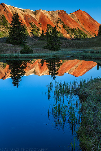
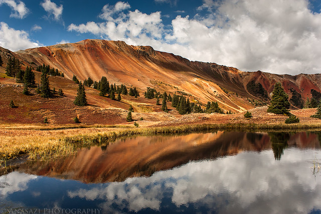
Reflection of Bonita Peak in the distance.
Bonita Peak Reflection by IntrepidXJ, on Flickr
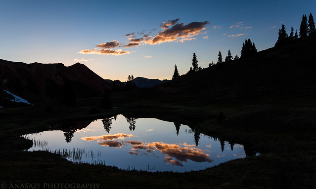
The last reflection of the evening before I went to bed.
Cloud Reflection by IntrepidXJ, on Flickr
Of course I woke up early enough to catch the sunrise. I just wish there had been some clouds around. Maybe next time...
Good Morning by IntrepidXJ, on Flickr
Morning Reflection by IntrepidXJ, on Flickr
When the sun was fully up we had some breakfast and broke down camp. Then we drove back over to the highway over Corkscrew Pass.
Fire Ban. A sign that we are probably going to be seeing a lot of in Colorado this year.
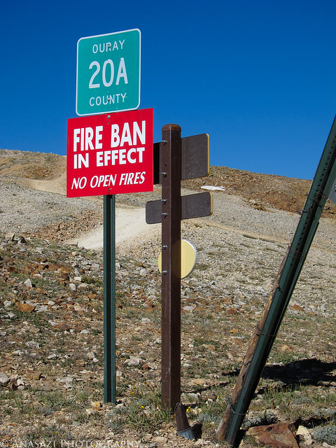
Fire Ban by IntrepidXJ, on Flickr
When we reached Ouray again we decided to turn up onto Camp Bird Road and drive up to Yankee Boy Basin. We passed Twin Falls on the way.
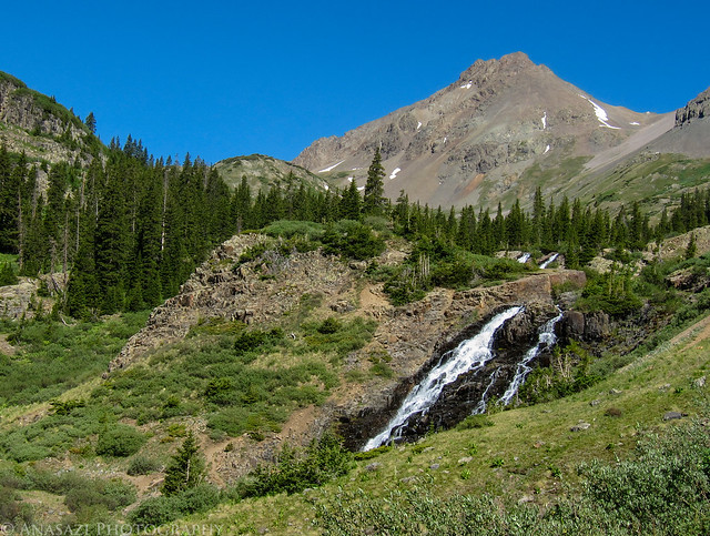
Twin Falls by IntrepidXJ, on Flickr
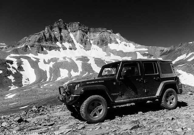
My Jeep at the upper trailhead in Yankee Boy Basin. I was surprised to find no one else up here since there's usually a few vehicles parked up here for the hike to Mount Sneffels and Blue Lakes Pass.
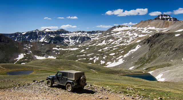
Yankee Boy Basin by IntrepidXJ, on Flickr
My Jeep under Gilpin Peak.
Under Gilpin Peak by IntrepidXJ, on Flickr
We drove down by Wright's Lake on our way back down to Ouray.
Wright's Lake by IntrepidXJ, on Flickr
After driving back down to Ouray we continued driving all the way home. It was a nice relaxing weekend that brought me back to how it all started for me; exploring the backcountry in my Jeep.
>> Gray Copper Gulch Photo Gallery
Featured image for slideshow:

The Original Trip Report on ADVENTR.CO
Amanda has been wanting to get back into the mountains for a while, so that's where we went this weekend. Saturday morning we left the heat of the Grand Valley behind and drove up into the San Juan Mountains. Back in 2009 I visited an area called Gray Copper Gulch situated between the Red Mountains and Brown Mountain. I have wanted to get back up there again to take some new photos and figured this weekend would be a great time. After driving through Ouray we drove over Corkscrew Pass and then into Gray Copper Gulch. We found a nice campsite between a few of the ponds that I wanted to photograph.
When we arrived in Gray Copper Gulch, clouds were rolling in and the wind was blowing pretty good, as you can tell from the ripples in the water.
Ripples & Clouds by IntrepidXJ, on Flickr
Camp setup with Red Mountain #1 in the background.
Home for the Night by IntrepidXJ, on Flickr
Once our camp was setup we left Gray Copper Gulch to drive a few of the high passes in the area.
Leaving Gray Copper Gulch by IntrepidXJ, on Flickr
Headed up the road to Hurricane Pass.
To Hurricane Pass by IntrepidXJ, on Flickr
Hurricane Pass, Elevation 12,730 feet.
Hurricane Pass by IntrepidXJ, on Flickr
A view down on Lake Como on the other side of Hurricane Pass.
Lake Como by IntrepidXJ, on Flickr
After dropping down a little ways from Hurricane Pass, we quickly started climbing back up to California Pass. My Jeep parked at California Pass, elevation 12,960 feet.
California Pass by IntrepidXJ, on Flickr
The view down into California Gulch from the pass.
California Gulch by IntrepidXJ, on Flickr
I stopped to photograph this old mining relic as we dropped down into California Gulch.
California View by IntrepidXJ, on Flickr
There were patches of Columbines along the road as we got closer to the ghost town of Animas Forks. Since the sky was completely overcast when we reached Animas Forks we didn't stick around long and continued on to Silverton.
Columbines by IntrepidXJ, on Flickr
A view out the rear window of an old abandoned car along the road.
Rear View by IntrepidXJ, on Flickr
After a nice dinner at Handlebars in Silverton, we drove up Cement Creek Gulch to reach our campsite again. The late afternoon light was much nicer when we arrived.
Gray Copper Camp by IntrepidXJ, on Flickr
Since the clouds had finally started to clear out and it was getting close to sunset, I spent the rest of the evening hiking around Gray Copper Gulch taking photos. There are a bunch of little ponds here that are great for reflections.
Beautiful view near our campsite in Gray Copper Gulch.
Evening View by IntrepidXJ, on Flickr
Hurricane Peak in the distance.
Reflecting Pond by IntrepidXJ, on Flickr
Evening Reflection by IntrepidXJ, on Flickr
Tree Reflections by IntrepidXJ, on Flickr
A nice view into Velocity Basin.
Velocity Basin Sunset by IntrepidXJ, on Flickr
Reflection of Bonita Peak in the distance.
Bonita Peak Reflection by IntrepidXJ, on Flickr
The last reflection of the evening before I went to bed.
Cloud Reflection by IntrepidXJ, on Flickr
Of course I woke up early enough to catch the sunrise. I just wish there had been some clouds around. Maybe next time...
Good Morning by IntrepidXJ, on Flickr
Morning Reflection by IntrepidXJ, on Flickr
When the sun was fully up we had some breakfast and broke down camp. Then we drove back over to the highway over Corkscrew Pass.
Fire Ban. A sign that we are probably going to be seeing a lot of in Colorado this year.
Fire Ban by IntrepidXJ, on Flickr
When we reached Ouray again we decided to turn up onto Camp Bird Road and drive up to Yankee Boy Basin. We passed Twin Falls on the way.
Twin Falls by IntrepidXJ, on Flickr
My Jeep at the upper trailhead in Yankee Boy Basin. I was surprised to find no one else up here since there's usually a few vehicles parked up here for the hike to Mount Sneffels and Blue Lakes Pass.
Yankee Boy Basin by IntrepidXJ, on Flickr
My Jeep under Gilpin Peak.
Under Gilpin Peak by IntrepidXJ, on Flickr
We drove down by Wright's Lake on our way back down to Ouray.
Wright's Lake by IntrepidXJ, on Flickr
After driving back down to Ouray we continued driving all the way home. It was a nice relaxing weekend that brought me back to how it all started for me; exploring the backcountry in my Jeep.
>> Gray Copper Gulch Photo Gallery
Featured image for slideshow:
")