- Joined
- Dec 23, 2013
- Messages
- 4,117
I've been contemplating this route for about two years now, and with the weather still holding out here in Salt Lake, I thought Saturday would be a great time to give it a try. Jeff, aka Circles, who joined me last weekend on Dale Peak decided to join me once again on this 10.8 mile loop. The route would take us up the west side of Grandeur Peak, to its summit, and then we would head down the most popular route, the Church Fork Trail, before jumping on the Pipeline Trail and then heading west to the Pipe Line Overlook, from there we made our way north until we intersected with the Dragon's Tail Route Trail and then on, back to our vehicles. The Pipe Line trail west of the Church Fork Trail, and the route from the overlook to the Dragon's Tail Trail I had never hiked before, so I was excited to see some new scenery.
We began at the trailhead at 8:00 am and began our route up Grandeur via the West Slope Trail. Now the West Slope Trail is one of my least favorite trails in the Wasatch. It's essentially straight up and exposed for most of the way to the summit. My knees and left hip were not to happy with me yesterday, so I just plodded along until the summit. When we reached the summit, we took one of our three breaks on the hike and enjoyed some snacks and the views. After maybe thirty minutes up top, we headed down the Church Fork Route, where we ran into quite a few people heading up to the summit.
We eventually reached the intersection with the Pipeline Trail, where we stopped and took our second break. A quick snack this time and we were off for Rattlesnake Gulch and the Pipe Line Overlook beyond. It was a little over three miles to the overlook, and when we reached it, we took our final break before making our way back north to the trailhead.

Route overview map

Reaching our trail that heads up the west side of Grandeur Peak

Common Storksbill along the trail

Once again, my obligatory Mount Olympus shot

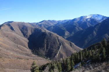
Parley's Canyon and I-80 still in the shadow of Grandeur

Sunlight on Parley's Ridge

Nothing but up from here on.

My knees are screaming!")

These asters have seen better days

Sunlight reaching the northern ridge and summmit

The east side of the Dragon's Trail dipping down into the drainage

Catching the morning sun through some Mountain Mahogany above us along the Dragon's Tail Ridge to our south

Alost 2/3rds of the way up we ran into some aster that is still blooming in December!

Jeff, stopping to take a picture of the aster

Reaching the mountain mahogany

Good to have the sun finally hitting us.

View to the north from the ridge

Lookout Peak in the distance. To the left of center is Dale Peak, where we hiked last week

Jeff, getting close to the summit

View from the top, looking east. There is no snow this time unlike two weeks ago on my Dragon's Tail hike

View from the top

Millvue Peak ahead, Murdock Peak beyond, and the snow covered Uintas in the far distance

From Mount Aire to Gbller Knob, and upper Millcreek Canyon

Summit shot thanks to a a trail runner

Snack and relaxation time

Jeff, taking some shots of the valley below before heading down Church Fork

Inversion building up in the southern end of the Salt Lake Valley

Beginning our decent into Church Fork

Oregon Grape along the trail

Aspen along the ridge

Nice view of upper Church Fork with Church Fork Peak. Can you spot the yurt?

A couple of spruce on the ridge

A view down into Church Fork

A look back up at Grandeur from the Church Fork side

The art of moseying.

Church Fork

Arriving at the Pipe Line Trail intersection

Limestone cliff band above

A look back up Millcreek Canyon with Millvue Peak at the center

Old piece of pipe and thus the name of the trail

Some donut humor on the pipe.

Making our way towards Rattlesnake Gulch

Entering Scout Hollow with Grandeur above

The Pipe Line Trail

@Titans - more spurge.

Unbelievable! A grass hopper in December. That's a first for me in the Wasatch.

The switchbacks down into Rattlesnake Gulch

Next stop: Pipe Line Overlook

View of Grandeur from Rattlesnake Gulch

Jeff on his way to the overlook

National Forest Signpost

Looking at the ridge across the canyon with Triangle Peak in the upper right

View north from the lookout

Grandeur Peak from the lookout

Leaving the lookout

Still some green in December amongst the scrub oak

Looking up towards the summit

Paraglider ahead

The Dragon Tail formation

More spring green in December

Jeff and the Dragon's Tail

I loved the looks of this juniper on the point

Another shot due east of the Dragon's Tail and a second paraglider

View of Grandeur from near the trailhead

Home sweet home! Back at the Jeep. The Subaru is in the shop. It had a seized caliper and they have to order a new one in. Can't
wait for that bill.
I've attached the KMZ file of our route for those who want to see it in Google Earth.
The End
We began at the trailhead at 8:00 am and began our route up Grandeur via the West Slope Trail. Now the West Slope Trail is one of my least favorite trails in the Wasatch. It's essentially straight up and exposed for most of the way to the summit. My knees and left hip were not to happy with me yesterday, so I just plodded along until the summit. When we reached the summit, we took one of our three breaks on the hike and enjoyed some snacks and the views. After maybe thirty minutes up top, we headed down the Church Fork Route, where we ran into quite a few people heading up to the summit.
We eventually reached the intersection with the Pipeline Trail, where we stopped and took our second break. A quick snack this time and we were off for Rattlesnake Gulch and the Pipe Line Overlook beyond. It was a little over three miles to the overlook, and when we reached it, we took our final break before making our way back north to the trailhead.
Route overview map
Reaching our trail that heads up the west side of Grandeur Peak
Common Storksbill along the trail
Once again, my obligatory Mount Olympus shot
Parley's Canyon and I-80 still in the shadow of Grandeur
Sunlight on Parley's Ridge
Nothing but up from here on.
My knees are screaming!
These asters have seen better days
Sunlight reaching the northern ridge and summmit
The east side of the Dragon's Trail dipping down into the drainage
Catching the morning sun through some Mountain Mahogany above us along the Dragon's Tail Ridge to our south
Alost 2/3rds of the way up we ran into some aster that is still blooming in December!
Jeff, stopping to take a picture of the aster
Reaching the mountain mahogany
Good to have the sun finally hitting us.
View to the north from the ridge
Lookout Peak in the distance. To the left of center is Dale Peak, where we hiked last week
Jeff, getting close to the summit
View from the top, looking east. There is no snow this time unlike two weeks ago on my Dragon's Tail hike
View from the top
Millvue Peak ahead, Murdock Peak beyond, and the snow covered Uintas in the far distance
From Mount Aire to Gbller Knob, and upper Millcreek Canyon
Summit shot thanks to a a trail runner
Snack and relaxation time
Jeff, taking some shots of the valley below before heading down Church Fork
Inversion building up in the southern end of the Salt Lake Valley
Beginning our decent into Church Fork
Oregon Grape along the trail
Aspen along the ridge
Nice view of upper Church Fork with Church Fork Peak. Can you spot the yurt?
A couple of spruce on the ridge
A view down into Church Fork
A look back up at Grandeur from the Church Fork side
The art of moseying.
Church Fork
Arriving at the Pipe Line Trail intersection
Limestone cliff band above
A look back up Millcreek Canyon with Millvue Peak at the center
Old piece of pipe and thus the name of the trail
Some donut humor on the pipe.
Making our way towards Rattlesnake Gulch
Entering Scout Hollow with Grandeur above
The Pipe Line Trail
@Titans - more spurge.
Unbelievable! A grass hopper in December. That's a first for me in the Wasatch.
The switchbacks down into Rattlesnake Gulch
Next stop: Pipe Line Overlook
View of Grandeur from Rattlesnake Gulch
Jeff on his way to the overlook
National Forest Signpost
Looking at the ridge across the canyon with Triangle Peak in the upper right
View north from the lookout
Grandeur Peak from the lookout
Leaving the lookout
Still some green in December amongst the scrub oak
Looking up towards the summit
Paraglider ahead
The Dragon Tail formation
More spring green in December
Jeff and the Dragon's Tail
I loved the looks of this juniper on the point
Another shot due east of the Dragon's Tail and a second paraglider
View of Grandeur from near the trailhead
Home sweet home! Back at the Jeep. The Subaru is in the shop. It had a seized caliper and they have to order a new one in. Can't
wait for that bill.
I've attached the KMZ file of our route for those who want to see it in Google Earth.
The End
Attachments
Last edited:
