Grandeur Peak - Dagon's Tail Route - November 21, 2021

scatman

Member
.
Joined
Dec 23, 2013
Messages
3,159
Well, the weekend warrior was back at it today with a hike to the summit of Grandeur Peak via the Dragon's Tail Route.

It was a balmy 28 degrees at the trailhead just before 8:00 am. Unfortunately there was a strong wind blowing out of Parleys Canyon which made the beginning of this hike quite chilly. Once I was able to get up alongside the dragon's tail, the winds calmed down and I was good to go. It had rained in the valley on Saturday, and the top of Grandeur got an inch, to an inch and a half of snow. This made for some slick footing, especially on the way down, and of course I took a spill on the descent. :)

While I ascended on the Dragon's Tail Route, I descended the Western Slope Trail, which is located one ridge to the north of the Dragon's Tail Route. Once the sunshine reached me, it turned into a beautiful day, and once again this week, the skies were clear and the air quality was good, which made views from the top very nice.
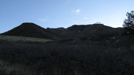
01.jpg

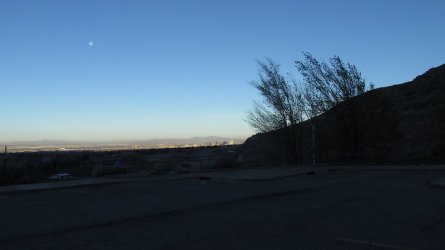
View from just above the trailhead in the early morning

02.jpg

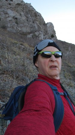
Beanie time

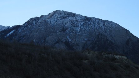
03.jpg

View of Grandeur from the west in the morning
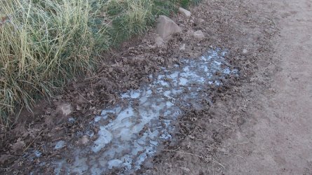
04.jpg

Ice in the puddles

05.jpg

Obligatory shot of Mount Olympus to the south. That snow wasn't there last weekend.
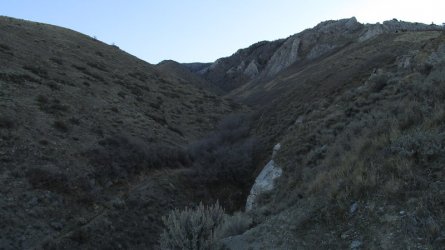
06.jpg

You can see the west end of the Dragon's Tail above
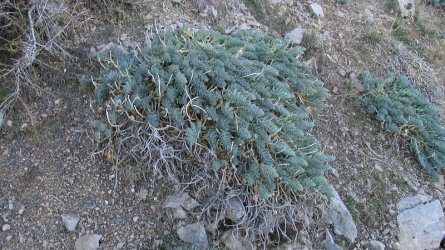
07.jpg

I swear spurge is taking over Utah! :mad:

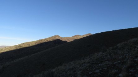
08.jpg

Sunrise on Parleys Ridge to the north
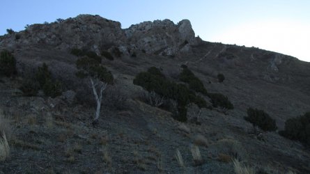
10.jpg

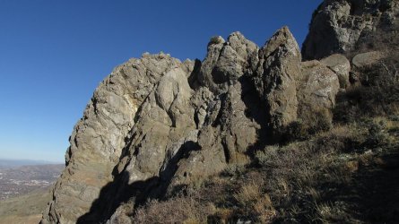
The Dragon's Tail dead ahead

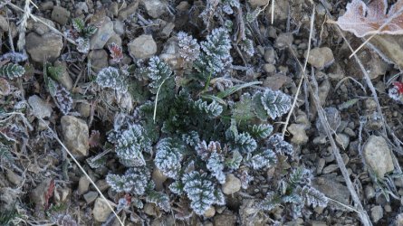
11.jpg

Frost on the common storksbill

12.jpg

Almost to the top of the curve of the Dragon's Tail. Still need my beanie
at this point
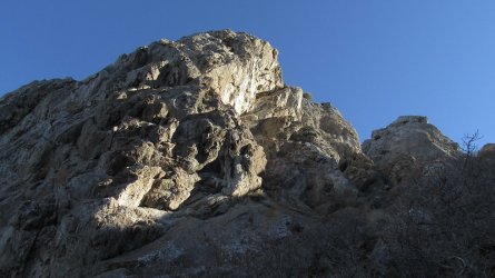
13.jpg

The sun finally hits the Dragon's Tail
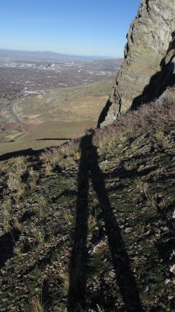
14.jpg

Hey, the headless horseman! :)

15.jpg

Rounding the curve in the Dragon's Tail
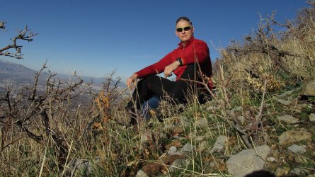
16.jpg

The bicycle cap is back! Soaking up some sunshine before continuing on.
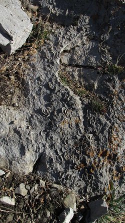
17.jpg

Not sure if you can make them out, but there are fossilized sea shells in
the limestone
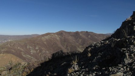
18.jpg

Parleys Ridge coming into view

19.jpg

I call this "Taming the dragon." :)

20.jpg

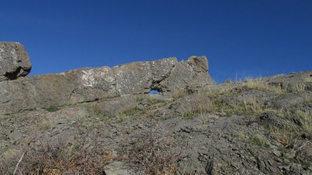
A small natural arch in the upper portion of the Dragon's Tail
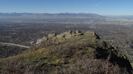
21.jpg

A look down at the eat end of the Dragon's Tail
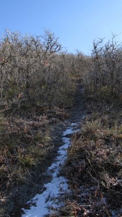
22.jpg

First snow on the trail

23.jpg

Mountain Mahogany time

24.jpg

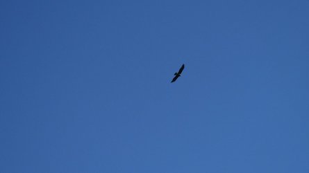
A good sized hawk above me

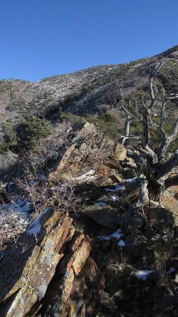
25.jpg

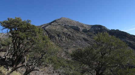
First good view of the summit of Grandeur
26.jpg

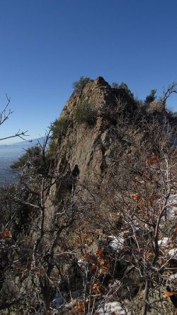
Following the spine of the ridge now

27.jpg

Looking back on a small scramble section
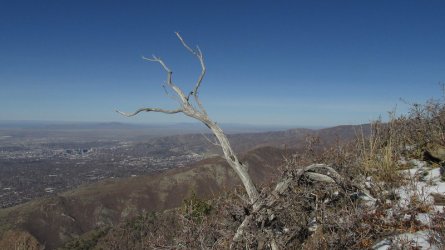
28.jpg

Dead mountain mahogany on the ridge

29.jpg

Ice in the mountain mahoganies near the summit
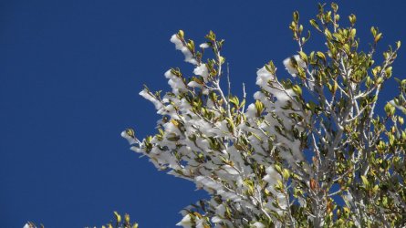
30.jpg

Close-up of the ice

31.jpg

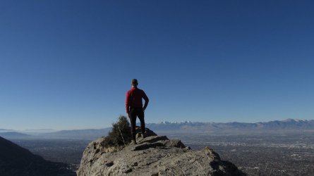
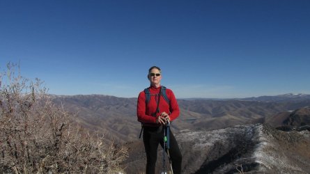
Summit shot

32.jpg

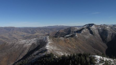
Views from the summit looking east - Church Fork Peak and Mount Aire beyond, along the ridgeline
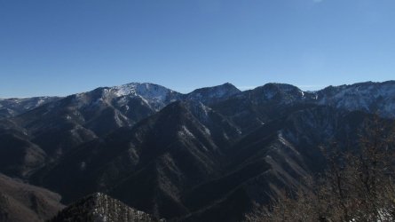
33.jpg

Views from the summit looking southeast - Gobblers Knob and Mount Raymond
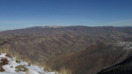
34.jpg

Views from the summit looking north - Dale Peak on Parleys Ridge with Grandview Peak and Lookout Peak along the furthest ridge
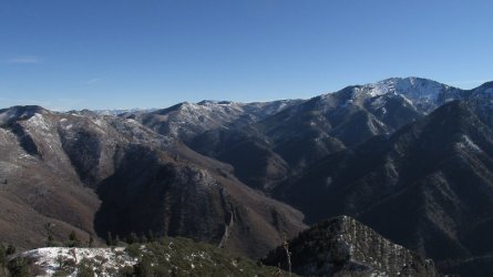
35.jpg

View from the summit looking ever so slightly southeast - Milvue Peak, Murdock Peak and Gobblers Knob once again
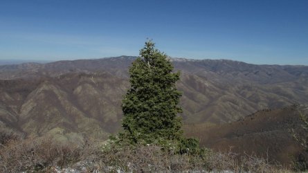
36.jpg

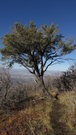
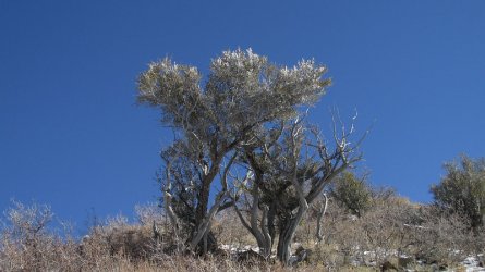
I liked the looks of this lone conifer as I began to head down
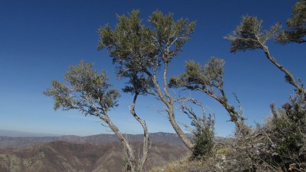
37.jpg

More mountain Mahogany along the ridge
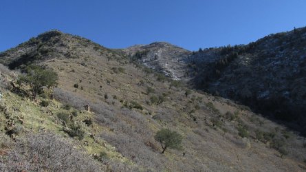
38.jpg

A quick peek back up at the summit of Grandeur, but this time from the West Slope Trail
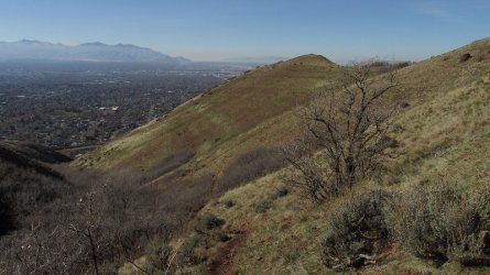
39.jpg

Dropping down into the drainage on my way back to the valley
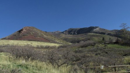
40.jpg

An afternoon shot from the west. This is the same shot I took earlier in the morning before sunrise, but now you can see it. :)
You can make out part of the Dragon's Tail at the upper right of the image.

41.jpg

The Sube eagerly awaits near the trailhead!


The End
 
Last edited:

Titans

Member
.
Joined
Aug 18, 2018
Messages
1,550
Very nice, weekend warrior! Yah, that was a bit spicy with all that wind yesterday. One strong gust yesterday moved the Merrels and me sideways, ever had that happen? I’m guessing you might now suggest practicing on a Bosu in a wind tunnel! And the spurge… yes, super invasive, spreads everywhere under the right conditions.
 

scatman

Member
.
Joined
Dec 23, 2013
Messages
3,159
Very nice, weekend warrior! Yah, that was a bit spicy with all that wind yesterday. One strong gust yesterday moved the Merrels and me sideways, ever had that happen? I’m guessing you might now suggest practicing on a Bosu in a wind tunnel! And the spurge… yes, super invasive, spreads everywhere under the right conditions.

About twenty years ago, my neighbors directly across the street from me moved. The new people that moved in replaced the grass in the parking strip with spurge. I had never seen it before and my wife had to tell me what it was. Soon it would take over their entire front yard. Maybe five or six years after they planted it, I started to see it on my way down to City Creek Canyon from 11th Avenue, along the side of the road and up on the hillsides a bit. A couple of years after that Salt Lake organized a spurge cleanup to pull it and discard of it. Sheila and I volunteered the first couple of years to help remove it. Unfortunately it wasn't enough, as I began to see it in lower City Creek. Now, I have seen it within a rocks throw of the water treatment plant that is located between 3 and 3.5 miles up the canyon, and in the spring I can see it blooming way up on some of the steep hillsides of the canyon. I haven't seen it yet above the treatment plant, but it is only a matter of time. It broke my heart yesterday to see it at the base of Grandeur. :cry: I'm not sure if my neighbors planting it started it off, but like I said I had never seen it before in this area of town at least.
 

Titans

Member
.
Joined
Aug 18, 2018
Messages
1,550
About twenty years ago, my neighbors directly across the street from me moved. The new people that moved in replaced the grass in the parking strip with spurge. I had never seen it before and my wife had to tell me what it was. Soon it would take over their entire front yard. Maybe five or six years after they planted it, I started to see it on my way down to City Creek Canyon from 11th Avenue, along the side of the road and up on the hillsides a bit. A couple of years after that Salt Lake organized a spurge cleanup to pull it and discard of it. Sheila and I volunteered the first couple of years to help remove it. Unfortunately it wasn't enough, as I began to see it in lower City Creek. Now, I have seen it within a rocks throw of the water treatment plant that is located between 3 and 3.5 miles up the canyon, and in the spring I can see it blooming way up on some of the steep hillsides of the canyon. I haven't seen it yet above the treatment plant, but it is only a matter of time. It broke my heart yesterday to see it at the base of Grandeur. :cry: I'm not sure if my neighbors planting it started it off, but like I said I had never seen it before in this area of town at least.

Whoa…. thanks for sharing. Sad story, but that’s exactly how it starts. Very difficult once it gets out of control like that. We get a lot of compliments about the “wonderful looking spurge” popping up everywhere around a hot stone patio out front (planted 1 plant a decade ago)…. Those I can easily pull, but birds may pick up the seeds too and it spreads… Im concerned about 1 ornamental grass (Adagio), which has escaped to the edge of the property close to wetlands. The best is to not plant any invasive species :cry:
 

swmalone

Member
Joined
Apr 27, 2016
Messages
483
@scatman I have loved reading about all of these weekend trips you do. How long does it take you to get to most of the trailheads?
 

scatman

Member
.
Joined
Dec 23, 2013
Messages
3,159
@scatman I have loved reading about all of these weekend trips you do. How long does it take you to get to most of the trailheads?

Glad you like the reports @swmalone. It takes me about 25 minutes to drive to the Mount Olympus Trailhead from my house, and probably 20 to reach the Grandeur Peak Trailhead. I could probably shave a few minutes off if traffic is light and I don't hit any red lights along the way.

As for the foothill hikes, at least this fall, I have just been heading out my front door and walking to the trailheads. Normally when I drive to them though, it can take anywhere from 5 - 10 minutes depending on which one I'm heading to.
 

Bob

Trailmaster
Joined
Mar 3, 2013
Messages
3,740
Guess nobody worries about the dyers woad...... It's as bad or worse
 
Last edited:

swmalone

Member
Joined
Apr 27, 2016
Messages
483
Glad you like the reports @swmalone. It takes me about 25 minutes to drive to the Mount Olympus Trailhead from my house, and probably 20 to reach the Grandeur Peak Trailhead. I could probably shave a few minutes off if traffic is light and I don't hit any red lights along the way.

As for the foothill hikes, at least this fall, I have just been heading out my front door and walking to the trailheads. Normally when I drive to them though, it can take anywhere from 5 - 10 minutes depending on which one I'm heading to.
I'm rather envious of your access to these trailheads. The closest for me is the Wellsvilles and I have to drive around to the East side for access. I am keeping track of these hikes you post for possible excursions for exploring areas we haven't spent much time on since moving to Utah.
 

scatman

Member
.
Joined
Dec 23, 2013
Messages
3,159
I'm rather envious of your access to these trailheads. The closest for me is the Wellsvilles and I have to drive around to the East side for access. I am keeping track of these hikes you post for possible excursions for exploring areas we haven't spent much time on since moving to Utah.

Yes, I'm lucky as far as access is concerned. Well, if you are ever down this way and want some company on a hike, just let me know. If you give me a little bit of notice, I should be able to fit it in.

I haven't hiked in the Wellsvilles since I was in college. I hiked up twice to Bob Stewart Peak and Wellsville Cone from the Sardine Canyon side back in 1984 and again in 85. I need to get to the peaks further north along the ridgeline someday. Maybe this summer I can fit one of them in.
 

scatman

Member
.
Joined
Dec 23, 2013
Messages
3,159
Guess nobody worries about the dyers woad...... It's as bad or worse

The woad has been there since I've been hiking the area, so it didn't affect me as much as the spurge going hog wild I guess.
 
Similar threads
Thread starter Title Forum Replies Date
scatman Grandeur Peak - November 11, 2022 Hiking & Camping 15
scatman Grandeur Peak - January 15, 2022 Hiking & Camping 6
scatman Grandeur Peak Loop - December 4, 2021 Hiking & Camping 4
scatman Grandeur Peak, The West Slope Approach - October 31, 2020 Hiking & Camping 7
scatman Grandeur Peak - West Slope Route - September 3, 2018 Hiking & Camping 12
scatman Grandeur Peak - January 17, 2016 Hiking & Camping 7
scatman Grandeur Peak - February 16, 2015 Hiking & Camping 3
scatman Grandeur Peak - Dragon's Tail Ridge Route - November 28, 2014 Hiking & Camping 19
scatman Grandeur and Church Fork Peaks Loop - May 29, 2021 Hiking & Camping 19
TannerT Grandeur 1/16 Hiking & Camping 12
scatman Lookout Peak - May 27, 2023 Hiking & Camping 13
scatman Frary Peak - Antelope Island - February 20, 2023 Hiking & Camping 10
scatman Ensign Peak - November 24, 2022 Hiking & Camping 11
Titans What’s your unfinished business? Hard canyon access, mtn peak, you name it! General Discussion 54
ram Eldorado Peak 2022 Backpacking 3
TheMountainRabbit Younts Peak (Teton/Washakie Wilderness) - July 2022 Backpacking 22
regehr Lookout Peak 6/25/22 Hiking & Camping 3
scatman Unnamed Peak 8194 - June 25, 2022 Hiking & Camping 17
scatman Mendon Peak - Wellsville Mountain Wilderness - June 4, 2022 Hiking & Camping 13
scatman Dale Peak - May 22, 2022 Hiking & Camping 21
westy Invite Glacier Peak, Washington Meet Up (Members Only) 2
TheMountainRabbit Invite Younts Peak, Mid-July 2022 Meet Up (Members Only) 11
LarryBoy SLC: Terrace Hills Drive to Big Mountain Peak Trip Planning 16
ram Glacier Peak July 2021 Backpacking 9
scatman Frary Peak - Antelope Island - January 7, 2022 Hiking & Camping 21
Wanderlust073 Raleigh Peak Hiking & Camping 4
scatman Dale Peak - November 27, 2021 Hiking & Camping 3
K Kings Peak Trip Trip Planning 6
TrektheWorld Crater Lake and Lone Eagle Peak Backpacking 1
la_alpinista Thoughts on potential off trail routes in Cloud Peak Wilderness CPW Trip Planning 1
scatman Lone Peak - July 14, 2021 Hiking & Camping 28
Bob Yellowstone - Electric Peak visit Backpacking 2
scatman Lewiston Peak - May 15, 2021 Hiking & Camping 7
LarryBoy Looping the Highline: Gilbert Peak Edition Backpacking 13
scatman Peak 6551 - Lakeside Mountains - April 17, 2021 Hiking & Camping 7
napatony13 Trinity Alps-Grizzly Peak Trail Hiking & Camping 0
scatman Lookout Peak - January 16, 2021 Hiking & Camping 10
scatman Frary Peak - December 5, 2020 Hiking & Camping 10
scatman Church Fork Peak - November 28, 2020 Hiking & Camping 2
scatman Naomi Peak - September 5, 2020 Hiking & Camping 2
andyjaggy Deep Creek Lakes and Windriver Peak Trip Planning 6
Curt Visiting (Part of) the Lake District of Cloud Peak Wilderness Backpacking 15
misSOULa Into the Winds: Titcomb Basin and Gannett Peak Attempt Backpacking 6
scatman Grandview Peak - July 24, 2020 Hiking & Camping 11
scatman Millvue Peak - July 3, 2020 Hiking & Camping 2
Mike K Kings Peak Via Garfield Basin Backpacking 18
DrNed Water Sources McKee Draw to Leidy Peak Trip Planning 12
scatman Ensign Peak to Grandview Peak Attempt Hiking & Camping 10
ram Colchuck Peak 7/10-12/2019 Backpacking 3
Udink Kimble and Turner Peak Hiking & Camping 9

Similar threads

Don't like ads? Become a BCP Supporting Member and kiss them all goodbye. Click here for more info.

Top