NateGeesaman
Donkey
- Joined
- Jan 20, 2012
- Messages
- 272
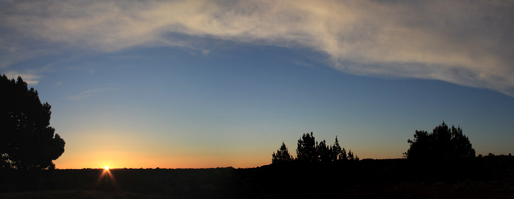
I recently had the good fortune of spending time along the Hole in the Rock Road area in Grand Staircase with my girlfriend. She has been so busy that she has missed out on my last few trips and it was good to spend an extended chunk of time in the desert and on the road with her. We left SLC around 6:00 A.M. and had a good hundred miles on the road before the sun rise.
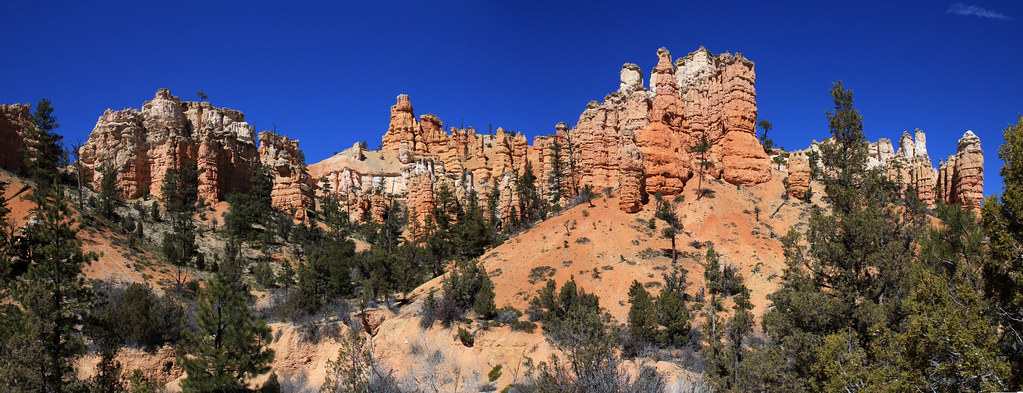
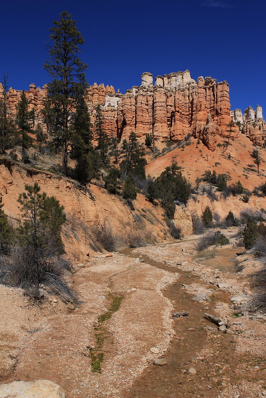
We stopped by Bryce on the way to our final destination and had some nice clouds and light.
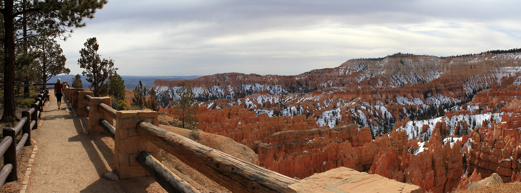
Ariel Bryce Pano by NateGeesaman, on Flickr
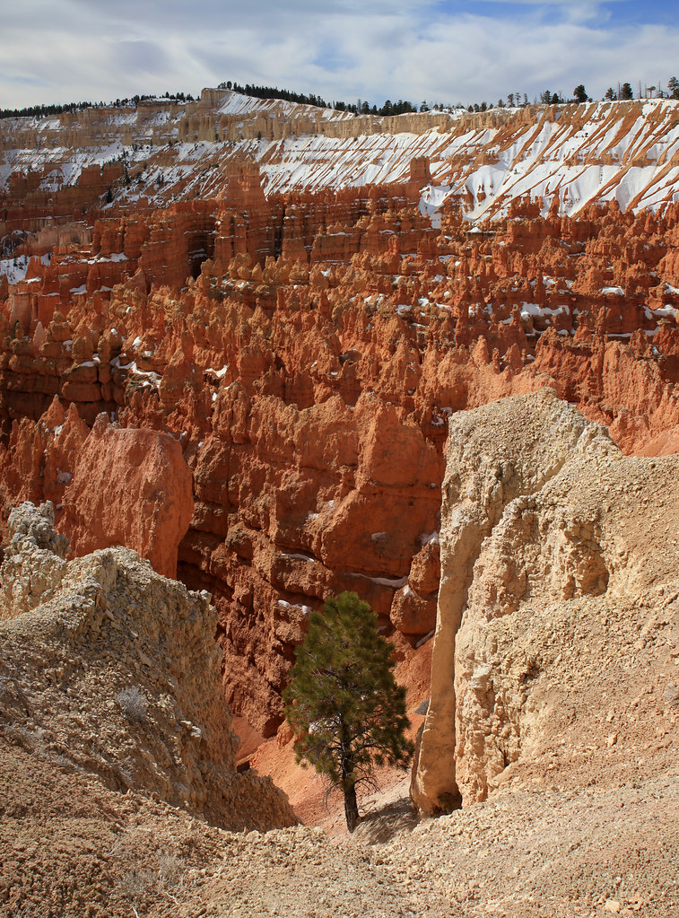
Bryce Vertorama by NateGeesaman, on Flickr
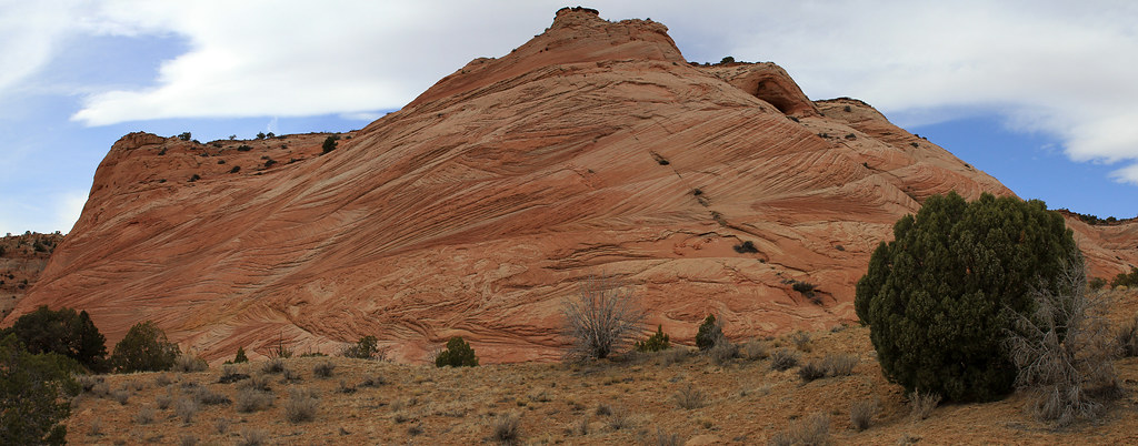
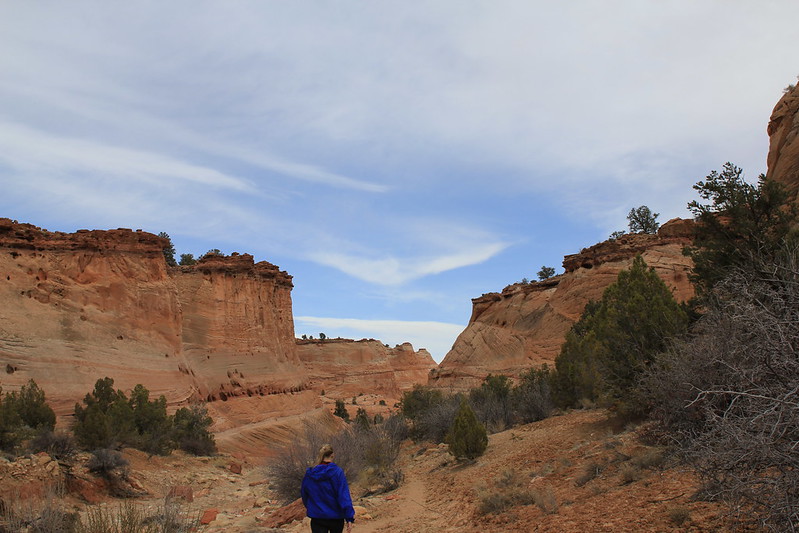
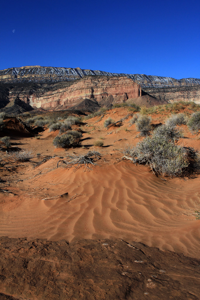
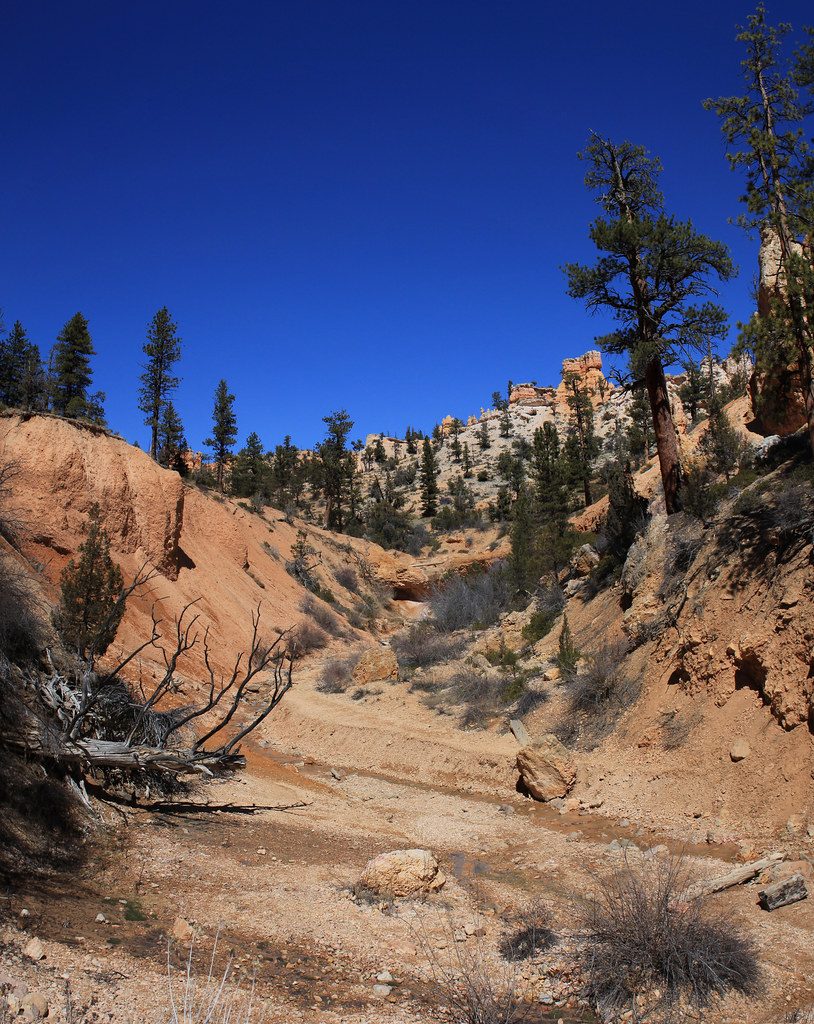
We were back on the road quickly though, as I was worried about squeezing in a good size hike and finding a good camp spot before dark. We arrived at the Zebra Canyon Trailhead around noon. Thanks to everyone from the backcountrypost.com/forum/ community for helping me decide on and find this hike. The trail did not suck and had a lot of beauty to share.
Along Zebra Canyon Trail by NateGeesaman, on Flickr
IMG_8982 by NateGeesaman, on Flickr
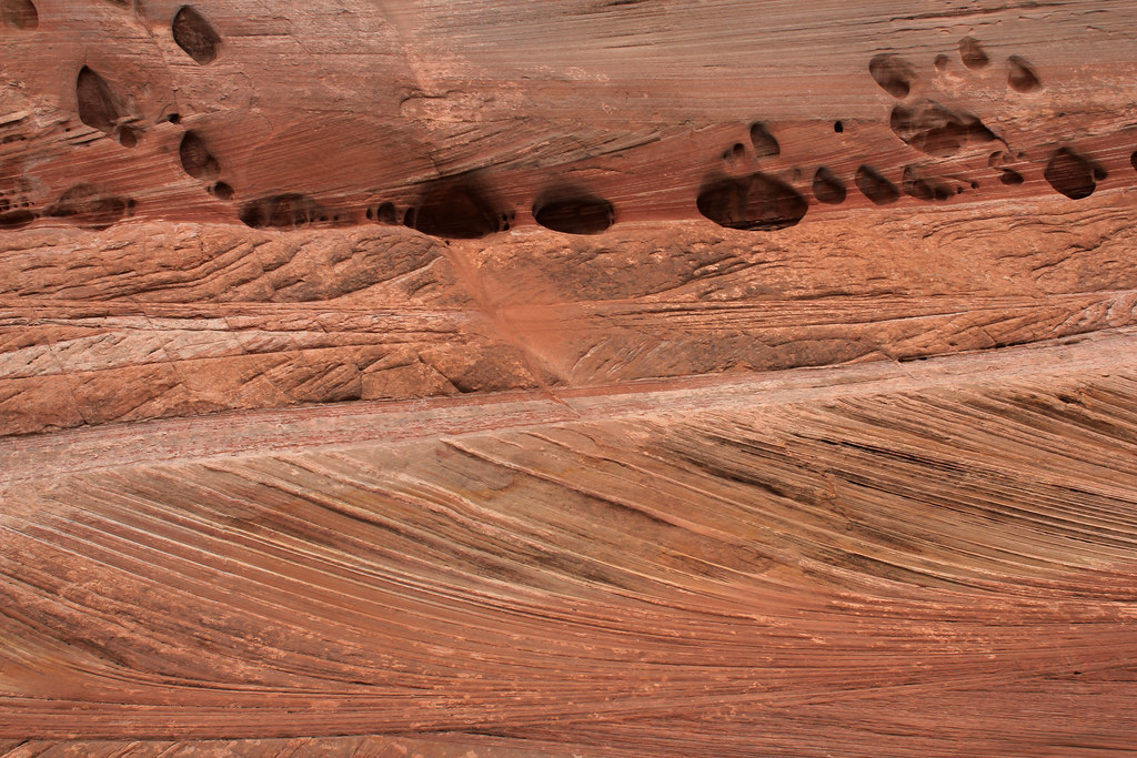
Escalante Textures by NateGeesaman, on Flickr
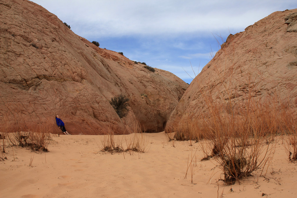
We made our way to the mouth of Zebra Canyon which was not difficult to find with the maps and instructions that backcountrypost.com/forum members led me to: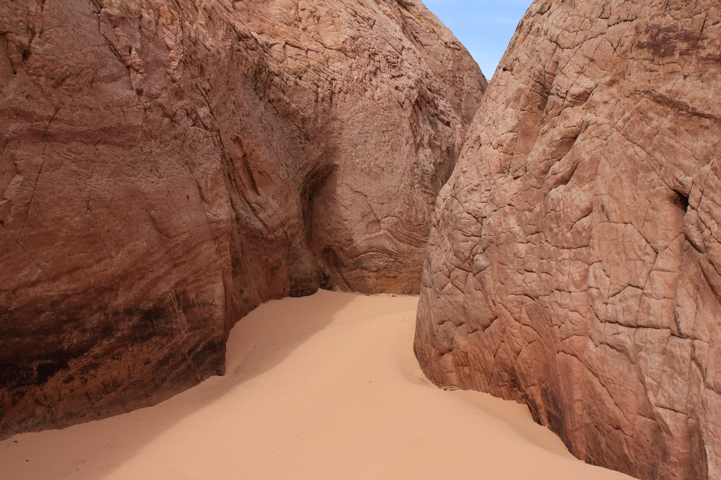
Zebra Entrance by NateGeesaman, on Flickr
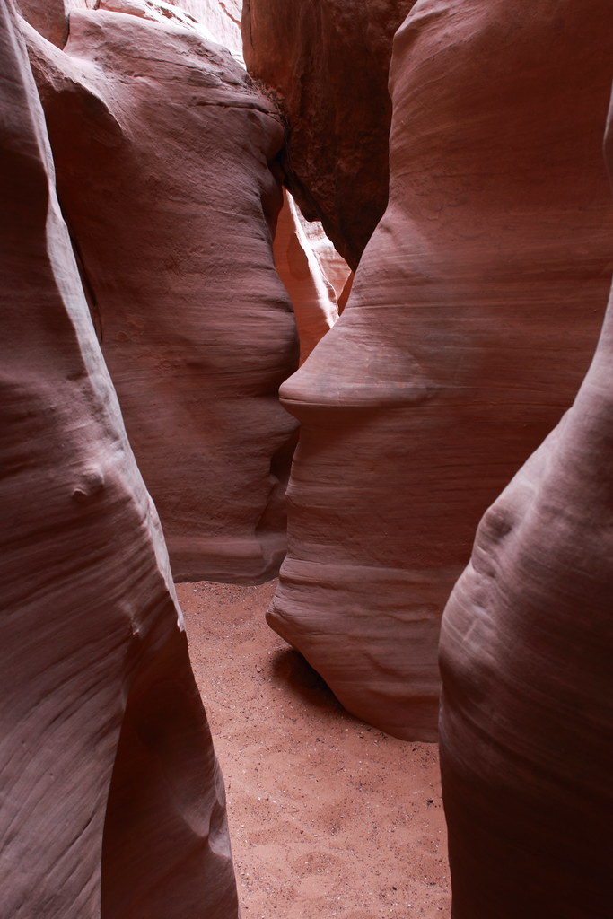
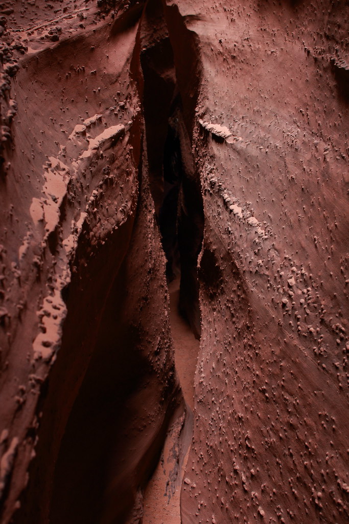
On to the innards of the Zebra:
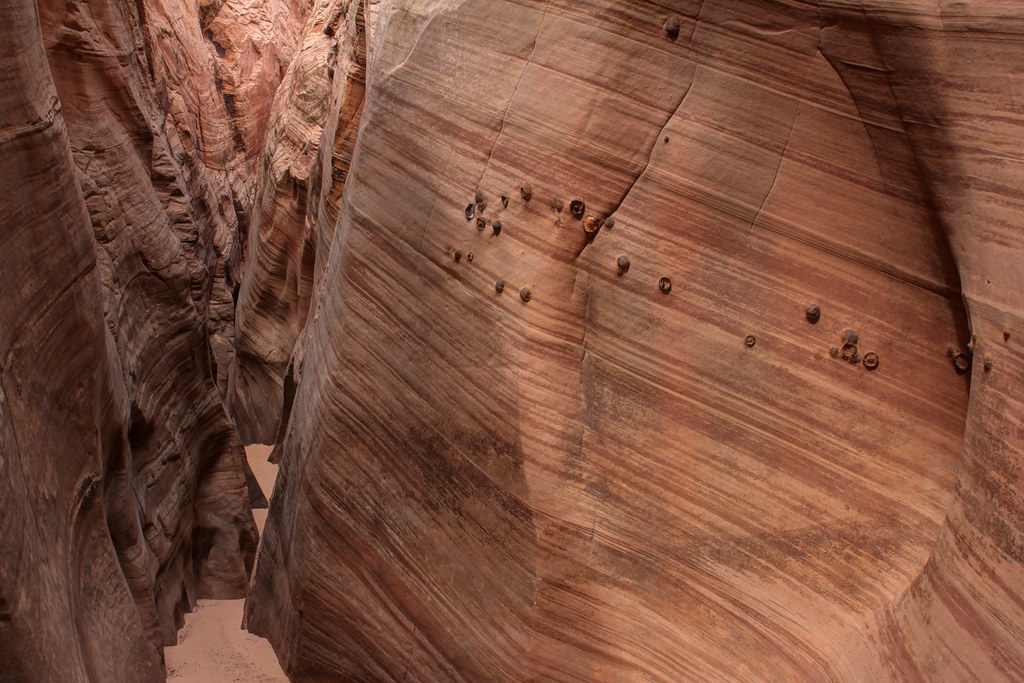
Zebra Canyon 2 by NateGeesaman, on Flickr
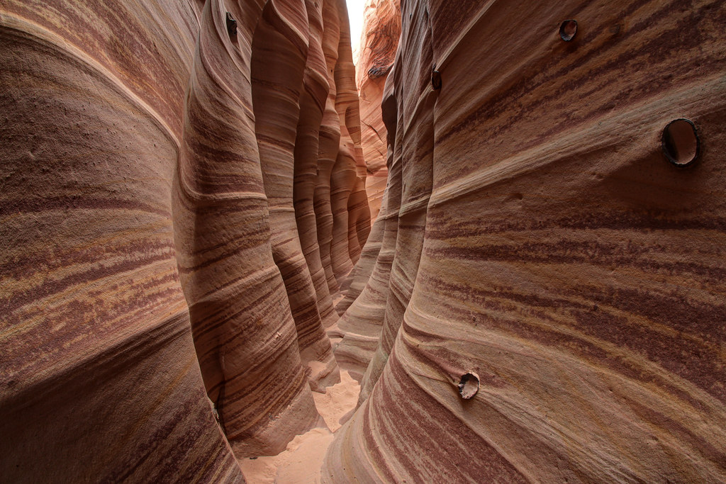
Zebra Canyon by NateGeesaman, on Flickr
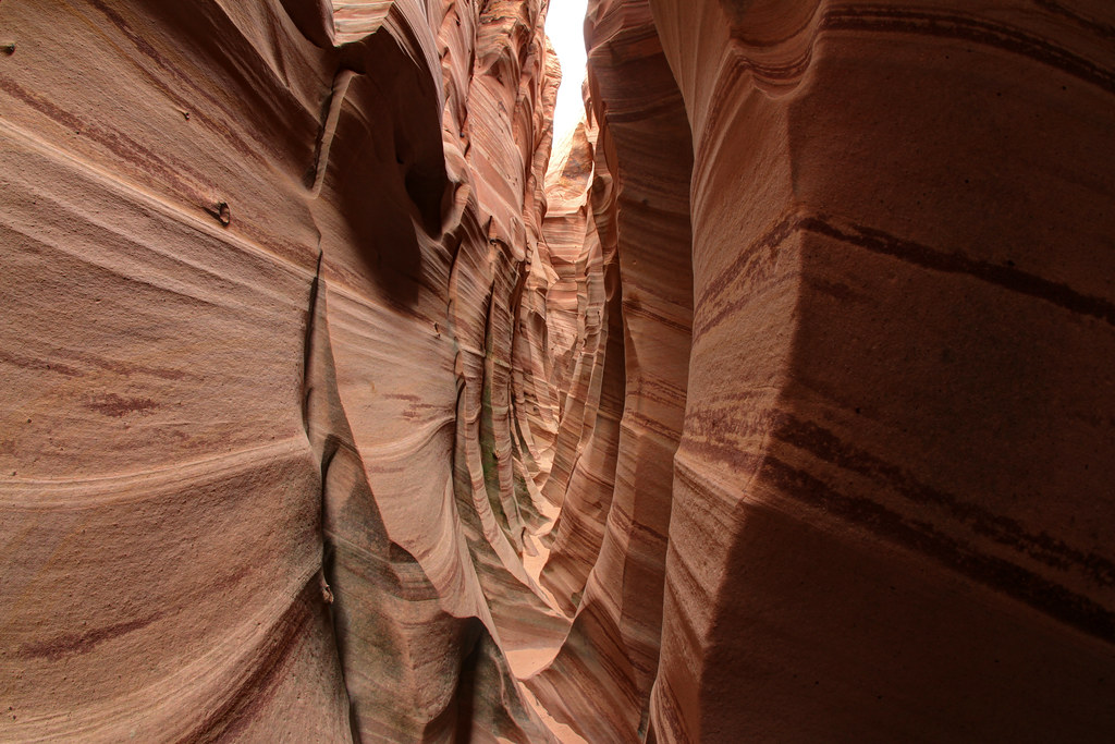
Zebra Slot by NateGeesaman, on Flickr
After the long drive and deep sand slog section of the hike, we were tired and we reluctantly decided to skip the search for Tunnel Slot.
Ariel Zebra Yawn by NateGeesaman, on Flickr
So back along the beautiful trail we went.
Zebra trail pano low by NateGeesaman, on Flickr
Zebra trail pano low by NateGeesaman, on Flickr
Zebra Trail Pano 2 by NateGeesaman, on Flickr
Now to find a camp spot. We checked out the road to Harris Wash and the primitive spots along that road, but decided to keep looking and continued South along H.I.T.R. Road.
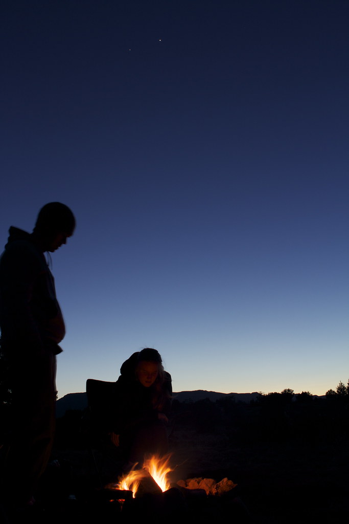
We arrived at Dancehall Rock during a dull sunset:
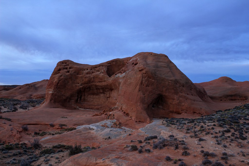
Dancehall Rock by NateGeesaman, on Flickr
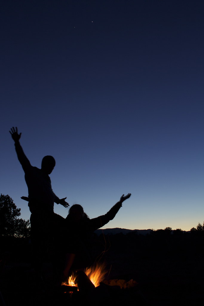
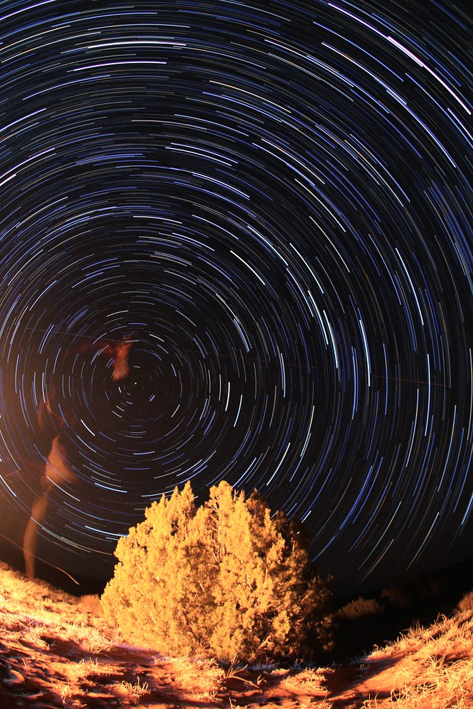
We found the Dancehall Rock area to be quite appealing and started a fire and cooked up our tin foil dinners. I took star shots while they cooked and played with long single exposure star trails. We had beautiful clouds all day, but come night time there was only a thin layer of high clouds to speak of and I had a good 1-2 hour window to shoot some stars. It was a great way to round off an extremely beautiful day.
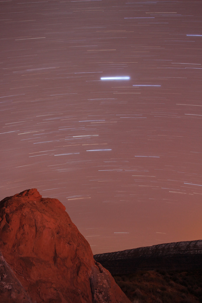
Southern Dancehall Trails by NateGeesaman, on Flickr
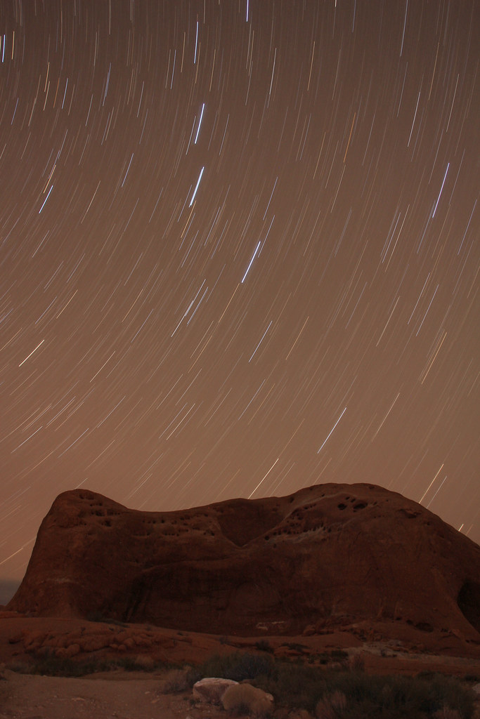
Dancehall rock trails by NateGeesaman, on Flickr
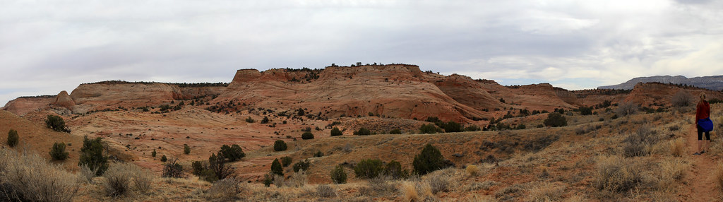
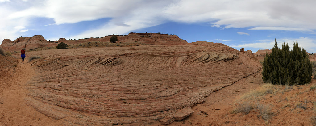
When I woke up after a hearty nights sleep in the back of my Subie, I decided to explore the area east of Dancehall Rock for a bit while Ariel finished getting her z's. I climbed on top of Dancehall and did my morning ritual and took in all the beauty around.
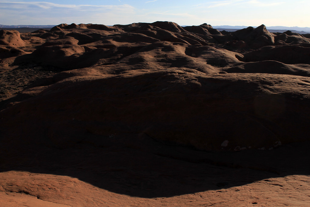
Above Dancehall by NateGeesaman, on Flickr
This area was way more beautiful than one would imagine after seeing it from the road. I had a great time climbing around and looking at the monstrous potholes and the beautiful desert gardens inside them. I didn't get any good pics of the potholes because of harsh bright morning light. There was beauty all around though.
Sand dance by NateGeesaman, on Flickr
Back on the road, we went to Devil's Garden and then all the way back out to the visitors center (like we should have done on the way in) to try and talk them into letting me camp there and get night shots in the area. Not happening
gnomage by NateGeesaman, on Flickr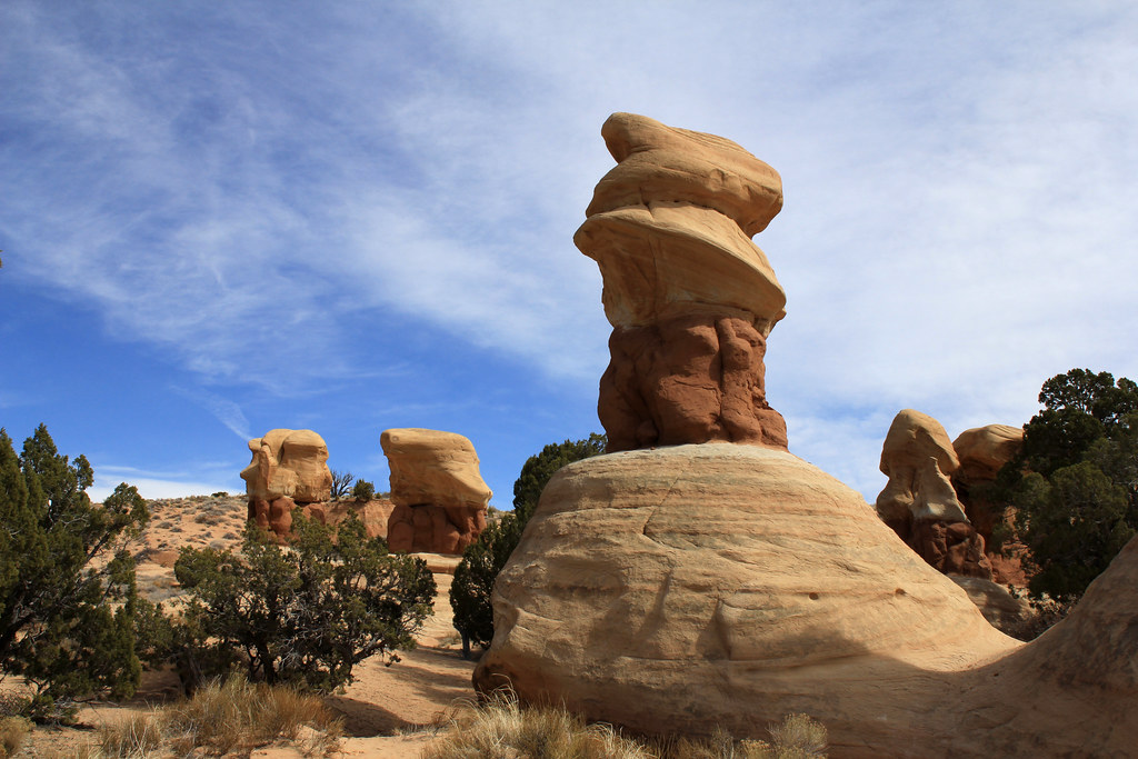
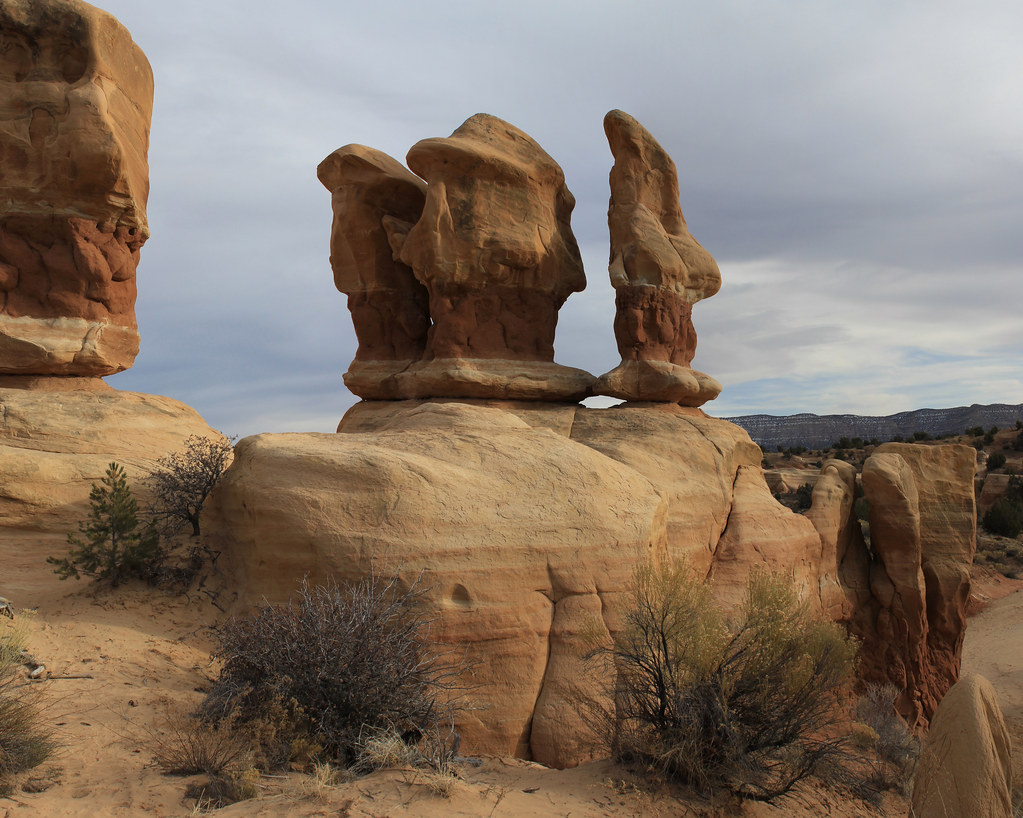
Hoodoo of Devil's Garden by NateGeesaman, on Flickr
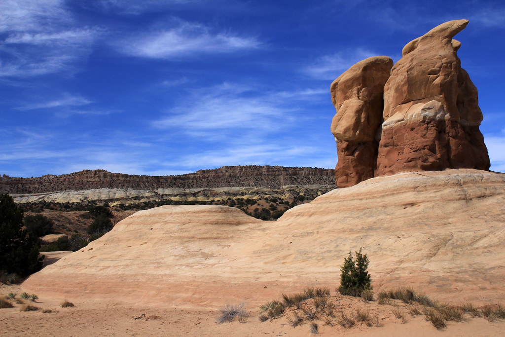
Devil's Garden Scene by NateGeesaman, on Flickr
Then it was on to the Dry Fork Slot Canyons. We hiked down to dry fork the wrong way, which was well marked with cairns. We dropped into the Dry Fork at the mouth of Spooky rather than Peek-a-boo. So we did Spooky first.
Spooky Canyon Curves by NateGeesaman, on Flickr
Spooky Canyon Ride by NateGeesaman, on Flickr
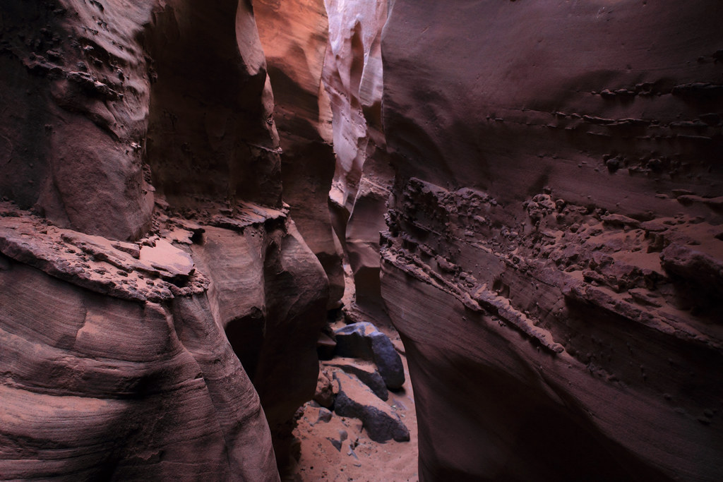
Spooky2 by NateGeesaman, on Flickr
This canyon was great! Such a fun, unique, and exciting place to go on a hike. Sadly, this was the only of the 4 slots we experienced. We tried to hike the loop to Peek-a-boo, but wound up cutting the wrong way back to the Dry Fork. We tried for a bit to find Peek-a-boo and even saw it clearly once we started to climb back out towards the trail head, but with tired legs from the back and forth in the deep sand... next time I guess.
Now to look for a camp spot close to Devil's Garden so as to accommodate my "need" to take star shots back there. We found a decent enough spot along the Harris Wash Road that was only 3.7 miles from Devil's Garden. So we cooked dinner and enjoyed the sunset waiting for stars to arrive.
You can see Jupiter and Venus directly above us in the twilight sky.
IMG_9945_2 by NateGeesaman, on Flickr
IMG_9936_2 by NateGeesaman, on Flickr
Then on to Devil's Garden to capture some stars:
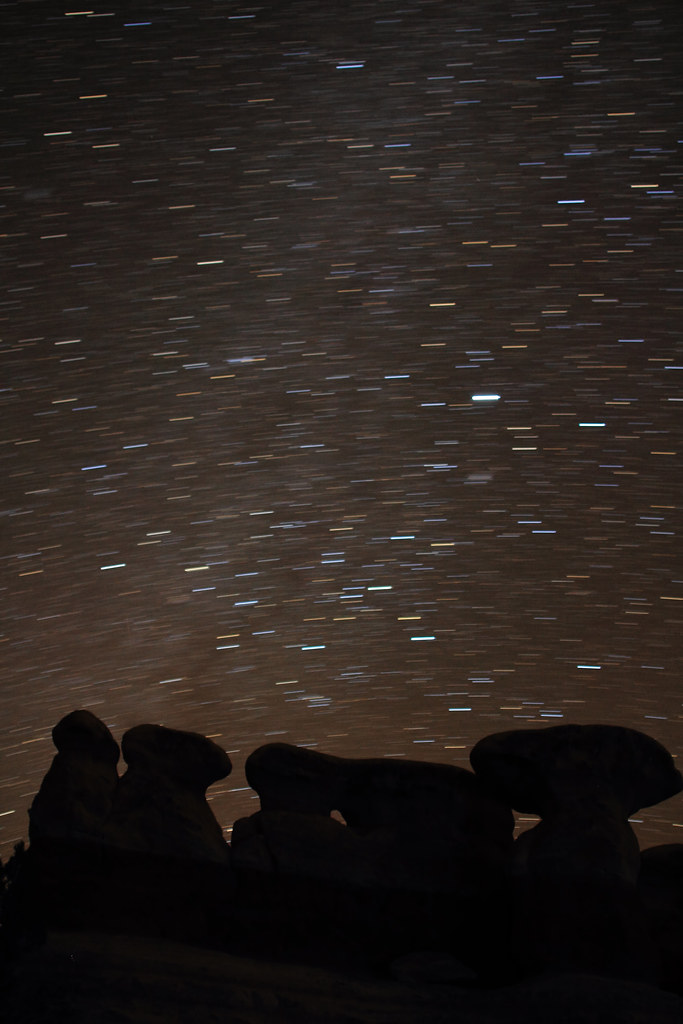
Hoodoos and Trails by NateGeesaman, on Flickr
Devil's Garden Night by NateGeesaman, on Flickr
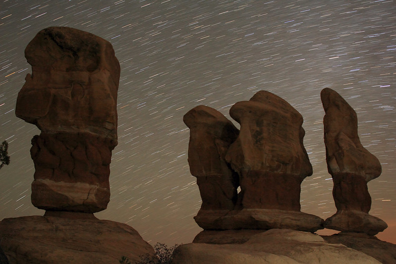
4 gnomes startrails by NateGeesaman, on Flickr
I would start one of my long exposures and then go check on Ariel who was reading in the car.
At one point when I went to go check on her, a big truck was slowly pulling into the parking area and I was worried this was the same ranger who told me I could definitely not camp there and the picnic are was for DAY use, but it was just some friendly people from my home state of Illinois who were looking for a spot to camp. I hope I was of some help to them.
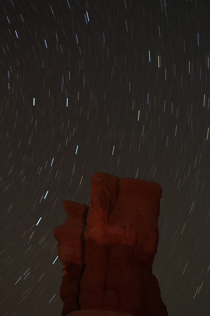
Devil's Hoodoo Night by NateGeesaman, on Flickr
Metate night by
NateGeesaman, on Flickr
Then it was back to Harris Wash Road. The 3.7 mile drive to our spot was easy, but our spot was hard to find in the dark, even knowing the exact distance. After arriving back at camp I shot some more star trails and we drank some good beers around the fire before going to bed.
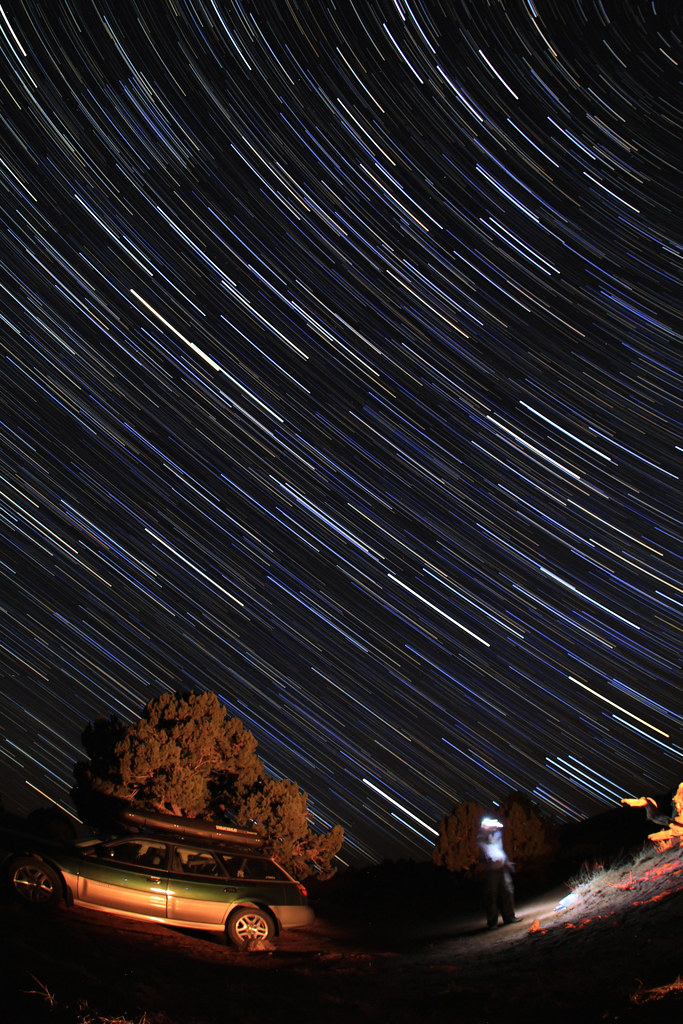
Grand Staircase Trails by NateGeesaman, on Flickr
Harris Wash Juniper trails by NateGeesaman, on Flickr
There was a decent sunrise in the morning.
Harris Wash Sunrise by NateGeesaman, on Flickr
We had some bomb curry vegetable soup for breakfast and then got on the road home.
Of course Bryce was on the way home again so we did the short Mossy Cave Trail:
Bryce Pano by NateGeesaman, on Flickr
Mossy Desert by NateGeesaman, on Flickr
This was an irrigation ditch dug by early Mormon settlers in the area:
Bryce Verto 2 by NateGeesaman, on Flickr
The cave's ice was on the wane, but still quite spectacular:
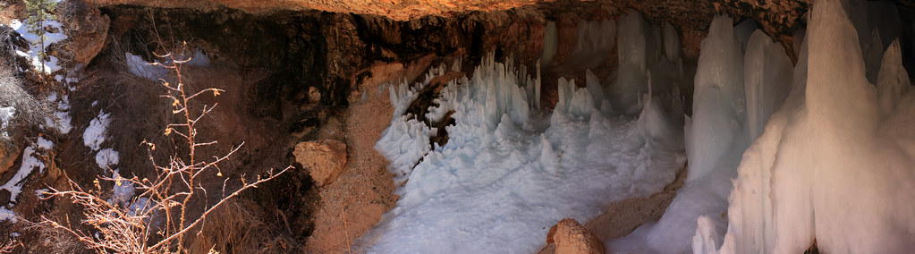
Mossy Cave Pano by NateGeesaman, on Flickr
Then it was back on the road. My camera batteries all pooped out by this point, but there were beautiful Lenticlar clouds all over on the drive home and it made for an extremely scenic and pleasurable time in the car. As if the trip home couldn't get any nicer, we stopped by the hot springs in Meadow and took a nice dip enjoying the beautiful weather and mountain scenery that place had on offer. After that, smooth sailing all the way home.
Featured image for slideshow:

We stopped by Bryce on the way to our final destination and had some nice clouds and light.
Ariel Bryce Pano by NateGeesaman, on Flickr
Bryce Vertorama by NateGeesaman, on Flickr
We were back on the road quickly though, as I was worried about squeezing in a good size hike and finding a good camp spot before dark. We arrived at the Zebra Canyon Trailhead around noon. Thanks to everyone from the backcountrypost.com/forum/ community for helping me decide on and find this hike. The trail did not suck and had a lot of beauty to share.
Along Zebra Canyon Trail by NateGeesaman, on Flickr
IMG_8982 by NateGeesaman, on Flickr
Escalante Textures by NateGeesaman, on Flickr
We made our way to the mouth of Zebra Canyon which was not difficult to find with the maps and instructions that backcountrypost.com/forum members led me to:
Zebra Entrance by NateGeesaman, on Flickr
On to the innards of the Zebra:
Zebra Canyon 2 by NateGeesaman, on Flickr
Zebra Canyon by NateGeesaman, on Flickr
Zebra Slot by NateGeesaman, on Flickr
After the long drive and deep sand slog section of the hike, we were tired and we reluctantly decided to skip the search for Tunnel Slot.
Ariel Zebra Yawn by NateGeesaman, on Flickr
So back along the beautiful trail we went.
Zebra trail pano low by NateGeesaman, on Flickr
Zebra trail pano low by NateGeesaman, on Flickr
Zebra Trail Pano 2 by NateGeesaman, on Flickr
Now to find a camp spot. We checked out the road to Harris Wash and the primitive spots along that road, but decided to keep looking and continued South along H.I.T.R. Road.
We arrived at Dancehall Rock during a dull sunset:
Dancehall Rock by NateGeesaman, on Flickr
We found the Dancehall Rock area to be quite appealing and started a fire and cooked up our tin foil dinners. I took star shots while they cooked and played with long single exposure star trails. We had beautiful clouds all day, but come night time there was only a thin layer of high clouds to speak of and I had a good 1-2 hour window to shoot some stars.
It was a great way to round off an extremely beautiful day.Southern Dancehall Trails by NateGeesaman, on Flickr
Dancehall rock trails by NateGeesaman, on Flickr
When I woke up after a hearty nights sleep in the back of my Subie, I decided to explore the area east of Dancehall Rock for a bit while Ariel finished getting her z's. I climbed on top of Dancehall and did my morning ritual and took in all the beauty around.
Above Dancehall by NateGeesaman, on Flickr
This area was way more beautiful than one would imagine after seeing it from the road. I had a great time climbing around and looking at the monstrous potholes and the beautiful desert gardens inside them. I didn't get any good pics of the potholes because of harsh bright morning light. There was beauty all around though.
Sand dance by NateGeesaman, on Flickr
Back on the road, we went to Devil's Garden and then all the way back out to the visitors center (like we should have done on the way in) to try and talk them into letting me camp there and get night shots in the area. Not happening
gnomage by NateGeesaman, on Flickr
Hoodoo of Devil's Garden by NateGeesaman, on Flickr
Devil's Garden Scene by NateGeesaman, on Flickr
Then it was on to the Dry Fork Slot Canyons. We hiked down to dry fork the wrong way, which was well marked with cairns. We dropped into the Dry Fork at the mouth of Spooky rather than Peek-a-boo. So we did Spooky first.
Spooky Canyon Curves by NateGeesaman, on Flickr
Spooky Canyon Ride by NateGeesaman, on Flickr
Spooky2 by NateGeesaman, on Flickr
This canyon was great! Such a fun, unique, and exciting place to go on a hike. Sadly, this was the only of the 4 slots we experienced. We tried to hike the loop to Peek-a-boo, but wound up cutting the wrong way back to the Dry Fork. We tried for a bit to find Peek-a-boo and even saw it clearly once we started to climb back out towards the trail head, but with tired legs from the back and forth in the deep sand... next time I guess.
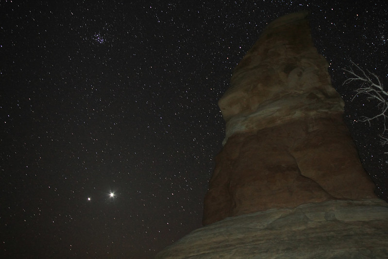
Now to look for a camp spot close to Devil's Garden so as to accommodate my "need" to take star shots back there. We found a decent enough spot along the Harris Wash Road that was only 3.7 miles from Devil's Garden. So we cooked dinner and enjoyed the sunset waiting for stars to arrive.
You can see Jupiter and Venus directly above us in the twilight sky.
IMG_9945_2 by NateGeesaman, on Flickr
IMG_9936_2 by NateGeesaman, on Flickr
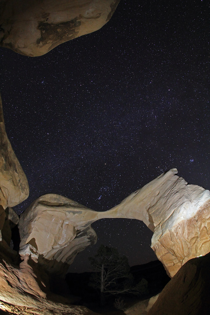
Then on to Devil's Garden to capture some stars:
Hoodoos and Trails by NateGeesaman, on Flickr
Devil's Garden Night by NateGeesaman, on Flickr
4 gnomes startrails by NateGeesaman, on Flickr
I would start one of my long exposures and then go check on Ariel who was reading in the car.
At one point when I went to go check on her, a big truck was slowly pulling into the parking area and I was worried this was the same ranger who told me I could definitely not camp there and the picnic are was for DAY use
, but it was just some friendly people from my home state of Illinois who were looking for a spot to camp. I hope I was of some help to them.Devil's Hoodoo Night by NateGeesaman, on Flickr
Metate night by
NateGeesaman, on Flickr
Then it was back to Harris Wash Road. The 3.7 mile drive to our spot was easy, but our spot was hard to find in the dark, even knowing the exact distance. After arriving back at camp I shot some more star trails and we drank some good beers around the fire before going to bed.
Grand Staircase Trails by NateGeesaman, on Flickr
Harris Wash Juniper trails by NateGeesaman, on Flickr
There was a decent sunrise in the morning.
Harris Wash Sunrise by NateGeesaman, on Flickr
We had some bomb curry vegetable soup for breakfast and then got on the road home.
Of course Bryce was on the way home again so we did the short Mossy Cave Trail:
Bryce Pano by NateGeesaman, on Flickr
Mossy Desert by NateGeesaman, on Flickr
This was an irrigation ditch dug by early Mormon settlers in the area:
Bryce Verto 2 by NateGeesaman, on Flickr
The cave's ice was on the wane, but still quite spectacular:
Mossy Cave Pano by NateGeesaman, on Flickr
Then it was back on the road. My camera batteries all pooped out by this point, but there were beautiful Lenticlar clouds all over on the drive home and it made for an extremely scenic and pleasurable time in the car. As if the trip home couldn't get any nicer, we stopped by the hot springs in Meadow and took a nice dip enjoying the beautiful weather and mountain scenery that place had on offer. After that, smooth sailing all the way home.
Featured image for slideshow: