fossana
Member
- Joined
- Jan 11, 2018
- Messages
- 1,038
Logistics
Start/end: Slickhorn Canyon 3rd fork trailhead (could be done in either direction). Marked as Slickhorn Canyon #6 on BLM map.
Mileage: ~10.5 miles
Difficulty: class 2
Navigation: Map/GPS may be useful. No signage in the canyons.
Filterable water: seasonal
Designation: Grand Gulch Wilderness Area
Fees: $2 per person per day, or $5 for 7 days (self-service day use permits)
Nearest town/gas: Mexican Hat or Blanding, UT
Date hiked: 11 May 2019
Notes: 1.2 miles of dirt road required unless you shuttle
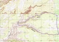
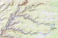
Approximate Route
Trip Report
My Grand Gulch backpacking trip was canceled due to rain, and it had been a long week of late nights to support the managed database launch at work. I knew the following week would be crunch time for the next big product launch, and if I didn't get some backcountry time over the weekend I might metaphorically kill someone. More rain was predicted near Zion, but Grand Gulch looked reasonable. That evening I threw together my gear and headed out. I stopped around 1am and camped just past Capitol Reef. After breakfast in Hanksville, I rolled into the Grand Gulch area late morning. The Kane Gulch ranger station lot was packed, so I decided to check out Slickhorn for some solitude.
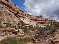
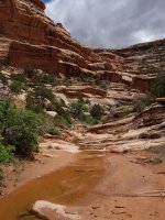
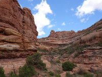
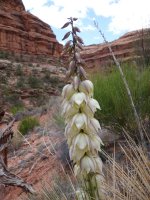
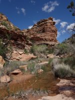
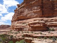
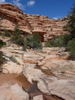
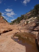
I parked at the Third Fork trailhead and headed downcanyon. Ruins in Slickhorn (as least advertised ones) aren't as plentiful as Grand Gulch proper, but neither are the crowds. With the recent rains, I didn't need to worry about running out of water. At times it looked like it was going to rain, but never did. I saw not a single person in the canyons nor on the road.
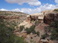
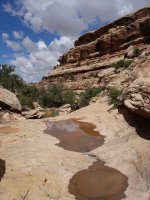
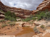
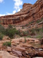
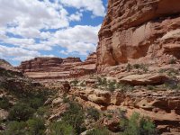
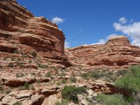
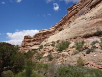
If you look closely you can see granaries along the prominent, continuous ledge in the first photo.
Start/end: Slickhorn Canyon 3rd fork trailhead (could be done in either direction). Marked as Slickhorn Canyon #6 on BLM map.
Mileage: ~10.5 miles
Difficulty: class 2
Navigation: Map/GPS may be useful. No signage in the canyons.
Filterable water: seasonal
Designation: Grand Gulch Wilderness Area
Fees: $2 per person per day, or $5 for 7 days (self-service day use permits)
Nearest town/gas: Mexican Hat or Blanding, UT
Date hiked: 11 May 2019
Notes: 1.2 miles of dirt road required unless you shuttle
Approximate Route

Trip Report
My Grand Gulch backpacking trip was canceled due to rain, and it had been a long week of late nights to support the managed database launch at work. I knew the following week would be crunch time for the next big product launch, and if I didn't get some backcountry time over the weekend I might metaphorically kill someone. More rain was predicted near Zion, but Grand Gulch looked reasonable. That evening I threw together my gear and headed out. I stopped around 1am and camped just past Capitol Reef. After breakfast in Hanksville, I rolled into the Grand Gulch area late morning. The Kane Gulch ranger station lot was packed, so I decided to check out Slickhorn for some solitude.
I parked at the Third Fork trailhead and headed downcanyon. Ruins in Slickhorn (as least advertised ones) aren't as plentiful as Grand Gulch proper, but neither are the crowds. With the recent rains, I didn't need to worry about running out of water. At times it looked like it was going to rain, but never did. I saw not a single person in the canyons nor on the road.


If you look closely you can see granaries along the prominent, continuous ledge in the first photo.


Attachments
Last edited:

