Grand Gulch, 11-13-20

gnwatts

Member
.
Joined
May 19, 2012
Messages
1,987
15 DSC00602.jpg


I hate it when I get nostalgic. But it is difficult, at least for me, to avoid it as I get older. I have a tradition of getting out to visit our wild places on my birthday, Robber's Roost and Road Canyon on Cedar Mesa were the most memorable. I really wanted my 62nd birthday to be special, so Grand Gulch seemed like the perfect place.

Our world is currently spiraling out of control as we all know, so I wanted to stop the spinning for a short time. So I decided to visit a place I have not seen for a while. I have been in the vicinity of the Government Trail and Polly's Canyon in the last few years, but have not camped here in 14 years.

I had 3 main goals in my short time here. The first two were visits to the Big Man panel, and to find a pictograph panel I had not seen in 28 years. It's exact location has been lost in the fog of time, and my memory, so I knew it might be difficult to achieve. But it would be really fun to try.

The third was to gather some images for a show I will be in at the Launchpad Gallery in Carbondale in April. My partner in this show, entitled "Stone Souls", is Alice Bedard-Voorhees, and we both felt this place would be an important place to visit, so she could gain some insight to where I was coming from. I also knew she would find a great deal of inspiration here also. Oh yeah, she brought along her husband Rick. :)
Alice is is a master at mixed media, combining Iphone photography with various print making techniques. The result being a unique interpretation of our natural world.
I thought it would be fun to include the text of our Gallery proposal:

Show Concept: Stone Souls

The term multinaturalism acknowledges the relationships of human beings with other forms in our world and how these beings “reveal themselves to humans”. Some of the first peoples talked about stones as guides or messengers. We also know that the physical traits of stones tell us much about the geological history. The words of shamans, poets, anthropologists, and archeologists add to our history of stones as messengers of a deeper relationship with the earth and in this instance our western land forms. For example, a Mexican belief was “at one time all men were stones”. And author Norman Maclean expressed their characteristics about communication and time in this statement:
“Eventually, all things merge into one…. The river was cut by the world's great flood and runs over rocks from the basement of time…. Under the rocks are the words, and some of the words are theirs.”

The works of photographer Greg Watts and mixed-media and print artist Alice Bedard-Voorhees express the importance of their relationships with stones and the spiritual and aesthetic relationships they inspire. Watts’ work captures stone and time, and the presence of other humans drawn to the same places that speak to their relationship to the same places hundreds of years prior. Bedard-Voorhees explores stones as relatives or extended family.

And away we go!

We all met at the empty parking lot at Kane Gulch Ranger Station. What an awful building this is, an affront to the amazing landscape it inhabits. IMO.
We were psyched the place was empty, a good sign. In the end we saw no one, and only one set of tracks.
Driving out to the Government Trail brought back many memories. There's the dreaded nostalgia thing again.
It was sunny, light wind and in the mid 40's. Perfect fall weather.
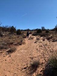
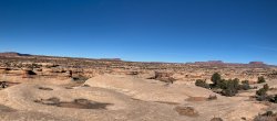
I love the short hike to the rim of Grand Gulch, with views from Navajo Mountain to the Bears Ears with the Henry's in between.

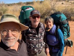
At the trail head:
2 IMG_3394.jpg


3 image0.jpeg


image5-Pano.jpg

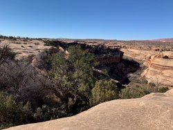
Looking down canyon from the rim, with the start of the Government Trail right below:
4 image1.jpeg


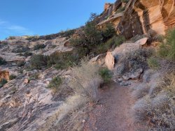
I have always found the descent into Grand Gulch a difficult backpack, very deceptive. It is fun to imagine the people in the Civilian Conservation Corp building this in the 1930's:

5 IMG_3409.jpg

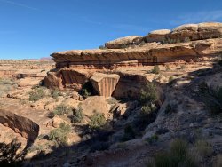
Incredible views as it contours it's way down to the stream bed:
6 IMG_3416.jpg

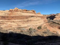
Looking up canyon, with Polly's Canyon entering on the right:
7 MG_3412.jpg

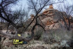
We decided to set up our 1st camp at the bottom of the trail in the sand, with some great slickrock to lounge on. No rain in the forecast to worry about.
It did start to get chilly pretty quick when the sun disappeared, eventually getting down into the mid 20's.
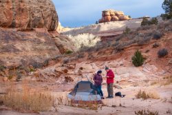
8 DSC00544.jpg

This is a good view of the Government Trail beyond:
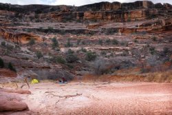
10 DSC00550.jpg

We started our 2 mile hike to Big Man mid morning, in windy conditions. It was pretty cold, with gusts up to 30 mph probably.
It was beautiful day though, and the hike was spectacular. We found one small pot hole of water the entire time, I have never seen this place so dry.
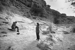
11 DSC00553.jpg

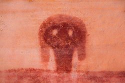
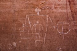
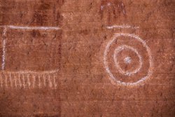
Big Man! A sexist title I think, as the Woman is much larger than the Man. Interesting title due to the matrilineal social structure they supposedly had.
I called the BLM yesterday, and asked about the visible chalk lines, and the ranger said they were original. I find that hard to believe, as many of the chalk lines follow chipped lines underneath, and are executed in ways that do not match the artistry found in the pictographs. I tried unsuccessfully to find some vintage photographs to see if they were present.
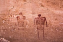
12 DSC00567.jpg

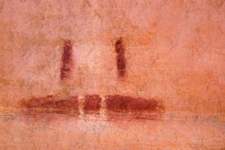
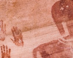
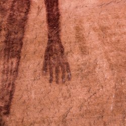
So my goal was to photograph details of the images, as there are many fine photographs of the entire figures, especially on BCP.
I removed the chalk lines on Big Woman in Lightroom:
14 DSC00582x.jpg


15.5 DSC00683.jpg

Gestation:

16 DSC00616.jpg


17 DSC00625.jpg


18 DSC00647.jpg

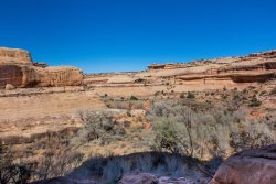
View from the panel, LUC:

22 DSC00712.jpg

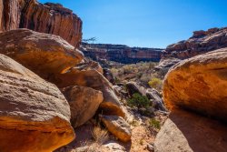
View LDC.
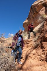
We ended up descending in this direction, an easier descent, and probably a better ascent also:
23 DSC00715.jpg


24 DSC00720.jpg

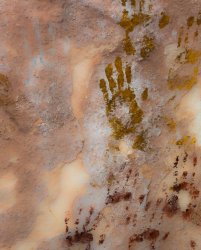
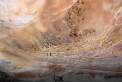
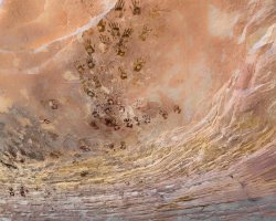
After a quick lunch I decided to try and find the pictograph panel I had seen 28 years ago. We were walking along a cliff face, and things looked vaguely familiar. Then, voila!
Found it.
26 DSC00801 1.jpg

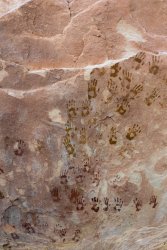
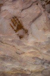
It was smaller than I remember. I really loved the green/yellow hand prints.
26.5 DSC00801.jpg


27 DSC00760.jpg


27.5 DSC00823.jpg

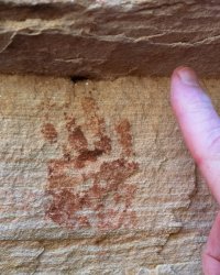
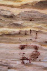
What affected me so much the 1st time I saw this was the hand print of an infant, as our son was born 9 months earlier. It had a profound impact on me. It still does:
DSC00799.jpg

I had seen a baby's foot pictograph in lower Grand Gulch years ago, so now I have closed the loop so to speak.
29 DSC00767.jpg


DSC00829.jpg


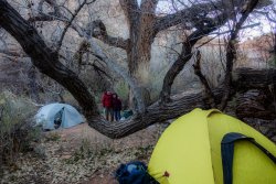
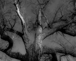
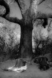
After our return to our camp site, we decided to move camp to a spot I knew at the mouth of Polly's, a few hundred feet up canyon. It is nestled into an enormous cottonwood, protected from the wind:
30 DSC00836.jpg


DSC00841.jpg


DSC00847.jpg


DSC00849.jpg

The next morning we packed up and ascended back to the car. My friends back to Santa Fe, me to Carbondale.
It was a great trip, a little short but that's ok. We accomplished our goals, and had a memorable time doing it.
Thanks for looking.
 
Fantastic report and amazing place. Great to see you found the panel you had hoped to find. I really enjoyed the photos of it.
 
Great pictures - camped by that old cottonwood a couple of times.
Thank you. I wonder how old that tree is.

Pictographs are amazing.
Thank You.

Fantastic report and amazing place. Great to see you found the panel you had hoped to find. I really enjoyed the photos of it.
Thank you.

Thanks for posting this--it gives me new inspiration to get back to this area
Thanks. I like this time of year, no one around including bugs.
 
Love government trail! You captured it well!

Thanks for the report! And congratulations on the show! I love the concept of more intimate details of panels as opposed to entire panels. I don't get out that far too often, but perhaps I'll try to make it for your show. Please keep us updated - especially given Covid restrictions.

I'm not sure if you read through the "guest book" at the panel. Last year there were a few pretty distinct political posts. I'm assuming the attitude will be the same or even worse this year.

I missed that second panel when I was down there, but do love the images. There's something that feels to me so intimately connected when I see handprints on the rocks.

Was it cold enough at this point for the frost to remain in areas of shade in the canyon? I noticed that on my trip there last Thanksgiving. I would have to roll up sleeves in the sunny portions and take them back down again in the shaded portions.
 
@ImNotDedYet Thanks for your comments.
We did read through the guest book. There were some comments about our political situation, both past and present. Not many though. The best one was from a guy who was there during the election, asking who won.
There was some frost in the morning, but it was gone by 10 or so, as it got up into the upper 40's and low 50's. It was perfect weather. Long nights in the sleeping bag though.
 
Congratulations on the show.
I would sure love to make it out to Grand Gulch someday. Maybe after I retire. Hopefully I will still be able to do the hiking. Enjoyed your pictures.
 
Awesome, thanks for sharing! It sounds like you had a great birthday trip, glad you got out. How was the road down to the Government TH? It was on our list, but we ended up doing another canyon you recently suggested, outstanding. We saw so many pictographs ( but no water in Grand Gulch).

I love the details you photographed. We saw some yellow/green handprints too on this trip (amount other colors), now I will go back and check for smaller hands! I do remember seeing some significant smaller hands than an adult, maybe kid size, but not baby size.

We did read this sign in at another trail register a day or two after the election. It said:
Name: “F .....” (you can fill in the name)
Town: “America“
Destination: “Beauty”
Comments: “Get the damn cows out!!!”
 
Thanks @Titans
The road to the trailhead is a little rough the last 3/4 mile.
I am glad you had a good trip.
The little hand prints were at the bottom of the panel, pretty low down.
Cows?
 
I forgot there are BLM and State lands near Government and the Collins Springs trail head. We did not see any recent cow turds at Government, just a few really old ones.
 
I forgot there are BLM and State lands near Government and the Collins Springs trail head. We did not see any recent cow turds at Government, just a few really old ones.

we saw that trail register off a side road to Burr trail rd... plenty of cow turds.....
 
Cows were there long before it was pooular to backpack gg.... For that matter entire s Utah .. personally, not arguing but I hate dogs worse in backcountry

It's multiple use not exclusive use
 
I think cows were banned from Grand Gulch Primitive Area around 20 years ago? I don't remember when dogs were banned.
 
I camped at a spot where the road to the Government Trail trailhead begins to require 4WD. There was plenty of recent evidence of cows up there.
 
Similar threads
Thread starter Title Forum Replies Date
RyanP Grand Gulch last-minute questions Trip Planning 14
fiber Lower Grand Gulch Pour-off Trip Planning 9
C Grand Gulch Cedar Mesa Utah 11 Day Backpack October 2022 Backpacking 10
TrailScot Dripping Canyon to Grand Gulch, Cedar Mesa, Utah - March 2022 Hiking & Camping 7
H Access to Grand Gulch via Water Canyon Trip Planning 2
D Springs in Grand Gulch 2022 Trip Planning 21
D Grand Gulch Shuttle Trip Planning 4
TrailScot Step Canyon access to Grand Gulch, Cedar Mesa Trip Planning 17
J Grand Gulch (Kane to Bullet) Water Availability Trip Planning 9
gnwatts Grand Gulch water Trip Planning 6
fossana Grand Gulch Pt 2 - Todie to Sheiks loop Hiking & Camping 9
fossana Grand Gulch Pt 1 - Slickhorn 3rd to Trail Fork loop Hiking & Camping 6
P Grand Gulch Water/Alternative Trip Trip Planning 3
J Grand Gulch Impassable? Trip Planning 8
IntrepidXJ Grand Gulch: Pollys Canyon to Collins Canyon Backpacking 1
IntrepidXJ Lower Grand Gulch Backpacking 5
kansas Hunting in Grand Gulch Trip Planning 3
LarryBoy Water Sources in Lower Grand Gulch Trip Planning 15
Bob Grand Gulch, Short Trip Backpacking 6
Bob Grand Gulch Area Weekend Trip Meet Up (Members Only) 1
Bob Grand Gulch - Moonhouse Backpacking 2
westerner54 Government Trail to Big Man Pictographs, Grand Gulch Utah Backpacking 3
westerner54 Lower Grand Gulch, Below the Narrows Backpacking 3
pixie1339 Grand Gulch Spring Conditions Trip Planning 3
Bob Backpacking into Shangri-la Canyon into Grand Gulch and out Water Canyon Resource Discussions 10
markj Meet up, Grand Gulch- May 8-11. Trip Planning 0
Bob Grand Gulch Meet Up (Members Only) 2
Bob Beta needed Grand Gulch area Trip Planning 6
NAYR Grand Gulch Must Sees. Trip Planning 3
Don Cedar Mesa / Grand Gulch (Mar 6-9) Trip Planning 8
DAA Grand Gulch, 4/27 - 4/30/13 Backpacking 15
Aldaron Grand Gulch Permits General Discussion 19
Nurrgle Grand Gulch Trip Planning 3
pixie1339 Grand Gulch Question Trip Planning 4
desertvic The Grand Staircase Escalante NM needs you! Meet Up (Members Only) 1
TractorDoc Paintbrush Canyon / Cascade Canyon Loop -- Grand Teton NP September 11, 2023 Hiking & Camping 9
D Grand Teton Cascade Loop Trip Planning 1
TheMountainRabbit Request: Grand Teton Ascent Trip Planning 0
Janice Such a GRAND Canyon - Deer Creek / Tapeats / Thunder River Backpacking 21
M Mee/Knowles Canyon Loop, Grand Junction Colorado Backpacking 4
OldBill Short hike at the Grand Canyon of Pennsylvania Hiking & Camping 1
TheMountainRabbit Ortenburger Lake, Talus Lake, & Glacier Peak (Grand Teton NP) - October 2023 Backpacking 14
TheMountainRabbit Invite Grand Teton NP, October 7th-10th 2023 Meet Up (Members Only) 0
fossana Public comment for revised Grand Staircase Escalante NM management plan (comments open 11 Aug - 9 Nov) General Discussion 11
Bob The New Grand Canyon Trip Planning 1
F Grand Canyon hermits rest to granite rapids to bright angel Trip Planning 10
NorthwestWanderer Backpacking Grand Teton National Park : Fossil Pass,Fox Creek Pass,Indian Lake,Alaska Basin,Hurricane Pass,Ice Floe Lake,& Snowdrift Lake Backpacking 19
dennisrodman A week in the Grand Canyon / Boucher / Hermit / Tonto Trail Trip Planning 4
futurafree Grand Canyon norovirus General Discussion 6
PaulMags Grand - Moab Route Backpacking 1

Similar threads

Back
Top