- Joined
- Dec 5, 2017
- Messages
- 1,371
This picture has a bit of everything from our breathtaking week in the Grand Canyon - flowers, water, rocks, and sky. Living for a week in the canyon was magical.

Day 0
We flew to Phoenix, got fuel in Flagstaff, and stayed at Cameron Trading Post. We were glad that we would approach the park from the east entrance rather than the more crowded and built-up main entrance.
Day 1
We checked out the beautiful Navajo art at Cameron Trading Post. We didn't buy the $465,000 rug but had a lot of fun looking anyway.") On our drive from Cameron to the Grand Canyon, I enjoyed seeing the canyon of the Little Colorado River. We had arranged a late morning meeting with our shuttle driver, Tim on the Rim (who worked out great), at Grandview Point so we could leave our car at the end and start at Lipan Point. We had extra time before meeting him and stopped at Desert View and Moran Point to gawk at the scenery. At Desert View, I was delighted to look down and see where we'd be camping the first night. Looking at my photos when I got home, I realized that I had seen lots of places from those two points where we ended up being during the trip. Stopping at the overlooks ahead of time proved to be very satisfying, and I'm glad we had time for that.
On our drive from Cameron to the Grand Canyon, I enjoyed seeing the canyon of the Little Colorado River. We had arranged a late morning meeting with our shuttle driver, Tim on the Rim (who worked out great), at Grandview Point so we could leave our car at the end and start at Lipan Point. We had extra time before meeting him and stopped at Desert View and Moran Point to gawk at the scenery. At Desert View, I was delighted to look down and see where we'd be camping the first night. Looking at my photos when I got home, I realized that I had seen lots of places from those two points where we ended up being during the trip. Stopping at the overlooks ahead of time proved to be very satisfying, and I'm glad we had time for that.
Looking upstream from Desert View - our first night's dry campsite was visible below

Looking downstream from Desert View - when I examined the picture after the trip, I realized that the sand dune next to our Hance Rapids camp was visible. And sure enough, when we were there I had looked up and noticed the Desert Watchtower way up high as a tiny dot.

View from Moran Point - Hance Rapids is visible, as well as the upper reaches of Red Canyon (where we didn't hike on this trip).

We started down the Tanner Trail at Lipan Point, and the scenery was outstanding right away. I had seen info about a recent rockfall at Peshlakai Point, and it was clearly visible along the Desert Palisades.

The watchtower at Desert View (where we had been earlier that day) was clearly visible, and it was watching over us throughout our trip - we saw it over and over again all week!
Our first cactus bloom. I was thrilled, having hoped that we wouldn't be too early for them. I think the heat wave a few weeks before our arrival helped. We saw cacti often throughout the trip, all different colors. I posted a bunch of flowers in the Wildflower section. They were spectacular.
Thanks to info from @b.stark, we dry camped the first night halfway between the rim and river, just above the Redwall. It was beautiful, and I highly recommend that.
View from camp

Day 2
Beautiful morning - I took this pano just before sunrise:

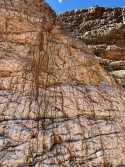
Hiking down to Tanner, there are so many interesting and varied rock layers to pass through.


When we got to Tanner, we staked out our campsite and rested in the shade a bit. It was a warm afternoon, but not too hot. We really lucked out with great weather on this trip - comfortable temps and despite the original forecast for chance of heavy rain on Days 4, 5, and 6, we only had rain the final evening.
Anyway, after resting, we took light packs and explored upstream along the Beamer as far as we had time for. I wish we had spent a night camping along Beamer and making our way all the way to the confluence with the Little Colorado River. Oh well.
I have a zillion photos along the Beamer and everything else from this trip; it was breathtaking all the time. I tried to limit myself but failed miserably and am posting way too many here...


Heading upstream along the Beamer


So many incredible rocks - all the time

We went about 2.5 miles up Beamer and enjoyed this sandy beach and shallow sandbar in the river.

We ended up seeing this rafting group multiple times over the next few days and camped near them at Escalante Beach.

Heading back to Tanner with golden late afternoon light


Day 3
Sleeping near the river and hearing the rapids all night is magical. In the morning we set out for Escalante Beach. It was fun to see a group of rafts and kayakers navigate Tanner Rapids.

Between Tanner and Cardenas


During our Cardenas Beach break, we had fun talking to NPS staff who were part of a vegetation restoration project. They shared cold drinks and geology knowledge!

We went up to the Anasazi Hilltop Ruin, which we later learned has mostly been reconstructed. This must have been a good spot for a lookout - you could see far and wide from there.

Then we headed to the Unkar Delta overlook, which had outstanding views down below and was fun to climb up to.


The yellow dots in the water are the rafts we had seen the previous evening.

So many cacti!

One of the NPS staff was a geologist, and since I want to study geology in my retirement and had watched a bunch of youtube videos before the trip, I asked her some questions. She showed me a picture of a rock with fossilized worm burrows and said we might see some. Sure enough we did.


So many cool rocks!


Embedded in this rock were moki marbles (iron concretions) similar to what we had previously seen on other trips.

I crept closer and took a look - one or more animals was using this cave as a home, as there was a bed of dried grass covering the floor.


This was a long day. We are not fast hikers, and it took us a long time to get from Tanner to Escalante. But I didn't mind that one bit - there were so many beautiful views and interesting things to look at.
Looking upstream, back where we had been earlier at Unkar Delta and Hilltop Ruin

Agave all over the place - and from observing it over and over again, I figured out a bit about its life cycle and then confirmed when I get home. It takes the plant a long time to mature, and then it eventually sends up its tall flower stalk which lasts for one season and then dries up and eventually falls over. It's a one-and-done plant.

Looking downstream


As we got closer to that night's camp, the route took us through and next to the wash of Escalante Creek.

Evening light near our campsite at Escalante Beach

Day 4
Early morning light at Escalante Rapids

A bit later before we left camp


So, this was our BIG day. Not mileage wise; it was our shortest day for that. But this was the day I had been thinking about for months. Worrying about. Would we be able to manage Papago Wall and Slide? Would we be ok??????? I'm happy to say, yes, we were fine. It was a great day filled with lots of Type 2 Fun.
Walking along the top of 75 Mile Canyon - fascinating to look down and see where we'd be at the bottom a little while later...


Approaching the spot where we'll drop down into the canyon

One went one way and the other went the other way - hmm... which way should I go?

Fantastic rocks and scenes in 75 Mile Canyon. We lingered.


@b.stark - just out of curiosity, I reread your prior trip report and laughed when I saw your photo taken from this exact same spot:

I have soooo many rock photos.

Exiting 75 Mile Canyon

Cool fossil (we took only its photo)

Between 75 Mile Canyon and Papago Wall, there were some fun scrambles. Apparently some people take a low route, but we followed the cairns for the high route.

All the spicy things we'd be doing the rest of the day were in this scene - Papago Wall, the traverse, and Papago Slide (well, you only see the bottom of it here).

But first we took a moment to relax in this cool little space where a lizard let me take its picture.

My pictures of Papago Wall don't show it well because I didn't want to stay back and get behind the others. As I had learned ahead of time, there are plenty of hand and foot holds.

After the Wall

The "Tight Squeeze"

It's a long way down... There were some sketchy parts up here - narrow space to walk with a rock sticking out on one side and steep drop on the other side. I don't have pictures of that...

Checking out the Slide - it looked like I expected it to look based on the research I had done.

Going across the top - we had done comparable things before so this didn't bother me.

What did bother me was the next part, which was going down very steep scree. I first tried standing up using my poles and then said screw it and sat down. Scooting on my butt was much better, and all 3 of us did this part this way, one at a time so as not to send rocks crashing into each other. Looking back up from my safe spot:

Looking down to the next part, which was fine.

Almost done!

After all this, we had a little bit of a walk to our camp at Hance Rapids. This guy welcomed me there.

We hung out at camp that afternoon, relaxing, enjoying the water, exploring the sand dune near camp that I later realized was visible from the top at Desert View.


The geology!!! Such an easy-to-spot fault for a geologist-wanna-be!!!

Desert Watchtower watching over us some more - I noticed it because I saw the late afternoon sun reflecting off its windows way up high.

At one point, our friend came running back from the water - "Grab your camera - the river's on fire!" But light changes quickly at this time of day, so I didn't see the full effect. This was pretty great nonetheless.

Day 5
More beautiful early morning light - at Hance Rapids


We set off in the direction of Hance Creek.

We were not alone here.

I had marked on my map where the basement rocks (Vishnu Schist) would begin, slightly downstream from Hance Rapids. Sure enough, we could clearly see this non-sedimentary rock begin to show itself. So fun!


Rocks, rocks, rocks!


Even though I included this in my wildflowers post, I can't resist including it again.

And this one. Dr. Seuss would have loved it.

Along the Tonto Trail (the "Escalante Route" is only between Tanner and Hance Rapids, and then the Tonto starts)


Ahead of time, I had no idea that the Hance Creek canyon would have so much spectacular schist and granite. Walking along the canyon before dropping down into it was terrific. In this picture you can see the wash at the bottom.

Another fabulous fault line to see, plus I'm pretty sure an unconformity [missing rock layer(s) of hundreds of millions of years or perhaps even a billion years due to erosion]

At Hance Creek, we first started setting up camp where the cottonwoods are, but then a guided group came and set up near us, so we decided to move to this huge spot that would have been great for a large group.

Day 6 - our last full day and night
We went from Hance Creek to Cottonwood Creek. Walking around Hance Creek canyon was terrific, just as it had been the day before.
The rock colors!

Loved this guy.


I thoroughly enjoyed the Angels Gate formation far up on the north side of the river . We saw it over and over again, with ever-changing light and shadow.

We got a tip from other hikers to go off trail a little bit to an overlook of the Sockdolager Rapid. We were glad we did this. Along the way there were tons of cacti and some more moki marbles embedded in a rock.


Heading back to the Tonto Trail

What kind of fossil is this? If anyone's still reading this way-too-long report and knows the fossil, I'd love to find out.

We got to Cottonwood Creek and eventually found a campsite pretty far upstream. We knew that rain was forecast for that evening, so we used our flies for the first time all week. We had gotten info from other hikers that there were great narrows to explore down the wash, and they were right. I am so glad we did this. With my short legs, I needed a boost here and there, but we were able to go down pretty far and were surrounded by fabulous basement rock. Apparently there's a big drop off that some people maybe can bypass, but we didn't make it that far since we had already gone past our turn-around time and knew that rain was on its way.


We had the pleasure of seeing this little guy.

Zoomed in a lot

The previous evening at Hance Creek, we had heard wonderful goat/sheep sounds from tree frogs. It was fun to see these tadpoles.

There was definitely some weather that night!

Day 7
As expected, it did rain on us during the night, but our tent kept us dry and comfortable. In the morning, we were treated to incredible lighting on Angels Gate and the walls across the river.


We made our way up to Grandview Trail and the top.
Lots of copper in the area above Horseshoe Mesa, making terrific rocks and staining the wood. (At least I think it's copper rather than iron, based on info I found later. If I'm wrong, please correct me.)


Going up Grandview, I kept turning around to look at the scenery behind me. It was great to see the narrows of Cottonwood Creek that we had explored the day before.

And it was great to see Angels Gate some more, as well as Horseshoe Mesa.


I love using the Peakfinder App in the mountains and didn't know if it would identify things in the Canyon. It does.

Getting closer to the top, I saw dayhikers and knew the end was near. I'm horrible at uphills, but the scenery was so spectacular and I was so sad to be finishing I wanted the uphill to last longer. I enjoyed seeing Grapevine Canyon down below (so many trees!) and found myself thinking maybe we'll get there on another trip hopefully some time soon...

Day 0
We flew to Phoenix, got fuel in Flagstaff, and stayed at Cameron Trading Post. We were glad that we would approach the park from the east entrance rather than the more crowded and built-up main entrance.
Day 1
We checked out the beautiful Navajo art at Cameron Trading Post. We didn't buy the $465,000 rug but had a lot of fun looking anyway.
On our drive from Cameron to the Grand Canyon, I enjoyed seeing the canyon of the Little Colorado River. We had arranged a late morning meeting with our shuttle driver, Tim on the Rim (who worked out great), at Grandview Point so we could leave our car at the end and start at Lipan Point. We had extra time before meeting him and stopped at Desert View and Moran Point to gawk at the scenery. At Desert View, I was delighted to look down and see where we'd be camping the first night. Looking at my photos when I got home, I realized that I had seen lots of places from those two points where we ended up being during the trip. Stopping at the overlooks ahead of time proved to be very satisfying, and I'm glad we had time for that.Looking upstream from Desert View - our first night's dry campsite was visible below
Looking downstream from Desert View - when I examined the picture after the trip, I realized that the sand dune next to our Hance Rapids camp was visible. And sure enough, when we were there I had looked up and noticed the Desert Watchtower way up high as a tiny dot.
View from Moran Point - Hance Rapids is visible, as well as the upper reaches of Red Canyon (where we didn't hike on this trip).
We started down the Tanner Trail at Lipan Point, and the scenery was outstanding right away. I had seen info about a recent rockfall at Peshlakai Point, and it was clearly visible along the Desert Palisades.
The watchtower at Desert View (where we had been earlier that day) was clearly visible, and it was watching over us throughout our trip - we saw it over and over again all week!
Our first cactus bloom. I was thrilled, having hoped that we wouldn't be too early for them. I think the heat wave a few weeks before our arrival helped. We saw cacti often throughout the trip, all different colors. I posted a bunch of flowers in the Wildflower section. They were spectacular.
Thanks to info from @b.stark, we dry camped the first night halfway between the rim and river, just above the Redwall. It was beautiful, and I highly recommend that.
View from camp
Day 2
Beautiful morning - I took this pano just before sunrise:
Hiking down to Tanner, there are so many interesting and varied rock layers to pass through.
When we got to Tanner, we staked out our campsite and rested in the shade a bit. It was a warm afternoon, but not too hot. We really lucked out with great weather on this trip - comfortable temps and despite the original forecast for chance of heavy rain on Days 4, 5, and 6, we only had rain the final evening.
Anyway, after resting, we took light packs and explored upstream along the Beamer as far as we had time for. I wish we had spent a night camping along Beamer and making our way all the way to the confluence with the Little Colorado River. Oh well.
I have a zillion photos along the Beamer and everything else from this trip; it was breathtaking all the time. I tried to limit myself but failed miserably and am posting way too many here...
Heading upstream along the Beamer
So many incredible rocks - all the time
We went about 2.5 miles up Beamer and enjoyed this sandy beach and shallow sandbar in the river.
We ended up seeing this rafting group multiple times over the next few days and camped near them at Escalante Beach.
Heading back to Tanner with golden late afternoon light
Day 3
Sleeping near the river and hearing the rapids all night is magical. In the morning we set out for Escalante Beach. It was fun to see a group of rafts and kayakers navigate Tanner Rapids.
Between Tanner and Cardenas
During our Cardenas Beach break, we had fun talking to NPS staff who were part of a vegetation restoration project. They shared cold drinks and geology knowledge!
We went up to the Anasazi Hilltop Ruin, which we later learned has mostly been reconstructed. This must have been a good spot for a lookout - you could see far and wide from there.
Then we headed to the Unkar Delta overlook, which had outstanding views down below and was fun to climb up to.
The yellow dots in the water are the rafts we had seen the previous evening.
So many cacti!
One of the NPS staff was a geologist, and since I want to study geology in my retirement and had watched a bunch of youtube videos before the trip, I asked her some questions. She showed me a picture of a rock with fossilized worm burrows and said we might see some. Sure enough we did.
So many cool rocks!
Embedded in this rock were moki marbles (iron concretions) similar to what we had previously seen on other trips.
I crept closer and took a look - one or more animals was using this cave as a home, as there was a bed of dried grass covering the floor.
This was a long day. We are not fast hikers, and it took us a long time to get from Tanner to Escalante. But I didn't mind that one bit - there were so many beautiful views and interesting things to look at.
Looking upstream, back where we had been earlier at Unkar Delta and Hilltop Ruin
Agave all over the place - and from observing it over and over again, I figured out a bit about its life cycle and then confirmed when I get home. It takes the plant a long time to mature, and then it eventually sends up its tall flower stalk which lasts for one season and then dries up and eventually falls over. It's a one-and-done plant.
Looking downstream
As we got closer to that night's camp, the route took us through and next to the wash of Escalante Creek.
Evening light near our campsite at Escalante Beach
Day 4
Early morning light at Escalante Rapids
A bit later before we left camp
So, this was our BIG day. Not mileage wise; it was our shortest day for that. But this was the day I had been thinking about for months. Worrying about. Would we be able to manage Papago Wall and Slide? Would we be ok??????? I'm happy to say, yes, we were fine. It was a great day filled with lots of Type 2 Fun.
Walking along the top of 75 Mile Canyon - fascinating to look down and see where we'd be at the bottom a little while later...
Approaching the spot where we'll drop down into the canyon
One went one way and the other went the other way - hmm... which way should I go?
Fantastic rocks and scenes in 75 Mile Canyon. We lingered.
@b.stark - just out of curiosity, I reread your prior trip report and laughed when I saw your photo taken from this exact same spot:
I have soooo many rock photos.
Exiting 75 Mile Canyon
Cool fossil (we took only its photo)
Between 75 Mile Canyon and Papago Wall, there were some fun scrambles. Apparently some people take a low route, but we followed the cairns for the high route.
All the spicy things we'd be doing the rest of the day were in this scene - Papago Wall, the traverse, and Papago Slide (well, you only see the bottom of it here).
But first we took a moment to relax in this cool little space where a lizard let me take its picture.
My pictures of Papago Wall don't show it well because I didn't want to stay back and get behind the others. As I had learned ahead of time, there are plenty of hand and foot holds.
After the Wall
The "Tight Squeeze"
It's a long way down... There were some sketchy parts up here - narrow space to walk with a rock sticking out on one side and steep drop on the other side. I don't have pictures of that...
Checking out the Slide - it looked like I expected it to look based on the research I had done.
Going across the top - we had done comparable things before so this didn't bother me.
What did bother me was the next part, which was going down very steep scree. I first tried standing up using my poles and then said screw it and sat down. Scooting on my butt was much better, and all 3 of us did this part this way, one at a time so as not to send rocks crashing into each other. Looking back up from my safe spot:
Looking down to the next part, which was fine.
Almost done!
After all this, we had a little bit of a walk to our camp at Hance Rapids. This guy welcomed me there.
We hung out at camp that afternoon, relaxing, enjoying the water, exploring the sand dune near camp that I later realized was visible from the top at Desert View.
The geology!!! Such an easy-to-spot fault for a geologist-wanna-be!!!
Desert Watchtower watching over us some more - I noticed it because I saw the late afternoon sun reflecting off its windows way up high.
At one point, our friend came running back from the water - "Grab your camera - the river's on fire!" But light changes quickly at this time of day, so I didn't see the full effect. This was pretty great nonetheless.
Day 5
More beautiful early morning light - at Hance Rapids
We set off in the direction of Hance Creek.
We were not alone here.
I had marked on my map where the basement rocks (Vishnu Schist) would begin, slightly downstream from Hance Rapids. Sure enough, we could clearly see this non-sedimentary rock begin to show itself. So fun!
Rocks, rocks, rocks!
Even though I included this in my wildflowers post, I can't resist including it again.
And this one. Dr. Seuss would have loved it.
Along the Tonto Trail (the "Escalante Route" is only between Tanner and Hance Rapids, and then the Tonto starts)
Ahead of time, I had no idea that the Hance Creek canyon would have so much spectacular schist and granite. Walking along the canyon before dropping down into it was terrific. In this picture you can see the wash at the bottom.
Another fabulous fault line to see, plus I'm pretty sure an unconformity [missing rock layer(s) of hundreds of millions of years or perhaps even a billion years due to erosion]
At Hance Creek, we first started setting up camp where the cottonwoods are, but then a guided group came and set up near us, so we decided to move to this huge spot that would have been great for a large group.
Day 6 - our last full day and night
We went from Hance Creek to Cottonwood Creek. Walking around Hance Creek canyon was terrific, just as it had been the day before.
The rock colors!
Loved this guy.
I thoroughly enjoyed the Angels Gate formation far up on the north side of the river . We saw it over and over again, with ever-changing light and shadow.
We got a tip from other hikers to go off trail a little bit to an overlook of the Sockdolager Rapid. We were glad we did this. Along the way there were tons of cacti and some more moki marbles embedded in a rock.
Heading back to the Tonto Trail
What kind of fossil is this? If anyone's still reading this way-too-long report and knows the fossil, I'd love to find out.
We got to Cottonwood Creek and eventually found a campsite pretty far upstream. We knew that rain was forecast for that evening, so we used our flies for the first time all week. We had gotten info from other hikers that there were great narrows to explore down the wash, and they were right. I am so glad we did this. With my short legs, I needed a boost here and there, but we were able to go down pretty far and were surrounded by fabulous basement rock. Apparently there's a big drop off that some people maybe can bypass, but we didn't make it that far since we had already gone past our turn-around time and knew that rain was on its way.
We had the pleasure of seeing this little guy.
Zoomed in a lot
The previous evening at Hance Creek, we had heard wonderful goat/sheep sounds from tree frogs. It was fun to see these tadpoles.
There was definitely some weather that night!
Day 7
As expected, it did rain on us during the night, but our tent kept us dry and comfortable. In the morning, we were treated to incredible lighting on Angels Gate and the walls across the river.
We made our way up to Grandview Trail and the top.
Lots of copper in the area above Horseshoe Mesa, making terrific rocks and staining the wood. (At least I think it's copper rather than iron, based on info I found later. If I'm wrong, please correct me.)
Going up Grandview, I kept turning around to look at the scenery behind me. It was great to see the narrows of Cottonwood Creek that we had explored the day before.
And it was great to see Angels Gate some more, as well as Horseshoe Mesa.
I love using the Peakfinder App in the mountains and didn't know if it would identify things in the Canyon. It does.
Getting closer to the top, I saw dayhikers and knew the end was near. I'm horrible at uphills, but the scenery was so spectacular and I was so sad to be finishing I wanted the uphill to last longer. I enjoyed seeing Grapevine Canyon down below (so many trees!) and found myself thinking maybe we'll get there on another trip hopefully some time soon...