GPS Coordinate Types

What is your favorite coordinate type?

  • Decimal Degrees

    Votes: 4 30.8%
  • Degrees, Minutes, Seconds

    Votes: 1 7.7%
  • Decimal Minutes

    Votes: 3 23.1%
  • UTM

    Votes: 5 38.5%

  • Total voters
    13

Nick

-
.
Joined
Aug 9, 2007
Messages
12,949
What type of GPS coordinates does everyone like to use the most and why?

These are the types I'm aware of. Descriptions below 'borrowed' from a University website I found.

  • Decimal Degrees. Example: 30.29128 -97.73858
  • Deg/Min/Sec: Example: 30° 17' 28" -97° 44' 18"
  • Decimal Minutes. Example: N30 17.477 W97 44.315
  • UTM: Example: 12T 435212mE 4494159mN
I like WGS84 decimal format but that's largely because that's what Google Maps defaults to so I use it for that a lot. Curious what others like and for what reasons. What is the easiest format to take and use on most devices?
 
None of the above. I've become a UTM advocate. UTM is the metric equivalent of coordinate systems. If you have your location with a UTM coordinate, and I give you the location of a cache with another UTM coordinate, you can navigate yourself there without a GPS. I defy anyone to figure out how to do that with a lat/long coordinate.
 
I also think it's weird how that site lists WGS84 as a coordinate format. My understanding is that WGS84 is really a coordinate frame (or reference system) that can be expressed in any of those formats (including UTM). And it's not just for "high end" equipment...it's pretty much the standard reference system, I think.

And a GPS can lists your coordinates in any format you want...I don't know that I would associate a GPS with a particular format.

Yeah, I guess I'm still a bit of a map nerd...sorry...I'll shut up now.
 
I was thinking the same things but I never really pay much attention to it so I figured the University of Texas might know their stuff...

So really we're talking about these formates:

WGS84 Decimal
WGS84 Mixed (????)
Deg/Min/Sec
UTM

Is that right?
 
Well, I think you can drop the WGS84 qualifier, because you can get the same coordinate formats out of NAD27, which is the datum used on the old USGS maps. Here's come good info on map datums: http://www.maptools.com/UsingUTM/mapdatum.html

This site just calls them:

Decimal Degrees
Degrees Minutes Seconds
Decimal Minutes

This site says pretty much the same thing.

That sounds right to me. It's just a coordinate format that isn't really dependent on the map datum, and WGS84 is a map datum.
 
I think this requires the same kind of answer you give your grandparents when they ask you which computer they should buy: that depends...what do you want to do with Google Maps?

Keep in mind that a coordinate format can be seamlessly converted in the GPS or the phone. So whichever format you prefer to use is mostly irrelevant to the GPS and the phone apps. For me, the format is really only important to me: which format is most useful and which is most user friendly.

Google is not a big fan of UTM, though. So, the integration of UTM for Google depends on how you want to use Google.

If you're wanting to use Google maps to import a GPX file (can you do that?), then the coordinate format shouldn't make any difference. If you're wanting to import a GPX file from Google into your GPS or a phone app, then the coordinate format won't make any difference, either. The GPS does all the heavy lifting behind the scenes for the necessary conversions. I think the decimal degrees format is the standard for GPX files, so regardless of the format you choose, any application that spits out a GPX files will use the decimal degrees format.

But if you're wanting to copy and paste a coordinate into a Google Map to see where it is, then you'll have to convert the UTM coordinate to a lat/long coordinate...and usually decimal degree is the easier format for that, I think.

So, what are you wanting to do with Google Maps, exactly?

The biggest reason I like UTM is that you don't need a GPS for the information to be useful. The numbers in the format are just the distance in meters from a specific reference point. So, if you are standing at this spot: 12S 573999 4252205. And then you want to walk to this spot: 12S 574999 4252305. Then you know that you need to walk 1000 meters east and 100 meters north. That's it. But if I give you a latitude and longitude coordinate, you can never figure out where it is without all kinds of math or a GPS.

So, to answer your questions: for the phone apps and GPS, the UTM format doesn't make any difference at all. For Google, it depends how you want to use it.
 
Man, I've been messing with Google Maps. That's painful. Why is My Places so different from the classic My Maps?

Here's what I've learned, though:

1. If you use UTM on your phone or GPS and then export a track as a GPX, then you can import that GPX with no problem in to the Google classic My Maps.

2. If you create a track or waypoints on Google Maps, you can export that as a KML file. Regardless of the coordinate format you use, you then need to convert it to a GPX file, and then you can import it into your phone/GPS.

So, if you're just importing or exporting with Google Maps, then the UTM format makes no difference at all.
 
I prefer decimal minutes, but only because that's what geocaching.com uses, and what my Garmin GPS defaults to, and all my geo-nerd friends are very familiar with it.
 
Looks like your UTM is taking a beating in the polls there, @Aldaron! ;)

Okay, so this is basically the conclusion I've come to from all of this.

UTM is AWESOME if you don't have electronics, but you better have a map with UTM on it.

UTM sucks for what I want to do the rest of the time (without having to convert).

Decimal minutes are what geo-nerds use, therefore it must be right.

I have a hard time remembering the magic keys to make a degree sign on my keyboard˚˚˚˚˚˚˚.

I still like decimal degrees but I think I'll start tossing out decimal minutes to look smarter. :)
 
I didn't become a fan of UTM until the past year or so, when I was working on teaching a GPS class for a university outdoor program. While putting the practical exercise together, I realized how much more versatile that UTM is than lat/long.

And I'll bet if you ask Americans if they prefer miles or kilometers, most will say they prefer miles...but which one is actually better! :)

What do you need to convert UTM for? Conversions are almost always behind the scenes.
 
I'm mostly just trying to figure out the most streamlined method that most people will be able to use without extra steps. I definitely see the appeal in being able to figure out a location without a device, but the ease of other formats not needing to convert is probably more important for what I'm shooting for.

For example, I have Backcountry Navigator Pro on my Android phone. I just took a set of UTM coords and popped them in there - nothing. Decimal degrees or minutes on the other hand worked great. Converting on the desktop isn't terribly difficult but opening another window on a phone and doing that is kind of a pain. Are there any devices/apps that auto convert UTM? Do real GPS units?
 
Are there any devices/apps that auto convert UTM? Do real GPS units?

In MotionX GPS and Gaia GPS, both iPhone apps, there is a setting where you change the default coordinate format. Once that's changed, whenever you try to enter coordinates, it automatically formats the data fields for UTM. My Garmin GPS is the same way: once you change the format in the settings, everything is formatted for the UTM.

It looks like your app is the same way: http://support.crittermap.com/entries/22657898-The-Settings-Menu

You just need to change the format in the settings.

But if you're asking these questions for a mass audience for a product of some kind, then I would not recommend UTM. For the same reason that Americans like their statute miles rather than kilometers, we're simply more familiar with lat/long coordinates than UTM coordinates. As a result, I would use lat/long coordinates for anything I wanted other people to use. I would think, though, that the decimal degree format would be easier to work with than the decimal minutes format.

But for personal use, UTM is hard to beat! If you ever run an adventure race, they'll probably use UTM coordinates. And most topo maps these days have the UTM grids printed on them.
 
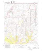
As an example of UTM being printed on maps, look at the attached USGS map from 1953. The numbers going down the sides and on the top and bottom are UTM coordinates. With a simple grid overlay tool, you can accurately determine coordinates on the map without a GPS in the field. You can't really do that with lat/long.

spur.jpg
 
UTM all the way baby.

Back before there was civilian GPS, I could nav off a topo with UTM just fine. And if I have a UTM coord for my position and you give me another UTM coord, I know how far and in what direction that coord is without even consulting a map.

- DAA
 
Thanks, this post is good info. And, timely. Just last week I was out and had some beta from a site to get to a slot canyon. My GPS is set to decimal minutes. I used to have it deg min sec but changed years ago to match geocaching. The beta I had was in decimal degrees. I could tell it wasn't deg min sec but was not familiar with the two decimal systems. All I could tell was that the number of decimals was off. If I just ignored and entered the number of decimals that would fit it had me about 7 miles off. It took a bit of head scratching but we finally got the GPS changed and it was suddenly on. I was planning on searching and finding some info to school up on this and voila, backcountrypost comes up with it without me even asking. Thanks.
 
Similar threads
Thread starter Title Forum Replies Date
fossana Ligado 5G rollout and GPS interference General Discussion 0
IntrepidXJ Gaia GPS acquired by Pocket Outdoor Media General Discussion 18
john.maldaner Gaia GPS: Sharing Tracks and Waypoints Gear 19
Titans Gaia GPS - CarPlay integration is now live ! Resource Discussions 10
john.maldaner Gaia GPS App Questoin Resource Discussions 7
john.maldaner GPS Recommendation, Please Gear 53
VegasHikeLife Paria Canyon GPS Coord. Trip Planning 6
Vegan.Hiker GPS Dog Tracking Devices / Gun Dog Whistles General Discussion 7
Outdoors24 Gaia GPS question General Discussion 5
R GPS Question Gear 13
Artemus GPS Doodles Trip Planning 5
Rockskipper Any GPS suggestions? Gear 22
Rockskipper Why you shouldn't trust your GPS General Discussion 21
Dave Gaia GPS alternatives General Discussion 48
Kyle P Biting the Bullet on a GPS Gear 44
Bob GPS .................. General Discussion 3
Aldaron iPhone GPS General Discussion 5
JaseTheAce GPS Gear 29
Ross Help choosing which GPS to hike in USA if buying in UK Gear 2
steve Google Maps Engine Question on windows 8.1 laptop with USB gps General Discussion 0
Nick Topo/GPS App for iPhone General Discussion 36
Nick GPS Distances General Discussion 7
powderglut Hand held GPS Gear 20
pstm13 DIY High Capacity Battery Pack for Phones and GPS @$40 Gear 4
Mike Jones GPS Logger Gear 19
Nick GPS Coordinates & Google Earth General Discussion 3
Joe Which Garmin Rino GPS? Gear 1
Nik Recommendation for Outdoor Handheld GPS Gear 12
Nick Lithium Batteries in a GPS unit Gear 6
Mike Jones Whats3words coordinate system General Discussion 12

Similar threads

Back
Top