- Joined
- Aug 9, 2007
- Messages
- 12,959
I still have some trip reports to post from 2018, but I'm going to try to keep up better on them this year and this one's easy, so here it goes. This is actually a combo of two trips to Gold Butte. The first was 4 nights at the end of December over New Years Eve, and the second was a shorter trip this past weekend.
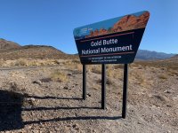
Audra and I drove down just in time to catch dusk on the long road out to Whitney Pocket. It was dark by the time we got there. We stopped and said hi to @blueeyes who was on her way out before we moved on to find a spot to camp. There were a handful of groups camped out at Whitney Pocket but we still found a nice one all to ourselves. I was excited to pop out of bed in the morning to finally see our surroundings. I was not disappointed.
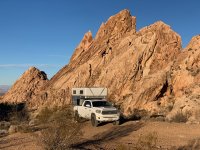
Sage and I went for a walk into the rocks while Audra slept. After a while I went back for coffee and to get her to come explore more with us.
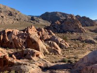
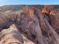
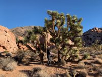
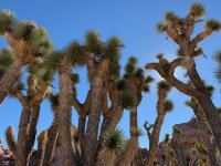
Joshua trees are awesome.
We wandered around the rocks near camp and then decided to head up the other side and loop back around.
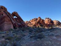
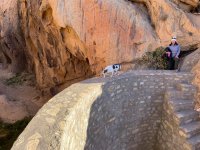
We stopped to check out this old CCC dam. Turns out @Artemus was in a campsite not 100 yards from here but he was well out of sight so we missed him (for now).
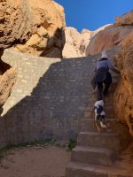
The reservoir was dry.
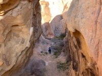
We wandered back to camp, made some more coffee and then drove out to do some exploring. I really didn't know much about the area we were headed except for one well known panel. We spotted this one soon after leaving the truck.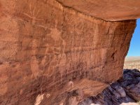
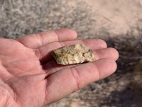
Soon we were distracted from visiting the main attraction by things on the ground. There were chipped and broken pieces all over the place. Some more complete than others.
We wandered until we found our way through to Falling Man from the back side. I didn't have coordinates loaded for this so I was pleased to find it so easily.
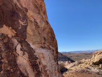
Crawling back through the usual route.
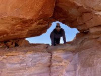
And back to finding more stuff on the ground.
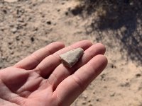
And more petroglyphs.
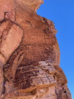
One of the things we love about camping out of the FWC is just kicking back and relaxing. After exploring around Fallen Man for several hours, we found a new camp and Audra took a nap. Sage and I did more wandering.
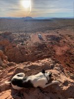

I was amazed to see how weak the root system of a Joshua tree is. But even when they tip over, they seem to be able to stay alive fairly well through all of the roots still in the ground.

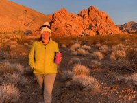
Audra awakes from her slumber and joins us for the sunset.
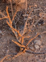
I'd never seen dead cholla before this. I was, and am, amazed.

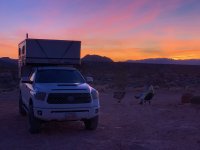
The sunset that night was excellent.

I posted some photos to Facebook that night and a friend gave me some ideas on other interesting things to see in the area. The main event was a 5+ mile hike to see some impressive petroglyphs. Again, we didn't have coordinates or anything, and that made things more fun.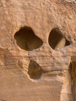
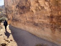
The main panel here is huge. There are so many interesting things that you could spend hours just looking at the wall.
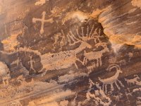
Looks like a heron?
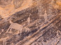
A hunting scene.
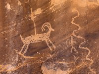
Kind of a little falling man.
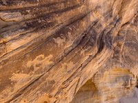
Tortoises!!
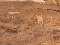


We explored around the area and found a some other smaller panels, including a very nice one high on a wall. We climbed up to get a better look.

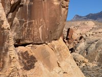
This area beckons more exploration, but not today.
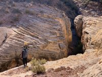
We took a different route back and found more petroglyphs and more pretty rocks. This was very small but almost perfect. I'd love to know how it was used.

On the way out we stopped for one more short hike to this panel with a bunch of sheep in a line. I'd like to see it again when it's not in direct sun.
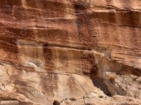
We found an old cowboy camp nearby and climbed some buttes to get a better view.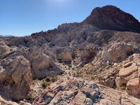
Another dam. This one was mostly filled in on the back side.
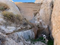
After that we made our way out to the Mud Wash valley to find camp.
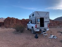
The golden hour view from camp was excellent.


It wasn't that cold!
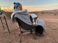
Who's a good Sage?!
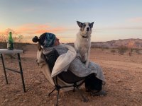
That's a good Sage!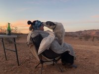
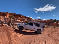
The next day we drove to Little Finland to explore. Our solar and battery combo wasn't keeping up as well as I'd like so I had to park strategically to capture more sun.
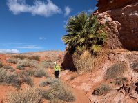
Palm trees!!
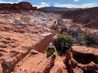
It looks like ice or snow, but this is just the rocks. This place was cooler than I had imagined.
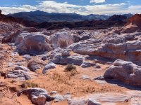
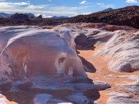
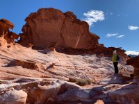
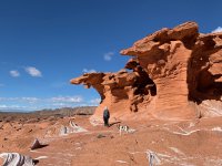
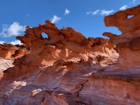
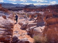
After exploring we went back and moved the truck to a spot on the north end to have lunch. We wanted to camp there. Bad. But it was New Year's Eve and we'd finally found out where @Artemus was camped out the previous night. After a little lunch and contemplation, we made our way back toward Whitney Pocket to find him.
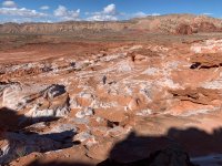
We ran into Art and friends shortly before getting to Whitney Pocket. They were on their way to Little Finland. It was super windy so we just decided to go find their camp and get settled in.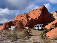
Audra took a little nap while Sage and I climbed the buttes behind camp.


We had a great night with Art and everyone else. Art's trailer is spacious and made a great place for all six of us humans (and some dogs) to celebrate the occasion. Sometime after midnight I stumbled back to the camper and the next day we made the uneventful drive home. The trip however was not at all uneventful. I dug it, and I kept thinking how much I wanted to go back. Hell, I didn't want to leave.
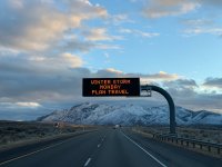
Fast forward a few weeks. @lostlandscapes and I had planned a trip over MLK weekend. We were originally shooting for Bears Ears but the forecast looked crazy. We were considering pulling the plug until we considered Gold Butte. Yeah, it's a drive, but it's actually shorter than going to Cedar Mesa and we figured I-15 would be better than some of the less traveled roads in the state. We just missed a storm on the way out and we knew there was something coming on Monday (the drive home) but weren't sure how big it would be. The signs on the drive down made us think more about it.
After a quick stop in Mesquite, we made our way out to a camp at Whitney Pocket. The super blood wolf moon was 2 days away and the already bright moon made for some good night hiking. The next day we made our way deeper into the monument. The plan was to hike to the same large panel I'd visited on the last trip but from the south, making about a 6+ mile route through some areas that don't see many people.
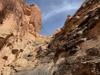
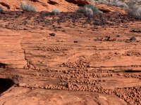
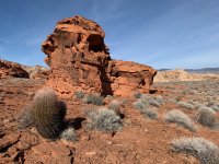

We camped at Little Finland that night in the spot I'd wanted to camp at before. A few groups of ATV's came through and made use of the mud in the main parking area. The area was saturated with water from a big storm that had moved through a day or two earlier. The palm trees all had seeps flowing out from under them.
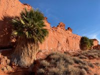
And another flowed right over the edge of the wall below LF.
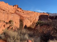
I didn't take many photos that evening. I mostly just took it in. (photo by Tim)
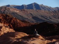
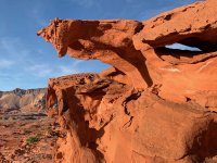
Photo by Tim.
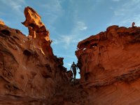
Back at camp for a nice sunset.
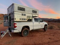

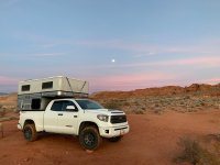
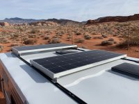
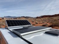
After the issues keeping the batteries full on the last trip, I added another 180 watt solar panel to my rig. I also made it so that I can tilt it toward the sun so we don't have to park funny or leave the roof half popped when we need juice. It worked very well.
The next morning we made our way over to another area I wanted to explore. We'd camped near here last time so I'd had plenty of time to wonder what was out here.
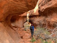
There were a ton of petroglyphs in slot canyons.
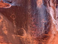
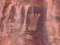
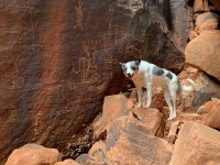
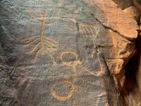
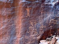
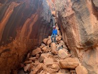
And a bunch more in a lot of other places.
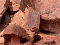
There were quite a few in this narrow slot that doesn't see as much traffic as the first one.
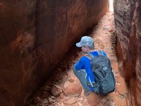
We wandered aimlessly, finding things in peculiar places.
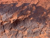
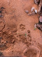
Tim spotted some strange tracks in the mud at the bottom of this slot canyon.
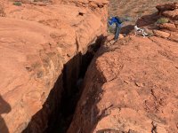
We went in to take a closer look. It appears that an animal came down the steep entry and then leaped over this muddy section, landing with all four paws in a row.
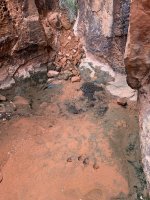
The animal was careful to step in the dirt elsewhere except for this one perfect print. We suspect it was a bobcat from the prints we looked at online afterward.
After a few hours we got back to the truck and made the sad decision to head home a day early. The Monday storm was forecasted to come in overnight and slam the entire I-15 corridor from Cedar City north. More than a foot of snow was expected with wind gusts north of 40mph. That was an adventure we just weren't up for.
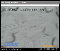
We made it home in time to see the super blood wolf moon from home. The next day I worked from home as the storm hammered Utah. I made sure to check out what we were missing on the traffic cameras. Even though it was an abbreviated trip, we still made the best of it and it was worth every bit of driving. I probably won't head back that way for a while, but I'm excited for when I do.

Audra and I drove down just in time to catch dusk on the long road out to Whitney Pocket. It was dark by the time we got there. We stopped and said hi to @blueeyes who was on her way out before we moved on to find a spot to camp. There were a handful of groups camped out at Whitney Pocket but we still found a nice one all to ourselves. I was excited to pop out of bed in the morning to finally see our surroundings. I was not disappointed.

Sage and I went for a walk into the rocks while Audra slept. After a while I went back for coffee and to get her to come explore more with us.


Joshua trees are awesome.

We wandered around the rocks near camp and then decided to head up the other side and loop back around.

We stopped to check out this old CCC dam. Turns out @Artemus was in a campsite not 100 yards from here but he was well out of sight so we missed him (for now).

The reservoir was dry.


We wandered back to camp, made some more coffee and then drove out to do some exploring. I really didn't know much about the area we were headed except for one well known panel. We spotted this one soon after leaving the truck.

Soon we were distracted from visiting the main attraction by things on the ground. There were chipped and broken pieces all over the place. Some more complete than others.


We wandered until we found our way through to Falling Man from the back side. I didn't have coordinates loaded for this so I was pleased to find it so easily.

Crawling back through the usual route.

And back to finding more stuff on the ground.

And more petroglyphs.

One of the things we love about camping out of the FWC is just kicking back and relaxing. After exploring around Fallen Man for several hours, we found a new camp and Audra took a nap. Sage and I did more wandering.


I was amazed to see how weak the root system of a Joshua tree is. But even when they tip over, they seem to be able to stay alive fairly well through all of the roots still in the ground.

Audra awakes from her slumber and joins us for the sunset.

I'd never seen dead cholla before this. I was, and am, amazed.


The sunset that night was excellent.


I posted some photos to Facebook that night and a friend gave me some ideas on other interesting things to see in the area. The main event was a 5+ mile hike to see some impressive petroglyphs. Again, we didn't have coordinates or anything, and that made things more fun.

The main panel here is huge. There are so many interesting things that you could spend hours just looking at the wall.


Looks like a heron?

A hunting scene.

Kind of a little falling man.

Tortoises!!


We explored around the area and found a some other smaller panels, including a very nice one high on a wall. We climbed up to get a better look.


This area beckons more exploration, but not today.

We took a different route back and found more petroglyphs and more pretty rocks. This was very small but almost perfect. I'd love to know how it was used.

On the way out we stopped for one more short hike to this panel with a bunch of sheep in a line. I'd like to see it again when it's not in direct sun.

We found an old cowboy camp nearby and climbed some buttes to get a better view.

Another dam. This one was mostly filled in on the back side.

After that we made our way out to the Mud Wash valley to find camp.

The golden hour view from camp was excellent.

It wasn't that cold!

Who's a good Sage?!

That's a good Sage!

The next day we drove to Little Finland to explore. Our solar and battery combo wasn't keeping up as well as I'd like so I had to park strategically to capture more sun.

Palm trees!!


It looks like ice or snow, but this is just the rocks. This place was cooler than I had imagined.


After exploring we went back and moved the truck to a spot on the north end to have lunch. We wanted to camp there. Bad. But it was New Year's Eve and we'd finally found out where @Artemus was camped out the previous night. After a little lunch and contemplation, we made our way back toward Whitney Pocket to find him.

We ran into Art and friends shortly before getting to Whitney Pocket. They were on their way to Little Finland. It was super windy so we just decided to go find their camp and get settled in.

Audra took a little nap while Sage and I climbed the buttes behind camp.


We had a great night with Art and everyone else. Art's trailer is spacious and made a great place for all six of us humans (and some dogs) to celebrate the occasion. Sometime after midnight I stumbled back to the camper and the next day we made the uneventful drive home. The trip however was not at all uneventful. I dug it, and I kept thinking how much I wanted to go back. Hell, I didn't want to leave.
Fast forward a few weeks. @lostlandscapes and I had planned a trip over MLK weekend. We were originally shooting for Bears Ears but the forecast looked crazy. We were considering pulling the plug until we considered Gold Butte. Yeah, it's a drive, but it's actually shorter than going to Cedar Mesa and we figured I-15 would be better than some of the less traveled roads in the state. We just missed a storm on the way out and we knew there was something coming on Monday (the drive home) but weren't sure how big it would be. The signs on the drive down made us think more about it.

After a quick stop in Mesquite, we made our way out to a camp at Whitney Pocket. The super blood wolf moon was 2 days away and the already bright moon made for some good night hiking. The next day we made our way deeper into the monument. The plan was to hike to the same large panel I'd visited on the last trip but from the south, making about a 6+ mile route through some areas that don't see many people.


We camped at Little Finland that night in the spot I'd wanted to camp at before. A few groups of ATV's came through and made use of the mud in the main parking area. The area was saturated with water from a big storm that had moved through a day or two earlier. The palm trees all had seeps flowing out from under them.

And another flowed right over the edge of the wall below LF.

I didn't take many photos that evening. I mostly just took it in. (photo by Tim)


Photo by Tim.

Back at camp for a nice sunset.


After the issues keeping the batteries full on the last trip, I added another 180 watt solar panel to my rig. I also made it so that I can tilt it toward the sun so we don't have to park funny or leave the roof half popped when we need juice. It worked very well.


The next morning we made our way over to another area I wanted to explore. We'd camped near here last time so I'd had plenty of time to wonder what was out here.

There were a ton of petroglyphs in slot canyons.


And a bunch more in a lot of other places.

There were quite a few in this narrow slot that doesn't see as much traffic as the first one.

We wandered aimlessly, finding things in peculiar places.

Tim spotted some strange tracks in the mud at the bottom of this slot canyon.

We went in to take a closer look. It appears that an animal came down the steep entry and then leaped over this muddy section, landing with all four paws in a row.

The animal was careful to step in the dirt elsewhere except for this one perfect print. We suspect it was a bobcat from the prints we looked at online afterward.

After a few hours we got back to the truck and made the sad decision to head home a day early. The Monday storm was forecasted to come in overnight and slam the entire I-15 corridor from Cedar City north. More than a foot of snow was expected with wind gusts north of 40mph. That was an adventure we just weren't up for.
We made it home in time to see the super blood wolf moon from home. The next day I worked from home as the storm hammered Utah. I made sure to check out what we were missing on the traffic cameras. Even though it was an abbreviated trip, we still made the best of it and it was worth every bit of driving. I probably won't head back that way for a while, but I'm excited for when I do.

