- Joined
- Dec 23, 2013
- Messages
- 4,124
I spent eleven days in Yellowstone in order to complete two back-to-back, four day backpacking trips, along with a couple of nifty day hikes thrown in for good measure. This report is about my first trip for four days into the Gneiss Creek area of the Park.
Day 1 - 4.3 miles to campsite WA1
On the 8th of September, our group joined up with @The Trout Whisperer in West Yellowstone and made our way to Ernie's for some lunch before hitting the trailhead. Ernie's makes wonderful sandwiches and I highly recommend stopping in for one if you find yourself in the area in the future.
After lunch, we drove north along Highway 191 about ten miles until we reached the northern end of the Gneiss Creek Trail. The beginning of the trail is actually on Forest Service Land, but after five-ten minutes or so of walking we reached the Park Boundary and the information sign for the Gneiss Creek Trail.
I must say that I was quite taken by the first couple miles of trail, which was unexpected on my part. First, all the aspen that were changing colors already, and quite frankly, just the sheer number of aspen, which is the most that I have ever seen in the Park. Though the day was warm for Yellowstone in September, I truly enjoyed the northern end of this trail.
Before too long we began dropping down to Campanula Creek and the multiple beaver dams amongst the streamside willows. The willows were also changing to yellow, which made for beautiful scenery every time we hit a creek over the next four days.
After Campanula Creek, we encountered sagebrush meadows, some relatively young lodgepoles that had been burned, and more meadows before reaching our campsite WA1.
Now while I like the location of WA1, the campsite itself was one of the worst, maybe even the worst campsite that I have stayed at in Yellowstone. The campsite itself is very exposed, It seemed as though the only trees were the ones supporting the bear pole. And even though we could have a fire at this site, there was no fire pit, or even rocks to make one.
Our group ended up just setting our tents up next to the willows along Gneiss Creek and hoping for the best.
That night, we had wolves howling back and forth throughout the night which was an absolute treat.
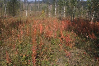
Some fireweed on the Forest Service portion of the trail
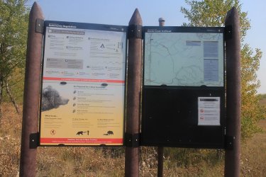
Gneiss Creek info sign at the Park Boundary
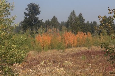
Aspens in their orange phase
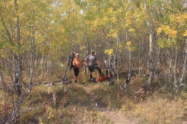
A break already?
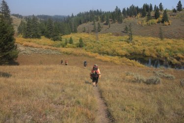
Dropping down the Campanula Creek and the beaver ponds
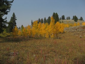
Just beautiful
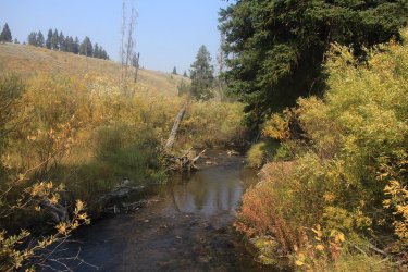
Campanula Creek
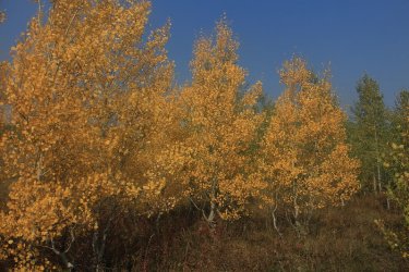
More yellows aspen to contend with.

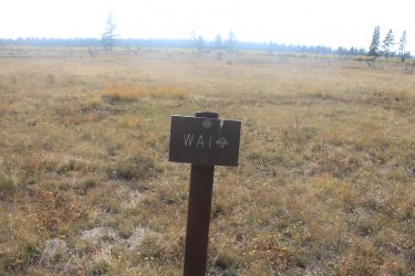
Arriving at camp
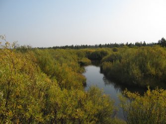
Gneiss Creek (our water source) nestled in amongst the willows
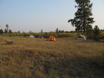
Our tent situation
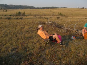
@The Trout Whisperer in his element
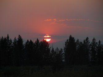
Sunset on Gneiss Creek
Day 2 - 16.2 miles roundtrip to the Cougar Creek Patrol Cabin and back
It was going to be hard to beat listening to wolves through the night, but the Cougar Creek Patrol Cabin was my goal for this trip, and it was something that I was looking forward to reaching.
Now the Gneiss Creek Trail runs through the Madison Valley, and the valley has numerous large, and when I say large, I mean very large meadows that one must pass through in order to get anywhere. So we took off early in the morning heading south towards Cougar Creek. It turns out that this day set a record high of 87 degrees for the area (this according to @The Trout Whisperer) which made for a very hot and exposed 16 miles.
Between the meadow walking, we would have to cross Gneiss Creek, Maple Creek and Cougar Creek before reaching the patrol cabin. While the meadows were very dry, I thought that they were still beautiful in their own right.
We had to leave the trail at Gneiss Creek in order to find a crossing spot, so that we wouldn't have to ford the creek. But by doing this, it meant that we had to contend with a large patch of thistles in order to return to the trail. This was a prickly situation for this kilt wearer. After more meadow walking, we then reached Maple Creek, and wouldn't you know it, the beavers had dams and ponds one right after another! Well, this was a first for the old Scatman: having to ford a beaver pond. Now whilst crossing said pond, The Trout Whisperer suddenly declared that he was going down, and he reached out and grabbed the top of my kilt to give him a bit of a lift. Unfortunately, it gave my right leg a sinking into the muck feeling, which rendered my right Croc ineffective. I had to stop and concentrate on overcoming the suction of the mud in the bottom of the pond in order to keep my footwear with me.
  Well, somehow we both survived to live for the next meadow crossing. @Rockskipper, I think The Trout Whisperer could use some tips on bog etiquette. Do you think that you could sign him up for your next class - Bogs 101?
We eventually reached the cutoff for some semi off-trail travel up Cougar Creek. Along the creek, we encountered a bull bison that seemed a bit surprised to have guests nearby. Soon though, we reached the patrol cabin which sits atop a small hill with views down the Cougar Creek drainage. Simply splendid. We ate our lunches on the cabins front stoop, and after lunch I went to investigate the old Cougar Creek Trail which heads northeast towards Winter Creek, and the patrol cabin that is located there.
After feeling confident that I had found this end of the old trail, we headed back to camp in relatively hot conditions. Of course, we still had issues when we crossed the beaver ponds again. I'm still amazed at the strength require to overcome the suction of a bog. It just bout wore me out.
Back at camp it was time for dinner and another beautiful sunset.
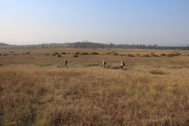
On our way to San Jose! Oops, I mean the Cougar Creek Patrol Cabin. The meadows along Gneiss Creek
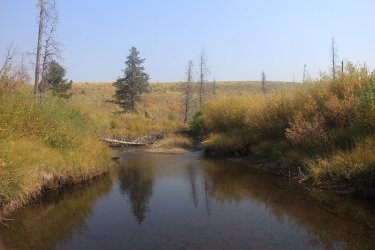
The beaver pond on Maple Creek
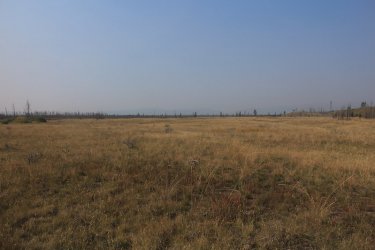
Enormous meadows in the Madison Valley
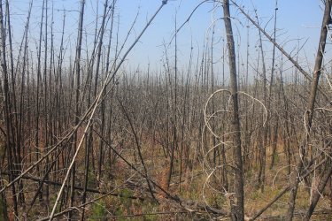
A ghost forest between meadows.
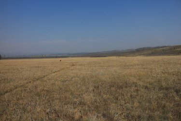
@The Trout Whisperer doing his best Julie Andrews imitation -The meadows are alive, with the sound of music.
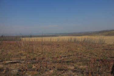
More meadows
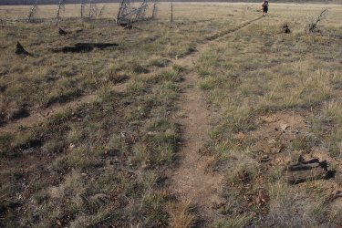
The intersection of the unofficial trail up Cougar Creek
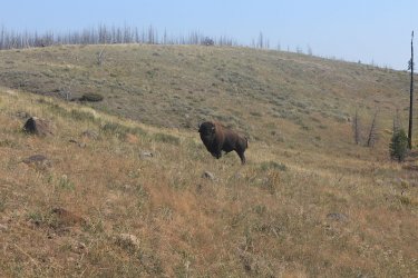
You shall not pass! I was able to alleviate the situation with some Scatman mind control.
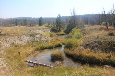
Cougar Creek at last
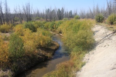
And more Cougar Creek
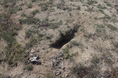
This was interesting - a bear had dug up a yellowjacket's nest.
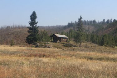
At last we arrive at the cabin
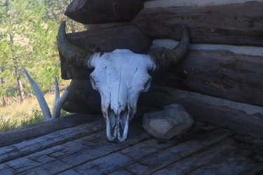
Cabin decorum
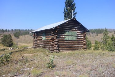
The backside of the Cougar Creek Patrol Cabin
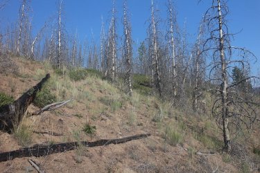
What I believe is the old Cougar Creek Trail. It is in bad shape I'm afraid.
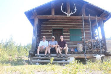
Group shot before we left the cabin
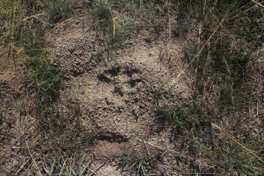
Wolf track on our way back. We ran into a lot of wolf tracks and scat on the Gneiss Creek Trail
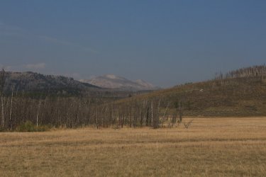
The smoky conditions cleared out enough for us to make out Mount Holmes to the northeast of us
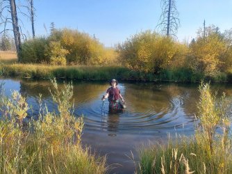
Crossing Maple Creek on our return trip
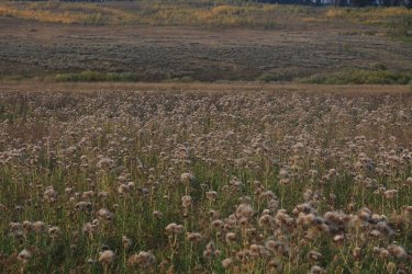
The thistle patch that I was complaining about earlier, but this time on our way back to camp.
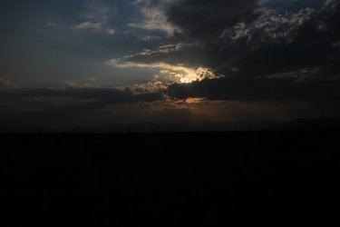
Another nice sunset on Gneiss Creek
Day 3 - 4 miles roundtrip to the top of the ridge east of camp to explore and see the views from the top.
A sleep in day for me. One of my backpacking buddies and I did a short hike to the high point of the ridge northeast of our campsite to see the views to the north and the Madison Valley to the south and southwest.
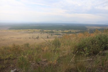
Looking down on a small portion of the Madison Valley
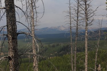
Looking north towards the Gallatin Range
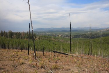
Look at all the new growth to the north of us
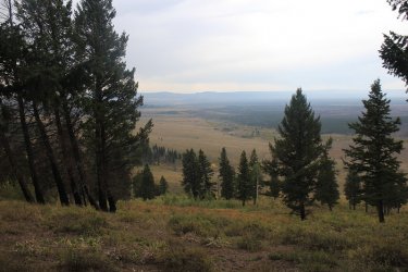
Looking down towards our campsite
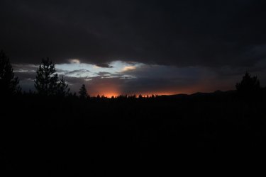
Night three's sunset on Gneiss Creek
Day 4 - 4.3 miles back to the trailhead
Just the reverse of day one for us today. The aspen and willow leaves were still peaking on our way out. Once back to the trailhead, we drove down to West Yellowstone to the Slippery Otter Pub for some food and drink to cap a successful and fun trip on Gneiss Creek.
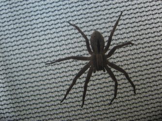
This guy was with me since I set up my tent on day one. Again, it was the Scatman mind control.
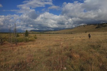
Hiking back out on a clear non smoky day
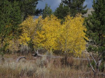
Sweet!
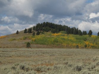
The lone hill on along the trail
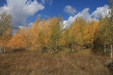
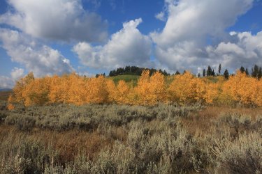
Aspen eye candy
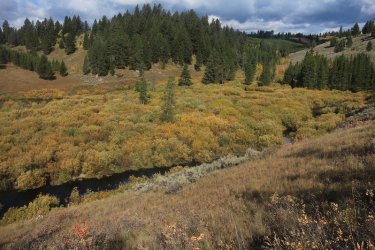
Back to the beaver ponds on Campanula Creek
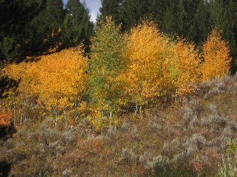
Heading up the hill into the aspen
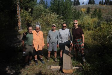
Lord have mercy - the chain gang.
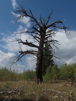
A widow maker near the Park boundary
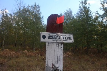
Back at the Park Boundary
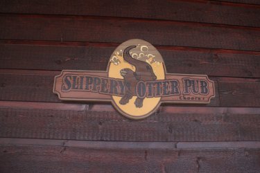
Refreshment awaits!
The End
Day 1 - 4.3 miles to campsite WA1
On the 8th of September, our group joined up with @The Trout Whisperer in West Yellowstone and made our way to Ernie's for some lunch before hitting the trailhead. Ernie's makes wonderful sandwiches and I highly recommend stopping in for one if you find yourself in the area in the future.
After lunch, we drove north along Highway 191 about ten miles until we reached the northern end of the Gneiss Creek Trail. The beginning of the trail is actually on Forest Service Land, but after five-ten minutes or so of walking we reached the Park Boundary and the information sign for the Gneiss Creek Trail.
I must say that I was quite taken by the first couple miles of trail, which was unexpected on my part. First, all the aspen that were changing colors already, and quite frankly, just the sheer number of aspen, which is the most that I have ever seen in the Park. Though the day was warm for Yellowstone in September, I truly enjoyed the northern end of this trail.
Before too long we began dropping down to Campanula Creek and the multiple beaver dams amongst the streamside willows. The willows were also changing to yellow, which made for beautiful scenery every time we hit a creek over the next four days.
After Campanula Creek, we encountered sagebrush meadows, some relatively young lodgepoles that had been burned, and more meadows before reaching our campsite WA1.
Now while I like the location of WA1, the campsite itself was one of the worst, maybe even the worst campsite that I have stayed at in Yellowstone. The campsite itself is very exposed, It seemed as though the only trees were the ones supporting the bear pole. And even though we could have a fire at this site, there was no fire pit, or even rocks to make one.
Our group ended up just setting our tents up next to the willows along Gneiss Creek and hoping for the best.
That night, we had wolves howling back and forth throughout the night which was an absolute treat.

Some fireweed on the Forest Service portion of the trail

Gneiss Creek info sign at the Park Boundary

Aspens in their orange phase

A break already?

Dropping down the Campanula Creek and the beaver ponds

Just beautiful

Campanula Creek

More yellows aspen to contend with.

Arriving at camp

Gneiss Creek (our water source) nestled in amongst the willows

Our tent situation

@The Trout Whisperer in his element

Sunset on Gneiss Creek
Day 2 - 16.2 miles roundtrip to the Cougar Creek Patrol Cabin and back
It was going to be hard to beat listening to wolves through the night, but the Cougar Creek Patrol Cabin was my goal for this trip, and it was something that I was looking forward to reaching.
Now the Gneiss Creek Trail runs through the Madison Valley, and the valley has numerous large, and when I say large, I mean very large meadows that one must pass through in order to get anywhere. So we took off early in the morning heading south towards Cougar Creek. It turns out that this day set a record high of 87 degrees for the area (this according to @The Trout Whisperer) which made for a very hot and exposed 16 miles.
Between the meadow walking, we would have to cross Gneiss Creek, Maple Creek and Cougar Creek before reaching the patrol cabin. While the meadows were very dry, I thought that they were still beautiful in their own right.
We had to leave the trail at Gneiss Creek in order to find a crossing spot, so that we wouldn't have to ford the creek. But by doing this, it meant that we had to contend with a large patch of thistles in order to return to the trail. This was a prickly situation for this kilt wearer.
We eventually reached the cutoff for some semi off-trail travel up Cougar Creek. Along the creek, we encountered a bull bison that seemed a bit surprised to have guests nearby. Soon though, we reached the patrol cabin which sits atop a small hill with views down the Cougar Creek drainage. Simply splendid. We ate our lunches on the cabins front stoop, and after lunch I went to investigate the old Cougar Creek Trail which heads northeast towards Winter Creek, and the patrol cabin that is located there.
After feeling confident that I had found this end of the old trail, we headed back to camp in relatively hot conditions. Of course, we still had issues when we crossed the beaver ponds again. I'm still amazed at the strength require to overcome the suction of a bog. It just bout wore me out.
Back at camp it was time for dinner and another beautiful sunset.

On our way to San Jose! Oops, I mean the Cougar Creek Patrol Cabin. The meadows along Gneiss Creek

The beaver pond on Maple Creek

Enormous meadows in the Madison Valley

A ghost forest between meadows.

@The Trout Whisperer doing his best Julie Andrews imitation -The meadows are alive, with the sound of music.

More meadows

The intersection of the unofficial trail up Cougar Creek

You shall not pass! I was able to alleviate the situation with some Scatman mind control.

Cougar Creek at last

And more Cougar Creek

This was interesting - a bear had dug up a yellowjacket's nest.

At last we arrive at the cabin

Cabin decorum

The backside of the Cougar Creek Patrol Cabin

What I believe is the old Cougar Creek Trail. It is in bad shape I'm afraid.

Group shot before we left the cabin

Wolf track on our way back. We ran into a lot of wolf tracks and scat on the Gneiss Creek Trail

The smoky conditions cleared out enough for us to make out Mount Holmes to the northeast of us

Crossing Maple Creek on our return trip

The thistle patch that I was complaining about earlier, but this time on our way back to camp.

Another nice sunset on Gneiss Creek
Day 3 - 4 miles roundtrip to the top of the ridge east of camp to explore and see the views from the top.
A sleep in day for me.

Looking down on a small portion of the Madison Valley

Looking north towards the Gallatin Range

Look at all the new growth to the north of us

Looking down towards our campsite

Night three's sunset on Gneiss Creek
Day 4 - 4.3 miles back to the trailhead
Just the reverse of day one for us today. The aspen and willow leaves were still peaking on our way out. Once back to the trailhead, we drove down to West Yellowstone to the Slippery Otter Pub for some food and drink to cap a successful and fun trip on Gneiss Creek.

This guy was with me since I set up my tent on day one. Again, it was the Scatman mind control.

Hiking back out on a clear non smoky day

Sweet!

The lone hill on along the trail


Aspen eye candy

Back to the beaver ponds on Campanula Creek

Heading up the hill into the aspen

Lord have mercy - the chain gang.

A widow maker near the Park boundary

Back at the Park Boundary

Refreshment awaits!
The End
