chandlerwest
Member
- Joined
- Feb 7, 2015
- Messages
- 550
I probably have alluded to this previously but I am proudly declaring it today. I am a "Collector" of Glacier National Park trail miles. Circumstances, desire and life events have blessed me with the opportunity to visit Glacier over a 39 years period. I solely day hike so accumulating miles could be considered limited. The need to out and back damn nearly everything accumulates over the decades. (For what it is worth I guesstimate my total miles hiked in GNP to be 1,603 miles. Give or take.) There are 734 miles of trail in GNP. After this August week I stand at 370 miles. More than half way which isn't bad for a day hiker. I have two lists. Hikes that I have not completed but logistically could, and hikes that I have not done since the mid 1980's that I could gladly do again. I believe that 400 miles is well within my grasp. But........the easy access trails are pretty much completed.
This week was going to be a high altitude week. My friend Kurt has only been to Glacier in August a couple times since 1985 so he was wanting to get elevation and, smoke from the annual fire seasons, has discouraged me from much altitude recently. We entered the week optimistic about our desire. But Kurt recently had some medical stuff come up and neither of us knew how that would play out. So....we were also guarded and flexible. Turns out that flexibility was required and personally this turned into the biggest mileage week, ever, for me. (68.4 miles)
Not sure how the week would progress we tackled the crux of the trip on Day 1. Swiftcurrent Lookout. A 16.6 mile day with approximately 3,600 feet of gain and decent in the middle. Plus there is a 1.5-2 hour commute to, then from, the trail head. Quite a day.
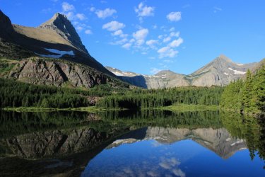
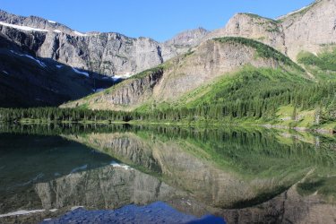
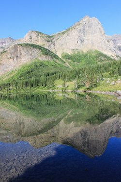
This is my first photo taken during the week. Another thousand or so to go. It is psychologically impossible for me Not to shoot pictures! Reflection in Red Rock Lake. Swiftcurrent Lookout is at the top of the pyramid on the right.
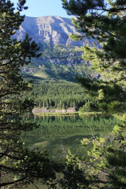
Bullhead Lake.
Kurt queried as to how the trail gets up there. One step at a time!
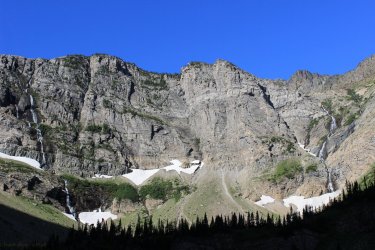
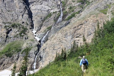
Falls coming down from snow fields and Swiftcurrent Glacier above.
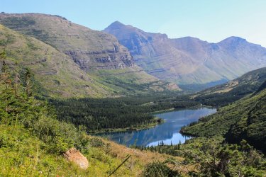
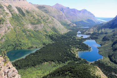
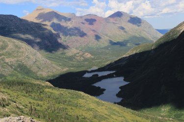
The string of lakes progressively show themselves as we climb.
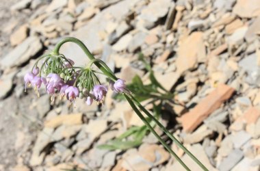
Nodding Onions
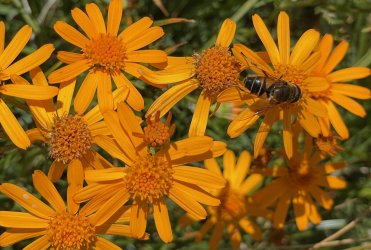
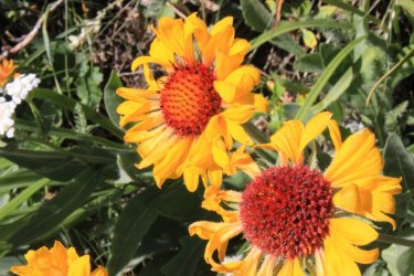
Blanket Flowers
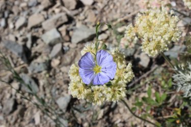
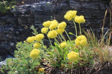
Flax backed by Buckwheat
There is no trail to get to the Windmaker Lake on the left. We wonder how it might be to bush whack there. Another day?......nah.
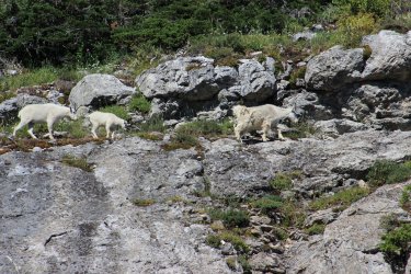
Kurt, with his Hunter Eyes, had spotted these Mountain Goats from a great distance and height away. Not sure if they came down to us or we got up to them.
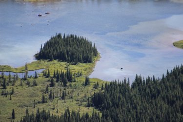
We spotted this Moose far below us.
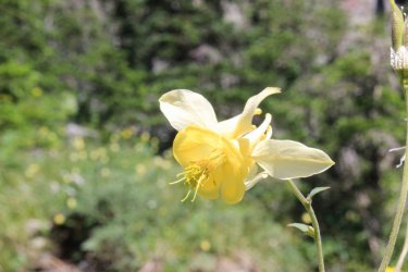
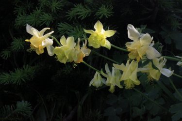
Yellow Columbine
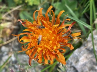
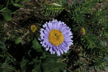
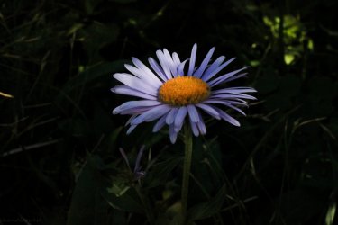
I have spent so much time with Glacier wildflowers I should know what they all are. But I have blind spots. This is a Aster/Daisy/Fleabane....ha It's purple!
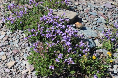
Beardtongue
The first view to the other side at Swiftcurrent Pass. Heaven's Peak
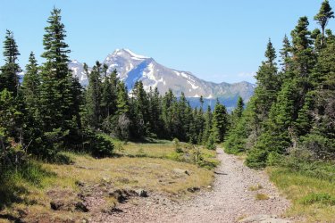
The Lookout up yonder
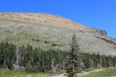
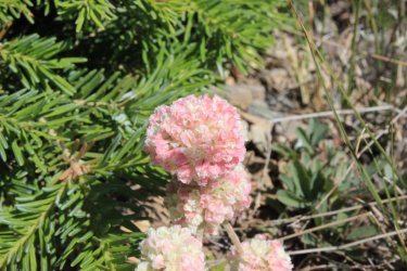
Cushion Buckwheat
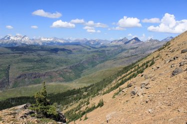
First views to the north.
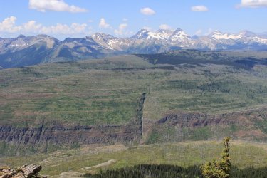
Back towards Logan Pass
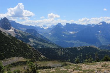
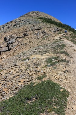
It's closer but looks farther away. I tried to teach Kurt the chandlerwest mantra of "Maintain Discipline." Taking short steps. Not concerned about covering distance. Just slowly moving forward. Of course I am helped by stopping to take pictures often.
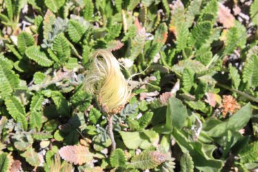
Mountain Aven/Dryas
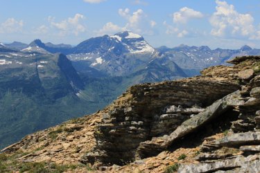
Longfellow Peak
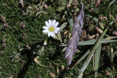
Alpine Chickweed
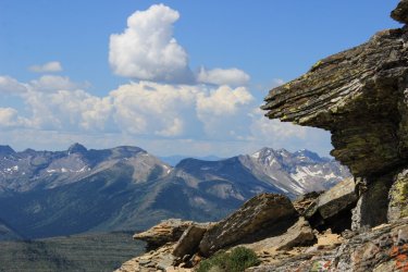
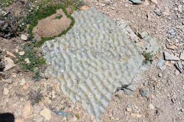
I never get tired of seeing evidence of shallow seas/lapping water at 8,000 feet.
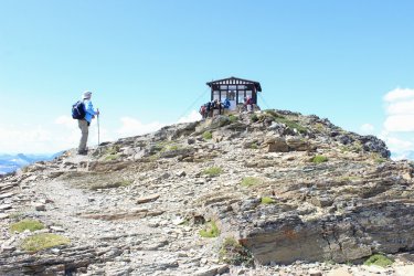
We made it!!!
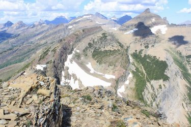
North up toward Stoney Indian
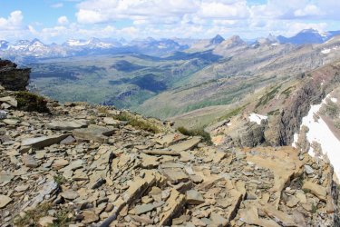
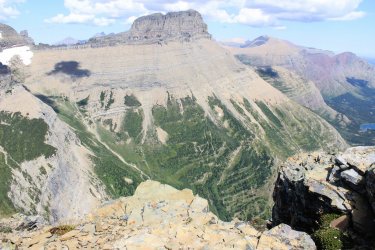
Mt. Wilbur
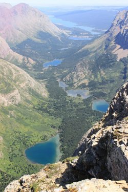
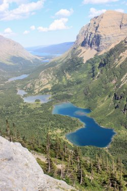
From top to bottom. Duck Lake on the Blackfoot Reservation in the hazy distance. Lake Sherbourne (a reservoir). Swiftcurrent Lake and Many Glacier Hotel. Fishercap Lake. Red Rock Lake. Two unnamed lakes. Bullhead Lake. Windmaker Lake.
I forgot that I had software to stitch photos together but I found a couple that worked. That is Granite Park Chalet on the far right. Swiftcurrent Glacier, left center.
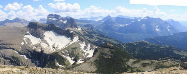
Mt. Gould with the rounded Gem Glacier tucked on the ridge below and Swiftcurrent Glacier
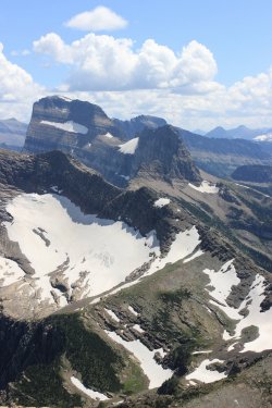
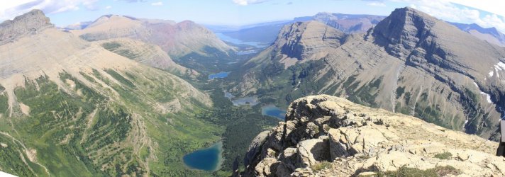
Time to make our way down.
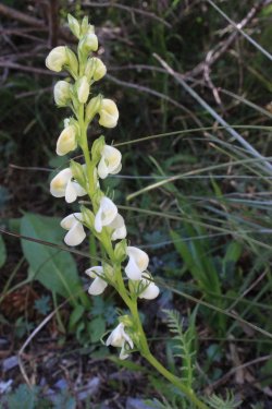
Curved Beaked Lousewort
Taking photos I would fall way behind Kurt. At one point I saw where he was and had to laugh. "It takes two to get this far apart. Me taking pictures and him not waiting for me."
In 1983 I rode a horse up this trail. I can remember Spider trying to scrape me off on these walls.
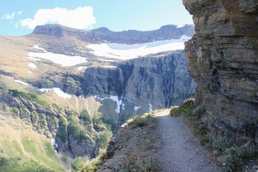
Wonderful shadows
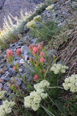
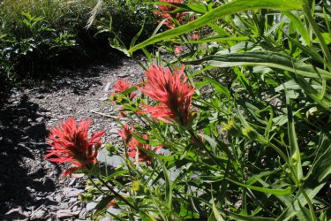
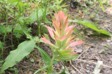
Most beautiful Indian Paintbrush
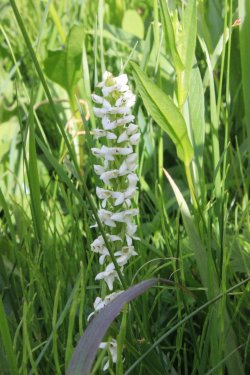
Bog Orchid
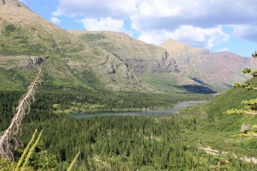
Back at Bullhead Lake
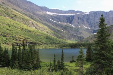
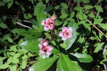
Pipsissewa. This little flower became the star of my week. So tiny and close to the ground and I saw it often.
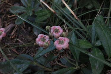
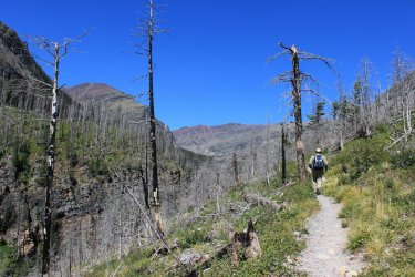
Day 2 - We were both feeling the previous day so we got a later roll out of the cabin. Decided to do a 10.9 mile day. Otokomi Lake. A trail that I last did in 1986. The hike went through the 2015 Reynold's Creek fire burn area. There was much discussion about the Wonder of fire burns. How it opens up the views. How you can see the terrain. How you can see the forest coming back.
Above St. Mary Lake.
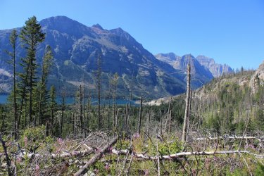
I told Kurt "this one is for @scatman ". So I had to describe Hugh and his Yellowstone travails. I believe that Yellowstone has grounds for a lawsuit for copyright infringement by Glacier Nat'l Park. Yellowstone owns the rights to blow downs.
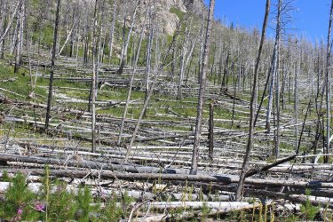
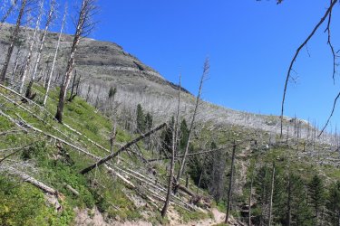
in 2018 Jeff and I attempted to climb Otokomi Mtn. This is a 2018 shot of the gorgeous burnt forest that we had to use to gain access
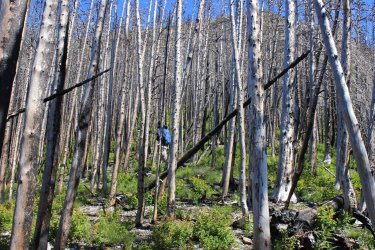
In June and earlier this morning I could tell that the standing stags were substantially less than in previous years. When I saw what happened to the access route I was open mouth, dumbfounded. It is a blown down rats nest. It looks like a bad comb over.
Our first looks of the head wall where the lake is located.
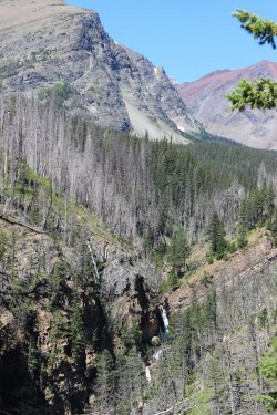
We were following Rose Creek. Numerous waterfalls and cascades
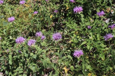
Bergamot
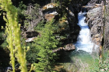
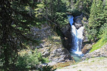
Kurt began to ask me specific questions about the trail. I felt bad that my best response seemed to be "I don't know......it was 1986." He was definitely grasping for something. Please note the Beargrass. The taller stems along the trail. The Beargrass must have been brilliant a couple weeks prior.
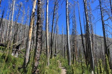
I could tell the Kurt was struggling behind me. He finally hollered and asked more question about the remaining trail and took off his boots. His right heel was a raw sore. Any blister was long busted. We plugged along for a while and eventually stopped stared at each other. He said that he was thinking about telling me to continue on and turning back. I told him that I was wondering if he was waiting for me to tell him to turn around and go back. Not knowing precisely what was ahead, but knowing that it was at least 4 miles down to the truck, he tapped out. With sadness I trudged on. Turning around occasionally hoping to see him continuing slowly behind me. Turned out it was another 25 minutes to the lake.
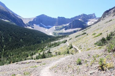
He had asked me if there was a view of the lake or is it one you don't see until you get to it. I surmised that there was no view. Which was the case.
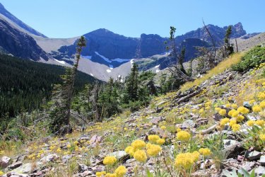
Otokomi Lake. All I remembered of this hike was the lake. Blue with red cliffs around it. Making it, kind of, unique in my mind.
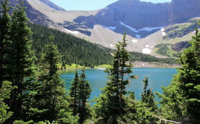
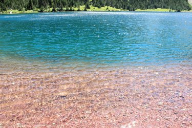
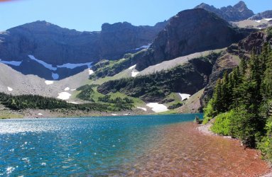
Making my way back out.
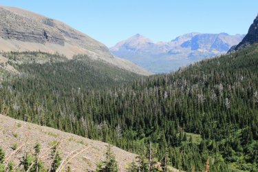
First view of St. Mary Lake
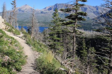
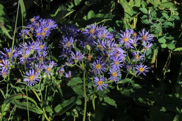
Day 3 - We were hoping that Kurt would possibly be able to hike later on in the week. He said that he would help me with the logistics on trails that I had not yet hiked. I dropped my car at the Fish Creek Picnic Area and he drove me to the head of Lake McDonald. I was going to hike the North Shore of Lake McDonald. 10.4 miles. It traverses burn area for 100% of its length. Not exactly a trail on anybodies to do list. Just the right thing for me!!!!!
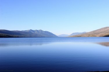
I had 2-3 miles of dirt road to walk before the official trail head. It was a glorious morning. I even found a couple blackberry bushes!!!!!
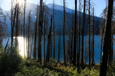
I remember watching video of people driving through a tunnel of flames as they escaped the Howe Ridge Fire in 2018. This very road!
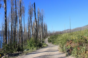
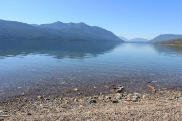
Looking across to McDonald Lodge
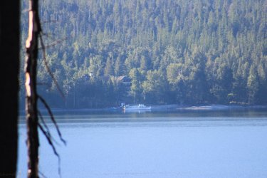
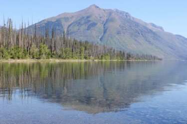
I was seeing dramatic shots everywhere.
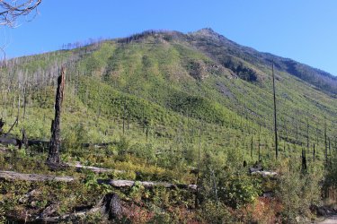
Mt. Stanton
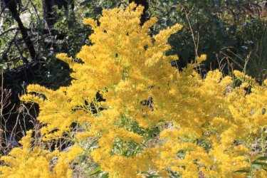
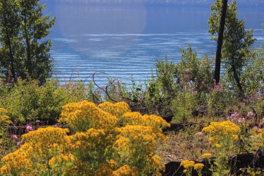
Goldenrod - Once I got to the trail I had no idea what type of shape it would be in. It isn't well traveled and would it be downfall after downfall? It was pretty sweet. Definitely lightly used but fairly maintained.
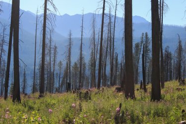
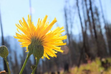
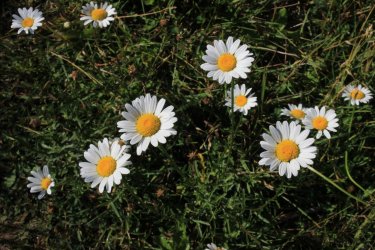
Oxeyed Daisy
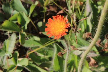
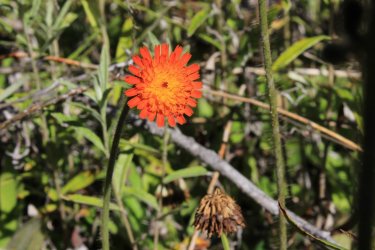
Orange Hawkweed
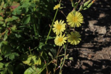
Prickly Lettuce
Constantly looking behind me to see how the view changed
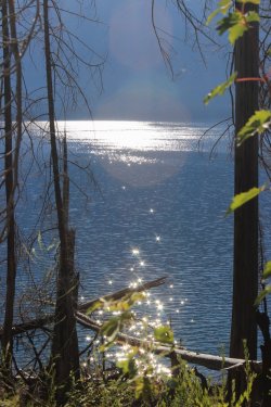
Trying to capture the suppleness of the lake
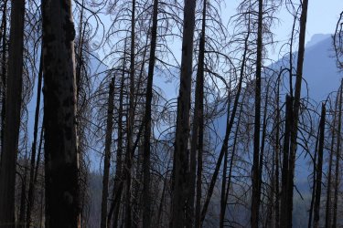
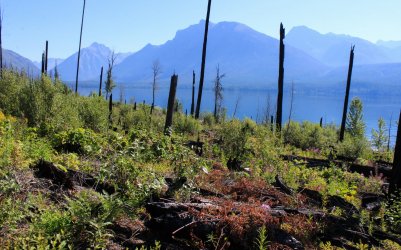
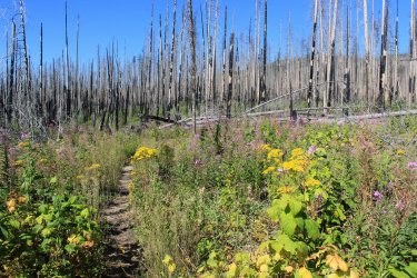
An interesting thing was seeing the various levels of fire burn. A handful of fires have come through over the century.
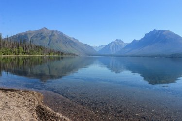
There is a back country campsite out here. Seems odd because the Going To The Sun road and it multitudes are a mile across the lake. Plus the site doesn't seem like it would work into a multi day backpack. But it had the best damn beach I would ever hope for. I could see myself packing into this spot for a night.
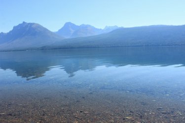
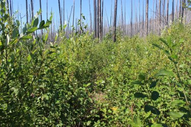
Just beyond the camp the trail was swallowed up by tall brush.
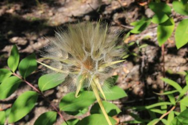
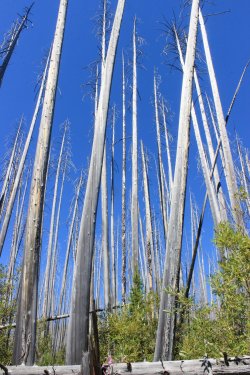
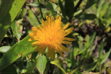
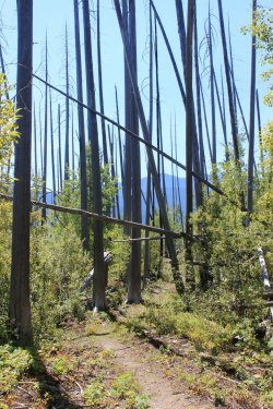
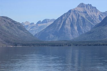
The Little Matterhorn finally popping out.
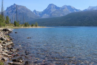
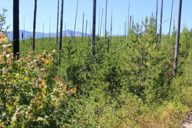
I came upon a forest that had active regrowth
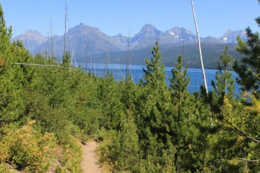
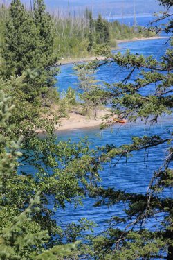
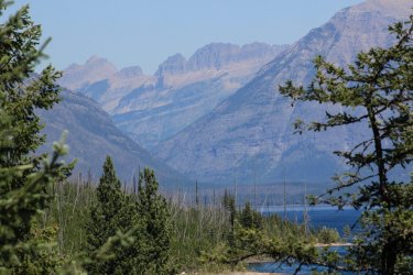
As I reached the Fish Creek Campground the fire suppression policy slaps you in the face. The forest immediately became thick and dark as they attempt to protect populated areas.
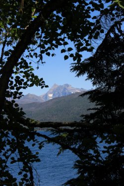
Day 4 - A twofer
I said to Kurt. "Tell me if this sound okay. We both drive towards Two Medicine (the east side). I park my car at Milepost 193.7. Hop in your truck and you drop me off at the trail head at the Two Med entrance station. I hike the Dry Fork Connector and come around to Two Medicine Lake were you can fish. You then drive me to Marias Pass and drop me off. I then hike the Autumn Creek Trail back to my car?"
The Dry Fork Connector trail is 2.5 miles of trail that nobody has a need to hike. The "main" trail starts at the lake. I am sure this Connector had a purpose decades ago. It has been actively on my "to do" list for quite some time. With Kurt fishing I felt it would be easy to tick off my list. BUT I tend to want to do it in June. Not waste an August hiking day for it. Well.....June as an issue. How high is Dry Fork Creek running? There is a seasonal bridge that may or may not be installed, yada, yada, yada. This past June, creeks were running high and my memory of that crossing lead me to think that it would be a horrible ford. I checked this hike off on this day!!!!!!!
The early morning light seemed quite special.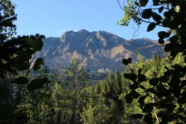
And purple flowers seemed to be especially perky.
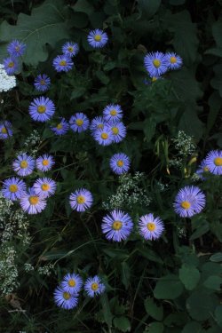
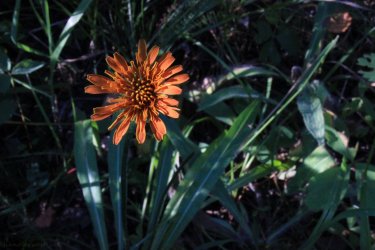
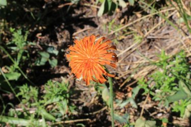
I was simply enjoying this good for nothing Dry Fork Connector Trail!!! Orange Agoseris
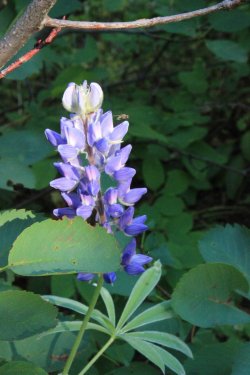
Lupine
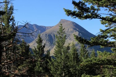
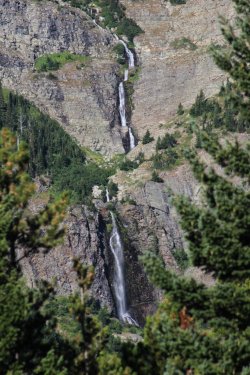
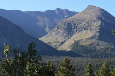
Rising Wolf Mountain started to come into view. I have considered this the most massive of mountains. Then I noticed the water cascading down it.
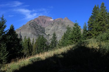
Then I realized. This cascade and waterfall is ONLY visible from this trail!!!!! The value of this useless trail immediately went up hundred fold. The Pitamakan Pass trail skirts below it but you cannot see it through the forest and the terrain.
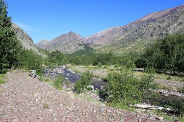
Dry Fork Creek. As you can see this drainage could get wide during high water season. It makes me want to do the Dry Fork Connector in June just to see water rushing through here.
Orange Agoseris. I love this flower as it is such a loner. You rarely see a 2nd one in the vicinity
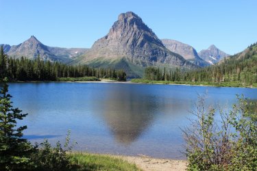
Pray Lake (just below Two Medicine Lake)
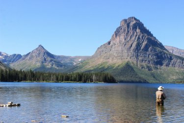
Kurt catching tonight's dinner. He had to gauze and duct tape his heel to get it into his waders.
It was off to Marias Pass and the 6.2 miles of what I call Autumn Creek West. Autumn Creek Trail is a bit of a burden to day hike. But with Kurt's help this year and last I have knocked out 2 of the 3 sections.
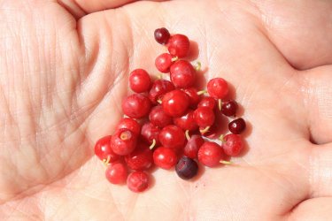
In 2015 Jeff and I went on a hike with the Hike734 guy and he introduced us to this berry. Fluffy plant.....tiny sweet berries. He named them Kinnickinnick and I have come to think he was mistaken about that. I see a lot of Kinnickinnick and none of it was that berry. I have not knowingly seen these berries since 2015. This afternoon I found myself in a forest floor full of the ripe berries. I believe they are Grouse Whortleberries. All this puff has berries.
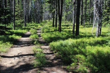
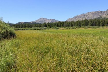
There is supposedly a lake just in from Marias Pass. Turns out that it is a meadow lake that it a bit seasonal....it seems.
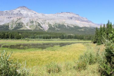
Elk Mountain
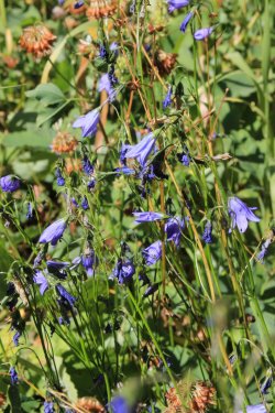
Harebells
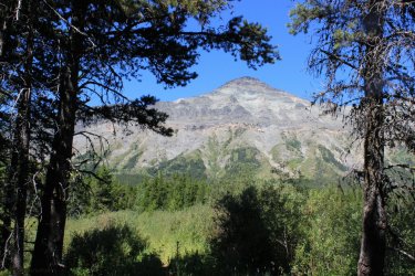
Summit Mountain
Pipsissewa. You all have seen me freak out about finding Calypso Orchids in June. I was the same about seeing these during this week.
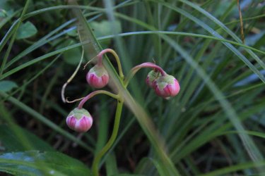
I think these are younger one but I could be wrong.
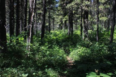
After a mile I finally reach the Autumn Trail proper. The trail started out being a decent trail.....through the woods.
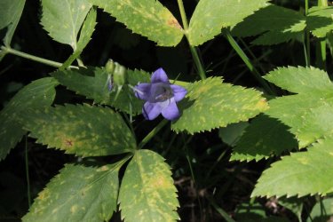
Harebell
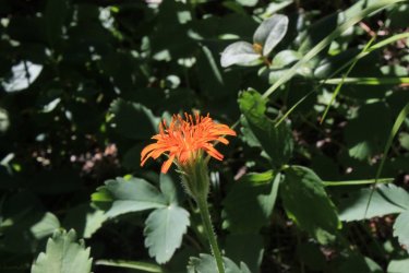
Eventually it starts to open up into small meadows with views of Elk Mountain and the surrounding range.
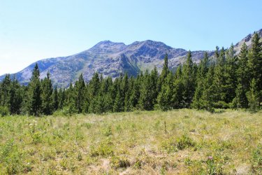
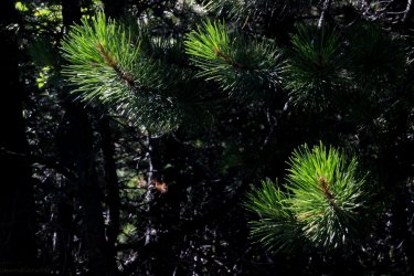
I was confused constantly because Elk Mountain kept being hidden by this mass in the foreground. So it was a lot of "is That Elk Mtn?"
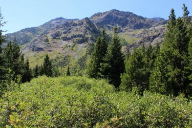
Okay......the trail became Quite overgrown. Brush devouring the trail. I am amazed at how use to (comfortable is not the proper word) this condition I have become over the last two August. The old me would laugh at the idea of hiking the trails that I have recently hiked. I was walking and I went "I'm not on a trail!" I froze. Retraced my steps until I felt that I was on the trail and looked around. I saw the next shot and wondered.......I put my hand in and parted the branches and ......"there's the trail!!!!!
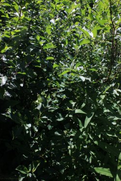
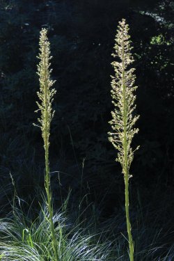
Quite the trail
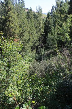
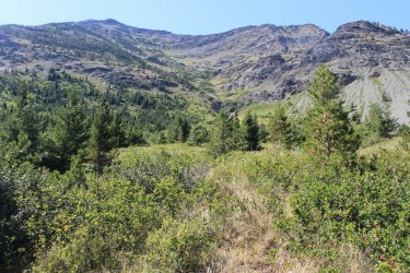
Looking back towards Summit Mountain
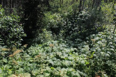
I went into this one hollow and found myself in Thimbleberries and brush that had been matted down. Something or someone had fallen and wallowed around. Right on my trail. To be honest it was scary. I felt like I was standing in a nest. I didn't get a good shot of the spot because I wanted to get out of there!
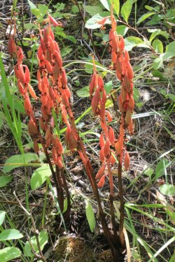
Coralroot Orchid seed pods
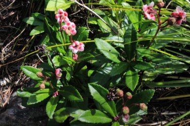
Pipsissewa
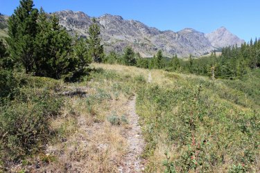
I heard a train and prayed that i was near the tracks. That it just wasn't the sound traveling uphill to me.
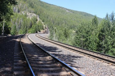
Day 5 - Kurt had given up hope of getting back on the trail. He expressed a desire to be fishing at Two Med at sunrise so that gave me the chance to do something crazy that I have wanted to do for years. To put up, or shut up about this hike. It is an 18.5 mile loop. One that I am certain that only a person who looks at a map for possible day hikes would even considered possible. Jeff has laughed at me for thinking of doing it. It is 18.5 miles of lightly traveled and rarely maintained trails. Probably 100% in the forest. "Why?" In retrospect.......it really looks cool on a map when you fill it in! This hike is as close to a back country experience as a day hiker can reach. It was wonderful.
I hit the trail at first light. I told Kurt I probably will be off the trail in 12 hours.
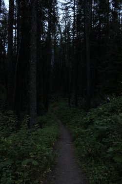
The first mile I have done a couple times as it is the access route to Scalplock Lookout.
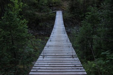
I had debated whether to do it clockwise or counter clockwise. I decided counter, as the steep section will be steep-er but shorter. It is great when a plan works out. I think I would have cried if I had done it clockwise. I am going to the Fielding Jct. then coming back from Park Creek. The Fielding section is 4.3 miles
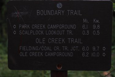
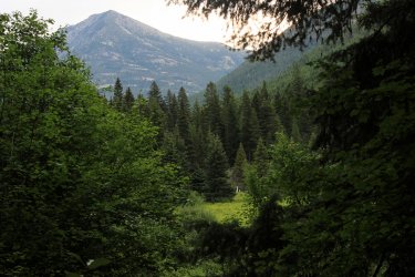
Ole Creek Drainage. I was pleasantly surprised at the views I had in this drainage. This side of the drainage was quite steep pitched so the trail skirted across high above the creek for the most part. So it wasn't 100% in the forest!! I was so excited to be there that I swear I didn't see a forest but I saw each individual tree.
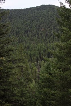
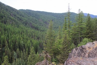
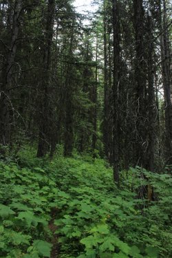
The trail was definitely lightly traveled. Had to pay attention as you dodged a bush encroaching the trail as there was a bad drop off to the right.
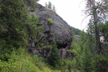
I saw the hind end of a black bear as it sprinted up a slope out of site. May have been 50 feet away. I had buckets of thimbleerries as......it is a lightly traveled trail
Elk Mountain and Ole Creek
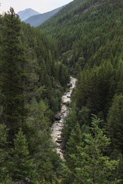
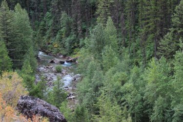
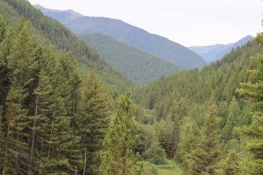
I was surprised by the rock walls.
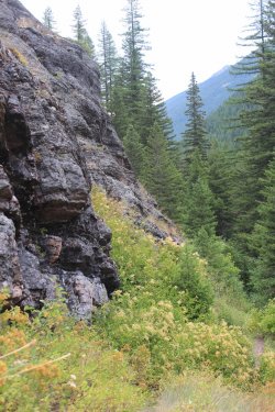
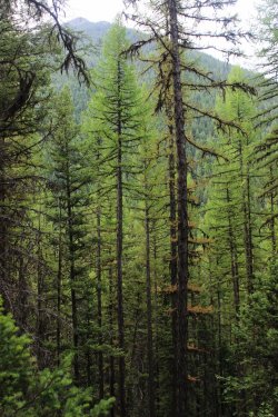
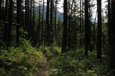
Yep that is the trail going.....through the woods.
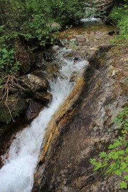
Crossing the creek that drains the section that I am going to be climbing up.
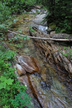
For the first time during the week I came into some wonderful huckleberry country. Again.....lightly traveled so they were all mine......and the bears.
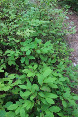
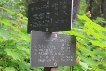
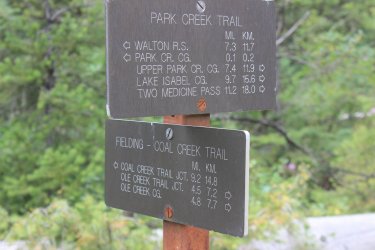
The Fielding Trail just shouts wilderness. It doesn't really go anywhere but it connects all of the drainage's. This junction was funny. The Ole Trail continued on but a huge tree had uprooted at the spot and the trail going forward was not obvious. The Fielding Trail headed up slope and was overgrown. But at this sign was a 6 foot circle of bare trodden ground. It had the appearance of back packers walking in circle assessing the situation. Groups sitting and eating snacks discussing their next steps. I had started at the Walton Range Station.
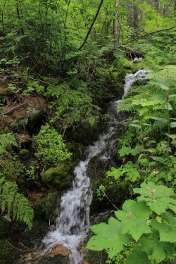
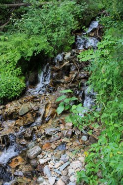
It turned out that the Fielding Trail up to the pass was the best conditioned trail of the day. It was steeper so I was taking it easy and the trail was .......a trail. Not some feint surface underneath the overgrowth. I was loving the small streams that I had to cross coming in from the right.
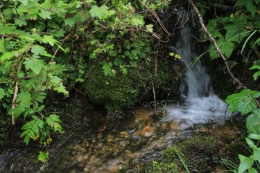
To be honest I was a bit giddy.
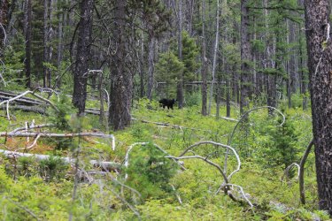
I saw the butt of another black bear (closer than the previous encounter) as it sprinted up the hill. This time it stopped and looked back at me and I was able to get a couple shots. Before I considered getting out my zoom lens I believe I heard a huff and I...... thank you'd and moved on.
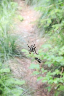
All morning I was running into spider webs. Nobody must hike these trails...ha. One, I could feel and hear the web ripping away from its base and I spent the next hour trying to get untangled from it. Going up hill I was going slow enough that I came across at least 4 webs like this one. I would look to see if I could skirt them somehow but I think every time I ended up folding up their work
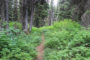
I eventually got to the top and it was a nice pleasant slope Definitely was next level overgrown though. I decided to continue my slow pace and I even found myself singing. I was doing the Ole/Fielding/Park Loop and it was all down hill from here. How cool is that?" (I know....this photo doesn't read as "next level overgrown".)
I started to run into downed trees. Not down fall. Downed trees. This began a continuous stream of "do I go over.....do I go under....do I go around....do I walk across hoping I don't break through and break a leg."
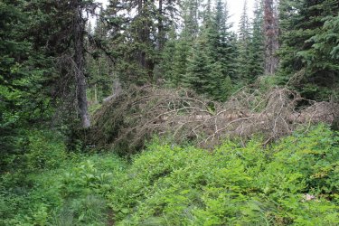
There....that is "next level" -ish
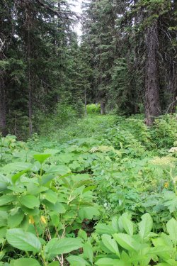
This forest looked like it could spontaneously combust.
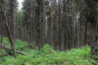
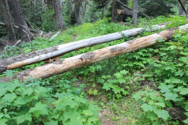
Trail
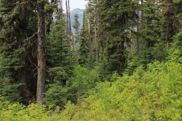
I had to laugh. I felt like I was crossing a stream but which log do I use. The initial log was an actually bridge-ish log.
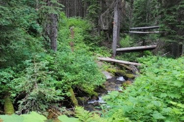
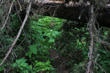
All I see are pikes waiting to skewer me.
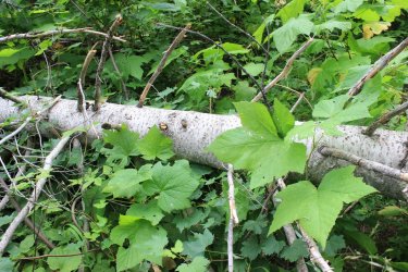
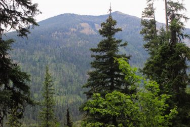
Oh look.....a view out. I can't say I have any sense of the Park Creek drainage.
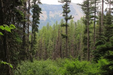
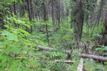
Somewhere along the way I fell. I could feel the rocks and roots under the brush but not truly see them. I stepped on a pitchy, slick, rock and......down I went. The beauty of it being so overgrown, dense, I bounced up completely unscathed. I would have been in tears having to navigate all of this stuff going uphill......and it seemed exceptionally long.
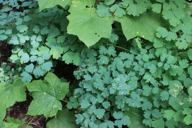
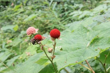
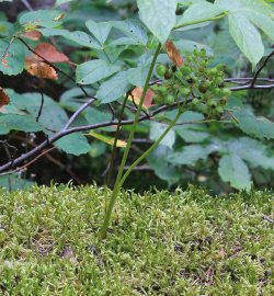
Thimbleberries Yes that is one of those nasty spiders.
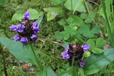
Common Self Heal - These tend to grow in moist areas underneath the tall stuff. They seemed fluorescent
Miniature world on a tree log
This trail junction sign to a day hiker feels like the middle of the wilderness. Out to the Walton Ranger Station I go.
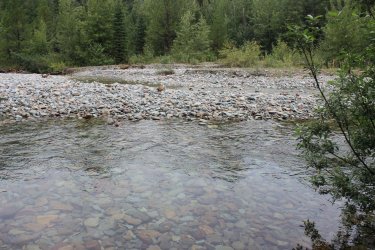
My sole view of Park Creek. The brush blocked views up and down stream. A 3 foot deep pool kept me from getting out into the drainage. In retrospect I would have jumped in just to get a peak of the other side. At the time I thought I would have opportunities downstream. Nope.
I got lazy on this shot. I didn't get down to take a proper shot. I just aimed and focused the best I could and called it good enough. (I must have been getting tired.) But I captured what I wanted.
Oh look.......there is Park Creek. I thought the trail would be closer.
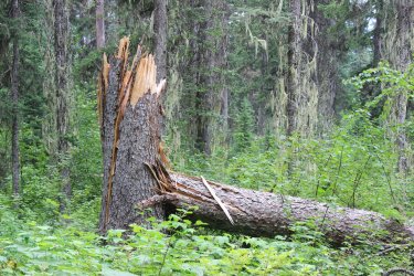
Can you imagine the torque that went into snapping this tree?
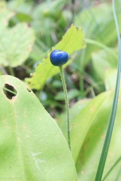
Queen Cup Beadlily
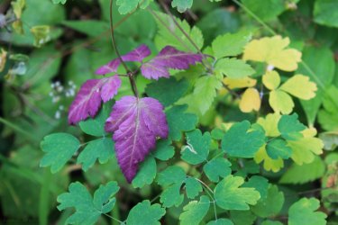
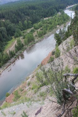
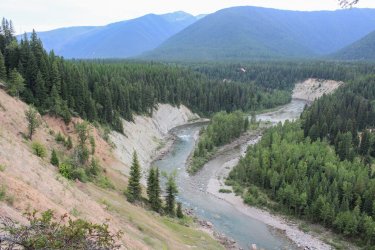
The trail meets up with the "retired" South Boundary Trail. For a few decades, due to under use and sloughing off into the Middle Fork of the Flathead River, this lower section of the South Boundary Trail was abandoned. View down stream
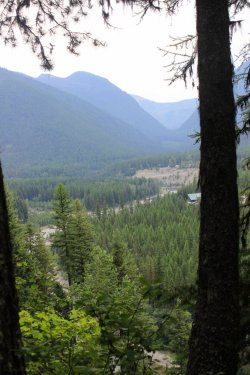
10.5 hours after I started I got back to my car. I assume that you all know how fulfilling it is to accomplish something extraordinary that you have always thought about doing.
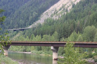
On our final day we heading into the park for a laid back afternoon.
View of the North Fork of the Flathead River.
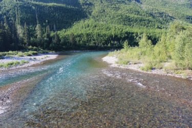
Same spot of the river in June
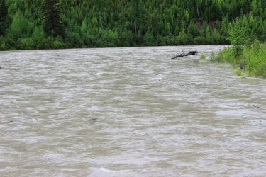
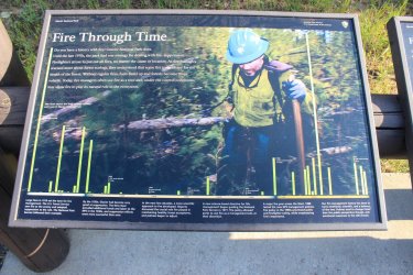
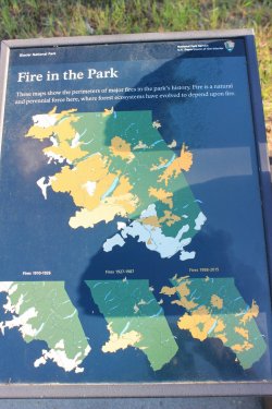
I am including these two story boards as they provide current and wonderful illustration of the fires of Glacier National Park. Fire is as much a presence in this park as glaciers.
This board explains why Jeff and I, when discussing when wildfires occurred, always default to 2003.
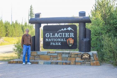
Maybe I should have my picture taken at ALL the entry signs. Ugh.
We drove up to Logan Pass hoping to find a parking space. With no luck we ended up at Lunch Creek. At the look in Kurt's eyes I knew I needed to put this on my "do it again with Kurt" list. A few years back I got up into the basin beyond.
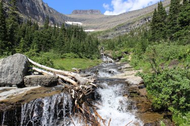
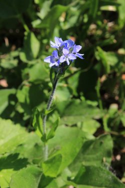
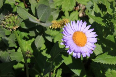
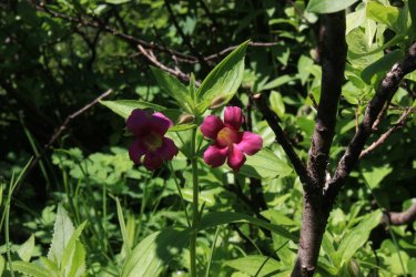
Monkeyflower
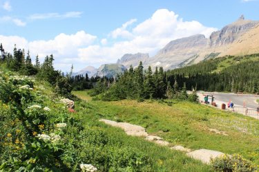
A parking space at Logan Pass opened up.
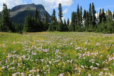
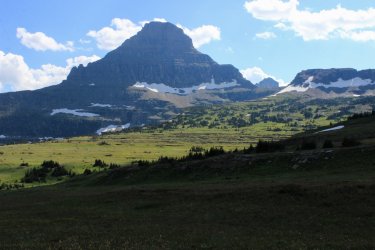
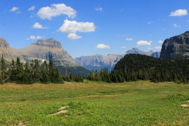
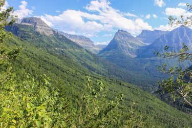
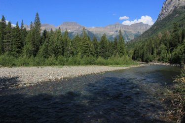
This is a spot along McDonald Creek with the Garden Wall beyond that I have taken many photos over the years.
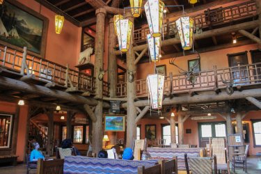
McDonald Lodge where Kurt and I still walk around and feel like it is "ours". We met and worked there in 1985
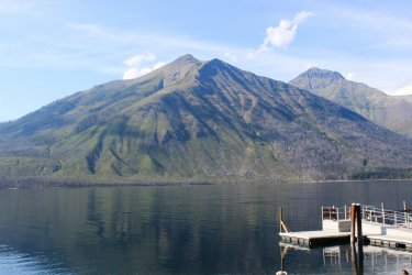
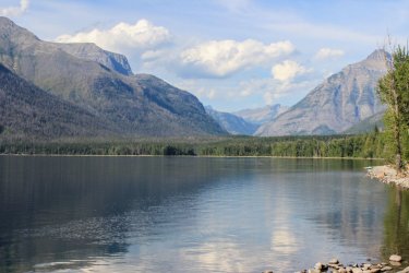
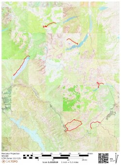
This is a map of the week. 29.6 miles of new trails. I like how the hikes are scattered around the park. Doesn't that loop look cool?!
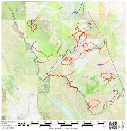
This is a map of the 370 miles of trails hiked in my lifetime. The blue are trails not hiked since the mid 1980's
I feel like I belong in a support meeting. "My name is Harry and I am a collector of trails in Glacier National Park."
Thank you so much for your time and patience in getting through this trip report.
This week was going to be a high altitude week. My friend Kurt has only been to Glacier in August a couple times since 1985 so he was wanting to get elevation and, smoke from the annual fire seasons, has discouraged me from much altitude recently. We entered the week optimistic about our desire. But Kurt recently had some medical stuff come up and neither of us knew how that would play out. So....we were also guarded and flexible. Turns out that flexibility was required and personally this turned into the biggest mileage week, ever, for me. (68.4 miles)
Not sure how the week would progress we tackled the crux of the trip on Day 1. Swiftcurrent Lookout. A 16.6 mile day with approximately 3,600 feet of gain and decent in the middle. Plus there is a 1.5-2 hour commute to, then from, the trail head. Quite a day.
This is my first photo taken during the week. Another thousand or so to go. It is psychologically impossible for me Not to shoot pictures! Reflection in Red Rock Lake. Swiftcurrent Lookout is at the top of the pyramid on the right.


Bullhead Lake.

Kurt queried as to how the trail gets up there. One step at a time!

Falls coming down from snow fields and Swiftcurrent Glacier above.

The string of lakes progressively show themselves as we climb.


Nodding Onions

Blanket Flowers

Flax backed by Buckwheat

There is no trail to get to the Windmaker Lake on the left. We wonder how it might be to bush whack there. Another day?......nah.

Kurt, with his Hunter Eyes, had spotted these Mountain Goats from a great distance and height away. Not sure if they came down to us or we got up to them.

We spotted this Moose far below us.

Yellow Columbine

I have spent so much time with Glacier wildflowers I should know what they all are. But I have blind spots. This is a Aster/Daisy/Fleabane....ha It's purple!

Beardtongue

The first view to the other side at Swiftcurrent Pass. Heaven's Peak

The Lookout up yonder

Cushion Buckwheat

First views to the north.


Back towards Logan Pass

It's closer but looks farther away. I tried to teach Kurt the chandlerwest mantra of "Maintain Discipline." Taking short steps. Not concerned about covering distance. Just slowly moving forward. Of course I am helped by stopping to take pictures often.

Mountain Aven/Dryas

Longfellow Peak

Alpine Chickweed


I never get tired of seeing evidence of shallow seas/lapping water at 8,000 feet.

We made it!!!

North up toward Stoney Indian


Mt. Wilbur

From top to bottom. Duck Lake on the Blackfoot Reservation in the hazy distance. Lake Sherbourne (a reservoir). Swiftcurrent Lake and Many Glacier Hotel. Fishercap Lake. Red Rock Lake. Two unnamed lakes. Bullhead Lake. Windmaker Lake.

I forgot that I had software to stitch photos together but I found a couple that worked. That is Granite Park Chalet on the far right. Swiftcurrent Glacier, left center.

Mt. Gould with the rounded Gem Glacier tucked on the ridge below and Swiftcurrent Glacier


Time to make our way down.

Curved Beaked Lousewort

Taking photos I would fall way behind Kurt. At one point I saw where he was and had to laugh. "It takes two to get this far apart. Me taking pictures and him not waiting for me."


In 1983 I rode a horse up this trail. I can remember Spider trying to scrape me off on these walls.

Wonderful shadows

Most beautiful Indian Paintbrush


Bog Orchid

Back at Bullhead Lake

Pipsissewa. This little flower became the star of my week. So tiny and close to the ground and I saw it often.

Day 2 - We were both feeling the previous day so we got a later roll out of the cabin. Decided to do a 10.9 mile day. Otokomi Lake. A trail that I last did in 1986. The hike went through the 2015 Reynold's Creek fire burn area. There was much discussion about the Wonder of fire burns. How it opens up the views. How you can see the terrain. How you can see the forest coming back.
Above St. Mary Lake.

I told Kurt "this one is for @scatman ". So I had to describe Hugh and his Yellowstone travails. I believe that Yellowstone has grounds for a lawsuit for copyright infringement by Glacier Nat'l Park. Yellowstone owns the rights to blow downs.

in 2018 Jeff and I attempted to climb Otokomi Mtn. This is a 2018 shot of the gorgeous burnt forest that we had to use to gain access

In June and earlier this morning I could tell that the standing stags were substantially less than in previous years. When I saw what happened to the access route I was open mouth, dumbfounded. It is a blown down rats nest. It looks like a bad comb over.

Our first looks of the head wall where the lake is located.

We were following Rose Creek. Numerous waterfalls and cascades

Bergamot


Kurt began to ask me specific questions about the trail. I felt bad that my best response seemed to be "I don't know......it was 1986." He was definitely grasping for something. Please note the Beargrass. The taller stems along the trail. The Beargrass must have been brilliant a couple weeks prior.

I could tell the Kurt was struggling behind me. He finally hollered and asked more question about the remaining trail and took off his boots. His right heel was a raw sore. Any blister was long busted. We plugged along for a while and eventually stopped stared at each other. He said that he was thinking about telling me to continue on and turning back. I told him that I was wondering if he was waiting for me to tell him to turn around and go back. Not knowing precisely what was ahead, but knowing that it was at least 4 miles down to the truck, he tapped out. With sadness I trudged on. Turning around occasionally hoping to see him continuing slowly behind me. Turned out it was another 25 minutes to the lake.

He had asked me if there was a view of the lake or is it one you don't see until you get to it. I surmised that there was no view. Which was the case.

Otokomi Lake. All I remembered of this hike was the lake. Blue with red cliffs around it. Making it, kind of, unique in my mind.


Making my way back out.


First view of St. Mary Lake


Day 3 - We were hoping that Kurt would possibly be able to hike later on in the week. He said that he would help me with the logistics on trails that I had not yet hiked. I dropped my car at the Fish Creek Picnic Area and he drove me to the head of Lake McDonald. I was going to hike the North Shore of Lake McDonald. 10.4 miles. It traverses burn area for 100% of its length. Not exactly a trail on anybodies to do list. Just the right thing for me!!!!!

I had 2-3 miles of dirt road to walk before the official trail head. It was a glorious morning. I even found a couple blackberry bushes!!!!!

I remember watching video of people driving through a tunnel of flames as they escaped the Howe Ridge Fire in 2018. This very road!

Looking across to McDonald Lodge

I was seeing dramatic shots everywhere.

Mt. Stanton


Goldenrod - Once I got to the trail I had no idea what type of shape it would be in. It isn't well traveled and would it be downfall after downfall? It was pretty sweet. Definitely lightly used but fairly maintained.


Oxeyed Daisy

Orange Hawkweed

Prickly Lettuce

Constantly looking behind me to see how the view changed

Trying to capture the suppleness of the lake

An interesting thing was seeing the various levels of fire burn. A handful of fires have come through over the century.


There is a back country campsite out here. Seems odd because the Going To The Sun road and it multitudes are a mile across the lake. Plus the site doesn't seem like it would work into a multi day backpack. But it had the best damn beach I would ever hope for. I could see myself packing into this spot for a night.


Just beyond the camp the trail was swallowed up by tall brush.


The Little Matterhorn finally popping out.

I came upon a forest that had active regrowth


As I reached the Fish Creek Campground the fire suppression policy slaps you in the face. The forest immediately became thick and dark as they attempt to protect populated areas.

Day 4 - A twofer
I said to Kurt. "Tell me if this sound okay. We both drive towards Two Medicine (the east side). I park my car at Milepost 193.7. Hop in your truck and you drop me off at the trail head at the Two Med entrance station. I hike the Dry Fork Connector and come around to Two Medicine Lake were you can fish. You then drive me to Marias Pass and drop me off. I then hike the Autumn Creek Trail back to my car?"
The Dry Fork Connector trail is 2.5 miles of trail that nobody has a need to hike. The "main" trail starts at the lake. I am sure this Connector had a purpose decades ago. It has been actively on my "to do" list for quite some time. With Kurt fishing I felt it would be easy to tick off my list. BUT I tend to want to do it in June. Not waste an August hiking day for it. Well.....June as an issue. How high is Dry Fork Creek running? There is a seasonal bridge that may or may not be installed, yada, yada, yada. This past June, creeks were running high and my memory of that crossing lead me to think that it would be a horrible ford. I checked this hike off on this day!!!!!!!
The early morning light seemed quite special.

And purple flowers seemed to be especially perky.

I was simply enjoying this good for nothing Dry Fork Connector Trail!!! Orange Agoseris

Lupine


Rising Wolf Mountain started to come into view. I have considered this the most massive of mountains. Then I noticed the water cascading down it.

Then I realized. This cascade and waterfall is ONLY visible from this trail!!!!! The value of this useless trail immediately went up hundred fold. The Pitamakan Pass trail skirts below it but you cannot see it through the forest and the terrain.


Dry Fork Creek. As you can see this drainage could get wide during high water season. It makes me want to do the Dry Fork Connector in June just to see water rushing through here.

Orange Agoseris. I love this flower as it is such a loner. You rarely see a 2nd one in the vicinity

Pray Lake (just below Two Medicine Lake)

Kurt catching tonight's dinner. He had to gauze and duct tape his heel to get it into his waders.

It was off to Marias Pass and the 6.2 miles of what I call Autumn Creek West. Autumn Creek Trail is a bit of a burden to day hike. But with Kurt's help this year and last I have knocked out 2 of the 3 sections.
In 2015 Jeff and I went on a hike with the Hike734 guy and he introduced us to this berry. Fluffy plant.....tiny sweet berries. He named them Kinnickinnick and I have come to think he was mistaken about that. I see a lot of Kinnickinnick and none of it was that berry. I have not knowingly seen these berries since 2015. This afternoon I found myself in a forest floor full of the ripe berries. I believe they are Grouse Whortleberries. All this puff has berries.


There is supposedly a lake just in from Marias Pass. Turns out that it is a meadow lake that it a bit seasonal....it seems.

Elk Mountain

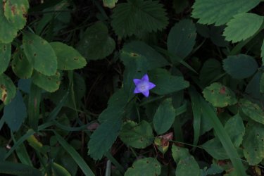
Harebells

Summit Mountain

Pipsissewa. You all have seen me freak out about finding Calypso Orchids in June. I was the same about seeing these during this week.

I think these are younger one but I could be wrong.

After a mile I finally reach the Autumn Trail proper. The trail started out being a decent trail.....through the woods.

Harebell


Eventually it starts to open up into small meadows with views of Elk Mountain and the surrounding range.


I was confused constantly because Elk Mountain kept being hidden by this mass in the foreground. So it was a lot of "is That Elk Mtn?"

Okay......the trail became Quite overgrown. Brush devouring the trail. I am amazed at how use to (comfortable is not the proper word) this condition I have become over the last two August. The old me would laugh at the idea of hiking the trails that I have recently hiked. I was walking and I went "I'm not on a trail!" I froze. Retraced my steps until I felt that I was on the trail and looked around. I saw the next shot and wondered.......I put my hand in and parted the branches and ......"there's the trail!!!!!


Quite the trail


Looking back towards Summit Mountain

I went into this one hollow and found myself in Thimbleberries and brush that had been matted down. Something or someone had fallen and wallowed around. Right on my trail. To be honest it was scary. I felt like I was standing in a nest. I didn't get a good shot of the spot because I wanted to get out of there!

Coralroot Orchid seed pods

Pipsissewa

I heard a train and prayed that i was near the tracks. That it just wasn't the sound traveling uphill to me.

Day 5 - Kurt had given up hope of getting back on the trail. He expressed a desire to be fishing at Two Med at sunrise so that gave me the chance to do something crazy that I have wanted to do for years. To put up, or shut up about this hike. It is an 18.5 mile loop. One that I am certain that only a person who looks at a map for possible day hikes would even considered possible. Jeff has laughed at me for thinking of doing it. It is 18.5 miles of lightly traveled and rarely maintained trails. Probably 100% in the forest. "Why?" In retrospect.......it really looks cool on a map when you fill it in! This hike is as close to a back country experience as a day hiker can reach. It was wonderful.
I hit the trail at first light. I told Kurt I probably will be off the trail in 12 hours.

The first mile I have done a couple times as it is the access route to Scalplock Lookout.

I had debated whether to do it clockwise or counter clockwise. I decided counter, as the steep section will be steep-er but shorter. It is great when a plan works out. I think I would have cried if I had done it clockwise. I am going to the Fielding Jct. then coming back from Park Creek. The Fielding section is 4.3 miles

Ole Creek Drainage. I was pleasantly surprised at the views I had in this drainage. This side of the drainage was quite steep pitched so the trail skirted across high above the creek for the most part. So it wasn't 100% in the forest!! I was so excited to be there that I swear I didn't see a forest but I saw each individual tree.


The trail was definitely lightly traveled. Had to pay attention as you dodged a bush encroaching the trail as there was a bad drop off to the right.

I saw the hind end of a black bear as it sprinted up a slope out of site. May have been 50 feet away. I had buckets of thimbleerries as......it is a lightly traveled trail
Elk Mountain and Ole Creek


I was surprised by the rock walls.


Yep that is the trail going.....through the woods.


Crossing the creek that drains the section that I am going to be climbing up.


For the first time during the week I came into some wonderful huckleberry country. Again.....lightly traveled so they were all mine......and the bears.

The Fielding Trail just shouts wilderness. It doesn't really go anywhere but it connects all of the drainage's. This junction was funny. The Ole Trail continued on but a huge tree had uprooted at the spot and the trail going forward was not obvious. The Fielding Trail headed up slope and was overgrown. But at this sign was a 6 foot circle of bare trodden ground. It had the appearance of back packers walking in circle assessing the situation. Groups sitting and eating snacks discussing their next steps. I had started at the Walton Range Station.

It turned out that the Fielding Trail up to the pass was the best conditioned trail of the day. It was steeper so I was taking it easy and the trail was .......a trail. Not some feint surface underneath the overgrowth. I was loving the small streams that I had to cross coming in from the right.

To be honest I was a bit giddy.


I saw the butt of another black bear (closer than the previous encounter) as it sprinted up the hill. This time it stopped and looked back at me and I was able to get a couple shots. Before I considered getting out my zoom lens I believe I heard a huff and I...... thank you'd and moved on.


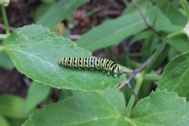
All morning I was running into spider webs. Nobody must hike these trails...ha. One, I could feel and hear the web ripping away from its base and I spent the next hour trying to get untangled from it. Going up hill I was going slow enough that I came across at least 4 webs like this one. I would look to see if I could skirt them somehow but I think every time I ended up folding up their work

I eventually got to the top and it was a nice pleasant slope Definitely was next level overgrown though. I decided to continue my slow pace and I even found myself singing. I was doing the Ole/Fielding/Park Loop and it was all down hill from here. How cool is that?" (I know....this photo doesn't read as "next level overgrown".)

I started to run into downed trees. Not down fall. Downed trees. This began a continuous stream of "do I go over.....do I go under....do I go around....do I walk across hoping I don't break through and break a leg."

There....that is "next level" -ish

This forest looked like it could spontaneously combust.


Trail

I had to laugh. I felt like I was crossing a stream but which log do I use. The initial log was an actually bridge-ish log.


All I see are pikes waiting to skewer me.

Oh look.....a view out. I can't say I have any sense of the Park Creek drainage.

Somewhere along the way I fell. I could feel the rocks and roots under the brush but not truly see them. I stepped on a pitchy, slick, rock and......down I went. The beauty of it being so overgrown, dense, I bounced up completely unscathed. I would have been in tears having to navigate all of this stuff going uphill......and it seemed exceptionally long.

Thimbleberries Yes that is one of those nasty spiders.

Common Self Heal - These tend to grow in moist areas underneath the tall stuff. They seemed fluorescent


Miniature world on a tree log

This trail junction sign to a day hiker feels like the middle of the wilderness. Out to the Walton Ranger Station I go.

My sole view of Park Creek. The brush blocked views up and down stream. A 3 foot deep pool kept me from getting out into the drainage. In retrospect I would have jumped in just to get a peak of the other side. At the time I thought I would have opportunities downstream. Nope.


I got lazy on this shot. I didn't get down to take a proper shot. I just aimed and focused the best I could and called it good enough. (I must have been getting tired.) But I captured what I wanted.

Oh look.......there is Park Creek. I thought the trail would be closer.


Can you imagine the torque that went into snapping this tree?

Queen Cup Beadlily


The trail meets up with the "retired" South Boundary Trail. For a few decades, due to under use and sloughing off into the Middle Fork of the Flathead River, this lower section of the South Boundary Trail was abandoned. View down stream


10.5 hours after I started I got back to my car. I assume that you all know how fulfilling it is to accomplish something extraordinary that you have always thought about doing.

On our final day we heading into the park for a laid back afternoon.
View of the North Fork of the Flathead River.

Same spot of the river in June

I am including these two story boards as they provide current and wonderful illustration of the fires of Glacier National Park. Fire is as much a presence in this park as glaciers.
This board explains why Jeff and I, when discussing when wildfires occurred, always default to 2003.


Maybe I should have my picture taken at ALL the entry signs. Ugh.

We drove up to Logan Pass hoping to find a parking space. With no luck we ended up at Lunch Creek. At the look in Kurt's eyes I knew I needed to put this on my "do it again with Kurt" list. A few years back I got up into the basin beyond.


Monkeyflower

A parking space at Logan Pass opened up.


This is a spot along McDonald Creek with the Garden Wall beyond that I have taken many photos over the years.

McDonald Lodge where Kurt and I still walk around and feel like it is "ours". We met and worked there in 1985


This is a map of the week. 29.6 miles of new trails. I like how the hikes are scattered around the park. Doesn't that loop look cool?!

This is a map of the 370 miles of trails hiked in my lifetime. The blue are trails not hiked since the mid 1980's

I feel like I belong in a support meeting. "My name is Harry and I am a collector of trails in Glacier National Park."
Thank you so much for your time and patience in getting through this trip report.
Last edited:

