chandlerwest
Member
- Joined
- Feb 7, 2015
- Messages
- 550
I don't have much of a story to tell and I sort of overdosed on taking pictures on this trip (983) that I wasn't going to do a trip report. But this morning my responsibility to BCP came to me. For six years I have been your supplier of your Glacier National Park fix. I just can't cut you off cold turkey.
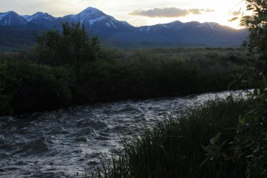
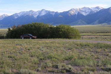
With Jeff's duty station for his summer with PIBO (Google it if you don't already know, as I can't truly explain it. They study streams and the corridor through which they travel.) in Leadore, Idaho I decided to drive up that route. With gas prices and another year of age I wasn't really up for this trip but this campsite got my attention and interest up.
FYI - Jeff starts the Masters in Natural Resources program in Missoula this fall.
We were threatened with rain the entire week in Glacier, but we were blessed not to get all that wet. (It was the week that Yellowstone got flooded.) The creeks and waterfalls were running high and fast!
It use to be that the North Fork area of the park felt like a quiet secret, but then the masses started flooding Glacier Nat'l Park and the excess spilled out to the North Fork. Social media seemed to go gaga over the @%#^# Huckleberry BearClaws sold at the Polebridge Mercantile.......sheesh. Traffic increased so much that this summer the park has started requiring a separate "ticket" to enter the park at Polebridge. To attempt to limit cars and protect the fragile environment, road and limited parking. The road was not built (or maintained) for this increase visitation. It was a pothole mess. Kind of sad that the masses thought/think that the North Fork wilderness is "accessible". I miss the days when Jeff and I drove up "just to have lunch on the beach." Or I could proudly take my sister and husband up to show them a lake that few saw. Oh well.....progress.
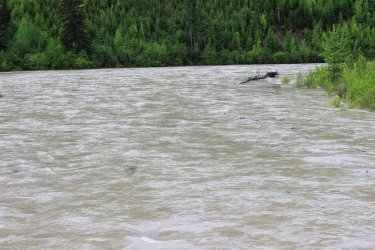
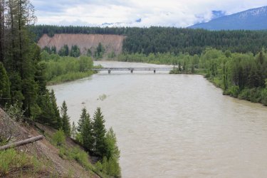
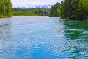
This shot is from the North Fork of the Flathead River bridge not far from West Glacier. The river was running high.....Ha.
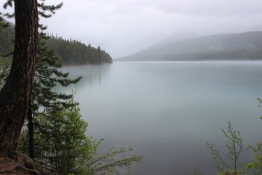
A beautiful day for a hike along Bowman Lake. I'm not being facetious.
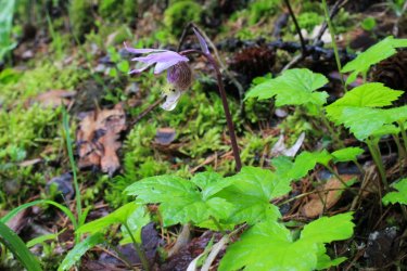
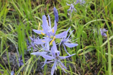
Seeing my first Calypso Orchid of June is reassurance that all is right in Glacier. "Welcome to the park Harry!"
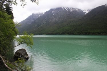
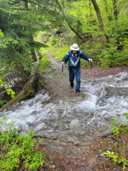
The side streams were sporting and helped us to get over getting our boots wet.
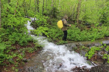
That's me
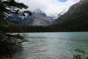
We got to the campground and when the mountains at the head of the lake opened up.....my week was paid for!
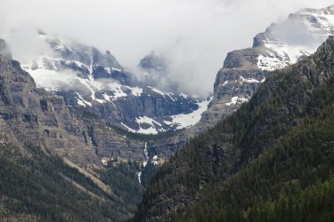
The trail out seemed much muddier. We surmised that the intermittent drizzle we had might have been actual rain behind us earlier. But the skies cleared out nicely.
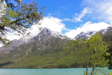
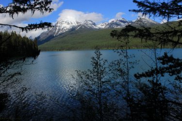
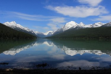
From the foot of Bowman Lake has to be one of the premiere views of the Park.
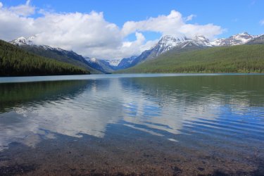
I had a couple hikes I wanted to do but high creek levels, muddy trails, uninstalled bridges and rain kept us in check. We spent a day in McDonald Valley. Something I have done numerous, glorious times.
McDonald Creek doesn't look swollen......ha. Beautiful waterfalls coming out of the mountains.
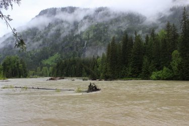
Scott had reassured me that inclement weather could produce interesting clouds and such. Attempting to get me out of my funk leading into this trip. (Scott is currently spending a couple weeks in the Aleutian Islands on a Steller Seal study.)
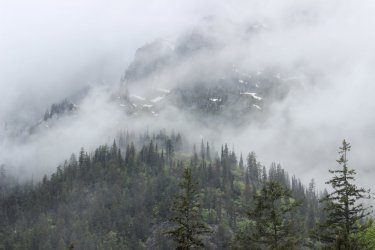
Backwash from the raging creek in the background.
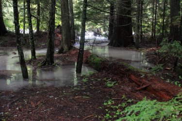
I know that I have seen McDonald Creek raging before but this year feels more intense. That is a gorge filled to the rim and beyond.
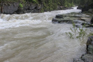
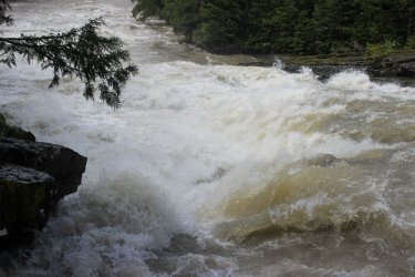
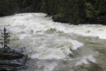
Snyder Creek emptying into Lake McDonald at the Lodge. There was no beach to sit and have our lunch this June.
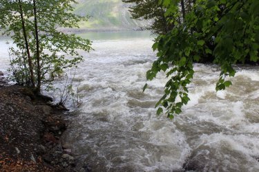
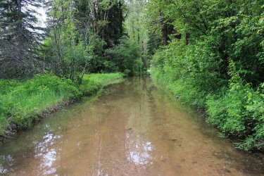
We (I was with Kurt, who I worked with in the park in 1985) were going to do a 7 ish mile hike but we were not "prepared" for walking an undetermined length through a flooded road just to access the trailhead.
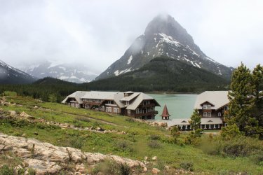
The next day we drove to the east side of the park just to check on how it was doing. Like visiting an old friend.
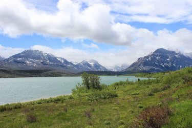
After a day of sitting out the rain we went back to tackle the trail through the flooded road. We were "prepared" this time!!! It was sort of anticlimactic as a lot of the water had receded. It was sort of sad.
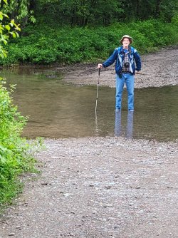
This is McDonald Creek below the 10 mile long Lake McDonald. A nice blue compared to the raging gray from the photos above.
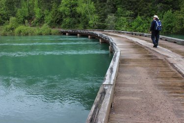
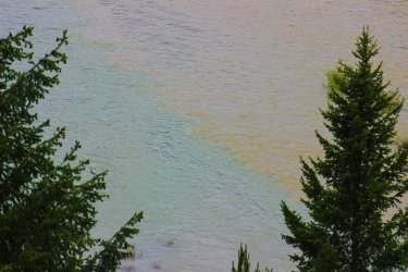
If you stare at this photo and squint a bit you can see the blue McDonald Creek running up against the brown wall of the Middle Fork of the Flathead River.....and losing.
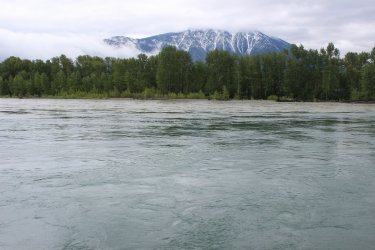
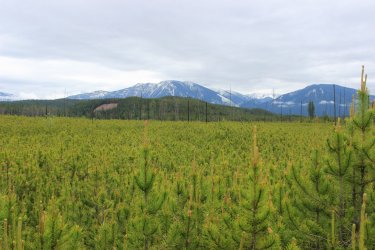
I have been on Jeff to take this hike for years. But he refused to amuse me. It doesn't really go anywhere. It just exists. As addressed in prior trip reports I am a collector of Glacier Park trails so I needed to get this one. Predominantly the trail went through a burn zone from Lord knows what year.
I should probably share some wildflowers as they have been a major part of the drug that I have fed you over the years. We felt like spring was late this week because wildflowers were not profuse. (Where did that word come from?)
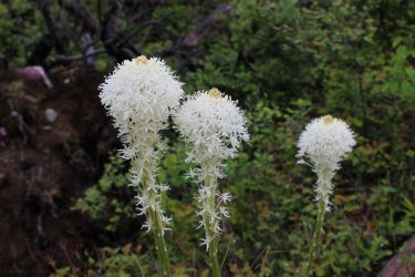
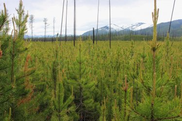
Kurt said that this trail would have been better if we had done it a couple years ago because the trees had grown to just above our heads. So.....a tunnel. I took this shot with the camera held high over my head. I was quite happy with the perspective.
We reached my goal. The confluence of the North Fork and the Middle Fork of the Flathead River.
I exaggerated the colors so as to highlight the waters mingling.
Another over the head shot.
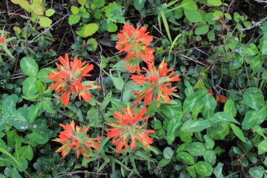
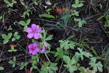
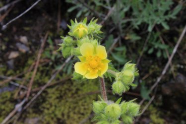
This wildflower "encounter" was special for me. It felt as if it was the first time I had seen this flower. I took so many pictures, from all angles, so it could be identified. Turns out is was "just" a Cutleaf Anemone. I looked at previous photos I had and they are all late in the life of the flower. In old age the flower is bold and harsh. Soooooooo seeing it in this young phase WAS special. In its initial phase the flower is cute and delicate.
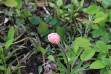
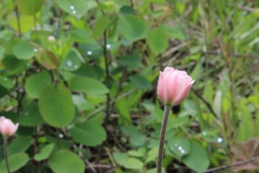
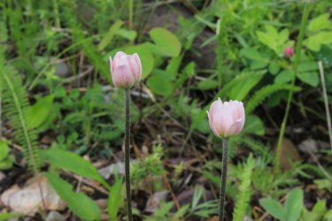
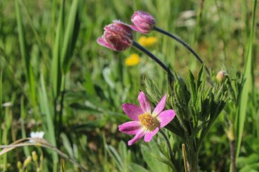
Alright.....To be fair, I will include a prior photo of the bold, harsh phase.
I exaggerated the colors to highlight how the Middle Fork of the Flathead pinches McDonald Creek up against the right shoreline
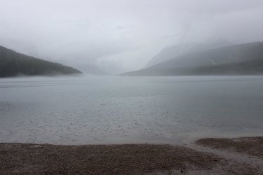
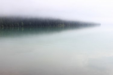
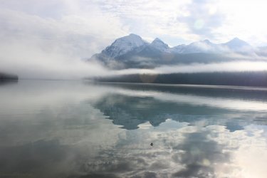
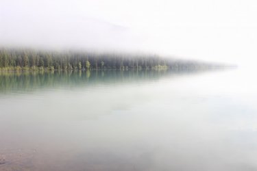
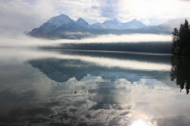
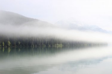
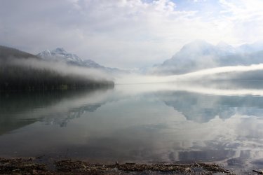
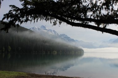
The final day we were back up to Bowman Lake in the North Fork. Yes......I had to plan far in advance to get my "ticket" to access this area of the park twice in one week. The hike has been at the top of my list of trails to "collect". But we were met with these conditions at Bowman Lake. It felt sacrilegious to move on from these conditions. It is hard to not feel like I am "being taken care of" when I get to experience this.
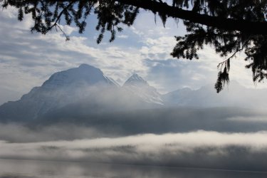
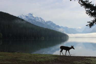
But off to Akokala Lake we go!!!!
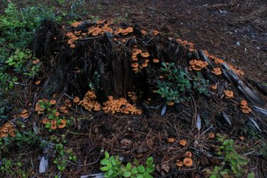
Up and over Numa Ridge then up the valley to the lake.
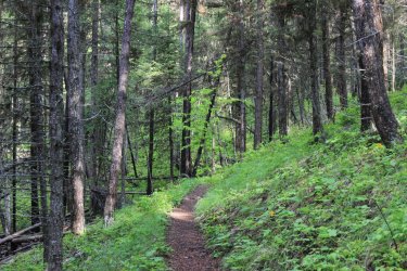
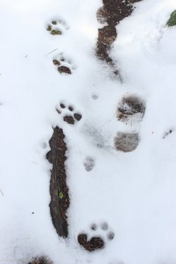
It seems that we were following this Mountain Lion for quite some time. That was cool!!!
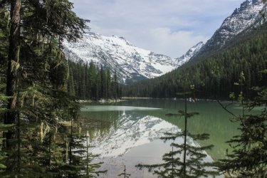
The backcountry campground was snow covered and access to the lake and view was more of a struggle than anticipated but we made it happen
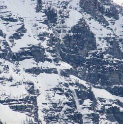
We heard numerous avalanches rumbling on the walls at the head of the valley. I was lucky enough to capture one.
We spent far too much time trying to find a flat, dry place for lunch. When Kurt suggested heading out on the trail and finding a spot I went......."I'm not Done with this lake Yet!"
So I climbed over the downfall, plopped down on my jacket, on the snow, and declared, "I am eating right here!"
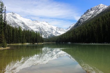
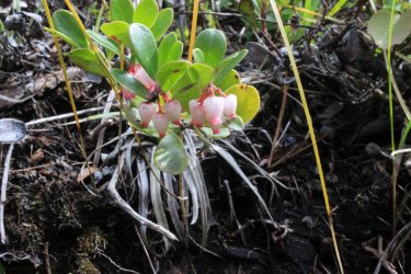
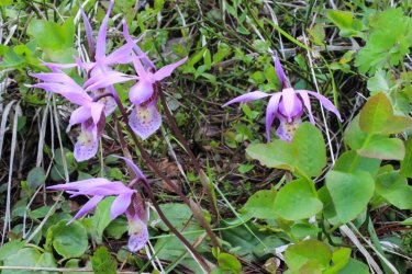
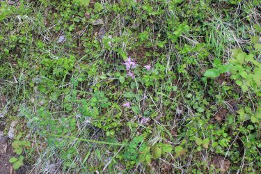
A nice family of Calypso Orchids. The 2nd photo is a reminder of just how small they are.
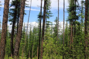
As we drove away from Bowman Lake were suggested that this might be the last we see this view. Having hiked all of the trails up here and the deteriorating road we have no "need" to make the trip. Never say never.
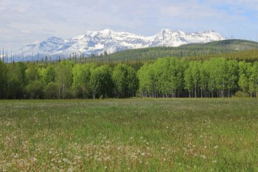
As we left the park near Polebridge I asked to run/hike fast the half mile to Covey Meadow. There were no wildflowers other than dead dandelions but I really love this view.
At 37 miles hiked it was a decent June week. All the hikes were 1st for me so......yeah! We plan on meeting up again in August where we hope to push the envelope while going down memory lane.
As your supplier of the Glacier Nat'l Park drug I am sorry......not sorry, for this dose of the Park.
With Jeff's duty station for his summer with PIBO (Google it if you don't already know, as I can't truly explain it. They study streams and the corridor through which they travel.) in Leadore, Idaho I decided to drive up that route. With gas prices and another year of age I wasn't really up for this trip but this campsite got my attention and interest up.


FYI - Jeff starts the Masters in Natural Resources program in Missoula this fall.
We were threatened with rain the entire week in Glacier, but we were blessed not to get all that wet. (It was the week that Yellowstone got flooded.) The creeks and waterfalls were running high and fast!
It use to be that the North Fork area of the park felt like a quiet secret, but then the masses started flooding Glacier Nat'l Park and the excess spilled out to the North Fork. Social media seemed to go gaga over the @%#^# Huckleberry BearClaws sold at the Polebridge Mercantile.......sheesh. Traffic increased so much that this summer the park has started requiring a separate "ticket" to enter the park at Polebridge. To attempt to limit cars and protect the fragile environment, road and limited parking. The road was not built (or maintained) for this increase visitation. It was a pothole mess. Kind of sad that the masses thought/think that the North Fork wilderness is "accessible". I miss the days when Jeff and I drove up "just to have lunch on the beach." Or I could proudly take my sister and husband up to show them a lake that few saw. Oh well.....progress.
This shot is from the North Fork of the Flathead River bridge not far from West Glacier. The river was running high.....Ha.

A beautiful day for a hike along Bowman Lake. I'm not being facetious.


Seeing my first Calypso Orchid of June is reassurance that all is right in Glacier. "Welcome to the park Harry!"


The side streams were sporting and helped us to get over getting our boots wet.

That's me

We got to the campground and when the mountains at the head of the lake opened up.....my week was paid for!


The trail out seemed much muddier. We surmised that the intermittent drizzle we had might have been actual rain behind us earlier. But the skies cleared out nicely.


From the foot of Bowman Lake has to be one of the premiere views of the Park.

I had a couple hikes I wanted to do but high creek levels, muddy trails, uninstalled bridges and rain kept us in check. We spent a day in McDonald Valley. Something I have done numerous, glorious times.
McDonald Creek doesn't look swollen......ha. Beautiful waterfalls coming out of the mountains.

Scott had reassured me that inclement weather could produce interesting clouds and such. Attempting to get me out of my funk leading into this trip. (Scott is currently spending a couple weeks in the Aleutian Islands on a Steller Seal study.)

Backwash from the raging creek in the background.

I know that I have seen McDonald Creek raging before but this year feels more intense. That is a gorge filled to the rim and beyond.


Snyder Creek emptying into Lake McDonald at the Lodge. There was no beach to sit and have our lunch this June.

We (I was with Kurt, who I worked with in the park in 1985) were going to do a 7 ish mile hike but we were not "prepared" for walking an undetermined length through a flooded road just to access the trailhead.

The next day we drove to the east side of the park just to check on how it was doing. Like visiting an old friend.


After a day of sitting out the rain we went back to tackle the trail through the flooded road. We were "prepared" this time!!! It was sort of anticlimactic as a lot of the water had receded. It was sort of sad.

This is McDonald Creek below the 10 mile long Lake McDonald. A nice blue compared to the raging gray from the photos above.

If you stare at this photo and squint a bit you can see the blue McDonald Creek running up against the brown wall of the Middle Fork of the Flathead River.....and losing.

I have been on Jeff to take this hike for years. But he refused to amuse me. It doesn't really go anywhere. It just exists. As addressed in prior trip reports I am a collector of Glacier Park trails so I needed to get this one. Predominantly the trail went through a burn zone from Lord knows what year.
I should probably share some wildflowers as they have been a major part of the drug that I have fed you over the years. We felt like spring was late this week because wildflowers were not profuse. (Where did that word come from?)


Kurt said that this trail would have been better if we had done it a couple years ago because the trees had grown to just above our heads. So.....a tunnel. I took this shot with the camera held high over my head. I was quite happy with the perspective.

We reached my goal. The confluence of the North Fork and the Middle Fork of the Flathead River.

I exaggerated the colors so as to highlight the waters mingling.

Another over the head shot.


This wildflower "encounter" was special for me. It felt as if it was the first time I had seen this flower. I took so many pictures, from all angles, so it could be identified. Turns out is was "just" a Cutleaf Anemone. I looked at previous photos I had and they are all late in the life of the flower. In old age the flower is bold and harsh. Soooooooo seeing it in this young phase WAS special. In its initial phase the flower is cute and delicate.


Alright.....To be fair, I will include a prior photo of the bold, harsh phase.

I exaggerated the colors to highlight how the Middle Fork of the Flathead pinches McDonald Creek up against the right shoreline

The final day we were back up to Bowman Lake in the North Fork. Yes......I had to plan far in advance to get my "ticket" to access this area of the park twice in one week. The hike has been at the top of my list of trails to "collect". But we were met with these conditions at Bowman Lake. It felt sacrilegious to move on from these conditions. It is hard to not feel like I am "being taken care of" when I get to experience this.


But off to Akokala Lake we go!!!!

Up and over Numa Ridge then up the valley to the lake.


It seems that we were following this Mountain Lion for quite some time. That was cool!!!

The backcountry campground was snow covered and access to the lake and view was more of a struggle than anticipated but we made it happen

We heard numerous avalanches rumbling on the walls at the head of the valley. I was lucky enough to capture one.

We spent far too much time trying to find a flat, dry place for lunch. When Kurt suggested heading out on the trail and finding a spot I went......."I'm not Done with this lake Yet!"
So I climbed over the downfall, plopped down on my jacket, on the snow, and declared, "I am eating right here!"

A nice family of Calypso Orchids. The 2nd photo is a reminder of just how small they are.


As we drove away from Bowman Lake were suggested that this might be the last we see this view. Having hiked all of the trails up here and the deteriorating road we have no "need" to make the trip. Never say never.

As we left the park near Polebridge I asked to run/hike fast the half mile to Covey Meadow. There were no wildflowers other than dead dandelions but I really love this view.

At 37 miles hiked it was a decent June week. All the hikes were 1st for me so......yeah! We plan on meeting up again in August where we hope to push the envelope while going down memory lane.
As your supplier of the Glacier Nat'l Park drug I am sorry......not sorry, for this dose of the Park.
