chandlerwest
Member
- Joined
- Feb 7, 2015
- Messages
- 550
The idea for this trip arose in early 2015. @Jeffrey Chandler piled these off trail trek ideas on me. I did everything not to say yes. "There are 734 miles of trail", blah blah, "I have a 30 year contract with the bears. I stay on the trails and I holler and they leave me alone", blah blah, "a coworker got eaten by a bear because he went off trail". In other words he was taking me out of my comfort zone. I pacified him in 2015 by climbing Mt. Oberlin.
Jump ahead to early 2016. Jeff starts hounding me to backpack in Glacier. Personally I do not have enough desire to do that to put out the financial costs. He had the desire to solo backpack. 15 years old with next to no experience......in Glacier.....with grizzlies. I could have said no but that would have been too easy. In June we dropped into the backcountry office so that they would tell him that they would not give him a permit because of his age. On the advance reservation site you need to be 18 so I felt that this was a done deal for me. They drug out a supervisor and he said that as long as a parent was with him in the office they would issue him a permit. Shit!
In July I turned to Jeff and said "remember all that angst and anxiety you gave me last year with your off trail stuff? Now you are giving me a new level of angst and anxiety and we have not even experienced last years crap yet." With all the Zion Nat'l Park adventures I have had the past 2 years I had gotten a lot more comfortable with the off trail idea. So as a compromise the backpacking was tabled for 2016 and we focused on off trail! What a wonderful idea. Sure beat....saying no to him repeatedly.
Our adventures took us on goat, social, mountaineering and abandoned trails.
Day One took us Snow Moon Basin. This route is used by those who choose to climb Mt. Allen. This picture shows everything but the initial trudge thru the forest and up "Dread Scree Stroll". We went across the slope/cliffs right to left, up to the basin, then up to the ridgeline on the left. Stopping below the start of the Class 4 cliff climb.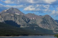
View up towards Mt. Gould and Grinnell Point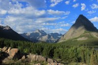
@Jeffrey Chandler with our starting point, Many Glacier Hotel, in the background. Jumping ahead a bit. See the valley in the middle? The bench on the left side? That is Shangri-La where we go on Day 2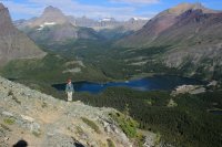
There was a bit of exposure getting across this face. But nothing sucking you down into it.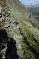
We make a 180 turn at the shoulder and head up to the basin. The "trail" hugs the base of the cliffs with a great scree drop on the left. Schwab Falls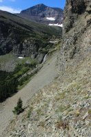
Falling Leaf Lake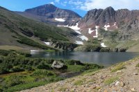
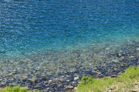
Nature's Infinity Pool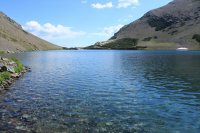
Snow Moon Lake
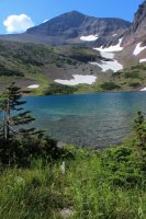
Short stream/falls between Falling Leaf and Snow Moon Lakes
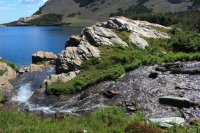
We cross the stream and have to make our way up the far slope. Avoiding the gnarly krumholz and brush as best we could. Unbeknownst to us, what we see is maybe half of what there was.
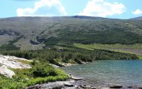
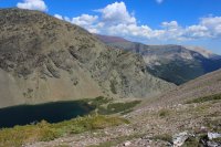
Just a lonnnng trudge. One step at a time.
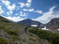
A pretty nice lunch spot. Hunkering down in the wind and looking at the mountains in the North.
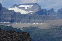
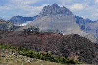
See that basin? That is where we go on Day Three
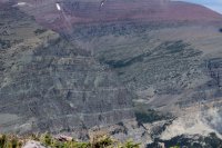
After a 3,000 foot climb from the parking lot we finally hit the ridge. Looking down onto the Cracker Lake Trail
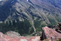
Hoping to see as much of Cracker Lake as possible I asked Jeff, "can we go just a little bit higher?"
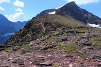
Cracker Lake and 10,010 Mt. Siyeh towering 4,000 over the lake. Cracker Lake owes it unique color to Siyeh Glacier
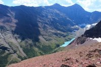
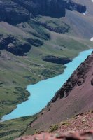
I literally shouted "look where my son got me!!!!" We decided to take a more direct route down. We found that we could walk across the top of a mat of brush easily and benignly. Shortly after leaving the ridge I here an exclamation from behind me. Jeff had been blown over by the wind and had cut his hand on the rocks.
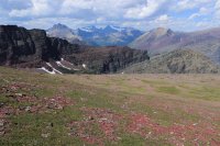
Snow Moon and Falling Leaf Lakes
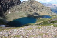
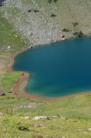
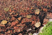
Upon arriving back at the slope/cliffs we reminded each other that we REALLY needed to be careful. Rubbery legs were going to make this trip more interesting.
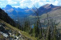
Lake Sherbourne
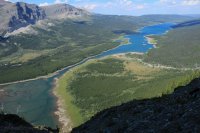
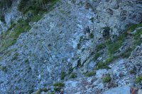
To some this controlled fall down to the forest could probably be done in a couple minutes. It took us quite a bit longer. I swear that downhiller phobia is a true mental state. We sat down for dinner at the cabin at 10:00PM. We know how to fill a day.
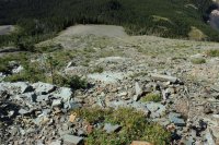
Day Two - The social trail takes off for Shangri-La
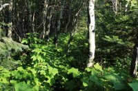
We have quite the elevation gain getting to the cliff face. THEN we need to get up the thing!
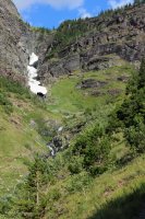
Initial crease to enter the climb.
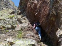
Guess where we go?
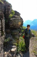
A bit of exposure. Enough people do this so if you are paying attention the route is nice to follow.
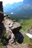
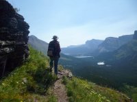
This could have been more dramatic if I had only followed thru on the thought to motion Jeff out to the point.
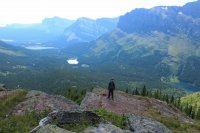
At the top of the cliffs we found a massive area plowed by a grizzly evidently going after a rodent. (Didn't get the shot.) The trip to the lake was INCREDIBLE with waterfalls and wildflowers. I was in Heaven.
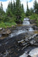
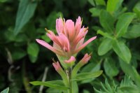
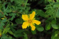
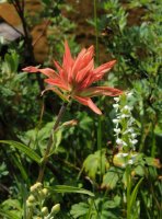
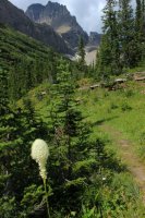
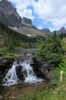
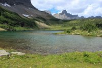
Shangri-La Lake
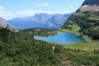
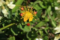
As Ptarmingan Wall came into view my stomach started tightening out of anticipation of what was coming.
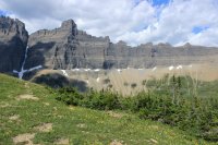
Holy Sheeit.
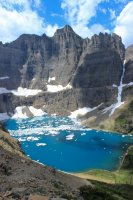
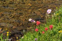
It took us 1 hour and 10 minutes to get down to Iceberg Lake. We hugged the brush as much as possible so that we could have something to arrest our fall, if need be. Had to take some flower shots to keep inner peace.
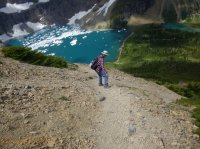
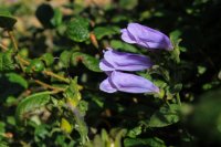
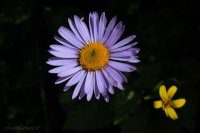
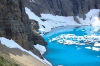
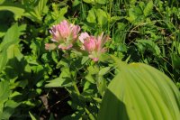
A couple times during the day Jeff had mentioned "Power Walking" out the Iceberg Lake trail. I would say "can't we just walk." After the terrain of these two days it really did feel like Power Walking out to the car. This picture looks back to the ridgeline where we were on Day One. The middle sliver of ridge (not foreground). The foreground left was the slope/cliff we traversed.
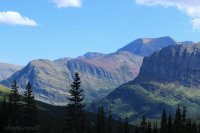
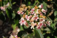
Day Three comes with a story. In 1987 I was the Relief Night Auditor at the lodges. The "Rover". I gave the location Night Auditors their day off. The lodge managers looked at me as the Controller's spy. Which I guess I was. On July 27th I received a phone call from the manage of Swiftcurrent Motor Inn. Their Night Auditor Gary Groeden had not come into work. After my shift was over I got over to Swiftcurrent to take care of the business end of things while the young Pakistani manager dealt with the missing Gary. Having talked to Gary many times about hiking in Glacier I was part of the whirlwind of "where is Gary?" He never talked about going off trail so I was holding out for him getting pissed at something and simply taking off back to Wisconsin. Six weeks later what was left of Gary was found cached in the brush near Natahki Lake in the Apikuny Basin. I struggled with Gary's death for close to 20 years. Why......and how did he get up there? You just don't walk into that Basin. Well, Jeff and I followed in the footsteps of my coworker and friend Gary. We follow the mile trail to Apikuny Falls then up the abandoned mountain trail to the basin.
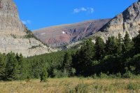
Looking back towards Day One terrain.
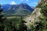
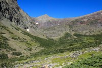
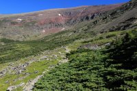
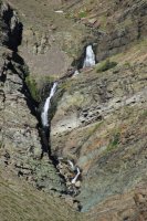
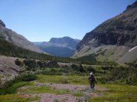
It was a beautiful open basin with short trees and red rock. Waterfalls come down from the Upper Basin where Natahki Lake is situated.
We saw a couple large families of Grouse.

We studied the slope up to Natahki Lake for quite awhile. Maybe we could see how to get thru the rocks/cliffs. Maybe we could get up the "path" that looked like a white line painted on a wall. Maybe we could get to Natahki Lake. BUT we would then have to get back down. What we came to realize was that Gary having a horrible bear encounter was the most pleasant experience he could have had. To have injured himself in a fall and laying until the bear came along was much more likely to have happened. As Jeff mentioned as we were deciding to turn around. The is "a lot of Spirit Energy here". Salute Gary!
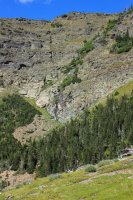
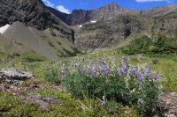
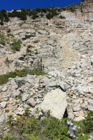
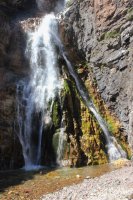
See the abandon trail going up this cliff? Neither do I. Coming down was only slightly a controlled fall. Apikuni Falls
Day Four was affected by the accumulation of three days of hiking and time constraints.
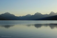
Lake McDonald.
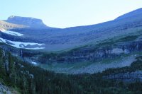
The initial plan was to go up Lunch Creek. A 2,000 ft. climb/trudge up this face to the saddle above. Then down to Piegan Pass, then over to Siyeh Pass and out to the road to take a Shuttle back to Logan Pass. The last shuttle comes thru at 6:30. It would have taken us a long time to get up to the saddle so we would have stressed about the shuttle most of the day. So we took a step back and did the Siyeh Pass trail.
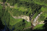
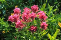
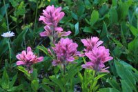
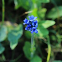
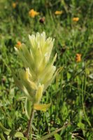
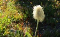
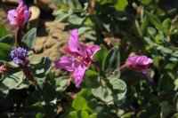
This trail is renown for its wildflowers. We hit the season pretty well.
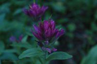
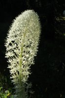
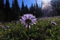
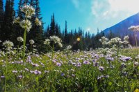
These next two shots were found 3 feet from each other.
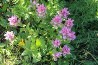
I want to point out the little ground squirrel in the bottom of the shot. Mt. Reynold's in the background.
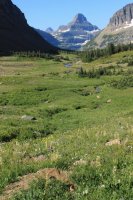
Piegan Mountain and Glacier
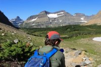
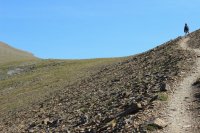
Jeff approaching Siyeh Pass
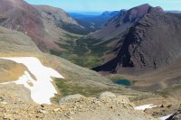
Boulder Creek. There is no official access to this area.
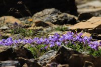
Sexton Glacier
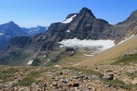
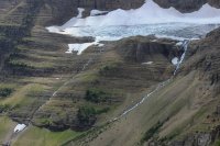
I could have cried when I saw what the 2015 Reynold's Creek fire did to the trees up here in Baring Creek. You can see from the stumps that these were not boring tall straight trees. They were the low to the ground, windswept kind. Tragic loss.
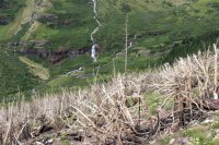
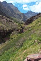
Day Five weather came in. We drove up to Logan Pass and sat in the car for a couple hours. Watching people and the weather.
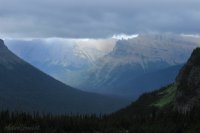
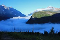
Sixth and final day. I discovered this route in 2012 while on a trip alone. In 2014 I took @Scott Chandler and my friend Kurt (Glacier co-worker from 1985) and @Jeffrey Chandler out to the nameless ridge. But two years ago Jeff refused to go across the cliff line so we had left him on the Dragon's Tail Saddle. He wanted to redeem himself and go all the way in 2016. We had a great inversion/fog in the drive up to Logan Pass.
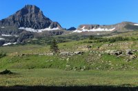
The initial goal is yonder saddle.
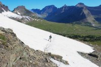
Looking down to Hidden Lake.
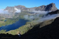
West of the saddle that stopped Jeff two years ago.
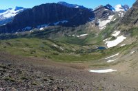
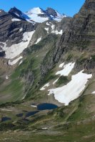
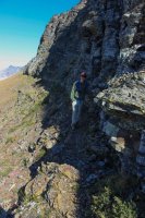
We walked the ridge until it cliffed out.
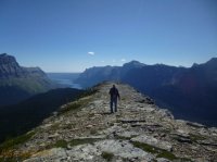
Blackfoot and Jackson Glacier Basin
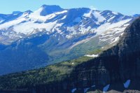
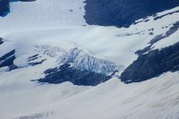
Huge cornice on Gunsight Mtn.
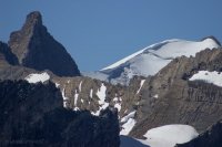
Looking north. Mt. Cleveland on the far left. Probably 20 miles away.
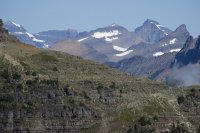
Garden Wall
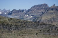
A nasty perspective of the Lunch Creek climb that we did not do on Day Four.
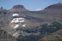
A look over towards Siyeh Pass and Going to the Sun Mtn.
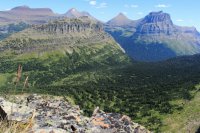
Mt. Reynold's
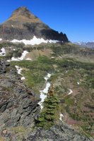
Twin Lakes. This basin is the source of Florence Falls which you saw in my June trip report.
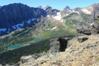
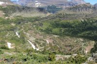
We start the long trek back.
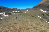
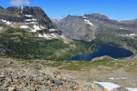
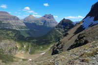
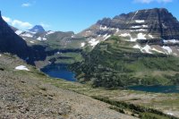
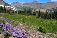
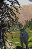
Almost back to the Hidden Lake Trail and horde of tourist we literally stumbled on to this fellow.
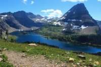
Our day took us up and over the saddles on the high left and middle.
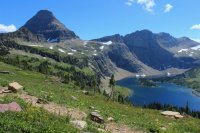
We didn't have huge miles for the week but we had massive elevation gain over varied terrain. I am very grateful that Jeff got me out of my comfort zone. I suppose what I need to do now is try to find some backpacking gear for $100.
Jump ahead to early 2016. Jeff starts hounding me to backpack in Glacier. Personally I do not have enough desire to do that to put out the financial costs. He had the desire to solo backpack. 15 years old with next to no experience......in Glacier.....with grizzlies. I could have said no but that would have been too easy. In June we dropped into the backcountry office so that they would tell him that they would not give him a permit because of his age. On the advance reservation site you need to be 18 so I felt that this was a done deal for me. They drug out a supervisor and he said that as long as a parent was with him in the office they would issue him a permit. Shit!
In July I turned to Jeff and said "remember all that angst and anxiety you gave me last year with your off trail stuff? Now you are giving me a new level of angst and anxiety and we have not even experienced last years crap yet." With all the Zion Nat'l Park adventures I have had the past 2 years I had gotten a lot more comfortable with the off trail idea. So as a compromise the backpacking was tabled for 2016 and we focused on off trail! What a wonderful idea. Sure beat....saying no to him repeatedly.
Our adventures took us on goat, social, mountaineering and abandoned trails.
Day One took us Snow Moon Basin. This route is used by those who choose to climb Mt. Allen. This picture shows everything but the initial trudge thru the forest and up "Dread Scree Stroll". We went across the slope/cliffs right to left, up to the basin, then up to the ridgeline on the left. Stopping below the start of the Class 4 cliff climb.

View up towards Mt. Gould and Grinnell Point

@Jeffrey Chandler with our starting point, Many Glacier Hotel, in the background. Jumping ahead a bit. See the valley in the middle? The bench on the left side? That is Shangri-La where we go on Day 2

There was a bit of exposure getting across this face. But nothing sucking you down into it.

We make a 180 turn at the shoulder and head up to the basin. The "trail" hugs the base of the cliffs with a great scree drop on the left. Schwab Falls

Falling Leaf Lake


Nature's Infinity Pool

Snow Moon Lake

Short stream/falls between Falling Leaf and Snow Moon Lakes

We cross the stream and have to make our way up the far slope. Avoiding the gnarly krumholz and brush as best we could. Unbeknownst to us, what we see is maybe half of what there was.


Just a lonnnng trudge. One step at a time.

A pretty nice lunch spot. Hunkering down in the wind and looking at the mountains in the North.


See that basin? That is where we go on Day Three

After a 3,000 foot climb from the parking lot we finally hit the ridge. Looking down onto the Cracker Lake Trail

Hoping to see as much of Cracker Lake as possible I asked Jeff, "can we go just a little bit higher?"

Cracker Lake and 10,010 Mt. Siyeh towering 4,000 over the lake. Cracker Lake owes it unique color to Siyeh Glacier


I literally shouted "look where my son got me!!!!" We decided to take a more direct route down. We found that we could walk across the top of a mat of brush easily and benignly. Shortly after leaving the ridge I here an exclamation from behind me. Jeff had been blown over by the wind and had cut his hand on the rocks.

Snow Moon and Falling Leaf Lakes


Upon arriving back at the slope/cliffs we reminded each other that we REALLY needed to be careful. Rubbery legs were going to make this trip more interesting.

Lake Sherbourne


To some this controlled fall down to the forest could probably be done in a couple minutes. It took us quite a bit longer. I swear that downhiller phobia is a true mental state. We sat down for dinner at the cabin at 10:00PM. We know how to fill a day.

Day Two - The social trail takes off for Shangri-La

We have quite the elevation gain getting to the cliff face. THEN we need to get up the thing!

Initial crease to enter the climb.

Guess where we go?

A bit of exposure. Enough people do this so if you are paying attention the route is nice to follow.


This could have been more dramatic if I had only followed thru on the thought to motion Jeff out to the point.

At the top of the cliffs we found a massive area plowed by a grizzly evidently going after a rodent. (Didn't get the shot.) The trip to the lake was INCREDIBLE with waterfalls and wildflowers. I was in Heaven.


Shangri-La Lake


As Ptarmingan Wall came into view my stomach started tightening out of anticipation of what was coming.

Holy Sheeit.

It took us 1 hour and 10 minutes to get down to Iceberg Lake. We hugged the brush as much as possible so that we could have something to arrest our fall, if need be. Had to take some flower shots to keep inner peace.


A couple times during the day Jeff had mentioned "Power Walking" out the Iceberg Lake trail. I would say "can't we just walk." After the terrain of these two days it really did feel like Power Walking out to the car. This picture looks back to the ridgeline where we were on Day One. The middle sliver of ridge (not foreground). The foreground left was the slope/cliff we traversed.


Day Three comes with a story. In 1987 I was the Relief Night Auditor at the lodges. The "Rover". I gave the location Night Auditors their day off. The lodge managers looked at me as the Controller's spy. Which I guess I was. On July 27th I received a phone call from the manage of Swiftcurrent Motor Inn. Their Night Auditor Gary Groeden had not come into work. After my shift was over I got over to Swiftcurrent to take care of the business end of things while the young Pakistani manager dealt with the missing Gary. Having talked to Gary many times about hiking in Glacier I was part of the whirlwind of "where is Gary?" He never talked about going off trail so I was holding out for him getting pissed at something and simply taking off back to Wisconsin. Six weeks later what was left of Gary was found cached in the brush near Natahki Lake in the Apikuny Basin. I struggled with Gary's death for close to 20 years. Why......and how did he get up there? You just don't walk into that Basin. Well, Jeff and I followed in the footsteps of my coworker and friend Gary. We follow the mile trail to Apikuny Falls then up the abandoned mountain trail to the basin.

Looking back towards Day One terrain.

It was a beautiful open basin with short trees and red rock. Waterfalls come down from the Upper Basin where Natahki Lake is situated.


We saw a couple large families of Grouse.

We studied the slope up to Natahki Lake for quite awhile. Maybe we could see how to get thru the rocks/cliffs. Maybe we could get up the "path" that looked like a white line painted on a wall. Maybe we could get to Natahki Lake. BUT we would then have to get back down. What we came to realize was that Gary having a horrible bear encounter was the most pleasant experience he could have had. To have injured himself in a fall and laying until the bear came along was much more likely to have happened. As Jeff mentioned as we were deciding to turn around. The is "a lot of Spirit Energy here". Salute Gary!


See the abandon trail going up this cliff? Neither do I. Coming down was only slightly a controlled fall. Apikuni Falls


Day Four was affected by the accumulation of three days of hiking and time constraints.
Lake McDonald.

The initial plan was to go up Lunch Creek. A 2,000 ft. climb/trudge up this face to the saddle above. Then down to Piegan Pass, then over to Siyeh Pass and out to the road to take a Shuttle back to Logan Pass. The last shuttle comes thru at 6:30. It would have taken us a long time to get up to the saddle so we would have stressed about the shuttle most of the day. So we took a step back and did the Siyeh Pass trail.


This trail is renown for its wildflowers. We hit the season pretty well.


These next two shots were found 3 feet from each other.


I want to point out the little ground squirrel in the bottom of the shot. Mt. Reynold's in the background.

Piegan Mountain and Glacier


Jeff approaching Siyeh Pass

Boulder Creek. There is no official access to this area.


Sexton Glacier


I could have cried when I saw what the 2015 Reynold's Creek fire did to the trees up here in Baring Creek. You can see from the stumps that these were not boring tall straight trees. They were the low to the ground, windswept kind. Tragic loss.


Day Five weather came in. We drove up to Logan Pass and sat in the car for a couple hours. Watching people and the weather.

Sixth and final day. I discovered this route in 2012 while on a trip alone. In 2014 I took @Scott Chandler and my friend Kurt (Glacier co-worker from 1985) and @Jeffrey Chandler out to the nameless ridge. But two years ago Jeff refused to go across the cliff line so we had left him on the Dragon's Tail Saddle. He wanted to redeem himself and go all the way in 2016. We had a great inversion/fog in the drive up to Logan Pass.

The initial goal is yonder saddle.


Looking down to Hidden Lake.

West of the saddle that stopped Jeff two years ago.


We walked the ridge until it cliffed out.

Blackfoot and Jackson Glacier Basin


Huge cornice on Gunsight Mtn.

Looking north. Mt. Cleveland on the far left. Probably 20 miles away.

Garden Wall

A nasty perspective of the Lunch Creek climb that we did not do on Day Four.

A look over towards Siyeh Pass and Going to the Sun Mtn.

Mt. Reynold's

Twin Lakes. This basin is the source of Florence Falls which you saw in my June trip report.


We start the long trek back.


Almost back to the Hidden Lake Trail and horde of tourist we literally stumbled on to this fellow.


Our day took us up and over the saddles on the high left and middle.

We didn't have huge miles for the week but we had massive elevation gain over varied terrain. I am very grateful that Jeff got me out of my comfort zone. I suppose what I need to do now is try to find some backpacking gear for $100.
Last edited:
