chandlerwest
Member
- Joined
- Feb 7, 2015
- Messages
- 550
As you may remember I have two timeshare weeks at a cabin resort a few miles south of West Glacier, MT. I had planned to let our June week be represented on the different "Photography" threads but then found that I did have a story to tell. So let's begin with a sprint through our June week.
The high country is restricted in June, due to snow, so we have attempted to milk the low country stream runoff and wildflowers.
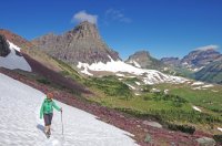
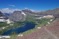
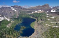
For a challenge we started the week by going for the high country. We were met by hurricane winds and eventually snow. This is a view down to Two Medicine Lake from the Scenic Pt. Trail.
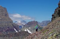
Before leaving home I had told @Jeffrey Chandler that "I was going to Trout Lake....I don't care what you do!" He gets hung up on the climb up and over Howe Ridge. 2,000+ feet up, 2,000+ feet down, turnaround and repeat. So Jeff went to Snyder Lake and I went to Trout Lake!
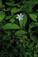
I was able to appreciate the wildflowers at my own pace.....ha.
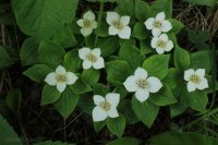
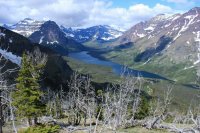
Trout Lake
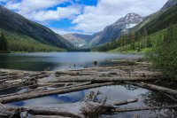
On August 12, 1967 within 100 feet from this spot an episode of "Night of the Grizzlies" played out. A group of lodge employees were camped in a backcountry world unrecognizable to BCP members. Garbage strewn everywhere. Food left out. Pack in pack out wasn't even an concept. They had a dog. But on that night one of these kids lost their life to a troubled Grizzly who's previous behavior had been ignored by the system in place at the time. While this occurred at Trout Lake another employee was killed near Granite Park Chalet by a bear who had become accustomed to feeding on garbage at the Chalet. As horrific as that night was it was the genesis of everything that we know as bear management and the backcountry responsibility we all have in the safety of humans and bears.
There are still plenty of bears in this valley.
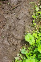
I went a couple miles beyond Trout Lake to Arrow Lake. Where coincidentally the bear that killed the girl was put down. The patrol cabin in the story has been reclaimed by nature.
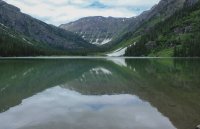
Lake McDonald on my way back down Howe Ridge. The trail was a beast for this out of shape old man.
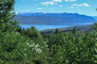
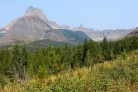
St. Mary Lake - See the pyramid peak on the right? Highest point? Reynolds Mtn. Jumping ahead in our story. WE ARE UP THERE IN AUGUST.
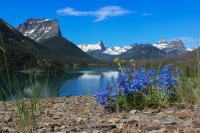
A sweet view of Glacier Lillies....and Mountains
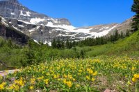
Virginia Falls
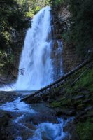
St. Mary Falls
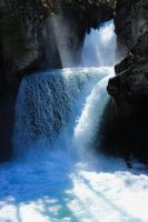
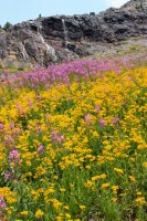
June is wonderful for wildflowers.
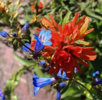
Let us jump ahead to August. As I have previously documented. I have day hiked every trail that you can day hike in Glacier. Hundreds of miles! I have been content with that but then @Jeffrey Chandler grew up and has wanted to push the envelope. Off Trail this! Climb that! I knew when Jeff was born I was going to be "old" when he was a teenager but here he was messing up my Glacier National Park comfort zone. And in some ways I resented him for making me uncomfortable in my 2nd home. I don't easily accept the physical and mental challenge but I have loved getting to the crazy places that he has taken me.
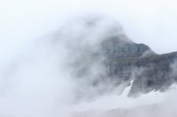
On day one we planned to climb Reynolds Mtn. 9,125 Ft. When we arrived at Logan Pass things were socked in. I felt like this was going to be a lot of energy for a trip into the clouds but neither of us thought of postponing the climb for a later day. I was intrigued by the possibility of the summit being above the clouds.
We are going up into that!
Epic Jeff
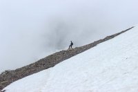
View from the initial saddle.
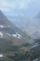
This initial phase was to go up through what they call The Gullys.
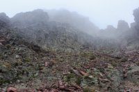
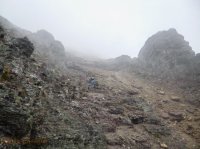
Then it was 650 feet of scree.
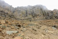
Then we got through 300 feet of cliffs.
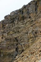
The crux was this wall that needed to be scaled. Luckily sometime in the last century a rock had lodged between the wall and the huge rock. It was at an inconvenient angle but beggars can't be choosers.
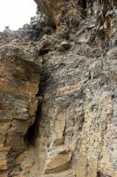
It was at this point the @Jeffrey Chandler mentioned that the clouds/fog take exposure out of the picture. You can't see the 1,500 foot drop-offs.
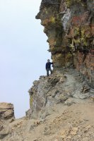
Finally get to the summit ridge and we are definitely in the clouds. Jeff felt like an astronaut in the vacuum of space. You can hear traffic and water thousands of feet below you. But we are just standing in the utter calmness. It was really cool!!!!
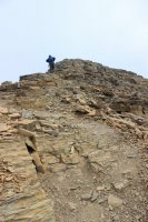
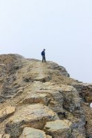
We found ourselves patiently waiting for any window in the whiteness. They would come in quick bursts and the clouds floated by and fed up from the valleys around us.
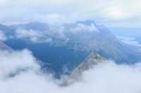
We had a shuttle to catch at Logan Pass so Jeff pushed me off the summit and things started to open up more.
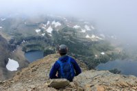
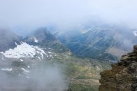
I was happy to sit on a rock in awe but I could tell Jeff was anxious. It took him a couple days to express it. With the slope of the summit ridge it didn't look like Hidden Lake was below us. It looked like it was in front of us at a 45 degree angle. Like we could reach straight out and touch it. Like in the movie Inception. Perfect description!
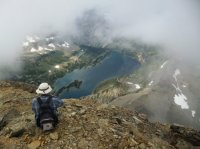
A view of me at the earlier shot of Jeff. Sans clouds.
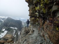
A view that captures part of the scree slope that Jeff loved sliding down.
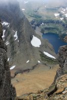
Sperry Glacier, where I go in a couple days.
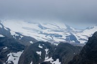
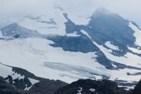
Twin Lakes and the ridge (this side of the lakes) I have gotten too in past years.
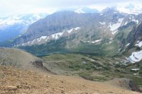
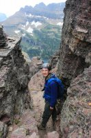
A view up at our 1,283 foot adventure through The Gullys, scree and cliffs.
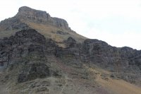
Going in we had met this fellow. He was coming down the trail. Jeff was able to get above the trail near a cliff wall but I was exposed with really no where to go comfortably. There was a 3 ft. rock just ahead of me so I went to the high side of it. Hoping that I was conveying to the goat what I wanted him to do. He did understand, as he continued down the trail on the opposite side of the rock.
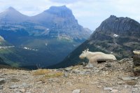
For as long as we are alive we will be repeating our nauseating mantra. "We were up there!"
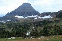
@Jeffrey Chandler had wanted to do a three day two night backpack but there was no reasonable walk-in availability so he did a one night to Lincoln Lake. I had day hiked this 16 mile forest monster in 2012 so I was comfortable in giving him free reign. Of course it provided me opportunity by myself....ha!
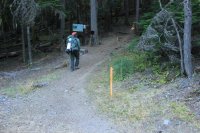
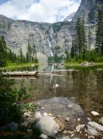
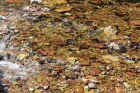
I wondered if I ever took the time to see McDonald Creek with low water in August. All I can say is "just look at that clear water!"
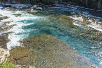
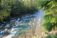
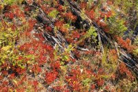
Then I drove up the Inside North Fork Road to the Camas Creek Trailhead. So those of you connecting the dot (ha) Camas Creek in the drainage with includes Trout and Arrow Lakes that I visited in June. Today I am hiking the western end of this drainage to Rogers Meadows. Had some autumn colors already.
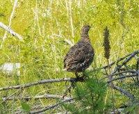
The picture I didn't get. This momma Spruce Grouse had a few chicks. One found itself in the trail ahead of me and it frantically couldn't get off to the left to its mom. It knew where she was but it seemed unable to commit to walking off the trail. At one point it was six inches from my foot.
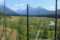
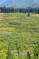
Rogers Meadow. Camas Creek slows down and meanders. I was able to climb up the slope to the left to get some altitude to try to shoot the wandering.
In 1985 I hiked to Sperry Glacier. It has been labeled "The Death March" ever since. Maybe this had something to do with it being a 20 mile day. 5,000 feet of elevation gain. That I had a fever coming down the trail at the end of the day. That I got off work as a night auditor at McDonald Lodge and immediately started the hike. OR (am not sure which work scenario it is) I had to work after the hike. So it seemed perfectly sane that 32 years later I should tackle the Death March again.
Wisdom does that not necessarily come with age but desire doesn't necessarily diminish with age.
Jeff was going to be walking out to McDonald Lodge. I told him that I would "try" to get out by 6:00PM. He said that he would not think about worrying until 7:00PM. So at 6:05AM I hit the trail. But not before walking down to the lake for the early morning shot.
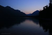
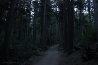
The initial 6 miles are a walk in the woods so it was just an attempt to keep up a respectable pace.
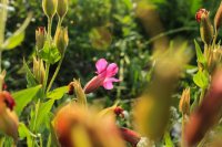
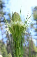
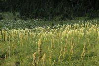
This summer brought a once in a century Beargrass bloom. This was the only hillside I saw still blooming.
I finally got to the Comeau Pass/Sperry Glacier Trail. This begins 3.5 miles of splendor. It is a trail built solely to take people to the glacier and I believe this gives the trail a different character.
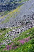
Fireweed and hint of the yellows to come.
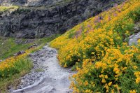
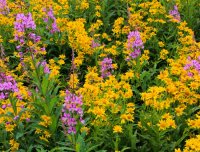
I loved this Marmot. Seeing it amongst the wildflowers, grasses and water was such a different feel than the usual rocky terrain.
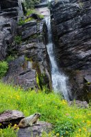
Looking down to Sperry Chalet and over to Lincoln Peak. Once again.. for those of you connecting the dots, Jeff is camped 2,000 feet below the beyond side of Lincoln Peak at Lincoln Lake.
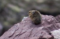
My first decent photo of a Pika. They are usually a "cheep" and a blur, but this guy seemed content on this rock.
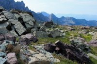
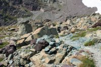
This section of the trail was so cool. For one thing it was flat and it felt like I was walking thru a formal gardens of square-ish boulder monuments.
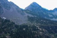
There were numerous small lakes.
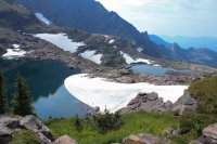
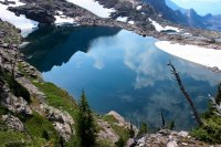
My first view of Comeau Pass. You might be able to make out a gash in the headwall (right third). That is where the steps are.
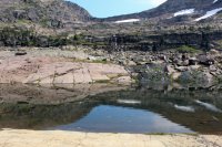
The steps were carved out back in the day when you could do that in National Parks. To provide access to Sperry Glacier.
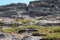
I have the end of my 5,000 foot gain in site and I find the steps guarded by a family of Mountain Goats.
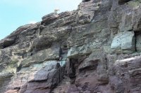
It took me until noon to get to Comeau Pass and I was still a mile from the Glacier. I began practicing my rant for when Jeff would give me attitude for not getting back by 7:00 PM. To get to the Sperry Glacier view I had to cross a series of snow fields and scoured landscape.
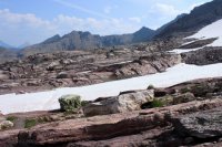
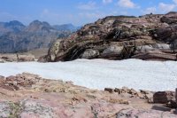
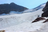
My main motivation for this hike was to reproduce photos that I took in 1985. To gage the glaciers shrinkage. This photo was taken in August 1985.
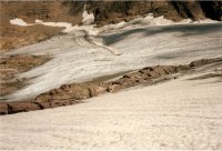
This photo was taken in August 2017. It has lost a fair share of ice at the toe of the glacier.
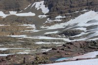
I have seen photos from the early 1900's where ice covered these lakes.
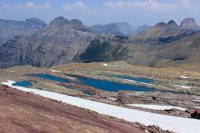
A view across to Reynolds Mtn. which shows most of our route from a couple days ago. We took the left of the two scars in the scree. This makes the upper cliffs look large. I'm Impressed...ha.
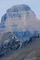
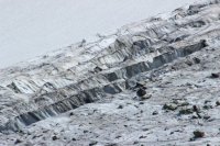
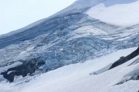
A photo taken of the head of the glacier in 1985.
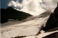
Photo taken August 2017. These are a harder comparative because we are dealing with thickness I suppose.
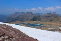
Mt. Brown and the Little Matterhorn. Getting to the Little Matterhorn could be interesting because look to the left you see Snyder Lakes and to the right is Avalanche Lake.
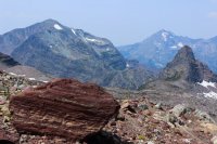
The view from Comeau Pass.
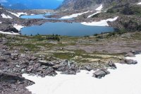
Due to fires in southern Montana our air quality was less than ideal. But it did provide for incredible silhouettes of the multitudes of ridges. We felt it gave it a neat 2D cartoon quality.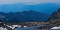
Getting back to the main trail.

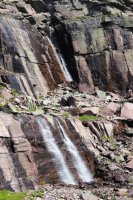
It was 3:30 PM and I had 6 miles to go. I might just meet the deadline.
I walked into McDonald Lodge at 5:55 PM. I felt like Phileas Fogg in Around the World in 80 Days!!!!!!
We both decided to take the next day to rest from our individual adventures.
We then tackled Ptarmigan Tunnel.
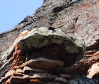
We both heard the sounds of baby raptors but could not zero in on them. There was a couple with binoculars and camera who helped us. Though we could not "see" them they assured us that it was there. That it was simply blending in with the rocks. So I was surprised to see a Peregrine Falcon in the photo.
Have to throw in another pop culture reference. Jeff would point out something and I would do my best Marvin the Robot imitation, from Hitchhikers Guide to the Galaxy. "yeh....all I see are the fields of beargrass that I missed blooming by a couple weeks."
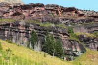
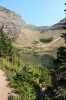
Ptarmigan Lake and the trail up to the tunnel.
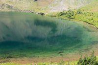
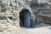
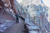
Jeff at the south door to the tunnel. I thought the shovel was a nice touch.
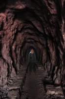
Ptarmigan Tunnel. At 7,200 feet. 250 feet long. Built in 1931
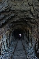
Continuation of the trail on the north side.
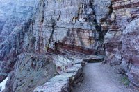
Elizabeth Lake and an incredible backcountry world to explore.
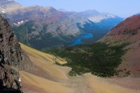
Jeff was geeking out at the massiveness of Mt. Merritt (10,004 ft.)
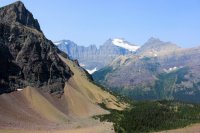
I was geeking out at the massive waterfall coming out of Old Sun Glacier. It was 3.5 miles away and it had mass and movement. Not just a white streak.
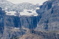
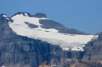
Then there was the Lithoid Cusp that Jeff can go on and on about. Only a very few have climbed it and the original climber didn't even take credit for it. (A guy thought he was the initial climber only to find evidence on top that someone else had been there......or something like that.). To the left of the snow streak.
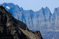
Back toward the north entrance to the tunnel. Impressive things were built by strong men during the depression.
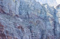
Jeff inside the tunnel. Did not use flash. Used high ISO sucking in the surrounding darkness. Pretty fun!
Looking down from the south tunnel door.
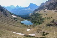
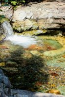
Driving across the Going To The Sun Road....Reynolds Mtn. Okay @Jeffrey Chandler lets exclaim.....WE WERE UP THERE!
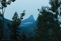
This was our fish that got away for the 2nd year in a row. We want to climb up Lunch Creek and climb Pollock Mt. and Piegan Mt. (off camera to the right.) We read the books and watch the video's so we know it is just a long 3,000 ft. plod. But when we look at this in person it sort of sucks the wind out of us. We need to make this a Day one adventure.
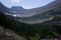
On our final day we drove up into another backcountry paradise to Bowman Lake. We plopped down on the shore and simply sat and had a picnic..
Thank you for coming along on our adventure.
The high country is restricted in June, due to snow, so we have attempted to milk the low country stream runoff and wildflowers.
For a challenge we started the week by going for the high country. We were met by hurricane winds and eventually snow. This is a view down to Two Medicine Lake from the Scenic Pt. Trail.

Before leaving home I had told @Jeffrey Chandler that "I was going to Trout Lake....I don't care what you do!" He gets hung up on the climb up and over Howe Ridge. 2,000+ feet up, 2,000+ feet down, turnaround and repeat. So Jeff went to Snyder Lake and I went to Trout Lake!
I was able to appreciate the wildflowers at my own pace.....ha.


Trout Lake

On August 12, 1967 within 100 feet from this spot an episode of "Night of the Grizzlies" played out. A group of lodge employees were camped in a backcountry world unrecognizable to BCP members. Garbage strewn everywhere. Food left out. Pack in pack out wasn't even an concept. They had a dog. But on that night one of these kids lost their life to a troubled Grizzly who's previous behavior had been ignored by the system in place at the time. While this occurred at Trout Lake another employee was killed near Granite Park Chalet by a bear who had become accustomed to feeding on garbage at the Chalet. As horrific as that night was it was the genesis of everything that we know as bear management and the backcountry responsibility we all have in the safety of humans and bears.
There are still plenty of bears in this valley.

I went a couple miles beyond Trout Lake to Arrow Lake. Where coincidentally the bear that killed the girl was put down. The patrol cabin in the story has been reclaimed by nature.

Lake McDonald on my way back down Howe Ridge. The trail was a beast for this out of shape old man.

St. Mary Lake - See the pyramid peak on the right? Highest point? Reynolds Mtn. Jumping ahead in our story. WE ARE UP THERE IN AUGUST.

A sweet view of Glacier Lillies....and Mountains

Virginia Falls

St. Mary Falls

June is wonderful for wildflowers.


Let us jump ahead to August. As I have previously documented. I have day hiked every trail that you can day hike in Glacier. Hundreds of miles! I have been content with that but then @Jeffrey Chandler grew up and has wanted to push the envelope. Off Trail this! Climb that! I knew when Jeff was born I was going to be "old" when he was a teenager but here he was messing up my Glacier National Park comfort zone. And in some ways I resented him for making me uncomfortable in my 2nd home. I don't easily accept the physical and mental challenge but I have loved getting to the crazy places that he has taken me.
On day one we planned to climb Reynolds Mtn. 9,125 Ft. When we arrived at Logan Pass things were socked in. I felt like this was going to be a lot of energy for a trip into the clouds but neither of us thought of postponing the climb for a later day. I was intrigued by the possibility of the summit being above the clouds.
We are going up into that!

Epic Jeff

View from the initial saddle.

This initial phase was to go up through what they call The Gullys.


Then it was 650 feet of scree.

Then we got through 300 feet of cliffs.

The crux was this wall that needed to be scaled. Luckily sometime in the last century a rock had lodged between the wall and the huge rock. It was at an inconvenient angle but beggars can't be choosers.

It was at this point the @Jeffrey Chandler mentioned that the clouds/fog take exposure out of the picture. You can't see the 1,500 foot drop-offs.

Finally get to the summit ridge and we are definitely in the clouds. Jeff felt like an astronaut in the vacuum of space. You can hear traffic and water thousands of feet below you. But we are just standing in the utter calmness. It was really cool!!!!


We found ourselves patiently waiting for any window in the whiteness. They would come in quick bursts and the clouds floated by and fed up from the valleys around us.

We had a shuttle to catch at Logan Pass so Jeff pushed me off the summit and things started to open up more.


I was happy to sit on a rock in awe but I could tell Jeff was anxious. It took him a couple days to express it. With the slope of the summit ridge it didn't look like Hidden Lake was below us. It looked like it was in front of us at a 45 degree angle. Like we could reach straight out and touch it. Like in the movie Inception. Perfect description!

A view of me at the earlier shot of Jeff. Sans clouds.

A view that captures part of the scree slope that Jeff loved sliding down.

Sperry Glacier, where I go in a couple days.


Twin Lakes and the ridge (this side of the lakes) I have gotten too in past years.


A view up at our 1,283 foot adventure through The Gullys, scree and cliffs.

Going in we had met this fellow. He was coming down the trail. Jeff was able to get above the trail near a cliff wall but I was exposed with really no where to go comfortably. There was a 3 ft. rock just ahead of me so I went to the high side of it. Hoping that I was conveying to the goat what I wanted him to do. He did understand, as he continued down the trail on the opposite side of the rock.

For as long as we are alive we will be repeating our nauseating mantra. "We were up there!"

@Jeffrey Chandler had wanted to do a three day two night backpack but there was no reasonable walk-in availability so he did a one night to Lincoln Lake. I had day hiked this 16 mile forest monster in 2012 so I was comfortable in giving him free reign. Of course it provided me opportunity by myself....ha!


I wondered if I ever took the time to see McDonald Creek with low water in August. All I can say is "just look at that clear water!"


Then I drove up the Inside North Fork Road to the Camas Creek Trailhead. So those of you connecting the dot (ha) Camas Creek in the drainage with includes Trout and Arrow Lakes that I visited in June. Today I am hiking the western end of this drainage to Rogers Meadows. Had some autumn colors already.


The picture I didn't get. This momma Spruce Grouse had a few chicks. One found itself in the trail ahead of me and it frantically couldn't get off to the left to its mom. It knew where she was but it seemed unable to commit to walking off the trail. At one point it was six inches from my foot.

Rogers Meadow. Camas Creek slows down and meanders. I was able to climb up the slope to the left to get some altitude to try to shoot the wandering.


In 1985 I hiked to Sperry Glacier. It has been labeled "The Death March" ever since. Maybe this had something to do with it being a 20 mile day. 5,000 feet of elevation gain. That I had a fever coming down the trail at the end of the day. That I got off work as a night auditor at McDonald Lodge and immediately started the hike. OR (am not sure which work scenario it is) I had to work after the hike. So it seemed perfectly sane that 32 years later I should tackle the Death March again.
Wisdom does that not necessarily come with age but desire doesn't necessarily diminish with age.
Jeff was going to be walking out to McDonald Lodge. I told him that I would "try" to get out by 6:00PM. He said that he would not think about worrying until 7:00PM. So at 6:05AM I hit the trail. But not before walking down to the lake for the early morning shot.


The initial 6 miles are a walk in the woods so it was just an attempt to keep up a respectable pace.

This summer brought a once in a century Beargrass bloom. This was the only hillside I saw still blooming.

I finally got to the Comeau Pass/Sperry Glacier Trail. This begins 3.5 miles of splendor. It is a trail built solely to take people to the glacier and I believe this gives the trail a different character.
Fireweed and hint of the yellows to come.


I loved this Marmot. Seeing it amongst the wildflowers, grasses and water was such a different feel than the usual rocky terrain.

Looking down to Sperry Chalet and over to Lincoln Peak. Once again.. for those of you connecting the dots, Jeff is camped 2,000 feet below the beyond side of Lincoln Peak at Lincoln Lake.

My first decent photo of a Pika. They are usually a "cheep" and a blur, but this guy seemed content on this rock.

This section of the trail was so cool. For one thing it was flat and it felt like I was walking thru a formal gardens of square-ish boulder monuments.


There were numerous small lakes.


My first view of Comeau Pass. You might be able to make out a gash in the headwall (right third). That is where the steps are.

The steps were carved out back in the day when you could do that in National Parks. To provide access to Sperry Glacier.

I have the end of my 5,000 foot gain in site and I find the steps guarded by a family of Mountain Goats.

It took me until noon to get to Comeau Pass and I was still a mile from the Glacier. I began practicing my rant for when Jeff would give me attitude for not getting back by 7:00 PM. To get to the Sperry Glacier view I had to cross a series of snow fields and scoured landscape.


My main motivation for this hike was to reproduce photos that I took in 1985. To gage the glaciers shrinkage. This photo was taken in August 1985.

This photo was taken in August 2017. It has lost a fair share of ice at the toe of the glacier.

I have seen photos from the early 1900's where ice covered these lakes.

A view across to Reynolds Mtn. which shows most of our route from a couple days ago. We took the left of the two scars in the scree. This makes the upper cliffs look large. I'm Impressed...ha.

A photo taken of the head of the glacier in 1985.

Photo taken August 2017. These are a harder comparative because we are dealing with thickness I suppose.


Mt. Brown and the Little Matterhorn. Getting to the Little Matterhorn could be interesting because look to the left you see Snyder Lakes and to the right is Avalanche Lake.

The view from Comeau Pass.

Due to fires in southern Montana our air quality was less than ideal. But it did provide for incredible silhouettes of the multitudes of ridges. We felt it gave it a neat 2D cartoon quality.

Getting back to the main trail.


It was 3:30 PM and I had 6 miles to go. I might just meet the deadline.

I walked into McDonald Lodge at 5:55 PM. I felt like Phileas Fogg in Around the World in 80 Days!!!!!!
We both decided to take the next day to rest from our individual adventures.
We then tackled Ptarmigan Tunnel.

We both heard the sounds of baby raptors but could not zero in on them. There was a couple with binoculars and camera who helped us. Though we could not "see" them they assured us that it was there. That it was simply blending in with the rocks. So I was surprised to see a Peregrine Falcon in the photo.

Have to throw in another pop culture reference. Jeff would point out something and I would do my best Marvin the Robot imitation, from Hitchhikers Guide to the Galaxy. "yeh....all I see are the fields of beargrass that I missed blooming by a couple weeks."

Ptarmigan Lake and the trail up to the tunnel.


Jeff at the south door to the tunnel. I thought the shovel was a nice touch.

Ptarmigan Tunnel. At 7,200 feet. 250 feet long. Built in 1931

Continuation of the trail on the north side.

Elizabeth Lake and an incredible backcountry world to explore.

Jeff was geeking out at the massiveness of Mt. Merritt (10,004 ft.)

I was geeking out at the massive waterfall coming out of Old Sun Glacier. It was 3.5 miles away and it had mass and movement. Not just a white streak.


Then there was the Lithoid Cusp that Jeff can go on and on about. Only a very few have climbed it and the original climber didn't even take credit for it. (A guy thought he was the initial climber only to find evidence on top that someone else had been there......or something like that.). To the left of the snow streak.

Back toward the north entrance to the tunnel. Impressive things were built by strong men during the depression.


Jeff inside the tunnel. Did not use flash. Used high ISO sucking in the surrounding darkness. Pretty fun!

Looking down from the south tunnel door.


Driving across the Going To The Sun Road....Reynolds Mtn. Okay @Jeffrey Chandler lets exclaim.....WE WERE UP THERE!

This was our fish that got away for the 2nd year in a row. We want to climb up Lunch Creek and climb Pollock Mt. and Piegan Mt. (off camera to the right.) We read the books and watch the video's so we know it is just a long 3,000 ft. plod. But when we look at this in person it sort of sucks the wind out of us. We need to make this a Day one adventure.

On our final day we drove up into another backcountry paradise to Bowman Lake. We plopped down on the shore and simply sat and had a picnic..

Thank you for coming along on our adventure.
Last edited:

