chandlerwest
Member
- Joined
- Feb 7, 2015
- Messages
- 550
What self deprecating story line do I have for this trip? As I have pushed into my 60's I seem to be focused on the mental and physical state of "what the hell am I doing out here!?" But this trip highlights why. No matter how debilitating I got.....it is all worth it!!!!
Due to Covid we didn't get to Glacier in 2019. The first time since 2005. Last week my hiking partner from Glacier 1985, Kurt, came in. He seemed intent on feeding us, fishing, and knocking a few trails off of my "Trails that I have never done, yet possibly could do, before I get too old".....list. Jeff is working this summer as a Stream Tech so he was able to show up for three nights. "I'm just a third wheel.....I will do whatever!"
The overriding lesson of this week was that maybe I should ease into the week better. Historically, the first hike is a doozy!! Being the freshest it just seemed to be a logical practice. We chose Elk Mountain. It is situated just off HWY 2 so we have driven by it hundreds of times. Mile wise it is short. There once was a lookout at the top and the trail is Steep. The crux of the trip is 2.3 miles and a 3,071 foot gain. Damn! Seeing it in print.....no wonder it was a gut punch.
Approaching the park boundary we heard the train approaching, so we hustled so we wouldn't have to stand and count cars for half an hour. Here we are on the safe/park side of the tracks.
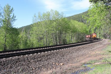
It felt wonderful to be in the Glacier National Park forest again. The wildflower season was running a bit late this year. We didn't have the variety but we still had our fill.
Service Berry
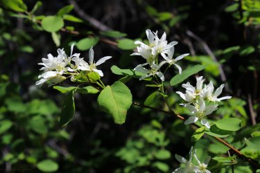
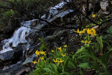
But we had Glacier Lilies......everywhere. Usually they are declining during our week but they were......everywhere.
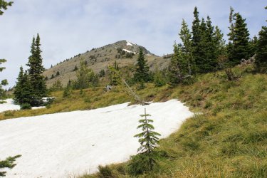
They put me in front for the haul up. Trusting that my pace would protect them from themselves. I had to stop nearly every ten steps to "let my thighs breathe." They were so pumped they felt like they were gasping for air. No pain....just that nagging blown out feeling. One of our first sightings of the summit. We were dealing also with a very very cold and strong wind. Ugh.
Stopping in the wind break of a few trees. That is my Jeffrey boy!!! Kurt taking a load off his knees. I Had to stop but Kurt's physical issues seemed to require him to keep moving so as to not lock up.
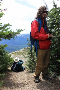
We made it to the top and immediately the challenge was worth it tenfold. The views were limited into Glacier to the north but unlimited into The Great Bear Wilderness to the west and the Bob Marshall Wilderness to the south. Un-frickin limited.
Looking north west up the Ole Drainage
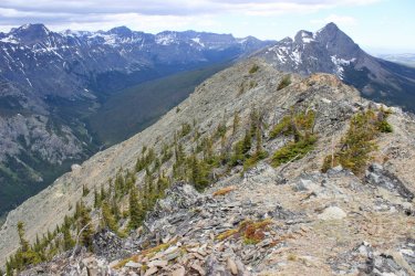
Looking west down the Ole Drainage towards the Great Bear Wilderness.
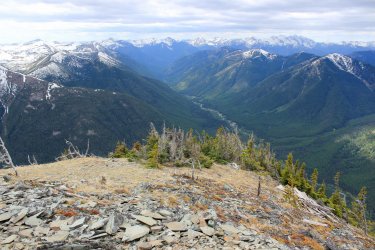
West toward HWY 2 and Lord knows how many miles into the distance 40,50,70 miles?
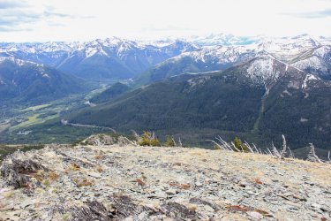
Looking south into the "Bob"
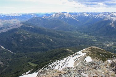
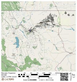
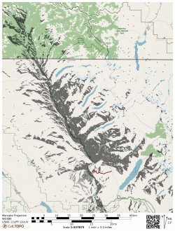
I worked up this "Viewshed" from the 7,835 summit of Elk Mountain. What I want to convey are all the dark speckles to the west and south. Those represent all of the snow capped peaks that we could see. Miles upon miles of them.
This view is up the "Fielding" region of Glacier. I hope someday to go over that lower saddle/pass in the foreground. (It will be an 18 mile walk in the woods....ugh).
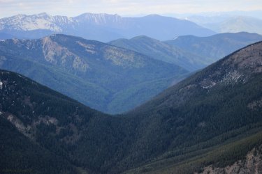
This is zoomed in on the south view into the Bob
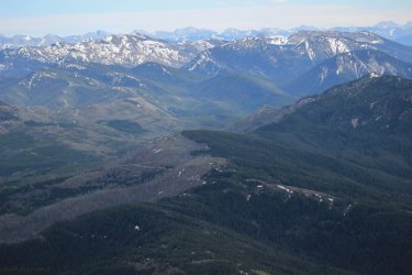
Off to the southwest. Look at the huge mountain on the left. This is a good time to slip in that I face planted on the summit. Due to the climb up my leg/balance reaction times weren't the best. I stubbed my toe and could not recover and fell/skidded front first. Naturally protecting my camera.....ha. All I got was a bruise on my left arm (that I didn't notice until the next day) and a small vertical cut on the joint of my thumb that bled like a stuck pig. I purposely did not assess how my bounces I was from tumbling hundreds of feet off the mountain. It was a reminder that "Shit happens fast!!!"
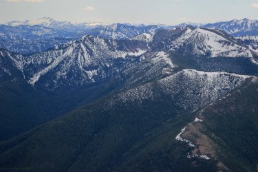
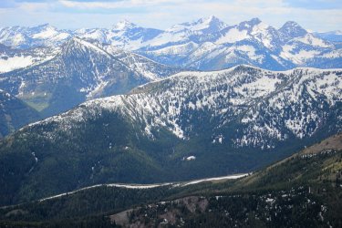
Into the Great Bear Wilderness
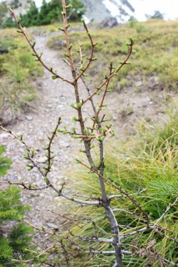
A young Larch Tree. Isn't it adorable? (A quiet prelude to set up the trip down.)
I was using trekking poles for the first time in my life so I want to lay the blame at their feet, which probably isn't fair. But surely they have some culpability. As they affect the workings of the body (though...supposedly helping.) The trail was steep. Continuously covered in pebbles and cones. So every step was a possible slip and fall. Thus one tends to walk guarded. So........my thighs were destroyed going uphill. My forelegs were destroyed coming down. I told Jeff "my thighs aren't doing a thing, they are just dead stumps on top of my lower legs. Remember the old cartoon (or was it Star Wars Phantom Menace?) when you poked a robot in the nose and it folded up into a box? That was me!!!! I seemed to have lost all natural ability to self correct. It was a rough/slow 2.3 miles down to the "flat". Once, the trail was overgrown and I folded up and was essentially below the brush. Out of sight. Jeff was 20 feet or so ahead of me. I tried to get up but the slope was such that I couldn't get purchase to push up. I raised my hand through the brush and hollered "Jeff.....I've fallen and I can't get up!" Through my misery we laughed constantly.
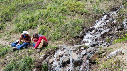
Finally making it to this stream we stopped for lunch and Jeff was teaching stuff about something. Jeff is a font of information. "I know the scientific name of everything but not the common names."
I told them that if a train is coming I WILL NOT be running to beat it. (I could not have ran if you gave me a $100 bill). I will gladly sit on the wrong side of the tracks for, how ever long! Wasn't a problem.
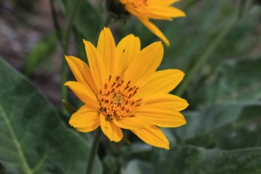
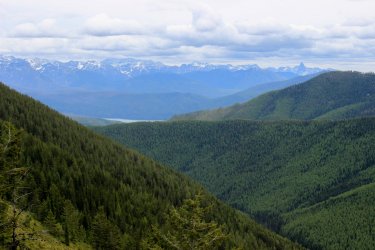
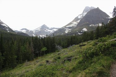
I unspokenly felt that Day 2 might be a rest day since both Kurt and I were a bit hobbled. Jeff was just spry as a lark walking my slow pace. But you CAN'T rest. The body needs to jump back on the forsaken horse. So we headed off (in no real hurry) to the Huckleberry Lookout Trail. For some reason I have never been able to get the boys to do this trail. Long uphill walk in the woods I suppose. The trail status report read "trail clear to 5 miles/6,100 feet then high angle snow fields to lookout." Probably the most accurate trail status report I have read. The five miles was a pleasant grade for 2,300 feet. And yes it had limited views out of the forest. But.....what views.
This view included an amazing water fall that we had trouble placing. Jeff and I could agree that that was Mt. Brown but the winding water confused us. Then he exclaimed "its the drainage out of Hidden Lake." I looked at him like he was an alien. Kurt's supported my look. "That drainage is back in a nook. It isn't visible from anywhere." But he and I have had similar disagreements on the trail before and I have learned not to dismiss him out of hand. The kid is always right!!! Coming down he went into more detail of his reasoning and I started to come around. I said "if you are right then this is the only place that the drainage can be seen from a trail in this Park."
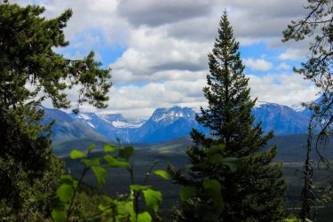
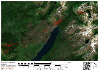
I got home and set to prove his assertion. I did a Viewshed from the outlet of Hidden Lake and it brushes through the Huckleberry Lookout Trail. What a spacial awareness he has!!! Hidden Lake is in the upper right and Huckleberry is lower left.
I fell in love with this McGee Creek Drainage. It was something about the Trees. Or the absolute wilderness of it all.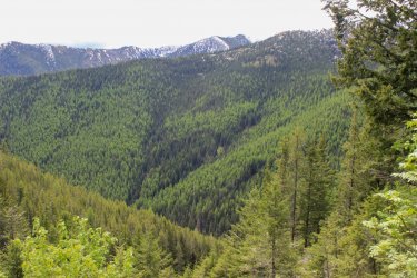
Lake McDonald makes an appearance. Mt. Stimson has its head in the clouds and Mt. St. Nicholas rises in the southern end of the park.
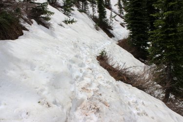
We reached the "high angle" snow fields at the ridge. Kurt had good boots so he took off across seemingly without a care. I had my trekking poles so I methodically made my way across. Jeff had nothing but a frozen left hand by the time we got across. We didn't have hundreds of feet of exposure but a misstep would have been a 30-50 foot slide only stopped because we crashed into a tree or such. So.......stressful.
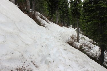
After the initial north facing cirque the trail was clear and flat....then we met a group coming down and they informed us that the worse was yet to come. This stretch was continuous but it was more crowned so it felt much more secure. Plus it was gently uphill which for physic reasons seems helpful.
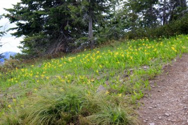
We were greeted by fields of Glacier Lilies up to the lookout.
Eating a late lunch in the wind break of the lookout Kurt asked why I had such a problem getting the boys ups here. Putting Jeff, sheepishly on the spot as the view was breathtaking!!!!! We could see the entire western front of Glacier National Park. From Elk Mountain to well into Canada. We could see all six 10,000 foot mountains of GNP. We could see the En-frickin-tire NORTH FORK section of the park. We could see Flathead Lake to the south. The Swan Mountains. The Great Bear Wilderness. Whatever that cool creek drainage was to the Northwest. Jeff could see all three of his campsites he had had prior to us arriving to the cabin.
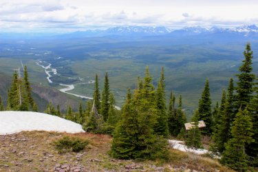
These are views started at due North walking around the lookout. North Fork of the Flathead River.
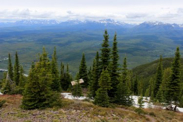
Swinging toward the east. Anaconda Drainage in the middle with Dutch Creek coming in on the right.
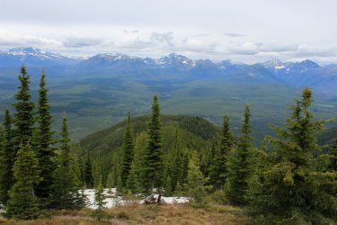
Dutch Creek with Camas Creek coming in on the right.
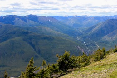
The view off to the Northwest.
View down to the North Fork of the Flathead River as it continues it confluence downstream with the Middle Fork.
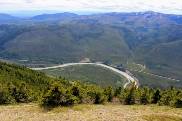
A view to the south following the river with Flathead Lake visible off in the distance. And the Swan Mountains Range.
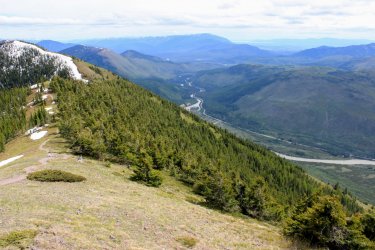
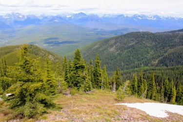
View south into The Great Bear Wilderness. Includes the visual of the two north facing cirques that we snow'd across. Mt. St. Nicholas left of center with Elk Mountain out there somewhere to its right. I repeat.....we could see the entire length of Glacier National Park.
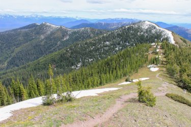
Camas Creek with its meadows and Mt. Jackson over on the right.
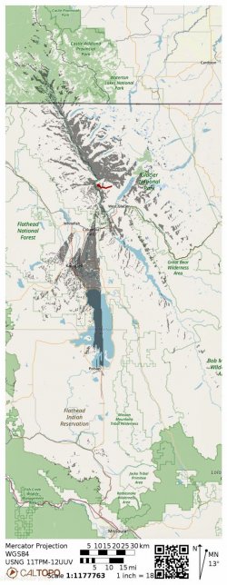
Here is a Viewshred from Huckleberry Lookout.
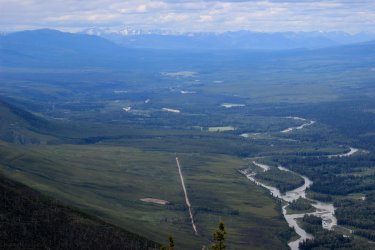
A closer look at the North Fork. An area of civilization history, forest fires and Jeff and I having walked the Inside North Fork Road.
Looking north into Canada.
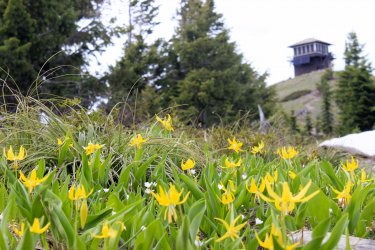
Glacier Lilies became my friends.
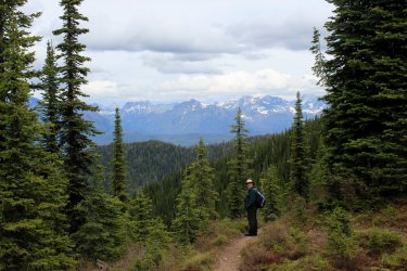
After three hours we make our way through the snow fields. They were wetter, plus generally downhill, thus slippery-er.
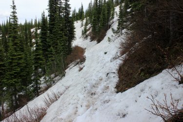
Okay.,.....this is where the story gets morbid. I gave Kurt and Jeff my disclaimers. I was hopeful that I would get down this 5 mile of "gentle" slope okay but after yesterday I wasn't confident. I was hopefully hesitant at best.
Have I mentioned how much I loved the look of the McGee Drainage? it felt like it has been spared from all of the fires that happen in the North Fork.
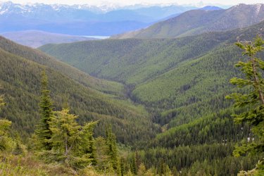
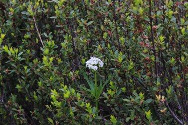
I was bringing up the rear of the team. Kurt was getting out of sight, Jeff was keeping within site of me but still well out in front. I was doing my thing of calmly attempting the decent. At some point I noticed that I was listing to the left. There was little that I could do about it. I felt that my lower back didn't have the ability to hold myself upright, nor complete the push off of a step. "I'm walking like I had a stroke!!!!!!" Jeff saw me and asked if I was okay. I said hell no I am f'd up. We were both comfortable that based on my thinking and talking I hadn't had a stroke but my body was giving off a fine simulation. And if a bear had charged us I would have had no defense for it. I had no ability to change gears. I was stuck in mosey. Without my trekking poles I would have toppled over instantly. Then mosquitoes hit. All I wanted to do was sit down in the trail but felt that the mosquitoes would turn me into a pile a pus. Taking a drink of water became an decision that lost out to the mosquitoes and my other woos. Kurt eventually saw me and informed me that I looked like shit. (Lord did we try to laugh through the misery.) I tried to get them to take the car keys, to run down and get out of the mosquitoes but they refused to leave me. At one point I shouted "where is the F'n bridge." Jeff informed me that there was quite a bit of hiking to do after the bridge. (Such a sweet knowledgeable boy!) I agreed with him but I need to get to the bridge before I can dream of getting to the car. Finally Kurt shouts "here is the bridge." Jeff watched me like a hawk as I crossed the plank bridge. Expecting to have to jump in the rushing creek when I toppled in. But I made it, looking a bit like the Arte Johnson's old man on Laugh In. Or was it Tim Conway on Carol Burnett. Once Kurt hollered out "there is the car" I had Jeff grab the keys and told him to get the trunk open because I didn't want us to be standing around any longer than necessary. Jeff volunteered to drive and I went to get in the front seat. I could not fold up enough to fit through the door. For a spit second I wondered if I had to ask Kurt to get out and push my head through. But I scalped myself and made it. Jeff was in the drivers seat freaking because a hundred mosquitoes were in the car. Kurt told him to just get moving as we can open the window and get them out quickly. I want to convey how hilarious we tried to make my/our condition out to be. To top off the scene, shortly down the road the car in front of us slows down and Kurt sees that there is a bear on the left far ahead. The car (from Oregon....it is forever etched in my brain) comes to a complete stop. We are a good quarter mile away and here is this asshat stopped trying to take a picture of this bear out his window with a huge telephoto lens...and the camera was on a tripod that kept getting stuck in his efforts. All the time the bear is a blooming quarter mile away. We could have gotten ever so much closer. I made a conscious decision not to blurt at Jeff to go around him. Deciding to let him deal with the absurdity of the situation on his own. I just sat there ragging on the asshat from Oregon. We never really saw the bear.
A final quite shot from the wonderful McGee Drainage. We never saw the creek but we could occasionally hear it.
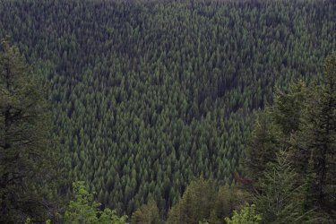
Jeff and I told Kurt that "we are taking tomorrow off." Kurt said he had declared that to himself while we were going UP to Huckleberry Lookout. The rains came in anyhow. After our second dinner on fresh caught fish Jeff left for work. Kurt and I drove into Glacier's McDonald valley because since working there in 1985 it is pretty special to the both of us.
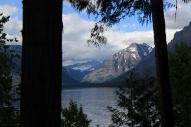
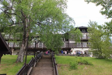
Walking around the old homestead that is McDonald Lodge.
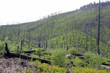
We drove over to the North shore to see how it was recovering from the fire from 2-3 years ago.
I started pushing the idea of Kurt fishing, because I knew it would be harder for us to do any hikes that would be longer than necessary. Day 4 was a bit drizzly so we headed over to the east side eventually expecting to get to Two Medicine Lake so Kurt could fish. We hiked an easy couple miles back to Red Rock Falls in the Many Glacier Valley. We HAD to check out the road construction that has been happening there for a couple years. For 35 years we have hoped that they would get that road into decent shape. We are still hopeful.....Ha.
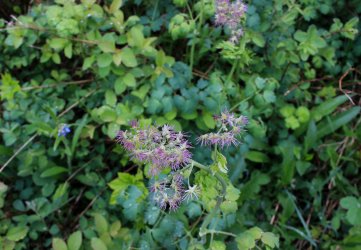
Another wildflower that seemed to prevalent this week was this guy. All day going up Elk Mountain I was seeing them but I could not think of the name!!! It was driving me crazy. I new that there was a Female and Male version but the name escaped me. I did the equivalent of a Wildflower book last year and had discussed this particular plant with my brother plenty of times. But I was drawing a blank on the name. That night Jeff came up with it. So since then I have been going Meadow-Rue, Meadow-Rue, Meadow-Rue
This is the female Meadow-Rue
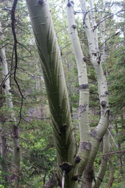
I thought it was interesting how water was wrapping around this tree.
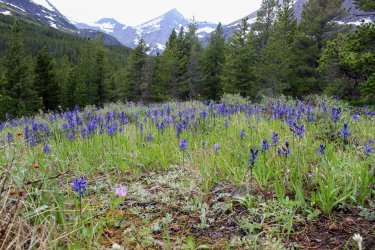
Field of Camas
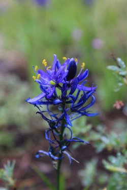
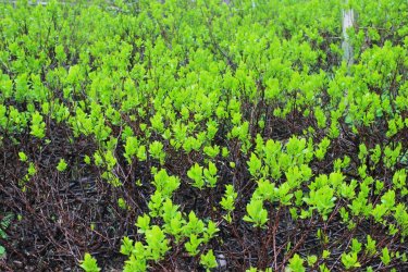
Just some pretty foliage
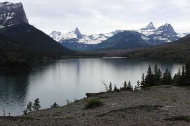
We then drove up the Going To The Sun Road as far was allowed. View from Sun Point.
Going To The Sun Mountain
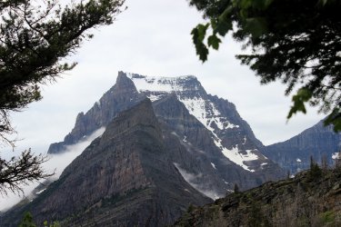
We finally reached Two Medicine Lake and I hung out at the shore while Kurt tried his luck.
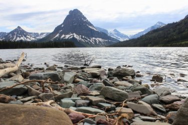
Day 5. It had rained most of the night and into the morning. So I wasn't exactly bouncing out of bed to greet the day. I am met with "Plan A" from Kurt. Drive to East Glacier to get a weather report then eventually get to fishing. And maybe I could do one of the small hikes on my list. Before he got to Plan B I jumped on his idea. "We both will drive....I park my car at Marias Pass and you then drop me off at the Firebrand Pass Trailhead. This will be my Proof of Concept Hike." I have always fantasized about a June week that would be rainy and I would spend the entire week taking long hikes in the forest with an umbrella. I was going to test out such a concept. I knew that this stretch of trail should be something that I could physically do so I had my umbrella and was excited to go. Of course it stopped raining by the time we got to the trail head......Ha. But the last hour of my hike it started raining so I still got to test the concept.
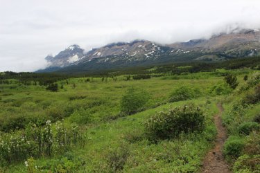
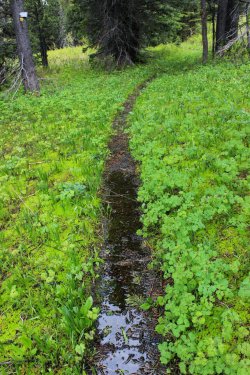
Due to the wet under brush and sloppy trail my feet got plenty soaked. But at least I didn't have to stress about keeping my feet dry all day. Having been to Firebrand Pass three times the initial section was familiar to me. I will be hiking through the forest below this rampart of mountains.
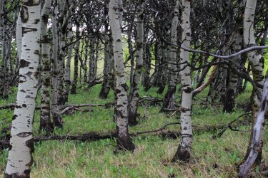
I love this grove of Birch.
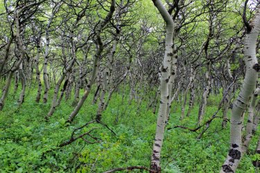
I start out on the seven mile middle section of the Autumn Creek Trail. Technically a part of the Continental Divide Trail (CDT). But most everybody that I have watched hike the CDT end up road walking into East Glacier since snow has already hit the mountains of Glacier NP.
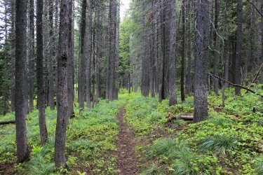
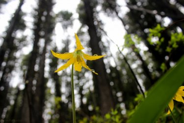
Had Glacier Lilies the entire way. Pretty incredible because historically I would not see these in lower terrain.
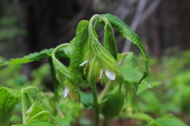
I loved the wilted lettuce look to this.
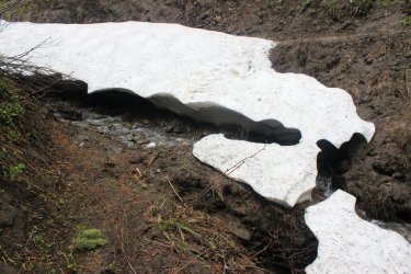
There were plenty of opportunities to assess "snow bridge or snow field." Not a benign distinction especially when alone on a relatively unused trail.
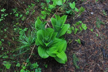
False Hellebore
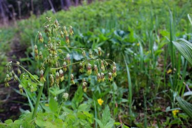
Meadow-Rue (Male) The old Chinese Lantern plant!
So relieving not to stress about getting my feet wet.
I am pretty sure this is Meadow Rue. So pretty.
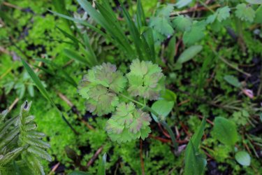
I had a few boggy sections
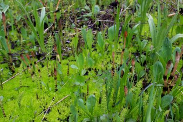
I lost count of all the streams I crossed. This is funny because Kurt liked this other idea of a trail I need to take in the Two Medicine valley. Thought that it would work wonderfully with his fishing. I had initially pushed the Dry Fork Creek Connector trail. But then I remembered that three miles in there was a crossing that I had to do. In my memory the area resembles a wider wash. I could not see a bridge, be it plank or swinging in my memory. Would I want to ford that crossing in spring run off conditions? So I did Autumn Creek instead......Ha
I remember how particular fast this water was running at this spot.
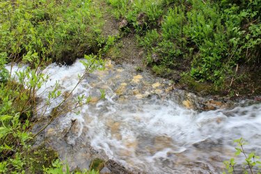
Meadow Rue - Female (Historically I don't think I have ever seen the female blooming)
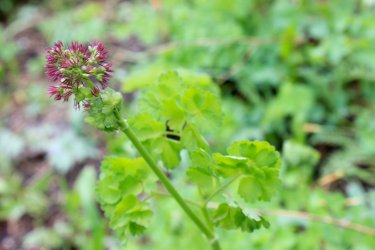
A few times it would open up and remind me of where I was at.
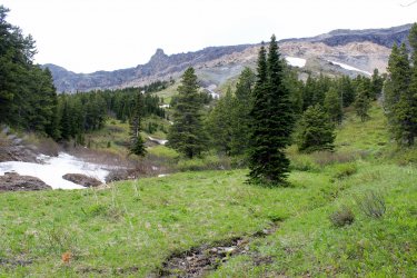
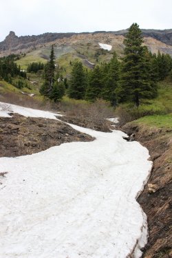
This was a particular puzzle to solve. This was a definite snow bridge with a roaring stream beneath. I went up stream into the brush and got across over to what I hoped was a snow "drift". I made it.
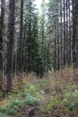
Yes it was a walk in the forest but it was quite engaging.
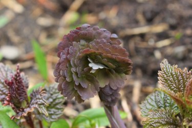
I saw this and hoped at least one of those was steady.
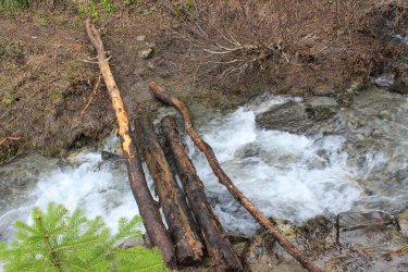
This was the fastest moving eight inch stream crossing. Kind of weird.
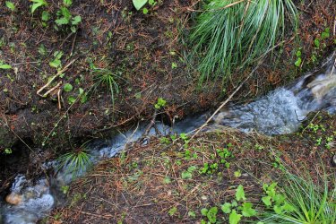
I had to unstrap the trekking poles for this one. Fast, DEEP water with a 15-20 foot high angle mud slope directly up the opposite bank. I stepped/plunged in and my trekking pole folded up as I failed to lock it properly. So here I was standing almost knee deep in rushing water whiles I fixed my pole and tried to figure out how I could hitch my leg up onto that rock then get up the slope in some "elegant" way. What I felt at the time was how pleasant the water felt. It wasn't a glacial shock. I made it.
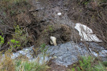
I hardly thought about this mess. I was in a bit of a groove so I just went!!!
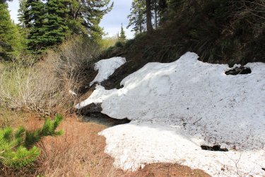
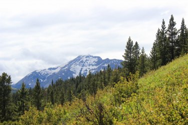
I came to the edge of a clearing so I went of the slope to get above the trees. This is Elk Mountain where we were so my day priors.
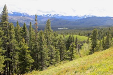
My exit went by that lake yonder.
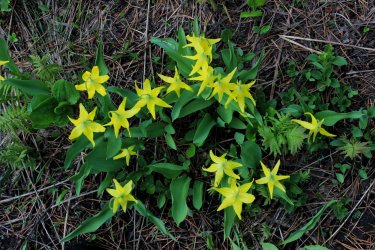
The rains came......yeah! I still had my Glacier Lily
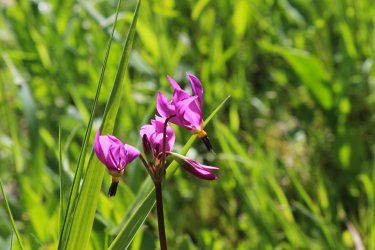
And Shooting Stars.
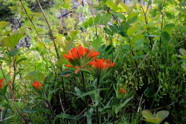
And occasionally an Indian Paintbrush
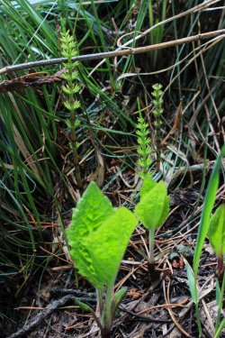
Finally reached the lake.....or as near as I could reasonably get to it.
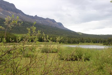
View back toward the area I had hiked from my parking spot.
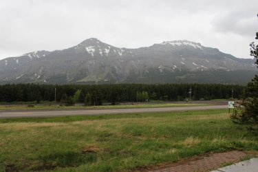
Are final day was mostly rain. Earlier in the week I had told Kurt that inevitably the last day of our week I end up in McDonald Valley. It spiritually means so much to me and since I am usually worn out it is a great place to get to on the final day.
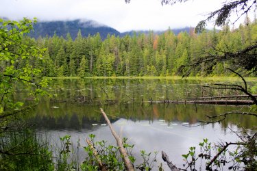
Having never been to lowly John's Lake (yet recently appreciated) I got to show it off to Kurt. As soon as I hit that ancient, huge tree forest the smell of it always grabs me at some subconscious emotional level.
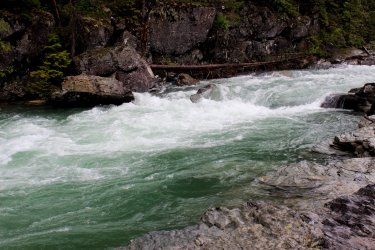
I told Kurt I am sure that I would be "just fine" to spend an entire week sitting by McDonald Creek some year.
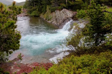
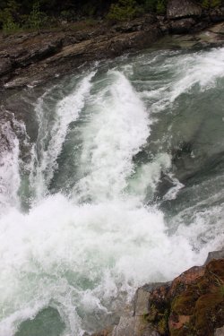
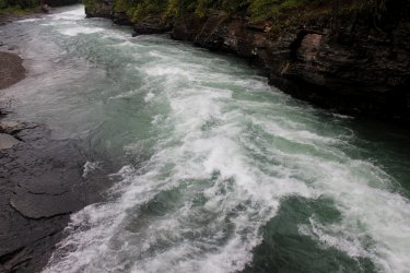
Note the vertical wave crashing against the grain as the water enters a falls.
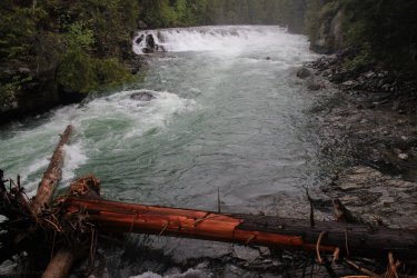
It will be much more serene in August when I plan to revisit the park.
I am grateful to have the opportunity to give BCP your fix of Glacier National Park. You have had to wait two long years.
Maybe I will start my week out a bit slower the next time.
Due to Covid we didn't get to Glacier in 2019. The first time since 2005. Last week my hiking partner from Glacier 1985, Kurt, came in. He seemed intent on feeding us, fishing, and knocking a few trails off of my "Trails that I have never done, yet possibly could do, before I get too old".....list. Jeff is working this summer as a Stream Tech so he was able to show up for three nights. "I'm just a third wheel.....I will do whatever!"
The overriding lesson of this week was that maybe I should ease into the week better. Historically, the first hike is a doozy!! Being the freshest it just seemed to be a logical practice. We chose Elk Mountain. It is situated just off HWY 2 so we have driven by it hundreds of times. Mile wise it is short. There once was a lookout at the top and the trail is Steep. The crux of the trip is 2.3 miles and a 3,071 foot gain. Damn! Seeing it in print.....no wonder it was a gut punch.
Approaching the park boundary we heard the train approaching, so we hustled so we wouldn't have to stand and count cars for half an hour. Here we are on the safe/park side of the tracks.

It felt wonderful to be in the Glacier National Park forest again. The wildflower season was running a bit late this year. We didn't have the variety but we still had our fill.
Service Berry

But we had Glacier Lilies......everywhere. Usually they are declining during our week but they were......everywhere.

They put me in front for the haul up. Trusting that my pace would protect them from themselves. I had to stop nearly every ten steps to "let my thighs breathe." They were so pumped they felt like they were gasping for air. No pain....just that nagging blown out feeling. One of our first sightings of the summit. We were dealing also with a very very cold and strong wind. Ugh.

Stopping in the wind break of a few trees. That is my Jeffrey boy!!! Kurt taking a load off his knees. I Had to stop but Kurt's physical issues seemed to require him to keep moving so as to not lock up.

We made it to the top and immediately the challenge was worth it tenfold. The views were limited into Glacier to the north but unlimited into The Great Bear Wilderness to the west and the Bob Marshall Wilderness to the south. Un-frickin limited.
Looking north west up the Ole Drainage

Looking west down the Ole Drainage towards the Great Bear Wilderness.

West toward HWY 2 and Lord knows how many miles into the distance 40,50,70 miles?

Looking south into the "Bob"

I worked up this "Viewshed" from the 7,835 summit of Elk Mountain. What I want to convey are all the dark speckles to the west and south. Those represent all of the snow capped peaks that we could see. Miles upon miles of them.

This view is up the "Fielding" region of Glacier. I hope someday to go over that lower saddle/pass in the foreground. (It will be an 18 mile walk in the woods....ugh).

This is zoomed in on the south view into the Bob

Off to the southwest. Look at the huge mountain on the left. This is a good time to slip in that I face planted on the summit. Due to the climb up my leg/balance reaction times weren't the best. I stubbed my toe and could not recover and fell/skidded front first. Naturally protecting my camera.....ha. All I got was a bruise on my left arm (that I didn't notice until the next day) and a small vertical cut on the joint of my thumb that bled like a stuck pig. I purposely did not assess how my bounces I was from tumbling hundreds of feet off the mountain. It was a reminder that "Shit happens fast!!!"

Into the Great Bear Wilderness

A young Larch Tree. Isn't it adorable? (A quiet prelude to set up the trip down.)

I was using trekking poles for the first time in my life so I want to lay the blame at their feet, which probably isn't fair. But surely they have some culpability. As they affect the workings of the body (though...supposedly helping.) The trail was steep. Continuously covered in pebbles and cones. So every step was a possible slip and fall. Thus one tends to walk guarded. So........my thighs were destroyed going uphill. My forelegs were destroyed coming down. I told Jeff "my thighs aren't doing a thing, they are just dead stumps on top of my lower legs. Remember the old cartoon (or was it Star Wars Phantom Menace?) when you poked a robot in the nose and it folded up into a box? That was me!!!! I seemed to have lost all natural ability to self correct. It was a rough/slow 2.3 miles down to the "flat". Once, the trail was overgrown and I folded up and was essentially below the brush. Out of sight. Jeff was 20 feet or so ahead of me. I tried to get up but the slope was such that I couldn't get purchase to push up. I raised my hand through the brush and hollered "Jeff.....I've fallen and I can't get up!" Through my misery we laughed constantly.
Finally making it to this stream we stopped for lunch and Jeff was teaching stuff about something. Jeff is a font of information. "I know the scientific name of everything but not the common names."

I told them that if a train is coming I WILL NOT be running to beat it. (I could not have ran if you gave me a $100 bill). I will gladly sit on the wrong side of the tracks for, how ever long! Wasn't a problem.

I unspokenly felt that Day 2 might be a rest day since both Kurt and I were a bit hobbled. Jeff was just spry as a lark walking my slow pace. But you CAN'T rest. The body needs to jump back on the forsaken horse. So we headed off (in no real hurry) to the Huckleberry Lookout Trail. For some reason I have never been able to get the boys to do this trail. Long uphill walk in the woods I suppose. The trail status report read "trail clear to 5 miles/6,100 feet then high angle snow fields to lookout." Probably the most accurate trail status report I have read. The five miles was a pleasant grade for 2,300 feet. And yes it had limited views out of the forest. But.....what views.
This view included an amazing water fall that we had trouble placing. Jeff and I could agree that that was Mt. Brown but the winding water confused us. Then he exclaimed "its the drainage out of Hidden Lake." I looked at him like he was an alien. Kurt's supported my look. "That drainage is back in a nook. It isn't visible from anywhere." But he and I have had similar disagreements on the trail before and I have learned not to dismiss him out of hand. The kid is always right!!! Coming down he went into more detail of his reasoning and I started to come around. I said "if you are right then this is the only place that the drainage can be seen from a trail in this Park."

I got home and set to prove his assertion. I did a Viewshed from the outlet of Hidden Lake and it brushes through the Huckleberry Lookout Trail. What a spacial awareness he has!!! Hidden Lake is in the upper right and Huckleberry is lower left.

I fell in love with this McGee Creek Drainage. It was something about the Trees. Or the absolute wilderness of it all.

Lake McDonald makes an appearance. Mt. Stimson has its head in the clouds and Mt. St. Nicholas rises in the southern end of the park.

We reached the "high angle" snow fields at the ridge. Kurt had good boots so he took off across seemingly without a care. I had my trekking poles so I methodically made my way across. Jeff had nothing but a frozen left hand by the time we got across. We didn't have hundreds of feet of exposure but a misstep would have been a 30-50 foot slide only stopped because we crashed into a tree or such. So.......stressful.

After the initial north facing cirque the trail was clear and flat....then we met a group coming down and they informed us that the worse was yet to come. This stretch was continuous but it was more crowned so it felt much more secure. Plus it was gently uphill which for physic reasons seems helpful.

We were greeted by fields of Glacier Lilies up to the lookout.

Eating a late lunch in the wind break of the lookout Kurt asked why I had such a problem getting the boys ups here. Putting Jeff, sheepishly on the spot as the view was breathtaking!!!!! We could see the entire western front of Glacier National Park. From Elk Mountain to well into Canada. We could see all six 10,000 foot mountains of GNP. We could see the En-frickin-tire NORTH FORK section of the park. We could see Flathead Lake to the south. The Swan Mountains. The Great Bear Wilderness. Whatever that cool creek drainage was to the Northwest. Jeff could see all three of his campsites he had had prior to us arriving to the cabin.
These are views started at due North walking around the lookout. North Fork of the Flathead River.

Swinging toward the east. Anaconda Drainage in the middle with Dutch Creek coming in on the right.

Dutch Creek with Camas Creek coming in on the right.

The view off to the Northwest.

View down to the North Fork of the Flathead River as it continues it confluence downstream with the Middle Fork.

A view to the south following the river with Flathead Lake visible off in the distance. And the Swan Mountains Range.

View south into The Great Bear Wilderness. Includes the visual of the two north facing cirques that we snow'd across. Mt. St. Nicholas left of center with Elk Mountain out there somewhere to its right. I repeat.....we could see the entire length of Glacier National Park.

Camas Creek with its meadows and Mt. Jackson over on the right.

Here is a Viewshred from Huckleberry Lookout.

A closer look at the North Fork. An area of civilization history, forest fires and Jeff and I having walked the Inside North Fork Road.

Looking north into Canada.

Glacier Lilies became my friends.


After three hours we make our way through the snow fields. They were wetter, plus generally downhill, thus slippery-er.

Okay.,.....this is where the story gets morbid. I gave Kurt and Jeff my disclaimers. I was hopeful that I would get down this 5 mile of "gentle" slope okay but after yesterday I wasn't confident. I was hopefully hesitant at best.
Have I mentioned how much I loved the look of the McGee Drainage? it felt like it has been spared from all of the fires that happen in the North Fork.


I was bringing up the rear of the team. Kurt was getting out of sight, Jeff was keeping within site of me but still well out in front. I was doing my thing of calmly attempting the decent. At some point I noticed that I was listing to the left. There was little that I could do about it. I felt that my lower back didn't have the ability to hold myself upright, nor complete the push off of a step. "I'm walking like I had a stroke!!!!!!" Jeff saw me and asked if I was okay. I said hell no I am f'd up. We were both comfortable that based on my thinking and talking I hadn't had a stroke but my body was giving off a fine simulation. And if a bear had charged us I would have had no defense for it. I had no ability to change gears. I was stuck in mosey. Without my trekking poles I would have toppled over instantly. Then mosquitoes hit. All I wanted to do was sit down in the trail but felt that the mosquitoes would turn me into a pile a pus. Taking a drink of water became an decision that lost out to the mosquitoes and my other woos. Kurt eventually saw me and informed me that I looked like shit. (Lord did we try to laugh through the misery.) I tried to get them to take the car keys, to run down and get out of the mosquitoes but they refused to leave me. At one point I shouted "where is the F'n bridge." Jeff informed me that there was quite a bit of hiking to do after the bridge. (Such a sweet knowledgeable boy!) I agreed with him but I need to get to the bridge before I can dream of getting to the car. Finally Kurt shouts "here is the bridge." Jeff watched me like a hawk as I crossed the plank bridge. Expecting to have to jump in the rushing creek when I toppled in. But I made it, looking a bit like the Arte Johnson's old man on Laugh In. Or was it Tim Conway on Carol Burnett. Once Kurt hollered out "there is the car" I had Jeff grab the keys and told him to get the trunk open because I didn't want us to be standing around any longer than necessary. Jeff volunteered to drive and I went to get in the front seat. I could not fold up enough to fit through the door. For a spit second I wondered if I had to ask Kurt to get out and push my head through. But I scalped myself and made it. Jeff was in the drivers seat freaking because a hundred mosquitoes were in the car. Kurt told him to just get moving as we can open the window and get them out quickly. I want to convey how hilarious we tried to make my/our condition out to be. To top off the scene, shortly down the road the car in front of us slows down and Kurt sees that there is a bear on the left far ahead. The car (from Oregon....it is forever etched in my brain) comes to a complete stop. We are a good quarter mile away and here is this asshat stopped trying to take a picture of this bear out his window with a huge telephoto lens...and the camera was on a tripod that kept getting stuck in his efforts. All the time the bear is a blooming quarter mile away. We could have gotten ever so much closer. I made a conscious decision not to blurt at Jeff to go around him. Deciding to let him deal with the absurdity of the situation on his own. I just sat there ragging on the asshat from Oregon. We never really saw the bear.
A final quite shot from the wonderful McGee Drainage. We never saw the creek but we could occasionally hear it.

Jeff and I told Kurt that "we are taking tomorrow off." Kurt said he had declared that to himself while we were going UP to Huckleberry Lookout. The rains came in anyhow. After our second dinner on fresh caught fish Jeff left for work. Kurt and I drove into Glacier's McDonald valley because since working there in 1985 it is pretty special to the both of us.

Walking around the old homestead that is McDonald Lodge.

We drove over to the North shore to see how it was recovering from the fire from 2-3 years ago.

I started pushing the idea of Kurt fishing, because I knew it would be harder for us to do any hikes that would be longer than necessary. Day 4 was a bit drizzly so we headed over to the east side eventually expecting to get to Two Medicine Lake so Kurt could fish. We hiked an easy couple miles back to Red Rock Falls in the Many Glacier Valley. We HAD to check out the road construction that has been happening there for a couple years. For 35 years we have hoped that they would get that road into decent shape. We are still hopeful.....Ha.


Another wildflower that seemed to prevalent this week was this guy. All day going up Elk Mountain I was seeing them but I could not think of the name!!! It was driving me crazy. I new that there was a Female and Male version but the name escaped me. I did the equivalent of a Wildflower book last year and had discussed this particular plant with my brother plenty of times. But I was drawing a blank on the name. That night Jeff came up with it. So since then I have been going Meadow-Rue, Meadow-Rue, Meadow-Rue
This is the female Meadow-Rue

I thought it was interesting how water was wrapping around this tree.

Field of Camas


Just some pretty foliage

We then drove up the Going To The Sun Road as far was allowed. View from Sun Point.

Going To The Sun Mountain

We finally reached Two Medicine Lake and I hung out at the shore while Kurt tried his luck.

Day 5. It had rained most of the night and into the morning. So I wasn't exactly bouncing out of bed to greet the day. I am met with "Plan A" from Kurt. Drive to East Glacier to get a weather report then eventually get to fishing. And maybe I could do one of the small hikes on my list. Before he got to Plan B I jumped on his idea. "We both will drive....I park my car at Marias Pass and you then drop me off at the Firebrand Pass Trailhead. This will be my Proof of Concept Hike." I have always fantasized about a June week that would be rainy and I would spend the entire week taking long hikes in the forest with an umbrella. I was going to test out such a concept. I knew that this stretch of trail should be something that I could physically do so I had my umbrella and was excited to go. Of course it stopped raining by the time we got to the trail head......Ha. But the last hour of my hike it started raining so I still got to test the concept.
Due to the wet under brush and sloppy trail my feet got plenty soaked. But at least I didn't have to stress about keeping my feet dry all day. Having been to Firebrand Pass three times the initial section was familiar to me. I will be hiking through the forest below this rampart of mountains.

I love this grove of Birch.


I start out on the seven mile middle section of the Autumn Creek Trail. Technically a part of the Continental Divide Trail (CDT). But most everybody that I have watched hike the CDT end up road walking into East Glacier since snow has already hit the mountains of Glacier NP.

Had Glacier Lilies the entire way. Pretty incredible because historically I would not see these in lower terrain.

I loved the wilted lettuce look to this.

There were plenty of opportunities to assess "snow bridge or snow field." Not a benign distinction especially when alone on a relatively unused trail.

False Hellebore

Meadow-Rue (Male) The old Chinese Lantern plant!

So relieving not to stress about getting my feet wet.

I am pretty sure this is Meadow Rue. So pretty.

I had a few boggy sections

I lost count of all the streams I crossed. This is funny because Kurt liked this other idea of a trail I need to take in the Two Medicine valley. Thought that it would work wonderfully with his fishing. I had initially pushed the Dry Fork Creek Connector trail. But then I remembered that three miles in there was a crossing that I had to do. In my memory the area resembles a wider wash. I could not see a bridge, be it plank or swinging in my memory. Would I want to ford that crossing in spring run off conditions? So I did Autumn Creek instead......Ha
I remember how particular fast this water was running at this spot.

Meadow Rue - Female (Historically I don't think I have ever seen the female blooming)

A few times it would open up and remind me of where I was at.

This was a particular puzzle to solve. This was a definite snow bridge with a roaring stream beneath. I went up stream into the brush and got across over to what I hoped was a snow "drift". I made it.

Yes it was a walk in the forest but it was quite engaging.


I saw this and hoped at least one of those was steady.

This was the fastest moving eight inch stream crossing. Kind of weird.

I had to unstrap the trekking poles for this one. Fast, DEEP water with a 15-20 foot high angle mud slope directly up the opposite bank. I stepped/plunged in and my trekking pole folded up as I failed to lock it properly. So here I was standing almost knee deep in rushing water whiles I fixed my pole and tried to figure out how I could hitch my leg up onto that rock then get up the slope in some "elegant" way. What I felt at the time was how pleasant the water felt. It wasn't a glacial shock. I made it.

I hardly thought about this mess. I was in a bit of a groove so I just went!!!

I came to the edge of a clearing so I went of the slope to get above the trees. This is Elk Mountain where we were so my day priors.

My exit went by that lake yonder.

The rains came......yeah! I still had my Glacier Lily

And Shooting Stars.

And occasionally an Indian Paintbrush


Finally reached the lake.....or as near as I could reasonably get to it.

View back toward the area I had hiked from my parking spot.

Are final day was mostly rain. Earlier in the week I had told Kurt that inevitably the last day of our week I end up in McDonald Valley. It spiritually means so much to me and since I am usually worn out it is a great place to get to on the final day.
Having never been to lowly John's Lake (yet recently appreciated) I got to show it off to Kurt. As soon as I hit that ancient, huge tree forest the smell of it always grabs me at some subconscious emotional level.

I told Kurt I am sure that I would be "just fine" to spend an entire week sitting by McDonald Creek some year.

Note the vertical wave crashing against the grain as the water enters a falls.


It will be much more serene in August when I plan to revisit the park.

I am grateful to have the opportunity to give BCP your fix of Glacier National Park. You have had to wait two long years.
Maybe I will start my week out a bit slower the next time.
Last edited:
