chandlerwest
Member
- Joined
- Feb 7, 2015
- Messages
- 550
I had vacationed in Glacier Nat'l Park a few of times in the late '70's and early '80's, but my infatuation was set in the summers of 1985, 86, and 87 when I worked in the lodges. As a night auditor I was free to hike 7 days a week if I wanted. I remember getting off work one morning in Lake McDonald and driving across the Pass to the Gunsight Trailhead. Hiking 20 some miles up and over two passes and working that night. Then in 1995 we bought a November timeshare week at Glacier Wilderness Resort. Ten cabins situated in TALL forest nine miles east/south of West Glacier. This week subsequently got upgraded to the first full week in June and I have added the first full week of August. Twenty one weekly trips in all have been enjoyed. The futures of both @Scott Chandler and @Jeffrey Chandler seem to have been grounded in these trips. My 94 year old mom keeps asking "how do you keep finding things to see." Jeff and I spent the first four days of this recent trip exulting over the new experiences we kept having.
Here is a picture of our cabin. I wanted to be clear that this a wilderness experience BUT we sure have a sweet base camp to come back to and eat frozen pizza's, tator tots, ice cream and drink Henry Weinhard's Cream Soda's.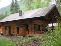
On our first day we wanted to assess the Reynold's Creek Fire along the shores of St. Mary's Lake. This fire shut down the east side of the park for a couple weeks last August. Before we got the trailhead we had seen a bull moose trot along the road then we saw this grizzly just east of Rising Sun Motor Inn. Usually our bear sightings are quite fleeting but this one we got to enjoy for quite awhile.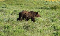
The iconic shot of Wild Goose Island.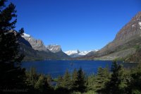
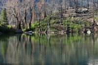
We had noticed on maps and Google Earth this lake not far off the roadway. "Lost Lake". I had never seen this lake even with it documented as being "right there!". With the fire I felt we would be able to see it and sure enough it was "right there!"
We finally got to the trailhead at Sunrift Gorge.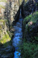
We made our way down to Baring Falls.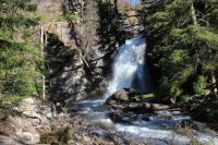
Along the shore of St. Mary's Lake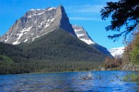
We did not find a scorched earth fire zone but one full of persevering greenery and wildflowers. Mountain views have been opened up expanding the experience ten fold.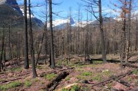
I geeked out over this moist wall. I swear these are yellow monkey flowers but I have never seen them be this small. Less than half inch across.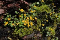
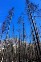
We were not able to find ground zero of the presumably man caused fire. We walked around the Reynolds Campground and it did not seem as if a fire got away from somebody there. This shot sort of documents how the fire jumped from the left side of the river to the trail side.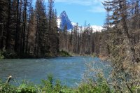
Past the fire zone we head up the Gunsight Trail. Mt. Jackson 10,052 ft. In its shadow is probably the largest complex of "Glaciers" still active in the park.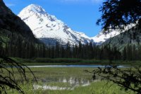
Our end goal.....Florence Falls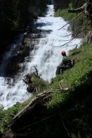
For me, the June week is all about the water and wildflowers.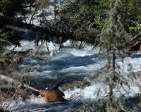
A zoom into the snow and ice fields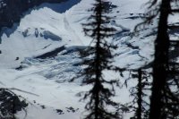
A lowly dandelion takes on a majesty!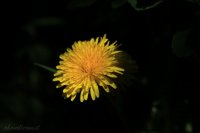
We somehow did not notice this on our way out. The left tree fell into the right tree then stacked purposefully on top of each other. No.....by the lay of the trees amongst the standing trees the fire/trail crew did not do this.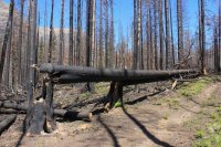
St. Mary's Falls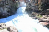
Taking one for the team Jeff stands in the drenching mist of Virginia Falls. After this shot I gave Jeff my camera so I could get close to the falls. I turned to face downstream and was met with a full rainbow that felt almost in reach spanning the creek. That is a shot seared in my brain forever.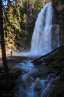
We hopped over this tree and just stared at each other. It had not been there on our way up to Virginia Falls. It had fallen down while we were there. Pretty cool!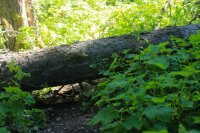
A Pileated Woodpecker. And he wasn't some fleeting glance out of the corner of our eyes. He hung around quite awhile.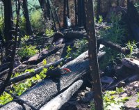
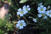
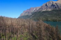
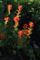
A shot down toward the lakeshore.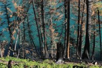
This young Beargrass simply made me laugh. It had so many stages going on at the same time.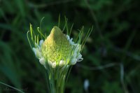
Day 1 ended up being a 16 mile day.
Day 2 took us to a region not exactly on the tourist radar. It is a two hour drive to the Lee's Ridge trailhead which is just south of the Canadian border in the northeast/Belly River section of the park. It is one of the few remaining day hikes that I need to experience. What we have read is that the price of admission is high (4 mile walk in the forest) but the payoff is worth it. If there EVER was an understatement that is it. I spent the forest hike looking for great early morning lighting.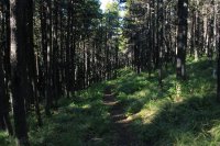
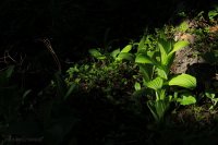
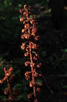
The elusive Forest Glacier Lily. I say this because they are usually found in the high country as the snow melts. But here they were in the deep dark forest.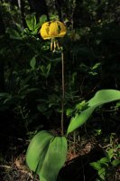
A Calypso Orchid. The only one seen all day. There is simply something grand about only seeing "one"!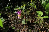
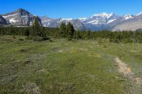
We break out of the forest on top of a 2 mile ridge. This is our first view across to the mountains to the west.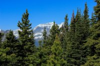
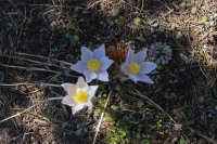
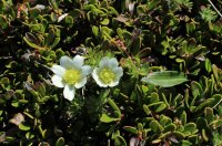
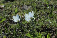
Lee's Ridge is a subalpine wonderland. Plants do not grow more than a couple inches off the ground. You might witness small areas of this stuff at a pass or along the road in Rocky Mtn. Nat'l Park at 12,000 ft. BUT I had no idea that such an expanse existed in Glacier.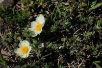
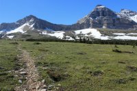
Mt. Cleveland 10,466 ft. the tallest mountain in Glacier.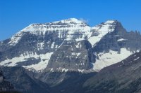
Holy crap a subalpine Columbine!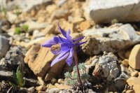
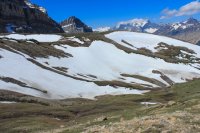
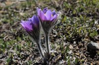
A view back across this subalpine world. There was surprisingly little wind, conditions were pristine. I could have sat all day.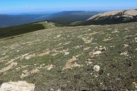
The subalpine version of the Juniper/Pinon Pine relationship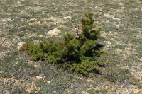
I saw these blossoms which caused me to "see" the leaves of this mat of a bush. I shouted to Jeff. I think this thing is related to the Manzanita bush. Sure enough Kinnikinnick is in the same genus.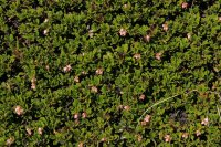
We are giants in this world. The combination of miniature and Grand is awe inspiring.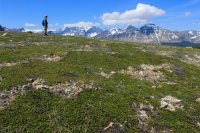
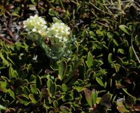
Chief Mountain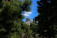
Keeping the momentum going, Day 3 lead us to the Mt. Brown Lookout. I have avoided this hike since 1985. It is one of those 1,000 ft in 1 mile hikes. (4,200 total gain). The first time I did it in 1985 it took me 3.5 hours to do the final 3.5 mile stretch. I did it two months later in 2.5 hours and felt positively manly...ha. It took Jeff and I three hours and I was very proud of us desert rats. Jeff was amused by my mantra..."maintain discipline". I wanted to get to the top feeling physically good and we were!
But first.........how many times have I driven along Lake McDonald???? The reflections can still suck the wind out of me.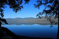
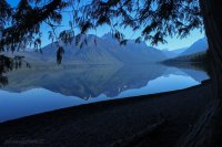
Finally on the trail. Looking across to the mountains of the Great Bear Wilderness.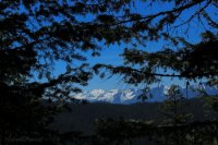
Mt. Edwards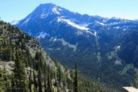
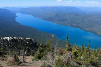
Views from the lookout.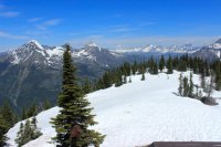
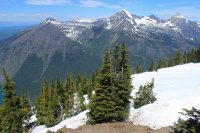
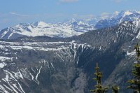
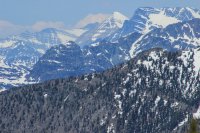
Mt. Cleveland (10,466) in the far back, 20 miles away left. Mt. Merritt (10,,004) 16 miles way on the right.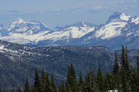
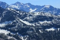
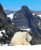
On the ridgeline below the lookout we had two cooperative Mountain Goats. I had what I felt was a very positive communication. I went around this tree to get a different angle and my eyes met her eyes. I retraced my steps and she (and I) noticeably relaxed.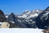
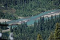
A view up McDonald Creek. And a look down into the area formerly known as Moose Country.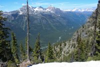
Day 4 was a chill of a day. A month ago Scott had asked "why haven't you gone to Stanton Lake?" So we went to Stanton Lake. The trailhead is 6 miles south of our cabin and it is a two mile hike west into the Great Bear Wilderness.
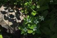
Beargrass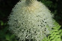
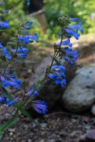
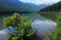
Stanton Lake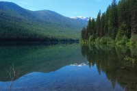
We got to the head of Stanton Lake and it was @Jeffrey Chandler turn to geek out. A reflecting Mt. Stimson (10,142 ft.) Accessing this mountain is probably a 3 day backpack due to the Middle Fork of the Flathead River. Its face is one of the grandest in the park. It can be seen only along a hundred foot section of HWY 2. Last August, during this brief window, we saw it all aglow with sunset light. And here Jeff was seeing a reflection of the 12 mile away remote, huge mountain. I will definitely try to get evening light on this shot in the future.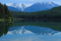
The leading ridge of Great Northern Mountain.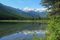
On day 1 while driving HWY 2 I went "hey!" In all these years I hadn't noticed that I could get a photo of Mt. St. Nicholas AND the Middle Fork of the Flathead.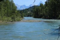
A frequent lunch spot at the foot of Lake McDonald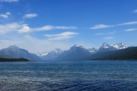
On day 5 I finally succeeded in getting one of my boys farther up the Swiftcurrent Valley in the Many Glaciers area. As a hike it is flat as a parking lot so it didn't have much pazzazz to them. They would laugh at me at suggesting hiking to Swiftcurrent Pass from the east. Lakes string together like pearls in this valley. I may as well have been asking them to use the stairs to get to the top of the Empire State Building. Jeff spent most of the day pointing out Mt. Wilbur climbing access routes with me....sheesh. My hopes were that all the lakes would be reflecting.
Fishercap Lake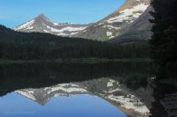
Red Rock Lake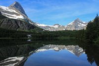
Red Rock Falls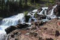
Just above Red Rock was this small falls. It brought audible oohs and aahs from both of us.. We hit it at just the right water level, and water flow. It is so transparent. If there had been fish above the falls we would have seen them.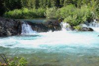
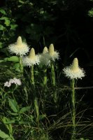
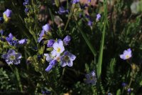
Bullhead Lake. My stated goal for the day. But I just kept on going. I quickly reassured Jeff that I had no desire to walk to the snow in the pass. I just wanted to get to the headwall. He said "I wondered why we got such an early start this morning". He should know me by now. Just because we leave before sunrise doesn't mean we will get back by mid afternoon.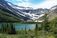
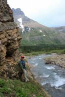
When we reached this spot we had already made a couple sporting stream crossing. We would need to remove footwear to go farther,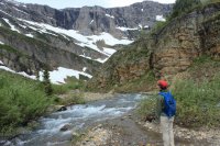 then assumed there would be more crossings ahead. BUT I wanted to get around the corner. Studying the right bank I turned to Jeff and saw that he was already off scouting a way over to the right bank. So I just followed him.
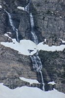
A few of the dozens of waterfalls coming from Swiftcurrent Glacier and snowfields above.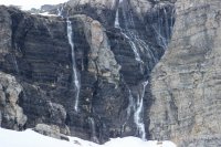
We hiked to the first switchback, took this shot back toward Bullhead Lake and headed back.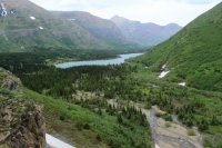
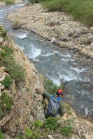
Bullhead Lake almost giving up a reflection.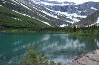
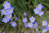
Our last day (6) usually turns into a quiet day as we probably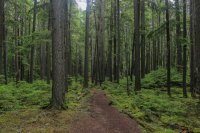 have 50 miles in already. My standby is the McDonald Creek Valley. I love that water and the green matted forest.
@Jeffrey Chandler and @chandlerwest at the brink of a waterfall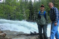
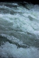
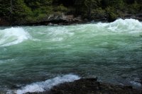
The power of this "creek" in June is beyond my words.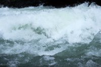
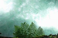
Then we made our way to Avalanche Gorge/Creek. I leaned over and saw this fern shot and almost giggled.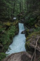
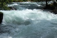
Bear Paw Falls very near to our cabin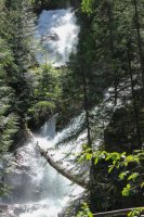
We ended up with 52 miles hiked for the week. We take off to do it all over again in 5 weeks. Jeff has some ambitious plans!!!
Here is a picture of our cabin. I wanted to be clear that this a wilderness experience BUT we sure have a sweet base camp to come back to and eat frozen pizza's, tator tots, ice cream and drink Henry Weinhard's Cream Soda's.

On our first day we wanted to assess the Reynold's Creek Fire along the shores of St. Mary's Lake. This fire shut down the east side of the park for a couple weeks last August. Before we got the trailhead we had seen a bull moose trot along the road then we saw this grizzly just east of Rising Sun Motor Inn. Usually our bear sightings are quite fleeting but this one we got to enjoy for quite awhile.

The iconic shot of Wild Goose Island.

We had noticed on maps and Google Earth this lake not far off the roadway. "Lost Lake". I had never seen this lake even with it documented as being "right there!". With the fire I felt we would be able to see it and sure enough it was "right there!"

We finally got to the trailhead at Sunrift Gorge.

We made our way down to Baring Falls.

Along the shore of St. Mary's Lake

We did not find a scorched earth fire zone but one full of persevering greenery and wildflowers. Mountain views have been opened up expanding the experience ten fold.

I geeked out over this moist wall. I swear these are yellow monkey flowers but I have never seen them be this small. Less than half inch across.


We were not able to find ground zero of the presumably man caused fire. We walked around the Reynolds Campground and it did not seem as if a fire got away from somebody there. This shot sort of documents how the fire jumped from the left side of the river to the trail side.

Past the fire zone we head up the Gunsight Trail. Mt. Jackson 10,052 ft. In its shadow is probably the largest complex of "Glaciers" still active in the park.

Our end goal.....Florence Falls

For me, the June week is all about the water and wildflowers.

A zoom into the snow and ice fields

A lowly dandelion takes on a majesty!

We somehow did not notice this on our way out. The left tree fell into the right tree then stacked purposefully on top of each other. No.....by the lay of the trees amongst the standing trees the fire/trail crew did not do this.

St. Mary's Falls

Taking one for the team Jeff stands in the drenching mist of Virginia Falls. After this shot I gave Jeff my camera so I could get close to the falls. I turned to face downstream and was met with a full rainbow that felt almost in reach spanning the creek. That is a shot seared in my brain forever.

We hopped over this tree and just stared at each other. It had not been there on our way up to Virginia Falls. It had fallen down while we were there. Pretty cool!

A Pileated Woodpecker. And he wasn't some fleeting glance out of the corner of our eyes. He hung around quite awhile.


A shot down toward the lakeshore.

This young Beargrass simply made me laugh. It had so many stages going on at the same time.

Day 1 ended up being a 16 mile day.
Day 2 took us to a region not exactly on the tourist radar. It is a two hour drive to the Lee's Ridge trailhead which is just south of the Canadian border in the northeast/Belly River section of the park. It is one of the few remaining day hikes that I need to experience. What we have read is that the price of admission is high (4 mile walk in the forest) but the payoff is worth it. If there EVER was an understatement that is it. I spent the forest hike looking for great early morning lighting.


The elusive Forest Glacier Lily. I say this because they are usually found in the high country as the snow melts. But here they were in the deep dark forest.

A Calypso Orchid. The only one seen all day. There is simply something grand about only seeing "one"!

We break out of the forest on top of a 2 mile ridge. This is our first view across to the mountains to the west.

Lee's Ridge is a subalpine wonderland. Plants do not grow more than a couple inches off the ground. You might witness small areas of this stuff at a pass or along the road in Rocky Mtn. Nat'l Park at 12,000 ft. BUT I had no idea that such an expanse existed in Glacier.


Mt. Cleveland 10,466 ft. the tallest mountain in Glacier.

Holy crap a subalpine Columbine!


A view back across this subalpine world. There was surprisingly little wind, conditions were pristine. I could have sat all day.

The subalpine version of the Juniper/Pinon Pine relationship

I saw these blossoms which caused me to "see" the leaves of this mat of a bush. I shouted to Jeff. I think this thing is related to the Manzanita bush. Sure enough Kinnikinnick is in the same genus.

We are giants in this world. The combination of miniature and Grand is awe inspiring.


Chief Mountain

Keeping the momentum going, Day 3 lead us to the Mt. Brown Lookout. I have avoided this hike since 1985. It is one of those 1,000 ft in 1 mile hikes. (4,200 total gain). The first time I did it in 1985 it took me 3.5 hours to do the final 3.5 mile stretch. I did it two months later in 2.5 hours and felt positively manly...ha. It took Jeff and I three hours and I was very proud of us desert rats. Jeff was amused by my mantra..."maintain discipline". I wanted to get to the top feeling physically good and we were!
But first.........how many times have I driven along Lake McDonald???? The reflections can still suck the wind out of me.


Finally on the trail. Looking across to the mountains of the Great Bear Wilderness.

Mt. Edwards

Views from the lookout.


Mt. Cleveland (10,466) in the far back, 20 miles away left. Mt. Merritt (10,,004) 16 miles way on the right.


On the ridgeline below the lookout we had two cooperative Mountain Goats. I had what I felt was a very positive communication. I went around this tree to get a different angle and my eyes met her eyes. I retraced my steps and she (and I) noticeably relaxed.


A view up McDonald Creek. And a look down into the area formerly known as Moose Country.


Day 4 was a chill of a day. A month ago Scott had asked "why haven't you gone to Stanton Lake?" So we went to Stanton Lake. The trailhead is 6 miles south of our cabin and it is a two mile hike west into the Great Bear Wilderness.
Beargrass


Stanton Lake

We got to the head of Stanton Lake and it was @Jeffrey Chandler turn to geek out. A reflecting Mt. Stimson (10,142 ft.) Accessing this mountain is probably a 3 day backpack due to the Middle Fork of the Flathead River. Its face is one of the grandest in the park. It can be seen only along a hundred foot section of HWY 2. Last August, during this brief window, we saw it all aglow with sunset light. And here Jeff was seeing a reflection of the 12 mile away remote, huge mountain. I will definitely try to get evening light on this shot in the future.


The leading ridge of Great Northern Mountain.


On day 1 while driving HWY 2 I went "hey!" In all these years I hadn't noticed that I could get a photo of Mt. St. Nicholas AND the Middle Fork of the Flathead.

A frequent lunch spot at the foot of Lake McDonald

On day 5 I finally succeeded in getting one of my boys farther up the Swiftcurrent Valley in the Many Glaciers area. As a hike it is flat as a parking lot so it didn't have much pazzazz to them. They would laugh at me at suggesting hiking to Swiftcurrent Pass from the east. Lakes string together like pearls in this valley. I may as well have been asking them to use the stairs to get to the top of the Empire State Building. Jeff spent most of the day pointing out Mt. Wilbur climbing access routes with me....sheesh. My hopes were that all the lakes would be reflecting.
Fishercap Lake

Red Rock Lake

Red Rock Falls

Just above Red Rock was this small falls. It brought audible oohs and aahs from both of us.. We hit it at just the right water level, and water flow. It is so transparent. If there had been fish above the falls we would have seen them.


Bullhead Lake. My stated goal for the day. But I just kept on going. I quickly reassured Jeff that I had no desire to walk to the snow in the pass. I just wanted to get to the headwall. He said "I wondered why we got such an early start this morning". He should know me by now. Just because we leave before sunrise doesn't mean we will get back by mid afternoon.

When we reached this spot we had already made a couple sporting stream crossing. We would need to remove footwear to go farther,
 then assumed there would be more crossings ahead. BUT I wanted to get around the corner. Studying the right bank I turned to Jeff and saw that he was already off scouting a way over to the right bank. So I just followed him.
A few of the dozens of waterfalls coming from Swiftcurrent Glacier and snowfields above.

We hiked to the first switchback, took this shot back toward Bullhead Lake and headed back.


Bullhead Lake almost giving up a reflection.


Our last day (6) usually turns into a quiet day as we probably
 have 50 miles in already. My standby is the McDonald Creek Valley. I love that water and the green matted forest.
@Jeffrey Chandler and @chandlerwest at the brink of a waterfall


The power of this "creek" in June is beyond my words.


Then we made our way to Avalanche Gorge/Creek. I leaned over and saw this fern shot and almost giggled.


Bear Paw Falls very near to our cabin

We ended up with 52 miles hiked for the week. We take off to do it all over again in 5 weeks. Jeff has some ambitious plans!!!
