Curt
Member
- Joined
- Feb 1, 2014
- Messages
- 426
My wife thought we should do something special for our 30th anniversary and that special thing would be to go to Alaska. I grew up in the desert and have never been all that interested in Alaska cause I thought it was just a cold wet place. But I've had a number of friends who went there and came back raving about what a great place it was. So I said, "Sure, let's go to Alaska" and she signed us up for a tour. One of the places on the tour was Glacier Bay. I have friends who've been there on cruises and said it was beautiful, but nothing I heard prepared me for how really wonderful it is. I hesitated to post this because I also went there on a cruise ship, and I thought it would be a little like reporting on seeing Rocky Mountain National Park from the seat of an RV. But the fact is, the only way to get to Glacier Bay is by airplane or ship. It is truly remote and I thought that in the end it does fit the category of backcountry even if you're visiting it by cruise ship.
I hope all of you get a chance to visit this wonderful place and, unlike me, that you can work out a way to do some kayaking or backpacking while you're there.

The picture below is looking up the Tarr Inlet.
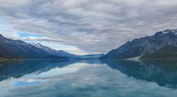
Margerie Glacier is the icy white appendage just to the right of center in the picture below. Immediately to the right of that is a brown horizontal bar which is the Grand Pacific Glacier. In 1780 a vast ice field protruded a couple miles out into Icy Strait south of what is currently Glacier Bay. By 1794 it had retreated about 7 miles north into the Sitakaday Narrows. And by 1900 the glacier ice field had retreated more than 60 miles north to about the current location of the various glaciers ending at Glacier Bay. The Grand Pacific Glacier is believed to be the principle glacier that had filled Glacier Bay prior to 1780.

Margerie Glacier

Mt. Cooper (6780 ft above sea level) The glacier at the base of the mountain on the left is the Lamplugh Glacier. The mountains to the west get bigger . The tallest is Mt Fairweather at 15300 ft above sea level.
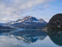
Lamplugh Galcier.
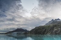
The cruise ship in the picture above gives some scale to the enormous, bigger-than-life size of everything in this place. The picture below was taken from a distance of about 1/2mile. there is a group of 5 kayaks in the water in front of the glacier which will not be visible due to the small size of this picture. But even in a much bigger picture they're barely visible. For a better view see https://www.flickr.com/photos/95721076@N04/15094593540/in/photostream/

Johns Hopkins Inlet. Johns Hopkins Glacier is visible in the distance at the center of the picture.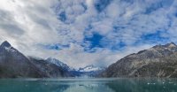
Reid Inlet and Reid Glacier are in the center of the picture
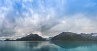
Leaving Glacier Bay

Many of the pictures are better viewed at a larger size. They can be seen on Flickr at https://www.flickr.com/photos/95721076@N04/sets/72157647769660016/
Featured image for home page:
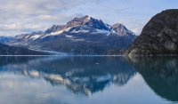
I hope all of you get a chance to visit this wonderful place and, unlike me, that you can work out a way to do some kayaking or backpacking while you're there.

The picture below is looking up the Tarr Inlet.

Margerie Glacier is the icy white appendage just to the right of center in the picture below. Immediately to the right of that is a brown horizontal bar which is the Grand Pacific Glacier. In 1780 a vast ice field protruded a couple miles out into Icy Strait south of what is currently Glacier Bay. By 1794 it had retreated about 7 miles north into the Sitakaday Narrows. And by 1900 the glacier ice field had retreated more than 60 miles north to about the current location of the various glaciers ending at Glacier Bay. The Grand Pacific Glacier is believed to be the principle glacier that had filled Glacier Bay prior to 1780.

Margerie Glacier

Mt. Cooper (6780 ft above sea level) The glacier at the base of the mountain on the left is the Lamplugh Glacier. The mountains to the west get bigger . The tallest is Mt Fairweather at 15300 ft above sea level.

Lamplugh Galcier.

The cruise ship in the picture above gives some scale to the enormous, bigger-than-life size of everything in this place. The picture below was taken from a distance of about 1/2mile. there is a group of 5 kayaks in the water in front of the glacier which will not be visible due to the small size of this picture. But even in a much bigger picture they're barely visible. For a better view see https://www.flickr.com/photos/95721076@N04/15094593540/in/photostream/
Johns Hopkins Inlet. Johns Hopkins Glacier is visible in the distance at the center of the picture.

Reid Inlet and Reid Glacier are in the center of the picture

Leaving Glacier Bay

Many of the pictures are better viewed at a larger size. They can be seen on Flickr at https://www.flickr.com/photos/95721076@N04/sets/72157647769660016/
Featured image for home page:

