Udink
Still right here.
- Joined
- Jan 17, 2012
- Messages
- 1,748
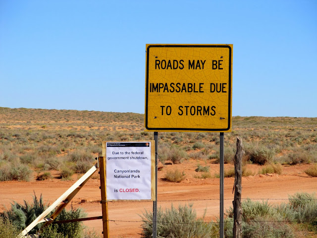
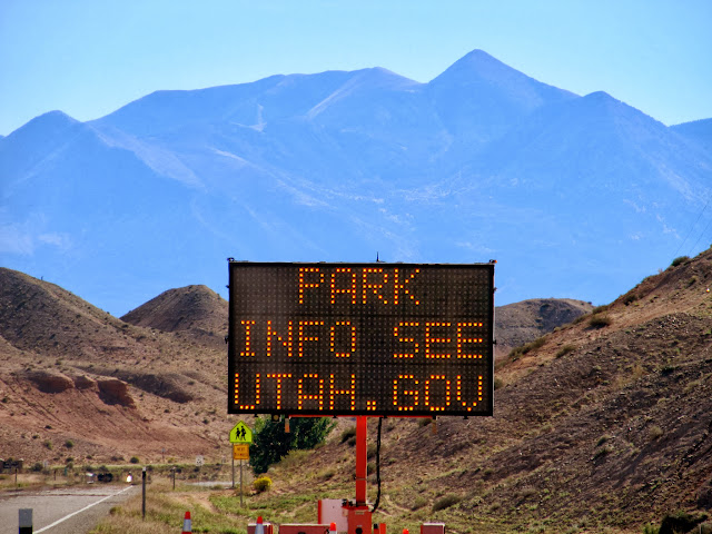
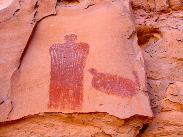
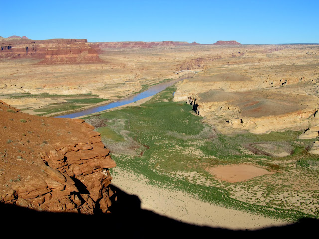
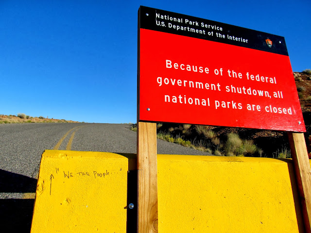
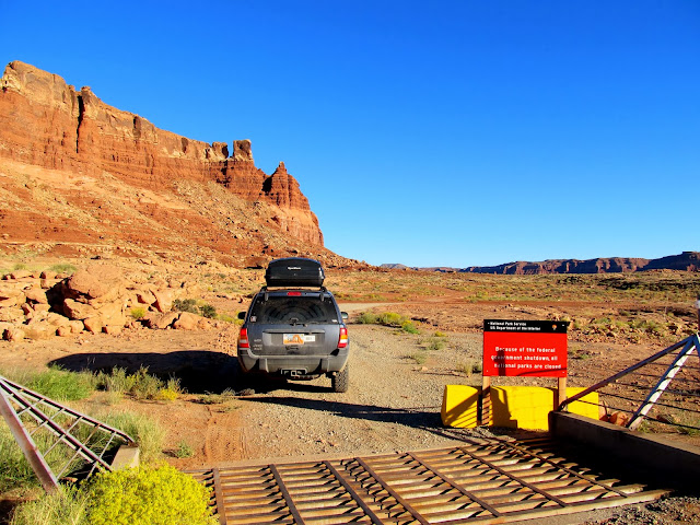
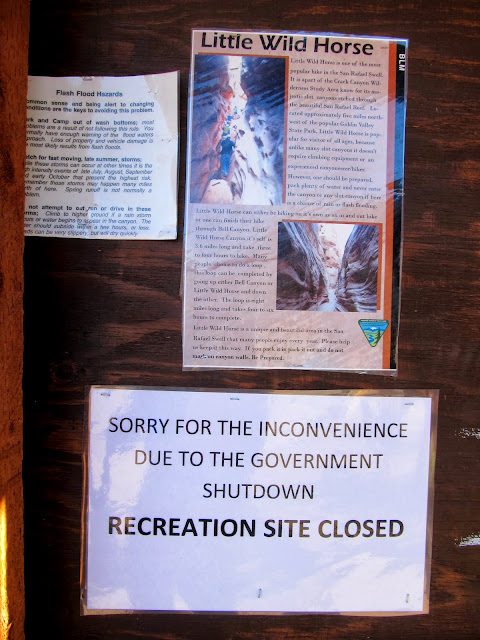
I spent last weekend at home with the kids while Traci was out of town, but I had Monday and Tuesday off work and I'd planned on exploring Clearwater and Rock canyons in Glen Canyon National Recreation Area those days. I didn't expect the U.S. government shutdown to affect my plans. Although that area is managed by the National Park Service, they don't provide any actual services there and I didn't see how the lack of a workforce could possibly prevent me from hiking and camping in the backcountry. During the drive south on Sunday afternoon I stopped briefly to see the Moqui Queen pictograph in North Wash. When I arrived at the Hite overlook and found the road partially barricaded, I began to worry. Closing off areas that are normally staffed by NPS personnel makes sense during a shutdown, but closing unmanned overlooks is total bull. I encountered a similar barricade on the dirt road to my destination between Hite and the Flint Trail. I spent a few minutes there thinking about whether to press on and eventually decided to scrap my plans. My primary concern wasn't being in a "closed" area, but being caught with my dogs in the Orange Cliffs area of GCNRA (which boundary is not made very clear to the general public), and being in a "closed" area would increase the odds of an encounter with a park ranger.
Turnoff from UT-24 to Hans Flat
UT-24 just north of Hanksville
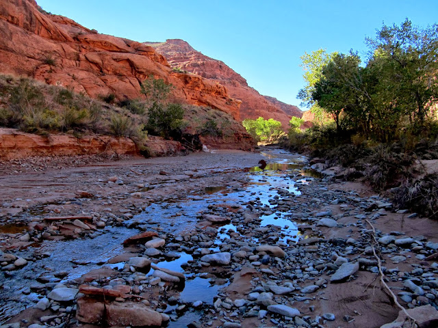
North Wash
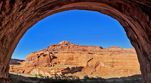
Moqui Queen pictograph
Moqui Queen alcove
View upstream from the Hite Overlook
We the people...
The road from near Hite that leads to the Flint Trail
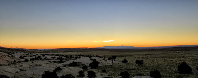
I drove back to the north and fell back on the good ol' San Rafael Reef. I camped at a familiar spot at the junction of the Temple Mountain and Goblin Valley roads. I slept very comfortably in the back of the Jeep, falling asleep somewhat early after spending the evening reading a book about the town of White Canyon in Glen Canyon. Sunset that evening was brilliant despite the clear sky, as was sunrise the following morning.
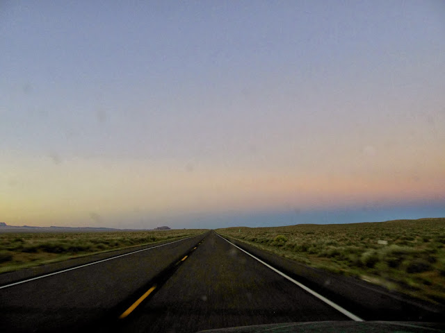
Driving north on UT-24
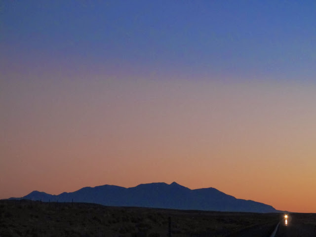
Henry Mountains at twilight
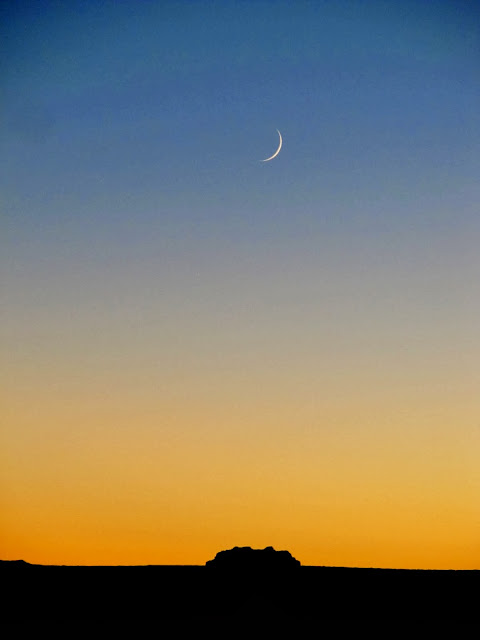
Crescent moon above Wild Horse Butte
Sunrise on the Henrys
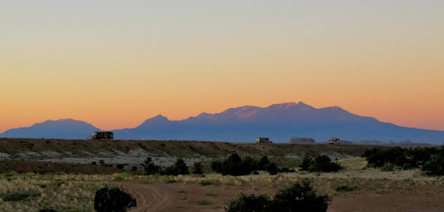
View toward the distant La Sals
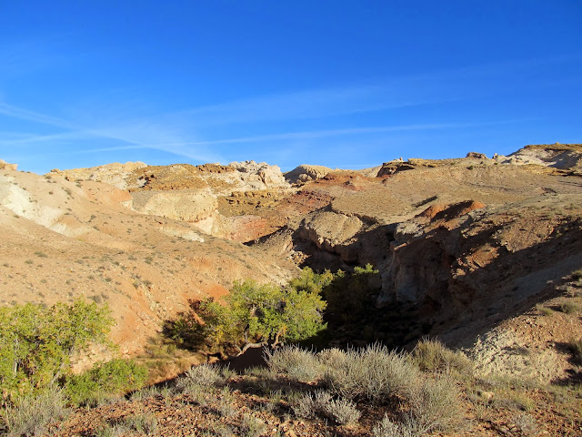
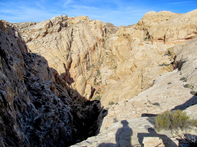
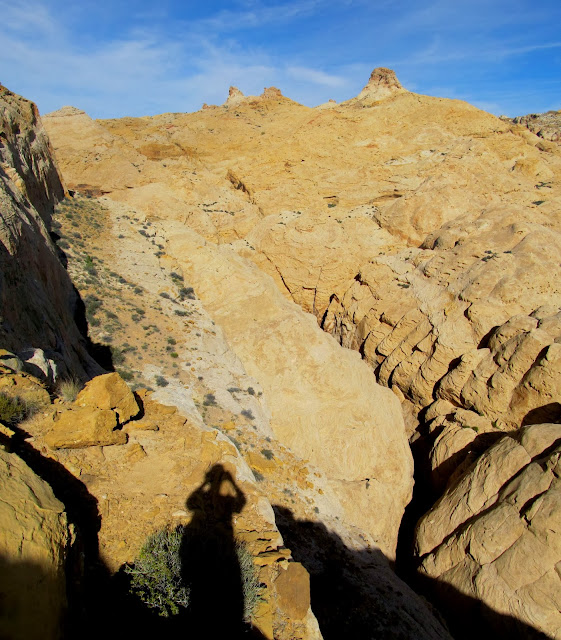
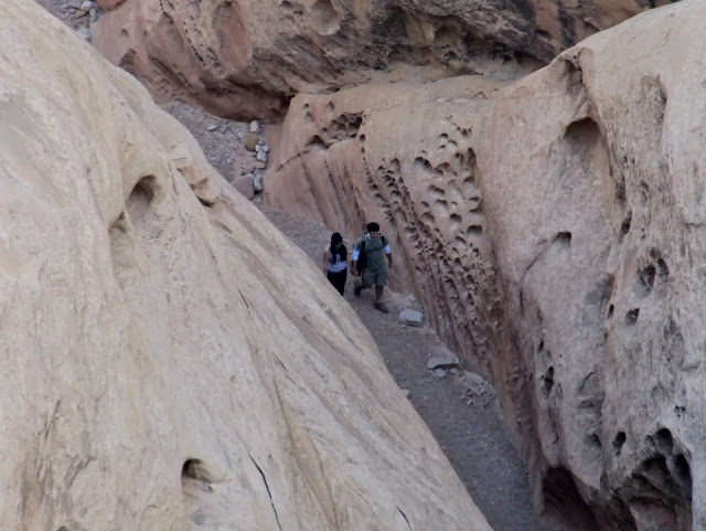
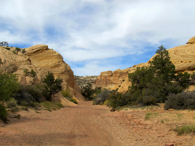
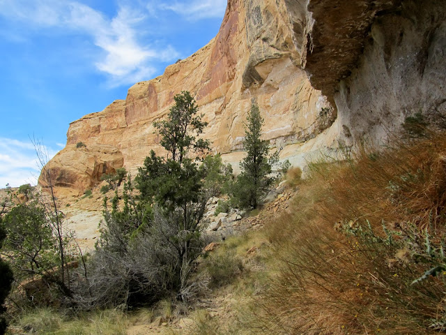
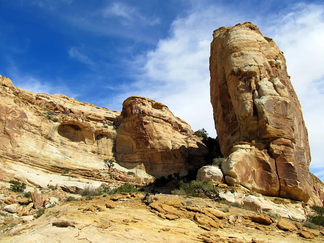
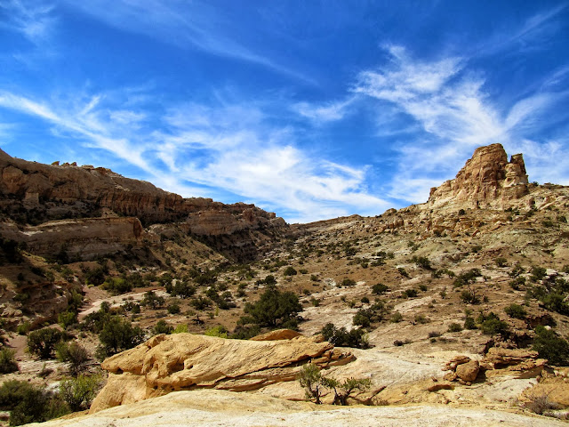
After breakfast on Monday morning I drove a short distance to the Little Wild Horse Canyon trailhead where I was the third vehicle in the parking lot. More people arrived as I was getting myself and the dogs ready for a hike. My plan was to hike up the San Rafael Reef just to the north of Little Wild Horse to a spot overlooking a sharp bend in the canyon. I hadn't done the usual planning and didn't have any waypoints in my GPS to help me get to the top of the Reef, but I'd studied the route in Google Earth enough that I was confident I could make my way up without issue. I was expecting a well-defined drainage leading up the Reef but what I found was a series of smaller drainages that all led in the general direction I wanted to go. A little more than an hour after I started hiking I reached the spot overlooking the canyon that I'd hoped to reach. I rested there, then hiked along the rim for a while as I watched for hikers in the canyon below. I hiked back to the trailhead and reached the Jeep before noon, then drove back to the previous night's camp spot to eat lunch.
Sign at the Little Wild Horse Canyon trailhead
Beginning to climb out of Little Wild Horse Canyon
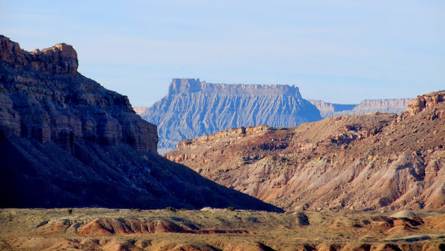
Factory Butte
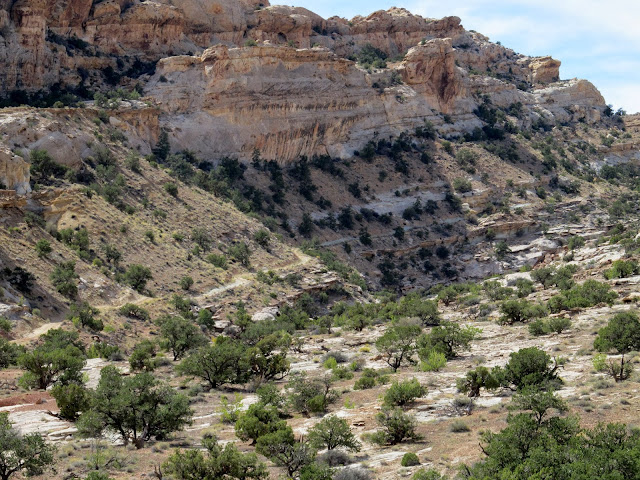
Top of the Reef above Little Wild Horse Canyon
Little Wild Horse Canyon trailhead
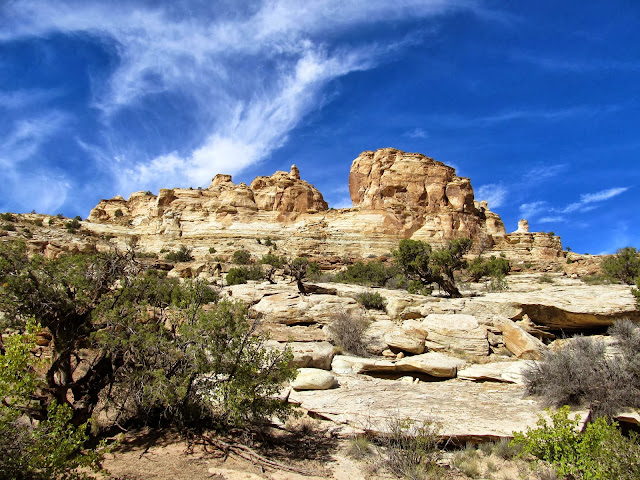
Formations above Little Wild Horse Canyon
Navajo Sandstone
Torrey and Boulder
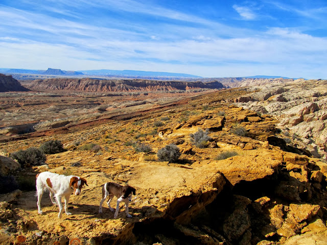
Above Little Wild Horse Canyon
Hikers in Little Wild Horse Canyon
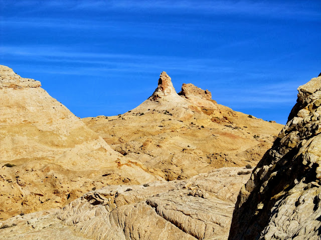
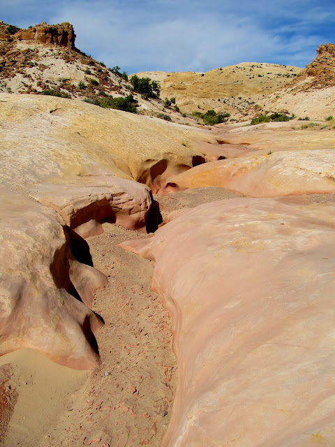
That afternoon I hiked Temple Wash. One can drive through North Temple Wash and South Temple Wash, but the main fork of Temple Wash is closed to motor vehicles and I had never been there before. Although the route through the canyon doesn't appear on the BLM's travel plan, it was clear that many people drive through it anyway. An old mining road runs along the bottom of the canyon for a distance before climbing out and paralleling the canyon bottom as it climbs up the San Rafael Reef toward Temple Mountain. I hiked for over an hour but the canyon wasn't holding my attention very well. I turned back without completing the hike through the canyon to the other side of the Reef. I was bored with this area and kicking myself for not having a good backup plan. I returned home a day early, out of ideas and without the necessary tools in the field to plan for the following day. Had I simply stayed another night I'm sure I would have come up with something worthwhile to do on Tuesday, but at the time I was glad to be heading home and looking forward to a cold beverage when I got there.
Temple Wash
Temple Wash
A seep in Temple Wash
Towering buttes above Temple Wash
Temple Wash
Old road climbing out of Temple Wash
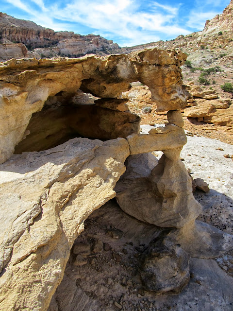
Delicate formation
View of cliffs above Temple Wash from where I turned around
Full photo gallery:
https://picasaweb.google.com/Dennis.Udink/GCNRAAboveLWHCTempleWash
[parsehtml]<iframe width="640" height="480" frameborder="0" scrolling="no" marginheight="0" marginwidth="0" src="https://maps.google.com/maps?f=q&source=s_q&hl=en&geocode=&q=http:%2F%2Fudink.org%2Fgeo%2FGCNRAAboveLWHCTempleWash.kmz&aq=&sll=39.60063,-110.806334&sspn=0.076582,0.169086&t=h&ie=UTF8&ll=38.274845,-110.591125&spn=1.034971,1.755066&z=9&output=embed"></iframe><br /><small><a href="https://maps.google.com/maps?f=q&source=embed&hl=en&geocode=&q=http:%2F%2Fudink.org%2Fgeo%2FGCNRAAboveLWHCTempleWash.kmz&aq=&sll=39.60063,-110.806334&sspn=0.076582,0.169086&t=h&ie=UTF8&ll=38.274845,-110.591125&spn=1.034971,1.755066&z=9" style="color:#0000FF;text-align:left">View Larger Map</a></small>[/parsehtml]Featured image for home page:

Turnoff from UT-24 to Hans Flat
UT-24 just north of Hanksville
North Wash
Moqui Queen pictograph
Moqui Queen alcove
View upstream from the Hite Overlook
We the people...
The road from near Hite that leads to the Flint Trail
I drove back to the north and fell back on the good ol' San Rafael Reef. I camped at a familiar spot at the junction of the Temple Mountain and Goblin Valley roads. I slept very comfortably in the back of the Jeep, falling asleep somewhat early after spending the evening reading a book about the town of White Canyon in Glen Canyon. Sunset that evening was brilliant despite the clear sky, as was sunrise the following morning.
Driving north on UT-24
Henry Mountains at twilight
Crescent moon above Wild Horse Butte
Sunrise on the Henrys
View toward the distant La Sals
After breakfast on Monday morning I drove a short distance to the Little Wild Horse Canyon trailhead where I was the third vehicle in the parking lot. More people arrived as I was getting myself and the dogs ready for a hike. My plan was to hike up the San Rafael Reef just to the north of Little Wild Horse to a spot overlooking a sharp bend in the canyon. I hadn't done the usual planning and didn't have any waypoints in my GPS to help me get to the top of the Reef, but I'd studied the route in Google Earth enough that I was confident I could make my way up without issue. I was expecting a well-defined drainage leading up the Reef but what I found was a series of smaller drainages that all led in the general direction I wanted to go. A little more than an hour after I started hiking I reached the spot overlooking the canyon that I'd hoped to reach. I rested there, then hiked along the rim for a while as I watched for hikers in the canyon below. I hiked back to the trailhead and reached the Jeep before noon, then drove back to the previous night's camp spot to eat lunch.
Sign at the Little Wild Horse Canyon trailhead
Beginning to climb out of Little Wild Horse Canyon
Factory Butte
Top of the Reef above Little Wild Horse Canyon
Little Wild Horse Canyon trailhead
Formations above Little Wild Horse Canyon
Navajo Sandstone
Torrey and Boulder
Above Little Wild Horse Canyon
Hikers in Little Wild Horse Canyon
That afternoon I hiked Temple Wash. One can drive through North Temple Wash and South Temple Wash, but the main fork of Temple Wash is closed to motor vehicles and I had never been there before. Although the route through the canyon doesn't appear on the BLM's travel plan, it was clear that many people drive through it anyway. An old mining road runs along the bottom of the canyon for a distance before climbing out and paralleling the canyon bottom as it climbs up the San Rafael Reef toward Temple Mountain. I hiked for over an hour but the canyon wasn't holding my attention very well. I turned back without completing the hike through the canyon to the other side of the Reef. I was bored with this area and kicking myself for not having a good backup plan. I returned home a day early, out of ideas and without the necessary tools in the field to plan for the following day. Had I simply stayed another night I'm sure I would have come up with something worthwhile to do on Tuesday, but at the time I was glad to be heading home and looking forward to a cold beverage when I got there.
Temple Wash
Temple Wash
A seep in Temple Wash
Towering buttes above Temple Wash
Temple Wash
Old road climbing out of Temple Wash
Delicate formation
View of cliffs above Temple Wash from where I turned around
Full photo gallery:
https://picasaweb.google.com/Dennis.Udink/GCNRAAboveLWHCTempleWash
[parsehtml]<iframe width="640" height="480" frameborder="0" scrolling="no" marginheight="0" marginwidth="0" src="https://maps.google.com/maps?f=q&source=s_q&hl=en&geocode=&q=http:%2F%2Fudink.org%2Fgeo%2FGCNRAAboveLWHCTempleWash.kmz&aq=&sll=39.60063,-110.806334&sspn=0.076582,0.169086&t=h&ie=UTF8&ll=38.274845,-110.591125&spn=1.034971,1.755066&z=9&output=embed"></iframe><br /><small><a href="https://maps.google.com/maps?f=q&source=embed&hl=en&geocode=&q=http:%2F%2Fudink.org%2Fgeo%2FGCNRAAboveLWHCTempleWash.kmz&aq=&sll=39.60063,-110.806334&sspn=0.076582,0.169086&t=h&ie=UTF8&ll=38.274845,-110.591125&spn=1.034971,1.755066&z=9" style="color:#0000FF;text-align:left">View Larger Map</a></small>[/parsehtml]Featured image for home page:
 It's funny: when I named Torrey, I did it after poring over a map looking for a good name. When I named Boulder, however, I did so after a pair of dogs somebody had at the Grandview Trailhead in the Uintas--they had two (I think) labradoodles named Torrey and Boulder.
 . Having just got back from the swell and hiking Ding and Dang, this was great to see and get more ideas cooking up. I love those shots from on top of LWH. We saw around 40 cars at the LWH trail head on Thursday
  only 3 cars at Ding and Dang. Going on top seems a great way to avoid the crowds while still immersing yourself in the beauty.