Yvonne
I lava it!!!
- Joined
- Jan 19, 2012
- Messages
- 4,139
I'm really slow in working on my pictures due to school, but I finally found some time to write up another trip report from Yellowstone.
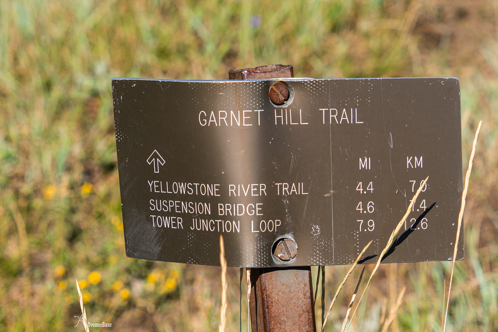
Garnet Hill is a rarely used trail in the northeastern part of Yellowstone, close to the Tower Junction, and the turn off to Lamar Valley. This hike was on my radar for quite a while, and the views seemed to be amazing from there. Because my foot was hurting a lot from my 17-mile hike the day before, I just wanted to do something easier. At this point, I did not know that my foot was broken, and I had a bit of a rough time hiking long miles. Since I had my basecamp at Madison campground, I always had to drive up north each morning, so I could do some of the hikes planned. Breakfast usually happened along the way, either at the Yellowstone picnic area nearby or at Sheapeater Cliff picnic area, which was also a fun spot to watch small critters like Pika and squirrels.
After this morning's breakfast at the Yellowstone picnic area, I parked my car at the small pullout just past Tower Junction. I was the only car here this morning.
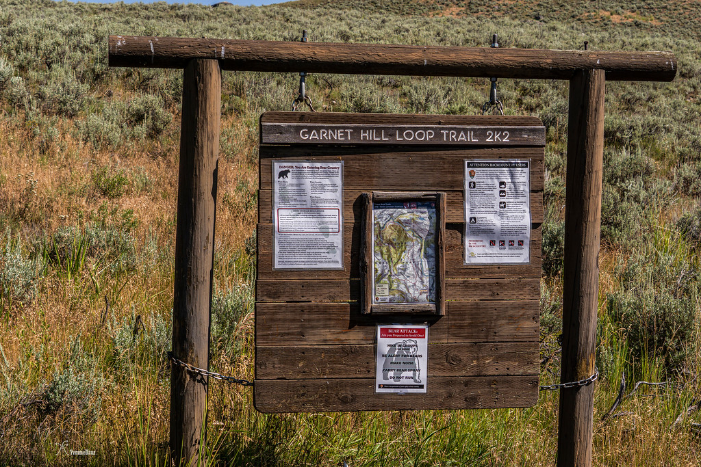
the trailhead sign provided a lot of information
Garnet Hill loop primarily loops through rolling hills and meadows of sagebrush and would have some nice views of the Yellowstone River and Buffalo Plateau to the north. So I was sort of excited to see it. The first half mile or so was shared with trail rides, so there were the typical horse droppings along the way. But the sagebrush scenery was amazing right from the beginning.
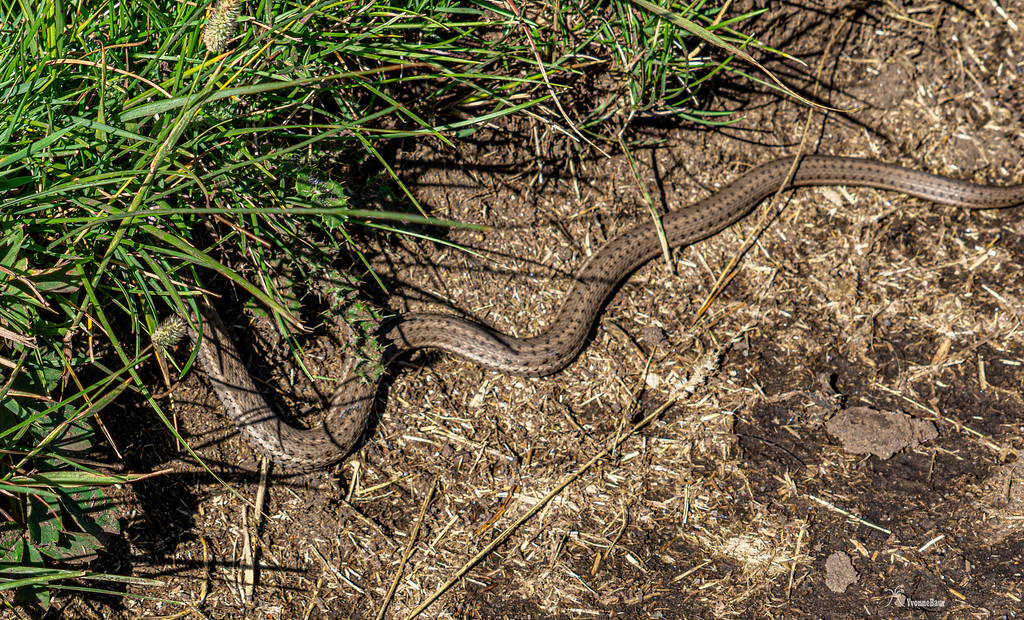
As soon as I started hiking, I saw my first snake!! And then soon after a few more, wow!! I was more than happy about it.
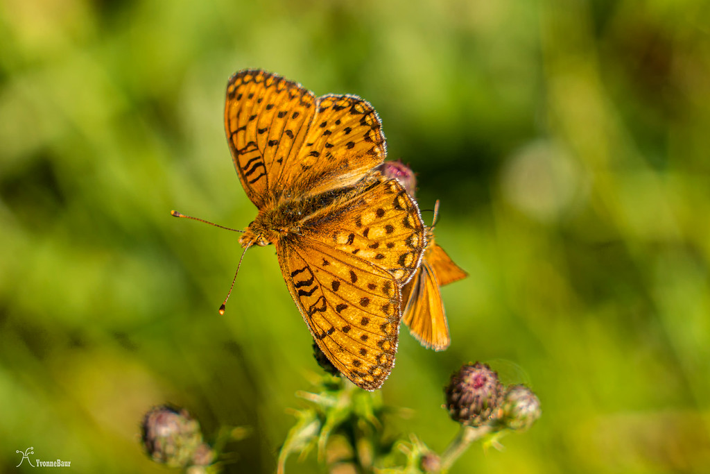
The entire area was full of wildflowers, and butterflies were out in abundance.
After I saw my 8th snake, I finally got a quick shot of the Northern Garter Snak before it disappeared into the sagebrush shrubs. I was more than happy about it.
After about half a mile, I saw some Sandhill Cranes in an open meadow. Since I'm usually a wildlife repellant, I walked really slow and quiet, so I wouldn't scare them off and had a chance to take a few shorts. I was surprised at how big they were.
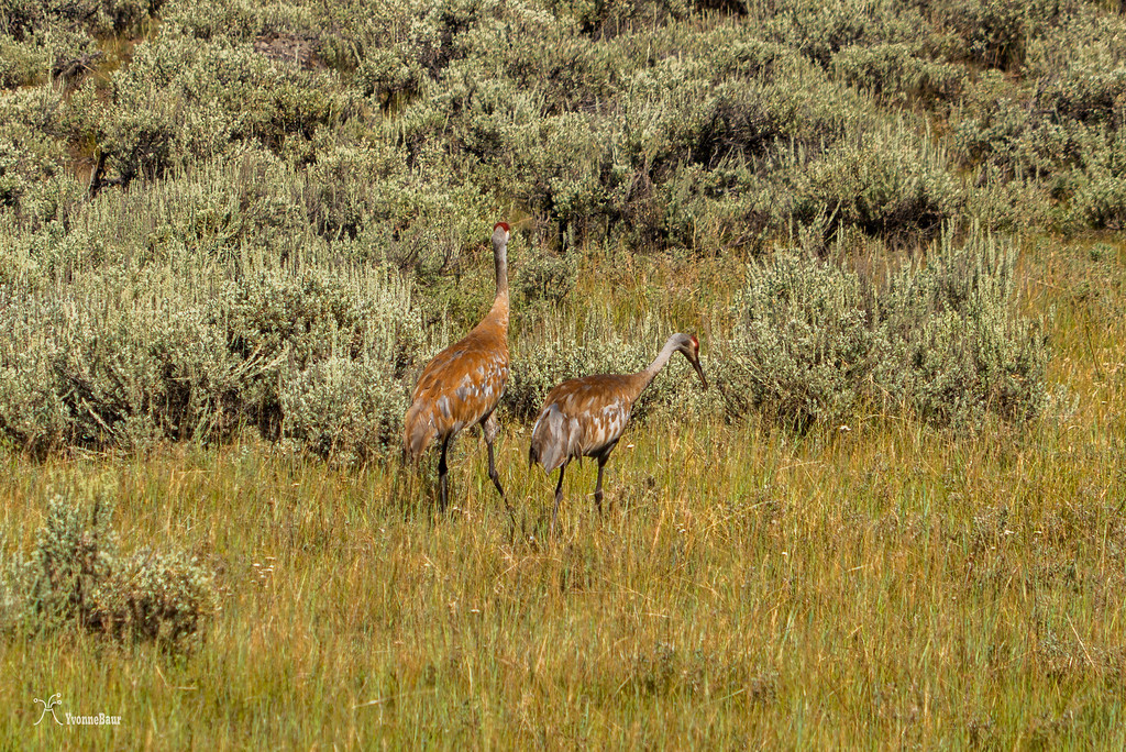
Sandhill Cranes
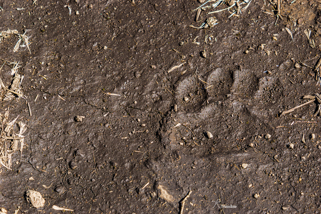
In some of the moist mud on the trail, I saw some fresh bear tracks. It had rained last night, and those tracks were very fresh. They were pretty impressive to see, and within the next half mile, I would see a lot more of it. I was definitely okay to see the tracks as long as the bear did not show up on the trail.
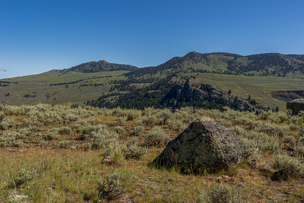
Placed all over the rolling hills were huge boulders, glacial erratics that told the past history of the area when massive glaciers covered the area.
It was pretty cool to see all these glacial remnants here in part of the Northern Range.
Glacial Erratic
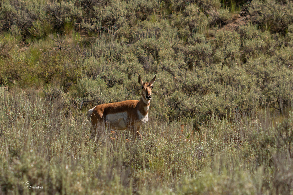
The trail dropped slightly down into a valley, and I enjoyed the views of the Buffalo Plateau to the Northwest and the ever-changing landscape. A herd of pronghorns was resting underneath a huge tree, and I got a view of one of the females and her two young ones of the year. Mama Pronghorn was very alert and watched me closely as I walked by about a quarter of a mile away.
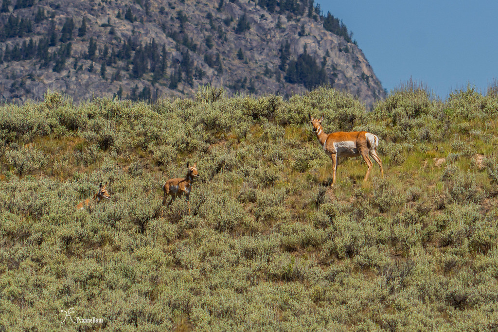
A bit later, after the trail dropped further down into a valley, I saw more pronghorns. It definitely was not a bad day with all the wildlife I've already seen today.
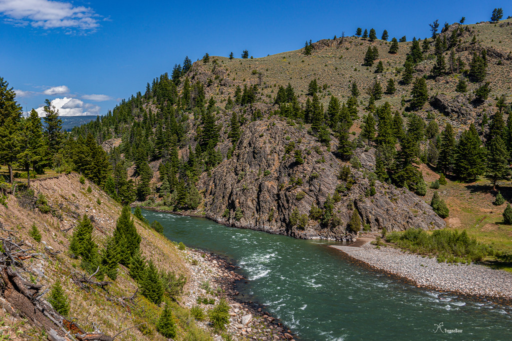
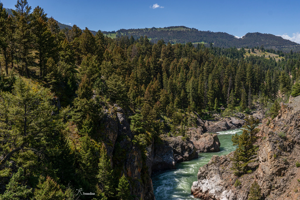
And then, after hiking for about 3 miles, the trail started to skirt the Yellowstone River, and I enjoyed the views of the river below me.
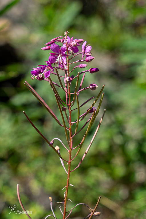
On the slopes was a lot of fireweeds, the first sign that fall was not too far away.
I enjoyed a nice lunch break high above the river and listened to the sound of the water. It was so peaceful out here, and I still haven't seen a single soul today.
Soon after, the trail climbed up to a plateau and left the river. The views stayed terrific in all directions.

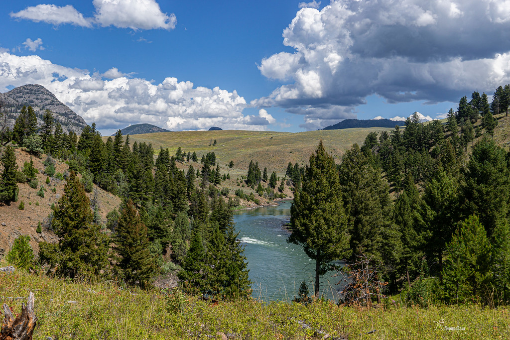
Yellowstone River and landscape to the Northwest
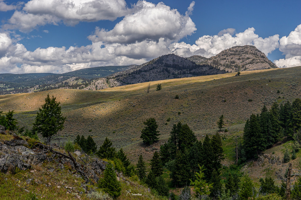
The clouds definitely made my day as well with all the interplay of shadow and light dancing on the rolling hills.
And of course, I found a lot of garnet minerals embedded in the shist along the trail. Garnet Hill was named after the minerals that can be found in abundance, I guess. It was nice to see the garnet minerals in all sizes growing out of the metamorphic shist rock samples. I love all the geology all around here.
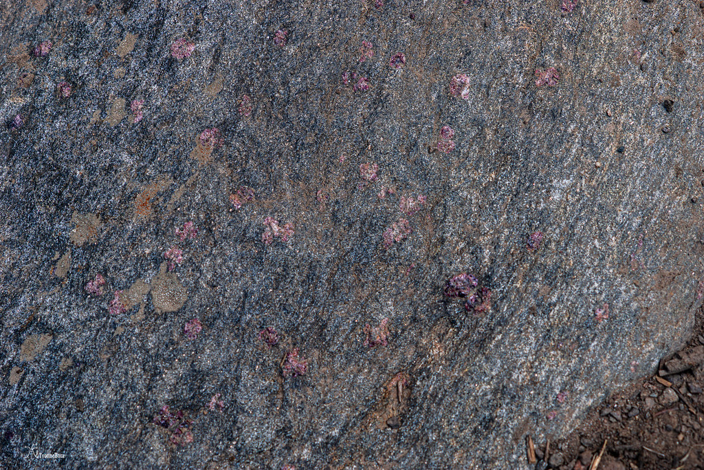
Garnet Shist
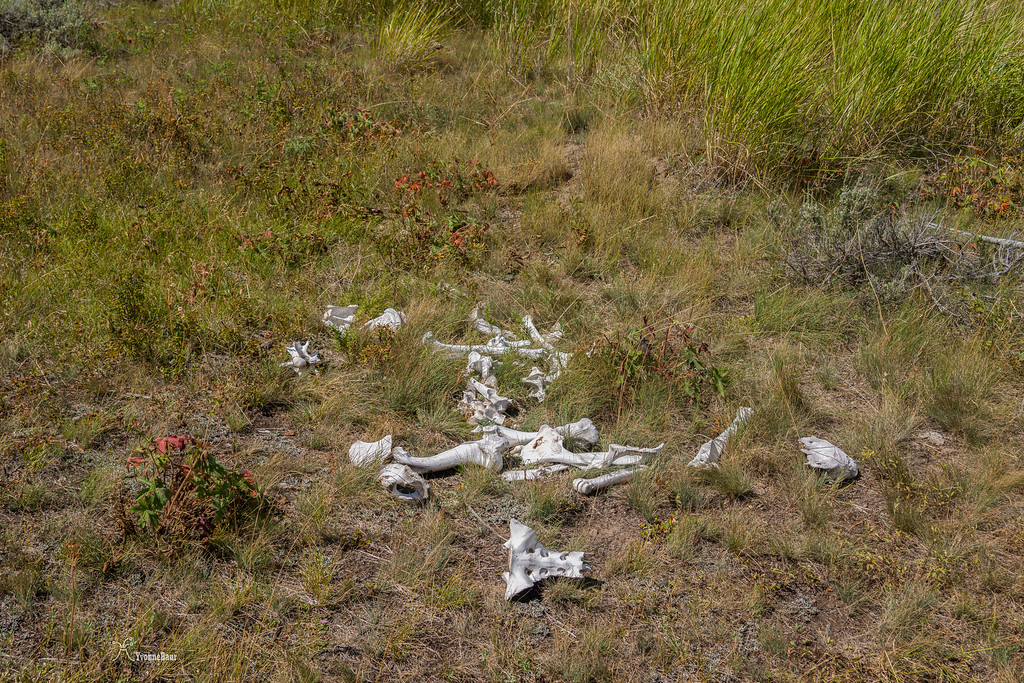
A bit later, I encountered the remnants of a carcass; it was just the bones that were left in the field. Yellowstone is definitely a tough place for animals to survive, especially during the winter.
A bit later, the trail came close to the Yellowstone River again, quiet and peaceful this time, with not many steep gradients and rapids.
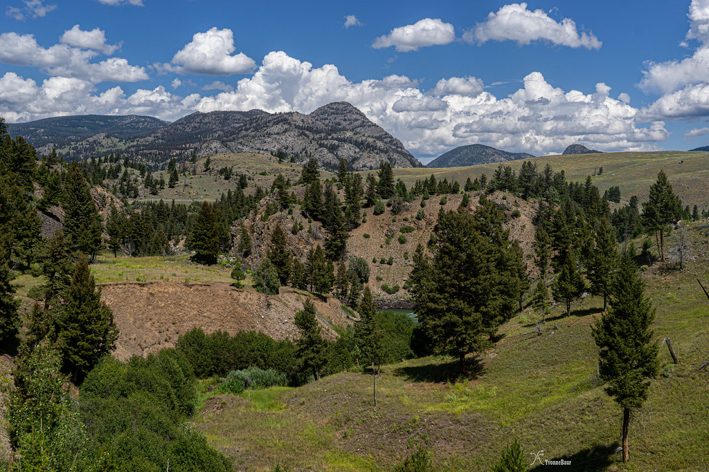
amazing scenery all over the place
Eventually, I reached the trail junction that leads to the Hellroaring trail. From here, I could take a small detour to the Suspension Bridge, which I gladly did. The bridge itself was worth to see, and the raging Hellroaring River below was pretty impressive.
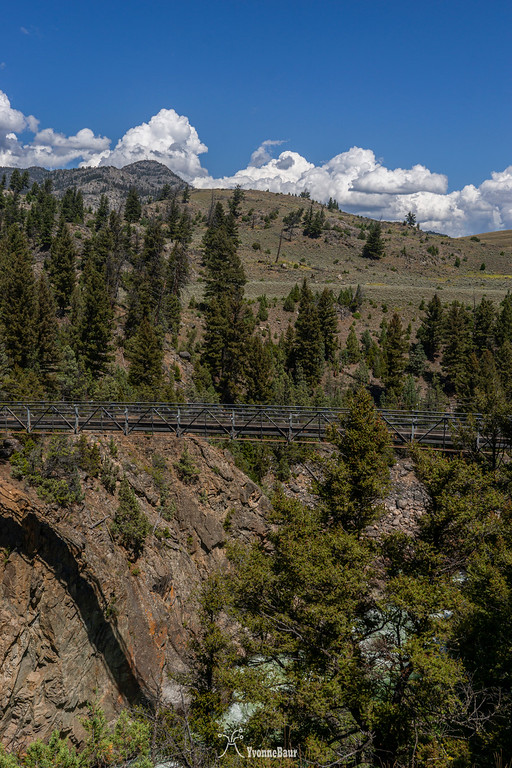
The water had carved a steep canyon by downcutting and roared and rushed through the steep and narrow canyon below me. It was quite the sight, and I took a little snack break in the shade and enjoyed the sights and sounds.
After back on the main trail, the trail went through a forest of lodgepole pines and followed Elk Creek for a while before a wide meadow opened up again. The trail went through Pleasant Valley before skirting back to the trailhead. The entire time I never saw a single soul and had it all on my own. Not too bad for a busy day during peak season in Yellowstone. I definitely enjoyed the trail a lot, and with only 580 ft of elevation gain, it was a really easy trail.
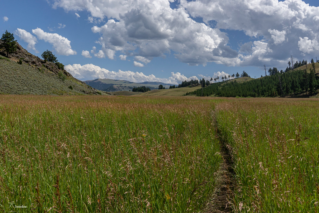
the trail through Pleasant Valley
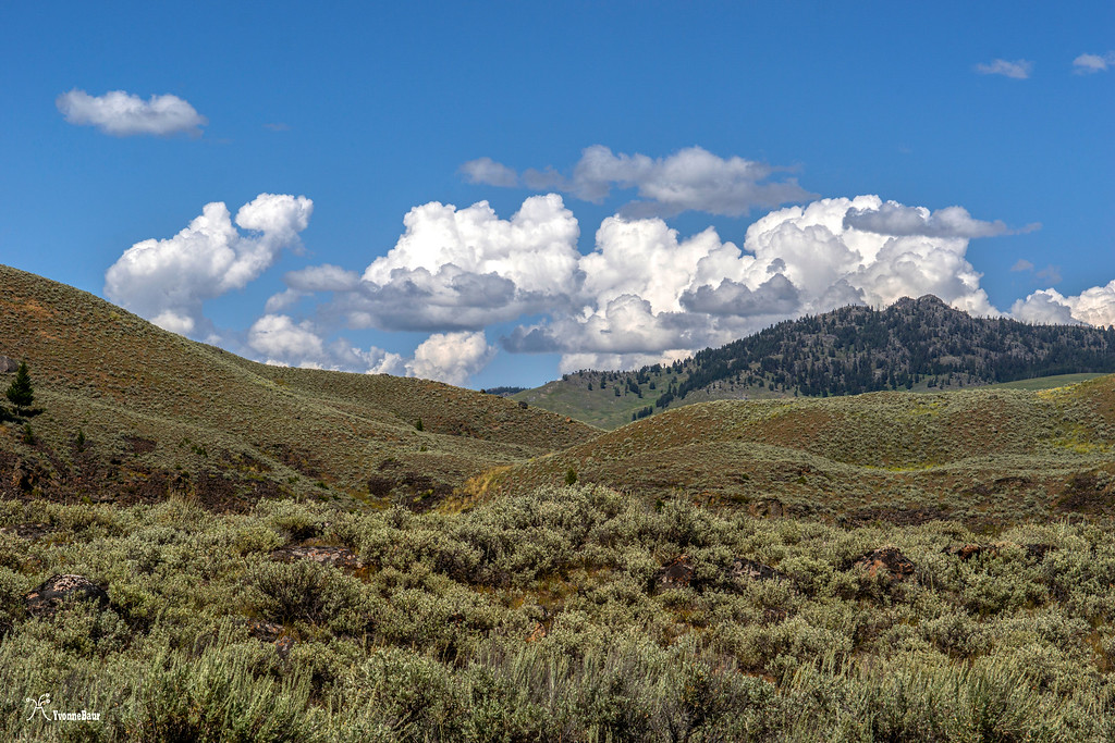
Rolling hills all the way back to the trailhead
I was pleasantly surprised by this trail and the scenery, I'm pretty sure I'll hike it again in the future.
Garnet Hill is a rarely used trail in the northeastern part of Yellowstone, close to the Tower Junction, and the turn off to Lamar Valley. This hike was on my radar for quite a while, and the views seemed to be amazing from there. Because my foot was hurting a lot from my 17-mile hike the day before, I just wanted to do something easier. At this point, I did not know that my foot was broken, and I had a bit of a rough time hiking long miles. Since I had my basecamp at Madison campground, I always had to drive up north each morning, so I could do some of the hikes planned. Breakfast usually happened along the way, either at the Yellowstone picnic area nearby or at Sheapeater Cliff picnic area, which was also a fun spot to watch small critters like Pika and squirrels.
After this morning's breakfast at the Yellowstone picnic area, I parked my car at the small pullout just past Tower Junction. I was the only car here this morning.
the trailhead sign provided a lot of information
Garnet Hill loop primarily loops through rolling hills and meadows of sagebrush and would have some nice views of the Yellowstone River and Buffalo Plateau to the north. So I was sort of excited to see it. The first half mile or so was shared with trail rides, so there were the typical horse droppings along the way. But the sagebrush scenery was amazing right from the beginning.
As soon as I started hiking, I saw my first snake!! And then soon after a few more, wow!! I was more than happy about it.
The entire area was full of wildflowers, and butterflies were out in abundance.
After I saw my 8th snake, I finally got a quick shot of the Northern Garter Snak before it disappeared into the sagebrush shrubs. I was more than happy about it.
After about half a mile, I saw some Sandhill Cranes in an open meadow. Since I'm usually a wildlife repellant, I walked really slow and quiet, so I wouldn't scare them off and had a chance to take a few shorts. I was surprised at how big they were.
Sandhill Cranes
In some of the moist mud on the trail, I saw some fresh bear tracks. It had rained last night, and those tracks were very fresh. They were pretty impressive to see, and within the next half mile, I would see a lot more of it. I was definitely okay to see the tracks as long as the bear did not show up on the trail.
Placed all over the rolling hills were huge boulders, glacial erratics that told the past history of the area when massive glaciers covered the area.
It was pretty cool to see all these glacial remnants here in part of the Northern Range.
Glacial Erratic
The trail dropped slightly down into a valley, and I enjoyed the views of the Buffalo Plateau to the Northwest and the ever-changing landscape. A herd of pronghorns was resting underneath a huge tree, and I got a view of one of the females and her two young ones of the year. Mama Pronghorn was very alert and watched me closely as I walked by about a quarter of a mile away.
A bit later, after the trail dropped further down into a valley, I saw more pronghorns. It definitely was not a bad day with all the wildlife I've already seen today.
And then, after hiking for about 3 miles, the trail started to skirt the Yellowstone River, and I enjoyed the views of the river below me.
On the slopes was a lot of fireweeds, the first sign that fall was not too far away.
I enjoyed a nice lunch break high above the river and listened to the sound of the water. It was so peaceful out here, and I still haven't seen a single soul today.
Soon after, the trail climbed up to a plateau and left the river. The views stayed terrific in all directions.
Yellowstone River and landscape to the Northwest
The clouds definitely made my day as well with all the interplay of shadow and light dancing on the rolling hills.
And of course, I found a lot of garnet minerals embedded in the shist along the trail. Garnet Hill was named after the minerals that can be found in abundance, I guess. It was nice to see the garnet minerals in all sizes growing out of the metamorphic shist rock samples. I love all the geology all around here.
Garnet Shist
A bit later, I encountered the remnants of a carcass; it was just the bones that were left in the field. Yellowstone is definitely a tough place for animals to survive, especially during the winter.
A bit later, the trail came close to the Yellowstone River again, quiet and peaceful this time, with not many steep gradients and rapids.
amazing scenery all over the place
Eventually, I reached the trail junction that leads to the Hellroaring trail. From here, I could take a small detour to the Suspension Bridge, which I gladly did. The bridge itself was worth to see, and the raging Hellroaring River below was pretty impressive.
The water had carved a steep canyon by downcutting and roared and rushed through the steep and narrow canyon below me. It was quite the sight, and I took a little snack break in the shade and enjoyed the sights and sounds.
After back on the main trail, the trail went through a forest of lodgepole pines and followed Elk Creek for a while before a wide meadow opened up again. The trail went through Pleasant Valley before skirting back to the trailhead. The entire time I never saw a single soul and had it all on my own. Not too bad for a busy day during peak season in Yellowstone. I definitely enjoyed the trail a lot, and with only 580 ft of elevation gain, it was a really easy trail.
the trail through Pleasant Valley
Rolling hills all the way back to the trailhead
I was pleasantly surprised by this trail and the scenery, I'm pretty sure I'll hike it again in the future.
")