Gaia GPS acquired by Pocket Outdoor Media

IntrepidXJ

ADVENTR
Joined
Jan 17, 2012
Messages
3,479
I wonder what this might mean for Gaia in the future?

Pocket Outdoor Media acquires Outside Magazine, Outside TV, Gaia GPS, athleteReg, and Peloton Magazine; Rebrands as Outside

 
Hopefully not the same like Delorme.


Gesendet von iPad mit Tapatalk
 
I don't use Gaia, so I don't care ... But I like the media buzzwords in that short summary "preeminent global source" and "active lifestyle participants". Am I an "active lifestyle participant"? I had no idea :)

seems like a weird bunch of businesses to lump together, but what do I know
 
Well in a matter of a couple months, Caltopo shut down its API, effectively killing BCN for my purposes, and Gaia got bought out. And Caltopo's app still isn't up to snuff.
 
Well in a matter of a couple months, Caltopo shut down its API, effectively killing BCN for my purposes, and Gaia got bought out. And Caltopo's app still isn't up to snuff.
Im curious whats up with this cause on my BCN caltopo still shows up as a source option. Along with FS and the USGS topos of course. Am I not using certain functionality so that the caltopo is still apparently available? I'm just confused cause its supposed to be gone but doesn't appear to be lol
 
Im curious whats up with this cause on my BCN caltopo still shows up as a source option. Along with FS and the USGS topos of course. Am I not using certain functionality so that the caltopo is still apparently available? I'm just confused cause its supposed to be gone but doesn't appear to be lol
The source is still listed as Caltopo but it's actually not.

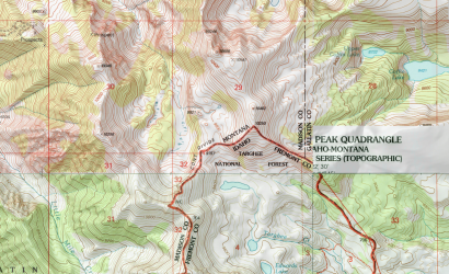
If it were Caltopo, it'd still have the same goofy bug in the Lionshead of the MT/ID border, where it omits part of the topo and shows the topo's label instead:

1618665575964.png

If you look on BCN, you'll see that's no longer the case. Also, it only goes to zoom 15, and the fidelity of its terrain shading is wayyyy lower. I think they probably just duped the USAtopo so it'd be more seamless for the people who were using the Caltopo layer. Alas, the USAtopo layer is kind of cheap Chinese knockoff compared to Caltopo's high-resolution products.

Also, Gaia's terrain shading doesn't hold a candle to Caltopo's either.

What really frustrates me about Caltopo (and this, coming from an early adopter and a pro subscriber since it became a thing), is that they stopped licensing their data to other companies, in order to strengthen their competitive position and get people using their own app. That's certainly their prerogative, but I think it was poorly timed. Caltopo's app is still pretty terrible (re-loads every time you navigate away from the foreground, sucks battery like crazy, handles large data sets very poorly). Gaia and BCN were filling a gap that Caltopo had left, and Caltopo removed that option without actually improving their app enough to make it a satisfactory replacement. So we get a whole bunch of companies jockeying for position, and the end result is that you and me get hosed.
 
Get a paper map. Learn the skills, use your brain. You’re in control.
 
  • Like
Reactions: Bob
Ok thanks @LarryBoy. I did notice the quality was variable but I figured that was the actual source layer. I've never used Gaia but compared to onyx the bcn still seems ok. Still a bummer that we lost caltopo on the bcn app.

@Dreamer por que no los dos lol
 
@scoags Sólo otra barrera entre tú y la naturaleza. Va os a usar la tecnología para destruir todo lo que es libre y vivo. Podría ser bénéficions o separates del dispositive pour unos momentos cortos.

Also, clearly all users are at the mercy of profit seeking corporations.
 
Last edited:
@scoags Sólo otra barrera entre tú y la naturaleza. Va os a usar la tecnología para destruir todo lo que es gratis y vivo. Podría ser bénéficions o separates del dispositive pour unos momentos cortos.

Also, clearly all users are at the mercy of profit seeking corporations.
Damn you making me use technology to translate an anti-technology post. :D
 
To me, a GPS vs paper maps debate makes about as much sense as a sleeping pad vs sleeping bag debate. They both keep you warm and cozy, but in very different ways. And they work best in tandem. Two different tools in the toolbox. The wise carpenter uses the right tool for the job.
 
Also, clearly it’s better to keep my curmudgeonly opinions to myself, especially right after a 2400 mile 3 day drive from <250’ to >9000’. I certainly don’t intend to be combative. Going forward I’ll commit to contributing uplifting content. I know it is pointless to rail against technology and the ways it is destroying our souls and home, and yet sometimes I will. I can and do leave my phone behind for months at a stretch as well as separating as much as I can from the ’civilized’ world. I’ve done a few trips with people and their phones and it is easy to see the separation from the wild and the chain dragging focus away from what is now.

Damn you making me use technology to translate an anti-technology post. :D
I did that on purpose. Plus I did not understand why @scoags thought it appropriate to address me directly in Spanish. I thought of using another but I like Spanish.

Haha well that might be a little dramatic. Hopefully that's not what you're dreaming about.

Honestly and sadly, I don’t think so. No dreaming necessary, just look around and observe the trends. As things get more and more crowded we will take everything.


To me, a GPS vs paper maps debate makes about as much sense as a sleeping pad vs sleeping bag debate. They both keep you warm and cozy, but in very different ways. And they work best in tandem. Two different tools in the toolbox. The wise carpenter uses the right tool for the job.
We see this very differently. I agree, it is a tool, but it has a much deeper impact on the user than say, a hammer. Coincidently, I’ve worked as a residential carpenter on and off for near 40 years. I have great respect and love for tools of all sorts. I don’t believe the pad/bag analogy is appropriate. Both of those are required. Perhaps a comparison between the venerable 20oz straight claw and an impact framing nailer. They do the same thing in very different ways. The hammer is essentially foolproof, the air nailer has many parts and will need regular maintenance, repair and rebuilding, it may break at any moment and become a useless piece of junk. The hammer is slower and requires more attention and skill. There is also the quality of the finished job. The nailer meets the code demands but my experience says a more durable and aesthetic result is garnered by hand. The mental differences are harder to finger, though they are definitely there.

What this really comes down to for me is the separation and distraction. The usefulness does not overcome the cons. Truthfully, I find the maps separate and distract as well, though to a lesser degree. I’ve been hiking the same range long enough to go for weeks without needing any navigation aids and it is fantastically freeing.

Thank You and Best Wishes, Eric
 
Without technology I'd have lived and died far away from the mountains. Call me selfish, but that's a decisive win for technology right there.

But back to the original post, I guess we just have to wait and see how this affects GaiaGPS functionality. It is somewhat reassuring that for now there aren't going to be any significant restructuring or staffing changes. I'd love for CalTopo to just get their app to a better place, but that seems a long way off at best.
 
Also, clearly it’s better to keep my curmudgeonly opinions to myself, especially right after a 2400 mile 3 day drive from <250’ to >9000’. I certainly don’t intend to be combative. Going forward I’ll commit to contributing uplifting content. I know it is pointless to rail against technology and the ways it is destroying our souls and home, and yet sometimes I will. I can and do leave my phone behind for months at a stretch as well as separating as much as I can from the ’civilized’ world. I’ve done a few trips with people and their phones and it is easy to see the separation from the wild and the chain dragging focus away from what is now.

I use my phone, in airplane mode, and take map and compass. I do try to limit my use of technology when out, but I admit I use a ton of technology when planning for trips. I believe I have gone on cell phone rants at least once on here, more likely a few times concerning my mother-in-law. We take her somewhere that doesn't have cell service and it is like she has the DTs, all twitchy and irritable.
 
@Dreamer the Spanish was a meme sorry nothing personal.


Can't say I can see how some backpackers using GPS is that big of a deal though.

Can't speak for anyone else but I happen to like curmudgeons.
 
You folks might want to check out Fatmap
 
...What really frustrates me about Caltopo (and this, coming from an early adopter and a pro subscriber since it became a thing), is that they stopped licensing their data to other companies, in order to strengthen their competitive position and get people using their own app. That's certainly their prerogative, but I think it was poorly timed. Caltopo's app is still pretty terrible (re-loads every time you navigate away from the foreground, sucks battery like crazy, handles large data sets very poorly). Gaia and BCN were filling a gap that Caltopo had left, and Caltopo removed that option without actually improving their app enough to make it a satisfactory replacement. So we get a whole bunch of companies jockeying for position, and the end result is that you and me get hosed.

Late jumping into this thread but thank @Wanderlust073 for the bump on it today. By the way, I have played around with FatMap a bit in the past and it was a bit buggy, clunky and laggy when I tried it out a while back. Perhaps it is better now.

Now back to @LarryBoy. You've got me really curious about your experiences and the way you've been using CalTopo on your phone because I'm quite different with my opinions about it and feel very grateful for it now. So now I have to ask, how are you using it that makes it suck battery on you? Do you use tracking with it? Do you use it on an iPhone? I've had a very different experience with their more recent updates and I've been using their mobile app since the first beta version became available and so I can say it has come a long way since and I like where they've been taking it. It's far better than it used to be with how I use it now. I currently have a Samsung S10 as my phone and will agree that it is a battery drain when tracking at medium and high levels. I only recently began trying out tracking with it. I did a couple days on a recent trip at "medium" level and that's been the only time I've notice a big battery drain with the app. I went from about 70% battery to 30% battery across 14 miles and about 8 hours with my normal use of the camera app and so forth. That's a lot more than I'm used to when not tracking while keeping my phone in Airplane mode as I typically do in the backcountry. I switched it down to the "Low" level to try that out and battery life improved dramatically. I also found that the resulting track in low mode was still quite accurate. I then used it that way on my last trip and it was still quite accurate until the next day, where the canyon got much more narrow and that resulted in a track with a lot of crazy bounce to it. I think that's pretty typical for most GPS devices though. Again, battery life was hardly worse for the wear using that low mode.

Now, I haven't been one to track much in the past and don't know how often I'll keep doing it, because I've always been one to design and mark up my route with CalTopo's feature rich website first and then sync it to my phone with the mobile app and just use the active GPS location mode on my downloaded map to keep track of my location in realtime and keep myself on course. In the past I'd exported to PDF for use with Avenza Maps app, and then moved on to exporting to GPX for a while and used with Gaia like so many others have and still do, but with the developmental progress that has been made to CalTopo's new app, I've not found myself missing any other app. I did use BCN a bit a long time ago, but at the time, found it to be not very intuitive at all before I moved on with the others I just mentioned. Perhaps it got a lot better itself as well after I left it. For what it's worth, I do like to keep in mind that Gaia and many of these other navigational apps have been around a lot longer and have had more time and more resources dedicated to them for development early on and have the advantage of being more mature now, but since CalTopo has now been growing and expanding a bit and receiving more of an investment in funding and personnel, it's clear their app and web interface is becoming more and more polished, in my opinion. For example, the web interface just got a makeover in recent weeks and now has a number of keyboard shortcuts that can be used for basic mapping and marking functions. It's taken me a bit to get used to the new locations of some of the items, like where to click to access your save maps and other data, but all in all, I do think it's getting a lot better, and a lot nicer as time goes by.

You also said it always loads from scratch anytime you transition another app into the foreground? I've not experienced that. I bounce back and forth between my phone's camera and CalTopo apps numerous times throughout the day when on trail. Switching back and forth between the two via "recent apps" or "open apps" shortcut is almost always seamless, fast, and responsive with virtually no lag time or re-loading for me between either app.

Now, I don't think I can speak to the large data sets issue you also mentioned. Perhaps that may be because I may not qualify as a power user with it. I mainly use to to make sure I'm on the right route I laid out before hand, help me get back on course if I go astray a bit, and measure out different distances and check elevation. The only thing I find it lacking in now from what other apps seem to have, is that when you do enable tracking, it only offers up a running duration while the track is in progress. There's no pacing info, it does not seem to maintain the duration after you stop the track, and does not auto-pause when you stop for a break like others.

I'd say one of the biggest things I really enjoy about it over others is how it maintains all the little different icons you can use with waypoints marked out in the web interface. I like being able to use different icon sets to distinguish campsites or places to look for potential campsites from strategic water sources, from places to look for rock art, ruins, etc, to big view points and so forth. I also really like all the different layers and even outside map sheets and shared sheets you can add, save, download, and/or sync to and from your account and over to the app.

Anyhow, I guess what I'm really interested in now is what exactly have I been missing out on (aside from the tracking data mentioned) by leaving Gaia and BCN or any other behind by going full on with CalTopo for the time being?
 
Last edited:
Similar threads
Thread starter Title Forum Replies Date
john.maldaner Gaia GPS: Sharing Tracks and Waypoints Gear 19
Titans Gaia GPS - CarPlay integration is now live ! Resource Discussions 10
john.maldaner Gaia GPS App Questoin Resource Discussions 7
Outdoors24 Gaia GPS question General Discussion 5
Dave Gaia GPS alternatives General Discussion 48
Nick Custom icon import to Gaia General Discussion 0
fossana Ligado 5G rollout and GPS interference General Discussion 0
john.maldaner GPS Recommendation, Please Gear 53
VegasHikeLife Paria Canyon GPS Coord. Trip Planning 6
Vegan.Hiker GPS Dog Tracking Devices / Gun Dog Whistles General Discussion 7
R GPS Question Gear 13
Artemus GPS Doodles Trip Planning 5
Rockskipper Any GPS suggestions? Gear 22
Rockskipper Why you shouldn't trust your GPS General Discussion 21
Kyle P Biting the Bullet on a GPS Gear 44
Bob GPS .................. General Discussion 3
Aldaron iPhone GPS General Discussion 5
JaseTheAce GPS Gear 29
Ross Help choosing which GPS to hike in USA if buying in UK Gear 2
steve Google Maps Engine Question on windows 8.1 laptop with USB gps General Discussion 0
Nick Topo/GPS App for iPhone General Discussion 36
Nick GPS Distances General Discussion 7
Nick GPS Coordinate Types General Discussion 27
powderglut Hand held GPS Gear 20
pstm13 DIY High Capacity Battery Pack for Phones and GPS @$40 Gear 4
Mike Jones GPS Logger Gear 19
Nick GPS Coordinates & Google Earth General Discussion 3
Joe Which Garmin Rino GPS? Gear 1
Nik Recommendation for Outdoor Handheld GPS Gear 12
Nick Lithium Batteries in a GPS unit Gear 6

Similar threads

Back
Top