- Joined
- May 31, 2015
- Messages
- 3,389
September 3-7, 2026
I usually put off writing these until winter, but I wanted to do this one while it was still somewhat fresh. Also it's pretty wintry outside here now anyway.
Instead of our usual type of trip to the SW part of Yellowstone, we opted to do something different this year, a little earlier in the season. We took the boat shuttle across Yellowstone Lake, then hiked up the Yellowstone River a ways, up onto the Buffalo Plateau, then down Soda Fork and out at Turpin Meadow. This route was entirely new ground for me and mostly new ground for Andrew and Steve. I hadn't been in the Teton Wilderness since 2019.
We camped at Bridge Bay the night before we started. We got our permits right away in the morning and went to the marina.
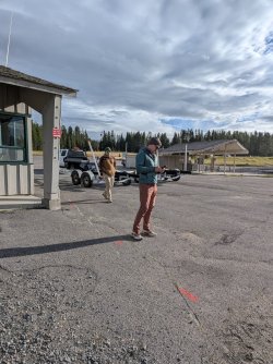
Getting ready to get on the boat.
Without any delay, we were on the boat and headed out toward 5E6, where we'd get dropped off. There was a good breeze, and the lake was pretty choppy that morning. We didn't stay outside the boat's cabin for very long.
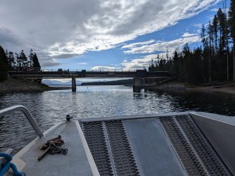
Pretty quickly, we were at the drop off spot, just a hair south of 5E6.
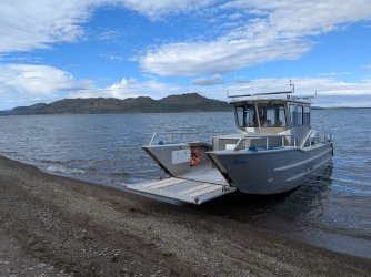
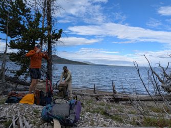
We put away our jackets and got ready to start moving.
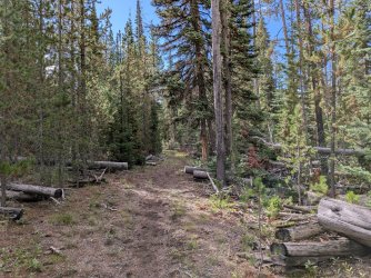
Lots of miles like this. Quite a nice trail all through the park portion of this trip.
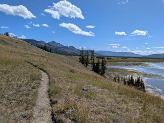
After lunch, we neared the river "delta." It was fairly warm and very dry out. The wind helped keep us cool. We really enjoyed the views along the lake, and it was also cool to be able to see so far ahead. Not a lot of places around here that you get to look up a valley like this and see the miles and miles you'll be covering over the next multiple days.
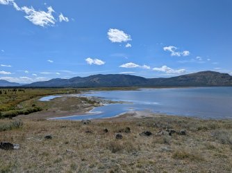
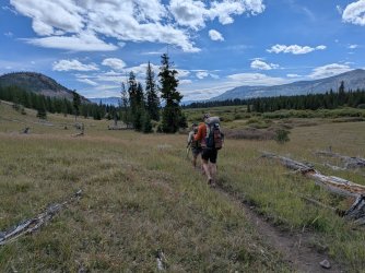
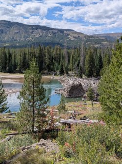
Big logjam across the river.
We came across one other group this day, and we think they were heading the same direction as us. We passed them right after crossing Beaver Dam Creek. In hindsight, we should have chatted with them, but we were kind of just locked in, moving forward at this point.
We reached our camp site by mid to late afternoon. I had not been drinking enough water and felt it. Our site was great, but the water situation was inconvenient. It was a decent sized spring pond, but it was hard to reach the water without walking through marshy spots, and it was 0.15-0.2 miles from the site itself.
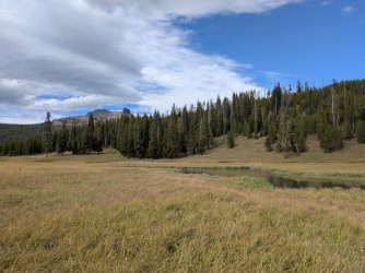
Good views from the pond though.
We watched some elk on the hill behind us in the evening. We scared them off when we had to go get more water, sadly. It was cool to see them up there. A big bull with a harem.
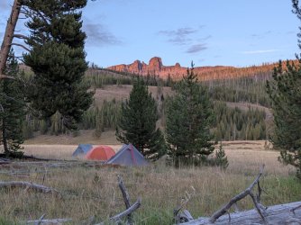
Tents around sunset.
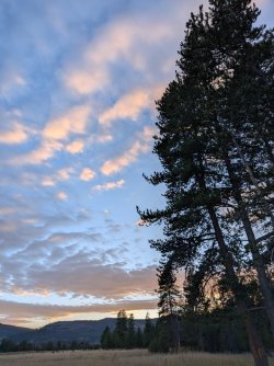
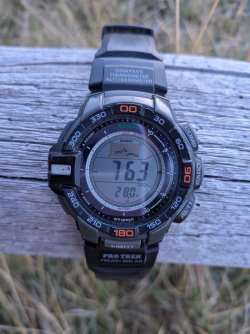
The camp site appears to be a in a cold sink, because in the morning, it was 27 degrees outside. Forecasted lows were in the high 30s to mid 40s. Here's a shot of my watch at 28 degrees. I failed to capture when it reached 27.
We heard wolves on and off that morning. First, right before sunrise. It was so distant, I thought it sounded kind of like faraway highway sounds at first. They went off a bit more after the sun was up, and we stood there listening. What a cool thing to start the day with.
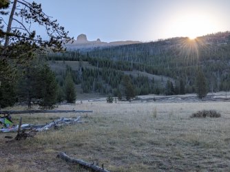
We had less distance to cover today, which was nice. The trail was more of the same from yesterday. Great views interspersed with some woods and a few creek crossings of varying sizes. The only people we saw on day 2 were a group of rangers on horseback, coming back from a patrol of the park border that week. Outfitting companies were starting to get set up for the hunting season, so we figure that was part of the reason. They said we were the only group they had seen on foot since they headed in at the beginning of the week.
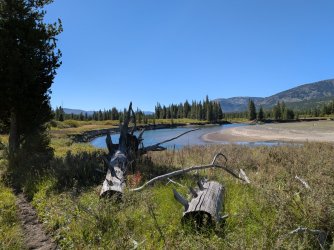
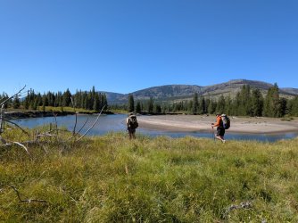
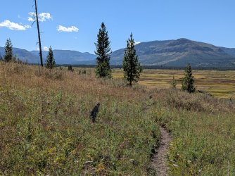
Couldn't stop marveling at how large this area is and how wonderful it is that there are no roads through it.
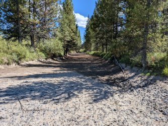
Crossed this interesting dry but large creek bed as we got close to camp.
Camp was on the banks of Thorofare Creek. Excellent spot, and a pretty long spur trail to get there.
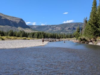
We cooled off and cleaned up a bit in the creek. Cold.
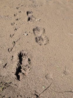
We found some grizzly tracks along the creek, next to some beaver (or otter?) tracks.
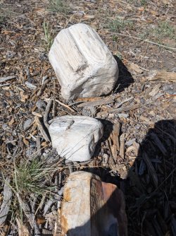
So much petrified wood all around the banks and in the creek.
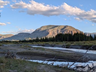
Great views of Hawks Rest from the fire ring.
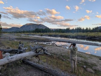
Glassing. They managed to find a bunch of elk on a very distance slope out of frame to the right. Much farther away than the first night.
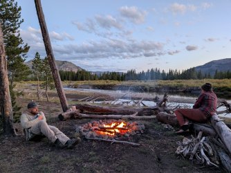
Pensive guys by the fire.
It rained just a bit overnight, but not much. I was pretty sure I heard something large in the brush as well, but it was gone after a short time.
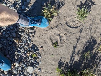
Starting out the next morning, rather than heading back down the spur trail to the main trail, we crossed the creek at camp and walked along the bank down to the trail. Lots of tracks in the sand on this side.
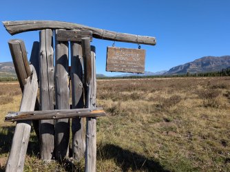
Before long, we had reached the park boundary.
Looking back the way we came.
The trail here was a little funny. We took the path that looked the most well worn and direct, but once we hit the trees, it was choked with deadfall and looked bad. So we went SW to skirt the trees, following another trail. It took us by a large outfitter's camp area that was unoccupied at the moment. The first of many we'd see.
We took a little detour to the main part of Bridger Lake to see what it was all about.
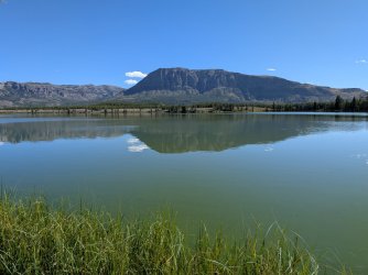
Turns out it was all about algae. That green color is a thick mat of it. Kind of gross, but interesting lake!
We got back to the main trail and checked out the fairly new bridge over the river while we had a snack. It was pretty nice.
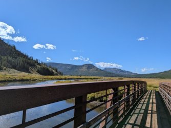
We did not cross over though, since we were going to keep following the Yellowstone.
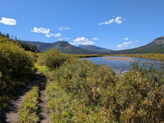
Lots of willow walking through here.
We passed another outfitter camp, the third or fourth of the day, and we talked for a minute with two guys out sawing logs. They had quite a setup with solar panels and electricity! Extension cords running from tent to tent and stuff. Not my style, but I guess their clients must appreciate it.
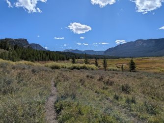
We got turned around a couple times in this area, following little side trails. This resulted in us having to bushwhack through some less than ideal spots.
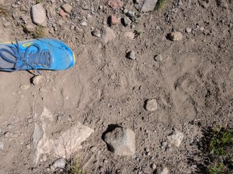
More bear tracks as the canyon narrowed a bit and we started to climb just a little more. It was headed the same way as us, but we never saw it.
We had lunch along the river at a spot where we could actually access the water. We watched a deer nearby as we ate, and it also watched us.
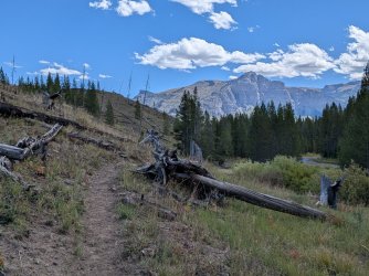
This was near where we ate.
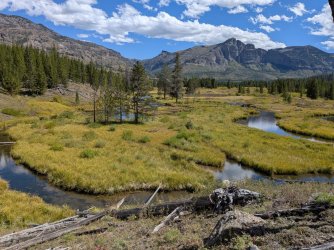
Couldn't believe how pretty this spot was. Lots of beaver action.
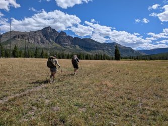 Big walking.
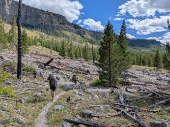 Farther up the canyon, there were some washouts, some newer than others. A few looked like they had happened this year. This one maybe not.
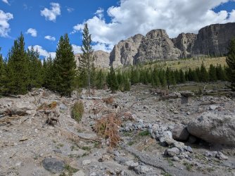
This one seemed new.
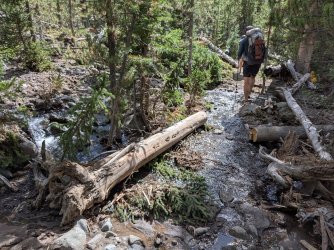
Another new one.
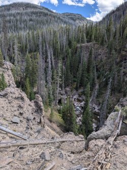
High above the river, looking down. We are getting close to camp by now. But we are very tired.
The last few miles really took it out of us. We were happy to reach the mouth of Woodard Canyon for camp.
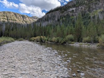
Cleaned up in the cold river.
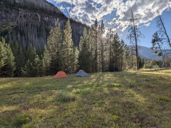
Camp. That is the trail right there, unfortunately. We (correctly) assumed no one else would be coming by that night.
As we sat by the fire that evening, we had an owl do a close flyby. That was cool. It was very dark up there.
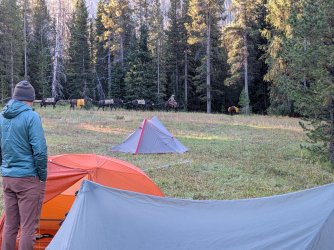
A mule team came by first thing in the morning though. They waved and went ahead. They must have camped near the forks of the Yellowstone up above since that's where they came from.
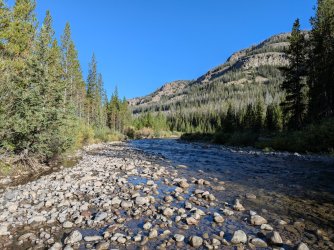
Crossing the river in the morning.
The climb up out of Woodard was a decent challenge for our tired legs. The trail was freshly mucked by the mule team also. Little did we know it would not be that bad compared to a lot of what we'd see that day and the next one.
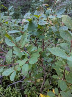
Found some great huckleberry patches!
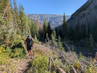
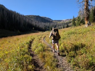
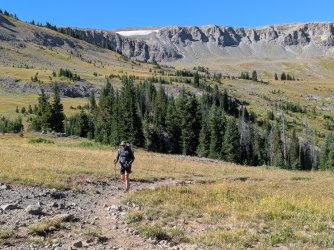
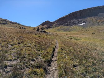
Nearing the top.
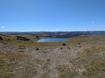
Topped out, looking down at Ferry Lake. I had wanted to get up here for a long time, and it was cool to do it finally.
We caught our breath and headed toward the top of Soda Fork.
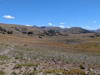
Looking back toward Younts and stuff.
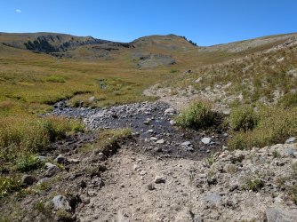
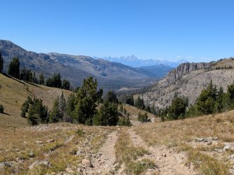
At the top of the Soda Fork drainage. Nice view. Rough trail.
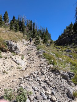
Ankle killer of a trail. Did not love.
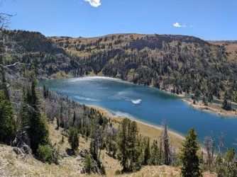
Crater Lake. A very neat one!
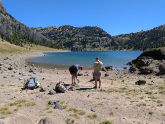
We stopped for lunch at this spot on the lake. Dipped our feet in the cold lake, filtered water, and took a nice rest. We didn't stay too long because we still had good ways to go.
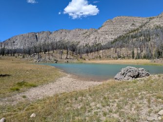
A pond a little below the lake. Nice color to the water.
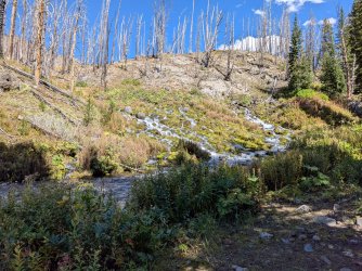
We stopped for a few minutes to marvel at the Soda Fork Big Springs. I think I appreciate things like this more now that I work in water resources. Amazing amount of very cold water coming out of the ground here.
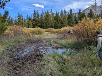
Had to contend with some pretty bad muck in the meadows up there. Usually preferable to push your way through the willows.
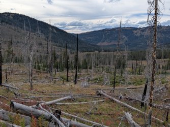
These burned meadows were pretty and full of fireweed. They seemed interminable after a while though. This was near the end of them, looking down to where we'd camp for the night.
We reached a big outfitter camp that was unoccupied, and since we were tired and didn't want to hunt around for other sites, we decided to camp right on the edge of it. We assumed there was a very low chance anyone would show up since it was around 5:30 p.m.
Well, who showed up about an hour later? A group of 4 or 5 guys working for an outfitter, along with a pack string. Of course! They seemed to be an advance party, getting things set up a few weeks before stuff really started going. Lucky for us, they were great. We had set up out of the way, and they encouraged us to use one of their bear boxes and the fire ring. According to their apparent leader, the space reserved to them is actually quite small. They of course use area outside of it, but anyone else is free to use the area outside their small permitted space.
As they were unloading, they had a little problem with a mule who scared itself, ripped the pole it was tethered to out of the ground, and took off running back down the trail, dragging the big pole right along with it. It startled a horse, and the horse also tore its pole out, but the horse didn't run away. So one of them had to ride out to retrieve the runaway mule. After that, they got the animals hobbled, and things were much calmer.
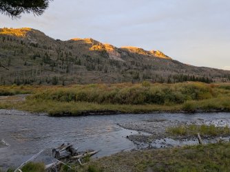
It was a nice evening along the creek.
There had been a chance of rain that day, but it didn't rain on us, luckily. That night, however, it absolutely poured. There was thunder and lightning also, but it was far away.
We got an early start for our hike out that morning. Packed up wet tents and got on our way. The trails were pure muck the entire 6 or so miles. I've never hiked through such consistently muddy conditions. I don't imagine the heavy use helps.
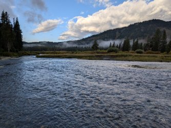
It was beautiful out though. We had some sandhill cranes making a lot of noise in this spot.
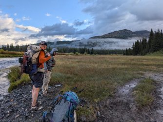
About to cross North Buffalo Fork, just below where Soda Fork comes in.
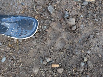
Fun tracks in the mud.
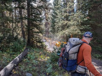
More mules. Can't remember if we saw one or two groups that morning.
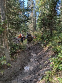
And this is a good representation of what the entire hike was that day. Deeply worn trail, pure slippery slop at the bottom.
I was the only one who fell down in the mud. I managed to land on the side of it though and didn't get too dirty. We got to Turpin Meadow by mid-morning. We chatted with a guy at the trailhead who was about to backpack in solo for a while. I think we may have undersold the mud challenge, but at least we made him aware.
We had time for breakfast at Heart Six Ranch, which was great and much needed. We got back to the cars at Bridge Bay and went our separate ways!
In hindsight, this would have been preferable to do over 5 nights and 6 days. The 15-mile third day followed by the 17-mile fourth day really worked us. We did what we could with the time we had though, and we had an awesome time. I keep thinking about it and what we'll do next.
I usually put off writing these until winter, but I wanted to do this one while it was still somewhat fresh. Also it's pretty wintry outside here now anyway.
Instead of our usual type of trip to the SW part of Yellowstone, we opted to do something different this year, a little earlier in the season. We took the boat shuttle across Yellowstone Lake, then hiked up the Yellowstone River a ways, up onto the Buffalo Plateau, then down Soda Fork and out at Turpin Meadow. This route was entirely new ground for me and mostly new ground for Andrew and Steve. I hadn't been in the Teton Wilderness since 2019.
We camped at Bridge Bay the night before we started. We got our permits right away in the morning and went to the marina.
Getting ready to get on the boat.
Without any delay, we were on the boat and headed out toward 5E6, where we'd get dropped off. There was a good breeze, and the lake was pretty choppy that morning. We didn't stay outside the boat's cabin for very long.
Pretty quickly, we were at the drop off spot, just a hair south of 5E6.
We put away our jackets and got ready to start moving.
Lots of miles like this. Quite a nice trail all through the park portion of this trip.
After lunch, we neared the river "delta." It was fairly warm and very dry out. The wind helped keep us cool. We really enjoyed the views along the lake, and it was also cool to be able to see so far ahead. Not a lot of places around here that you get to look up a valley like this and see the miles and miles you'll be covering over the next multiple days.
Big logjam across the river.
We came across one other group this day, and we think they were heading the same direction as us. We passed them right after crossing Beaver Dam Creek. In hindsight, we should have chatted with them, but we were kind of just locked in, moving forward at this point.
We reached our camp site by mid to late afternoon. I had not been drinking enough water and felt it. Our site was great, but the water situation was inconvenient. It was a decent sized spring pond, but it was hard to reach the water without walking through marshy spots, and it was 0.15-0.2 miles from the site itself.
Good views from the pond though.
We watched some elk on the hill behind us in the evening. We scared them off when we had to go get more water, sadly. It was cool to see them up there. A big bull with a harem.
Tents around sunset.
The camp site appears to be a in a cold sink, because in the morning, it was 27 degrees outside. Forecasted lows were in the high 30s to mid 40s. Here's a shot of my watch at 28 degrees. I failed to capture when it reached 27.
We heard wolves on and off that morning. First, right before sunrise. It was so distant, I thought it sounded kind of like faraway highway sounds at first. They went off a bit more after the sun was up, and we stood there listening. What a cool thing to start the day with.
We had less distance to cover today, which was nice. The trail was more of the same from yesterday. Great views interspersed with some woods and a few creek crossings of varying sizes. The only people we saw on day 2 were a group of rangers on horseback, coming back from a patrol of the park border that week. Outfitting companies were starting to get set up for the hunting season, so we figure that was part of the reason. They said we were the only group they had seen on foot since they headed in at the beginning of the week.
Couldn't stop marveling at how large this area is and how wonderful it is that there are no roads through it.
Crossed this interesting dry but large creek bed as we got close to camp.
Camp was on the banks of Thorofare Creek. Excellent spot, and a pretty long spur trail to get there.
We cooled off and cleaned up a bit in the creek. Cold.
We found some grizzly tracks along the creek, next to some beaver (or otter?) tracks.
So much petrified wood all around the banks and in the creek.
Great views of Hawks Rest from the fire ring.
Glassing. They managed to find a bunch of elk on a very distance slope out of frame to the right. Much farther away than the first night.
Pensive guys by the fire.
It rained just a bit overnight, but not much. I was pretty sure I heard something large in the brush as well, but it was gone after a short time.
Starting out the next morning, rather than heading back down the spur trail to the main trail, we crossed the creek at camp and walked along the bank down to the trail. Lots of tracks in the sand on this side.
Before long, we had reached the park boundary.
Looking back the way we came.
The trail here was a little funny. We took the path that looked the most well worn and direct, but once we hit the trees, it was choked with deadfall and looked bad. So we went SW to skirt the trees, following another trail. It took us by a large outfitter's camp area that was unoccupied at the moment. The first of many we'd see.
We took a little detour to the main part of Bridger Lake to see what it was all about.
Turns out it was all about algae. That green color is a thick mat of it. Kind of gross, but interesting lake!
We got back to the main trail and checked out the fairly new bridge over the river while we had a snack. It was pretty nice.
We did not cross over though, since we were going to keep following the Yellowstone.
Lots of willow walking through here.
We passed another outfitter camp, the third or fourth of the day, and we talked for a minute with two guys out sawing logs. They had quite a setup with solar panels and electricity! Extension cords running from tent to tent and stuff. Not my style, but I guess their clients must appreciate it.
We got turned around a couple times in this area, following little side trails. This resulted in us having to bushwhack through some less than ideal spots.
More bear tracks as the canyon narrowed a bit and we started to climb just a little more. It was headed the same way as us, but we never saw it.
We had lunch along the river at a spot where we could actually access the water. We watched a deer nearby as we ate, and it also watched us.
This was near where we ate.
Couldn't believe how pretty this spot was. Lots of beaver action.
Big walking.Farther up the canyon, there were some washouts, some newer than others. A few looked like they had happened this year. This one maybe not.This one seemed new.
Another new one.
High above the river, looking down. We are getting close to camp by now. But we are very tired.
The last few miles really took it out of us. We were happy to reach the mouth of Woodard Canyon for camp.
Cleaned up in the cold river.
Camp. That is the trail right there, unfortunately. We (correctly) assumed no one else would be coming by that night.
As we sat by the fire that evening, we had an owl do a close flyby. That was cool. It was very dark up there.
A mule team came by first thing in the morning though. They waved and went ahead. They must have camped near the forks of the Yellowstone up above since that's where they came from.
Crossing the river in the morning.
The climb up out of Woodard was a decent challenge for our tired legs. The trail was freshly mucked by the mule team also. Little did we know it would not be that bad compared to a lot of what we'd see that day and the next one.
Found some great huckleberry patches!
Nearing the top.
Topped out, looking down at Ferry Lake. I had wanted to get up here for a long time, and it was cool to do it finally.
We caught our breath and headed toward the top of Soda Fork.
Looking back toward Younts and stuff.
At the top of the Soda Fork drainage. Nice view. Rough trail.
Ankle killer of a trail. Did not love.
Crater Lake. A very neat one!
We stopped for lunch at this spot on the lake. Dipped our feet in the cold lake, filtered water, and took a nice rest. We didn't stay too long because we still had good ways to go.
A pond a little below the lake. Nice color to the water.
We stopped for a few minutes to marvel at the Soda Fork Big Springs. I think I appreciate things like this more now that I work in water resources. Amazing amount of very cold water coming out of the ground here.
Had to contend with some pretty bad muck in the meadows up there. Usually preferable to push your way through the willows.
These burned meadows were pretty and full of fireweed. They seemed interminable after a while though. This was near the end of them, looking down to where we'd camp for the night.
We reached a big outfitter camp that was unoccupied, and since we were tired and didn't want to hunt around for other sites, we decided to camp right on the edge of it. We assumed there was a very low chance anyone would show up since it was around 5:30 p.m.
Well, who showed up about an hour later? A group of 4 or 5 guys working for an outfitter, along with a pack string. Of course! They seemed to be an advance party, getting things set up a few weeks before stuff really started going. Lucky for us, they were great. We had set up out of the way, and they encouraged us to use one of their bear boxes and the fire ring. According to their apparent leader, the space reserved to them is actually quite small. They of course use area outside of it, but anyone else is free to use the area outside their small permitted space.
As they were unloading, they had a little problem with a mule who scared itself, ripped the pole it was tethered to out of the ground, and took off running back down the trail, dragging the big pole right along with it. It startled a horse, and the horse also tore its pole out, but the horse didn't run away. So one of them had to ride out to retrieve the runaway mule. After that, they got the animals hobbled, and things were much calmer.
It was a nice evening along the creek.
There had been a chance of rain that day, but it didn't rain on us, luckily. That night, however, it absolutely poured. There was thunder and lightning also, but it was far away.
We got an early start for our hike out that morning. Packed up wet tents and got on our way. The trails were pure muck the entire 6 or so miles. I've never hiked through such consistently muddy conditions. I don't imagine the heavy use helps.
It was beautiful out though. We had some sandhill cranes making a lot of noise in this spot.
About to cross North Buffalo Fork, just below where Soda Fork comes in.
Fun tracks in the mud.
More mules. Can't remember if we saw one or two groups that morning.
And this is a good representation of what the entire hike was that day. Deeply worn trail, pure slippery slop at the bottom.
I was the only one who fell down in the mud. I managed to land on the side of it though and didn't get too dirty. We got to Turpin Meadow by mid-morning. We chatted with a guy at the trailhead who was about to backpack in solo for a while. I think we may have undersold the mud challenge, but at least we made him aware.
We had time for breakfast at Heart Six Ranch, which was great and much needed. We got back to the cars at Bridge Bay and went our separate ways!
In hindsight, this would have been preferable to do over 5 nights and 6 days. The 15-mile third day followed by the 17-mile fourth day really worked us. We did what we could with the time we had though, and we had an awesome time. I keep thinking about it and what we'll do next.