- Joined
- Aug 9, 2007
- Messages
- 12,955
September 2011
The first post-Labor day trip into the Uintas for the year is in the books and boy was it nice. It's absolutely amazing the difference in the crowds after one simple holiday. The destination for this trip was Four Lakes Basin and Allen Lake in the High Uintas Wilderness.
I've had Four Lakes on my list for quite some time but I've never been all that motivated to get out there. I've heard it can get busy out there and to make it worse, it's at least an 18 mile out and back hike. I suppose you could make it a point to point between the Grandview and Highline trailheads but that would involve a lot of driving between the two points.
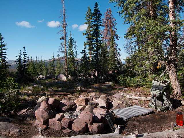
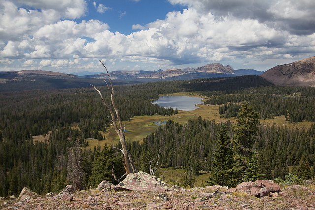
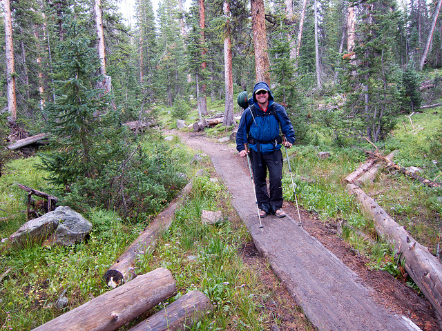
We started our trip at the Highline trailhead near Hayden Pass off of the Mirror Lake Highway. We left Park City just after 3pm and made it to the trailhead a little after 4pm with a light sprinkle falling. There were only 5 or 6 cars in the Highline trailhead, pretty slow for a Friday afternoon. After getting our packs ready we were on the trail a little after 4:30 on our way towards Four Lakes Basin. We were hoping to get to Carolyn or Olga Lake before sunset but we knew that we might not make it. It's about 7 miles to Olga and we had a little under 3 hours to get it done if we wanted to be at camp before the sun went down.
Here's a map of the route we took with my GPS tracks. The route ended up being 21 miles with a little more than 4,500 feet of elevation gain including our side trip up to Cyclone Pass.
[parsehtml]
<iframe width="640" height="640" frameborder="0" scrolling="no" marginheight="0" marginwidth="0" src="http://www.mappingsupport.com/p/gmap4.php?q=mymap,214533597045798101523.0004acdd42f071dfed5a7&z=12&t=t2"></iframe><br /><small>View <a href="http://www.mappingsupport.com/p/gmap4.php?q=mymap,214533597045798101523.0004acdd42f071dfed5a7&z=14&t=t2" target="_blank">Four Lakes Basin Map</a> full sized in a new window.</small></br></br>
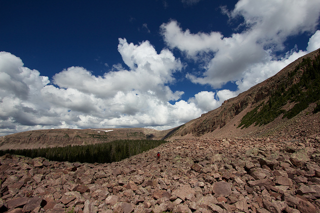
[/parsehtml]It had been a few years since I hiked this section of the Highline Trail I had forgotten just how much elevation change there is. The trail starts by dropping about 400 feet right off the bat. It's pretty much all downhill until you reach the wilderness boundary. From there its up and down, up and down until you hit the first big stream after the Naturalist Basin Junction. I believe this is the Duchesne River. From there up to Carlyn/Olga you regain 600+ feet while hiking up a moderately steep, very rocky trail.
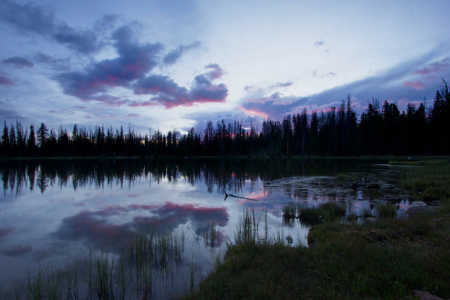
We considered camping near the Duchesne when we got there. But the GPS was showing 1.22 miles as the crow flies to get to Carolyn. We had about 40 minutes of light left so we went for it. I didn't realize it was all going to be straight up! Fortunately we made it there just in time for sunset. I snapped this shot as we walked around the lake looking for a campsite.
Taylor found us a campsite above the lake on a ridge on the southwest side. We explored the entire east side and found no good campsites. There were some really good ones along the northwest side but they looked heavily used so we passed them by.
The last of the sunset from our campsite on the ridge.
Later that night we went down to the lake to take some photos. Unfortunately there were a lot of thin, whispy clouds so I didn't do much with star trails. I tried one long exposure, about 15 minutes but in that amount of time my entire camera became covered in condensation and it ruined the exposure. It must have rained a lot earlier that day, everything out there was completely saturated and it was clear that the trails had actually been flowing a bit. This is the only decent shot I got down at Carolyn Lake that night.
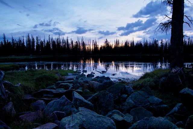
The next morning we were able to properly appreciate the view we had from camp. There were a few trees in the way but it was still awesome. We could see all across Grandaddy Basin and back over towards Bald Mountain, Mount Watson, etc. We even had a clear view of Mount Timpanogos all the way over on the Wasatch Range! Here's a shot from camp as we packed up.
Carolyn Lake in the morning.
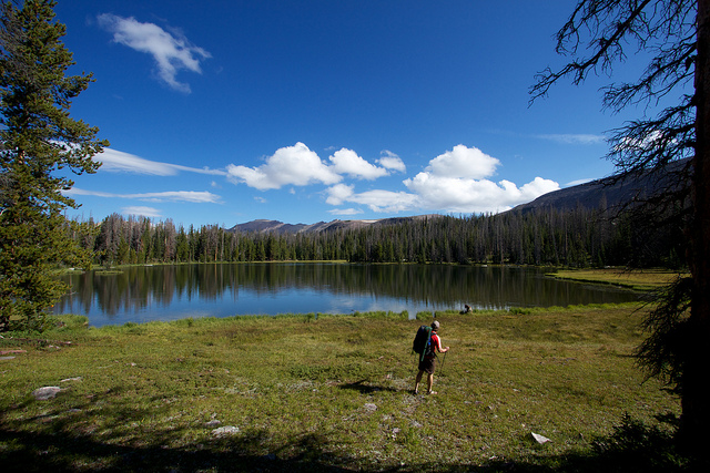
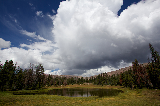
We hiked off trail up to Olga Lake before connecting with the trail to Four Lakes Basin. Olga was pretty but I didn't see any signs of fish. I didn't see any campsites either but we just walked along the south shore. It seemed like there should be some on the other end or on the sides. That reminds me, there were plenty of fish in Carolyn Lake, they were rising like crazy in the evening and in the morning but we didn't try to catch any.
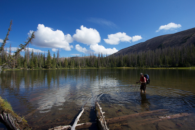
Taylor getting his feet wet in Olga Lake.
Up the hill from Olga Lake we finally connected with the Four Lakes Basin trail around 10,700 feet. From here the trail skirts the foot of the mountain to get into Four Lakes Basin, reaching a peak altitude of 10,920 on the low pass as you enter the basin. This shot is of Jean and Dean Lake, the first two lakes along the trail into Four Lakes Basin.
We didn't stop at Dean & Jeans, instead we kept going and took the junction towards Dayne's Lake. It's very pretty, open country around Dayne's and Dale. The trail is clear for the first little bit but then it just kind of disappears into the wide open, grassy fields around the lower lakes. There are plenty of good campsites in the area between the two lakes.
This is a panorama taken from the inlet on the east end of Dayne's Lake.

We stopped at Dayne's Lake for minute and decided we would hike up to Cyclone Pass before continuing on to our destination for the day; Allen Lake. The map shows a trail heading up to Cyclone but we didn't follow it. We just kind of wandered up through the meadows and forest to the base of the pass. There we found a huge cairn at the foot of a slope of huge boulders. We couldn't see any other cairns in either direction so we decided to climb up the boulders. Getting up the slope was a little tricky. The boulders were so large that there were giant gaps in between that would be very bad to fall into. I'm talking 4-8 foot deep holes in the rocks. Nikita struggled with that part.
After the scramble up the rocks we ended up on a bench that was also nothing but boulders. It was a little easier getting through these but definitely not fun. Notice Taylor in the shot to give some scale.
After a traversing along the boulder-strewn bench, we finally made it to a clearing where we found the proper trail. To find the correct trail, approach Cyclone Pass just a little south of the pass itself. Stay at the foot of the boulders until they clear up and you'll find a path. From the bench, the trail goes pretty much straight up the pass. It switches back and forth a tiny bit at first but after that it's not much better than hiking straight up the slope.
Taylor hiking up the trail to Cyclone Pass
Arriving on top of Cyclone Pass
Nikita was tired after the hike up to the pass. I'm constantly amazed at how strong of a hiker she still is despite being more than 9 years old. But this trip might have pushed her a little too hard. Kills me to say it but I think this might have been the last 20+ mile trip she'll ever make it on.

Sea Lion Lake, south of Cyclone Pass. Thompson Lake, notorious thanks to the Probst book on the Uintas, was just out of sight to the north.
The view west from on top of Cyclone Pass. Dayne's Lake is in the foreground. You can clearly see most of the peaks in the Mirror Lake Highway area like Bald, Reid, Watson and Murdock. In the distance you can see the Wasatch Mountains.
We hung out on the pass for 15 or 20 minutes soaking in the views before making our way back down. The clouds were dramatic and moving fast and it was constantly looking like it could turn into a storm at any moment. This shot is looking back up at Cyclone Pass at a small pond on the way to Allen Lake.
After a nice off-trail stroll through the woods we finally found ourselves at Allen Lake. The lake was named after a forest service ranger named Floyd Allen who was struck and killed by lightning here on August 26, 1938. Pretty incredible to think of how remote this was back then. For us, we had logged a little over 11 miles with our detours to get here from the Mirror Lake Highway. Back then I don't even know where the best starting point would have been. Was there a some sort of dirt road where the Mirror Lake highway is now? If anyone has any information on that, I'd love to know.
One of the key reasons we chose Allen Lake was because of the description in the guidebook Hiking Utah's High Uintas by Jeffrey Probst. In it, Allen Lake is described as one of the best lakes for Grayling in the state of Utah. They say that it produces larger than average Grayling and that the state record will likely end up coming from this lake. Sounds fun!
Despite all my time in the Uintas, I had yet to ever catch a Grayling so after setting up our tents I got the rod out and got to it. On the first cast I had a hit but missed it. And second cast, Grayling!!
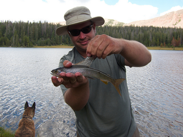
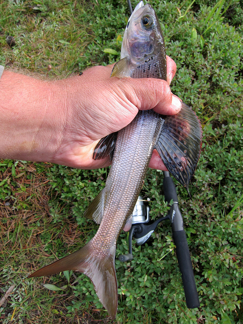
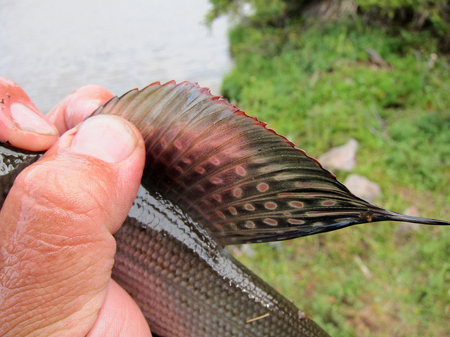
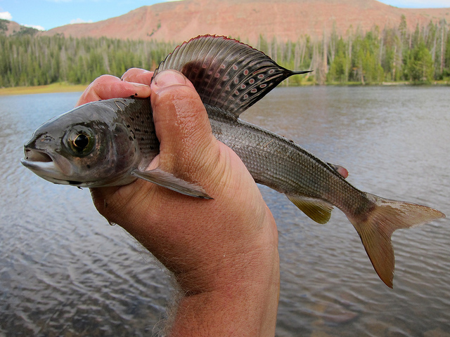
The fishing was red hot. They were a little tricky to hook but they at least hit my fly about every cast. Here's a few shots of some of the bigger ones. Keep in mind I have unusually large hands. These were all in the 12"+ range.
Taylor's first fish.
The technique for catching the Grayling was different than what I'm used to with typical Brook Trout and Cutthroat Trout in the Uintas. First of all, a fly rod is pretty much useless. The grayling never come anywhere near the shore. Even with the nice open shoreline, your chances of being able to cast into them with a fly rod is pretty much zero. Even that night, when the lake was boiling like I'd never seen before, they never came near the shore. I'm talking hundreds of fish rising simultaneously! It was quite the sight.
The succesful technique involved small to medium dark flies dragged slowly behind a bubble. The water was too choppy to be able to see a dry fly on the surface so that might have worked well but for me dragging it was the ticket. They would almost always hit within the first 10-20 feet of reeling. The best flies were a Royal Wulf and a Renegade. And speaking of the Royal Wulf. Be careful of them when you're trying to fly cast into strong wind! Taylor sunk one pretty deep into his neck. I had to take his forceps and rip this out for him.
It was a great lazy day at Allen Lake. We fished on and off, Taylor took a long nap in the hammock and I sat on the shore and watched the incredible clouds fly by. I shot a time lapse for a bit of it.
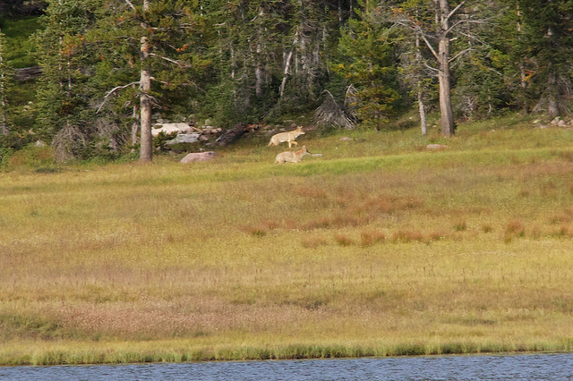
Later in the afternoon I noticed some movement on the other side of the lake. I had to run and get my long lens and put it on. Fortunately these two coyotes stuck around long enough for some shots.

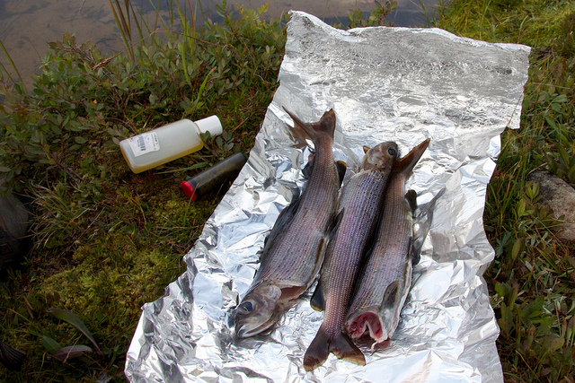
Neither of us had ever eaten Grayling so we kept a few to try out with dinner. It turned out they aren't very good, or at least for us. I've heard from others that they really enjoy them. We found the scales to be very problematic and the texture to be too soft. The flavor wasn't bad though and most of the bones are extra large which keeps them out of the meat pretty well. I don't think I'll eat Grayling again though.
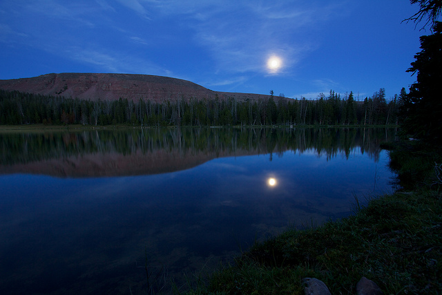
The full moon rising over Allen Lake
It rained a bit on us later that night but nothing big. We got packed up in the morning but just as we were getting ready to leave we noticed two bow hunters walking down the shore of the lake. Incredibly, these were the first humans we had seen since Friday night, not far from the Highline Trailhead. The hunters approached and we said hello, one of them walked up to me and asked if I had seen any naked women swimming in the lake. I looked at him a bit perplexed. If you read my website regularly then you probably know about my trip into The Winds last month where we encountered a topless woman swimming in a high alpine lake. Well it turns out this stranger was actually a regular reader of my website who I had actually exchanged several emails with earlier this summer. Great running into you out there, Riley!
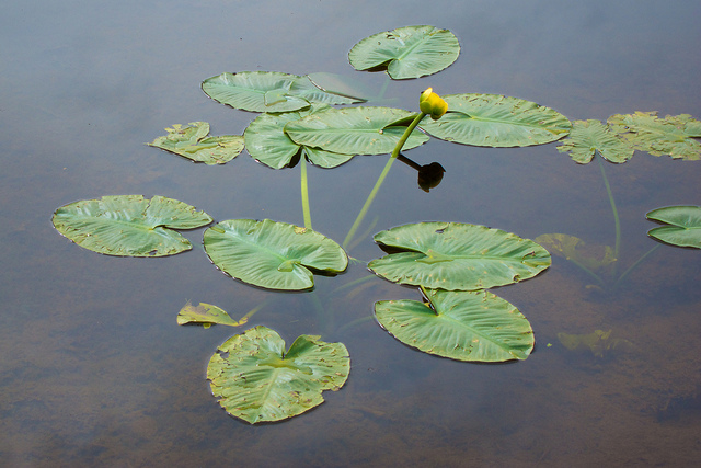
We sat and talked to Riley and his friend for a while before heading out. It's about 10 miles from Allen Lake to the Highline Trailhead so we had a bit of a hike ahead of us. Fortunately, we were going to see at least a bit of new trail on the way out. We skipped the hike back through Four Lakes Basin and took the more direct route back past Bedground Lake. The first mile to that point is off trail. I kept the big camera packed away for the hike out so very few photos were taken. There were some ncie lily pads on Bedground Lake though.
The day stayed cool and overcast for most of the hike out. Then for the last 2+ miles we got hit with a nice storm. Lots of hail and rain. It was fun to hike in knowing that we had a nice, warm truck and a change of clothes waiting at the trailhead.
This might end up being my last trip to the Uintas for 2011. I hoped to get back up there one or two more times but it's about time I took a weekend at home and after that I feel the call of the desert. But who knows, last year my last Uintas trip was in October. If not then, I'll see them next year. Hopefully the snow melts before July!
The first post-Labor day trip into the Uintas for the year is in the books and boy was it nice. It's absolutely amazing the difference in the crowds after one simple holiday. The destination for this trip was Four Lakes Basin and Allen Lake in the High Uintas Wilderness.
I've had Four Lakes on my list for quite some time but I've never been all that motivated to get out there. I've heard it can get busy out there and to make it worse, it's at least an 18 mile out and back hike. I suppose you could make it a point to point between the Grandview and Highline trailheads but that would involve a lot of driving between the two points.
We started our trip at the Highline trailhead near Hayden Pass off of the Mirror Lake Highway. We left Park City just after 3pm and made it to the trailhead a little after 4pm with a light sprinkle falling. There were only 5 or 6 cars in the Highline trailhead, pretty slow for a Friday afternoon. After getting our packs ready we were on the trail a little after 4:30 on our way towards Four Lakes Basin. We were hoping to get to Carolyn or Olga Lake before sunset but we knew that we might not make it. It's about 7 miles to Olga and we had a little under 3 hours to get it done if we wanted to be at camp before the sun went down.
Here's a map of the route we took with my GPS tracks. The route ended up being 21 miles with a little more than 4,500 feet of elevation gain including our side trip up to Cyclone Pass.
[parsehtml]
<iframe width="640" height="640" frameborder="0" scrolling="no" marginheight="0" marginwidth="0" src="http://www.mappingsupport.com/p/gmap4.php?q=mymap,214533597045798101523.0004acdd42f071dfed5a7&z=12&t=t2"></iframe><br /><small>View <a href="http://www.mappingsupport.com/p/gmap4.php?q=mymap,214533597045798101523.0004acdd42f071dfed5a7&z=14&t=t2" target="_blank">Four Lakes Basin Map</a> full sized in a new window.</small></br></br>
[/parsehtml]It had been a few years since I hiked this section of the Highline Trail I had forgotten just how much elevation change there is. The trail starts by dropping about 400 feet right off the bat. It's pretty much all downhill until you reach the wilderness boundary. From there its up and down, up and down until you hit the first big stream after the Naturalist Basin Junction. I believe this is the Duchesne River. From there up to Carlyn/Olga you regain 600+ feet while hiking up a moderately steep, very rocky trail.
We considered camping near the Duchesne when we got there. But the GPS was showing 1.22 miles as the crow flies to get to Carolyn. We had about 40 minutes of light left so we went for it. I didn't realize it was all going to be straight up! Fortunately we made it there just in time for sunset. I snapped this shot as we walked around the lake looking for a campsite.
Taylor found us a campsite above the lake on a ridge on the southwest side. We explored the entire east side and found no good campsites. There were some really good ones along the northwest side but they looked heavily used so we passed them by.
The last of the sunset from our campsite on the ridge.
Later that night we went down to the lake to take some photos. Unfortunately there were a lot of thin, whispy clouds so I didn't do much with star trails. I tried one long exposure, about 15 minutes but in that amount of time my entire camera became covered in condensation and it ruined the exposure. It must have rained a lot earlier that day, everything out there was completely saturated and it was clear that the trails had actually been flowing a bit. This is the only decent shot I got down at Carolyn Lake that night.
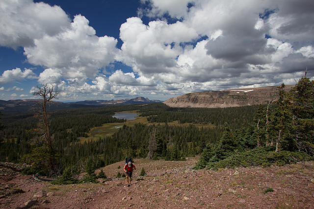
The next morning we were able to properly appreciate the view we had from camp. There were a few trees in the way but it was still awesome. We could see all across Grandaddy Basin and back over towards Bald Mountain, Mount Watson, etc. We even had a clear view of Mount Timpanogos all the way over on the Wasatch Range! Here's a shot from camp as we packed up.
Carolyn Lake in the morning.
We hiked off trail up to Olga Lake before connecting with the trail to Four Lakes Basin. Olga was pretty but I didn't see any signs of fish. I didn't see any campsites either but we just walked along the south shore. It seemed like there should be some on the other end or on the sides. That reminds me, there were plenty of fish in Carolyn Lake, they were rising like crazy in the evening and in the morning but we didn't try to catch any.
Taylor getting his feet wet in Olga Lake.
Up the hill from Olga Lake we finally connected with the Four Lakes Basin trail around 10,700 feet. From here the trail skirts the foot of the mountain to get into Four Lakes Basin, reaching a peak altitude of 10,920 on the low pass as you enter the basin. This shot is of Jean and Dean Lake, the first two lakes along the trail into Four Lakes Basin.
We didn't stop at Dean & Jeans, instead we kept going and took the junction towards Dayne's Lake. It's very pretty, open country around Dayne's and Dale. The trail is clear for the first little bit but then it just kind of disappears into the wide open, grassy fields around the lower lakes. There are plenty of good campsites in the area between the two lakes.
This is a panorama taken from the inlet on the east end of Dayne's Lake.
We stopped at Dayne's Lake for minute and decided we would hike up to Cyclone Pass before continuing on to our destination for the day; Allen Lake. The map shows a trail heading up to Cyclone but we didn't follow it. We just kind of wandered up through the meadows and forest to the base of the pass. There we found a huge cairn at the foot of a slope of huge boulders. We couldn't see any other cairns in either direction so we decided to climb up the boulders. Getting up the slope was a little tricky. The boulders were so large that there were giant gaps in between that would be very bad to fall into. I'm talking 4-8 foot deep holes in the rocks. Nikita struggled with that part.
After the scramble up the rocks we ended up on a bench that was also nothing but boulders. It was a little easier getting through these but definitely not fun. Notice Taylor in the shot to give some scale.
After a traversing along the boulder-strewn bench, we finally made it to a clearing where we found the proper trail. To find the correct trail, approach Cyclone Pass just a little south of the pass itself. Stay at the foot of the boulders until they clear up and you'll find a path. From the bench, the trail goes pretty much straight up the pass. It switches back and forth a tiny bit at first but after that it's not much better than hiking straight up the slope.
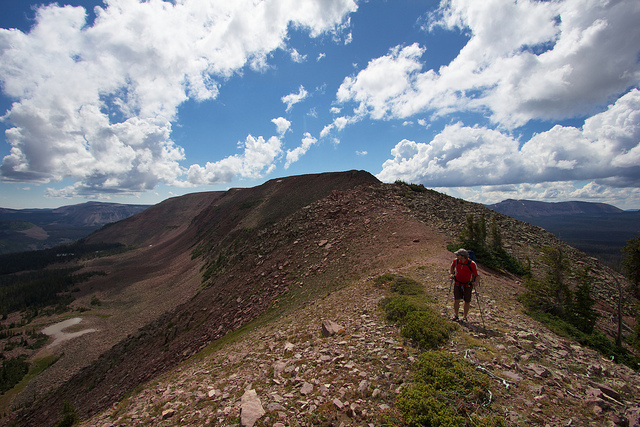
Taylor hiking up the trail to Cyclone Pass
Arriving on top of Cyclone Pass
Nikita was tired after the hike up to the pass. I'm constantly amazed at how strong of a hiker she still is despite being more than 9 years old. But this trip might have pushed her a little too hard. Kills me to say it but I think this might have been the last 20+ mile trip she'll ever make it on.
Sea Lion Lake, south of Cyclone Pass. Thompson Lake, notorious thanks to the Probst book on the Uintas, was just out of sight to the north.
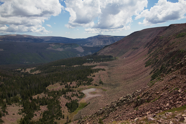
The view west from on top of Cyclone Pass. Dayne's Lake is in the foreground. You can clearly see most of the peaks in the Mirror Lake Highway area like Bald, Reid, Watson and Murdock. In the distance you can see the Wasatch Mountains.
We hung out on the pass for 15 or 20 minutes soaking in the views before making our way back down. The clouds were dramatic and moving fast and it was constantly looking like it could turn into a storm at any moment. This shot is looking back up at Cyclone Pass at a small pond on the way to Allen Lake.
After a nice off-trail stroll through the woods we finally found ourselves at Allen Lake. The lake was named after a forest service ranger named Floyd Allen who was struck and killed by lightning here on August 26, 1938. Pretty incredible to think of how remote this was back then. For us, we had logged a little over 11 miles with our detours to get here from the Mirror Lake Highway. Back then I don't even know where the best starting point would have been. Was there a some sort of dirt road where the Mirror Lake highway is now? If anyone has any information on that, I'd love to know.
One of the key reasons we chose Allen Lake was because of the description in the guidebook Hiking Utah's High Uintas by Jeffrey Probst. In it, Allen Lake is described as one of the best lakes for Grayling in the state of Utah. They say that it produces larger than average Grayling and that the state record will likely end up coming from this lake. Sounds fun!
Despite all my time in the Uintas, I had yet to ever catch a Grayling so after setting up our tents I got the rod out and got to it. On the first cast I had a hit but missed it. And second cast, Grayling!!
The fishing was red hot. They were a little tricky to hook but they at least hit my fly about every cast. Here's a few shots of some of the bigger ones. Keep in mind I have unusually large hands. These were all in the 12"+ range.
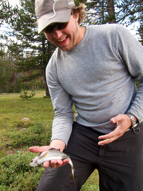
Taylor's first fish.
The technique for catching the Grayling was different than what I'm used to with typical Brook Trout and Cutthroat Trout in the Uintas. First of all, a fly rod is pretty much useless. The grayling never come anywhere near the shore. Even with the nice open shoreline, your chances of being able to cast into them with a fly rod is pretty much zero. Even that night, when the lake was boiling like I'd never seen before, they never came near the shore. I'm talking hundreds of fish rising simultaneously! It was quite the sight.
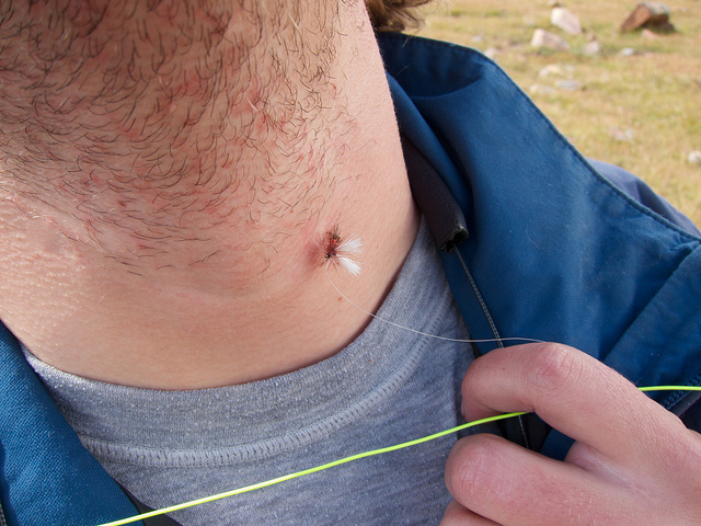
The succesful technique involved small to medium dark flies dragged slowly behind a bubble. The water was too choppy to be able to see a dry fly on the surface so that might have worked well but for me dragging it was the ticket. They would almost always hit within the first 10-20 feet of reeling. The best flies were a Royal Wulf and a Renegade. And speaking of the Royal Wulf. Be careful of them when you're trying to fly cast into strong wind! Taylor sunk one pretty deep into his neck. I had to take his forceps and rip this out for him.
It was a great lazy day at Allen Lake. We fished on and off, Taylor took a long nap in the hammock and I sat on the shore and watched the incredible clouds fly by. I shot a time lapse for a bit of it.
Later in the afternoon I noticed some movement on the other side of the lake. I had to run and get my long lens and put it on. Fortunately these two coyotes stuck around long enough for some shots.
Neither of us had ever eaten Grayling so we kept a few to try out with dinner. It turned out they aren't very good, or at least for us. I've heard from others that they really enjoy them. We found the scales to be very problematic and the texture to be too soft. The flavor wasn't bad though and most of the bones are extra large which keeps them out of the meat pretty well. I don't think I'll eat Grayling again though.
The full moon rising over Allen Lake
It rained a bit on us later that night but nothing big. We got packed up in the morning but just as we were getting ready to leave we noticed two bow hunters walking down the shore of the lake. Incredibly, these were the first humans we had seen since Friday night, not far from the Highline Trailhead. The hunters approached and we said hello, one of them walked up to me and asked if I had seen any naked women swimming in the lake. I looked at him a bit perplexed. If you read my website regularly then you probably know about my trip into The Winds last month where we encountered a topless woman swimming in a high alpine lake. Well it turns out this stranger was actually a regular reader of my website who I had actually exchanged several emails with earlier this summer. Great running into you out there, Riley!
We sat and talked to Riley and his friend for a while before heading out. It's about 10 miles from Allen Lake to the Highline Trailhead so we had a bit of a hike ahead of us. Fortunately, we were going to see at least a bit of new trail on the way out. We skipped the hike back through Four Lakes Basin and took the more direct route back past Bedground Lake. The first mile to that point is off trail. I kept the big camera packed away for the hike out so very few photos were taken. There were some ncie lily pads on Bedground Lake though.
The day stayed cool and overcast for most of the hike out. Then for the last 2+ miles we got hit with a nice storm. Lots of hail and rain. It was fun to hike in knowing that we had a nice, warm truck and a change of clothes waiting at the trailhead.
This might end up being my last trip to the Uintas for 2011. I hoped to get back up there one or two more times but it's about time I took a weekend at home and after that I feel the call of the desert. But who knows, last year my last Uintas trip was in October. If not then, I'll see them next year. Hopefully the snow melts before July!
")