napatony13
Member
- Joined
- Feb 5, 2021
- Messages
- 187
I was able to take advantage of the good weather the last week of February and snuck away on a quick getaway. As you might guess from the title I did a a fair amount of driving, but got to see an amazing array of rock art.
I left NorCal at noon and started the long haul eastward, The drive across Nevada was prettier than usual with fresh snow on all the mountain peaks.
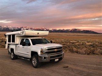
After spending the night in Great Basin NP I was up early the next morning and headed to my first stop, Parowan Gap.
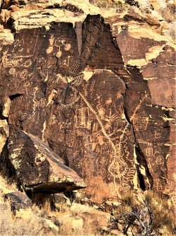
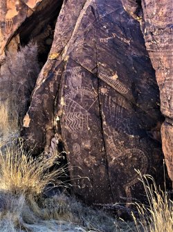
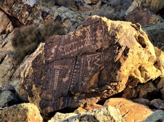
My next stop would be south of Zion to see the unique deeply-incised glyphs near there.
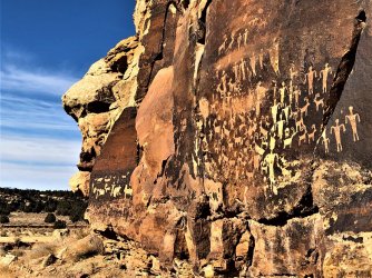
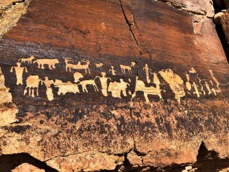
From there I turned south. My last stop of the day would be right along I-70. Despite being within sight of the freeway traffic, there were no trails and no evidence of recent visits to these panels.
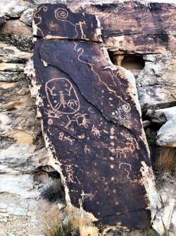
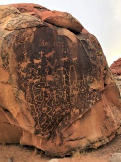
I then continued on to Gold Butte NM. Even in the dark it was evident that the notorious potholed road leading there had gotten no better since my last visit a few years ago. I pulled over for the night at the first spot that looked decent. In the morning I could see Lake Mead off in the distance.
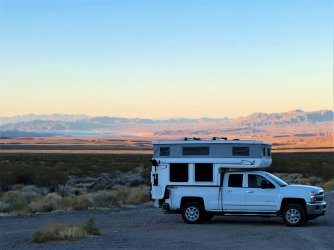
I then continued on in search of a few sites I'd missed on my earlier visit. I soon learned that although they still show up quite clearly on satellite images, the roads leading into these sites had been blocked off. This meant a few extra miles of hiking, but it was well worth the effort. The first stop was a billboard sized rock face covered with images of mountain sheep. It was a hard one to photograph, but very impressive to see in person.
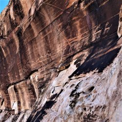
From there it was just a few miles of driving to reach the trailhead for the next panel. The hiking was a little rougher to this one as there were long sections of deep sand.
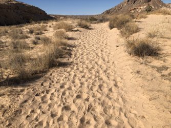
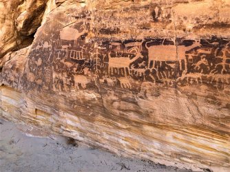
When I reached the main panel I could see that it lived up to its billing...it stretched over 60' long and was made up of hundreds of figures, including a wide assortment of animals.
Unfortunately most of it was in the bright morning sunlight and didn't photograph as well as I was hoping.
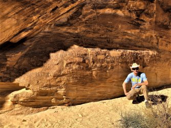
There were more glyphs, stylistically different and perhaps from a different time, high up on a rockface overlooking the main panel. I decided to scramble up there to try and get a better look.
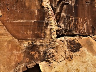
Getting closer meant scooting out on these micro-ledges that were about 40' off the ground. It was semi-sketchy but I have grippy shoes so I went for it.
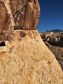
Crisp, clear and pristine...
My next target was a more modest panel and I only had very limited intel on it. From looking at my GPS it appeared to be about 3 miles away by foot in an adjacent valley. The directions I had took me there via a big looping drive of about 15 miles on a rough dirt track. This would cut the walking distance down to about 1.5 miles each way. After doing some rough calcs in my head I decided that it was going to be about the same amount of time either way, so rather than beat the truck & camper I opted for the cross-country hike. This would have the added benefit of bringing me back past the big panel when it was in the shade. I was able to follow game/cattle trails up and thru the saddle. The GPS data I had was errant and it initially took me to the wrong side of the valley. After it became apparent that my directions were off, I deduced that the panel was most likely hiding somewhere in the cliffs on the opposite side of the plain.
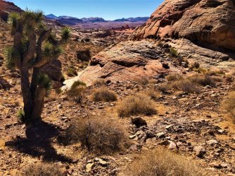
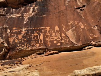
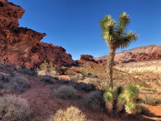
I eventually located the glyphs; they were in the deep red sandstone formation in the upper-center of the above photo.
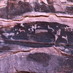
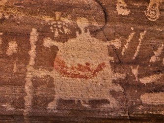
As expected they weren't as impressive as the previous panels, but they were still worth seeing. Among them was an atlatl, a strange, legless, ghost-like creature, and what appeared to me to be an axe attack.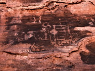
From here I was able to take a more direct path back across the valley. The desert colors out in this part of the country are really spectacular, but it's not somewhere I'd want to be in the Summer. Even with temps in the low 70s the deep sand and lack of shade had me wishing I'd carried more water.
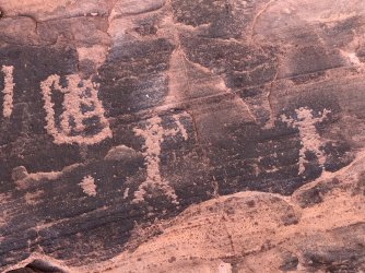
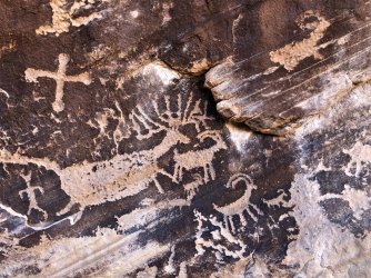
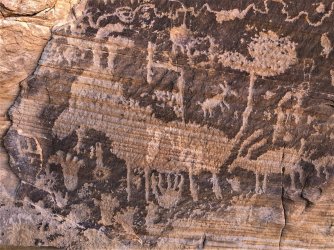
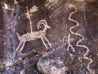
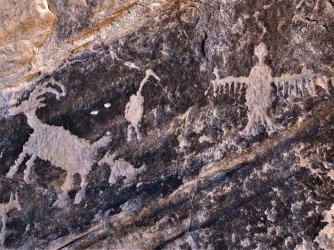
The big panel was now in full shade and I was able to get some better pictures. It's location in a narrow draw made getting its entire length in a photo impossible, but here are a few of the more interesting sections. For reference the largest bighorn figure was about 3' long.
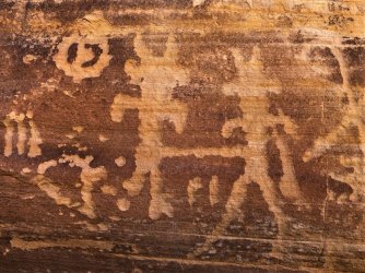
After leaving Gold Butte I headed south, then turned west and began closing the loop on my route back home. I arrived at my next destination right at sunset and found a nice fire ring all stocked with wood and kindling. I rarely bother with a campfire, but this seemed like the perfect evening to have one.
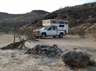
Unfortunately by the time I finished dinner the camper was being buffeted by some extremely strong winds that would intermittently come blasting down the canyon. I thought this was a localized event but the next morning I heard a Las Vegas radio station talking about the event. Upon returning to CA I heard the same winds happened there too.
The next morning I hiked into up a canyon to my next petroglyph site. The dry streambed was wide and flat; the sloping sediments of the canyon walls created an optical illusion that made it appear you were hiking downstream the entire time. This dark limestone was embedded with a lot of fossils, mostly corals and mollusks.
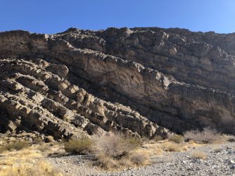
Eventually the canyon slotted up. The majority of the petroglyphs were located at the mouth of this narrow section.
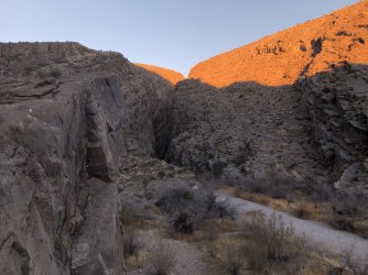
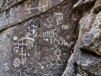
The quality of these wasn't the best, partially because of the rock surface and also because this area had a lot of graffiti.
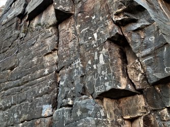
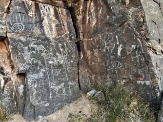
There were more glyphs up in the canyon narrows. This shield glyph was the most unusual, however I'm not sure if it is authentic or something more modern.
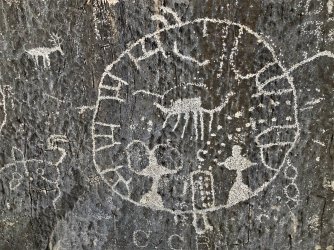
Here are a few more from the narrows. It was unusual to see them right down at ground level...there was plenty of space up higher, so it seems likely that the canyon has been filling with gravel over the years.
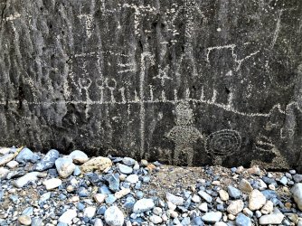
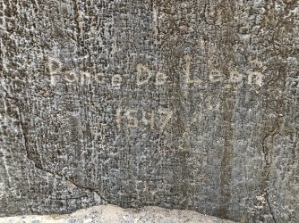
Someone with a sense of humor but a poor grasp of history was here:
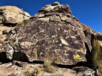
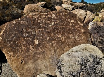
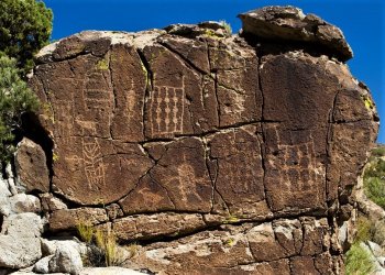
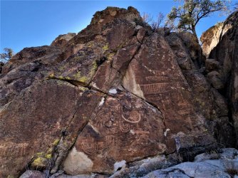
From here I headed NW to my next stop up in Basin and Range National Monument. In my original plans I had something else in mind, so I hadn't done much research on this site. But after a lot of second guessing and one wrong turn I was able to find it. The glyphs were scattered over a wide area in a boulder-strewn valley. There were no trails so this turned into a real Easter egg hunt, This would be a fun area to explore some more...I'm sure I must have missed a lot.
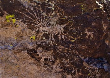
From here I turned west and started making my way towards home. My plan was to drive until dark, then continue on the next morning to one more site. I had two to choose from, one up near Reno, the other down south in Inyo County where my son is living. The latter was my preferred choice, and once I confirmed that my son would have time to go with me I turned in that direction.
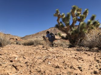
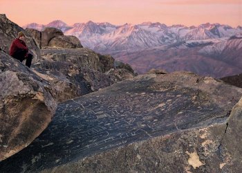
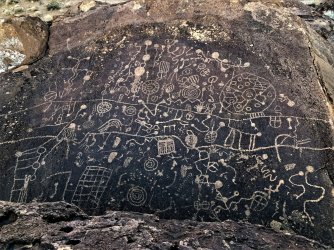
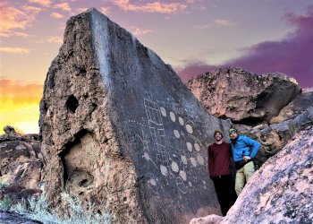
The next morning we were up before dawn and heading out into the tablelands. I knew the primary panel we were looking for was unusual in that it was carved on a nearly flat, horizontal boulder. Getting to it before the sun got too high would make for better pictures. After a short, steep climb we reached the slab. Even though I'd seen pictures of it I was unprepared for how impressive it was. A second panel was located nearby, and it was incredible in its own right. I felt very privileged to see these and to get to share it with my son.
It was a great way to cap off a very memorable trip,
I left NorCal at noon and started the long haul eastward, The drive across Nevada was prettier than usual with fresh snow on all the mountain peaks.

After spending the night in Great Basin NP I was up early the next morning and headed to my first stop, Parowan Gap.


My next stop would be south of Zion to see the unique deeply-incised glyphs near there.


From there I turned south. My last stop of the day would be right along I-70. Despite being within sight of the freeway traffic, there were no trails and no evidence of recent visits to these panels.


I then continued on to Gold Butte NM. Even in the dark it was evident that the notorious potholed road leading there had gotten no better since my last visit a few years ago. I pulled over for the night at the first spot that looked decent. In the morning I could see Lake Mead off in the distance.

I then continued on in search of a few sites I'd missed on my earlier visit. I soon learned that although they still show up quite clearly on satellite images, the roads leading into these sites had been blocked off. This meant a few extra miles of hiking, but it was well worth the effort. The first stop was a billboard sized rock face covered with images of mountain sheep. It was a hard one to photograph, but very impressive to see in person.

From there it was just a few miles of driving to reach the trailhead for the next panel. The hiking was a little rougher to this one as there were long sections of deep sand.

When I reached the main panel I could see that it lived up to its billing...it stretched over 60' long and was made up of hundreds of figures, including a wide assortment of animals.
Unfortunately most of it was in the bright morning sunlight and didn't photograph as well as I was hoping.

There were more glyphs, stylistically different and perhaps from a different time, high up on a rockface overlooking the main panel. I decided to scramble up there to try and get a better look.

Getting closer meant scooting out on these micro-ledges that were about 40' off the ground. It was semi-sketchy but I have grippy shoes so I went for it.

Crisp, clear and pristine...

My next target was a more modest panel and I only had very limited intel on it. From looking at my GPS it appeared to be about 3 miles away by foot in an adjacent valley. The directions I had took me there via a big looping drive of about 15 miles on a rough dirt track. This would cut the walking distance down to about 1.5 miles each way. After doing some rough calcs in my head I decided that it was going to be about the same amount of time either way, so rather than beat the truck & camper I opted for the cross-country hike. This would have the added benefit of bringing me back past the big panel when it was in the shade. I was able to follow game/cattle trails up and thru the saddle. The GPS data I had was errant and it initially took me to the wrong side of the valley. After it became apparent that my directions were off, I deduced that the panel was most likely hiding somewhere in the cliffs on the opposite side of the plain.

I eventually located the glyphs; they were in the deep red sandstone formation in the upper-center of the above photo.
As expected they weren't as impressive as the previous panels, but they were still worth seeing. Among them was an atlatl, a strange, legless, ghost-like creature, and what appeared to me to be an axe attack.


From here I was able to take a more direct path back across the valley. The desert colors out in this part of the country are really spectacular, but it's not somewhere I'd want to be in the Summer. Even with temps in the low 70s the deep sand and lack of shade had me wishing I'd carried more water.


The big panel was now in full shade and I was able to get some better pictures. It's location in a narrow draw made getting its entire length in a photo impossible, but here are a few of the more interesting sections. For reference the largest bighorn figure was about 3' long.


After leaving Gold Butte I headed south, then turned west and began closing the loop on my route back home. I arrived at my next destination right at sunset and found a nice fire ring all stocked with wood and kindling. I rarely bother with a campfire, but this seemed like the perfect evening to have one.

Unfortunately by the time I finished dinner the camper was being buffeted by some extremely strong winds that would intermittently come blasting down the canyon. I thought this was a localized event but the next morning I heard a Las Vegas radio station talking about the event. Upon returning to CA I heard the same winds happened there too.
The next morning I hiked into up a canyon to my next petroglyph site. The dry streambed was wide and flat; the sloping sediments of the canyon walls created an optical illusion that made it appear you were hiking downstream the entire time. This dark limestone was embedded with a lot of fossils, mostly corals and mollusks.

Eventually the canyon slotted up. The majority of the petroglyphs were located at the mouth of this narrow section.

The quality of these wasn't the best, partially because of the rock surface and also because this area had a lot of graffiti.


There were more glyphs up in the canyon narrows. This shield glyph was the most unusual, however I'm not sure if it is authentic or something more modern.

Here are a few more from the narrows. It was unusual to see them right down at ground level...there was plenty of space up higher, so it seems likely that the canyon has been filling with gravel over the years.


Someone with a sense of humor but a poor grasp of history was here:

From here I headed NW to my next stop up in Basin and Range National Monument. In my original plans I had something else in mind, so I hadn't done much research on this site. But after a lot of second guessing and one wrong turn I was able to find it. The glyphs were scattered over a wide area in a boulder-strewn valley. There were no trails so this turned into a real Easter egg hunt, This would be a fun area to explore some more...I'm sure I must have missed a lot.


From here I turned west and started making my way towards home. My plan was to drive until dark, then continue on the next morning to one more site. I had two to choose from, one up near Reno, the other down south in Inyo County where my son is living. The latter was my preferred choice, and once I confirmed that my son would have time to go with me I turned in that direction.
The next morning we were up before dawn and heading out into the tablelands. I knew the primary panel we were looking for was unusual in that it was carved on a nearly flat, horizontal boulder. Getting to it before the sun got too high would make for better pictures. After a short, steep climb we reached the slab. Even though I'd seen pictures of it I was unprepared for how impressive it was. A second panel was located nearby, and it was incredible in its own right. I felt very privileged to see these and to get to share it with my son.


It was a great way to cap off a very memorable trip,
Last edited:

