- Joined
- Aug 9, 2007
- Messages
- 12,957
Are you guys sick of my Glen Canyon reports yet? At the beginning of this year, I put our boat up for sale. I love the trips we do out of it, but I hate how having it compels me to go on boat trips more often than I might want to otherwise. And to further the frustration, the dream in my head of walking the hundreds of recovering Glen Canyon tributaries wasn't coming to fruition as easily as I thought. 2015 brought some of the craziest weather I'd ever seen in my life. We came closer than most will ever dream of getting wiped away by a flash flood. Twice. And the hiking didn't come easy in between. The logistics of taking a boat capable of covering large distances to the backs of canyons and leaving it are trickier than you might think.
After a few days I came to my senses and took the ad for the boat down. But this year would be different. We'd use it like we stole it and try harder to get into more canyons. Every trip we would think "what if we didn't have this anymore?" and at the end of the year, we'd have a better idea of whether we should keep it.
It's almost October now, and man, 2016 has really changed my perspective on things. 6 trips and 20 bag nights just out on Glen Canyon boat trips so far this year (not counting packrafting). That's just over half of my 39 nights YTD. And not one of those nights did I sleep in a tent. We didn't see a flash flood this year. Hell, we didn't even really get rained on with the exception of a few drops on this last trip. What a change from last year. But perhaps the best change is that we explored so many canyons by foot and kayak; Smith Fork, Forbidden, Iceberg, Rincon, Fiftymile, Grotto, Balanced Rock, West, Desha, Bend, Cottonwood, Wilson, Deep, Forbidding and Mountain Sheep. The water came up higher than it has been in the last 4 years in July, but that didn't hinder anything. It was still ~80 feet below high water mark with so much to see and do.
Okay, okay, enough reflecting. On to this last trip. This was the 'big trip' of the year. Big in the sense that we had lots of company. 6 of us, plus 3 of my dogs. That's a full boat. This was the weekend after Labor Day so we targeted the area around Dangling Rope assuming that traffic would be significantly lower with kids back in school. Day one is always about finding a great campsites, especially when you have to have space for tents. It took much longer than expected, but after exploring several canyons, we finally found an incredible spot just off of the Colorado River channel near Forbidding Canyon, the home of Rainbow Bridge National Monument. I recently picked up a GoPro so I decided to play with it in camp that afternoon.
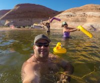
Noodling in the shadow of Navajo Mountain.
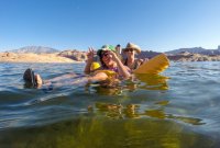
Nikita still hangin' in there. This was the perfect beach for her in her condition. Nice and flat with tons of shoreline to poke around in. She had a good time.
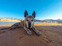
The next morning we loaded up the kayaks and motored up Forbidding Canyon. But instead of turning into Bridge Creek where 99% of the traffic goes to see Rainbow Bridge, we continued up the main canyon.
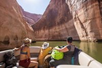
We found a convenient spot to beach the boat and prepare to paddle the rest of the way to where we could begin hiking up the canyon. Audra stayed with the boat and the old dog. Unfortunately, as we began to paddle away, we found a flaw in our meticulous planning. We took so long making breakfast and getting ready that it was already late morning and we hadn't packed lunch. Not usually a huge deal, but due to some health issues in the group, we had to suddenly cut our anticipated hike time down to just a few hours. Not ideal, but we were in the boats and ready to go so off we went.
I took a few video clips on the hike, but not enough to make much of a video so I had to slip in a few photos.
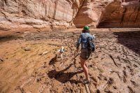
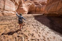
As the water drops, the silt beds turn into sticky mud flats that can be anywhere from gross and inconvenient to very dangerous. We were able to get through this one by tossing driftwood out to make a bridge. Toss a few sticks, step on them, toss a few more.
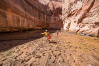
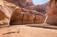
Just weeks earlier, the reservoir extended up canyon beyond this deep undercut.
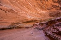
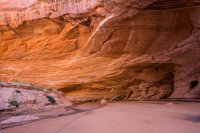
Just beyond the undercut, we reached the 2016 high water mark. From here up, the reservoir hasn't touched anything since 2011 or earlier and it wasn't hard to tell.
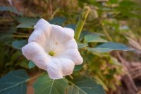
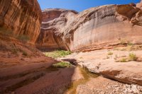
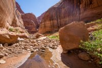
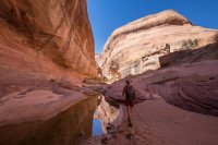
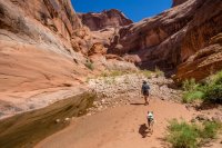
This canyon was a jaw dropper on every bend. I could spend many days here.
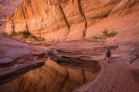
We stopped near here for a dip before turning around. We were still about 20-25 feet below the high water mark as you can see by the bathtub ring in this photo. It was gut wrenching to have to turn back so early, but it's ok. I'm definitely coming back to this one.
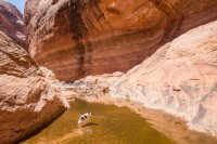
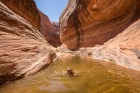
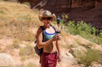
@Jen finally found the use of the super coozie (Yeti Colster knock off). Put a beer in it and toss it in the backpack, and an hour and a half later you still have a cold beer to drink on the walk out!
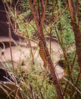
A lizzard hiding in the shade of a tamarisk tree.
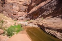
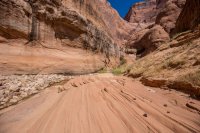
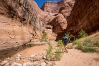
Love this canyon, particularly without the reservoir on top of it.
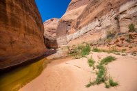
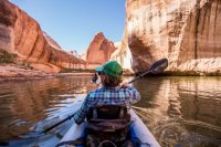
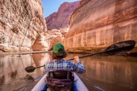
Paddling back out to meet Audra and the big boat.
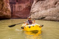
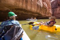
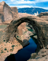
We got back to the boat and had a soak before heading back to camp for lunch. Later that evening, we headed over to Bridge Creek to take a walk up to Rainbow Bridge. Every time I've been here the docks have been loaded with boats, but this time we almost had it to ourselves.
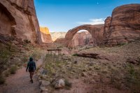
We were hoping for some late light on the arch, but we were too late.
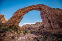
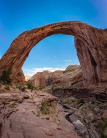
A vertical pano of Rainbow Bridge and Bridge Creek below. Hard to believe that the reservoir would come all the way up under the arch if it ever were to fill again.
Back out on the Colorado, we encountered a fine sunset in progress.
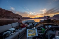
We killed the motor and took it in. You couldn't do this in the busy summer months here. Well, not unless you enjoyed getting smashed by boat wake. There was no one around now.
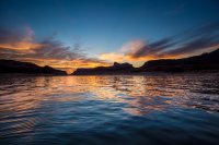
We stayed up late that night playing card games and drinking. Around 4 or 5 in the morning, I awoke to rain on my face. I popped up and opened up the bimini on the boat. Not enough to shelter all of either of us, but it offered a little protection. The rain ebbed and flowed a bit but never really picked up enough to be an issue. This was surprising though, because the forecast looked totally clear when we left. When we finally got out of bed, the sky was still overcast. We had a good view of Navajo Mountain so we were able to pull down a forecast. 3% chance of rain. And sure enough, once we started cooking breakfast, the clouds burned off and it was another beautiful day in Glen Canyon.
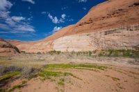
That morning, I took my camera with my up to the groover. Our site was adjacent to a large area that I found very interesting. Look at the photo below. You can see the high water mark (3700 feet), and in the vegetation, you can see the high water mark of 2016 (~3621 feet). The difference is that the 2016 HWM is marked in the vegetation. See where the grass goes from green to dead? See the bushes that are half alive and half dead? That dead swatch was under water weeks earlier.
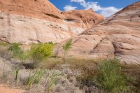
Same area, but closer to the water. See the cottonwoods that are alive on top and dead on the bottom half? Again, the 2016 HWM. These cottonwoods have had 4+ years to spring back and almost got taken out by the high water this year, but they just keep on going.
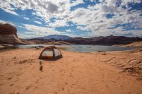
Walking back to the boat from the groover. We setup a tent, but we never slept in it. Good place to put our stuff during the day though.
After much deliberation, we decided to hike Mountain Sheep Canyon this day. Ironically, we were greeted by a large group of Bighorn Sheep as we entered the canyon.
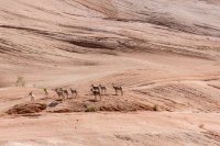
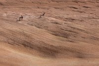
We motored into the canyon until the boat wouldn't fit anymore. In fact, we had a hard time turning around, especially with the kayaks and packraft on my stern. We motored back out to a place we could park the boat but it was a long way from the upper canyon. After a soak and some lunch, we decided to still try for it. Into the kayaks and off we went. These are all GoPro shots from here on out.
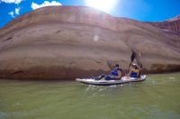
Alli paddling while I played the part of the f*@king fotografer.
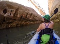
Packrafts can't track for shit so we tied Jen up to us and dragged her in. You could hardly tell she was back there.
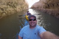
Sage in her usual position on the bow.
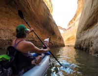
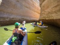
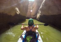
After much paddling, we finally found where the reservoir ended. Unfortunately, it was also quick silt hell. If it weren't for some convenient logs amongst the sludge, we would have had a really hard time. The much kept us from being able to hike further up the canyon. This is just one of those things you have to deal with sometimes in the Glen Canyon we know now. When the water drops, silt develops at the heads of the canyons. Flash floods will come through and blast it out, but in between, it can become a very, very bad place to be.
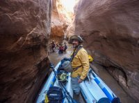
After a brief attempt to hike the canyon, we were back in the kayaks and paddling out.
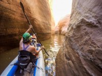
It's still a gorgeous canyon even from a kayak. Can't wait to walk more of this someday.
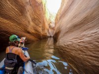
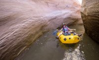
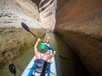
Here's a little video clip of us paddling through Mountain Sheep Canyon. If you're into seeing more videos and photos of Glen Canyon recovering, go subscribe to the new Glen Canyon Rising YouTube channel: https://www.youtube.com/channel/UC9hL4KbRbHnvsiodih-fXMg. And of course, the FB page: https://www.facebook.com/GlenCanyonRising/
We got back to the boat and spent some time cleaning and packing up the kayaks. After a quick stop at Dangling Rope, we headed back to camp. It was a little windy that night but we still got in one last noodle session before dinner, drinks and bed. The next day we motored back out to Wahweap with a quick stop in Warm Creek for a final swim. I never really know, but I think this will be our final trip out there this year. I still feel conflicted about the boat, but not like at the start of the year. I love exploring this place, and I really love showing people that there's still so much out there and how quickly the canyons can bounce back. I don't think we'll try to keep the same pace in 2016, but it will still be worth it. I can't really imagine not having this type of trip available anymore.
After a few days I came to my senses and took the ad for the boat down. But this year would be different. We'd use it like we stole it and try harder to get into more canyons. Every trip we would think "what if we didn't have this anymore?" and at the end of the year, we'd have a better idea of whether we should keep it.
It's almost October now, and man, 2016 has really changed my perspective on things. 6 trips and 20 bag nights just out on Glen Canyon boat trips so far this year (not counting packrafting). That's just over half of my 39 nights YTD. And not one of those nights did I sleep in a tent. We didn't see a flash flood this year. Hell, we didn't even really get rained on with the exception of a few drops on this last trip. What a change from last year. But perhaps the best change is that we explored so many canyons by foot and kayak; Smith Fork, Forbidden, Iceberg, Rincon, Fiftymile, Grotto, Balanced Rock, West, Desha, Bend, Cottonwood, Wilson, Deep, Forbidding and Mountain Sheep. The water came up higher than it has been in the last 4 years in July, but that didn't hinder anything. It was still ~80 feet below high water mark with so much to see and do.
Okay, okay, enough reflecting. On to this last trip. This was the 'big trip' of the year. Big in the sense that we had lots of company. 6 of us, plus 3 of my dogs. That's a full boat. This was the weekend after Labor Day so we targeted the area around Dangling Rope assuming that traffic would be significantly lower with kids back in school. Day one is always about finding a great campsites, especially when you have to have space for tents. It took much longer than expected, but after exploring several canyons, we finally found an incredible spot just off of the Colorado River channel near Forbidding Canyon, the home of Rainbow Bridge National Monument. I recently picked up a GoPro so I decided to play with it in camp that afternoon.

Noodling in the shadow of Navajo Mountain.

Nikita still hangin' in there. This was the perfect beach for her in her condition. Nice and flat with tons of shoreline to poke around in. She had a good time.

The next morning we loaded up the kayaks and motored up Forbidding Canyon. But instead of turning into Bridge Creek where 99% of the traffic goes to see Rainbow Bridge, we continued up the main canyon.

We found a convenient spot to beach the boat and prepare to paddle the rest of the way to where we could begin hiking up the canyon. Audra stayed with the boat and the old dog. Unfortunately, as we began to paddle away, we found a flaw in our meticulous planning. We took so long making breakfast and getting ready that it was already late morning and we hadn't packed lunch. Not usually a huge deal, but due to some health issues in the group, we had to suddenly cut our anticipated hike time down to just a few hours. Not ideal, but we were in the boats and ready to go so off we went.

I took a few video clips on the hike, but not enough to make much of a video so I had to slip in a few photos.

As the water drops, the silt beds turn into sticky mud flats that can be anywhere from gross and inconvenient to very dangerous. We were able to get through this one by tossing driftwood out to make a bridge. Toss a few sticks, step on them, toss a few more.


Just weeks earlier, the reservoir extended up canyon beyond this deep undercut.


Just beyond the undercut, we reached the 2016 high water mark. From here up, the reservoir hasn't touched anything since 2011 or earlier and it wasn't hard to tell.


This canyon was a jaw dropper on every bend. I could spend many days here.

We stopped near here for a dip before turning around. We were still about 20-25 feet below the high water mark as you can see by the bathtub ring in this photo. It was gut wrenching to have to turn back so early, but it's ok. I'm definitely coming back to this one.


@Jen finally found the use of the super coozie (Yeti Colster knock off). Put a beer in it and toss it in the backpack, and an hour and a half later you still have a cold beer to drink on the walk out!

A lizzard hiding in the shade of a tamarisk tree.


Love this canyon, particularly without the reservoir on top of it.

Paddling back out to meet Audra and the big boat.


We got back to the boat and had a soak before heading back to camp for lunch. Later that evening, we headed over to Bridge Creek to take a walk up to Rainbow Bridge. Every time I've been here the docks have been loaded with boats, but this time we almost had it to ourselves.

We were hoping for some late light on the arch, but we were too late.

A vertical pano of Rainbow Bridge and Bridge Creek below. Hard to believe that the reservoir would come all the way up under the arch if it ever were to fill again.

Back out on the Colorado, we encountered a fine sunset in progress.

We killed the motor and took it in. You couldn't do this in the busy summer months here. Well, not unless you enjoyed getting smashed by boat wake. There was no one around now.

We stayed up late that night playing card games and drinking. Around 4 or 5 in the morning, I awoke to rain on my face. I popped up and opened up the bimini on the boat. Not enough to shelter all of either of us, but it offered a little protection. The rain ebbed and flowed a bit but never really picked up enough to be an issue. This was surprising though, because the forecast looked totally clear when we left. When we finally got out of bed, the sky was still overcast. We had a good view of Navajo Mountain so we were able to pull down a forecast. 3% chance of rain. And sure enough, once we started cooking breakfast, the clouds burned off and it was another beautiful day in Glen Canyon.
That morning, I took my camera with my up to the groover. Our site was adjacent to a large area that I found very interesting. Look at the photo below. You can see the high water mark (3700 feet), and in the vegetation, you can see the high water mark of 2016 (~3621 feet). The difference is that the 2016 HWM is marked in the vegetation. See where the grass goes from green to dead? See the bushes that are half alive and half dead? That dead swatch was under water weeks earlier.

Same area, but closer to the water. See the cottonwoods that are alive on top and dead on the bottom half? Again, the 2016 HWM. These cottonwoods have had 4+ years to spring back and almost got taken out by the high water this year, but they just keep on going.

Walking back to the boat from the groover. We setup a tent, but we never slept in it. Good place to put our stuff during the day though.

After much deliberation, we decided to hike Mountain Sheep Canyon this day. Ironically, we were greeted by a large group of Bighorn Sheep as we entered the canyon.


We motored into the canyon until the boat wouldn't fit anymore. In fact, we had a hard time turning around, especially with the kayaks and packraft on my stern. We motored back out to a place we could park the boat but it was a long way from the upper canyon. After a soak and some lunch, we decided to still try for it. Into the kayaks and off we went. These are all GoPro shots from here on out.

Alli paddling while I played the part of the f*@king fotografer.

Packrafts can't track for shit so we tied Jen up to us and dragged her in. You could hardly tell she was back there.

Sage in her usual position on the bow.


After much paddling, we finally found where the reservoir ended. Unfortunately, it was also quick silt hell. If it weren't for some convenient logs amongst the sludge, we would have had a really hard time. The much kept us from being able to hike further up the canyon. This is just one of those things you have to deal with sometimes in the Glen Canyon we know now. When the water drops, silt develops at the heads of the canyons. Flash floods will come through and blast it out, but in between, it can become a very, very bad place to be.

After a brief attempt to hike the canyon, we were back in the kayaks and paddling out.

It's still a gorgeous canyon even from a kayak. Can't wait to walk more of this someday.


Here's a little video clip of us paddling through Mountain Sheep Canyon. If you're into seeing more videos and photos of Glen Canyon recovering, go subscribe to the new Glen Canyon Rising YouTube channel: https://www.youtube.com/channel/UC9hL4KbRbHnvsiodih-fXMg. And of course, the FB page: https://www.facebook.com/GlenCanyonRising/
We got back to the boat and spent some time cleaning and packing up the kayaks. After a quick stop at Dangling Rope, we headed back to camp. It was a little windy that night but we still got in one last noodle session before dinner, drinks and bed. The next day we motored back out to Wahweap with a quick stop in Warm Creek for a final swim. I never really know, but I think this will be our final trip out there this year. I still feel conflicted about the boat, but not like at the start of the year. I love exploring this place, and I really love showing people that there's still so much out there and how quickly the canyons can bounce back. I don't think we'll try to keep the same pace in 2016, but it will still be worth it. I can't really imagine not having this type of trip available anymore.

