Deadeye008
Hambone
- Joined
- Jan 18, 2012
- Messages
- 742
I was going to wait until I had the video done for this trip to post a TR but I haven't had the time lately to work on the video so I'll just add it to the report when I get it done. I have been backpacking into this area for the past 15+ years. Always coming up the Dry Creek TH and always with the three most popular lakes, Fish, Sand, and Round. This trip I decided to come in on a different route and explore the other lakes in the basin to see what they had to offer. The route we took came in from the East. We followed a 4x4 road off of Hwy 150 and ended up at the end of the road just North of Whiskey Island Lake. From there we headed West, up and over the ridge gaining some 600 ft of elevation in less than .5 mile. It was steeper than I had figured be we made the ridgeline in under half an hour. From the ridge we hooked up with a game trail that lead us Southwest down back down the 600ft we had just gained and into the basin. This trail was more gradual route we had taken up on the other side. Our destination was W-57 were we would spend the night. It sat 2.5 miles from our TH. W-57 is more of a pond than a lake. Roughly 75yds across and half that distance wide. I had been told that it held some decent sized Brookies but most of what we caught were around 12". I saw a few that would have went a little longer than that. All of the fish in there were really healthy and most of them were strutting their deep, rich fall spawning colors already. After arriving at the lake we set up camp, ate lunch, did a little fishing, and then decided to head over to Fish and Sand Lakes to catch some Grayling and check out some historic site in the area. From W-57 it took us about 20 minutes to get to the Eastern shore of Fish Lake. The dam on the Eastern shore was built by CCC workers in the 1930's and there are still various artifacts that can be found from that era including the remains of a log cabin that they inhabited. Also in the are are some sites/artifacts that are much older than those left by the CCC workers. We located the remains of a cabin that is located Northwest of the CCC cabin. All that remains are the logs in the ground that make up the outline of where the cabin once stood. Legend has it this cabin was inhabited by Spanish miners who worked the mine located on the Northwest shore of the lake. We could see the remains of a two track road that led to the entrance of the mine. We passed a few tree carvings along the way to the mine entrance also. In front of the now collapsed mine entrance there is a large pine tree with what looks like a cross carved in it. I have also heard others refer to it as a sword. Whatever it is, it was carved quite a while ago as it is over an inch deep in the tree. After checking out the historic sites in the area we did some fishing. It was red hot for pan sized grayling. I had on a foam beetle most of the time and it wouldn't last for than 10 seconds on top of the water before being snatched up by a hungry grayling. We fished at Fish Lake for about an hour working our way along the shoreline catching grayling after grayling until we made it to the eastern most side of the North shore. We then decided to go North to Sand lake and fish Eastward along the Southern shore. Fishing was just as hot as on Fish Lake but the fish were generally smaller. After fishing along the Southern shore of Sand Lake we decided to head back to our camp but we would take a short detour to check out W-53 and it's fish population. W-53 is basically a small and shallow pond with rust colored water. We fished it for about 45 minutes seeing a few rises. Just before leaving I had 2 or 3 hits on my foam beetle but was unable to hook up with the fish. I believe they were small Brookies. We got back to our camp, ate some dinner and then did some more fishing. As I was walking along the shore of W-57 I was startled by some barking and then some howling. I have heard plenty of coyotes in my days but this one was very close and sounded really hostile. I guess I must have startled him. He kept barking and howling at us for a good 15 minutes and every so often we could hear other coyotes in the distance as well. There must be a pretty healthy population of coyotes in the area. We heard them well into the night. I actually recorded some video/audio of them on my DSLR which I'll include in the video when I get it finished. That night I shot a few different star trails as we watched the meteor shower. Unfortunately none of the meteors crossed in front of my lens. It was great to be able to sit by a campfire for the first time this year. I got up early the next morning and did some fishing as I ate my breakfast. We had a red fox run right through our camp in the morning. Our campsite at W-57 looked like it hadn't been used in a few years and it was nice to have the place to ourselves. The animals in the area seemed to not mind us there either. Well, all except for the coyote the night before. After fishing for a couple of hours we decided to check out two other lakes in the basin on our way out. We cruised over to W-52 and W-51 to check out their fish populations. According to the DWR they are stocked with a couple hundred Brook Trout every three years or so. We circled each of the lakes fishing and looking for signs of fish but found nothing. The water in both lakes was a murky rust color. The lakes are fairly deep lakes(25ft) so I don't think the fish would have died over the winter. Not sure what to think. After fishing those two lakes we started the grueling hike back over the ridge. I think going down the backside of the ridge was even worse than coming up. All in all a great trip but I don't know if I would ever go into that basin using that route again. Here's some pics.
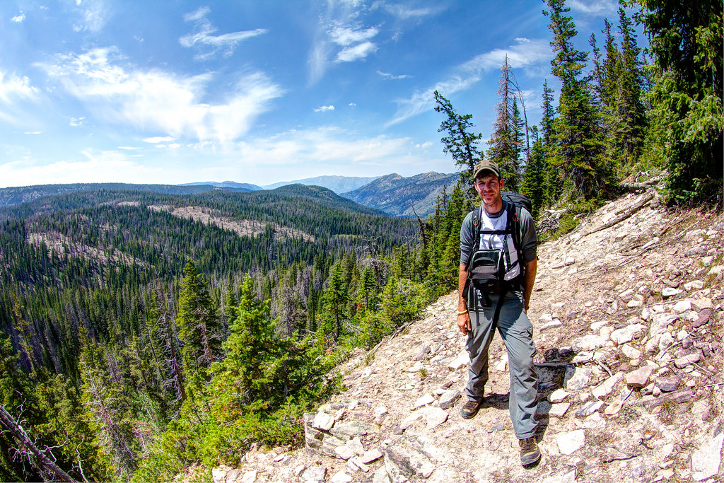
My buddy taking a quick break as we ascended the steep slope up to the ridgeline. The basin in the background is where we started.
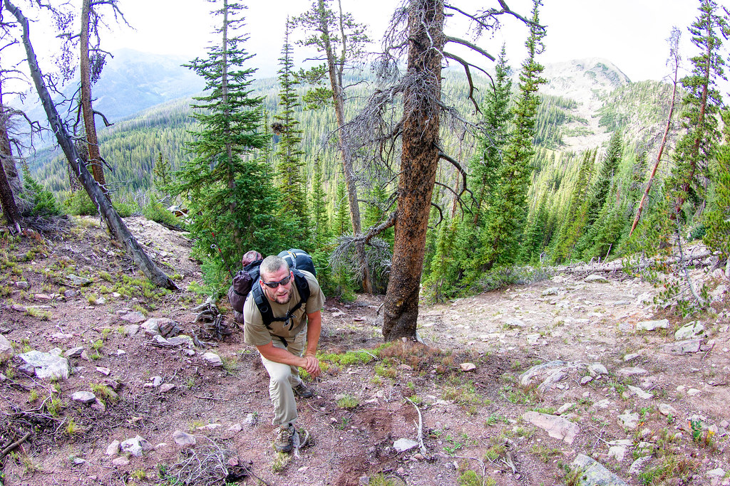
Nearing the ridge by Deadeye008, on Flickr
This is the marker tree in front of the collapsed mine entrance
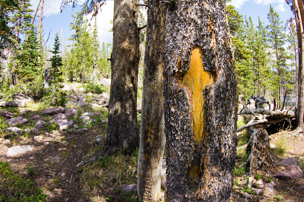
Spanish Mine Marker by Deadeye008, on Flickr
Collapsed mine entrance
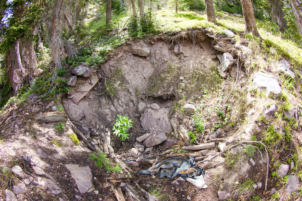
Collapsed Mine by Deadeye008, on Flickr
Old miners cabin remains
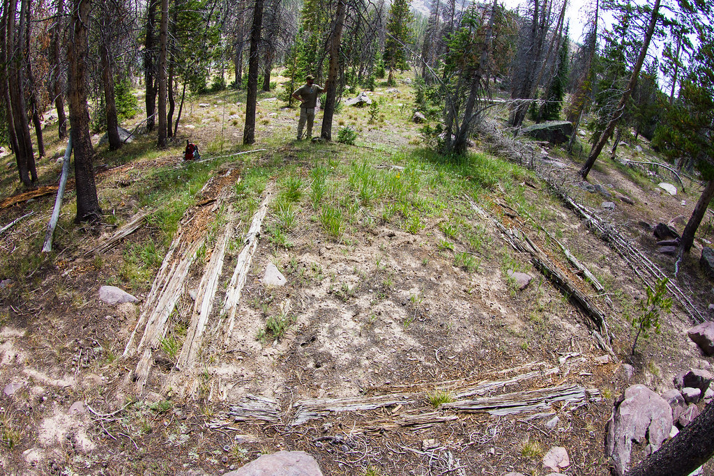
Old Miners Cabin Remains by Deadeye008, on Flickr
Old CCC cabin remains
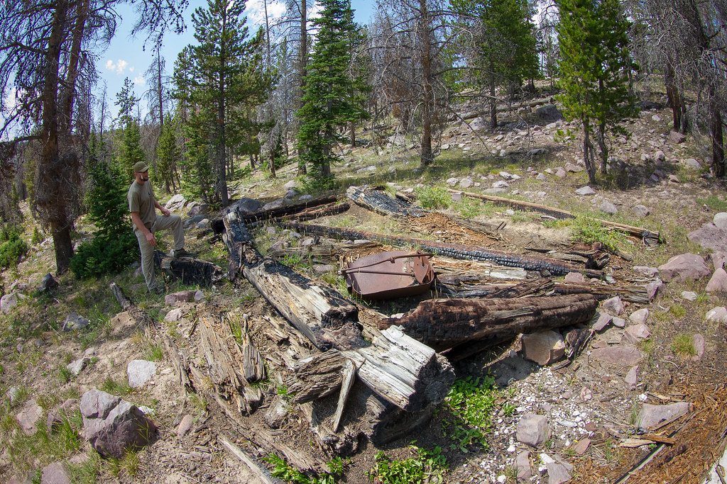
IMG_6806.jpg by Deadeye008, on Flickr
Fish Lake Sign

IMG_6804.jpg by Deadeye008, on Flickr
Old CCC artifact
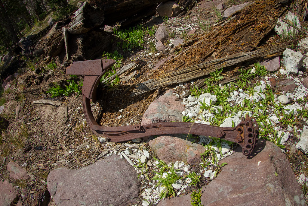
IMG_6805.jpg by Deadeye008, on Flickr
Brookie from W-57
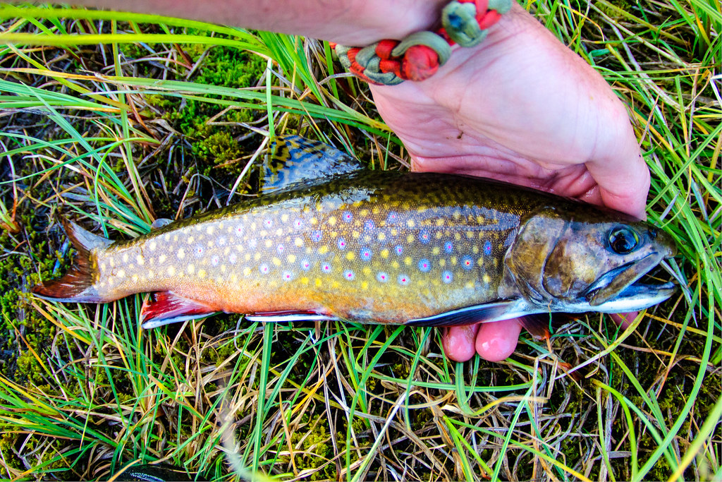
Gorgeous little brookie by Deadeye008, on Flickr
W-57 treeline reflection
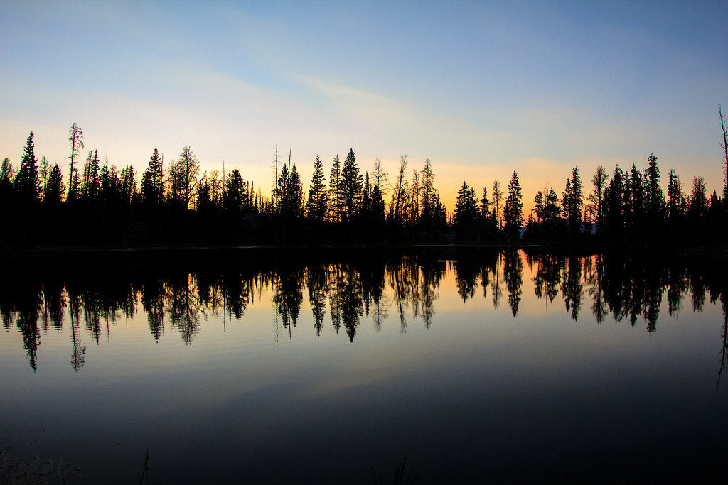
Symmetry by Deadeye008, on Flickr
Twilight and alpenglow on W-57
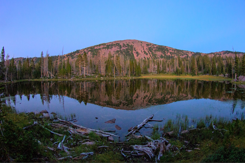
Twilight by Deadeye008, on Flickr
Milky Way beginning to appear over W-57
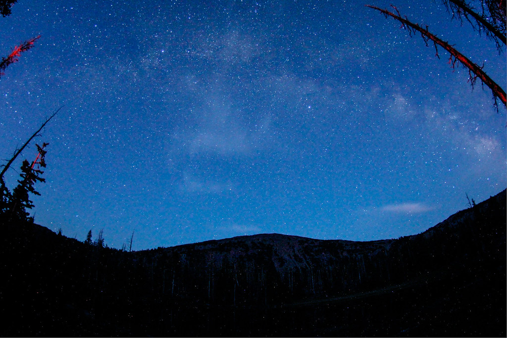
Milky Way begins to appear just after twilight by Deadeye008, on Flickr
Fish Lake
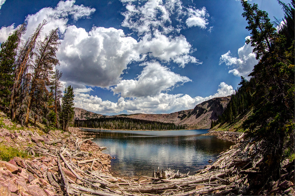
Clouds over Fish Lake by Deadeye008, on Flickr
Sand Lake
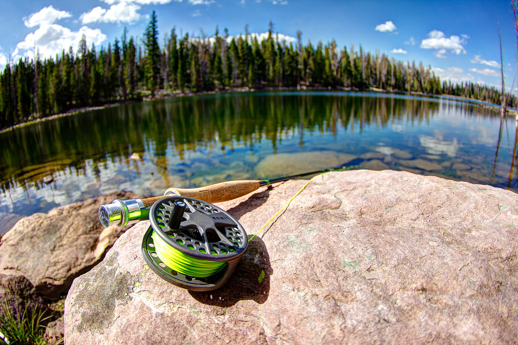
Rod and Sand Lake by Deadeye008, on Flickr
Taking a break at W-53
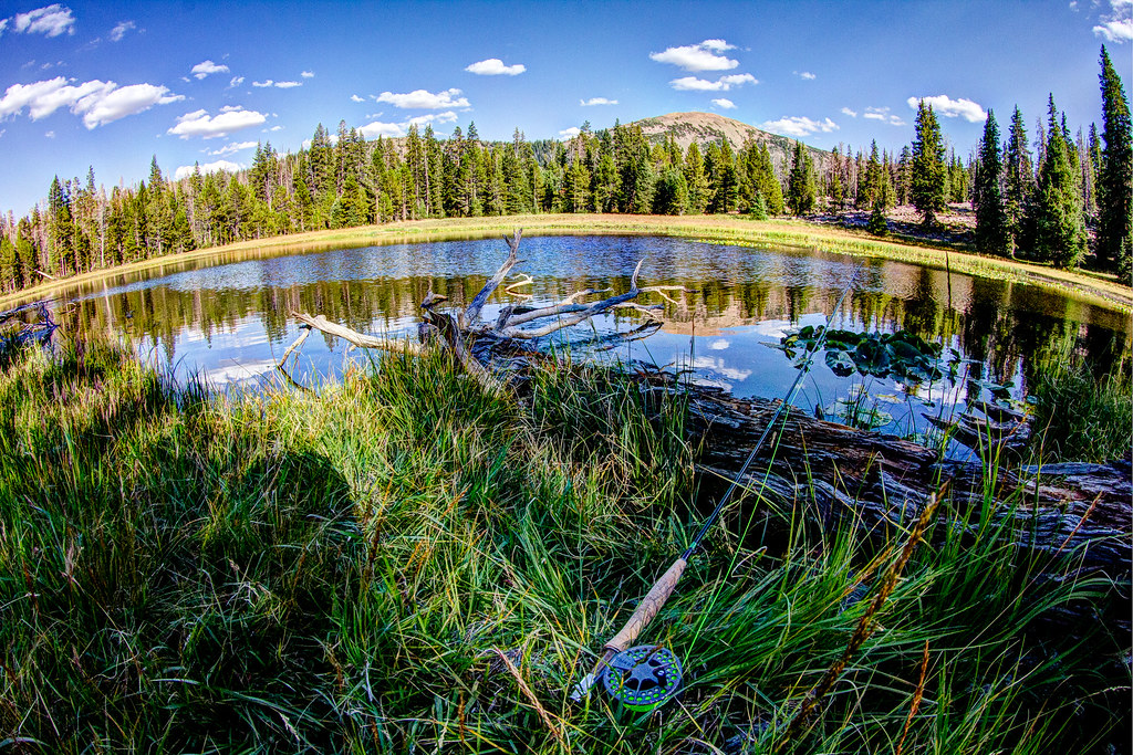
Taking in the scenery by Deadeye008, on Flickr
Campsite under the stars
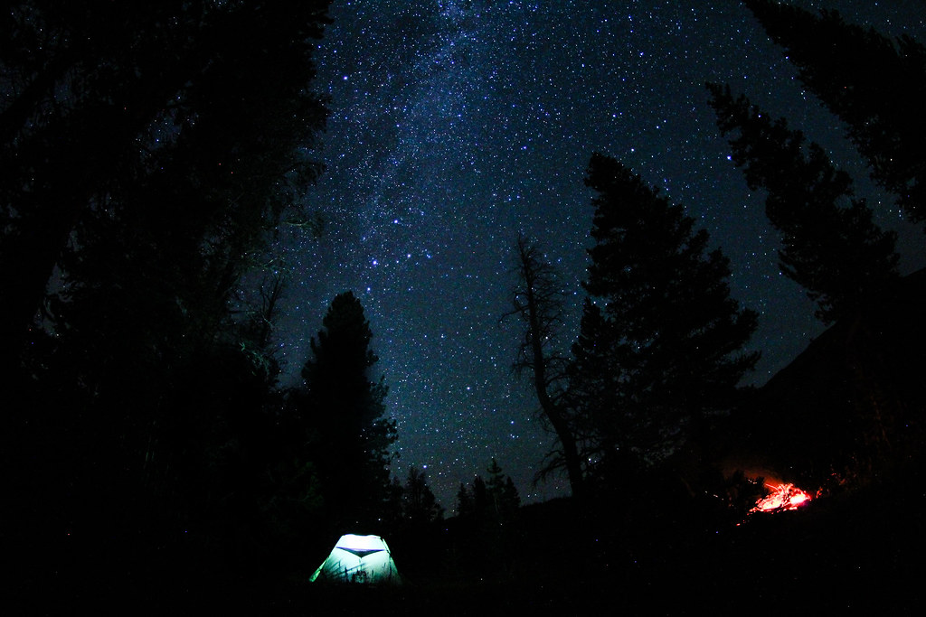
Campsite under the stars by Deadeye008, on Flickr
Brookie close-up
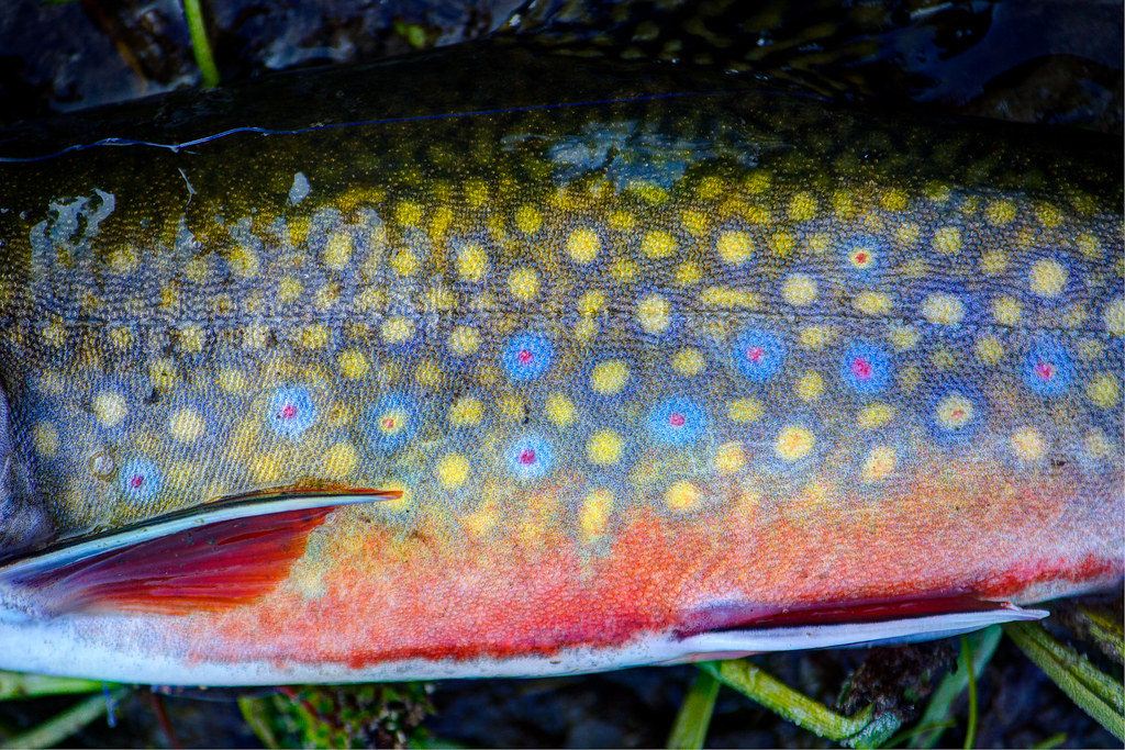
Deep colors on this guy by Deadeye008, on Flickr
Game trail we followed in and out of the basin, offering some nice views
Some amazing views on the hike out of the basin by Deadeye008, on Flickr
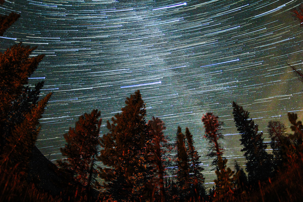
Milky Way
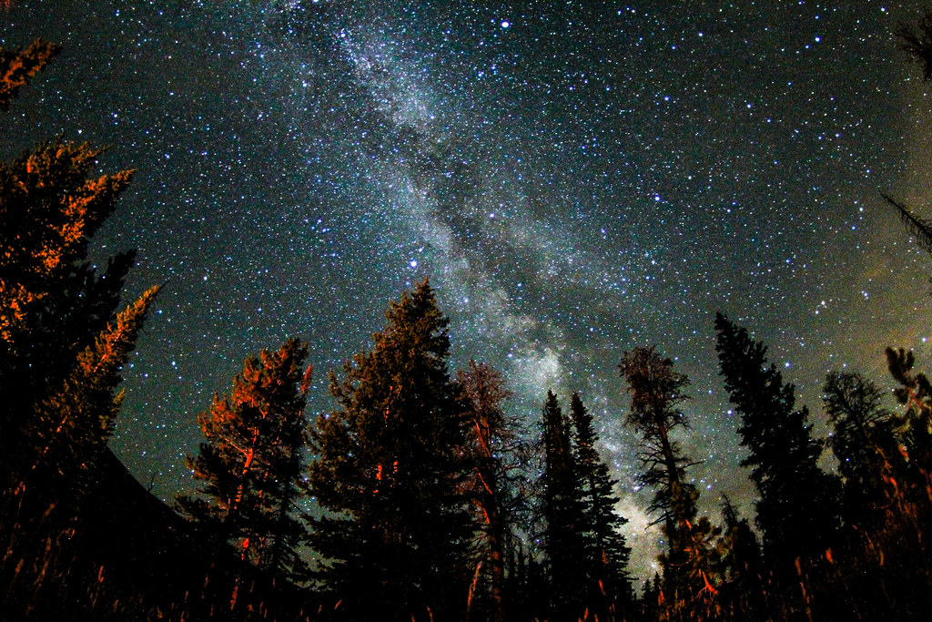
IMG_7052.jpg by Deadeye008, on Flickr
Grayling under the water
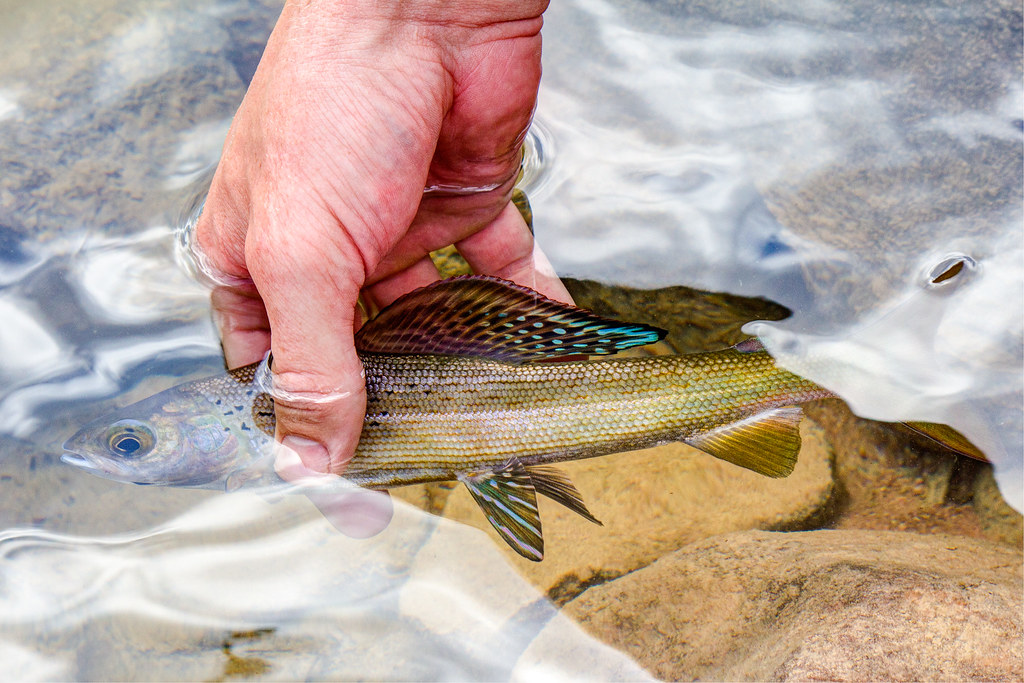
Arctic Grayling by Deadeye008, on Flickr
Featured image for home page:

My buddy taking a quick break as we ascended the steep slope up to the ridgeline. The basin in the background is where we started.
Nearing the ridge by Deadeye008, on Flickr
This is the marker tree in front of the collapsed mine entrance
Spanish Mine Marker by Deadeye008, on Flickr
Collapsed mine entrance
Collapsed Mine by Deadeye008, on Flickr
Old miners cabin remains
Old Miners Cabin Remains by Deadeye008, on Flickr
Old CCC cabin remains
IMG_6806.jpg by Deadeye008, on Flickr
Fish Lake Sign
IMG_6804.jpg by Deadeye008, on Flickr
Old CCC artifact
IMG_6805.jpg by Deadeye008, on Flickr
Brookie from W-57
Gorgeous little brookie by Deadeye008, on Flickr
W-57 treeline reflection
Symmetry by Deadeye008, on Flickr
Twilight and alpenglow on W-57
Twilight by Deadeye008, on Flickr
Milky Way beginning to appear over W-57
Milky Way begins to appear just after twilight by Deadeye008, on Flickr
Fish Lake
Clouds over Fish Lake by Deadeye008, on Flickr
Sand Lake
Rod and Sand Lake by Deadeye008, on Flickr
Taking a break at W-53
Taking in the scenery by Deadeye008, on Flickr
Campsite under the stars
Campsite under the stars by Deadeye008, on Flickr
Brookie close-up
Deep colors on this guy by Deadeye008, on Flickr
Game trail we followed in and out of the basin, offering some nice views
Some amazing views on the hike out of the basin by Deadeye008, on Flickr
Milky Way
IMG_7052.jpg by Deadeye008, on Flickr
Grayling under the water
Arctic Grayling by Deadeye008, on Flickr
Featured image for home page: