Scott Chandler
Wildness is a necessity- John Muir
- Joined
- Jan 4, 2014
- Messages
- 1,099
I have lived all around the Grand Canyon my whole life. Growing up in eastern AZ the south rim happened at least once a year, I think, my memory is blurry of those days. Eventually moving to St George, UT, the north rim became the spot to go, any while we had the vehicles Toroweap was the bee's knees. Yet with all that time, I had never gone into the belly of the beast. I remember visiting the canyon as a child and being scared stiff. I could only look across that massive expanse, to look down weakened the knees and made vertigo all the more of a safety issue. Those railings they had? Yeah, a kid could just fall away under one of those. Gravity seems far stronger near that impressive void.
As I got older and heights ceased to be the monster they were and instead a draw of intense curiosity, the Grand Canyon has become quite the mystical space. I've read a ton about the canyon and have planned entire trips, yet still it was a challenge to get down in there, moreso for logistics than for fear now though. The place is extremely committing, and the permit regulations aren't the most user friendly in the world. I hiked down Cathedral Wash just upstream from Navajo Bridge in the Marble Canyon section, which was absolutely amazing, but also lacked the feel of going into the bowels of the earth. I think overall elevation change there is a couple hundred feet after all. But it wet the lips even further. At the time I felt that I had finally entered the Grand Canyon! Yet as time passed, the accomplishment diminished a bit. I had to go back, so when the planets aligned and brought five amazing people from my time at Katmai together at the South Rim this winter, I knew the moment had to be seized.
A long drive after work had me by the canyon around midnight. Under the moonlight... there was a hole there. It wasn't terribly dramatic haha. The next day I was so exhausted that we kept things mellow, trying to spot javelina and being turned away from a Kolb Studio Tour that had stopped just a couple days beforehand.
The next day though, we were up in the brisk morning light to head down the Bright Angel Trail. It would be my friends Daniel and Whitney's final trip into the canyon before moving to Glacier National Park, so they wanted to see and show off the oasis of Indian Garden and proceed along to Plateau Point so that I could see the inner gorge.
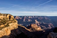
The morning light was sublime.
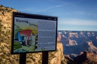
I'm glad that some parks don't have to be so stodgy. Apparently there is a staff sticker in which this man is Victor. Don't be like Victor.
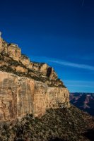
For anyone interested in geology, the canyon is amazing. For those interested in trails, the fact a trail goes down through these layers is amazing. Birds called left and right, some I recognized, others not so much. Amazing, upon amazing, upon amazing, upon amazing. This picture is at the Coconino Sandstone layer.
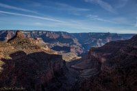
Indian Garden lies down there. The Battleship on the left was a good gauge of how far down our progress was.
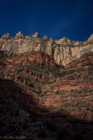
The distinct difference in colors makes the geology all the more approachable here. So red! So white!
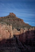
Below The Battleship now, entering the Redwall Limestone.
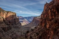
I started taking a lot more pictures when we hit the Redwall. The feel of the canyon changed a lot!
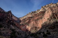
From the bottom of the Redwall, a grey limestone as most are, stained by the Supai Group's redness. The Coconino Sandstone rises shear above that with the Kaibab Limestone seeming to create parapets at the top.
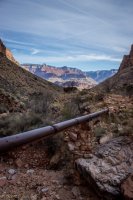
The trail follows the water pipeline from the North Rim to the South Rim. Believe it or not, the South Rim somehow gets its water from a spring on the other side of the river. The thing was built to last something like twenty years, and I think is running on around sixty now. Breaks are nearly constant on it and my friends had to go under water restrictions for a few weeks over a big one.
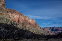
Reaching the Bright Angel Shale and Muav Limestone below the Redwall brought about an entirely different feel to the experience. I WAS IN THE GRAND CANYON
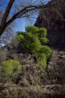
Indian Garden looks like an amazing place to hang out at. The water and foliage debunked that whole desert feel. We took a break here where it was now a good bit warmer to snack, take in the sounds of water and do some birding. We found a Brown Creeper hanging out by these very happy looking cottonwoods and a "big bird" that I saw circling the cliffs turned out to be a large adult condor! From here to Plateau Point felt like nothing compared to the trail down.
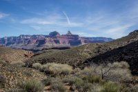
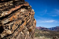
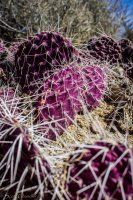
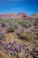
I can see how people die out here. Not a ton of shade and everything seems a bit harsh. The purple cacti are sure pretty!
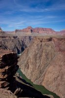
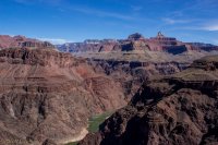
Before we knew it, the river was there, cutting through the basement of the continent. It was a glorious spot. Talk about feeling dwarfed. Plateau Point sits at the cusp of some of the oldest rocks of the world. A deep gorge sat to our north, a canyon rim so tall that it seemed more a mountain to our south.
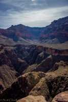
We lunched with a view up Pipe Spring Canyon to escape the wind and watch a few people traveling the trail. Quite a ways down still to go to get to the river. See a couple happy green trees in the distance? I wanted to visit them. The waterfall of the creek from Indian Garden directly below was impressive, another thing I wanted to visit.
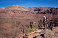
We are but ants.
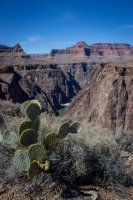
We walked the rim a bit to watch some rafts go through the next set of rapids. It looked intense from the rim, but they sure rode it like the rapid was nothing. This cactus was equally impressive.
From there it was back up we went! We had a dinner with the other Katmai family to catch after all.
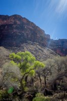
Happy tree!
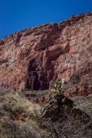
Cactus and shear cliffs
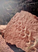
Ancient tracks, right by the trail.
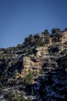
The Kolb Brother Studio, what a spot to be.
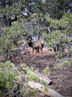
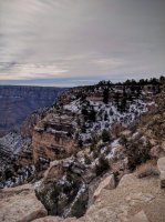
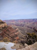
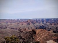
The next day involved driving back to home. I hiked to Shoshone Point past a bunch of elk that didn't seem to care much. Quite the nice view.
The San Francisco Peaks in the distance.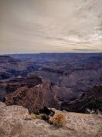
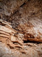
My friends clued me in to an Ancestral Puebloan granary right below the rim of the point. Quite the view. Right when I think I see patterns for where these things are, I find another one that doesn't fit that trend.
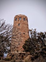
From there it was off to Desert View and the Watchtower. I didn't remember this spot being so cool. Really didn't.
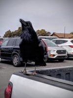
A raven I had a talking to about his begging.
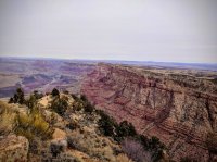
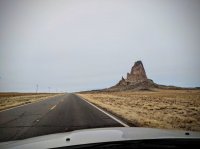
Along the drive home I spotted five archeological sites from the road, a few awesome volcanic necks and stopped at Goosenecks State Park. Amazing country we have out here. Time to plan for a return to the canyon.

As I got older and heights ceased to be the monster they were and instead a draw of intense curiosity, the Grand Canyon has become quite the mystical space. I've read a ton about the canyon and have planned entire trips, yet still it was a challenge to get down in there, moreso for logistics than for fear now though. The place is extremely committing, and the permit regulations aren't the most user friendly in the world. I hiked down Cathedral Wash just upstream from Navajo Bridge in the Marble Canyon section, which was absolutely amazing, but also lacked the feel of going into the bowels of the earth. I think overall elevation change there is a couple hundred feet after all. But it wet the lips even further. At the time I felt that I had finally entered the Grand Canyon! Yet as time passed, the accomplishment diminished a bit. I had to go back, so when the planets aligned and brought five amazing people from my time at Katmai together at the South Rim this winter, I knew the moment had to be seized.
A long drive after work had me by the canyon around midnight. Under the moonlight... there was a hole there. It wasn't terribly dramatic haha. The next day I was so exhausted that we kept things mellow, trying to spot javelina and being turned away from a Kolb Studio Tour that had stopped just a couple days beforehand.
The next day though, we were up in the brisk morning light to head down the Bright Angel Trail. It would be my friends Daniel and Whitney's final trip into the canyon before moving to Glacier National Park, so they wanted to see and show off the oasis of Indian Garden and proceed along to Plateau Point so that I could see the inner gorge.

The morning light was sublime.

I'm glad that some parks don't have to be so stodgy. Apparently there is a staff sticker in which this man is Victor. Don't be like Victor.

For anyone interested in geology, the canyon is amazing. For those interested in trails, the fact a trail goes down through these layers is amazing. Birds called left and right, some I recognized, others not so much. Amazing, upon amazing, upon amazing, upon amazing. This picture is at the Coconino Sandstone layer.

Indian Garden lies down there. The Battleship on the left was a good gauge of how far down our progress was.

The distinct difference in colors makes the geology all the more approachable here. So red! So white!

Below The Battleship now, entering the Redwall Limestone.

I started taking a lot more pictures when we hit the Redwall. The feel of the canyon changed a lot!

From the bottom of the Redwall, a grey limestone as most are, stained by the Supai Group's redness. The Coconino Sandstone rises shear above that with the Kaibab Limestone seeming to create parapets at the top.

The trail follows the water pipeline from the North Rim to the South Rim. Believe it or not, the South Rim somehow gets its water from a spring on the other side of the river. The thing was built to last something like twenty years, and I think is running on around sixty now. Breaks are nearly constant on it and my friends had to go under water restrictions for a few weeks over a big one.

Reaching the Bright Angel Shale and Muav Limestone below the Redwall brought about an entirely different feel to the experience. I WAS IN THE GRAND CANYON

Indian Garden looks like an amazing place to hang out at. The water and foliage debunked that whole desert feel. We took a break here where it was now a good bit warmer to snack, take in the sounds of water and do some birding. We found a Brown Creeper hanging out by these very happy looking cottonwoods and a "big bird" that I saw circling the cliffs turned out to be a large adult condor! From here to Plateau Point felt like nothing compared to the trail down.


I can see how people die out here. Not a ton of shade and everything seems a bit harsh. The purple cacti are sure pretty!


Before we knew it, the river was there, cutting through the basement of the continent. It was a glorious spot. Talk about feeling dwarfed. Plateau Point sits at the cusp of some of the oldest rocks of the world. A deep gorge sat to our north, a canyon rim so tall that it seemed more a mountain to our south.

We lunched with a view up Pipe Spring Canyon to escape the wind and watch a few people traveling the trail. Quite a ways down still to go to get to the river. See a couple happy green trees in the distance? I wanted to visit them. The waterfall of the creek from Indian Garden directly below was impressive, another thing I wanted to visit.

We are but ants.

We walked the rim a bit to watch some rafts go through the next set of rapids. It looked intense from the rim, but they sure rode it like the rapid was nothing. This cactus was equally impressive.
From there it was back up we went! We had a dinner with the other Katmai family to catch after all.

Happy tree!

Cactus and shear cliffs

Ancient tracks, right by the trail.

The Kolb Brother Studio, what a spot to be.
The next day involved driving back to home. I hiked to Shoshone Point past a bunch of elk that didn't seem to care much. Quite the nice view.


The San Francisco Peaks in the distance.


My friends clued me in to an Ancestral Puebloan granary right below the rim of the point. Quite the view. Right when I think I see patterns for where these things are, I find another one that doesn't fit that trend.
From there it was off to Desert View and the Watchtower. I didn't remember this spot being so cool. Really didn't.

A raven I had a talking to about his begging.


Along the drive home I spotted five archeological sites from the road, a few awesome volcanic necks and stopped at Goosenecks State Park. Amazing country we have out here. Time to plan for a return to the canyon.


