- Joined
- Jul 24, 2021
- Messages
- 166
Even though this is sort of a trip report, I felt like it belonged in the Trip Planning section so as to help anyone planning a trip that would involve this sand slide.
I had been planning a packrafting trip that would have taken me into Davis Gulch and then I was planning on hiking out via the cattle trail exit and then cross-country over to FiftyMile Canyon, coming in via the sand slide. Due to several factors, I aborted my plans and used my time in the area to do day hikes instead. When I was originally planning the trip, one of my concerns was the potential difficulty of coming into FiftyMile via the sand slide. I searched the Internet for any information I could find, but other than a few BCP trips reports that talked about their sucess in doing the Davis to FiftyMile traverse, I couldn't find any solid info that would help me gauge the difficulty.
While day hiking FiftyMile, I decided to take some photos and attempt to hike at least a portion of the sand slide to get a better feeling for what I would have been up against had I made the trip with my full pack. Here's some information that I hope will help others who may also be interested in coming into FiftyMile via the sand slide.
Here's a Google Earth view of the area for reference.
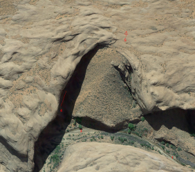
The top of the slide is generally south.
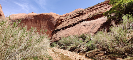
I approached the sand slide from upcanyon (from the west) and the first thing I noticed was the west side of the slide did not look to be easily negotiable. I'm sure there are some more skilled climbers that might be able to do it, but it wasn't for me.
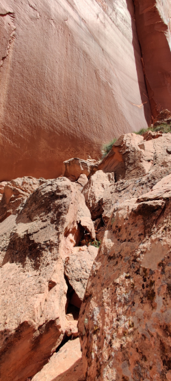
Here's a couple of photos taken of the west side. The big concern for me was a few drop offs, that a more skilled climber may be able to negotiate.
(1)
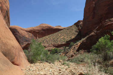
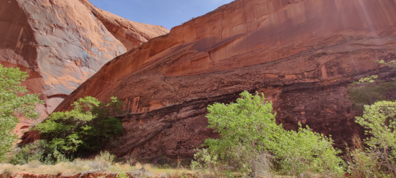
Walking downcanyon further, standing in the stream looking up at the slide, I was looking at a shear wall that felt like it was 75 - 100 feet tall.
(3)
Thankfully, the east side of the slide sloped down to meet the canyon floor.
This portion was much more doable with sloping slickrock and some rocky sections before you would get to the sandy portion.
Here's the mouth of the gully where the slide meets the canyon bottom.
(4)
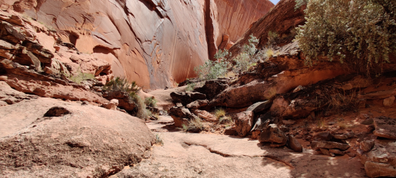
The best way down the slide, from what I could tell, is to switchback down the sand on a steep descent at first, and then to stay closer to the east side canyon wall climbing down the rocky "gully".
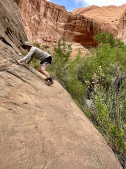
This rocky section required a good bit of scrambling, and when coming down, the occasional drop down that I would have taken my pack off for and dropped it down to the next level, then hand carried and dropped again and repeat. It wasn't too bad, just more time consuming than you might expect from just looking at the Google Earth view.
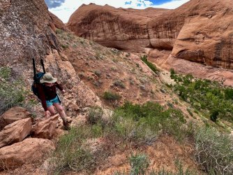
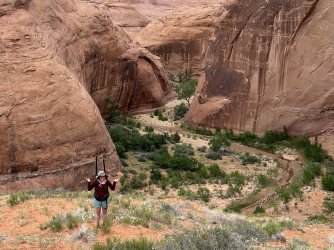
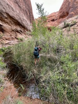
Here is a series of photos as I scrambled my way partially up the slide. (Area of the red line in the overview.)
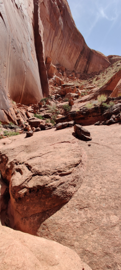
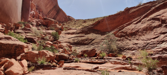
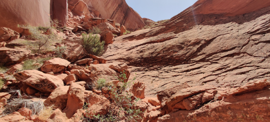
Viewing the lower portion of the slide from the side.
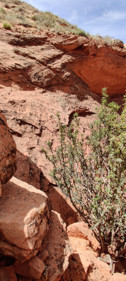
Looking back up the rocky "gully".
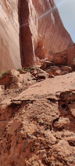
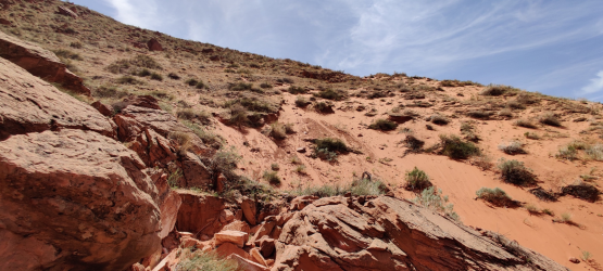
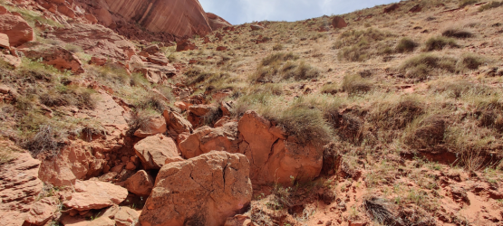
The is where I stopped climbing. You can see the faint trail on one of its switchbacked descents.
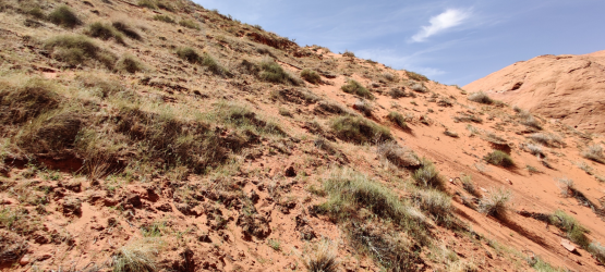
Here's the view back to the sand slide from further downcanyon.
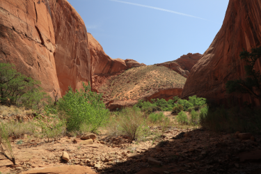
All in all, I think the total elevation difference from the top of the slide to the bottom is 350 - 400 feet.
If anyone else has done this route and has additional information and/or photos, I would love for you to post it up so we can help others seeking more information about this route.
I had been planning a packrafting trip that would have taken me into Davis Gulch and then I was planning on hiking out via the cattle trail exit and then cross-country over to FiftyMile Canyon, coming in via the sand slide. Due to several factors, I aborted my plans and used my time in the area to do day hikes instead. When I was originally planning the trip, one of my concerns was the potential difficulty of coming into FiftyMile via the sand slide. I searched the Internet for any information I could find, but other than a few BCP trips reports that talked about their sucess in doing the Davis to FiftyMile traverse, I couldn't find any solid info that would help me gauge the difficulty.
While day hiking FiftyMile, I decided to take some photos and attempt to hike at least a portion of the sand slide to get a better feeling for what I would have been up against had I made the trip with my full pack. Here's some information that I hope will help others who may also be interested in coming into FiftyMile via the sand slide.
Here's a Google Earth view of the area for reference.

The top of the slide is generally south.
I approached the sand slide from upcanyon (from the west) and the first thing I noticed was the west side of the slide did not look to be easily negotiable. I'm sure there are some more skilled climbers that might be able to do it, but it wasn't for me.
Here's a couple of photos taken of the west side. The big concern for me was a few drop offs, that a more skilled climber may be able to negotiate.
(1)


Walking downcanyon further, standing in the stream looking up at the slide, I was looking at a shear wall that felt like it was 75 - 100 feet tall.
(3)

Thankfully, the east side of the slide sloped down to meet the canyon floor.
This portion was much more doable with sloping slickrock and some rocky sections before you would get to the sandy portion.
Here's the mouth of the gully where the slide meets the canyon bottom.
(4)

The best way down the slide, from what I could tell, is to switchback down the sand on a steep descent at first, and then to stay closer to the east side canyon wall climbing down the rocky "gully".
This rocky section required a good bit of scrambling, and when coming down, the occasional drop down that I would have taken my pack off for and dropped it down to the next level, then hand carried and dropped again and repeat. It wasn't too bad, just more time consuming than you might expect from just looking at the Google Earth view.
Here is a series of photos as I scrambled my way partially up the slide. (Area of the red line in the overview.)


Viewing the lower portion of the slide from the side.

Looking back up the rocky "gully".


The is where I stopped climbing. You can see the faint trail on one of its switchbacked descents.

Here's the view back to the sand slide from further downcanyon.

All in all, I think the total elevation difference from the top of the slide to the bottom is 350 - 400 feet.
If anyone else has done this route and has additional information and/or photos, I would love for you to post it up so we can help others seeking more information about this route.

