IntrepidXJ
ADVENTR
- Joined
- Jan 17, 2012
- Messages
- 3,493
Death Valley Trip 2013 | Day 7
Friday, February 15, 2013
The Original Trip Report on ADVENTR.CO
After spending much of the week exploring Death Valley and not running into many people, things would finally change today. I would start seeing quite a few more people and even getting stuck behind slow drivers and traffic on the park roads. At first I wasn't sure why all of a sudden there were more people in the park, but later I remembered that Monday was President's Day and that this would be a long weekend for a lot of people wanting to get out. I guess my time exploring the park without crowds was coming to an end.
After a pleasant night camping at the base of the Eureka Dunes, I was up in the dark and hiking back into the dunes so I could catch the sunrise.
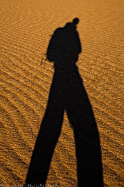
Sand & Shadow by IntrepidXJ, on Flickr
A close look at the edge of a dune.
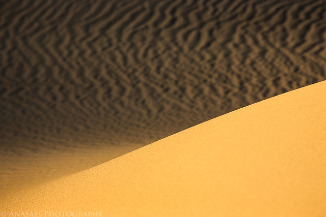
Sand by IntrepidXJ, on Flickr
Nice ripples in the sand.
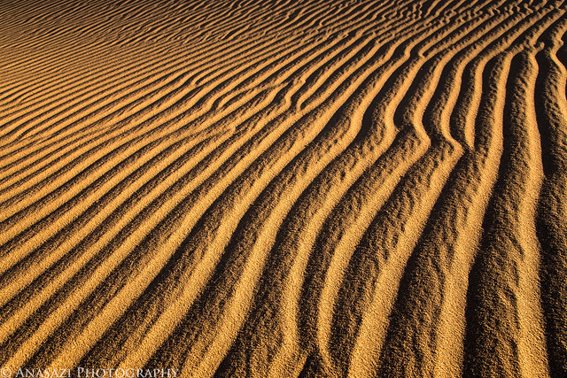
Ripples by IntrepidXJ, on Flickr
When the sun was up high enough, I returned to camp and loaded my Jeep. I left the Eureka Valley and drove across the Last Chance Range to Crankshaft Junction where I headed south into Death Valley again.
Back in Death Valley on this hazy morning.
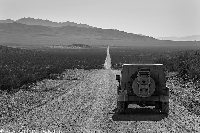
Straight Road by IntrepidXJ, on Flickr
On the drive south I made a detour to Beatty, Nevada to fill up my fuel tank and decided to make a quick stop at the ghost town of Rhyolite nearby. I didn't stay long, but I snapped a few pictures of some of the buildings still standing.
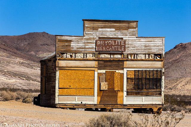
Ryholite Mercantile by IntrepidXJ, on Flickr
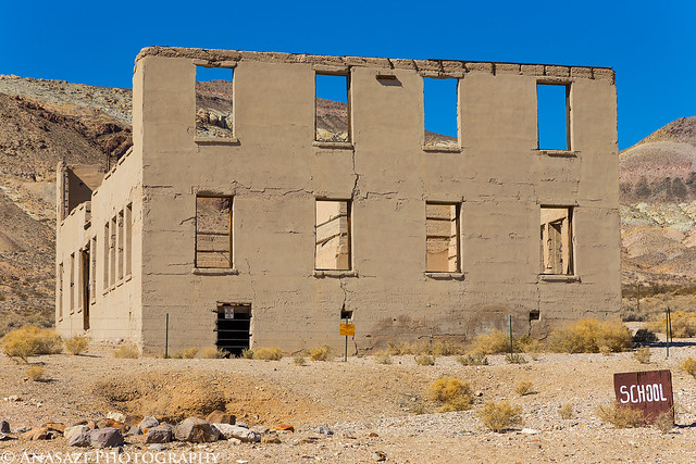
School by IntrepidXJ, on Flickr
I still had a few hours before sunset, so I decided to hike to the narrows of Marble Canyon since I was in the area.
The beginning of the hike.
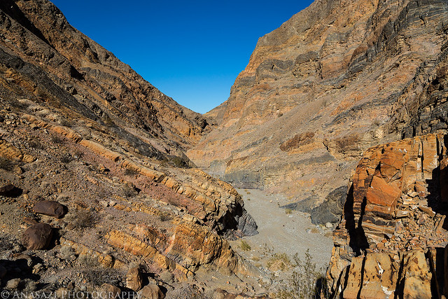
Marble Canyon by IntrepidXJ, on Flickr
I even found a few petroglyphs.

Marble Petroglyphs by IntrepidXJ, on Flickr
Entering the narrows.

Nice Curves by IntrepidXJ, on Flickr
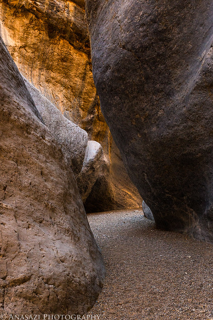
Marble Passage by IntrepidXJ, on Flickr
Great reflected light on this wall of the canyon.
Golden Wall by IntrepidXJ, on Flickr
It was a very cool slot canyon to explore.
Narrows by IntrepidXJ, on Flickr
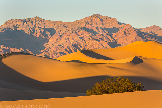
When I was done exploring the narrows I had to hurry up and get back to the Mesquite Flat Sand Dunes so that I didn't miss the sunset. I spent a bit of time hiking far out into the Mesquite Dunes looking for areas that had no footprints in the sand. Unfortunately, no matter how far out I went I was unable to find any dunes that didn't have footprints on them.
Mesquite Sand Dune by IntrepidXJ, on Flickr
Alone by IntrepidXJ, on Flickr
Since there were a lot of people at the dunes this evening, I included a few of them in my shots.
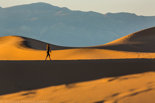
Dune Hiker by IntrepidXJ, on Flickr
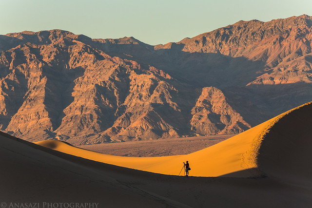
Photographer by IntrepidXJ, on Flickr
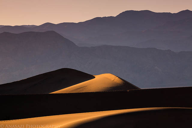
Mesquite Sunset by IntrepidXJ, on Flickr
Dune Evening by IntrepidXJ, on Flickr
When the light was gone, it was time for me to find a campsite. I was originally planning on camping along the Cottonwood Canyon road, but when I had driven up to Marble Canyon earlier I noticed that all the spots along the road were already taken. It was the first time all week I had even seen anyone else camping in the backcountry. I only wanted to camp there so I would be close to the Mesquite Dunes for sunrise, but after my evening at the dunes I really didn't feel like returning for sunrise. Instead, I decided to return to Zabriskie Point for sunrise the following morning, so I drove up the nearby Echo Canyon road to look for a site. There were quite a few people camped along here, too, but I managed to find a small site to setup camp.
>> Eureka Dunes to the Mesquite Dunes Photo Gallery
Featured Image for Home Page:

Friday, February 15, 2013
The Original Trip Report on ADVENTR.CO
After spending much of the week exploring Death Valley and not running into many people, things would finally change today. I would start seeing quite a few more people and even getting stuck behind slow drivers and traffic on the park roads. At first I wasn't sure why all of a sudden there were more people in the park, but later I remembered that Monday was President's Day and that this would be a long weekend for a lot of people wanting to get out. I guess my time exploring the park without crowds was coming to an end.
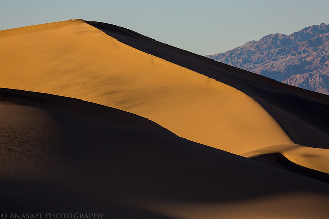
After a pleasant night camping at the base of the Eureka Dunes, I was up in the dark and hiking back into the dunes so I could catch the sunrise.
Sand & Shadow by IntrepidXJ, on Flickr
A close look at the edge of a dune.
Sand by IntrepidXJ, on Flickr
Nice ripples in the sand.
Ripples by IntrepidXJ, on Flickr
When the sun was up high enough, I returned to camp and loaded my Jeep. I left the Eureka Valley and drove across the Last Chance Range to Crankshaft Junction where I headed south into Death Valley again.
Back in Death Valley on this hazy morning.
Straight Road by IntrepidXJ, on Flickr
On the drive south I made a detour to Beatty, Nevada to fill up my fuel tank and decided to make a quick stop at the ghost town of Rhyolite nearby. I didn't stay long, but I snapped a few pictures of some of the buildings still standing.
Ryholite Mercantile by IntrepidXJ, on Flickr
School by IntrepidXJ, on Flickr
I still had a few hours before sunset, so I decided to hike to the narrows of Marble Canyon since I was in the area.
The beginning of the hike.
Marble Canyon by IntrepidXJ, on Flickr
I even found a few petroglyphs.
Marble Petroglyphs by IntrepidXJ, on Flickr
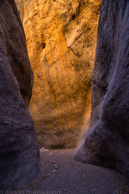
Entering the narrows.
Nice Curves by IntrepidXJ, on Flickr
Marble Passage by IntrepidXJ, on Flickr
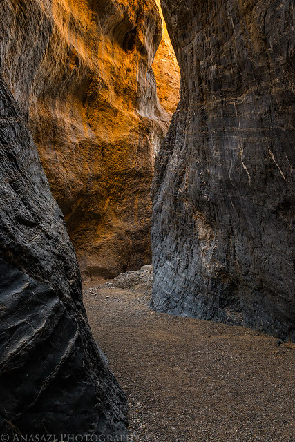
Great reflected light on this wall of the canyon.
Golden Wall by IntrepidXJ, on Flickr
It was a very cool slot canyon to explore.
Narrows by IntrepidXJ, on Flickr
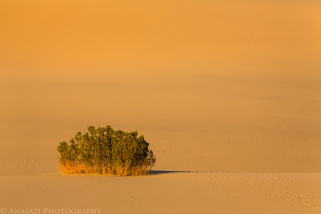
When I was done exploring the narrows I had to hurry up and get back to the Mesquite Flat Sand Dunes so that I didn't miss the sunset. I spent a bit of time hiking far out into the Mesquite Dunes looking for areas that had no footprints in the sand. Unfortunately, no matter how far out I went I was unable to find any dunes that didn't have footprints on them.
Mesquite Sand Dune by IntrepidXJ, on Flickr
Alone by IntrepidXJ, on Flickr
Since there were a lot of people at the dunes this evening, I included a few of them in my shots.
Dune Hiker by IntrepidXJ, on Flickr
Photographer by IntrepidXJ, on Flickr
Mesquite Sunset by IntrepidXJ, on Flickr
Dune Evening by IntrepidXJ, on Flickr
When the light was gone, it was time for me to find a campsite. I was originally planning on camping along the Cottonwood Canyon road, but when I had driven up to Marble Canyon earlier I noticed that all the spots along the road were already taken. It was the first time all week I had even seen anyone else camping in the backcountry. I only wanted to camp there so I would be close to the Mesquite Dunes for sunrise, but after my evening at the dunes I really didn't feel like returning for sunrise. Instead, I decided to return to Zabriskie Point for sunrise the following morning, so I drove up the nearby Echo Canyon road to look for a site. There were quite a few people camped along here, too, but I managed to find a small site to setup camp.
>> Eureka Dunes to the Mesquite Dunes Photo Gallery
Featured Image for Home Page: