Escalante question

JDWalters

Member
Joined
Apr 21, 2017
Messages
120
Hi all,

I am planning a trip for next month and will be going through Escalante. I love how wide open the country is out there, and was hoping to explore some areas that I found on Google Earth that probably don't have trails going to them. There are two areas that I have in mind:

The first is around the confluence of Deer Creek and Boulder Creek. It appears that I should be able to hike over to that area from Calf Creek Campground. Getting a good view of Boulder Creek from above doesn't appear to be too difficult, but getting down and over the creek looks like it might be tricky. My question is, have any of you done this before? I've read TRs about folks going down Boulder Creek or Deer Creek, but they were usually in the creek itself, or in a different area. I am primarily interested in viewing the the valleys/canyons from above. It appears that there is some colorful slickrock in that area.

The other area that I was interested in exploring was a little southeast of Impossible Peak. It appears that there is a road that leads to that area (though how passable the road is, I don't know). I would like to climb several of the mesas around there. I would prefer class III or less climbing -- maybe class IV. I have seen several TRs about Egg Canyon, and that looks like a nice option as well.

Any suggestions or advice would be greatly appreciated. I wish that I could get to this area more often -- there is so much to see!
 

Artemus

I walk
.
Joined
Jun 25, 2012
Messages
4,425
Hi all,

I am planning a trip for next month and will be going through Escalante. I love how wide open the country is out there, and was hoping to explore some areas that I found on Google Earth that probably don't have trails going to them. There are two areas that I have in mind:

The first is around the confluence of Deer Creek and Boulder Creek. It appears that I should be able to hike over to that area from Calf Creek Campground. Getting a good view of Boulder Creek from above doesn't appear to be too difficult, but getting down and over the creek looks like it might be tricky. My question is, have any of you done this before? I've read TRs about folks going down Boulder Creek or Deer Creek, but they were usually in the creek itself, or in a different area. I am primarily interested in viewing the the valleys/canyons from above. It appears that there is some colorful slickrock in that area.

The other area that I was interested in exploring was a little southeast of Impossible Peak. It appears that there is a road that leads to that area (though how passable the road is, I don't know). I would like to climb several of the mesas around there. I would prefer class III or less climbing -- maybe class IV. I have seen several TRs about Egg Canyon, and that looks like a nice option as well.

Any suggestions or advice would be greatly appreciated. I wish that I could get to this area more often -- there is so much to see!
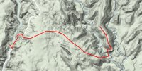
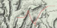
Perhaps you could put up a map with your intended route and destination and we could kibbutz. It would be easier and you could use google maps or caltopo.
 

JDWalters

Member
Joined
Apr 21, 2017
Messages
120
Good idea. I've posted them below. I don't really even know what the area of the second photo is called. There are very few labels to go by when looking for information about it. Thanks for looking at these!


calfcreek.jpg ridges.jpg
 

Jammer

❤2Hike
.
Joined
Feb 23, 2012
Messages
642
Getting down into Boulder Creek that way is likely to be very difficult. I think Kelsey writes about a method in that area, but I'd have to look exactly where. I tried an alternate method many years ago and got ledged out and then slotted up and was forced to backtrack.

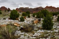
Re: the Egg Canyon routes, I bet getting on top there will be difficult too as that upper rock layer (Wingate?) is often vertical in that area, so you will have to seek out a major weakness. The saddle in the middle of pic 2 is doable though.

Also, to get up to Impossible Peak area from the Upper Gulch, there is really only one direct route and it involves ropes to get up. There is a much longer route around to the north as well. It's probably easier to go DOWN via Boulder Mountain. This is what I did on one of my big hikes. You can read about that part here:

http://www.acrossutah.com/wordpress/boulder-mountain-to-moab-part-1/
 
Last edited:

regehr

Member
Joined
Mar 28, 2012
Messages
1,962
I"ve been up on Durffey Mesa a few times and it's a great area to wander around. Never been to that southern end, but in GE it looks like there's that one layer of Navajo up high that might be problematic. But if it doesn't go, it's clear you can get down by walking a mile north and then dropping down one of several SW-facing gullies. Looks like a great walk.
 

regehr

Member
Joined
Mar 28, 2012
Messages
1,962
I have walked down to Boulder Creek from Durffey Mesa and it wasn't difficult, but this was well north of where you're talking about.
 

Writhdar

Member
Joined
Dec 14, 2015
Messages
15
Sections of Hike's 5 & 6 of Steve Allen's "Canyoneering 3" have what you want. Possibly due to continental drift, his starting point mile markers are off.

Hike 6 - start @ MM76.7 on Hwy 12 and follow his route down to Boulder Creek. It meets the creek a ways above the confluence.

Hike 5 --- start at MM 76.4. You do the return leg (in reverse) - he calls it "Exit Boulder Creek". From car, go SE over big ridge, then head down generally SE'erly . Spectacular pouroffs that are easily dealt with on right (ldc). His final drop, which is almost above the confluence, to the creek looks scary to me - there is an easy ramp a little bit upstream.
 

Writhdar

Member
Joined
Dec 14, 2015
Messages
15
question for regehr --- I am interested in access from Deer Creek just above the Deer-Boulder confluence to the slickrock to its east - right looking upstream. Steve Allen mentions some constructed cattle trails that leave the east side of the creek. Do you know where the cattle trails are or other access from the creek (east side of creek - right bank looking upstream)?
 

regehr

Member
Joined
Mar 28, 2012
Messages
1,962
question for regehr --- I am interested in access from Deer Creek just above the Deer-Boulder confluence to the slickrock to its east - right looking upstream. Steve Allen mentions some constructed cattle trails that leave the east side of the creek. Do you know where the cattle trails are or other access from the creek (east side of creek - right bank looking upstream)?
Sorry, I don't, I haven't visited that confluence yet!
 

JDWalters

Member
Joined
Apr 21, 2017
Messages
120
Sections of Hike's 5 & 6 of Steve Allen's "Canyoneering 3" have what you want. Possibly due to continental drift, his starting point mile markers are off.

Hike 6 - start @ MM76.7 on Hwy 12 and follow his route down to Boulder Creek. It meets the creek a ways above the confluence.

Hike 5 --- start at MM 76.4. You do the return leg (in reverse) - he calls it "Exit Boulder Creek". From car, go SE over big ridge, then head down generally SE'erly . Spectacular pouroffs that are easily dealt with on right (ldc). His final drop, which is almost above the confluence, to the creek looks scary to me - there is an easy ramp a little bit upstream.
Thanks for the information! I don't have Allen's book, but I keep hearing/reading about it. I am leaving in less than two weeks, but it sounds like that might be a good purchase, assuming it arrives in time.
 

JDWalters

Member
Joined
Apr 21, 2017
Messages
120
Getting down into Boulder Creek that way is likely to be very difficult. I think Kelsey writes about a method in that area, but I'd have to look exactly where. I tried an alternate method many years ago and got ledged out and then slotted up and was forced to backtrack.

Re: the Egg Canyon routes, I bet getting on top there will be difficult too as that upper rock layer (Wingate?) is often vertical in that area, so you will have to seek out a major weakness. The saddle in the middle of pic 2 is doable though.

Also, to get up to Impossible Peak area from the Upper Gulch, there is really only one direct route and it involves ropes to get up. There is a much longer route around to the north as well. It's probably easier to go DOWN via Boulder Mountain. This is what I did on one of my big hikes. You can read about that part here:

http://www.acrossutah.com/wordpress/boulder-mountain-to-moab-part-1/
Thanks for the info about both areas! Your description and photos of the Upper Gulch area were some of the only info that I could find -- that photo of the canyon below Impossible Peak only increased my desire to explore the area. Thank you for posting it!
 

JDWalters

Member
Joined
Apr 21, 2017
Messages
120
I"ve been up on Durffey Mesa a few times and it's a great area to wander around. Never been to that southern end, but in GE it looks like there's that one layer of Navajo up high that might be problematic. But if it doesn't go, it's clear you can get down by walking a mile north and then dropping down one of several SW-facing gullies. Looks like a great walk.
Thanks! Durffey Mesa and Sugarloaf look interesting as well. I sure wish I had more vacation time.
 

JDWalters

Member
Joined
Apr 21, 2017
Messages
120
Thank you all for your responses! Unfortunately, I didn't end up exploring either of these areas. It rained for most of the afternoon and even hailed. It was a beautiful area and I hope to get back at some point.
hail.jpg
 
Similar threads
Thread starter Title Forum Replies Date
radioradio Anxious About Escalante Trip Planning 63
regehr Escalante dumpsters Trip Planning 9
regehr potable water in Escalante town? Trip Planning 6
D Fox Canyon Escalante? General Discussion 6
Janice Water questions - Escalante area Trip Planning 38
Duketogo13 BMT- Death Hollow-Escalante Triangle loop Trip Planning 20
Janice Cosmic Ashtray via Wolverine/Little Death Hollow & Escalante River? Trip Planning 16
Duketogo13 Questions about packrafting the Escalante/Lake Powell in September. Need help! Trip Planning 5
priz1234 The Gulch Escalante 4/17-4/18 Backpacking 2
RyanP Conditions (water/bugs) for Escalante/Death Hollow Trip Planning 27
J Escalante Natl. Mon. to Bryce N.P. the (unknown) Final Dayhikes April 15-16, 2021 Hiking & Camping 9
Bob Lost in the Escalante .......... Blast from the Past Backpacking 6
Bob A short Escalante trip end of April Backpacking 5
swmalone Restaurant Suggestions for Escalante or Boulder General Discussion 11
S Packrafting Escalante - FiftyMile Creek and low water level Lake Powell Trip Planning 8
swmalone Camping suggestions for Escalante in May Trip Planning 2
Muddy Waters Stevens, Fold, Escalante River, Fools, Kings Mesa Trip Reports 3
W 9 Days Solo Escalante Loop in October (water advice) - Stevens Canyon, Baker Route over Waterpocket fold, Halls Narrows to Moody Canyons Trip Planning 11
T Status of Traffic - Hole in the rock road - Escalante - September? Trip Planning 2
ramblinman Boulder Creek Day Hike, Escalante National Monument Hiking & Camping 5
M Ideas for 4 nights in Escalante Trip Planning 30
M Non-technical 1-2 night backpacking w dogs and kids - Escalante-ish area in April? Trip Planning 14
A 1st time backpacker in Escalante, UT Trip Planning 13
Stephanie B Grand Staircase Escalante National Monument - Kanab Area Hiking & Camping 2
Titans Permits car camping Grand Staircase Escalante NM? Trip Planning 6
Devin Ashby The Lower Gulch - Escalante (Seeking info on the route) Trip Planning 14
R Escalante River / Calf Creek Falls Current Conditions Trip Planning 10
cmgz Boulder Mail Trail - Escalante Trailhead to Mamie Creek Hiking & Camping 1
W Escalante River Backpacking Trip Planning 12
ADubs Looking for info from anyone who has done the Egypt loop and exited via 25mile wash (Escalante). Trip Planning 3
swmalone Rain, Mud, and Wind....First Trip to Escalante Area Hiking & Camping 16
canadug Current Escalante and Cap Reef Road conditons Trip Planning 17
JDWalters Access to Escalante River/Lake Powell near Cathedral in the Desert Trip Planning 7
regehr Escalante Jan 19 2019 Trip Planning 2
Jazzy Joe Looking for Escalante Area Short Backpacking Suggestions Early Spring Trip Planning 21
Nick Me love me some Escalante!! Backpacking 24
LarryBoy Water source information - Escalante/CRNP area Trip Planning 14
fossana Stephens Canyon Loop, part of Escalante Overland Route or ? Trip Planning 18
Artemus PUBLIC COMMENT - Bears Ears and Grand Staircase Escalante Management Plans General Discussion 19
Kyle P Escalante Area Gear Stores General Discussion 14
J Escalante Natl Mon. Wolverine and Little Death Hollow and overland routes April 22-25, 2018 Backpacking 0
Thebikepedalingginger Escalante Romp Backpacking 13
Strawsome What is your favorite hike in the Escalante/Hole in the rock road area? General Discussion 6
T Water availability next week in Cedar Mesa & Escalante areas Trip Planning 5
M Escalante- Little Death Hollow Loop conditions? Trip Planning 14
Nethos Capitol Reef/Escalante 2018 Trip Planning 11
swmalone Looking for Assistance to Introduction to Escalante Area Trip Planning 4
Devin Ashby Upper Escalante Canyon / Death Hollow Info? Trip Planning 15
J Escalante Packrafting Backpacking 4
swmalone Escalante Canyons National Park General Discussion 59

Similar threads

Don't like ads? Become a BCP Supporting Member and kiss them all goodbye. Click here for more info.

Top