- Joined
- Aug 9, 2007
- Messages
- 12,959
First off, if you haven't already checked out @gnwatts excellent trip report from this same trip, go do it right here.
There's not many trips that combine ease, serenity and scenery quite like a well-timed spring or fall trip into Glen Canyon. The timing is the trick though. Hit it right and it's like you have an entire planet to yourself with blue skies, mirror reflections and endless canyons to explore. Hit it wrong and it's pure misery, but at least no one is around to see you suffer.
On April 1st, 2016, we got lucky and hit the conditions just right. Thanks to @hatchcanyon and his thread of awesome aerial photos, this trip came together. At first I thought @Artemus was joking about wanting to go climb the Rincon. But after a follow up message, I realized he was serious. We picked some dates, rounded up some company and waited.
On the drive down we met up with @gnwatts and ended up camping in North Temple Wash. A big storm system was moving south right over where we were headed. We still got soaked for a minute, but then it was clear. The next morning we loaded up and headed south to Bullfrog.
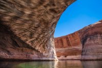
A quick stop in Lost Eden Canyon on our way south revealed some impressive reflections.
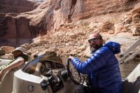
@Artemus having a nice time captaining Barke Diem in Annie's Canyon.
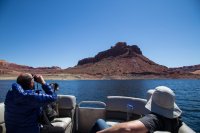
We stopped near the Rincon for a lunch break, followed by some rincon recon of the route for tomorrow summit attempt.
I was originally planning on at least trying to hike the Rincon, but a series of events with my old pup Nikita changed that. She started having major problems related to her spondylosis (arthritis in the spine). She was fecal incontinent about every other day and she could barely stay upright, much less walk around confidently. It was heart breaking. She was already on several meds and getting a bi-weekly shot, but we wanted to see if there was anything else we could do to make her more comfortable. If something is going to take her from me, I can accept that, but not being able to feel her back end is a pretty poor reason to say goodbye.
The vet looked it over and decided we could be giving her a lot more of the drugs she was on. She also gave Nikita a couple of localized shots to the affected areas in her spine. You can see some of the affected areas in this x-ray. Notice where her vertabrae appear to be fused together with bone? Well, they are.

Speaking of the vet, I was amused by this chart on the wall that I noticed while Nikita was back getting x rayed. According to this, they stop counting Nikita when she was 12 (94 in dog years). In reality, she is at least 14 now, so something like 108? Oh, and apparently she has been 'geriatric' for the last 8 years! I dunno, but I know the vet says she is in excellent condition other than the arthritis and her happy dementia.

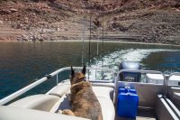
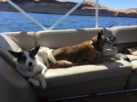
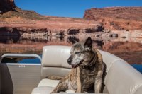
After that vet appointment, Nikita sprung back like she was a spry 12 years old again. I'm not sure if it was the local injections or the increased pills or what, but she was loving life. I intended to leave her at home, but I got to thinking that this might be her last chance to go play on the beach again. Our next boat trip isn't planned until July because of work this spring. If she detiorates at the rate she was going, I wasn't even sure if she'd be around, much less able to enjoy herself. It was an easy decision. She was coming with and I would be doing no hiking. It's good to have a boat watcher. Even better to get your best friend out on another adventure though. She loves those loungers.
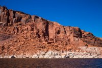
After scouting the Rincon, we decided to head up into Iceberg for a hike and maybe to find camp. On the way, I spotted this amazing erosion taking place at the end of the Waterpocket Fold. Do you see the 3 different bathtub rings here? Do you realize what that means and how awesome it is??? Notice the lack of varnish as well. GLEN CANYON RISING!
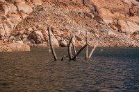
The water was low compared to the last time I was in Iceberg. These ghosts of cottonwoods were adorned with milk jugs tied to ropes. Seems sillly right now, but when those logs are a few inches under the surface, it can be a life saver. More on that later...
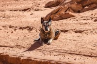
I dropped off the boys to hike to the Iceberg Cathedral. I've been there twice so it felt just fine to go claim one of the finest campsites in the area and settle in. The sun was shining, the drinks were cold and the music sounded great. But more importantly, Nikita was SO happy to be there.
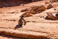
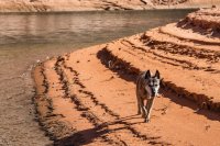
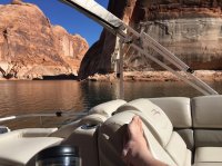
I got things setup in camp and went back to pickup the hikers after a couple hours. The sun had left camp so we floated around soaking it in for a while, eventually moving to a side canyon that still had plenty of light. As the sun went down, we moved further up canyon, eventually ending up near an Osprey nest in a dead cottonwood. We realized this as we looked up to see a massive bird of prey almost directly over our heads with a good sized fish in it's talons. Well, most of a fish.
We parked the boat on a small beach and sat back in awe as we witnessed a mated pair of Osprey circle overhead. As if that couldn't be any more mind-blowing, a raven moved in on the nest. We watched as the two massive birds swirled through the air in combat. I gave up trying to catch a photo before that even started, but I'll never forget that experience for the rest of my life. Just incredible. Here's the one photo of our Osprey friends that I was able to catch. What's the wing span on that, @Artemus? I'd guess upwards of five feet? One of them flew over our campsite the next day carrying a large stick back to the nest. It looked massive.
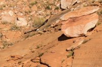
The nest is right there in the cottonwood on the right.
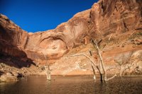
After the Osprey show, we went back to camp. I've seen, and been involved with some pretty spectacular tent setup failures in my life, but that night took the cake. I have to give Greg credit though, it was really windy there for a while. Naturally, it quit as soon as we got it put up. The night turned out to be totally calm. This shot is looking up the hill from the boat at Greg and his tent.
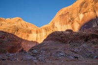
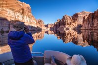
This is usually the first thing I see when I wake up on the boat. Almost always glass this time of day. I'm quite fond of starting my days like this.
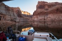
Dan and Art got ready quickly and we ran them back over to the Rincon to start their hike. We didn't make it far from camp before we were all awe-struck by the unique beauty that being here in April offers.
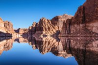
Supersymmetry.
There they go! Mya, Dan and Art, heading for the top of the Rincon.
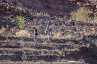
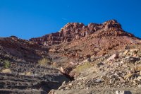
Zoomed out with a shot of their route and objective. They went straight up the chute on the right.
Greg and I went back to camp and packed up. A bottle of something champagne like from a very non-France country was opened. It was good. Nikita was still very happy.
And I was very happy when I saw a Glen Canyon first for me - an otter! At first I thought it must be a beaver, but we saw this guy get all the way out of the water and walk on the rocks, and it was definitely an otter! I haven't even heard of them in this part of the lake. Sightings in the San Juan arm are more common. Now I just need to see a romp of otters and I can die happy.
We followed the otter for a bit before we got the radio call from Art and Dan that they had succeeded and were on their way down. We went back over there, parked the boat, and went for a swim in the brisk 54˚ water. Not warm enough to stay in for long, but still great for a quick dip.
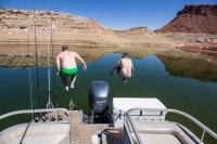
To celebrate the successful Rincon summit, the real champagne was opened (and by real it I mean it is made in America, costs $12 for a magnum and says champagne on the bottle) and we continued south toward the Escalante. A quick stop at Bowns Canyon though. Dan went to check out the waterfall up close.
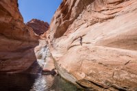
See him up there?
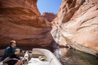
It was a good day. Greg doing his thing:
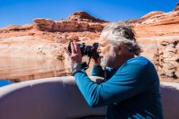
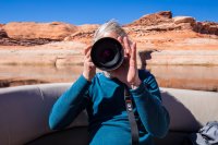
And Art having a great time at the helm. That look on Dan's face needs no narration.
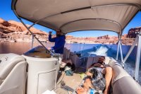
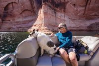
Next stop, The Cathedral in the Desert.
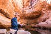
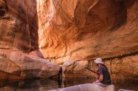
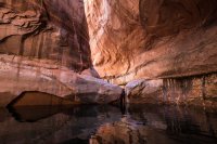
Art gazing up to the sky.
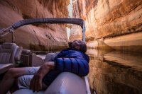
Or perhaps at his good friend, corvus corax?
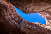
Dan serenaded us.
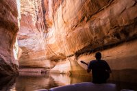
Reflections outside of the cathedral.
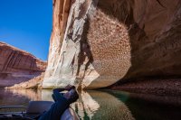
This picture makes me so damn happy. Glen canyon rising.
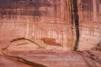
Next stop, our home for the night in Fiftymile Creek. Travel upstream is hindered right now by a large sand dune. The lake continues, but is only connected by the opening in Gregory Natural Bridge. There it is, just 40 feet or so below the surface right behind my boat. Formerly one of the largest natural bridges in the world. The river flowed right through it.
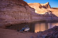
But as far as Lake Powell campsites go, you don't get much better than this.
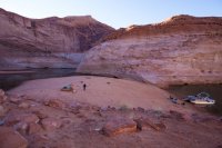
I camped here once before for a night, but didn't go into the big alcove nearby. What a mistake.
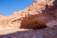
Mind boggling. See Dan standing on the hill in the middle?
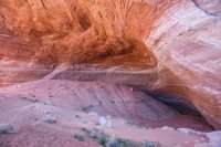
Looking out. Notice the bathtub ring. This would all be gone at full pool.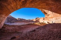
The low spot at the back of the alcove fed a nice little garden.
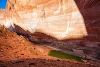
Nikita couldn't make the hike into the alcove because of the rocky terrain so Art waited with her while I checked it out and then I rushed down to take over. She's pretty happy on her boat.
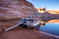
It was a calm night out on the boat. The stars were bright and we took full advantage gazing up at them from the loungers. The next day it was time to head home, but first, a trip to the top of the Escalante. Reflections again.
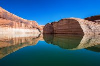
We made it all the way to the top and in to foot deep water. Close enough to see the riffles of the Escalante river fade away into the flat water of the reservoir. On the way back out, I asked if we should take a quick trip up Willow Gulch before heading back. It was a unanimous yes.
When you boat in Glen Canyon, one of the greatest dangers is what I like to call 'whales'. They are the rocks sitting just under the surface, waiting to take out your engine, or worse, take out your entire boat, and in some cases, take lives. On every trip we do a little safety talk and 'whale watching' is at the top of the list. Everyone knows what they are, how to spot them and what to do if they see them.
As we approached Willow, I remembered there were some nasty rocks near the mouth of the canyon so I made sure to check my Navionics chart that shows underwater topography. I didn't see anything on the map, and I saw some exposed rocks on the bend that looked familiar. It must be that, I thought. So I zipped right into the mouth of the canyon doing about 18-20 mph. No more than a couple hundred feet in, I heard Art yell the word you never want to hear on Lake Powell: "WHALE!!!!"
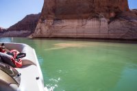
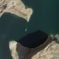
I immediately killed the throttle as the hull hit solid rock. The bow popped up as the sound of aluminum scraping across sandstone rang out through the canyon. We came to an abrupt stop. I looked over to see a cloud of dirt swirling in the teal green water off the starboard side. Just below it, the top of a sandstone pillar sat just a few inches below the surface. If the dam weren't in place, this would be close to a 100 foot tower of rock standing guard at the mouth of the canyon. The whole thing was no bigger than about 12x12 feet around. A little in either direction and we would have floated right past.
I killed the motor. The stereo kept playing and it took me a minute to realize I could, and should, make it stop. I was in shock. It was a tough shift from the euphoria of zipping through incredible scenery to the situation we were now in. Everyone was okay, but the boat was very much stuck on that rock. The stern was much higher than the bow. No one was in imminent danger for the moment. At this point I didn't know if the pontoons were shredded open or not, but the situation was stable. At the very worst, we could radio for help. Often the radios don't work out in the remote canyons, so I carry a Spot GPS transmitter that will summon help, in fact the help button on it is 'hard wired' to summon a tow boat via BoatUS. We were fine, but might have to sit there for quite a while since it's a solid 50+ miles from the nearest marina/civilization.
We went into action to get an idea of the damage and attempt to self-rescue. I hopped into the 53˚ water to get a better look. Standing next to the starboard pontoon, the water was less than ankle deep! We had hit the rock and scraped nearly all the way across. Another few feet and the lower unit of my engine would have been the next to slam into the rock. We raised the motor and started rocking the boat to see if we could get it off by pushing it the rest of the way over. We attempted various combinations with some of us in the water pushing and shoving with redistributing weight on the bow to try and pop it off the rock. It would move a bit, but it would just pivot. We could really only push from one side which made things difficult.
After a while we could tell our current approach wasn’t going to set us free. The idea of radioing for help came up, but we weren’t ready to give up just yet. We needed to shift more weight to the bow to help the stern come off the rocks. We’d already moved the big items, now it was time to start emptying out compartments and piling things up toward the front. As all of this took place, I pretty much just stayed parked on the bow accepting items and piling them up. I've got more weight on any of these guys, so it makes sense for me to be up there. Some of the things brought to the front were our anchors, which gave me an idea. I informed my compadres of my thoughts and they were on board. We unstrung an anchor rope and tied it to the port bow cleat. Then underscore hopped in the deeper water on the port side of the boat and walked an anchor out to the edge of the rock we were stuck on. It took a few tries, but eventually he was able to huck it off into what was probably 100’+ deep water. We started pulling it in and sure enough, it set on something down there. We had tension now. Something to work with other than our bodies pushing off the rock immediately adjacent to the boat. With the rope taught, we all started pulling, spinning the boat back in the direction it came. We made it 360˚, still stuck on the rock but at least we were moving! At that point, most of the group was back in the water rocking it back and forth. Once we got another 90˚ or so, we finally broke free. We were floating again!!! FREE! I think we were stuck for around a half an hour.
It was such a relief to feel the buoyancy of a the boat floating again as we drifted away from the rock. It didn’t last for long though. I knew that if we’d ripped open a pontoon, that water would now be filling it up. My boat has three pontoons, the ones on each side are compartmentalized, so ideally, we would just partially sink. We’d still be able to motor back but with the boat listing severely to one side or the other.
I turned on the motor and we puttered out into the Escalante. At any moment I expected to notice the boat beginning to sink on the starboard side. That’s where we hit the hardest. Meanwhile, the last of our beer supply came out of the cooler to celebrate our victory over that damn rock. It was 10am on a Sunday, afterall. But as we enjoyed our beers, I just couldn’t focus on anything but the prospect of getting the hell out of there as fast as possible, in case we were taking on water. After a few minutes, we pulled in all of the loose anchors and gear and I put the hammer down. We’re well over 50 miles from the marina. Full throttle is hardly fuel efficient, but it got us into the mid 30’s even with our heavy load. I kept stressing that we were listing to the starboard side, but maybe not.
After a stop at the Rincon floating shitter to clean out Crape Diem, we made it all the way back to Bullfrog and put the boat on the trailer without issue. I hopped out to watch it come out of the water to see if I could see water rushing out from anywhere. Nothing. I looked down the keels, expecting at least to see some mangled aluminum. Nothing. Those big aluminum cans held up great. Granted, they to have some reinforcements and there is a ½” thick solid aluminum keel along the length of each one, but still. Very impressive. And now I have a great story to tell when I tell new people on the boat about the importance of whale watching. I still can't believe we got out of that scot free.
I hope you understand why we have no photos of us un-sticking the boat, but here's one I took right after we started floating away from the whale.
And here is a satellite image of the whale. This was taken when the water was a foot lower, so the whale would actually have been sticking out of the water about 9" then, but you get the point. Lesson learned, don't mess with whales, and pontoon boats are by far the best way to explore Lake Powell. Go drive a wake boat over that and tell me how it goes.
There's not many trips that combine ease, serenity and scenery quite like a well-timed spring or fall trip into Glen Canyon. The timing is the trick though. Hit it right and it's like you have an entire planet to yourself with blue skies, mirror reflections and endless canyons to explore. Hit it wrong and it's pure misery, but at least no one is around to see you suffer.
On April 1st, 2016, we got lucky and hit the conditions just right. Thanks to @hatchcanyon and his thread of awesome aerial photos, this trip came together. At first I thought @Artemus was joking about wanting to go climb the Rincon. But after a follow up message, I realized he was serious. We picked some dates, rounded up some company and waited.
On the drive down we met up with @gnwatts and ended up camping in North Temple Wash. A big storm system was moving south right over where we were headed. We still got soaked for a minute, but then it was clear. The next morning we loaded up and headed south to Bullfrog.
A quick stop in Lost Eden Canyon on our way south revealed some impressive reflections.

@Artemus having a nice time captaining Barke Diem in Annie's Canyon.

We stopped near the Rincon for a lunch break, followed by some rincon recon of the route for tomorrow summit attempt.

I was originally planning on at least trying to hike the Rincon, but a series of events with my old pup Nikita changed that. She started having major problems related to her spondylosis (arthritis in the spine). She was fecal incontinent about every other day and she could barely stay upright, much less walk around confidently. It was heart breaking. She was already on several meds and getting a bi-weekly shot, but we wanted to see if there was anything else we could do to make her more comfortable. If something is going to take her from me, I can accept that, but not being able to feel her back end is a pretty poor reason to say goodbye.
The vet looked it over and decided we could be giving her a lot more of the drugs she was on. She also gave Nikita a couple of localized shots to the affected areas in her spine. You can see some of the affected areas in this x-ray. Notice where her vertabrae appear to be fused together with bone? Well, they are.

Speaking of the vet, I was amused by this chart on the wall that I noticed while Nikita was back getting x rayed. According to this, they stop counting Nikita when she was 12 (94 in dog years). In reality, she is at least 14 now, so something like 108? Oh, and apparently she has been 'geriatric' for the last 8 years! I dunno, but I know the vet says she is in excellent condition other than the arthritis and her happy dementia.

After that vet appointment, Nikita sprung back like she was a spry 12 years old again. I'm not sure if it was the local injections or the increased pills or what, but she was loving life. I intended to leave her at home, but I got to thinking that this might be her last chance to go play on the beach again. Our next boat trip isn't planned until July because of work this spring. If she detiorates at the rate she was going, I wasn't even sure if she'd be around, much less able to enjoy herself. It was an easy decision. She was coming with and I would be doing no hiking. It's good to have a boat watcher. Even better to get your best friend out on another adventure though. She loves those loungers.


After scouting the Rincon, we decided to head up into Iceberg for a hike and maybe to find camp. On the way, I spotted this amazing erosion taking place at the end of the Waterpocket Fold. Do you see the 3 different bathtub rings here? Do you realize what that means and how awesome it is??? Notice the lack of varnish as well. GLEN CANYON RISING!

The water was low compared to the last time I was in Iceberg. These ghosts of cottonwoods were adorned with milk jugs tied to ropes. Seems sillly right now, but when those logs are a few inches under the surface, it can be a life saver. More on that later...

I dropped off the boys to hike to the Iceberg Cathedral. I've been there twice so it felt just fine to go claim one of the finest campsites in the area and settle in. The sun was shining, the drinks were cold and the music sounded great. But more importantly, Nikita was SO happy to be there.


I got things setup in camp and went back to pickup the hikers after a couple hours. The sun had left camp so we floated around soaking it in for a while, eventually moving to a side canyon that still had plenty of light. As the sun went down, we moved further up canyon, eventually ending up near an Osprey nest in a dead cottonwood. We realized this as we looked up to see a massive bird of prey almost directly over our heads with a good sized fish in it's talons. Well, most of a fish.
We parked the boat on a small beach and sat back in awe as we witnessed a mated pair of Osprey circle overhead. As if that couldn't be any more mind-blowing, a raven moved in on the nest. We watched as the two massive birds swirled through the air in combat. I gave up trying to catch a photo before that even started, but I'll never forget that experience for the rest of my life. Just incredible. Here's the one photo of our Osprey friends that I was able to catch. What's the wing span on that, @Artemus? I'd guess upwards of five feet? One of them flew over our campsite the next day carrying a large stick back to the nest. It looked massive.

The nest is right there in the cottonwood on the right.

After the Osprey show, we went back to camp. I've seen, and been involved with some pretty spectacular tent setup failures in my life, but that night took the cake. I have to give Greg credit though, it was really windy there for a while. Naturally, it quit as soon as we got it put up. The night turned out to be totally calm. This shot is looking up the hill from the boat at Greg and his tent.

This is usually the first thing I see when I wake up on the boat. Almost always glass this time of day. I'm quite fond of starting my days like this.

Dan and Art got ready quickly and we ran them back over to the Rincon to start their hike. We didn't make it far from camp before we were all awe-struck by the unique beauty that being here in April offers.

Supersymmetry.

There they go! Mya, Dan and Art, heading for the top of the Rincon.

Zoomed out with a shot of their route and objective. They went straight up the chute on the right.

Greg and I went back to camp and packed up. A bottle of something champagne like from a very non-France country was opened. It was good. Nikita was still very happy.

And I was very happy when I saw a Glen Canyon first for me - an otter! At first I thought it must be a beaver, but we saw this guy get all the way out of the water and walk on the rocks, and it was definitely an otter! I haven't even heard of them in this part of the lake. Sightings in the San Juan arm are more common. Now I just need to see a romp of otters and I can die happy.

We followed the otter for a bit before we got the radio call from Art and Dan that they had succeeded and were on their way down. We went back over there, parked the boat, and went for a swim in the brisk 54˚ water. Not warm enough to stay in for long, but still great for a quick dip.

To celebrate the successful Rincon summit, the real champagne was opened (and by real it I mean it is made in America, costs $12 for a magnum and says champagne on the bottle) and we continued south toward the Escalante. A quick stop at Bowns Canyon though. Dan went to check out the waterfall up close.

See him up there?

It was a good day. Greg doing his thing:


And Art having a great time at the helm. That look on Dan's face needs no narration.


Next stop, The Cathedral in the Desert.


Art gazing up to the sky.

Or perhaps at his good friend, corvus corax?

Dan serenaded us.

Reflections outside of the cathedral.

This picture makes me so damn happy. Glen canyon rising.

Next stop, our home for the night in Fiftymile Creek. Travel upstream is hindered right now by a large sand dune. The lake continues, but is only connected by the opening in Gregory Natural Bridge. There it is, just 40 feet or so below the surface right behind my boat. Formerly one of the largest natural bridges in the world. The river flowed right through it.

But as far as Lake Powell campsites go, you don't get much better than this.

I camped here once before for a night, but didn't go into the big alcove nearby. What a mistake.

Mind boggling. See Dan standing on the hill in the middle?

Looking out. Notice the bathtub ring. This would all be gone at full pool.

The low spot at the back of the alcove fed a nice little garden.

Nikita couldn't make the hike into the alcove because of the rocky terrain so Art waited with her while I checked it out and then I rushed down to take over. She's pretty happy on her boat.

It was a calm night out on the boat. The stars were bright and we took full advantage gazing up at them from the loungers. The next day it was time to head home, but first, a trip to the top of the Escalante. Reflections again.

We made it all the way to the top and in to foot deep water. Close enough to see the riffles of the Escalante river fade away into the flat water of the reservoir. On the way back out, I asked if we should take a quick trip up Willow Gulch before heading back. It was a unanimous yes.
When you boat in Glen Canyon, one of the greatest dangers is what I like to call 'whales'. They are the rocks sitting just under the surface, waiting to take out your engine, or worse, take out your entire boat, and in some cases, take lives. On every trip we do a little safety talk and 'whale watching' is at the top of the list. Everyone knows what they are, how to spot them and what to do if they see them.
As we approached Willow, I remembered there were some nasty rocks near the mouth of the canyon so I made sure to check my Navionics chart that shows underwater topography. I didn't see anything on the map, and I saw some exposed rocks on the bend that looked familiar. It must be that, I thought. So I zipped right into the mouth of the canyon doing about 18-20 mph. No more than a couple hundred feet in, I heard Art yell the word you never want to hear on Lake Powell: "WHALE!!!!"
I immediately killed the throttle as the hull hit solid rock. The bow popped up as the sound of aluminum scraping across sandstone rang out through the canyon. We came to an abrupt stop. I looked over to see a cloud of dirt swirling in the teal green water off the starboard side. Just below it, the top of a sandstone pillar sat just a few inches below the surface. If the dam weren't in place, this would be close to a 100 foot tower of rock standing guard at the mouth of the canyon. The whole thing was no bigger than about 12x12 feet around. A little in either direction and we would have floated right past.
I killed the motor. The stereo kept playing and it took me a minute to realize I could, and should, make it stop. I was in shock. It was a tough shift from the euphoria of zipping through incredible scenery to the situation we were now in. Everyone was okay, but the boat was very much stuck on that rock. The stern was much higher than the bow. No one was in imminent danger for the moment. At this point I didn't know if the pontoons were shredded open or not, but the situation was stable. At the very worst, we could radio for help. Often the radios don't work out in the remote canyons, so I carry a Spot GPS transmitter that will summon help, in fact the help button on it is 'hard wired' to summon a tow boat via BoatUS. We were fine, but might have to sit there for quite a while since it's a solid 50+ miles from the nearest marina/civilization.
We went into action to get an idea of the damage and attempt to self-rescue. I hopped into the 53˚ water to get a better look. Standing next to the starboard pontoon, the water was less than ankle deep! We had hit the rock and scraped nearly all the way across. Another few feet and the lower unit of my engine would have been the next to slam into the rock. We raised the motor and started rocking the boat to see if we could get it off by pushing it the rest of the way over. We attempted various combinations with some of us in the water pushing and shoving with redistributing weight on the bow to try and pop it off the rock. It would move a bit, but it would just pivot. We could really only push from one side which made things difficult.
After a while we could tell our current approach wasn’t going to set us free. The idea of radioing for help came up, but we weren’t ready to give up just yet. We needed to shift more weight to the bow to help the stern come off the rocks. We’d already moved the big items, now it was time to start emptying out compartments and piling things up toward the front. As all of this took place, I pretty much just stayed parked on the bow accepting items and piling them up. I've got more weight on any of these guys, so it makes sense for me to be up there. Some of the things brought to the front were our anchors, which gave me an idea. I informed my compadres of my thoughts and they were on board. We unstrung an anchor rope and tied it to the port bow cleat. Then underscore hopped in the deeper water on the port side of the boat and walked an anchor out to the edge of the rock we were stuck on. It took a few tries, but eventually he was able to huck it off into what was probably 100’+ deep water. We started pulling it in and sure enough, it set on something down there. We had tension now. Something to work with other than our bodies pushing off the rock immediately adjacent to the boat. With the rope taught, we all started pulling, spinning the boat back in the direction it came. We made it 360˚, still stuck on the rock but at least we were moving! At that point, most of the group was back in the water rocking it back and forth. Once we got another 90˚ or so, we finally broke free. We were floating again!!! FREE! I think we were stuck for around a half an hour.
It was such a relief to feel the buoyancy of a the boat floating again as we drifted away from the rock. It didn’t last for long though. I knew that if we’d ripped open a pontoon, that water would now be filling it up. My boat has three pontoons, the ones on each side are compartmentalized, so ideally, we would just partially sink. We’d still be able to motor back but with the boat listing severely to one side or the other.
I turned on the motor and we puttered out into the Escalante. At any moment I expected to notice the boat beginning to sink on the starboard side. That’s where we hit the hardest. Meanwhile, the last of our beer supply came out of the cooler to celebrate our victory over that damn rock. It was 10am on a Sunday, afterall. But as we enjoyed our beers, I just couldn’t focus on anything but the prospect of getting the hell out of there as fast as possible, in case we were taking on water. After a few minutes, we pulled in all of the loose anchors and gear and I put the hammer down. We’re well over 50 miles from the marina. Full throttle is hardly fuel efficient, but it got us into the mid 30’s even with our heavy load. I kept stressing that we were listing to the starboard side, but maybe not.
After a stop at the Rincon floating shitter to clean out Crape Diem, we made it all the way back to Bullfrog and put the boat on the trailer without issue. I hopped out to watch it come out of the water to see if I could see water rushing out from anywhere. Nothing. I looked down the keels, expecting at least to see some mangled aluminum. Nothing. Those big aluminum cans held up great. Granted, they to have some reinforcements and there is a ½” thick solid aluminum keel along the length of each one, but still. Very impressive. And now I have a great story to tell when I tell new people on the boat about the importance of whale watching. I still can't believe we got out of that scot free.
I hope you understand why we have no photos of us un-sticking the boat, but here's one I took right after we started floating away from the whale.

And here is a satellite image of the whale. This was taken when the water was a foot lower, so the whale would actually have been sticking out of the water about 9" then, but you get the point. Lesson learned, don't mess with whales, and pontoon boats are by far the best way to explore Lake Powell. Go drive a wake boat over that and tell me how it goes.

