Udink
Still right here.
- Joined
- Jan 17, 2012
- Messages
- 1,734
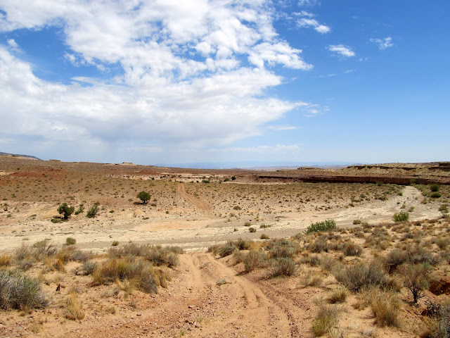
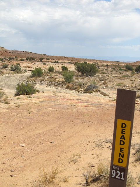
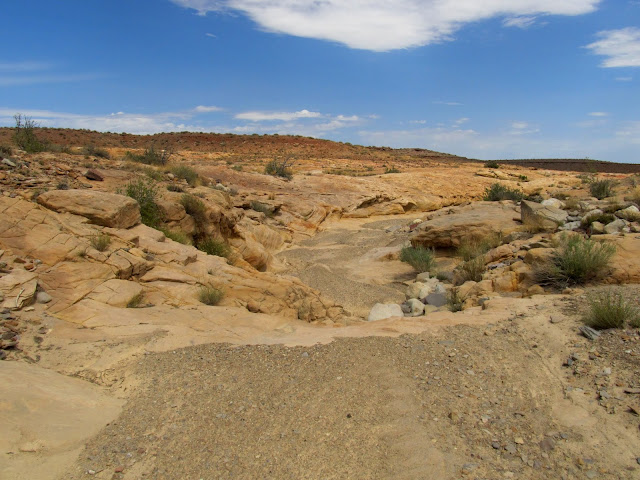
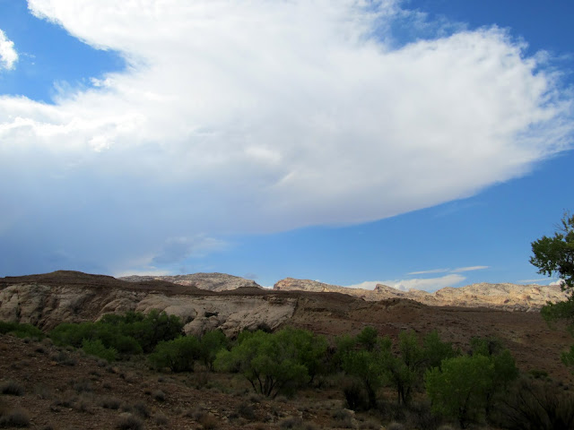
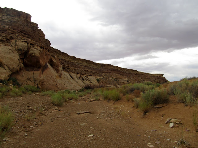
For a few weeks now I've been having desert withdrawals. The weather's just been too warm to venture into the low country, but last weekend I couldn't take it any longer. With a forecast high of 98 degrees and a 20% chance of rain showers, I set out to find some petroglyphs in Ernie Canyon that Scott P. mentioned in response to one of my trip reports from March. I planned on hiking down Ernie Canyon and searching for rock art starting from the end of trail 921, then when reaching the spot where the canyon crosses a long fault line, crossing over into Iron Wash and again searching for rock art there as I made my way back toward the truck. I didn't actually decide to do this trip until after I'd already awakened late on Saturday morning, so it was nearly noon before I was out there hiking. It was hot and partly cloudy, but not unbearable. I started off by checking out small side drainages in Ernie canyon, and in the first one I searched I had some success. There were a couple of small and admittedly uninteresting petroglyphs, but still, it was something! There were some tadpoles and toads in the potholes in another side canyon, and later I'd see many, many more toads.
The start of the hike
End of trail 921
The first small side canyon I searched for rock art
Success! 20 minutes into the hike and I found a couple of petroglyphs
Side canyon
Potholes
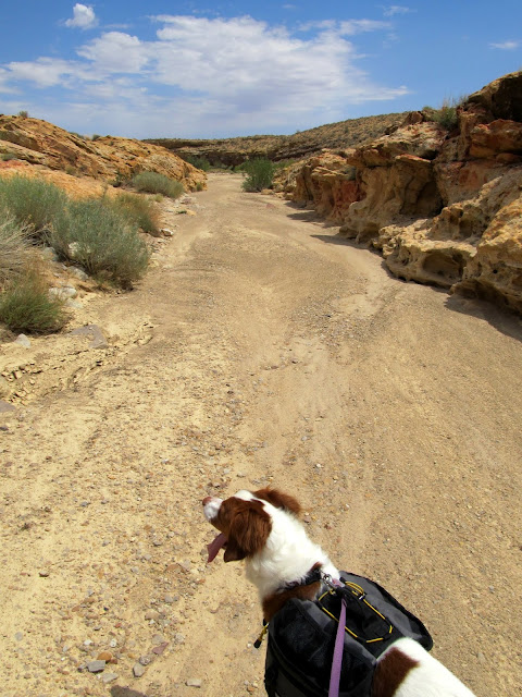
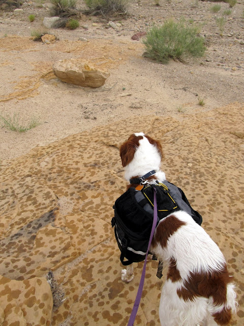
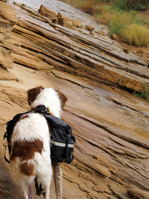
Torrey doing what Torrey does
Toads
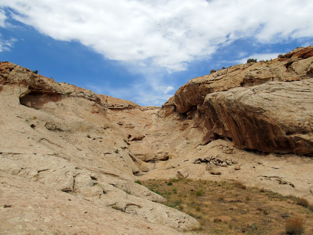
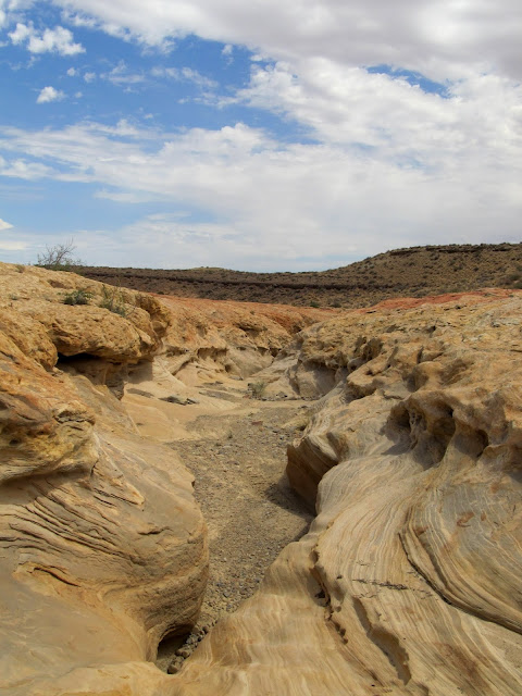
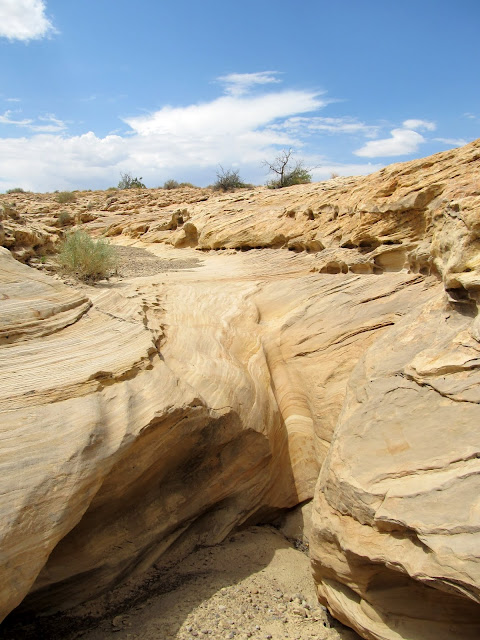
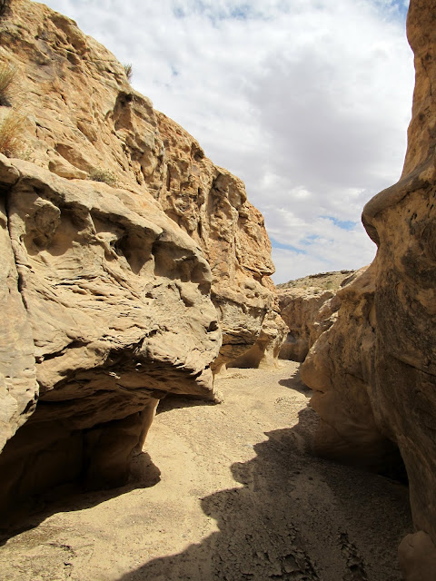
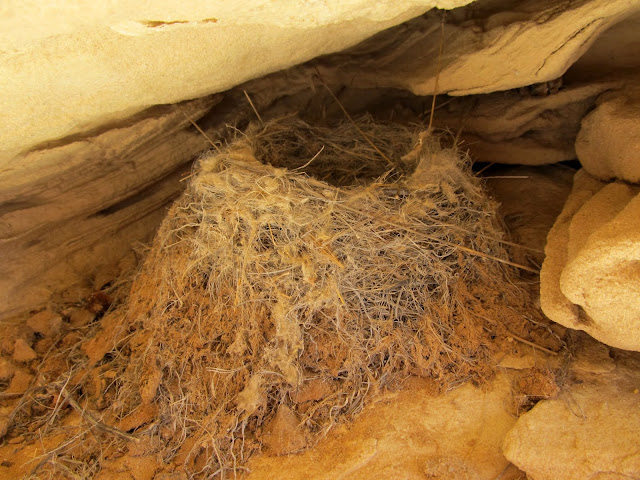
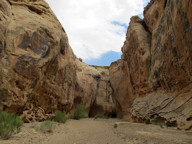
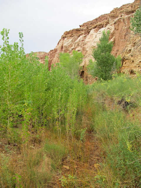
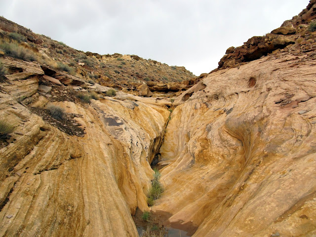
I slowly made my way down Ernie Canyon and came to the first of two drops/dryfalls that were visible in Google Earth. I could tell from the shadows in the satellite imagery that there was some sort of drop in each spot, but beyond that I couldn't guess as to their height or difficulty to bypass. This first one proved to be easy, with one short drop that Torrey even made it down without help. It was followed by a short section of shallow narrows where I saw a couple of interesting but vacant bird nests. The narrows ended as abruptly as they'd began, and for a short while after that I was again walking in a wide, sandy and gravelly wash. I rounded a couple of curves in the wash, and as I got closer to the next drop I spied something interesting and unexpected in the wash ahead of me just as I noticed some darker clouds moving in over the San Rafael Reef.
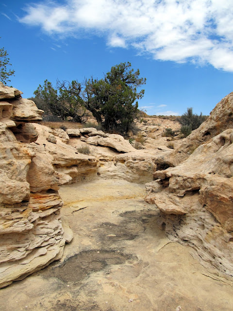
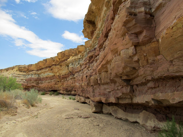
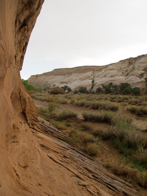
Ernie Canyon begins to deepen and narrow
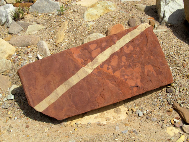
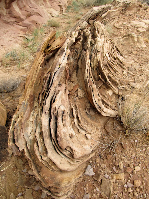
I wanted to bring this rock home with me. It was about 3ftx1ftx6in--too heavy to carry.
The start of a short and shallow section of narrows in Ernie Canyon
Ernie Canyon narrows. The first drop was easily downclimbable--Torrey even made it down without help.
Ernie Canyon narrows
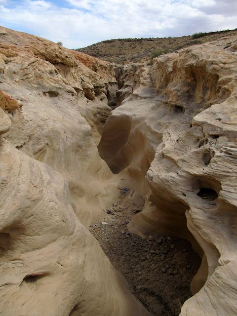
Ernie Canyon narrows
Bird nest in the canyon wall
Below the narrows
Carmel Formation shale on one side of Ernie Canyon
Dark clouds moving in, and the start of something interesting and unexpected in the canyon
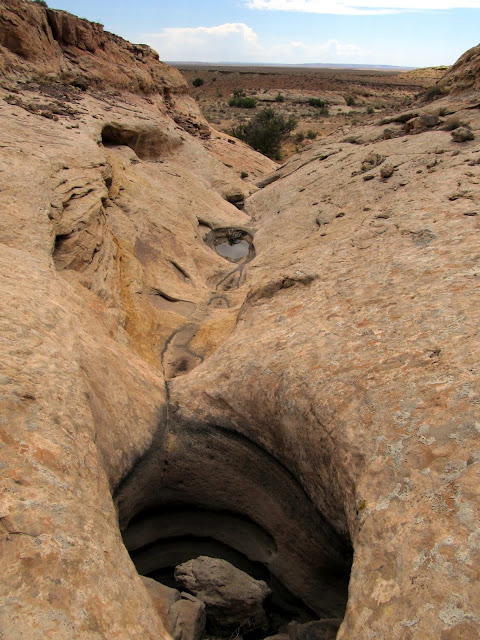
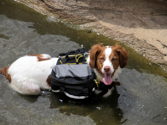
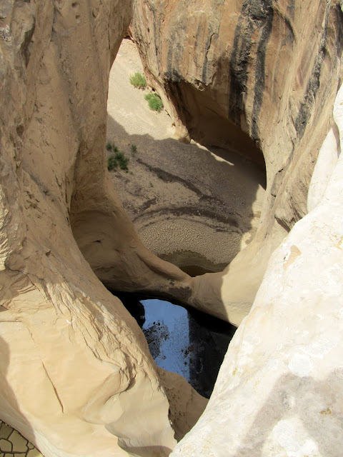
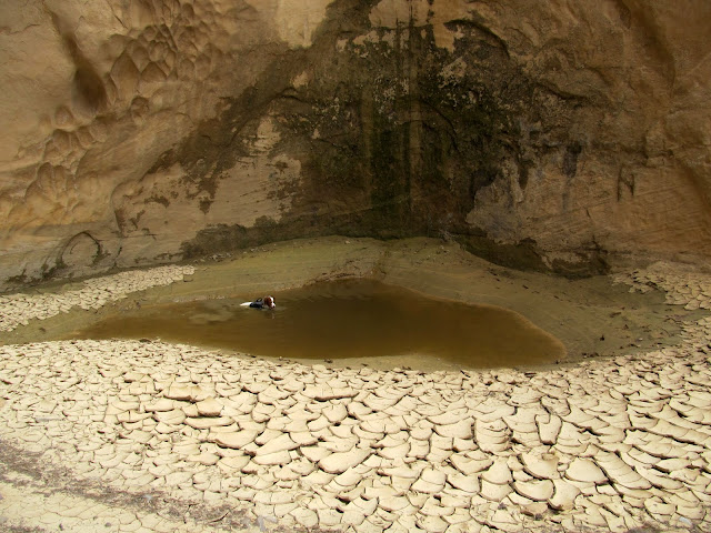
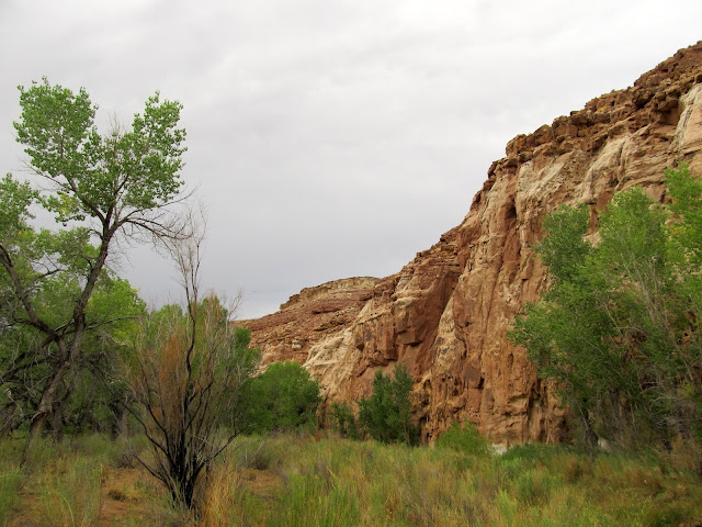
I approached the next drop, not being able to see beyond it and not knowing whether it was passable. I got to the edge where it turned vertical and realized just how huge the dryfall was. It was tiered, with one pothole part of the way down that was visible from the start of the drop, and another pothole farther down that I wasn't able to see until I walked the rim for a bit. The entire drop was easily bypassable on the right by walking the rim and following a steep chute down to the canyon's bottom below the drop. By the time I got to the canyon bottom below the drop, the sun had disappeared behind the clouds. I walked up the bottom of the canyon until I stood at a big pool of water at the bottom of the dryfall. There was a huge amphitheater scoured out of the sandstone near the pool, and in it I found a friend's initials carved--he's been everywhere, it seems!
Whoa, a big drop coming up!
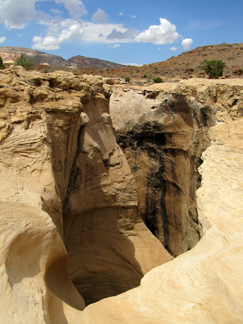
The first pothole below the drop
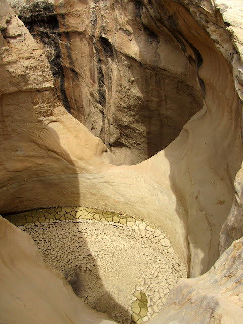
A second pothole
The route I used to scramble down into the canyon below the big drop
Looking up Ernie Canyon toward the big drop
At the drop
Stinky dog getting stinkier
The sky above the drop
This guy has been everywhere!

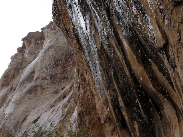
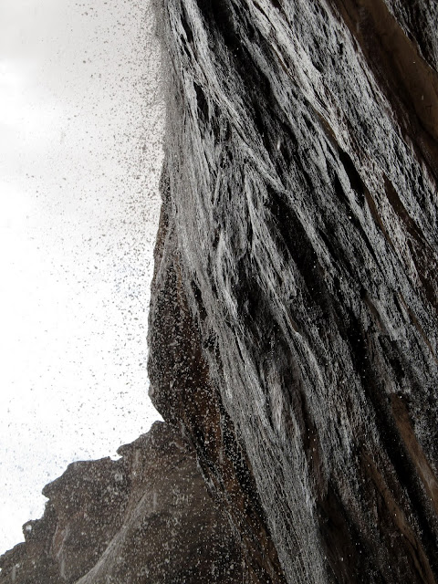
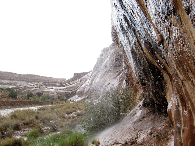
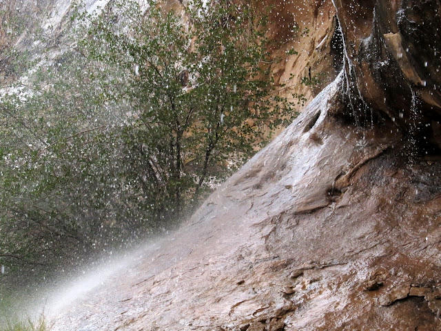
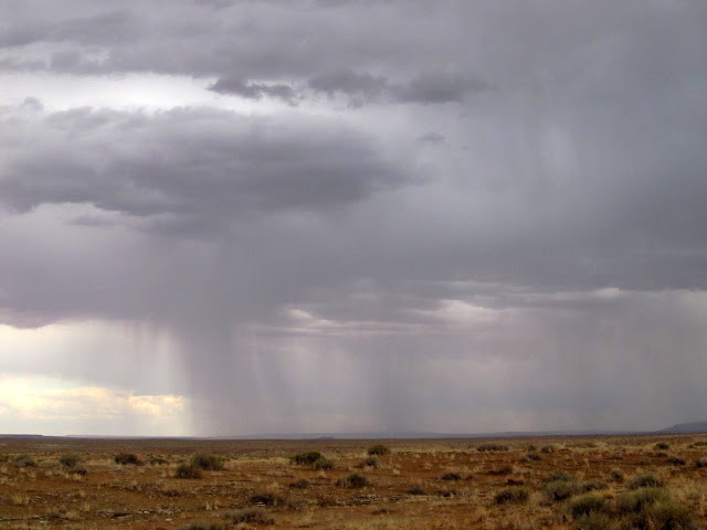
I enjoyed the amphitheater for a while, and Torrey swam in and drank from the pool. The darkening skies worried me, though, especially in this stretch of canyon with purely vertical walls and no way to escape a flash flood. I reluctantly continued down-canyon. About 10 minutes later the rain came. I hiked for another five minutes in the rain before finding a large dry spot underneath an overhanging cliff that looked like it would make a good place to wait out the storm. I stood there, sheltered from the rain, and took a few photos and videos of the storm. As I was doing so, runoff began gently flowing down the cliff behind me. As the rain worsened, so did the runoff until it was a series of waterfalls. My dry overhang shrank to a very tiny spot where I could stand and not get wet. One time I was standing right where a new waterfall formed and I was surprised by the warmth of the water--it was much, much warmer than the rain falling, almost the same temperature as I'd prefer my shower at home to run.
Darker clouds moving in
Here comes the rain!
View from under the overhanging cliff--it's dry, for now
Then it was more than a trickle
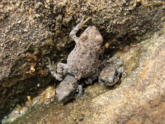
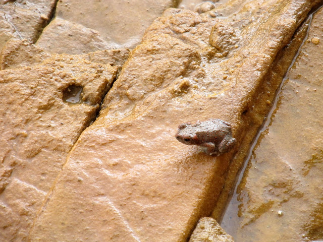
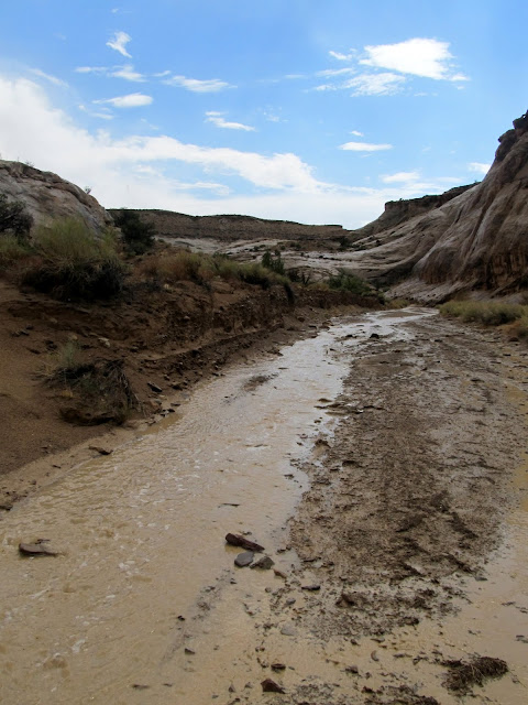
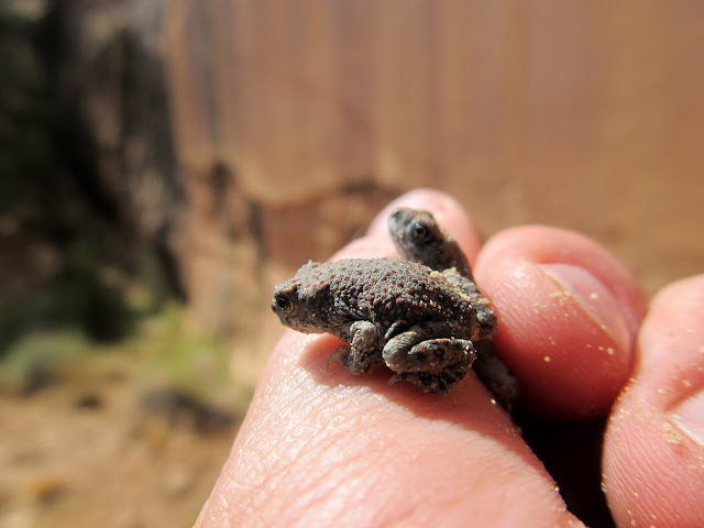
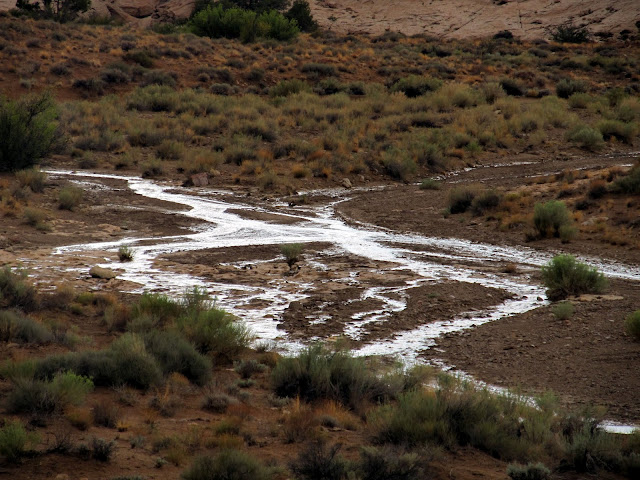
[parsehtml]<iframe width="853" height="480" src="http://www.youtube.com/embed/RDnUcO59doY?rel=0" frameborder="0" allowfullscreen></iframe>[/parsehtml]While I waited out the rain, the desert came alive with amphibians. I first noticed the toads when Torrey left the shelter of the overhang to root around in a bush. I eventually saw the toad she was after and was surprised to see it where there had previously been no standing water. I was more surprised to see scores more toads come out of their hiding spots and into the rain. Even now I'm not sure where they came from, but it's apparent that toads are everywhere in the desert and, if you're lucky, you might see them emerge. Torrey ignored the downpour and began chasing them, and I had to ensure that she didn't harm them too badly or even eat one. She did catch a few, but I made her spit them out. I spent about 30 minutes in the overhang before the rain suddenly subsided and the sun reappeared. By then the wash had a small and steady flow of water which continued for the remainder of the time I was there.
With the rain came the toads--there were seriously dozens of them that came out from hiding. Two are visible here just above Torrey's left ear.
Toad
Quite a bit of water running off the cliff. My dry spot under the overhang shrunk to a tiny space, where I still got a little wet.
During the worst of the rain
Runoff coming down the cliff
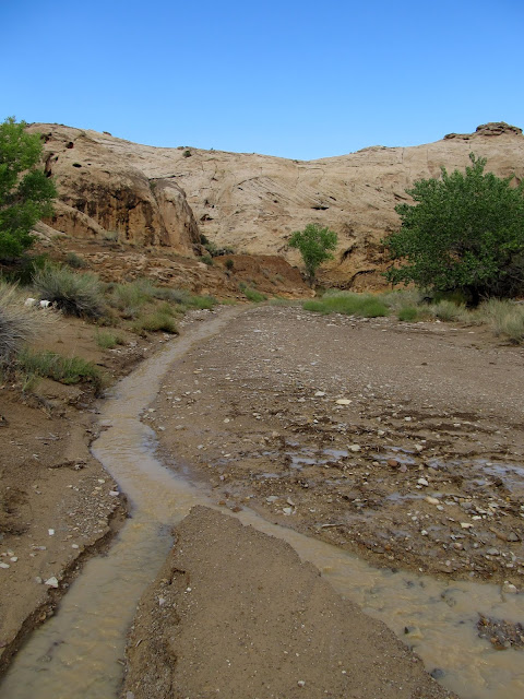
After the rain let up, Ernie Canyon had a small, steady flow
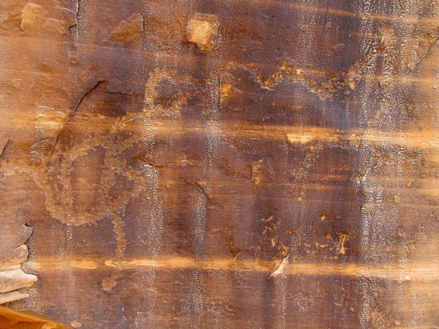
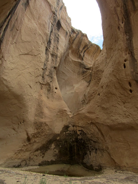
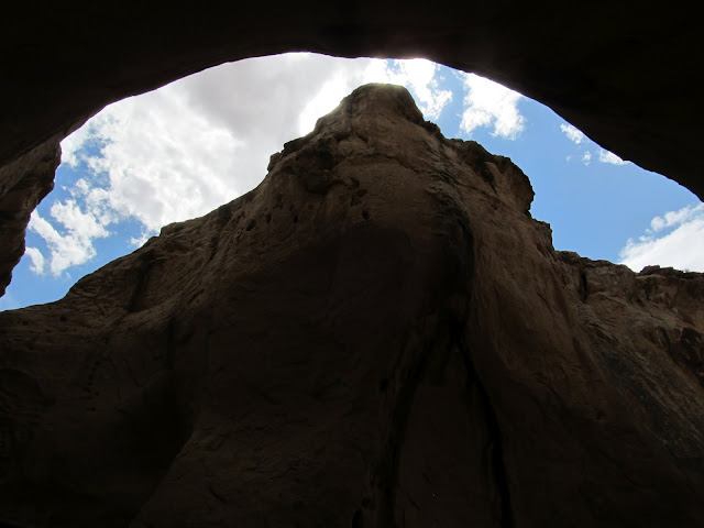
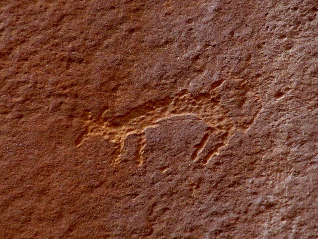
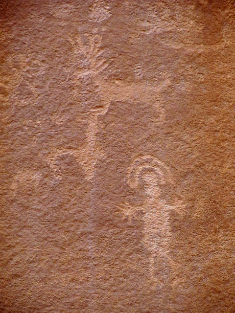
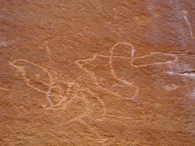
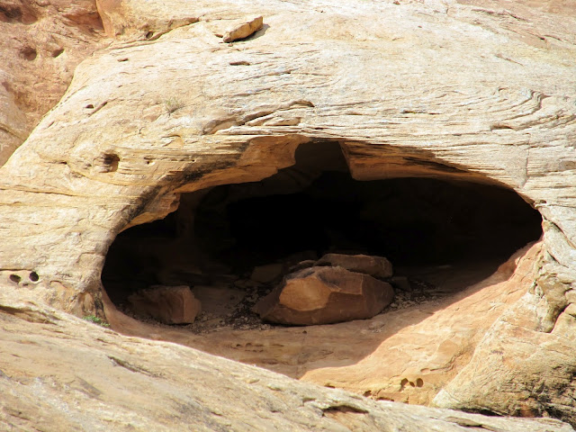
I wasn't expecting to encounter the main petroglyph panel for a while yet, but it turned out that it was only a couple hundred yards downstream of where I'd sheltered from the storm. Scott wasn't exaggerating--it's one of the best petroglyph panels in this part of the San Rafael Swell. There were a couple of large, very busy panels with many figures, shapes, and animals pecked into the rock. They were all very high up on the cliff, mostly too high to even reach, which made photographing them difficult. I imagine that the sand and rocks against the cliff were higher hundreds of years ago when the rock art was made. Just down-canyon from the petroglyphs, but above the first vertical canyon wall, was a very interesting cave. I didn't think I could scale the cliff to get up to the next tier where the cave lies, or at least I didn't want to attempt it without help. It will have to wait for another trip.
A couple of the dozens of toads near the rock art
Dog? Coyote? Cool petroglyph either way.
Petroglyphs
Petroglyphs that reminded me of the squiggly lines I found earlier in the canyon
Cool rocks!
A cave that seemed unreachable from this spot. I'll have to return to find a way up!
Zoom shot of the cave
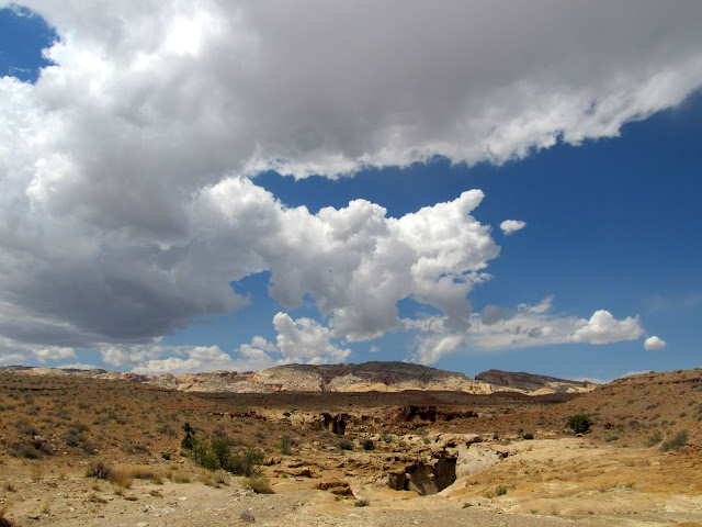
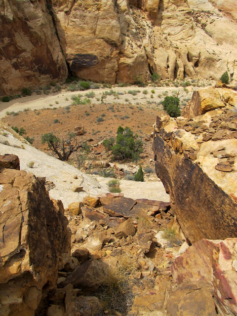
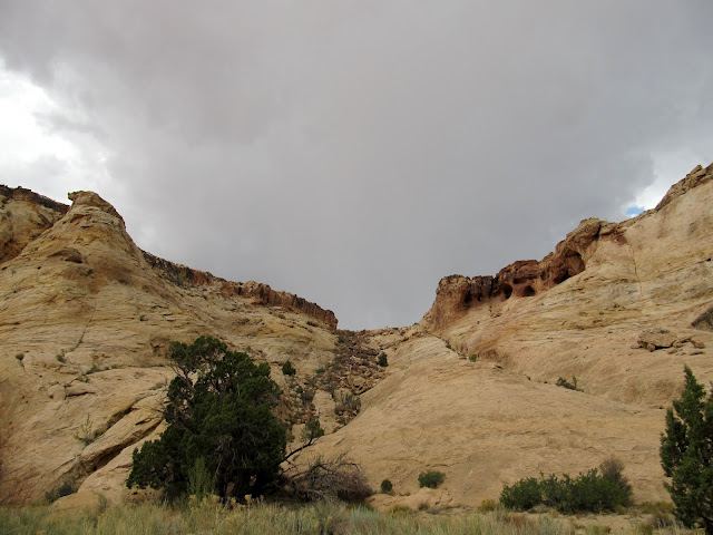
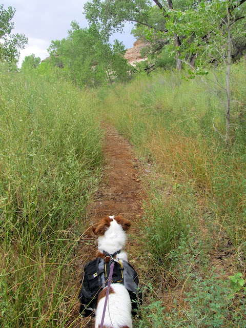
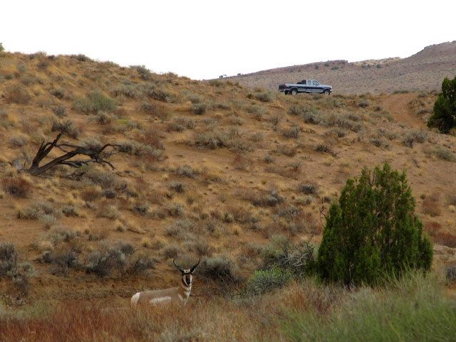
The rock art was near where Ernie Canyon crosses the fault line, so after finishing up at the petroglyphs I hiked about half a mile over to Iron Wash. As I did that a second storm started moving in. This one looked even bigger than the storm I'd waited out, and it was accompanied by plenty of lightning and thunder. Instead of looking for rock art in Iron Wash, I chose to just hurry through it to my planned exit point toward the truck. I unexpectedly found the first half-mile stretch of Iron Wash to be very overgrown and lush. For such a huge drainage, the watercourse in that part of the canyon was small and difficult to pick out. I made my way through dense greenery until finally the canyon opened up and I reached a small side drainage that led me to the flats between Iron Wash and Ernie Canyon. I stayed in bottom of the small drainage as long as I could because it afforded at least some minor protection from any potential lightning strikes. Out on the flats, I could see that the bulk of the storm was to the south and that only the edge of it was overhead. Still, the flash flood potential in any of the canyons was higher than I was comfortable with, so I was glad to be out. I reached Ernie Canyon and hiked upstream, covering a short stretch that I'd already hiked down earlier in the day. I avoided the main watercourse and stuck to the higher ground as I hiked back to the truck. When I got within sight of the truck I saw some pronghorn bedded down aside the wash bottom. We stared at each other for a brief moment before the male rounded up his harem and they bolted off to the east.
Ernie Canyon
The edge of another storm front
Bushwhack in Iron Wash. With another storm moving in, this time with a lot of lightning, I rushed through Iron Wash without looking for rock art.
Iron Wash
For having a huge drainage, the watercourse in this stretch of Iron Wash is surprisingly overgrown
The bushwhacking finally ended and I hauled ass through this part
Climbing out of Iron Wash
On the flats between Iron Wash and Ernie Canyon, with rain falling to the east in the San Rafael Desert
Water flowing in Ernie Canyon
Pronghorn near the truck
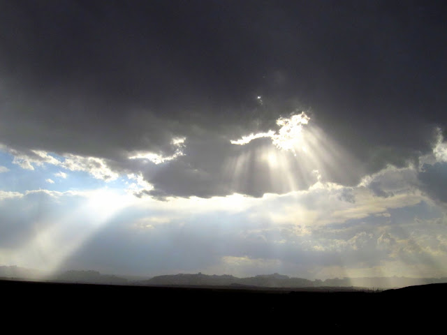
The sun's rays on the drive home, near the junction of I-70 and US-6
The clouds and rain helped to moderate the high temperatures on this trip. I'm sooo glad I went! The high humidity, on the other hand, made me dripping wet even when it wasn't raining. It was a small price to pay for helping to cure my desertlust.
Full Photo Gallery:
https://picasaweb.google.com/Dennis.Udink/ErnieCanyonAndIronWashLoop
GPS Tracklog and Photo Waypoints:
[parsehtml]<iframe width="640" height="480" frameborder="0" scrolling="no" marginheight="0" marginwidth="0" src="https://maps.google.com/maps?q=http:%2F%2Fudink.org%2Fgeo%2FErnieCanyonAndIronWashLoop.kmz&hl=en&sll=39.60063,-110.806334&sspn=0.077243,0.169086&t=h&ie=UTF8&ll=38.739591,-110.510144&spn=0.016067,0.027466&z=15&output=embed"></iframe><br /><small><a href="https://maps.google.com/maps?q=http:%2F%2Fudink.org%2Fgeo%2FErnieCanyonAndIronWashLoop.kmz&hl=en&sll=39.60063,-110.806334&sspn=0.077243,0.169086&t=h&ie=UTF8&ll=38.739591,-110.510144&spn=0.016067,0.027466&z=15&source=embed" style="color:#0000FF;text-align:left">View Larger Map</a></small>
[/parsehtml]Featured image for home page:

The start of the hike
End of trail 921
The first small side canyon I searched for rock art
Success! 20 minutes into the hike and I found a couple of petroglyphs
Side canyon
Potholes
Torrey doing what Torrey does
Toads
I slowly made my way down Ernie Canyon and came to the first of two drops/dryfalls that were visible in Google Earth. I could tell from the shadows in the satellite imagery that there was some sort of drop in each spot, but beyond that I couldn't guess as to their height or difficulty to bypass. This first one proved to be easy, with one short drop that Torrey even made it down without help. It was followed by a short section of shallow narrows where I saw a couple of interesting but vacant bird nests. The narrows ended as abruptly as they'd began, and for a short while after that I was again walking in a wide, sandy and gravelly wash. I rounded a couple of curves in the wash, and as I got closer to the next drop I spied something interesting and unexpected in the wash ahead of me just as I noticed some darker clouds moving in over the San Rafael Reef.
Ernie Canyon begins to deepen and narrow
I wanted to bring this rock home with me. It was about 3ftx1ftx6in--too heavy to carry.
The start of a short and shallow section of narrows in Ernie Canyon
Ernie Canyon narrows. The first drop was easily downclimbable--Torrey even made it down without help.
Ernie Canyon narrows
Ernie Canyon narrows
Bird nest in the canyon wall
Below the narrows
Carmel Formation shale on one side of Ernie Canyon
Dark clouds moving in, and the start of something interesting and unexpected in the canyon
I approached the next drop, not being able to see beyond it and not knowing whether it was passable. I got to the edge where it turned vertical and realized just how huge the dryfall was. It was tiered, with one pothole part of the way down that was visible from the start of the drop, and another pothole farther down that I wasn't able to see until I walked the rim for a bit. The entire drop was easily bypassable on the right by walking the rim and following a steep chute down to the canyon's bottom below the drop. By the time I got to the canyon bottom below the drop, the sun had disappeared behind the clouds. I walked up the bottom of the canyon until I stood at a big pool of water at the bottom of the dryfall. There was a huge amphitheater scoured out of the sandstone near the pool, and in it I found a friend's initials carved--he's been everywhere, it seems!
Whoa, a big drop coming up!
The first pothole below the drop
A second pothole
The route I used to scramble down into the canyon below the big drop
Looking up Ernie Canyon toward the big drop
At the drop
Stinky dog getting stinkier
The sky above the drop
This guy has been everywhere!
I enjoyed the amphitheater for a while, and Torrey swam in and drank from the pool. The darkening skies worried me, though, especially in this stretch of canyon with purely vertical walls and no way to escape a flash flood. I reluctantly continued down-canyon. About 10 minutes later the rain came. I hiked for another five minutes in the rain before finding a large dry spot underneath an overhanging cliff that looked like it would make a good place to wait out the storm. I stood there, sheltered from the rain, and took a few photos and videos of the storm. As I was doing so, runoff began gently flowing down the cliff behind me. As the rain worsened, so did the runoff until it was a series of waterfalls. My dry overhang shrank to a very tiny spot where I could stand and not get wet. One time I was standing right where a new waterfall formed and I was surprised by the warmth of the water--it was much, much warmer than the rain falling, almost the same temperature as I'd prefer my shower at home to run.
Darker clouds moving in
Here comes the rain!
View from under the overhanging cliff--it's dry, for now
Then it was more than a trickle
[parsehtml]<iframe width="853" height="480" src="http://www.youtube.com/embed/RDnUcO59doY?rel=0" frameborder="0" allowfullscreen></iframe>[/parsehtml]While I waited out the rain, the desert came alive with amphibians. I first noticed the toads when Torrey left the shelter of the overhang to root around in a bush. I eventually saw the toad she was after and was surprised to see it where there had previously been no standing water. I was more surprised to see scores more toads come out of their hiding spots and into the rain. Even now I'm not sure where they came from, but it's apparent that toads are everywhere in the desert and, if you're lucky, you might see them emerge. Torrey ignored the downpour and began chasing them, and I had to ensure that she didn't harm them too badly or even eat one. She did catch a few, but I made her spit them out. I spent about 30 minutes in the overhang before the rain suddenly subsided and the sun reappeared. By then the wash had a small and steady flow of water which continued for the remainder of the time I was there.
With the rain came the toads--there were seriously dozens of them that came out from hiding. Two are visible here just above Torrey's left ear.
Toad
Quite a bit of water running off the cliff. My dry spot under the overhang shrunk to a tiny space, where I still got a little wet.
During the worst of the rain
Runoff coming down the cliff
After the rain let up, Ernie Canyon had a small, steady flow
I wasn't expecting to encounter the main petroglyph panel for a while yet, but it turned out that it was only a couple hundred yards downstream of where I'd sheltered from the storm. Scott wasn't exaggerating--it's one of the best petroglyph panels in this part of the San Rafael Swell. There were a couple of large, very busy panels with many figures, shapes, and animals pecked into the rock. They were all very high up on the cliff, mostly too high to even reach, which made photographing them difficult. I imagine that the sand and rocks against the cliff were higher hundreds of years ago when the rock art was made. Just down-canyon from the petroglyphs, but above the first vertical canyon wall, was a very interesting cave. I didn't think I could scale the cliff to get up to the next tier where the cave lies, or at least I didn't want to attempt it without help. It will have to wait for another trip.
A couple of the dozens of toads near the rock art
Dog? Coyote? Cool petroglyph either way.
Petroglyphs
Petroglyphs that reminded me of the squiggly lines I found earlier in the canyon
Cool rocks!
A cave that seemed unreachable from this spot. I'll have to return to find a way up!
Zoom shot of the cave
The rock art was near where Ernie Canyon crosses the fault line, so after finishing up at the petroglyphs I hiked about half a mile over to Iron Wash. As I did that a second storm started moving in. This one looked even bigger than the storm I'd waited out, and it was accompanied by plenty of lightning and thunder. Instead of looking for rock art in Iron Wash, I chose to just hurry through it to my planned exit point toward the truck. I unexpectedly found the first half-mile stretch of Iron Wash to be very overgrown and lush. For such a huge drainage, the watercourse in that part of the canyon was small and difficult to pick out. I made my way through dense greenery until finally the canyon opened up and I reached a small side drainage that led me to the flats between Iron Wash and Ernie Canyon. I stayed in bottom of the small drainage as long as I could because it afforded at least some minor protection from any potential lightning strikes. Out on the flats, I could see that the bulk of the storm was to the south and that only the edge of it was overhead. Still, the flash flood potential in any of the canyons was higher than I was comfortable with, so I was glad to be out. I reached Ernie Canyon and hiked upstream, covering a short stretch that I'd already hiked down earlier in the day. I avoided the main watercourse and stuck to the higher ground as I hiked back to the truck. When I got within sight of the truck I saw some pronghorn bedded down aside the wash bottom. We stared at each other for a brief moment before the male rounded up his harem and they bolted off to the east.
Ernie Canyon
The edge of another storm front
Bushwhack in Iron Wash. With another storm moving in, this time with a lot of lightning, I rushed through Iron Wash without looking for rock art.
Iron Wash
For having a huge drainage, the watercourse in this stretch of Iron Wash is surprisingly overgrown
The bushwhacking finally ended and I hauled ass through this part
Climbing out of Iron Wash
On the flats between Iron Wash and Ernie Canyon, with rain falling to the east in the San Rafael Desert
Water flowing in Ernie Canyon
Pronghorn near the truck
The sun's rays on the drive home, near the junction of I-70 and US-6
The clouds and rain helped to moderate the high temperatures on this trip. I'm sooo glad I went! The high humidity, on the other hand, made me dripping wet even when it wasn't raining. It was a small price to pay for helping to cure my desertlust.
Full Photo Gallery:
https://picasaweb.google.com/Dennis.Udink/ErnieCanyonAndIronWashLoop
GPS Tracklog and Photo Waypoints:
[parsehtml]<iframe width="640" height="480" frameborder="0" scrolling="no" marginheight="0" marginwidth="0" src="https://maps.google.com/maps?q=http:%2F%2Fudink.org%2Fgeo%2FErnieCanyonAndIronWashLoop.kmz&hl=en&sll=39.60063,-110.806334&sspn=0.077243,0.169086&t=h&ie=UTF8&ll=38.739591,-110.510144&spn=0.016067,0.027466&z=15&output=embed"></iframe><br /><small><a href="https://maps.google.com/maps?q=http:%2F%2Fudink.org%2Fgeo%2FErnieCanyonAndIronWashLoop.kmz&hl=en&sll=39.60063,-110.806334&sspn=0.077243,0.169086&t=h&ie=UTF8&ll=38.739591,-110.510144&spn=0.016067,0.027466&z=15&source=embed" style="color:#0000FF;text-align:left">View Larger Map</a></small>
[/parsehtml]Featured image for home page: