- Joined
- Aug 9, 2007
- Messages
- 12,956
With the exception of the BMT in January and some Wingate Wandering in early March, I've been noticeably absent from the backpacking subforum this year. Not because I didn't want to, it just got shuffled to the back behind the work hikes that took all of my hiking energy and the boat camping trips which have become something I've really enjoyed in between.
Last week it dawned on me that I needed to get at least one night in the high country before the snow flies, so @slc_dan and I made plans to head to the Uintas. I'm not exactly in the physical condition for backpacking right now. My knee has deteriorated so badly that I have to 'reset it' several times per day. An excruciatingly painful process that is quickly leading me to my fourth knee surgery later this fall. So with that in mind, I picked a destination that could be as short or as long as we wanted: Echo Lake.
Echo is most famous for being one of the few places in Utah that holds coveted Golden Trout. They've been around in this basin since the 70's, but in the last few years, the DWR has actually been stocking them here. Echo can be accessed directly with a HC 4WD vehicle but the ride is pretty rough. The combination of easy access and gold makes it a popular destination.
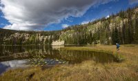
We arrived at Echo mid-morning on a Saturday. We didn't see a lot of people on the Murdock Basin road so I thought it would be pretty desolate. I love post-Labor Day in the Uintas. But to our surprise, there were actually quite a few people fishing at Echo. None of them were very friendly so we decided to just walk the shoreline and keep going to the lakes above Echo that are much more difficult to access. The light that morning was awesome with dramatic clouds and yellowing autumn grass.
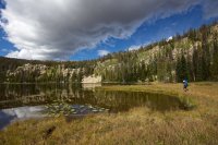
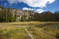
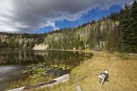
We worked our way around the lake and then up a steep slope. The entire slope heading to Joan and Gem lakes looks like it is lined with cliffs from below. The terrain in between is very steep.
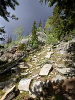
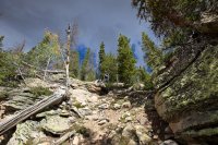
Dan and Sage in the first cliff break we used.
Echo Lake from above.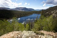
The final cliff break was more difficult than the first. It was a long, solid wall. Dan went up here but I decided to poke around for an easier spot. Turns out I should have gone with him as I ended up coming back to it anyway. It was a little tricky solo getting Sage and my pack up. We went up the crack behind the big bush by Sage.
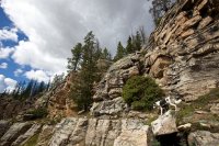
Looking down from the access crack. There are much easier ways to get up further south.
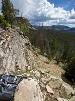
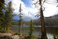
The next lake we stopped at was Gem. Once again, fantastic light and clouds were abundant.
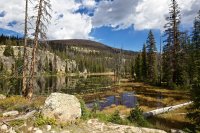
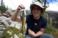
And the fishing wasn't terrible either. Dan immediately hooked this interesting tiger on his second cast. At least I think it's a tiger. I've never seen one quite like it. There were also some smaller brookies around.
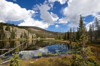
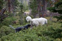
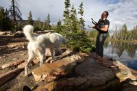
Next we wandered over to Joan Lake. It is much larger and had some nice campsites, so we setup our tents and had some lunch. After failing to catch fish, a storm moved in and we huddled under some trees. That huge white dog is named Oquirrh. His parents were nearby fishing on a day hike and he liked to come visit us. He almost looked like a mountain goat from a distance.
Finally the storm broke, but not for long. Another round came through forcing us back to shelter until sometime around 5 or 6 when the sun came out for a little while longer before setting over Mount Cardwell.
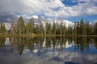
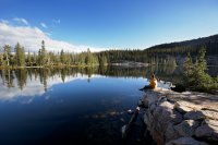
Awesome reflections as the storm moved out.
Oquirrh with @slc_dan for scale.
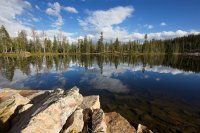
We did not get many fish at Joan. One to be exact. But they were out there.
That night we had a big storm move through around 3am. Lightning and thunder crashing down right on top of us. That always scares me a bit. I guess getting fried in your tent in the wilderness wouldn't be the worst way to go though. The next day there wasn't a cloud in the sky until we started the hike out. We tried to find the easier route down this time.
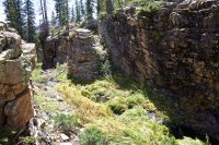
This shot is of the outlet stream of Joan. It cuts through a really cool gorge before dropping down through the cliffs to Echo Lake. The easiest access is just south of this.
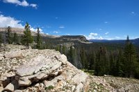
We finally found a cairned route down and started following it toward Echo.
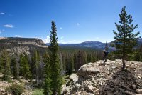
But then we lost it so we just went for the steep chutes and avoided cliffs as necessary.
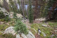
Very, very steep.
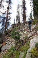
After the grueling one mile walk back to the truck, we were headed back down the rough Murdock Basin Road. Most of the aspens were still green, but there were some nice pockets of color here and there.
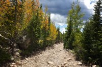
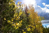
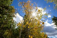
It was a fine little adventure to say goodbye to the high country for the year. Hopefully the next knee surgery will let me do a lot more of these next year. Now it's time to go rest my knee on the boat for a while.
Featured image for home page:
Last week it dawned on me that I needed to get at least one night in the high country before the snow flies, so @slc_dan and I made plans to head to the Uintas. I'm not exactly in the physical condition for backpacking right now. My knee has deteriorated so badly that I have to 'reset it' several times per day. An excruciatingly painful process that is quickly leading me to my fourth knee surgery later this fall. So with that in mind, I picked a destination that could be as short or as long as we wanted: Echo Lake.
Echo is most famous for being one of the few places in Utah that holds coveted Golden Trout. They've been around in this basin since the 70's, but in the last few years, the DWR has actually been stocking them here. Echo can be accessed directly with a HC 4WD vehicle but the ride is pretty rough. The combination of easy access and gold makes it a popular destination.
We arrived at Echo mid-morning on a Saturday. We didn't see a lot of people on the Murdock Basin road so I thought it would be pretty desolate. I love post-Labor Day in the Uintas. But to our surprise, there were actually quite a few people fishing at Echo. None of them were very friendly so we decided to just walk the shoreline and keep going to the lakes above Echo that are much more difficult to access. The light that morning was awesome with dramatic clouds and yellowing autumn grass.


We worked our way around the lake and then up a steep slope. The entire slope heading to Joan and Gem lakes looks like it is lined with cliffs from below. The terrain in between is very steep.

Dan and Sage in the first cliff break we used.

Echo Lake from above.

The final cliff break was more difficult than the first. It was a long, solid wall. Dan went up here but I decided to poke around for an easier spot. Turns out I should have gone with him as I ended up coming back to it anyway. It was a little tricky solo getting Sage and my pack up. We went up the crack behind the big bush by Sage.

Looking down from the access crack. There are much easier ways to get up further south.

The next lake we stopped at was Gem. Once again, fantastic light and clouds were abundant.

And the fishing wasn't terrible either. Dan immediately hooked this interesting tiger on his second cast. At least I think it's a tiger. I've never seen one quite like it. There were also some smaller brookies around.


Next we wandered over to Joan Lake. It is much larger and had some nice campsites, so we setup our tents and had some lunch. After failing to catch fish, a storm moved in and we huddled under some trees. That huge white dog is named Oquirrh. His parents were nearby fishing on a day hike and he liked to come visit us. He almost looked like a mountain goat from a distance.

Finally the storm broke, but not for long. Another round came through forcing us back to shelter until sometime around 5 or 6 when the sun came out for a little while longer before setting over Mount Cardwell.

Awesome reflections as the storm moved out.

Oquirrh with @slc_dan for scale.


We did not get many fish at Joan. One to be exact. But they were out there.

That night we had a big storm move through around 3am. Lightning and thunder crashing down right on top of us. That always scares me a bit. I guess getting fried in your tent in the wilderness wouldn't be the worst way to go though. The next day there wasn't a cloud in the sky until we started the hike out. We tried to find the easier route down this time.
This shot is of the outlet stream of Joan. It cuts through a really cool gorge before dropping down through the cliffs to Echo Lake. The easiest access is just south of this.


We finally found a cairned route down and started following it toward Echo.

But then we lost it so we just went for the steep chutes and avoided cliffs as necessary.

Very, very steep.

After the grueling one mile walk back to the truck, we were headed back down the rough Murdock Basin Road. Most of the aspens were still green, but there were some nice pockets of color here and there.


It was a fine little adventure to say goodbye to the high country for the year. Hopefully the next knee surgery will let me do a lot more of these next year. Now it's time to go rest my knee on the boat for a while.
Featured image for home page:

