Tres Westbrook
Member
- Joined
- Feb 10, 2013
- Messages
- 122
Along the far northeast coast of the United States lies Down East Maine. East of Cutler, Maine, the state has set aside an area along the coast known as the Cutler Coast Public Reserve, which preserves approximately 5 miles of dramatic Maine coastline. they say it is some of the last undeveloped coastline along the east coast.
Over the 2014 Labor Day weekend, my wife and I hiked the two trails that create a loop of approximately 9 miles. It was part of a week-long trip to the area during which we also intended to hike Mt. Katahdin in Baxter State Park, Maine and Franconia Ridge in Franconia Notch State Park, New Hampshire.
We began by flying into Bangor and driving up to Lubec, which is about as far northeast as you can get in the United States. We stayed at West Quoddy Head Light Station B&B, which is an old coast guard station that has been converted to a B&B. The next morning we drove about 10 miles down the coast to the trail head.
The loop consists of two trails known as the Inland Trail and the Coastal Trail. As the names suggest, the Coastal Trail follows the dramatic Maine coast for around 4 miles and the Inland Trail traverses old-growth forest and bogs just inland from the coast. There are three campsites toward the end of the Coastal Trail, located about 10 minutes apart. Because the weather was foggy and rainy when we arrived we decided to take the Inland Trail to the coast, then head up to camp and hopefully have better weather for our hike along the coast the next day. The weather did not totally cooperate, and we were shrouded in fog for a good portion of the second day. However, it was a pleasant hike along well maintained and marked trails, and it was fairly secluded, despite it being a holiday weekend. We only saw a few other parties during our hike, and none during our return hike along the coast until we were almost back to the trail head. Once the fog lifted the views form the cliffs were dramatic. It was a great introduction to Maine. Unfortunately the weather deteriorated later in the afternoon and remained bad for the next couple of days, disrupting our plan to hike Katahdin.
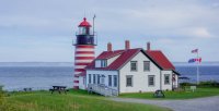
West Quoddy Head Light House - the easternmost point on the US mainland.
From the trail head, the trail heads straight for the coast. After around a half mile, the trail splits into the Coastal Trail and the Inland Trail. Several Sections of the Inland Trail consist of boardwalk over bogs and swampy areas.
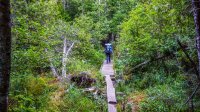
The Inland Trail also travels across gentle hills through old growth forest.

The Inland Trail also skirts a beaver pond on its way to the coast.
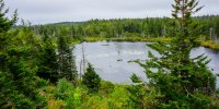
First view of the coast and the end of the Inland Trail. This area is known as Fairy Head.
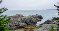
From Fairy Head, the Coastal Trail runs in a northeast direction. The three campsites are spaced about a quarter mile from each other, off the main trail down short access trails.
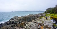
Once we set up camp we took time to just take in the beauty of the area.
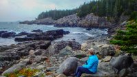
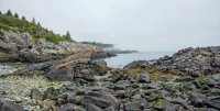
The next day we completed our hike, enjoying the beautiful and dramatic Down East coastline. After about 4 miles, the trail turns back inland, connecting back up with the the Inland Trail after about half a mile.
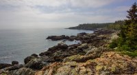
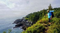
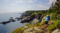
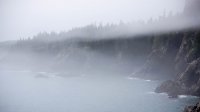
Video of our hike along the Cutler Coast:
Featured image for home page:
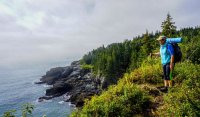
Over the 2014 Labor Day weekend, my wife and I hiked the two trails that create a loop of approximately 9 miles. It was part of a week-long trip to the area during which we also intended to hike Mt. Katahdin in Baxter State Park, Maine and Franconia Ridge in Franconia Notch State Park, New Hampshire.
We began by flying into Bangor and driving up to Lubec, which is about as far northeast as you can get in the United States. We stayed at West Quoddy Head Light Station B&B, which is an old coast guard station that has been converted to a B&B. The next morning we drove about 10 miles down the coast to the trail head.
The loop consists of two trails known as the Inland Trail and the Coastal Trail. As the names suggest, the Coastal Trail follows the dramatic Maine coast for around 4 miles and the Inland Trail traverses old-growth forest and bogs just inland from the coast. There are three campsites toward the end of the Coastal Trail, located about 10 minutes apart. Because the weather was foggy and rainy when we arrived we decided to take the Inland Trail to the coast, then head up to camp and hopefully have better weather for our hike along the coast the next day. The weather did not totally cooperate, and we were shrouded in fog for a good portion of the second day. However, it was a pleasant hike along well maintained and marked trails, and it was fairly secluded, despite it being a holiday weekend. We only saw a few other parties during our hike, and none during our return hike along the coast until we were almost back to the trail head. Once the fog lifted the views form the cliffs were dramatic. It was a great introduction to Maine. Unfortunately the weather deteriorated later in the afternoon and remained bad for the next couple of days, disrupting our plan to hike Katahdin.
West Quoddy Head Light House - the easternmost point on the US mainland.

From the trail head, the trail heads straight for the coast. After around a half mile, the trail splits into the Coastal Trail and the Inland Trail. Several Sections of the Inland Trail consist of boardwalk over bogs and swampy areas.

The Inland Trail also travels across gentle hills through old growth forest.

The Inland Trail also skirts a beaver pond on its way to the coast.

First view of the coast and the end of the Inland Trail. This area is known as Fairy Head.

From Fairy Head, the Coastal Trail runs in a northeast direction. The three campsites are spaced about a quarter mile from each other, off the main trail down short access trails.

Once we set up camp we took time to just take in the beauty of the area.


The next day we completed our hike, enjoying the beautiful and dramatic Down East coastline. After about 4 miles, the trail turns back inland, connecting back up with the the Inland Trail after about half a mile.


Video of our hike along the Cutler Coast:
Featured image for home page:

Attachments
Last edited:

