mak1277
Member
- Joined
- May 2, 2014
- Messages
- 106
Dolly Sods Wilderness is a 17,000 acre wilderness area in West Virginia, about 3 hours from the DC Metro area. It's described as a high altitude plateau and includes a variety of different ecological zones (high meadows, bogs and forests are all present). While I've never been there, I imagine that hiking in Dolly Sods is reminiscent of being in Scotland.
I took a day off work on Friday and drove up to do a one-night trip, approximately 11 miles each day.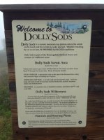
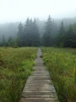
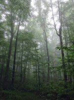
The area was used during WWII as an artillery training range for the Army. In addition to the sign above, there is also a sign that tells you what to do if you find un-exploded mortar shells (hint: don't touch). It was really foggy when I arrived, with temps in the 60s...nearly 20* lower than where I was coming from. The fog made for an eerie walk through the forests and high meadows for the first few miles.

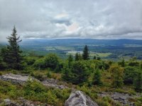
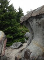
As the fog burned off, I turned south and walked along a rocky, windblown ridge. There were numerous wind-shaped rocks along the way, as well as a few nice overlooks into the Canaan Valley.
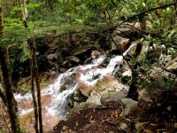
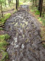
As I made my way lower in elevation I entered the woods. My path took me along a nice stream, complete with waterfall, but also allowed me to experience the only true negative in the Wilderness...mud. The entire place drains very poorly, and there are some trails that force you to walk through knee-deep mud for miles. Fortunately, I avoided most of the really bad stuff this trip.
My campsite for the night was off-trail, at the end of a tenth-mile rock scramble. The reward for my effort was a fantastic viewpoint overlooking the Lion's Head (can you see it?) and the Red Creek Canyon.


For the gear heads in the crowd, my fancy feast stove in action: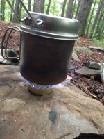
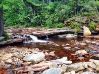
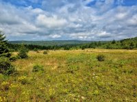
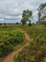
Day 2 was a much nicer day, and the trails took my past the forks of the Red Creek (with a ton of amazing campsites), and more lovely meadow walking. In the third picture you can see the effect of the constant wind on the trees.
As much as I like keeping my favorite places less crowded, I have to highly recommend Dolly Sods for anyone in the East/Mid-Atlantic area.
Featured image for home page:

I took a day off work on Friday and drove up to do a one-night trip, approximately 11 miles each day.

The area was used during WWII as an artillery training range for the Army. In addition to the sign above, there is also a sign that tells you what to do if you find un-exploded mortar shells (hint: don't touch). It was really foggy when I arrived, with temps in the 60s...nearly 20* lower than where I was coming from. The fog made for an eerie walk through the forests and high meadows for the first few miles.


As the fog burned off, I turned south and walked along a rocky, windblown ridge. There were numerous wind-shaped rocks along the way, as well as a few nice overlooks into the Canaan Valley.


As I made my way lower in elevation I entered the woods. My path took me along a nice stream, complete with waterfall, but also allowed me to experience the only true negative in the Wilderness...mud. The entire place drains very poorly, and there are some trails that force you to walk through knee-deep mud for miles. Fortunately, I avoided most of the really bad stuff this trip.


My campsite for the night was off-trail, at the end of a tenth-mile rock scramble. The reward for my effort was a fantastic viewpoint overlooking the Lion's Head (can you see it?) and the Red Creek Canyon.


For the gear heads in the crowd, my fancy feast stove in action:

Day 2 was a much nicer day, and the trails took my past the forks of the Red Creek (with a ton of amazing campsites), and more lovely meadow walking. In the third picture you can see the effect of the constant wind on the trees.


As much as I like keeping my favorite places less crowded, I have to highly recommend Dolly Sods for anyone in the East/Mid-Atlantic area.
Featured image for home page:

