balzaccom
Member
- Joined
- Sep 30, 2014
- Messages
- 838
Hoping to sneak in a few days of hiking before the big crowds of Labor Day, we drove south to the Dinkey Lakes Wilderness and found just what we were looking for. 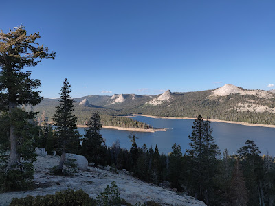
Day One: it began a long drive down to Courtwright Reservoir with stops in Madera for lunch at a Chinese restaurant (forgettable) and Prather to pick up our permit and get the latest Tom Harrison Map of the Dinkey Lakes Wilderness. As usual, during the hike we noticed a few differences between the USGS topo maps and the Harrison map—and in this case, the Harrison map was a bit more accurate. We camped at the PG&E campground at Trapper Springs, even though we could have camped right at the trailhead. But the campground had vault toilets and drinking water. We paid $24 for that! After dinner we climbed up on the nearby dome for wonderful views of the reservoir and surrounding peaks.
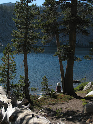
Day Two: With my wife’s foot still a question, we’ve been aiming for shorter hiking days, and this was no exception. Our goal was Cliff Lake, less than five miles from the trailhead. The first three miles was a cakewalk, with quite a few bugs in the middle, but the last third climbs up to Cliff Lake and was about as much as her foot could manage. We were at the lake by lunchtime. After our PB&J sandwiches, we set up our tent in a quiet spot a bit back and away from the lake and took a nap. With most of the afternoon still ahead of us, we set out cross-country to find Christenson Lake, which was lovely and quiet. We hiked around it, then went back to Cliff Lake to catch a few brook trout.
Boy are there a lot of campsites at Cliff Lake. Most of them are huge, too close to the water to be legal, and completely cleared of anything organic—just rocks and sand. That night we were joined by two couples—one quiet couple camped far away on the other end of the lake, and the other couple camped between us and managed to shout, hoot and holler most of the evening as they played some kind of game through the forest...
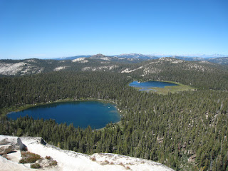
Day Three: This was going to be an easy day, just up and over the pass, and then another mile to Island Lake. We took it slow up to the pass, and then the trail drops very quickly to Rock Lake. The trout were rising like crazy at about 9:30, but we continued on to Second Dinkey Lake, and then took the more rustic trail up to Island Lake. This is marked as not suitable for stock, but it is really only difficult in a short section—one that was also complicated by a massive treefall. Once we detoured past that it was easy, and we arrived to find only two people there—and they were leaving that day.
We found a nice campsite perched up behind some huge boulders on the west side of the lake, and set up camp. We explored around the lake for the rest of the morning, and then after lunch we climbed the small dome north of the lake for some absolutely stunning views of the other lakes in the area, plus the whole Sierra crest to the east. Fabulous. We also met a group of about six or eight guys, one of whom was flying a drone around. A few cross words were exchanged at that point. Grrr.
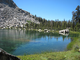
And once back in camp, we decided to cross-country over and down to Fingerbowl Lake—another absolute jewel of crystal clear water set into a granite bowl. Wonderful spot. And while there were no fish in the lake, it would have made a very nice and quiet campsite. Next time.
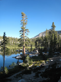
Day Four: We thought we would leave Island Lake to the flying droners, so we got up early and left for Second Dinkey Lake and Rock Lake. Since the fish were rising there the day before, I thought it might be worth fishing there this morning. It was, for 8-10 inch brookies. We didn’t set up our tent at Rock Lake though, because we really weren’t sure about our plans. We waffled about this all day long. After fishing, we decided to day-hike down to Little Lake for lunch: a short, steep trail that led to another amazing lake. There was a perfect (and perfectly legal!) campsite there, and we ate our lunch out on the peninsula underneath the towering Dogtooth Peak. Had it not been for the steep climb back out, we might have gone and fetched our packs and camped here for the night.
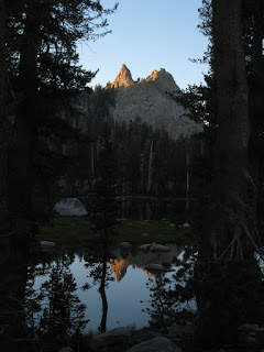
After a lovely lunch (we didn’t see another soul on this trail) we got back to Rock Lake where I fished a bit more. A group of three guys had set up camp on the far southeast corner of the lake, and we had staked our claim to a nice spot on the ridge to the northeast. They skinny-dipped while I fished, and luckily we weren’t too close to each other. But as the afternoon progressed we started thinking about the hike out the next day…and my wife was worried about it. So we decided to hoist our packs and hike back up over the pass and down into Cliff Lake. But this time we camped at Christenson Lake instead, and we had the place to ourselves. It was a really lovely spot, with views from the ridge behind our camp to the far Sierra, and towards the lake and this side of Dogtooth Peak. Idyllic.
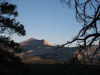
Day Five: This was an easy one, just about five miles, almost all downhill. But we were surprised by the number of hikers we met. We had seen an average of six people per day for the previous three days, and now we were meeting real crowds hiking up to Cliff Lake on Sunday.
We made it back to the van to discover that the parking area (which had had only five cars in it when we started our trip) was now packed to the gills with at least thirty cars. In fact, I moved the van before we had packed up so that a late-arriving hiker could park in our place. What struck us about this area was that it was really quite easy to access, and yet we hadn’t met that many people. Sure, some of the lakes were heavily impacted by campsites and fire rings, but all in all, it was everything we could hope for in a trip that didn’t require long miles on the trail, and still delivered everything you’d want in a backpacking trip.
The rest of the photos from our trip are here: https://photos.app.goo.gl/udpzeV8tqaidNYSXA

Day One: it began a long drive down to Courtwright Reservoir with stops in Madera for lunch at a Chinese restaurant (forgettable) and Prather to pick up our permit and get the latest Tom Harrison Map of the Dinkey Lakes Wilderness. As usual, during the hike we noticed a few differences between the USGS topo maps and the Harrison map—and in this case, the Harrison map was a bit more accurate. We camped at the PG&E campground at Trapper Springs, even though we could have camped right at the trailhead. But the campground had vault toilets and drinking water. We paid $24 for that! After dinner we climbed up on the nearby dome for wonderful views of the reservoir and surrounding peaks.
Day Two: With my wife’s foot still a question, we’ve been aiming for shorter hiking days, and this was no exception. Our goal was Cliff Lake, less than five miles from the trailhead. The first three miles was a cakewalk, with quite a few bugs in the middle, but the last third climbs up to Cliff Lake and was about as much as her foot could manage. We were at the lake by lunchtime. After our PB&J sandwiches, we set up our tent in a quiet spot a bit back and away from the lake and took a nap. With most of the afternoon still ahead of us, we set out cross-country to find Christenson Lake, which was lovely and quiet. We hiked around it, then went back to Cliff Lake to catch a few brook trout.
Boy are there a lot of campsites at Cliff Lake. Most of them are huge, too close to the water to be legal, and completely cleared of anything organic—just rocks and sand. That night we were joined by two couples—one quiet couple camped far away on the other end of the lake, and the other couple camped between us and managed to shout, hoot and holler most of the evening as they played some kind of game through the forest...
Day Three: This was going to be an easy day, just up and over the pass, and then another mile to Island Lake. We took it slow up to the pass, and then the trail drops very quickly to Rock Lake. The trout were rising like crazy at about 9:30, but we continued on to Second Dinkey Lake, and then took the more rustic trail up to Island Lake. This is marked as not suitable for stock, but it is really only difficult in a short section—one that was also complicated by a massive treefall. Once we detoured past that it was easy, and we arrived to find only two people there—and they were leaving that day.
We found a nice campsite perched up behind some huge boulders on the west side of the lake, and set up camp. We explored around the lake for the rest of the morning, and then after lunch we climbed the small dome north of the lake for some absolutely stunning views of the other lakes in the area, plus the whole Sierra crest to the east. Fabulous. We also met a group of about six or eight guys, one of whom was flying a drone around. A few cross words were exchanged at that point. Grrr.
And once back in camp, we decided to cross-country over and down to Fingerbowl Lake—another absolute jewel of crystal clear water set into a granite bowl. Wonderful spot. And while there were no fish in the lake, it would have made a very nice and quiet campsite. Next time.
Day Four: We thought we would leave Island Lake to the flying droners, so we got up early and left for Second Dinkey Lake and Rock Lake. Since the fish were rising there the day before, I thought it might be worth fishing there this morning. It was, for 8-10 inch brookies. We didn’t set up our tent at Rock Lake though, because we really weren’t sure about our plans. We waffled about this all day long. After fishing, we decided to day-hike down to Little Lake for lunch: a short, steep trail that led to another amazing lake. There was a perfect (and perfectly legal!) campsite there, and we ate our lunch out on the peninsula underneath the towering Dogtooth Peak. Had it not been for the steep climb back out, we might have gone and fetched our packs and camped here for the night.
After a lovely lunch (we didn’t see another soul on this trail) we got back to Rock Lake where I fished a bit more. A group of three guys had set up camp on the far southeast corner of the lake, and we had staked our claim to a nice spot on the ridge to the northeast. They skinny-dipped while I fished, and luckily we weren’t too close to each other. But as the afternoon progressed we started thinking about the hike out the next day…and my wife was worried about it. So we decided to hoist our packs and hike back up over the pass and down into Cliff Lake. But this time we camped at Christenson Lake instead, and we had the place to ourselves. It was a really lovely spot, with views from the ridge behind our camp to the far Sierra, and towards the lake and this side of Dogtooth Peak. Idyllic.
Day Five: This was an easy one, just about five miles, almost all downhill. But we were surprised by the number of hikers we met. We had seen an average of six people per day for the previous three days, and now we were meeting real crowds hiking up to Cliff Lake on Sunday.
We made it back to the van to discover that the parking area (which had had only five cars in it when we started our trip) was now packed to the gills with at least thirty cars. In fact, I moved the van before we had packed up so that a late-arriving hiker could park in our place. What struck us about this area was that it was really quite easy to access, and yet we hadn’t met that many people. Sure, some of the lakes were heavily impacted by campsites and fire rings, but all in all, it was everything we could hope for in a trip that didn’t require long miles on the trail, and still delivered everything you’d want in a backpacking trip.
The rest of the photos from our trip are here: https://photos.app.goo.gl/udpzeV8tqaidNYSXA
