SteveR
Member
- Joined
- Sep 22, 2016
- Messages
- 1,018
This was going to be a much shorter report, but I got carried away with extra photos....
As usual In early October, we left the dying embers of what had been a glorious fall behind in Alberta, and pointed our truck south towards the Colorado Plateau in search of an extension to summer. After 18 hours of driving spread over a day and a half- we pulled off the interstate towards a peaceful first night in the desert, after a stop in nearby Green River to stock up on melons at the Vetere's stand.
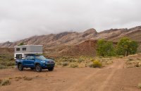
Steady rain began overnight and continued through breakfast, before turning to a cold drizzle. The plan for our first few days had been to take the backroads to Moonshine Wash and Colonnade Arch, and then
possibly a side trip to Happy Canyon before continuing down Hwy. 95 to the Cedar Mesa area. Over second cups of coffee in the comfort of our camper, we re-shuffled our agenda and decided to make a break south, where less rain had fallen, and the forecast called for clear skies to arrive sooner.
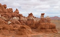
We drove out of the rain at Hanksville, where advice was given whilst topping up our water tank at the BLM office to "avoid the Poison Springs Road for the time being" and wait for more drying. Thus- a short ways south on 95, we pulled off onto a short stretch of semi-slick dirt to check out Little Egypt.
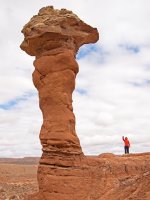
Having never stopped in before, we were pleasantly surprised to find an area somewhat like Goblin Valley, which while not as extensive, was more than interesting enough for a two hour walk- much needed after all that time spent behind the wheel.
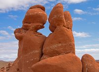
And right on cue- the grey skies began to lift! Onwards to the second of the afternoon's attractions...
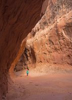
As at Little Egypt- we had driven by the trailhead for Leprechaun canyon many times without stopping. Despite the limited distance up-canyon that is suitable for the non-technically inclined, this short stroll was very worthwhile.
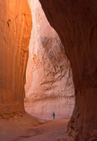
The afternoon light was quite amazing.
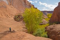
Blue skies beckon to the south, at the mouth of Leprechaun Canyon.
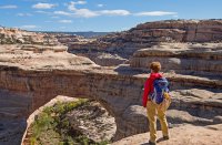
Frost blanketed the ground in the morning at our campsite near Natural Bridges, making for a chilly start as we descended towards Sipapu Bridge
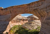
Having done the loop though the 3 bridges in 2010, we headed the other way under Sipapu.
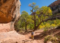
The warm sun in the canyon bottom was just what we had come all this way south for.
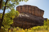
Not to mention the beautiful canyon walls.
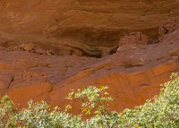
After easy hiking, and a brief side excursion to a small ruin along the way- we arrived at our destination. With our lack of serious rock climbing skills- this ledge proved to be inaccessible for us.
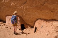
On another ledge that was simple to access- some nice granaries, and other structures that were much more decrepit.
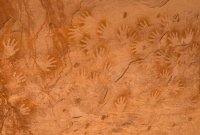
Most of the pictographs were very faded, but these handprints remained in good shape.
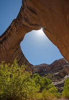
Rejoining the crowds on the trail up to the rim, we left the monument for two nights at Comb Wash with our friends and fellow desert aficionados Larry and Karen, also from Calgary.
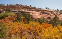
A morning drive towards the Bears Ears through fall colors which were prime at higher elevations, took us to the trailhead for Lewis Lodge.
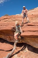
We had piled into Larry's stock 3/4 ton pickup for the drive from camp, which after inspecting the final stretch of road we decided was definitely not up to the task. A quick walk down the very rough track led to a good trail through P-J forest, and then onto slickrock down to the first drop- easily done with the aid of this weathered tree.
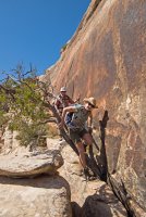
The exposed crux was easily located and found to be simple, with "wide enough" ledges of solid rock giving easy and reasonably safe travel for these non climbers. The rope that I had brought to potentially rig a handline, stayed put in my pack.
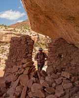
Portal guarding the main body of ruins.
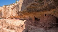
Ruins spread out over several hundred metres of ledge.
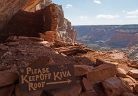
No kidding!
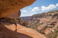
The ledge is wide here...
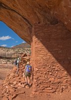
...and ok here, but be careful.
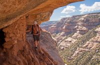
It's a bit tenuous here...
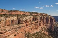
...because! Looking at the ruins from across the canyon on the way out.
As is usually the case- up climbing the crux went quickly, but not so much the long trudge uphill in the afternoon sun on the old road to our parking spot. That did little to dampen spirits though, on what was a great day.
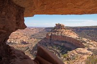
Another warm night with the crickets in Comb Wash, and a second hike with our friends. We had been here previously, but not so Larry And Karen. With a shorter hike requested after yesterday- it was worth a re-visit.
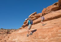
Someone had asked for some slick rock scrambling!
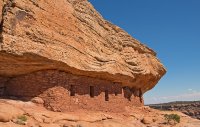
The well preserved ruins are in a stunning location.
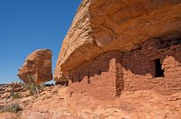
I wondered if these have seen any restoration work, as they are not really tucked that deeply into the overhang.
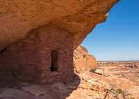
Skilled masonry with nice artistic touches.
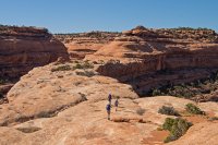
Upon returning to the trailhead- we said our fond farewells to our friends, whose agenda pointed north, while we would eventually be going further south. After much needed solar showers- we set up camp for a night at Muley Point.
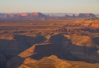
Buffeting by wind overnight made for an interrupted sleep, but the gusts abated enough come morning for breakfast outside in the lee of our camper, while taking in the view to the south over the San Juan towards Monument Valley.
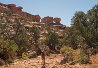
Nearby ruins were the day's destination. It was a relief to be down out of the winds which continued to blow, in a canyon that offered easy travel in the wash or open benches with fine scenery along the way.
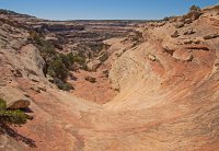
One broken down set of ruins was easy to find- but where was the main attraction? After searching successive ledges that only petered out to nothing, we ascended the opposite side to get a bearing on them. The only way up though, led to a 2m high overhanging pouroff which required a rebuilding of the stone pile needed to reach a couple of small handholds. With that out of the way (just below centre here shown from above) a steepish sandstone gully led to the correct ledge.
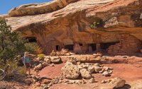
There are numerous structures in varying states of repair.
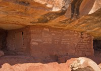
Many intact doorways are a feature here.
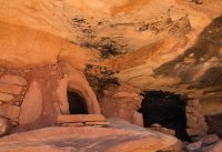
A granary next to a soot blackened room.
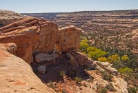
The backside of the tumbledown lower ruins as seen from above.
Rather than descend the way we had come via the pour-off rockpile, which despite my renovating was still a bit wobbly, we explored an alternate way back into the drainage. Weaving between ledge systems took us down, and back north for a shorter return to our parking spot on the rim.
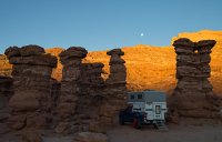
Sheltering from the incessant wind- we tucked into the Recapture Pocket east of Bluff for the night.
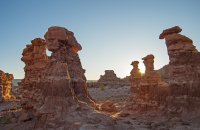
This is another interesting place to explore, and we spent some time in the morning doing just that.
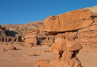
A fun place to wander around with a camera in. But enough of that, we had some driving to do...
Turning south towards New Mexico, we stopped at Shiprock to wander around a flea market, where I absentmindedly stuck my left foot into a deep rut in the dried mud of the lot where the market was taking place, twisting my knee in the process. This would come back to haunt me...
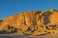
By the time we had resupplied in Farmington, driven to Chaco and setup camp, all we had time for on this day was a quick look at Pueblo Bonito.
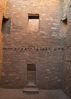
Remnants of the floor structure in a 3 story building.
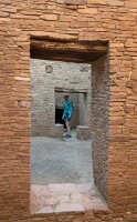
Amazing hand-worked stone.
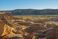
Multiple large kivas. Our late arrival worked in our favour, as we had the place to ourselves.
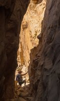
My knee seemed ok- only minor pain and swelling with good range of motion. My wife Jo who works in physio, prescribed ibuprofen and a loop hike to Pueblo Alto. The route starts and finishes though a crack in the cliff face above the ruins at Kin Kletso.
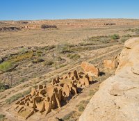
Kin Kletso from above.
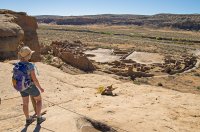
The tail of the loop goes by a viewpoint overlooking Pueblo Bonito. Going clockwise, the trail roughly follows a Chacoan road north to Pueblo Alto.
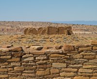
New Alto, as seen from the partially excavated walls of Pueblo Alto.
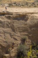
Beyond Alto, sandstone benches were followed to complete a circle above these stairs, and more overlooks of the ruins that lay on the plains below the cliffs.
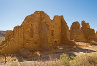
Closing the loop took us back through the crack, and out past the walls of Kin Kletso.
Back at the trailhead, a further glitch in our plans surfaced while checking the camper tie-downs in advance of our drive to the Bisti Badlands- a broken eye bolt! Improvising some lashings from 6 mil cord for a bit of added security, we traversed over to Bisti via pavement and a good county dirt road in the late afternoon.
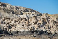
We spent a comfortable night, after a sunset wander in the badlands to the west of our camp spot, sheltered from the strong north winds of an approaching cold front behind a small butte to the NW of the Bisti parking lot. Starting out eastwards from the lot in the morning with the wind at our backs, we quickly reached the first of several bays of hoodoos along the escarpment that rises to the south. We poked briefly into that one, but the next two hoodoo zones proved to much better (above).
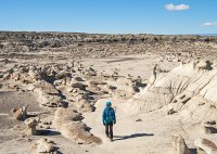
Many of the features are small in scale, and the palette of colors is mostly of grey and tan, but there are lots of interesting things to see along the way.
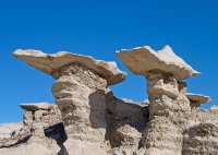
Winglike formations.
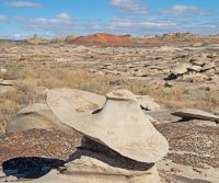
"I'm a sandstone cowboy..."
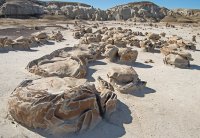
The "cracked eggs".
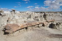
Beyond the eggs- petrified trees in abundance,
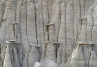
Hoodoo birthplace.
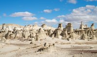
A weird and wonderful landscape.
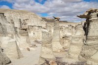
Sentinels guard the entrance to "Hoodoo City".
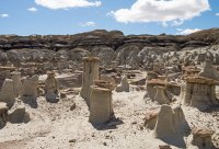
After a late lunch in Hoodoo City, we amended our original plan which was to loop back via the hills to the north, in light of my still somewhat tender knee. Roughly retracing our morning's route- we found the so-called "Bisti Arch" which was a bit of a let-down at only about 1 metre wide.
Evening found us back in Utah, with plans to meet a couple of friends at Cedar mesa in the morning.
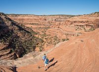
After a roadside rendezvous with Dana and Cindy, we walked the rim of a canyon in search of ledges holding ruins.
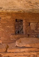
The first set proved to be inaccessible without a rope for protection, but further along was a group consisting only of remnant dividing walls, some with passage doors between rooms.
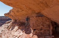
On another ledge- these were in better condition.
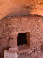
Rather than walls extending up to the overhang, this granary has a roof in good shape.
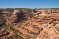
It was along one of these ledges though- where I put my left foot down onto a stepping stone that had easily supported the 3 others, only to have the underlying rock give way, buckling my already wonky knee which had been feeling really good, and shooting a dart of pain down my leg. Our day ended early as I painfully hobbled back to our starting point. Ice and a trailhead beer helped, but I was still feeling it as we hit Hwy 95 going north, not sure if that was it for our holiday.
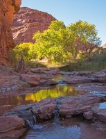
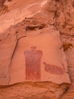
In need of a break and movement before the leg stiffened up, we stopped at Hog Springs, another place that we had simply cruised by in the past, visiting a nice little roadside oasis and a good pictograph.
Back in the truck- decisions had to be made. Between my leg issue, and the busted tie-down, we decided that completing our original agenda by finishing up at Happy Canyon and Moonshine Wash was not the smartest idea. We would stick closer to the pavement, and hike some easier options.
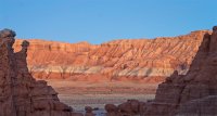
With that in mind, we set-up for the next 2 nights at an old favourite spot in the Swell, pulled out the chairs for happy hour, and watched as a soft light descended at dusk.
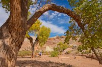
As it was nearby and the leg was feeling ok after rest, vitamin I and a tensor brace- we gave Little Wildhorse-Bell another go, thinking that well over a week of dry weather would give us passage, where deep cold water had stymied us in the past.
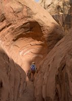
We reached the pool in question quickly and sure enough, while still very wet, it was much lower than last year. As my wife waited, I waded in barefoot to test the waters and found it only crotch deep, with the cold water soothing my leg as a bonus. I headed back across to grab my pack and convince Jo that it was good to go, but I could not sell her on the prospect of chest deep immersion, as she is a petite 5 feet tall. What to do now?
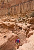
We backtracked and drove to another nearby spot. Crack Canyon promised dryer conditions, and made for a great afternoon stroll.
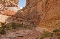
Impressive canyon walls begin after a preliminary walk in the wash. We were here about ten years ago and it seemed to me that we were able to legally drive part of the wash then, saving a bit of distance.
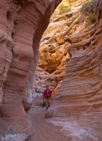
Well worth a second visit.
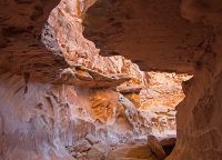
The short "subway" section.
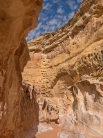
Sculpted walls.
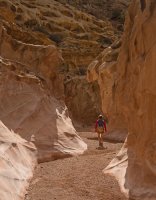
There are a couple of minor obstacles to downclimb further into the canyon, but most of it is easy walking.
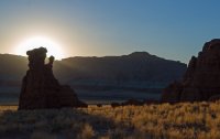
Another swell morning.
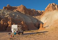
Savoring the desert sun and taking our time with breakfast outside, we came to the decision to pull the plug on our trip a day early, and start the long haul home to Alberta. But first- a morning leg stretcher.
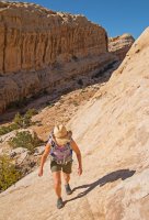
After walking a short ways up a nearby canyon that cuts into the Swell, we ramped up slickrock to visit a really nice panel.
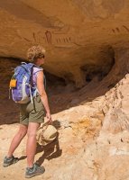
We paused for a while to contemplate.
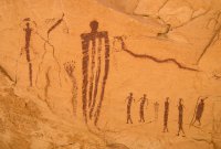
Who were these people and what were they conveying? Somehow seeming both primitive and sophisticated, these evocative figures are art in the purest sense.
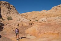
There were plenty of options to hike up onto the swell, and spend a full day here by revisiting a nearby arch, but we reluctantly hit the road north towards Salt Lake. There will be other times to fulfill our agenda! After an incident free trek home, and a few weeks of cycling "therapy", the leg is doing fine.
As I've been editing photos from the trip over the last few weeks, winter has descended upon us in southern Alberta and we have switched gears into skiing already. As much as we enjoy the snow season- we are already looking forward to next October's fix of desert sun.
More pix can be found, here:
https://steveriggs.smugmug.com/Utah2017/
Edited for grammar, operator error, and unwanted spell check "corrections".
As usual In early October, we left the dying embers of what had been a glorious fall behind in Alberta, and pointed our truck south towards the Colorado Plateau in search of an extension to summer. After 18 hours of driving spread over a day and a half- we pulled off the interstate towards a peaceful first night in the desert, after a stop in nearby Green River to stock up on melons at the Vetere's stand.

Steady rain began overnight and continued through breakfast, before turning to a cold drizzle. The plan for our first few days had been to take the backroads to Moonshine Wash and Colonnade Arch, and then
possibly a side trip to Happy Canyon before continuing down Hwy. 95 to the Cedar Mesa area. Over second cups of coffee in the comfort of our camper, we re-shuffled our agenda and decided to make a break south, where less rain had fallen, and the forecast called for clear skies to arrive sooner.

We drove out of the rain at Hanksville, where advice was given whilst topping up our water tank at the BLM office to "avoid the Poison Springs Road for the time being" and wait for more drying. Thus- a short ways south on 95, we pulled off onto a short stretch of semi-slick dirt to check out Little Egypt.

Having never stopped in before, we were pleasantly surprised to find an area somewhat like Goblin Valley, which while not as extensive, was more than interesting enough for a two hour walk- much needed after all that time spent behind the wheel.

And right on cue- the grey skies began to lift! Onwards to the second of the afternoon's attractions...

As at Little Egypt- we had driven by the trailhead for Leprechaun canyon many times without stopping. Despite the limited distance up-canyon that is suitable for the non-technically inclined, this short stroll was very worthwhile.

The afternoon light was quite amazing.

Blue skies beckon to the south, at the mouth of Leprechaun Canyon.

Frost blanketed the ground in the morning at our campsite near Natural Bridges, making for a chilly start as we descended towards Sipapu Bridge

Having done the loop though the 3 bridges in 2010, we headed the other way under Sipapu.

The warm sun in the canyon bottom was just what we had come all this way south for.

Not to mention the beautiful canyon walls.

After easy hiking, and a brief side excursion to a small ruin along the way- we arrived at our destination. With our lack of serious rock climbing skills- this ledge proved to be inaccessible for us.

On another ledge that was simple to access- some nice granaries, and other structures that were much more decrepit.

Most of the pictographs were very faded, but these handprints remained in good shape.

Rejoining the crowds on the trail up to the rim, we left the monument for two nights at Comb Wash with our friends and fellow desert aficionados Larry and Karen, also from Calgary.

A morning drive towards the Bears Ears through fall colors which were prime at higher elevations, took us to the trailhead for Lewis Lodge.

We had piled into Larry's stock 3/4 ton pickup for the drive from camp, which after inspecting the final stretch of road we decided was definitely not up to the task. A quick walk down the very rough track led to a good trail through P-J forest, and then onto slickrock down to the first drop- easily done with the aid of this weathered tree.

The exposed crux was easily located and found to be simple, with "wide enough" ledges of solid rock giving easy and reasonably safe travel for these non climbers. The rope that I had brought to potentially rig a handline, stayed put in my pack.

Portal guarding the main body of ruins.

Ruins spread out over several hundred metres of ledge.

No kidding!

The ledge is wide here...

...and ok here, but be careful.

It's a bit tenuous here...

...because! Looking at the ruins from across the canyon on the way out.
As is usually the case- up climbing the crux went quickly, but not so much the long trudge uphill in the afternoon sun on the old road to our parking spot. That did little to dampen spirits though, on what was a great day.

Another warm night with the crickets in Comb Wash, and a second hike with our friends. We had been here previously, but not so Larry And Karen. With a shorter hike requested after yesterday- it was worth a re-visit.

Someone had asked for some slick rock scrambling!

The well preserved ruins are in a stunning location.

I wondered if these have seen any restoration work, as they are not really tucked that deeply into the overhang.

Skilled masonry with nice artistic touches.

Upon returning to the trailhead- we said our fond farewells to our friends, whose agenda pointed north, while we would eventually be going further south. After much needed solar showers- we set up camp for a night at Muley Point.

Buffeting by wind overnight made for an interrupted sleep, but the gusts abated enough come morning for breakfast outside in the lee of our camper, while taking in the view to the south over the San Juan towards Monument Valley.

Nearby ruins were the day's destination. It was a relief to be down out of the winds which continued to blow, in a canyon that offered easy travel in the wash or open benches with fine scenery along the way.

One broken down set of ruins was easy to find- but where was the main attraction? After searching successive ledges that only petered out to nothing, we ascended the opposite side to get a bearing on them. The only way up though, led to a 2m high overhanging pouroff which required a rebuilding of the stone pile needed to reach a couple of small handholds. With that out of the way (just below centre here shown from above) a steepish sandstone gully led to the correct ledge.

There are numerous structures in varying states of repair.

Many intact doorways are a feature here.

A granary next to a soot blackened room.

The backside of the tumbledown lower ruins as seen from above.
Rather than descend the way we had come via the pour-off rockpile, which despite my renovating was still a bit wobbly, we explored an alternate way back into the drainage. Weaving between ledge systems took us down, and back north for a shorter return to our parking spot on the rim.

Sheltering from the incessant wind- we tucked into the Recapture Pocket east of Bluff for the night.

This is another interesting place to explore, and we spent some time in the morning doing just that.

A fun place to wander around with a camera in. But enough of that, we had some driving to do...
Turning south towards New Mexico, we stopped at Shiprock to wander around a flea market, where I absentmindedly stuck my left foot into a deep rut in the dried mud of the lot where the market was taking place, twisting my knee in the process. This would come back to haunt me...

By the time we had resupplied in Farmington, driven to Chaco and setup camp, all we had time for on this day was a quick look at Pueblo Bonito.

Remnants of the floor structure in a 3 story building.

Amazing hand-worked stone.

Multiple large kivas. Our late arrival worked in our favour, as we had the place to ourselves.

My knee seemed ok- only minor pain and swelling with good range of motion. My wife Jo who works in physio, prescribed ibuprofen and a loop hike to Pueblo Alto. The route starts and finishes though a crack in the cliff face above the ruins at Kin Kletso.

Kin Kletso from above.

The tail of the loop goes by a viewpoint overlooking Pueblo Bonito. Going clockwise, the trail roughly follows a Chacoan road north to Pueblo Alto.

New Alto, as seen from the partially excavated walls of Pueblo Alto.

Beyond Alto, sandstone benches were followed to complete a circle above these stairs, and more overlooks of the ruins that lay on the plains below the cliffs.

Closing the loop took us back through the crack, and out past the walls of Kin Kletso.
Back at the trailhead, a further glitch in our plans surfaced while checking the camper tie-downs in advance of our drive to the Bisti Badlands- a broken eye bolt! Improvising some lashings from 6 mil cord for a bit of added security, we traversed over to Bisti via pavement and a good county dirt road in the late afternoon.

We spent a comfortable night, after a sunset wander in the badlands to the west of our camp spot, sheltered from the strong north winds of an approaching cold front behind a small butte to the NW of the Bisti parking lot. Starting out eastwards from the lot in the morning with the wind at our backs, we quickly reached the first of several bays of hoodoos along the escarpment that rises to the south. We poked briefly into that one, but the next two hoodoo zones proved to much better (above).

Many of the features are small in scale, and the palette of colors is mostly of grey and tan, but there are lots of interesting things to see along the way.

Winglike formations.

"I'm a sandstone cowboy..."

The "cracked eggs".

Beyond the eggs- petrified trees in abundance,

Hoodoo birthplace.

A weird and wonderful landscape.

Sentinels guard the entrance to "Hoodoo City".

After a late lunch in Hoodoo City, we amended our original plan which was to loop back via the hills to the north, in light of my still somewhat tender knee. Roughly retracing our morning's route- we found the so-called "Bisti Arch" which was a bit of a let-down at only about 1 metre wide.
Evening found us back in Utah, with plans to meet a couple of friends at Cedar mesa in the morning.

After a roadside rendezvous with Dana and Cindy, we walked the rim of a canyon in search of ledges holding ruins.

The first set proved to be inaccessible without a rope for protection, but further along was a group consisting only of remnant dividing walls, some with passage doors between rooms.

On another ledge- these were in better condition.

Rather than walls extending up to the overhang, this granary has a roof in good shape.

It was along one of these ledges though- where I put my left foot down onto a stepping stone that had easily supported the 3 others, only to have the underlying rock give way, buckling my already wonky knee which had been feeling really good, and shooting a dart of pain down my leg. Our day ended early as I painfully hobbled back to our starting point. Ice and a trailhead beer helped, but I was still feeling it as we hit Hwy 95 going north, not sure if that was it for our holiday.

In need of a break and movement before the leg stiffened up, we stopped at Hog Springs, another place that we had simply cruised by in the past, visiting a nice little roadside oasis and a good pictograph.

Back in the truck- decisions had to be made. Between my leg issue, and the busted tie-down, we decided that completing our original agenda by finishing up at Happy Canyon and Moonshine Wash was not the smartest idea. We would stick closer to the pavement, and hike some easier options.

With that in mind, we set-up for the next 2 nights at an old favourite spot in the Swell, pulled out the chairs for happy hour, and watched as a soft light descended at dusk.

As it was nearby and the leg was feeling ok after rest, vitamin I and a tensor brace- we gave Little Wildhorse-Bell another go, thinking that well over a week of dry weather would give us passage, where deep cold water had stymied us in the past.

We reached the pool in question quickly and sure enough, while still very wet, it was much lower than last year. As my wife waited, I waded in barefoot to test the waters and found it only crotch deep, with the cold water soothing my leg as a bonus. I headed back across to grab my pack and convince Jo that it was good to go, but I could not sell her on the prospect of chest deep immersion, as she is a petite 5 feet tall. What to do now?

We backtracked and drove to another nearby spot. Crack Canyon promised dryer conditions, and made for a great afternoon stroll.

Impressive canyon walls begin after a preliminary walk in the wash. We were here about ten years ago and it seemed to me that we were able to legally drive part of the wash then, saving a bit of distance.

Well worth a second visit.

The short "subway" section.

Sculpted walls.

There are a couple of minor obstacles to downclimb further into the canyon, but most of it is easy walking.

Another swell morning.

Savoring the desert sun and taking our time with breakfast outside, we came to the decision to pull the plug on our trip a day early, and start the long haul home to Alberta. But first- a morning leg stretcher.

After walking a short ways up a nearby canyon that cuts into the Swell, we ramped up slickrock to visit a really nice panel.

We paused for a while to contemplate.

Who were these people and what were they conveying? Somehow seeming both primitive and sophisticated, these evocative figures are art in the purest sense.

There were plenty of options to hike up onto the swell, and spend a full day here by revisiting a nearby arch, but we reluctantly hit the road north towards Salt Lake. There will be other times to fulfill our agenda! After an incident free trek home, and a few weeks of cycling "therapy", the leg is doing fine.
As I've been editing photos from the trip over the last few weeks, winter has descended upon us in southern Alberta and we have switched gears into skiing already. As much as we enjoy the snow season- we are already looking forward to next October's fix of desert sun.
More pix can be found, here:
https://steveriggs.smugmug.com/Utah2017/
Edited for grammar, operator error, and unwanted spell check "corrections".
Last edited:
