regehr
Member
- Joined
- Mar 28, 2012
- Messages
- 2,434
I first hiked Deseret Peak as an out-and-back on the main (Mill Fork) trail, which starts at the Loop Campground near Grantsville, UT. One-way driving time from SLC is about an hour. It's a beautiful half-day hike with great views. You could easily make a day out of it if you left late, spent more time on the summit, etc.
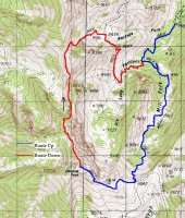
Yesterday I hiked Deseret Peak going up the Mill Fork trail and down the Pockets Fork trail, which is slightly longer and has a bit of up and down, plus a few steep spots. The thing I hadn't known is that the Pockets Fork trail is much more scenic. It's really incredible -- on a par with the Timpooneke Trail or anything else in the Wasatch. Over at Summitpost there's a description of the loop and here's a map (stolen from there):
I climbed Des Peak in just under 2 hours and moseyed down in about 2.5 hours. The mountain was surprisingly crowded and I ended up sharing the summit with four other groups (note to self: avoid Saturdays in the future). I'm guessing that the vast majority of the hiking usage in the Stansbury Range is on Des Peak; solitude can no doubt be found not far away, for example on North and South Willow Peaks.
On a normal snow year, June 20 would be too early to do this hike in sneakers. This year (and perhaps in any "new normal snow year") this wasn't a problem. A week ago I'd have been happier with poles and a couple weeks ago an axe and boots would have been a good idea.
Looking north at N and S Willow Peaks:
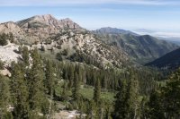
At the left, the steep headwall of Mill Fork. On the skyline, the main Wasatch Peaks, you can just make out the peaks above Broads Fork, Box Elder, and Timp.
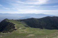
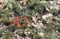
Not peak wildflower season yet, maybe in a couple of weeks.
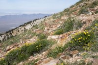
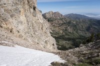
One of Des Peak's twin couloirs, too melted out now to climb:
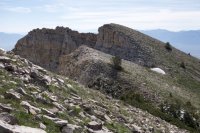
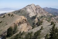
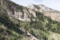
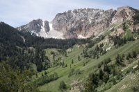
Beautiful scenery on the Skull Valley side of the range, though that area still shows heavy damage from fires a few years ago:
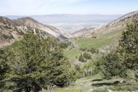
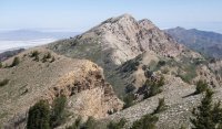
The tiny blip on the summit is two people standing next to each other:
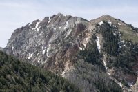
I'm a sucker for an aspen forest.
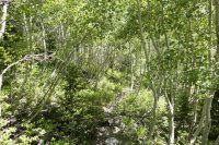
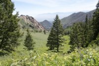
This is the view that you totally miss from the Mill Fork trail:
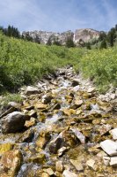
Featured image for home page:
Yesterday I hiked Deseret Peak going up the Mill Fork trail and down the Pockets Fork trail, which is slightly longer and has a bit of up and down, plus a few steep spots. The thing I hadn't known is that the Pockets Fork trail is much more scenic. It's really incredible -- on a par with the Timpooneke Trail or anything else in the Wasatch. Over at Summitpost there's a description of the loop and here's a map (stolen from there):

I climbed Des Peak in just under 2 hours and moseyed down in about 2.5 hours. The mountain was surprisingly crowded and I ended up sharing the summit with four other groups (note to self: avoid Saturdays in the future). I'm guessing that the vast majority of the hiking usage in the Stansbury Range is on Des Peak; solitude can no doubt be found not far away, for example on North and South Willow Peaks.
On a normal snow year, June 20 would be too early to do this hike in sneakers. This year (and perhaps in any "new normal snow year") this wasn't a problem. A week ago I'd have been happier with poles and a couple weeks ago an axe and boots would have been a good idea.
Looking north at N and S Willow Peaks:

At the left, the steep headwall of Mill Fork. On the skyline, the main Wasatch Peaks, you can just make out the peaks above Broads Fork, Box Elder, and Timp.

Not peak wildflower season yet, maybe in a couple of weeks.


One of Des Peak's twin couloirs, too melted out now to climb:


Beautiful scenery on the Skull Valley side of the range, though that area still shows heavy damage from fires a few years ago:

The tiny blip on the summit is two people standing next to each other:

I'm a sucker for an aspen forest.


This is the view that you totally miss from the Mill Fork trail:


Featured image for home page:

Last edited:
