regehr
Member
- Joined
- Mar 28, 2012
- Messages
- 2,407
I lived in Utah for years and years without hiking in the Stansbury Range, but six or seven years ago I realized how great this area is and now try to climb Deseret Peak every summer. I think of it as sort of a 2/3 Timp climb in terms of time and effort, easy to knock off by mid-day with an early start.
I've often looked longingly at the twin couloirs that climb about 1300' from the upper bowl below the summit to a flat area a short walk from the peak itself. These are also often easily visible if you look south while flying from SLC to the central west coast. This year at the beginning of July the consolidated snow conditions were excellent, clearly the best since 2011, so my friend Brian and I decided to climb one of these couloirs.
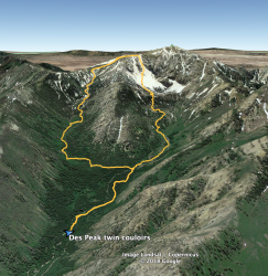
It was like 8:15am before we started hiking, I didn't see the point in getting out too early and running into snow so firm that it would make self arrest impossible. Here's the route we took (leaving out a quick trip to the summit w/o packs or GPS). At the bottom of this image is the trailhead at around 7400'. The route roughly follows the stream for a little ways before splitting at like 7800'. The normal route heads up (left in the pic) via Mill Fork and the couloir route keeps following the stream up Dry Lake Fork. There's a decent trail the we just missed, so we spent a while in some steep deadfall zones, ugh. But in any case there's no super wrong way to go in here, any upward movement should lead to the couloirs.
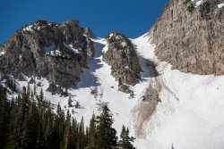
It took longer than I'd thought to get near the base of the couloirs but finally we had a good view. The east one (left in the image) is a bit steeper (summitpost says 38 degrees) whereas the west one is just 36 degrees. The west couloir is also at the base of the huge cliff system east of Des Peak's summit, and receives a lot more rockfall (not all of the crap in the couloir is rockfall, some of it is melted out).
Looking back north from near the base of the couloirs:
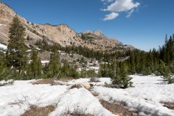
Looking south from the same spot:
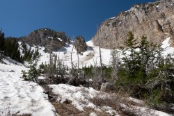
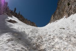
Here we're looking sort of obliquely up the W couloir from below the rocks that divide the two couloirs. We rested up here, put on helmets, and decided that we liked the line of the W coulour a bit better. We'd been listening carefully and hadn't heard any rockfall, and the cliffs had been in the sun for quite a while at this point, so we hoped that we could move pretty quickly through the dangerous part. It wasn't steep yet and I wasn't sure the benefit of crampons outweighted the risk of someone spiking their own calf so we didn't put them on.
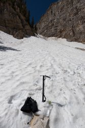
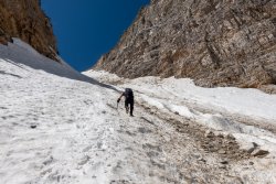
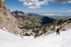
Here Brian is probably nearing the steepest part, and we had already stopped to put on crampons, which turned out to be a great decision, just so much awesomeness in being glued to the snow by those monster steel spikes. We both had on lightweight mountain boots that are really a bit too flexible for comfy front-pointing, though. The snow was really perfect and even in the steepest areas the pucker factor I've had on other snow climbs and had been expecting here just was not there, other than in the potential for nasty rockfall.
 \\
\\
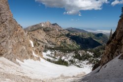
Looking back down.
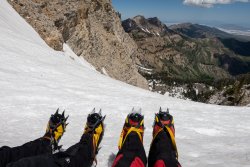
Whoops, crampons need adjusting. Be quick about it, dude!!!
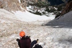
At this point we heard our first rockfall-- a few fist sized rocks were popping off the big cliffs and bouncing around. None of them came close to us but it did create a sense of urgency. Here we're finally above the bulk of the rockfall.
And finally I'm at the top. Hi Brian!!!
This picture is mandatory, I'm not sorry.
Summit view.
Looking down from the top of the E couloir.
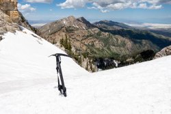
Looking E at some Oquirrhs and Wasatches.
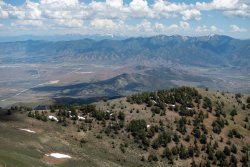
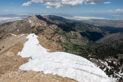
This is the part of the hike near peak 10874 where there's often a small snowfield to cross into mid/late summer. To the left of the melted out talus patches you can see some tracks from where @danger02ward and his buddies glissaded a week earlier, Our glissade tracks are to the right in the photo. This was a super fast, fun glissade, very steep at the top with a nice runout.
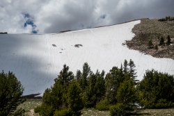
Looking up at N and S Willow Peaks.
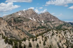
There was also a nice long glissade down the top of Mill Fork, but not fast since there were a lot of trees in the way and no safe runout. Then an easy walk out. Last couple times I've been to Des Peak I've been stopping for coffee or iced tea at Java Bean in Grantsville, I recommend it.
I've often looked longingly at the twin couloirs that climb about 1300' from the upper bowl below the summit to a flat area a short walk from the peak itself. These are also often easily visible if you look south while flying from SLC to the central west coast. This year at the beginning of July the consolidated snow conditions were excellent, clearly the best since 2011, so my friend Brian and I decided to climb one of these couloirs.
It was like 8:15am before we started hiking, I didn't see the point in getting out too early and running into snow so firm that it would make self arrest impossible. Here's the route we took (leaving out a quick trip to the summit w/o packs or GPS). At the bottom of this image is the trailhead at around 7400'. The route roughly follows the stream for a little ways before splitting at like 7800'. The normal route heads up (left in the pic) via Mill Fork and the couloir route keeps following the stream up Dry Lake Fork. There's a decent trail the we just missed, so we spent a while in some steep deadfall zones, ugh. But in any case there's no super wrong way to go in here, any upward movement should lead to the couloirs.

It took longer than I'd thought to get near the base of the couloirs but finally we had a good view. The east one (left in the image) is a bit steeper (summitpost says 38 degrees) whereas the west one is just 36 degrees. The west couloir is also at the base of the huge cliff system east of Des Peak's summit, and receives a lot more rockfall (not all of the crap in the couloir is rockfall, some of it is melted out).

Looking back north from near the base of the couloirs:

Looking south from the same spot:

Here we're looking sort of obliquely up the W couloir from below the rocks that divide the two couloirs. We rested up here, put on helmets, and decided that we liked the line of the W coulour a bit better. We'd been listening carefully and hadn't heard any rockfall, and the cliffs had been in the sun for quite a while at this point, so we hoped that we could move pretty quickly through the dangerous part. It wasn't steep yet and I wasn't sure the benefit of crampons outweighted the risk of someone spiking their own calf so we didn't put them on.

Here Brian is probably nearing the steepest part, and we had already stopped to put on crampons, which turned out to be a great decision, just so much awesomeness in being glued to the snow by those monster steel spikes. We both had on lightweight mountain boots that are really a bit too flexible for comfy front-pointing, though. The snow was really perfect and even in the steepest areas the pucker factor I've had on other snow climbs and had been expecting here just was not there, other than in the potential for nasty rockfall.
 \\
\\Looking back down.

Whoops, crampons need adjusting. Be quick about it, dude!!!

At this point we heard our first rockfall-- a few fist sized rocks were popping off the big cliffs and bouncing around. None of them came close to us but it did create a sense of urgency. Here we're finally above the bulk of the rockfall.

And finally I'm at the top. Hi Brian!!!

This picture is mandatory, I'm not sorry.

Summit view.

Looking down from the top of the E couloir.

Looking E at some Oquirrhs and Wasatches.

This is the part of the hike near peak 10874 where there's often a small snowfield to cross into mid/late summer. To the left of the melted out talus patches you can see some tracks from where @danger02ward and his buddies glissaded a week earlier, Our glissade tracks are to the right in the photo. This was a super fast, fun glissade, very steep at the top with a nice runout.

Looking up at N and S Willow Peaks.

There was also a nice long glissade down the top of Mill Fork, but not fast since there were a lot of trees in the way and no safe runout. Then an easy walk out. Last couple times I've been to Des Peak I've been stopping for coffee or iced tea at Java Bean in Grantsville, I recommend it.
