desertvic
Member
- Joined
- Mar 13, 2021
- Messages
- 28
I have friends visiting in a couple of weeks, and I'm trying to map out a scenic route in the Deer Creek/Brigham Tea Bench area that would offer a good mix of wading and slick rock exploration.
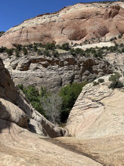
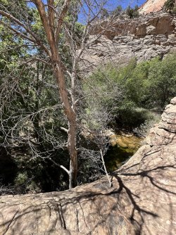
For some reason, my map had a pin at this location (37.80969, -111.36578) labeled “Class 3 Entry/Exit Point.” I scouted it yesterday but ended up stuck at the end of a dry fall, about 10 feet above Deer Creek. Jumping onto a nearby tree was an option, but it seemed too risky to attempt alone. I'm wondering if I might have been at the wrong spot.
Does anyone have information about this specific entry/exit point? I can’t recall where I originally found this data.
Thanks!
(pics of the dry fall above the river are attached)