- Joined
- May 5, 2012
- Messages
- 1,732
"Attach this to your pack." The park ranger slid the wax-coated paper across the counter. "I'll be honest — you're not going to see another ranger once you leave the visitor center. It doesn't look like anyone's been in the canyon for days. You'll be alone down there."
"I hope so. That's why I'm here at this time of year."
"Make sure you've told someone your plans," she continued, unfazed. "We're pretty short on staff during the winter. There's a good chance if something happens, no one will notice your car at the Post for weeks. If you run into trouble, your emergency contact will need to call the county sheriff. Then, if necessary, they'll contact us."

I've had mixed results with December outings the last few years. It's a toss-up between wintry weather or mild, enjoyable conditions in the canyon country.
With a week off work after Thanksgiving, I weighed options for places to go. Hoping for some amazing scenery, I opted to head through the Swell to Capitol Reef.

Unfortunately, the very mild skies Utah experienced during most of November and December took a brief sojourn for the time I was away. This meant no amazing sunset shots from the Wedge.


I overnighted here, then drove down to I-70 the next morning.

Along the way, I made the obligatory stop at the well-documented Buckhorn Wash panel.


As well as the San Rafael River bridge.

From the freeway, I headed west to SR 72 and then south over Hogan Pass. I'd never taken this route to Capitol Reef, usually doing the run down I-15 to highways 50 and 24.

Snow falling over the Fishlake National Forest had me wondering whether or not it would be worth backpacking. Reluctant, I picked up a permit for Lower Muley Twist at the Capitol Reef visitor center. The kind ranger manning the desk gave me no attitude, just advice to watch the steep wash crossing on the road to the Post.
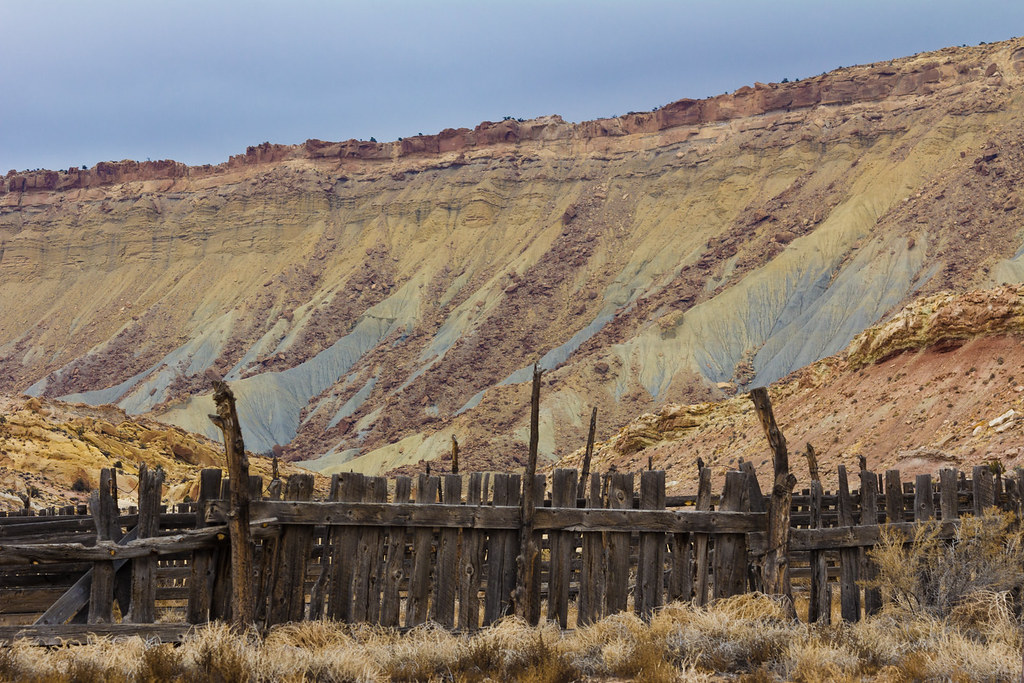
The crossing was no problem. I was much more disturbed by this roadside scene. Does anyone want some naturally-tanned cow leather?

Low, flat clouds on the drive along the Notom Road didn't buoy my enthusiasm much.

But it was too late to have a change of heart. Once at the Post, I made some sandwiches, packed up and set out over the cutoff trail.


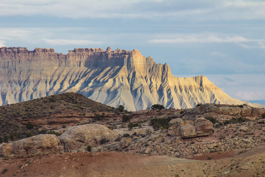
Interesting extrusions are exposed along the top of the reef.

The air felt cool but sweat dripped from my chin on the climb up the reef. Then, a pleasant walk through a meadow led to Lower Muley Twist Canyon proper.


Having made a late start, I wasn't able to get far before the onset of dark forced me to find a place to pitch camp.

This giant alcove seemed to fit the bill.


Flood waters at the back of the alcove had formed a cut bank and, above it, a flat sandy patch perfect for my small camp.
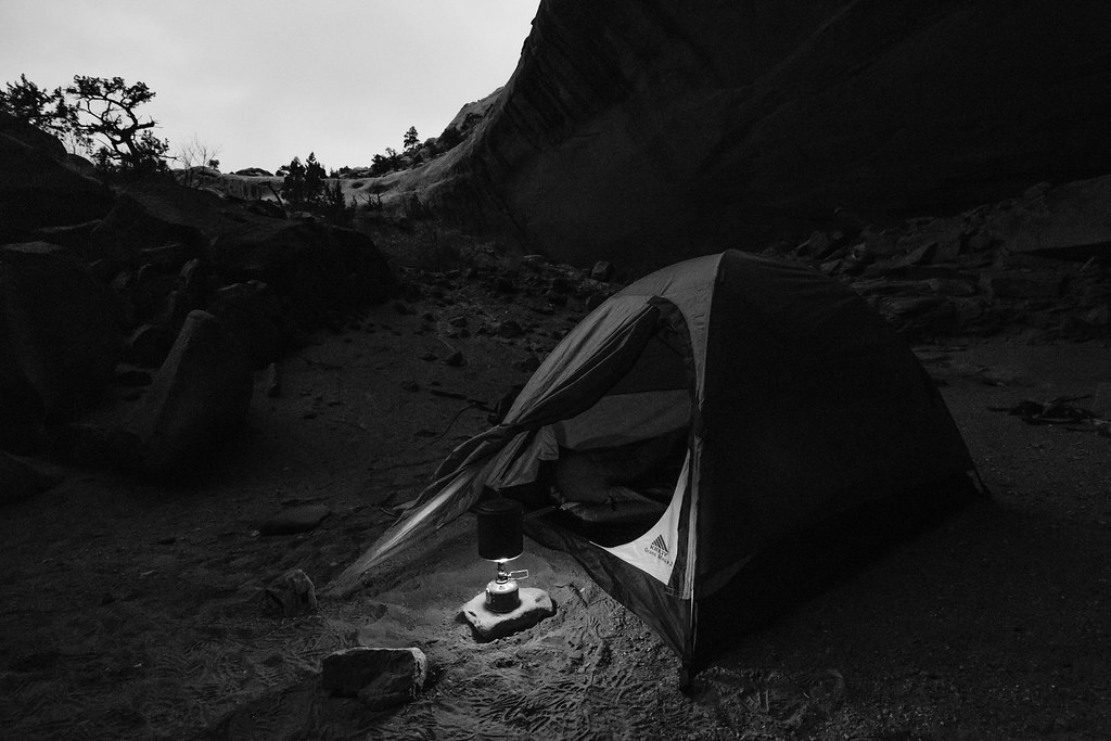 Cooking for One by ashergrey, on Flickr
[PARSEHTML]<iframe src="http://www.mappingsupport.com/p/gmap4.php?q=https://dl.dropboxusercontent.com/u/3847512/GPS/Lower_Muley_1.kml&t=t4" frameborder="0" marginheight="0" scrolling="no" width="800" height="800"></iframe><br><br>[/PARSEHTML]
The onset of night's dark came without a sunset. The air chilled, remaining quiet and still. I settled in with a book and enjoyed the silence.

A bright moon broke free of the canyon rim around 4 a.m. It slid over a hole in the clouds. Its beam of silver light brought me awake. Knowing daylight remained hours away, I read some more before dropping off to sleep for a second time.
At around 7:30 I rose, dressed in clothes made stiff by the night's freezing cold and broke camp.
The cobbles under foot were solid, sand cemented by rain that had fallen and frozen days before. Only faint outlines of footsteps were visible here or there in the softer spots.
Giant alcoves begged for exploration, though many were located high on the slopes above the canyon bottom and out of my reach.


The unmistakable Cowboy Camp stank like desiccated horse manure.

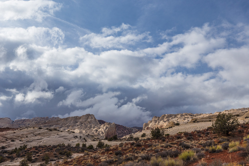
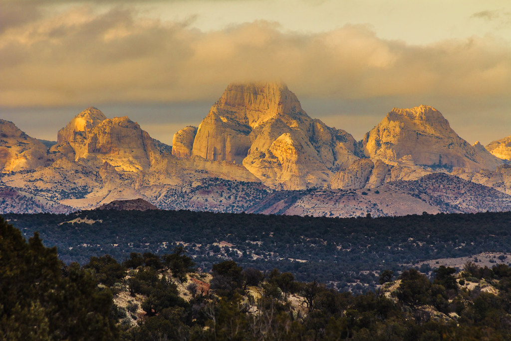
Much to my excitement, sunlight started to pierce the clouds as the canyon turned to cut through the Waterpocket Fold.


Miles of walking and frustration over lackluster photography conditions started to pay off as I munched an apple along Halls Creek.
 Dark Skies over the Reef by ashergrey, on Flickr
iPhone 6 panorama encompassing about 220 degrees field of view, looking south.

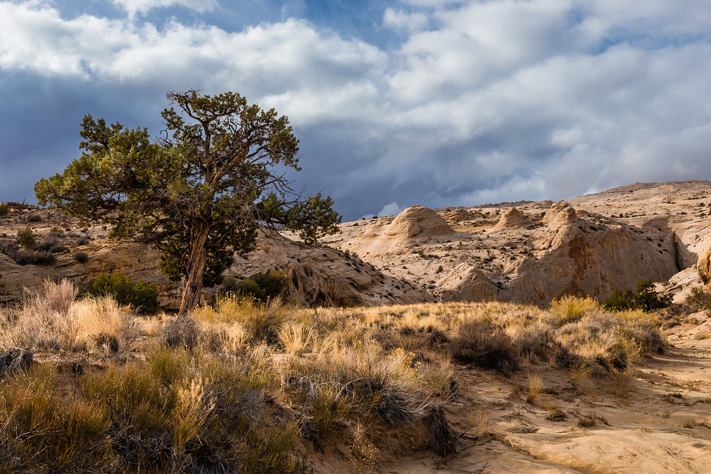
Clouds boiled to the south as the sun played peek-a-boo.
 Waiting for Rain by ashergrey, on Flickr
Miles more walking waited though. No time to sit around enjoying the scenery.

The clouds were moving north, but slowly.

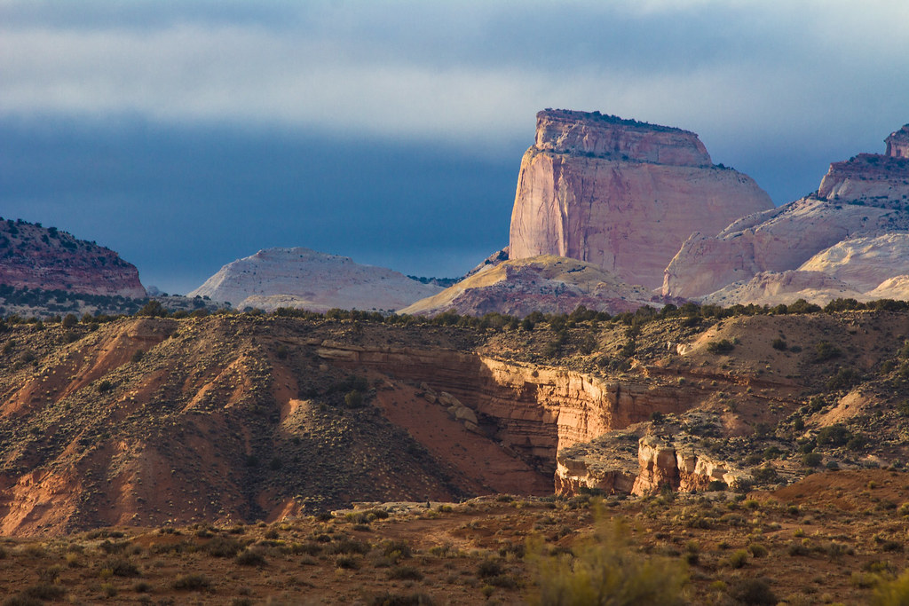
Patches of golden light kept popping up on the Reef and on the cliffs to the east.


Hot spots were also popping up on my heels.

I should have stopped and dealt with them, but instead kept telling myself I only had a mile or so left to go. That lasted six or eight miles.
The pain became intense. I tried to focus on other things. Cotton tails darted among the brush. Coyote scat littered the trail.
Another iPhone shot. I think this one was actually a mistake, but I ended up liking the square composition.

Every time I hike in Capitol Reef, I find interesting rocks. I'm not sure what it is about the area but it just seems to bring in such an odd assortment.
This sandstone piece had delicate ridges and bowls.

While this kidney-shaped slab showed some very obvious scrape marks along the inner curve.

Arriving back at the Post, I found my car alone. Just as I left it.

 Swap Mesa by ashergrey, on Flickr

[PARSEHTML]<iframe src="http://www.mappingsupport.com/p/gmap4.php?q=https://dl.dropboxusercontent.com/u/3847512/GPS/Lower_Muley_2.kml&t=t4" frameborder="0" marginheight="0" scrolling="no" width="800" height="800"></iframe><br><br>[/PARSEHTML]
The sun started to dip low as I drove back along the Notom Road.
 Caineville Mesa by ashergrey, on Flickr
 Lost in the Clouds by ashergrey, on Flickr

 Salmon Sandstone by ashergrey, on Flickr

The clouds closed, skies darkened and night fell. But not before a last reminder of why I love this place.
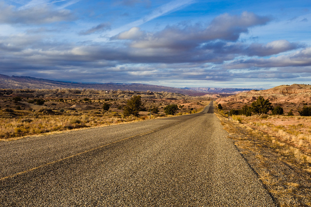 Notom Road by ashergrey, on Flickr
Featured image for home page:

"I hope so. That's why I'm here at this time of year."
"Make sure you've told someone your plans," she continued, unfazed. "We're pretty short on staff during the winter. There's a good chance if something happens, no one will notice your car at the Post for weeks. If you run into trouble, your emergency contact will need to call the county sheriff. Then, if necessary, they'll contact us."
I've had mixed results with December outings the last few years. It's a toss-up between wintry weather or mild, enjoyable conditions in the canyon country.
With a week off work after Thanksgiving, I weighed options for places to go. Hoping for some amazing scenery, I opted to head through the Swell to Capitol Reef.
Unfortunately, the very mild skies Utah experienced during most of November and December took a brief sojourn for the time I was away. This meant no amazing sunset shots from the Wedge.
I overnighted here, then drove down to I-70 the next morning.
Along the way, I made the obligatory stop at the well-documented Buckhorn Wash panel.
As well as the San Rafael River bridge.
From the freeway, I headed west to SR 72 and then south over Hogan Pass. I'd never taken this route to Capitol Reef, usually doing the run down I-15 to highways 50 and 24.
Snow falling over the Fishlake National Forest had me wondering whether or not it would be worth backpacking. Reluctant, I picked up a permit for Lower Muley Twist at the Capitol Reef visitor center. The kind ranger manning the desk gave me no attitude, just advice to watch the steep wash crossing on the road to the Post.
The crossing was no problem. I was much more disturbed by this roadside scene. Does anyone want some naturally-tanned cow leather?
Low, flat clouds on the drive along the Notom Road didn't buoy my enthusiasm much.
But it was too late to have a change of heart. Once at the Post, I made some sandwiches, packed up and set out over the cutoff trail.
Interesting extrusions are exposed along the top of the reef.
The air felt cool but sweat dripped from my chin on the climb up the reef. Then, a pleasant walk through a meadow led to Lower Muley Twist Canyon proper.
Having made a late start, I wasn't able to get far before the onset of dark forced me to find a place to pitch camp.
This giant alcove seemed to fit the bill.
Flood waters at the back of the alcove had formed a cut bank and, above it, a flat sandy patch perfect for my small camp.
Cooking for One by ashergrey, on Flickr[PARSEHTML]<iframe src="http://www.mappingsupport.com/p/gmap4.php?q=https://dl.dropboxusercontent.com/u/3847512/GPS/Lower_Muley_1.kml&t=t4" frameborder="0" marginheight="0" scrolling="no" width="800" height="800"></iframe><br><br>[/PARSEHTML]
The onset of night's dark came without a sunset. The air chilled, remaining quiet and still. I settled in with a book and enjoyed the silence.
A bright moon broke free of the canyon rim around 4 a.m. It slid over a hole in the clouds. Its beam of silver light brought me awake. Knowing daylight remained hours away, I read some more before dropping off to sleep for a second time.
At around 7:30 I rose, dressed in clothes made stiff by the night's freezing cold and broke camp.
The cobbles under foot were solid, sand cemented by rain that had fallen and frozen days before. Only faint outlines of footsteps were visible here or there in the softer spots.
Giant alcoves begged for exploration, though many were located high on the slopes above the canyon bottom and out of my reach.
The unmistakable Cowboy Camp stank like desiccated horse manure.
Much to my excitement, sunlight started to pierce the clouds as the canyon turned to cut through the Waterpocket Fold.
Miles of walking and frustration over lackluster photography conditions started to pay off as I munched an apple along Halls Creek.
Dark Skies over the Reef by ashergrey, on FlickriPhone 6 panorama encompassing about 220 degrees field of view, looking south.
Clouds boiled to the south as the sun played peek-a-boo.
Waiting for Rain by ashergrey, on FlickrMiles more walking waited though. No time to sit around enjoying the scenery.
The clouds were moving north, but slowly.
Patches of golden light kept popping up on the Reef and on the cliffs to the east.
Hot spots were also popping up on my heels.
I should have stopped and dealt with them, but instead kept telling myself I only had a mile or so left to go. That lasted six or eight miles.
The pain became intense. I tried to focus on other things. Cotton tails darted among the brush. Coyote scat littered the trail.
Another iPhone shot. I think this one was actually a mistake, but I ended up liking the square composition.
Every time I hike in Capitol Reef, I find interesting rocks. I'm not sure what it is about the area but it just seems to bring in such an odd assortment.
This sandstone piece had delicate ridges and bowls.
While this kidney-shaped slab showed some very obvious scrape marks along the inner curve.
Arriving back at the Post, I found my car alone. Just as I left it.
Swap Mesa by ashergrey, on Flickr[PARSEHTML]<iframe src="http://www.mappingsupport.com/p/gmap4.php?q=https://dl.dropboxusercontent.com/u/3847512/GPS/Lower_Muley_2.kml&t=t4" frameborder="0" marginheight="0" scrolling="no" width="800" height="800"></iframe><br><br>[/PARSEHTML]
The sun started to dip low as I drove back along the Notom Road.
Caineville Mesa by ashergrey, on FlickrLost in the Clouds by ashergrey, on FlickrSalmon Sandstone by ashergrey, on FlickrThe clouds closed, skies darkened and night fell. But not before a last reminder of why I love this place.
Notom Road by ashergrey, on FlickrFeatured image for home page:
") We did not see a soul from Poison Spring to Coyote Gulch, for 6 days.
We did not see a soul from Poison Spring to Coyote Gulch, for 6 days.")