- Joined
- Aug 9, 2007
- Messages
- 12,955
September 2010
September brings colder weather back to the high elevations and me back to the desert. This year we planned a nice backpacking trip to Death Hollow. One of my favorite desert destinations. It was the first place I ever backpacked and it's an awesome place to bring the dogs. We've come here a lot now, five times I think. But it was going to be Adam's first backpacking trip to the desert and so I thought this would be a great place to start him out.
This is a map of the area around Death Hollow and with some of the various access points marked.
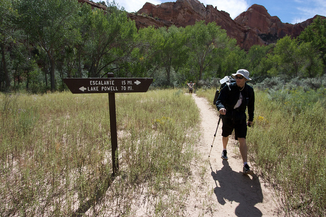
The original plan was to do the point-to-point route that starts at the Boulder air strip and ends at the Highway 12 bridge but the opportunity came up for me to meet Kev and do some canyons so we trimmed this trip to 3 days which would have made that 25 mile route a little more than we wanted to do. Especially since we wanted to spend at least one day doing nothing but swimming and relaxing, no hiking. With that in mind we decided to start the hike at the town trailhead, hike all the way into Death Hollow on day 1, relax on day 2 and then hike out to the Highway 12 bridge trailhead on Day 3.
The canyon starts out very modest from the town trailhead.
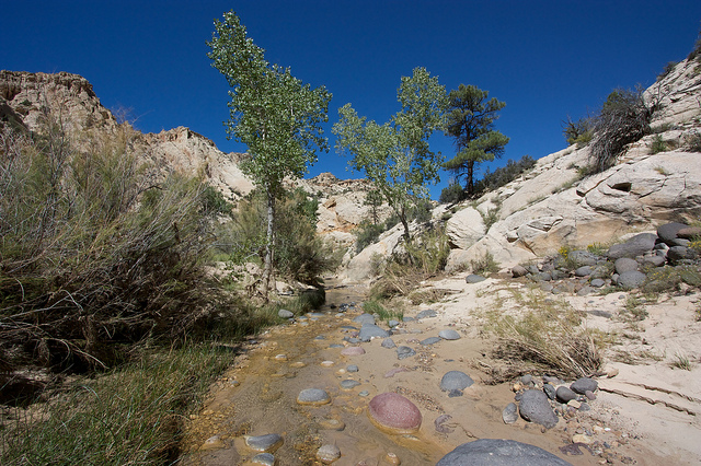
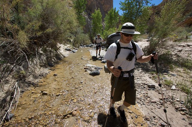
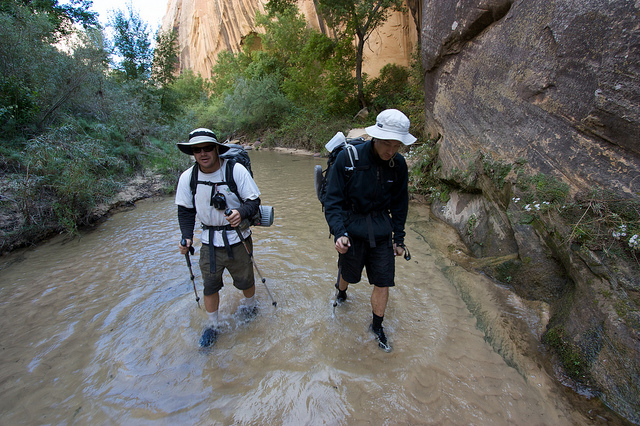
There is a bit of a trail but after a while it is usually easier to just walk in the river.
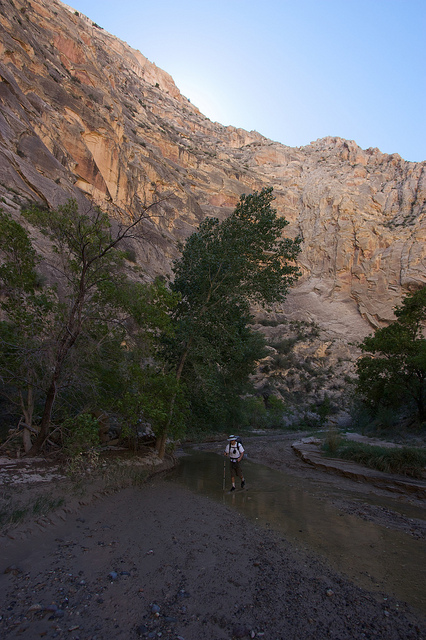
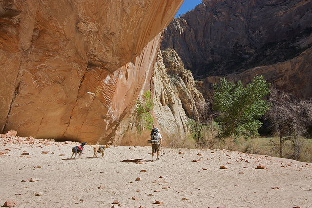
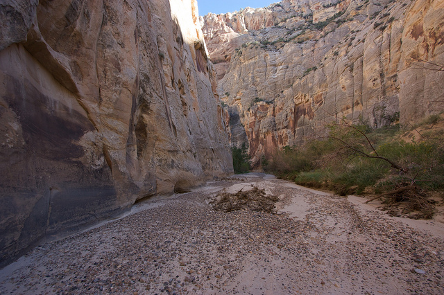
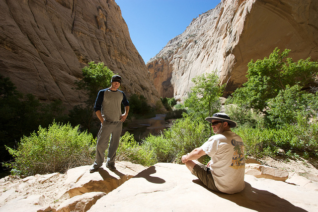
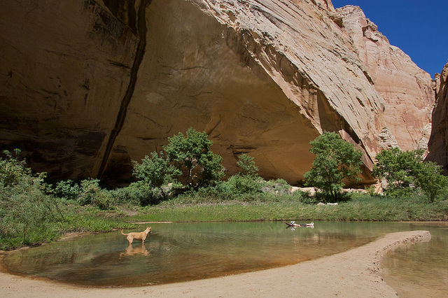
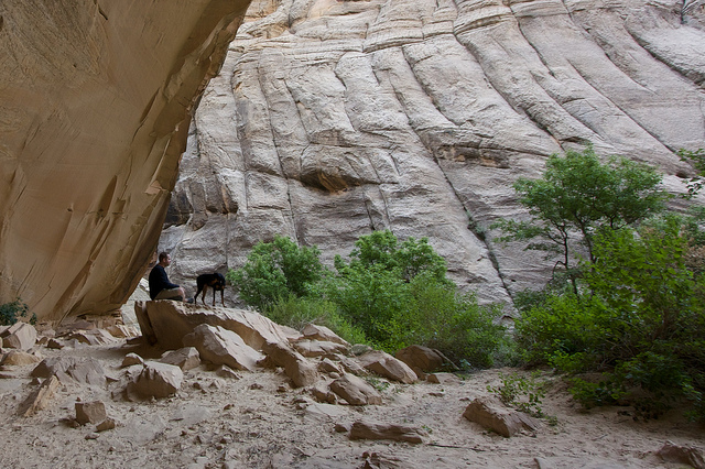
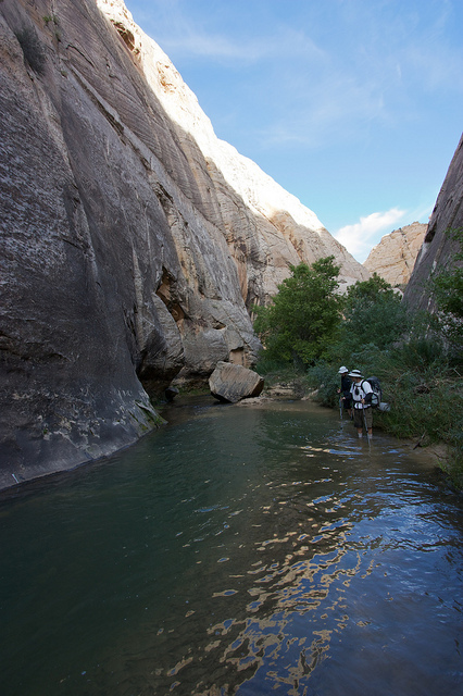
Within a mile or two the scenery gets a lot more dramatic as the canyon walls tower above.
A big alcove a few miles down the canyon. There's some cool rock art in here. Audra and I camped in this alcove back in 2007, see that trip report here: Escalante & Willow Gulch, March 2007
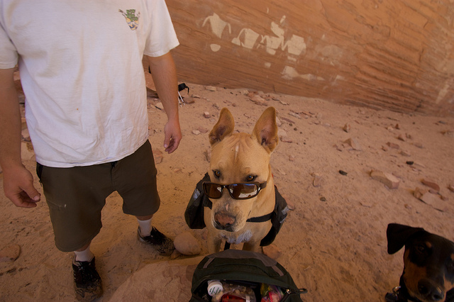
Sonny bonehead and some rock art in the background.
We stopped in the alcove and had a snack before heading on down the canyon. We had about 6 more miles before we would get to the confluence with Death Hollow.
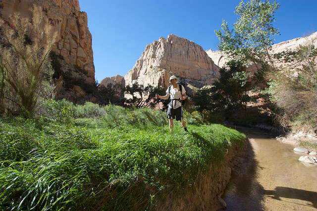
I think September/October might be my favorite time to be in the desert. Everything is so alive, unlike the early spring when all the dead plants from winter are still around.
Adam on the high road
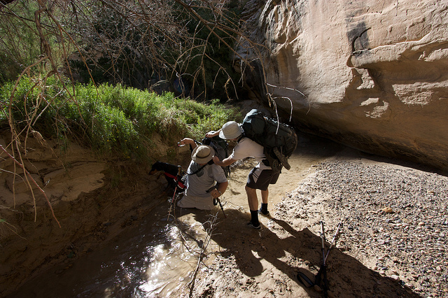
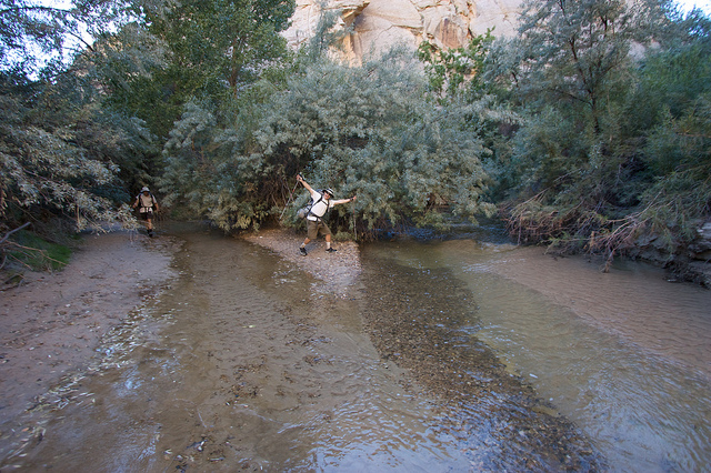
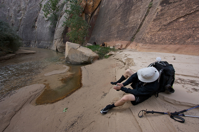
A little further down the canyon we hit a bend with a tiny bit of quicksand. I stopped and pointed it out to Adam and then about 20 feet later I hit a very sneaky patch in the middle of the river. I went from hiking in about 2" of water on a solid bed of sand to being in quicksand up to my thighs. Everything in my pockets was ruined. My expensive camera was hanging on a sling at waist level and was just inches from destruction. This pic is of Adam trying to remove my backpack as I continued to sink.
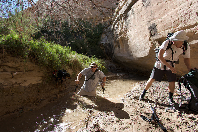
Trying to use my poles to get out.
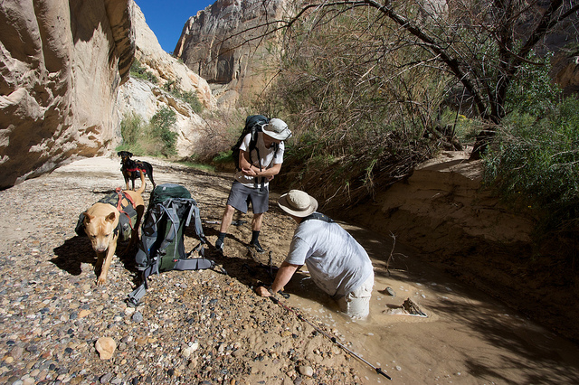
I eventually had to roll out sideways and crawl out.
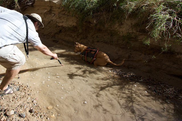
Okay, see the shadows under the bubbles on the water? That's how deep the water is, just a couple of inches.
And this is what happens when you apply weight to it.
After my little quicksand epic we stopped and had one last break before continuing on to Death Hollow. Shortly down the canyon, about 5 miles from the trailhead, we were surprised to see all of that flowing water disappear under ground. The Escalante River had literally run dry.
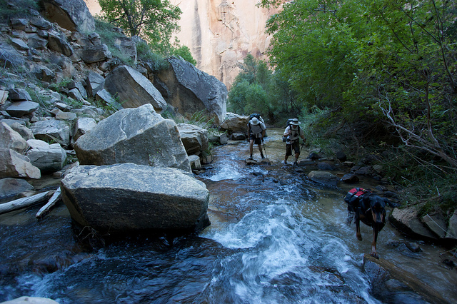
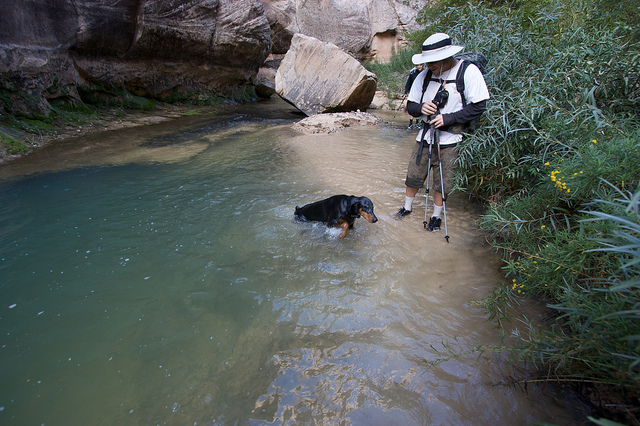
Shortly before the confluence with Death Hollow a small trickle reappeared but there was probably 2 miles of bone dry river bed in between. This is at the confluence of Death Hollow. Escalante River on the left, Death Hollow's Mamie Creek on the right.
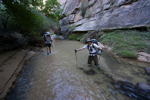
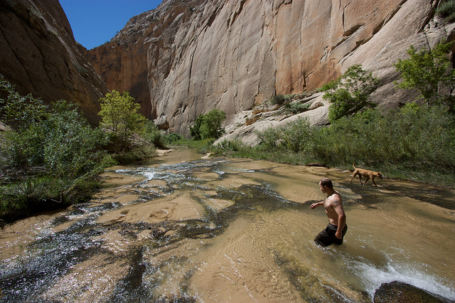
Death Hollow was flowing strong, maybe a little higher than the last time I was there. Most of it was around knee deep with the occasional pothole that would sneak up and sink a dog.
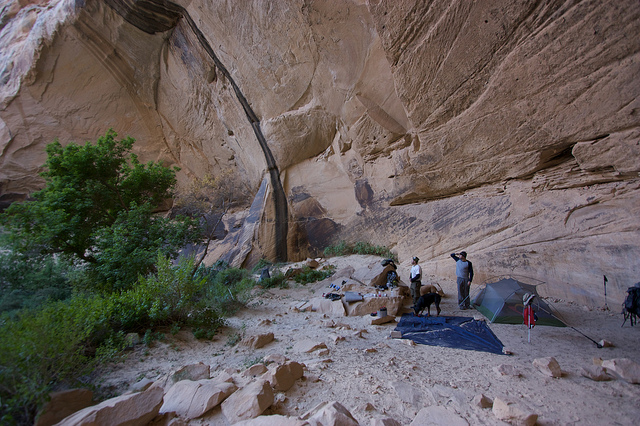
The day light was almost gone by the time we made it up into Death Hollow. We hurried up canyon and found a camp spot that we have enjoyed many times before.
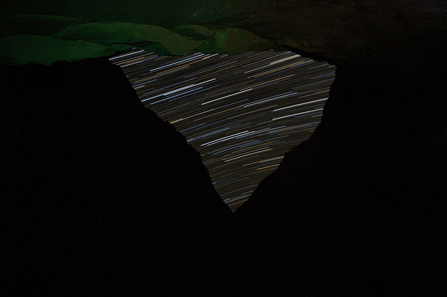
I tried out some star trails that night with our narrow view of the sky.
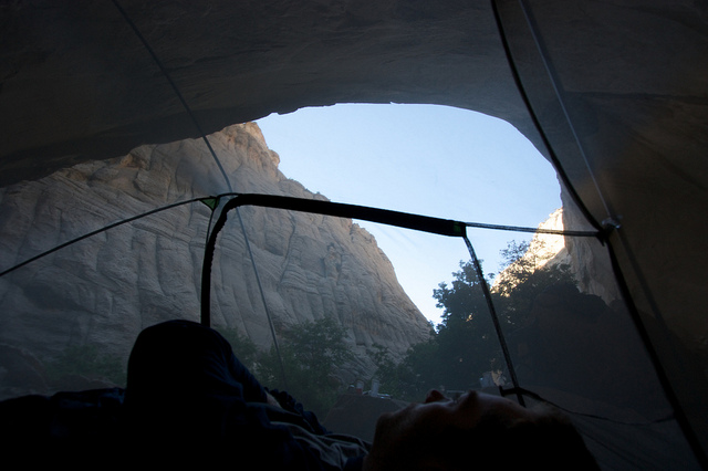
What a view from the tent
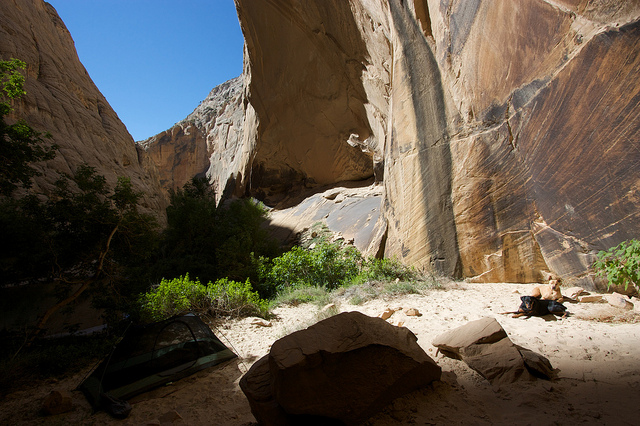
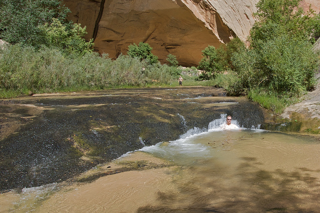
The next morning we lounged around camp and spent the entire day just relaxing in the sun, swimming, floating, getting blasted in the waterfalls. Just what we had hoped for.
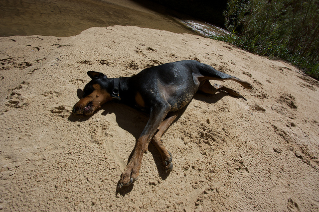
The dogs followed the sun as it worked its way into our alcove.
Sunshine finally filled the alcove, now we just had to wait for it to hit the swimming hole before we can go for a dip.
That's more like it
That's me sitting in the falls. Photo by Adam.
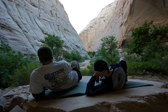
Inflatable mattress. Very nice.
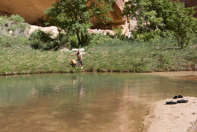
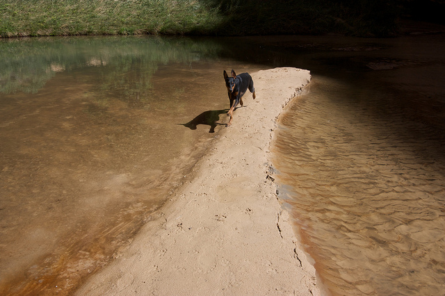
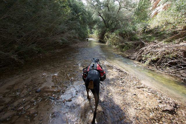
And the dogs loved running around on the sandy beaches and playing in the water.
We had some surprise visitors in the late afternoon.

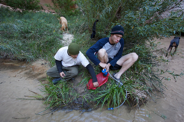
Nate and Adam on water filtering duty later that evening
Our campsite has a great rock to relax on
The next morning it was time to pack up and head out to the Highway 12 bridge over the Escalante River where my truck was waiting. This is Teak and I out on the camp rock in the morning.
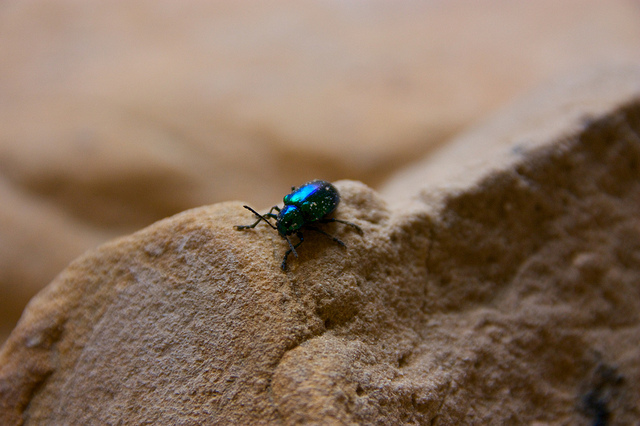
A colorful beetle we found in camp.
Teak went for an accidental swim in this swimming hole in lower Death Hollow
If only the sun were shining lower in the canyon, this is a great swimming hole.
Back on the Escalante River. The first several miles to Sand Creek were worse than I remember them. The russian olive has gotten really out of control. Fortunately the BLM was in that area removing them, so very appreciated.
One of the perils of river hiking; sand in shoes.
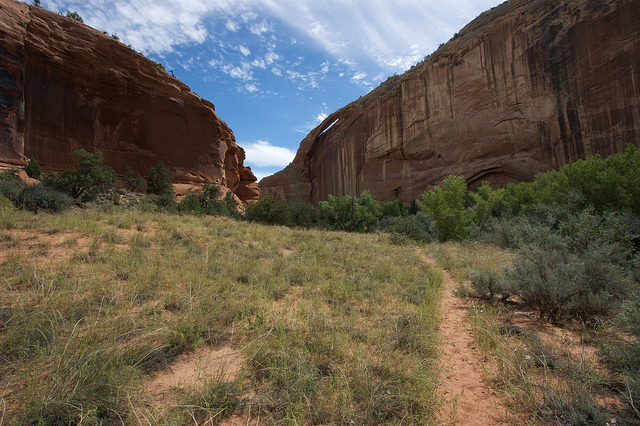
The river was so overgrown that it was good to take any trails we could find to cut across river bends.
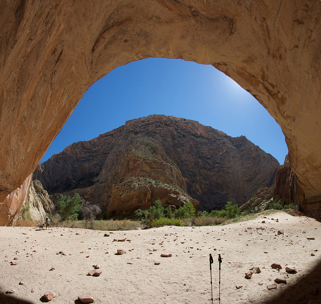
Once you reach Sand Creek it's easier to stay out of the river and things got really scenic. The trail quickly passes this arch, then a cliff dwelling.
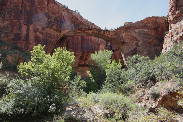
And a bend or two later, the Escalante Natural Bridge
Must have beef jerky!
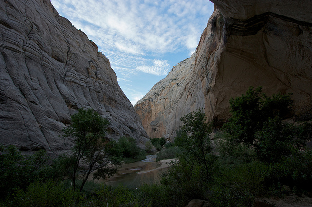
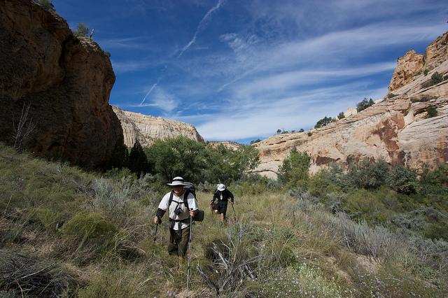
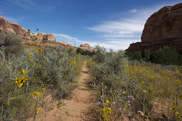
The wildflowers were really booming and the sky was blue with whispy white clouds creating excellent contrast against the rocks.
Arriving at the Highway 12 trailhead.
September brings colder weather back to the high elevations and me back to the desert. This year we planned a nice backpacking trip to Death Hollow. One of my favorite desert destinations. It was the first place I ever backpacked and it's an awesome place to bring the dogs. We've come here a lot now, five times I think. But it was going to be Adam's first backpacking trip to the desert and so I thought this would be a great place to start him out.
This is a map of the area around Death Hollow and with some of the various access points marked.
The original plan was to do the point-to-point route that starts at the Boulder air strip and ends at the Highway 12 bridge but the opportunity came up for me to meet Kev and do some canyons so we trimmed this trip to 3 days which would have made that 25 mile route a little more than we wanted to do. Especially since we wanted to spend at least one day doing nothing but swimming and relaxing, no hiking. With that in mind we decided to start the hike at the town trailhead, hike all the way into Death Hollow on day 1, relax on day 2 and then hike out to the Highway 12 bridge trailhead on Day 3.
The canyon starts out very modest from the town trailhead.
There is a bit of a trail but after a while it is usually easier to just walk in the river.
Within a mile or two the scenery gets a lot more dramatic as the canyon walls tower above.
A big alcove a few miles down the canyon. There's some cool rock art in here. Audra and I camped in this alcove back in 2007, see that trip report here: Escalante & Willow Gulch, March 2007
Sonny bonehead and some rock art in the background.
We stopped in the alcove and had a snack before heading on down the canyon. We had about 6 more miles before we would get to the confluence with Death Hollow.
I think September/October might be my favorite time to be in the desert. Everything is so alive, unlike the early spring when all the dead plants from winter are still around.
Adam on the high road
A little further down the canyon we hit a bend with a tiny bit of quicksand. I stopped and pointed it out to Adam and then about 20 feet later I hit a very sneaky patch in the middle of the river. I went from hiking in about 2" of water on a solid bed of sand to being in quicksand up to my thighs. Everything in my pockets was ruined. My expensive camera was hanging on a sling at waist level and was just inches from destruction. This pic is of Adam trying to remove my backpack as I continued to sink.
Trying to use my poles to get out.
I eventually had to roll out sideways and crawl out.
Okay, see the shadows under the bubbles on the water? That's how deep the water is, just a couple of inches.
And this is what happens when you apply weight to it.
After my little quicksand epic we stopped and had one last break before continuing on to Death Hollow. Shortly down the canyon, about 5 miles from the trailhead, we were surprised to see all of that flowing water disappear under ground. The Escalante River had literally run dry.
Shortly before the confluence with Death Hollow a small trickle reappeared but there was probably 2 miles of bone dry river bed in between. This is at the confluence of Death Hollow. Escalante River on the left, Death Hollow's Mamie Creek on the right.
Death Hollow was flowing strong, maybe a little higher than the last time I was there. Most of it was around knee deep with the occasional pothole that would sneak up and sink a dog.
The day light was almost gone by the time we made it up into Death Hollow. We hurried up canyon and found a camp spot that we have enjoyed many times before.
I tried out some star trails that night with our narrow view of the sky.
What a view from the tent
The next morning we lounged around camp and spent the entire day just relaxing in the sun, swimming, floating, getting blasted in the waterfalls. Just what we had hoped for.
The dogs followed the sun as it worked its way into our alcove.
Sunshine finally filled the alcove, now we just had to wait for it to hit the swimming hole before we can go for a dip.
That's more like it
That's me sitting in the falls. Photo by Adam.
Inflatable mattress. Very nice.
And the dogs loved running around on the sandy beaches and playing in the water.
We had some surprise visitors in the late afternoon.
Nate and Adam on water filtering duty later that evening
Our campsite has a great rock to relax on
The next morning it was time to pack up and head out to the Highway 12 bridge over the Escalante River where my truck was waiting. This is Teak and I out on the camp rock in the morning.
A colorful beetle we found in camp.
Teak went for an accidental swim in this swimming hole in lower Death Hollow
If only the sun were shining lower in the canyon, this is a great swimming hole.
Back on the Escalante River. The first several miles to Sand Creek were worse than I remember them. The russian olive has gotten really out of control. Fortunately the BLM was in that area removing them, so very appreciated.
One of the perils of river hiking; sand in shoes.
The river was so overgrown that it was good to take any trails we could find to cut across river bends.
Once you reach Sand Creek it's easier to stay out of the river and things got really scenic. The trail quickly passes this arch, then a cliff dwelling.
And a bend or two later, the Escalante Natural Bridge
Must have beef jerky!
The wildflowers were really booming and the sky was blue with whispy white clouds creating excellent contrast against the rocks.
Arriving at the Highway 12 trailhead.