- Joined
- Dec 2, 2019
- Messages
- 182
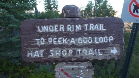
The Under-the-Rim trail at Bryce Canyon National Park is one of the iconic backcountry routes of the US South-West. It is usually done as a 3-4 day backpacking adventure, starting at Bryce Point in the northern section of the park, and ending at Rainbow Point in the south (or vice-versa).
In order to avoid having to carry a heavy backpack (including the obligatory bear-proof canister) for several days, I had originally considered walking this 23 mile trail in a single day. However, although such a hike is realistic for a strong hiker, I ultimately decided against this idea, which I think turned out to be the correct decision.
I wanted to ensure that I had plenty of time to enjoy the scenery, so I decided that I would hike the Under-the-Rim trail as 2 long day-hikes. Although this presented a couple of logistical issues, concerning transport, it meant that I could walk carrying only a light day-pack, and obviously avoid the requirement of obtaining an overnight backcountry permit.
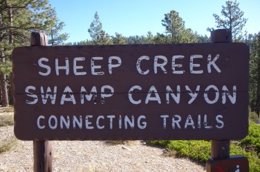
On the first day, I caught the park's shuttle bus out to Bryce Point to start the hike. From there I walked 10.5 miles of the Under-the-Rim Trail to Swamp Canyon, and then used the connector trail for 1.5 miles to take me back to the main park road. From there, it was another 3.5 miles along the road, back to the campground. I half-heartedly tried to hitch a ride on this latter section, but it's a fairly fast piece of road, with few obvious places for a car to pull over, so I didn't really expect that anyone would stop.
On the second day, I drove to the Swamp Canyon trailhead, and used the connector trail for 1 mile, to rejoin the Under-the-Rim trail again. From there, it was another 12.5 miles to complete the trail at Rainbow Point. My plan then was to sidle up to some friendly looking folks in the parking lot and ask if they might kindly give me a ride back to my vehicle. This turned out to be a bit more difficult than I imagined, and I was turned down flat by the first 8 or 9 people that I approached. Luckily, after about 30 minutes, a very nice couple from Germany came to my rescue, and drove me the 15 miles back to my car. In hindsight, it's probably understandable that people were a little reluctant to give me a ride; if a smelly hiker, in a floppy hat, and a strange accent approached me in a remote parking lot, I doubt I'd be wanting him in my car either !
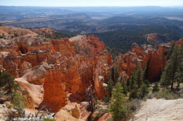
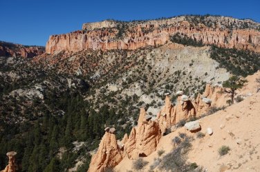
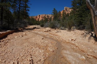
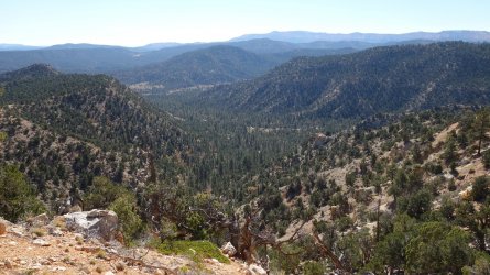
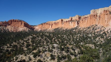
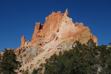
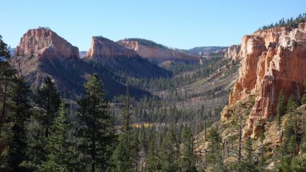
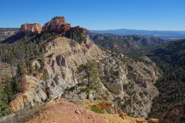
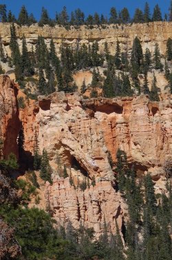
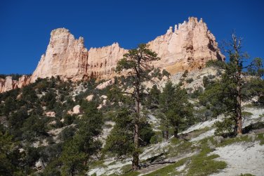
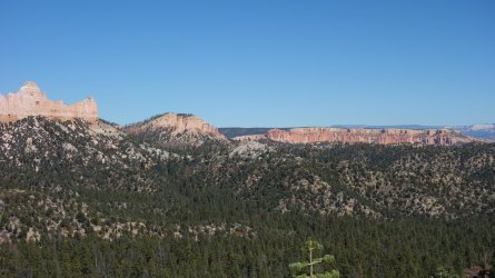
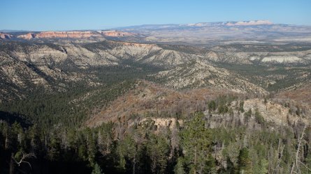
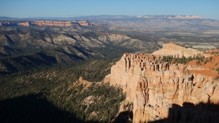
I thoroughly enjoyed the Under-the-Rim trail at Bryce Canyon. The perfect sunny days, blue skies, and crisp, clear mountain air at this elevated altitude made for ideal walking conditions. Hiking this route is a very different experience from visiting the popular main part of the park. Obviously, there are far fewer people on the trail, such that after the first couple of miles, I saw 5 people on the entire trip. Scenery wise, although not as immediately spectacular as the hoodoos of the Bryce amphitheater, it is still a stunningly beautiful area to visit, with glorious views of the pink and orange cliffs lining the route, as well as offering sweeping vistas across towards the Grand Staircase.
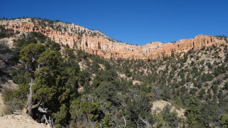
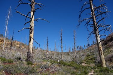
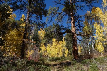
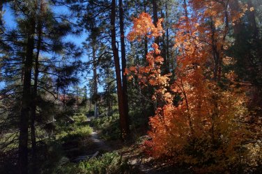
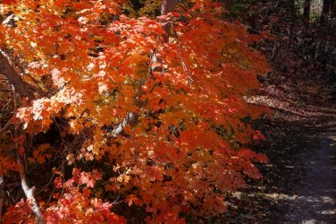
Much of the route wends through a lovely high altitude forest of gambel oak, manzantina, ponderosa pine, and aspen. This was especially pretty due to the preponderance of fall colors in the vegetation. The route is certainly undulating, and there are plenty of slopes to negotiate, but the trail is actually very well designed such that there are very few taxing uphills to worry about; even the final 1,100 ft climb up to Rainbow Point winds gently and subtly around the hills and before you know it, you've reached the trailhead at an altitude of 9,100 ft.
If anyone has a few days at Bryce Canyon National Park, and has perhaps walked the park's main popular trails before, I highly recommend the Under-the-Rim train, either as a backpack, or a series of day-hikes.
.In order to avoid having to carry a heavy backpack (including the obligatory bear-proof canister) for several days, I had originally considered walking this 23 mile trail in a single day. However, although such a hike is realistic for a strong hiker, I ultimately decided against this idea, which I think turned out to be the correct decision.
I wanted to ensure that I had plenty of time to enjoy the scenery, so I decided that I would hike the Under-the-Rim trail as 2 long day-hikes. Although this presented a couple of logistical issues, concerning transport, it meant that I could walk carrying only a light day-pack, and obviously avoid the requirement of obtaining an overnight backcountry permit.
On the first day, I caught the park's shuttle bus out to Bryce Point to start the hike. From there I walked 10.5 miles of the Under-the-Rim Trail to Swamp Canyon, and then used the connector trail for 1.5 miles to take me back to the main park road. From there, it was another 3.5 miles along the road, back to the campground. I half-heartedly tried to hitch a ride on this latter section, but it's a fairly fast piece of road, with few obvious places for a car to pull over, so I didn't really expect that anyone would stop.
On the second day, I drove to the Swamp Canyon trailhead, and used the connector trail for 1 mile, to rejoin the Under-the-Rim trail again. From there, it was another 12.5 miles to complete the trail at Rainbow Point. My plan then was to sidle up to some friendly looking folks in the parking lot and ask if they might kindly give me a ride back to my vehicle. This turned out to be a bit more difficult than I imagined, and I was turned down flat by the first 8 or 9 people that I approached. Luckily, after about 30 minutes, a very nice couple from Germany came to my rescue, and drove me the 15 miles back to my car. In hindsight, it's probably understandable that people were a little reluctant to give me a ride; if a smelly hiker, in a floppy hat, and a strange accent approached me in a remote parking lot, I doubt I'd be wanting him in my car either !
I thoroughly enjoyed the Under-the-Rim trail at Bryce Canyon. The perfect sunny days, blue skies, and crisp, clear mountain air at this elevated altitude made for ideal walking conditions. Hiking this route is a very different experience from visiting the popular main part of the park. Obviously, there are far fewer people on the trail, such that after the first couple of miles, I saw 5 people on the entire trip. Scenery wise, although not as immediately spectacular as the hoodoos of the Bryce amphitheater, it is still a stunningly beautiful area to visit, with glorious views of the pink and orange cliffs lining the route, as well as offering sweeping vistas across towards the Grand Staircase.
Much of the route wends through a lovely high altitude forest of gambel oak, manzantina, ponderosa pine, and aspen. This was especially pretty due to the preponderance of fall colors in the vegetation. The route is certainly undulating, and there are plenty of slopes to negotiate, but the trail is actually very well designed such that there are very few taxing uphills to worry about; even the final 1,100 ft climb up to Rainbow Point winds gently and subtly around the hills and before you know it, you've reached the trailhead at an altitude of 9,100 ft.
If anyone has a few days at Bryce Canyon National Park, and has perhaps walked the park's main popular trails before, I highly recommend the Under-the-Rim train, either as a backpack, or a series of day-hikes.
.
........
 .
..
.
.
........
 ......
.
.
.
.........
.
.
.
.........
.
.
.
.........
.
.
.
.........
.
.
.
........
.
.
.
........
 .
..
.
.
........
.
.
.
........
.
.
.
.........
.
.
.
.........
.
.
.
.........
.
.
.
.........
.
.
.
.........
.
.
.
.........
.
.
.
.........
.
.
.
........
.
.
.
.........
.
.
.
.........
Last edited:
