- Joined
- Dec 5, 2017
- Messages
- 1,333
After spending the first half of our vacation in Ouray, we went to Telluride for the second half. Our son was eager to spend time there, and even though it's more upscale than I'd like, it worked out well because there are so many trails and roads right from town. While my husband and I hiked, our sons made great use of the jeep roads for running and mountain biking. In the evenings, we enjoyed taking the free gondola up the ski mountain for sunset viewing. Again, we made great use of @Diane Greer 's advice and excellent book and website when planning our hikes. The wildflowers were incredible, and I loved all the aspens. I'm scheming for a return trip in Sept. 2025 to enjoy the hikes again with fall color.
The Sneffels Highline loop was outstanding. We got completely soaked at the end, but that didn't diminish our enjoyment of it at all.
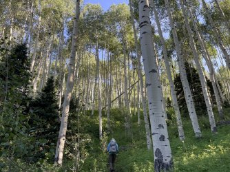
I can't wait to come back and see all these aspens in the fall.
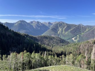
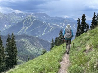
Telluride's ski slopes are visible across the valley
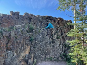
We felt like climbing this just for fun. "Real" climbers could have scaled it in about 5 seconds, but for us it was the perfect challenge.
Switchbacks lead to the saddle on the left (not visible)
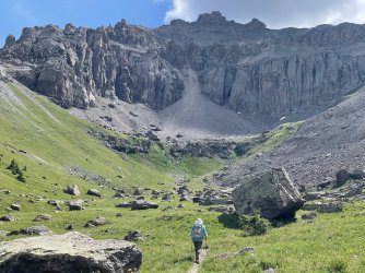
Very rocky at the saddle
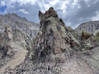
Big views looking back the way we had come
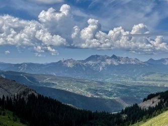
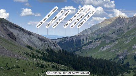
It's very satisfying to identify the mountains using the PeakFinder app.
Big views looking down to where we'll be next - in Mill Creek Basin
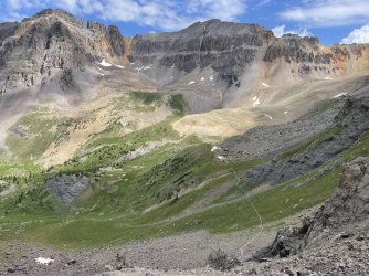
Heading down from the saddle
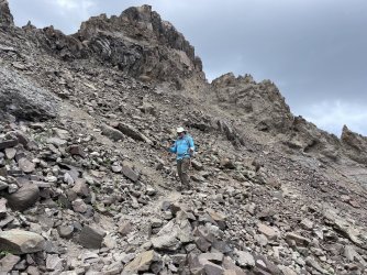
It was at this point that I noticed something pretty cool. In the ridge ahead of us, there was a keyhole window and interesting rocks whose shapes resembled ones I had seen above Upper Blue Lake the other day. Later I looked more carefully at the map, and sure enough they were the same rocks and window, just from 2 different sides of the ridge. Since I take a zillion photos, I had no trouble finding ones that matched up. I put them together in this "Both Sides Now" picture.
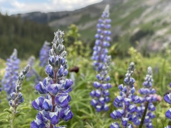
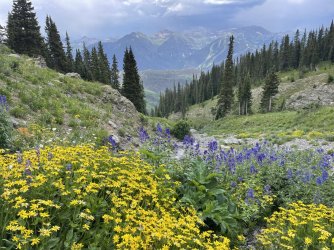
We made our way down and saw so many beautiful wildflowers. Too many pictures to include them all!
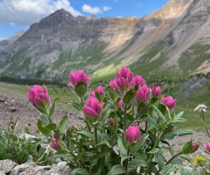
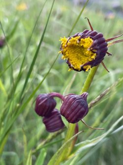
I had never noticed these "nodding ragwort" before.
I knew from our Utah trips that Abajo and Pennell are very far away.
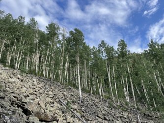
So many aspens down below, in addition to the ones we walked by in the forest. This hike really will be stunning at peak fall color.
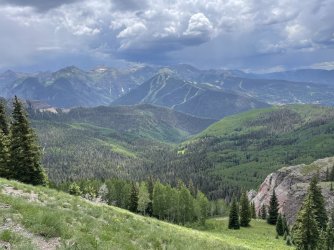
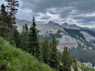
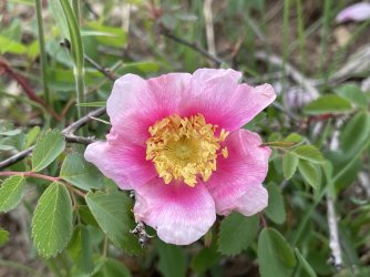
Oh my, will that rain across the way come our way???
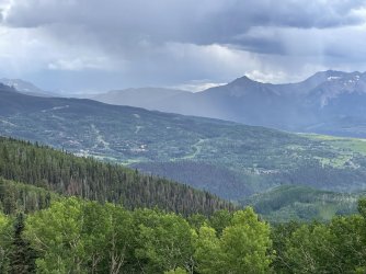
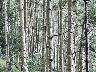
Not that rain, but other storms came our way. During the hailstorm, we took shelter under a short pine tree for a little while. I was fascinated to see that half of each aspen trunk was wet and half was dry.
After the hail, it stopped raining but then started up again and kept going for the rest of our hike. There's been a lot of rain in these woods...
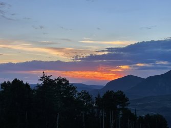
The rain cleared up and that evening we took the free gondola up to enjoy sunset. The LaSals were visible way off in the distance.
The next day, we did a shorter hike to Lake Hope, where there were beautiful wildflowers again. Our rental SUV did OK on the long rocky road to the TH, but we easterners are not used to that kind of driving!
View looking back behind us on the way to Lake Hope
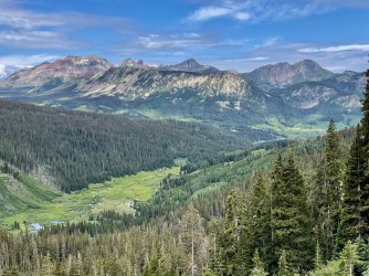
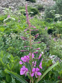
We saw less fireweed on this trip than on other years' summer trips. Maybe this time we were at higher elevations earlier.
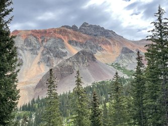
Vermillion Peak
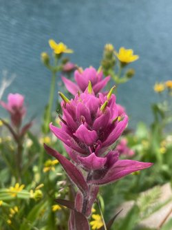
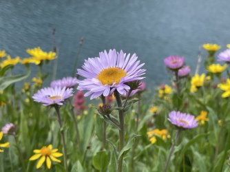
Tons of flowers above the lake
Heading up to the pass
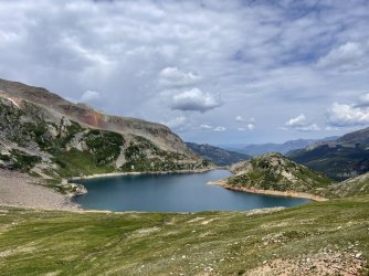
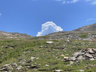
View of the other side from the pass
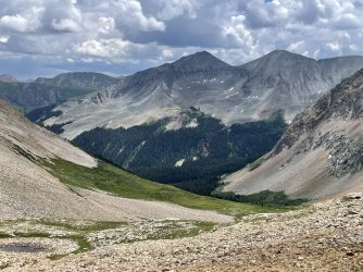
Dark clouds forming - better get down quickly. Will we get soaked again? (NO - hooray!)
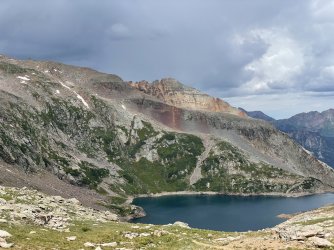
While we were hiking, our kids were doing massive runs and mountain bike rides. In the evening, we took the gondola up again for a picnic and more sunset viewing.
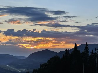
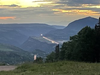
While we were watching, the Telluride airstrip lights turned on. "Hmmm... do they always do that at night? No, we didn't see them the night before. Does that mean a plane is coming? Yup, there's a light..." We had a good time watching the plane come in for a landing.
Our final hike was another spectacular one, Lizard Head. On previous days, we had already seen Lizard Head, Mt. Wilson, Wilson Peak, etc. off in the distance multiple times. It started in the woods, and I'm filing it away for doing again during fall aspen color.
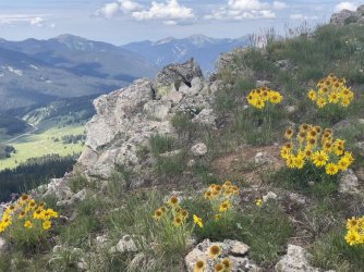
We got to Black Face Mtn and weren't sure if the weather would permit us to do the whole loop or if we'd have to turn back. We had started early (as on all the other days - no sleeping in on this vacation!) but didn't know if we'd be able to get down before the storms arrived. We decided to give the loop a try and were so glad we did. Here are some of the views at Black Face:
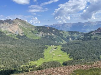
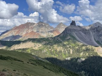
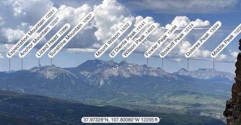
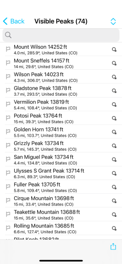
PeakFinder showed 74 visible peaks at that spot. This is a screenshot of only the first page out of 6.
There were lots of puffy clouds, so the light and shadow kept changing. We got lots of different views of Lizard Head and the other peaks, partly because of the shadows and partly because the trail brought us from one side to the other and down below. It all looked great!
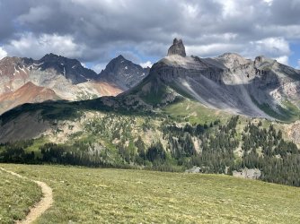
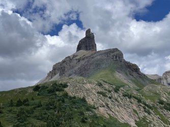
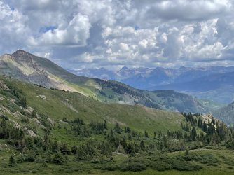
It was fun to walk across this part.
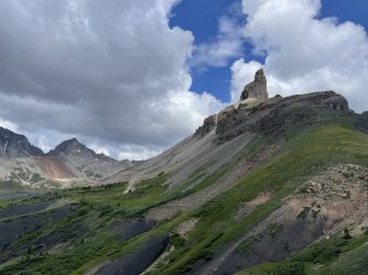
Oh no - will that rain get us? (Not that rain, but later yes...)
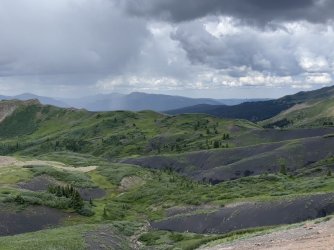
Looks rather ominous...
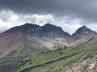
We were fascinated by the volcanic black sand/rock.
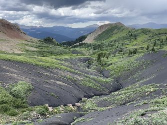
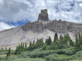
We went down the Cross Mountain trail, which was a bit less interesting than the parts we had done so far. But we saw some interesting things along the way:
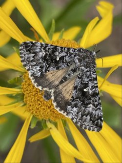
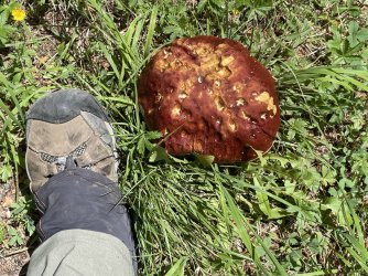
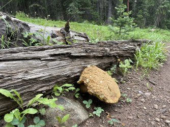
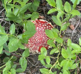
We would have walked the final part of the loop along the old railroad bed parallel to the road, but it was quite open there and unappealing amidst the rain and thunder. We got a ride from the Cross Mtn TH to the Lizard Head TH and heard about 2 people who had been hit by lightning nearby - well below treeline but out in the open like where we would have been walking. It felt good to be safe in their truck...
We thoroughly enjoyed this trip. We missed backpacking but were glad to spend time with our kids and to enjoy the spectacular scenery. We will be back!
The Sneffels Highline loop was outstanding. We got completely soaked at the end, but that didn't diminish our enjoyment of it at all.
I can't wait to come back and see all these aspens in the fall.

Telluride's ski slopes are visible across the valley

We felt like climbing this just for fun. "Real" climbers could have scaled it in about 5 seconds, but for us it was the perfect challenge.

Switchbacks lead to the saddle on the left (not visible)

Very rocky at the saddle

Big views looking back the way we had come

It's very satisfying to identify the mountains using the PeakFinder app.

Big views looking down to where we'll be next - in Mill Creek Basin

Heading down from the saddle

It was at this point that I noticed something pretty cool. In the ridge ahead of us, there was a keyhole window and interesting rocks whose shapes resembled ones I had seen above Upper Blue Lake the other day. Later I looked more carefully at the map, and sure enough they were the same rocks and window, just from 2 different sides of the ridge. Since I take a zillion photos, I had no trouble finding ones that matched up. I put them together in this "Both Sides Now" picture.

We made our way down and saw so many beautiful wildflowers. Too many pictures to include them all!


I had never noticed these "nodding ragwort" before.


I knew from our Utah trips that Abajo and Pennell are very far away.


So many aspens down below, in addition to the ones we walked by in the forest. This hike really will be stunning at peak fall color.


Oh my, will that rain across the way come our way???

Not that rain, but other storms came our way. During the hailstorm, we took shelter under a short pine tree for a little while. I was fascinated to see that half of each aspen trunk was wet and half was dry.

After the hail, it stopped raining but then started up again and kept going for the rest of our hike. There's been a lot of rain in these woods...

The rain cleared up and that evening we took the free gondola up to enjoy sunset. The LaSals were visible way off in the distance.

The next day, we did a shorter hike to Lake Hope, where there were beautiful wildflowers again. Our rental SUV did OK on the long rocky road to the TH, but we easterners are not used to that kind of driving!
View looking back behind us on the way to Lake Hope

We saw less fireweed on this trip than on other years' summer trips. Maybe this time we were at higher elevations earlier.

Vermillion Peak

Tons of flowers above the lake


Heading up to the pass


View of the other side from the pass

Dark clouds forming - better get down quickly. Will we get soaked again? (NO - hooray!)

While we were hiking, our kids were doing massive runs and mountain bike rides. In the evening, we took the gondola up again for a picnic and more sunset viewing.

While we were watching, the Telluride airstrip lights turned on. "Hmmm... do they always do that at night? No, we didn't see them the night before. Does that mean a plane is coming? Yup, there's a light..." We had a good time watching the plane come in for a landing.

Our final hike was another spectacular one, Lizard Head. On previous days, we had already seen Lizard Head, Mt. Wilson, Wilson Peak, etc. off in the distance multiple times. It started in the woods, and I'm filing it away for doing again during fall aspen color.

We got to Black Face Mtn and weren't sure if the weather would permit us to do the whole loop or if we'd have to turn back. We had started early (as on all the other days - no sleeping in on this vacation!) but didn't know if we'd be able to get down before the storms arrived. We decided to give the loop a try and were so glad we did. Here are some of the views at Black Face:


PeakFinder showed 74 visible peaks at that spot. This is a screenshot of only the first page out of 6.

There were lots of puffy clouds, so the light and shadow kept changing. We got lots of different views of Lizard Head and the other peaks, partly because of the shadows and partly because the trail brought us from one side to the other and down below. It all looked great!


It was fun to walk across this part.

Oh no - will that rain get us? (Not that rain, but later yes...)

Looks rather ominous...

We were fascinated by the volcanic black sand/rock.


We went down the Cross Mountain trail, which was a bit less interesting than the parts we had done so far. But we saw some interesting things along the way:


We would have walked the final part of the loop along the old railroad bed parallel to the road, but it was quite open there and unappealing amidst the rain and thunder. We got a ride from the Cross Mtn TH to the Lizard Head TH and heard about 2 people who had been hit by lightning nearby - well below treeline but out in the open like where we would have been walking. It felt good to be safe in their truck...
We thoroughly enjoyed this trip. We missed backpacking but were glad to spend time with our kids and to enjoy the spectacular scenery. We will be back!
Last edited:

