JimmyW
Member
- Joined
- Aug 17, 2015
- Messages
- 29
Lewis & Clark Pass, near Lincoln, MT, is the crossing where the explorers crossed the divide on July 6, 1806. It's accessed by an easy 1.5 mile trail that takes off from the end of Alice Creek Rd. The pass was used by ancient Indians and you still can find arrow heads right on the trail, though they're somewhat scarce these days. I took a trip up the Alice Creek Basin, which connects to the pass a few miles from where I quit. A loop hike is do-able in a day.
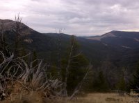
This is on the trail heading around toward L&C Pass. The pass is on the horizon, in the lower point of the saddle in the distant park. The peak on the right is Green Mountain, which is on the Continental Divide Trail. On the left is Red Mountain (the granite outcropping), also on the Divide Trail.

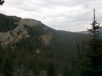
Here, I'm heading up the trail that goes around Red Mountain and is where I quit for the day. It probably was another 3-4 miles to the pass.

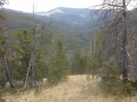
This shot shows the Alice Creek drainage where the trail heads up to where I'm standing. There are a few switchbacks that get you up and over the top. It's not too bad of a climb, gaining about 1,700' over 4 miles. I pack my bear spray in this country.
This is on the trail heading around toward L&C Pass. The pass is on the horizon, in the lower point of the saddle in the distant park. The peak on the right is Green Mountain, which is on the Continental Divide Trail. On the left is Red Mountain (the granite outcropping), also on the Divide Trail.

Here, I'm heading up the trail that goes around Red Mountain and is where I quit for the day. It probably was another 3-4 miles to the pass.

This shot shows the Alice Creek drainage where the trail heads up to where I'm standing. There are a few switchbacks that get you up and over the top. It's not too bad of a climb, gaining about 1,700' over 4 miles. I pack my bear spray in this country.

