- Joined
- Feb 15, 2020
- Messages
- 616
This was a pretty fantastic trip though a number of things didn't go as originally planned. First of all, the much higher snowpack in the Sierra Nevada this year was very evident and affected multiple sections of the trip. Additionally, when the trip was first conceived there would have been four of us - by the time it rolled around we were down to two. And then, due to an injury it ended up just being me for the final section.
The general idea for the route was to hit a few highlights we missed in Yosemite NP last year before heading north and completing (roughly) section 5 of Steve Roper's Sierra High Route (1982). We did Section 4 last year - you can see that trip report here. Roper's route is the original "high route" and as far as I can tell none of the others even come close to its quality. Obviously the scenery is fantastic - easy enough in the Sierra - but the routing is really fantastic. (By comparison none of the various Wind River High Routes are nearly so elegant - despite the obviously fantastic scenery.)
I've absolutely loved getting out to the Sierra more - and I hope to continue the trend. That said, it's definitely more people and less wildlife than my more regular destinations. (I did have one pretty awesome wildlife experience on this one though - read on to hear about it.)
Day 1: Dana Meadows to Upper Kuna Creek
If I'm being honest, this trip kind of snuck up on me and I wasn't really in the best "backpacking mindset". Even after landing in Bishop, meeting up w/ my hiking partner, and camping at Twin Lakes CG for a night I was still feeling a bit "meh". My first few miles of hiking involved a bit more "how many miles/days is this?" than I'm proud of. But as we were climbing up and over Kuna Crest from Helen Lake, I started remembering why I do this. And by the middle of Day 2, I was fully ready to just explore the Sierra forever.
The early sections were fairly innocuous, but the weather was fantastic. (We just missed Hurricane Hillary which had finished its downpour the day previous.)
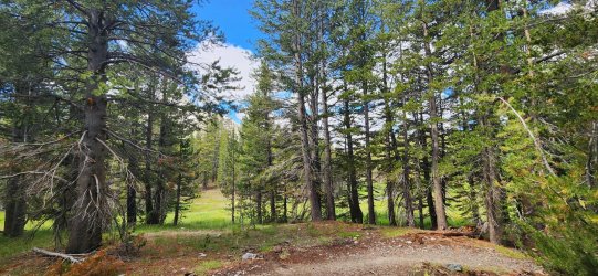
Lots of beautiful fungi to be found - likely a combination of the extra moisture from the massive snowfall and the recent rainfall.
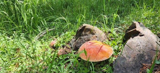
The meadows were all very vibrant green and large snowfields persisted above treeline. Much different than prior years and very obvious even on satellite imagery.
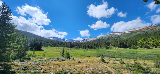
Even just climbing up to Helen Lake involved a decent sized snowfield.
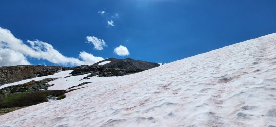
Looking at Helen Lake and the Kuna Crest.
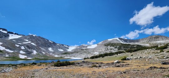
Climbing up the Crest.
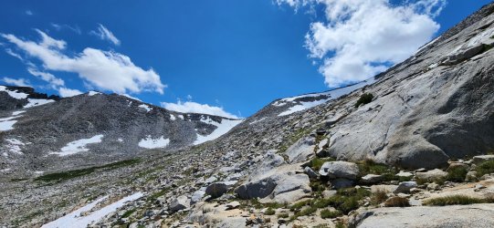
Looking out at Mount Lyell and Mount Maclure from the top of the pass.
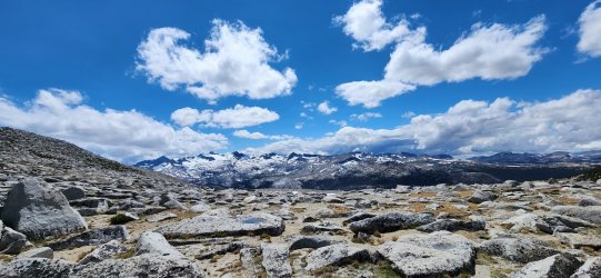
Camp for the evening.
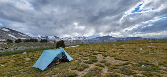
The nearby water sources did not have any fish, but they were absolutely swarming with very large tadpoles. Really cool to see - I'm always fascinated by the cold-blooded vertebrates that live in the high alpine.
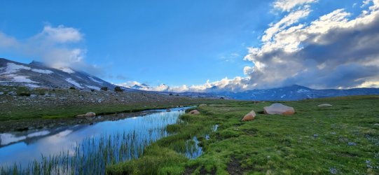
Another nice shot of camp.

Day 2: Upper Kuna Creek to Ireland Lake
Today would necessitate our first (and biggest) re-route due to the increased snowpack. Our original plan would have us climb up the Lyell Glacier and circle Lyell/Maclure, but with just a light ice axe and microspikes the climb up the glacier looked pretty intense at worst and potentially dangerous. With the very large sections of unmelted snowfields, hit by a few days of rain, and then a significant temperature drop, the snow/ice was pretty hard/slick even well into the afternoon. I'd love to talk to someone that climbed the glacier this year, because I was tempted to try but my hiking partner (smartly, I think) dissuaded me.
The day would be fantastic regardless - I think the route change gave us a look at some less traveled sections as well. And Ireland Lake made for an excellent evening's camp.
I stared at Lyell Glacier all morning.
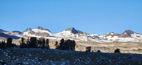
Unnamed lake just below Donahue Peak - pretty cool spot, but windy.
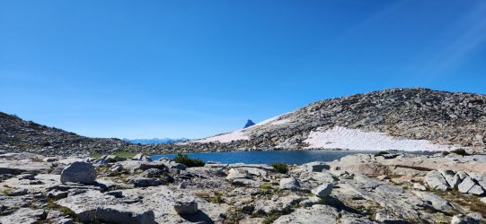
We jumped on the JMT very briefly where it comes down from Donahue Pass before heading towards Lyell.
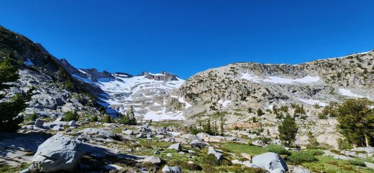
From here we would traverse below the Lyell and Maclure Glaciers on the northeast side instead of our original plan. It was a beautiful route - though we did want our ice axes and microspikes on a few fairly steep snowfields.
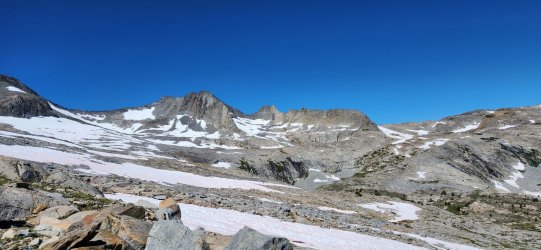
Looking down on the Lyell Fork (and the JMT).
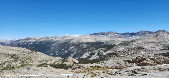
Pretty cool unnamed lake below Simmons Peak. It seems like most years this is melted out by early July.
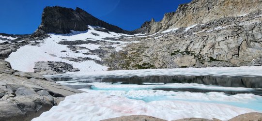
On our way down to Lake Ireland.
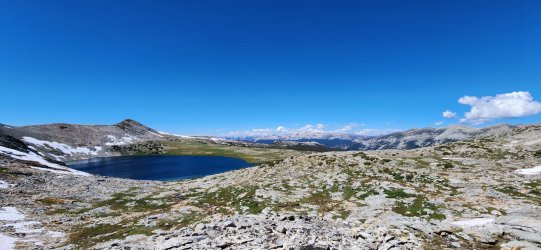
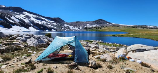
Camp for the evening. Another great spot.
Day 3: Ireland Lake to Rafferty Creek
Today was a very short day - we'd banked some time in hopes of climbing Lyell, but decided to use it sleeping in and hanging around camp. We didn't set off until almost 10a.
Relaxing in the AM doesn't come naturally to me, but it was pretty nice... maybe I'm getting old, but I think I may need to start including more of these AMs.
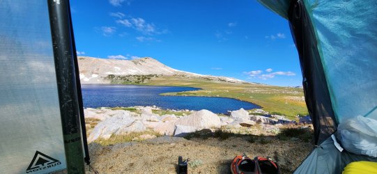
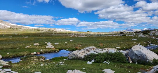
Had a small group of deer sneak up on my while I was filling water.
Much of today's route would be on trail - only ended up hiking for a few hours.
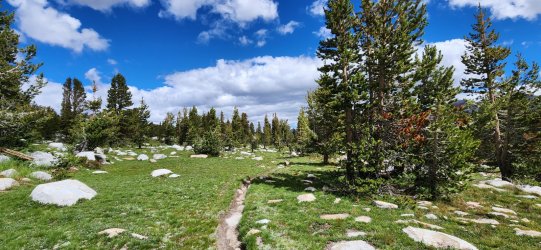
Evelyn Lake.
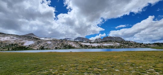
At the end of the day we cut off trail to head for Rafferty Creek - we camped just outside the Tuolumne Meadows "no camping" zone. In camp my hiking partner was nursing a bit of a knee injury - we were still optimistic at this point though.
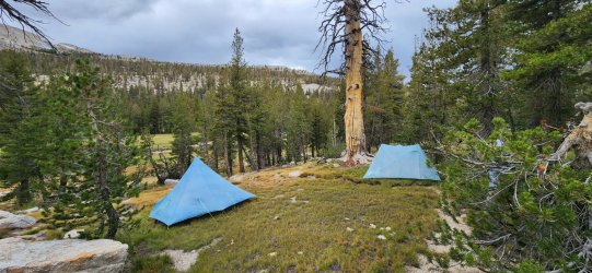
Day 4: Rafferty Creek to Lee Vining Creek
Day 4 ended up being a bit of a mixed bag. The first section down to Tuolumne is pretty innocuous and when we arrived there my partner broke the news to me that he didn't think he was up for the remainder. We discussed some logistics and decided I would continue and meet him in a few days at Twin Lakes. The second part of the day was fantastic, though I was bummed on his behalf.
About the time I arrived at the Great Sierra Mine he contacted me and let me know he had gotten to his car quicker than expected and was gonna hike up from the Sawmill CG to meet me. I was happy to hear that - plus he brought me some Skittles and Coke Zero. Pretty nice.
(Note: those familiar w/ the area might note this is a "no camping" zone. We had permission from a leaseholder to camp on their parcel - otherwise you need to continue north past Conness Lakes for legal camping.)
On the way up to the Gaylor Lakes basin.

I really appreciated the Gaylor Lakes basin - the trail petered out shortly after this point. (No camping allowed in this basin.)
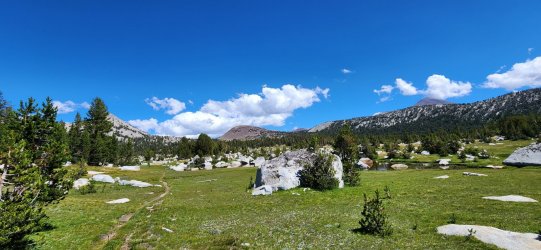
Some remnants of the Great Sierra Mine. Saw a couple groups of backpackers here - being one of the very few legal camping areas on this section I was not surprised.
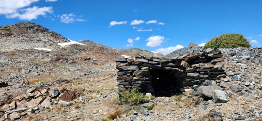
There was quite a bit more snow than anticipated on the north side of the mine - necessitated the spikes and ice axe again.
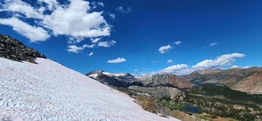
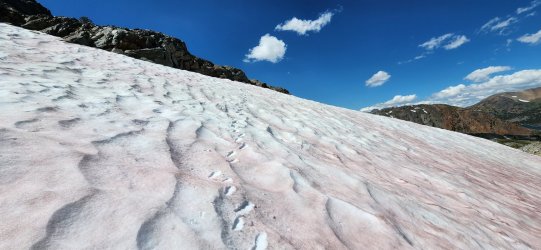
Saw a pair of prints from a couple that was also doing the high route - I would finally run into them briefly on Day 5.
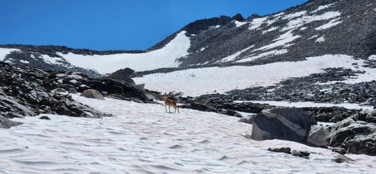
Not much food up here, buddy...
Spuller Lake. (I think... 95% sure that's where this is.)

Camp for the night was the worst of the trip - lots of bugs and just kind of underwhelming. But - as previously mentioned - options are very limited and I was happy to meet up w/ my hiking partner again, however briefly.

Day 5: Lee Vining Creek to Stanton Pass
At one point I'd considered climbing Mount Conness this AM, but given the snow conditions and having no partner I decided to just continue along the route. Today would end up being the "crux" of the trip - in particular Sky Pilot Col. It would also be the best day of the whole route - I absolutely loved the climb up and over Sky Pilot Col.
The beautiful weather continued. No complaints in that regard.

Conness Pass (not sure that's an official name) is a pretty unique one - it involves a pretty easy climb, but then in order to safely descend you have to climb up further on the north side and traverse to a rib that will take you down to Conness Lakes.
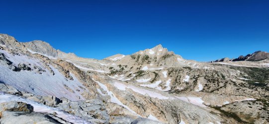
The very large Saddlebag Lake (reservoir) in the distance.
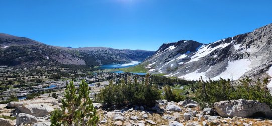
Sky Pilot Col is directly above the snowfield at center. I ended up staring at it for hours as I approached from Conness Pass - pretty intimidating to be honest.
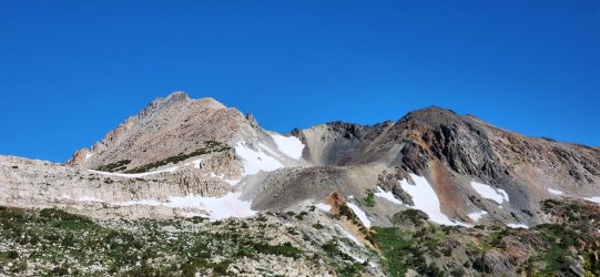
Looking back down.
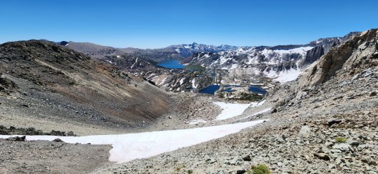
360° view from Sky Pilot Col. Better views on the south side, but more adventure on the north.
Plenty of snow on the way down... some nice glissades to be had where the snow was a bit softer, too.
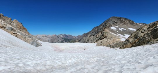
On my way down I saw one of the cooler backcountry wildlife interactions I've had the luck to experience. (I would kill for a video, but sadly it happened too fast.) I had spotted a pair of Golden Eagles lazily circling from the top of the pass (at the time I just knew it was a large raptor). As I got over a small boulderfield and another large snowfield came into view I spotted a marmot running across the snow - followed by chaos as he was absolutely obliterated by a diving Golden Eagle. They rolled end over end over each other and came to a rest a few yards from the initial impact. I tried to make myself inconspicuous, but after the chaos calmed the eagle spotted me and took back off. This left a badly injured (terminal) marmot right in the middle of the snowfield. I had to go by and snapped a few pictures (and even a video), but tried to move on as quickly as possible so that the eagle could return. I briefly considered putting the marmot out of its misery, but figured nature (the eagle) would take care of it if I just got out of the way.
The initial impact. (Video of the attack site here, but a little graphic and a dying marmot so viewer discretion advised.)

Long descent... almost down to Shepherd Lake.
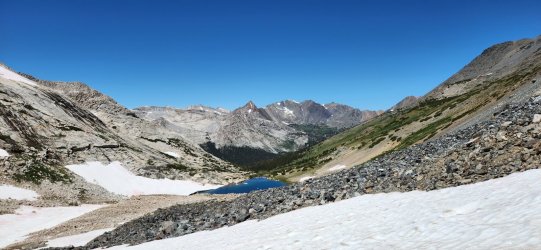
Looking back up from my lunch spot. Ran into the couple whose tracks I'd been seeing off-and-on - they were doing the whole high route in one shot. Sounded like they'd had an awesome time, though they took a few days in Mammoth Lakes during the hurricane-related storms.
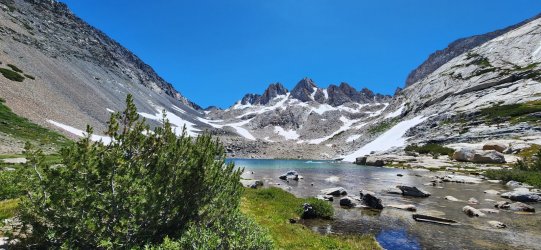
Virginia Canyon was pretty nice - I never get tired of the large trees in California. Some sections involved some bushwhacking, but once down in the trees is was very pleasant.

Looking back across Virginia Canyon as I head up towards Soldier Lake. This climb was not particularly strenuous, but I was pretty wiped so it was slow going. Beautiful views always make it easier though.
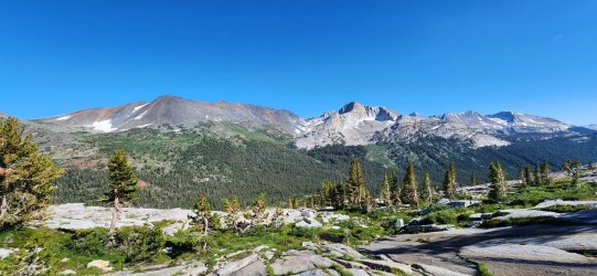
Soldier Lake. I considered stopping for the night, but I wanted to get a look at Stanton Pass so I continued another half mile or so and was rewarded with an excellent camp site.
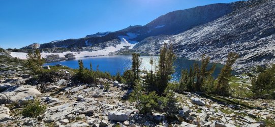
Camp for the night and a look at Stanton Pass.
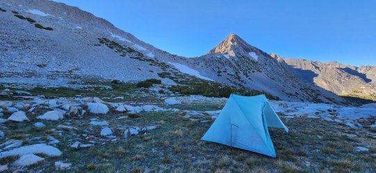
Looking down at Return Lake.
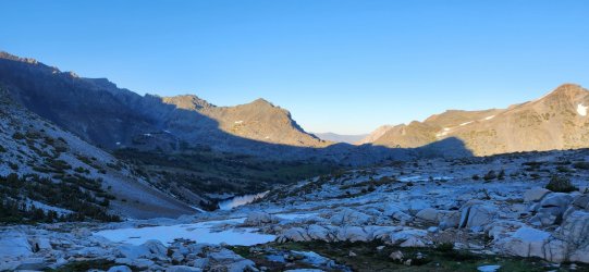
Day 6: Stanton Pass to Twin Lakes
Originally this was to be a 7 day trip, but with the snow adjustments and ending up by myself it was pretty simple to wrap it up in 6. Stanton Pass was fairly steep, but fairly short. I'd read some pretty gnarly reports of the northwest side, but it was fairly easy to descend - I think following the "correct" route is pretty important. I mostly stayed on the lower slabs on the north flank of Stanton Peak and had no issues - no worse than a soft Class 3.
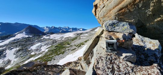
Trail cam at the top of Stanton Pass.
Spiller Creek drainage.
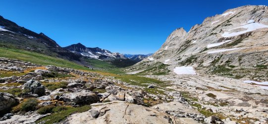
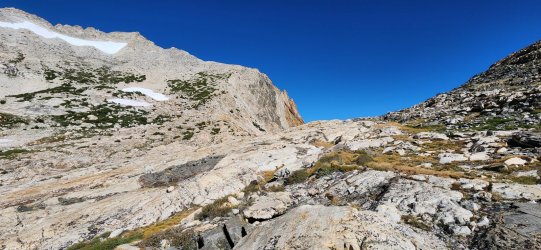
Horse Creek Pass - the final of the trip. The south side of the pass is very gentle and grassy - the north side is much rockier and had a bunch of snow (this year at least). I started picking up sections of trail once I began the descent, but it wasn't marked or heavily traveled until a couple miles down.
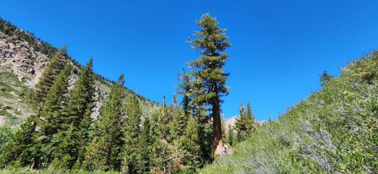
Love these trees.
Just a bonus slow-motion video of a White-Lined Sphinx Moth (also known as the Hummingbird Moth, for good reason). I saw a bunch of these in the 9k'-11k' range and really enjoyed watching them flit around.
Yet another fantastic trip. I've had great luck with weather so far this year. Can it continue for my upcoming Bob Marshall trip? To be determined...
The general idea for the route was to hit a few highlights we missed in Yosemite NP last year before heading north and completing (roughly) section 5 of Steve Roper's Sierra High Route (1982). We did Section 4 last year - you can see that trip report here. Roper's route is the original "high route" and as far as I can tell none of the others even come close to its quality. Obviously the scenery is fantastic - easy enough in the Sierra - but the routing is really fantastic. (By comparison none of the various Wind River High Routes are nearly so elegant - despite the obviously fantastic scenery.)
I've absolutely loved getting out to the Sierra more - and I hope to continue the trend. That said, it's definitely more people and less wildlife than my more regular destinations. (I did have one pretty awesome wildlife experience on this one though - read on to hear about it.)
Day 1: Dana Meadows to Upper Kuna Creek
If I'm being honest, this trip kind of snuck up on me and I wasn't really in the best "backpacking mindset". Even after landing in Bishop, meeting up w/ my hiking partner, and camping at Twin Lakes CG for a night I was still feeling a bit "meh". My first few miles of hiking involved a bit more "how many miles/days is this?" than I'm proud of. But as we were climbing up and over Kuna Crest from Helen Lake, I started remembering why I do this. And by the middle of Day 2, I was fully ready to just explore the Sierra forever.
The early sections were fairly innocuous, but the weather was fantastic. (We just missed Hurricane Hillary which had finished its downpour the day previous.)

Lots of beautiful fungi to be found - likely a combination of the extra moisture from the massive snowfall and the recent rainfall.

The meadows were all very vibrant green and large snowfields persisted above treeline. Much different than prior years and very obvious even on satellite imagery.

Even just climbing up to Helen Lake involved a decent sized snowfield.

Looking at Helen Lake and the Kuna Crest.

Climbing up the Crest.

Looking out at Mount Lyell and Mount Maclure from the top of the pass.

Camp for the evening.

The nearby water sources did not have any fish, but they were absolutely swarming with very large tadpoles. Really cool to see - I'm always fascinated by the cold-blooded vertebrates that live in the high alpine.

Another nice shot of camp.

Day 2: Upper Kuna Creek to Ireland Lake
Today would necessitate our first (and biggest) re-route due to the increased snowpack. Our original plan would have us climb up the Lyell Glacier and circle Lyell/Maclure, but with just a light ice axe and microspikes the climb up the glacier looked pretty intense at worst and potentially dangerous. With the very large sections of unmelted snowfields, hit by a few days of rain, and then a significant temperature drop, the snow/ice was pretty hard/slick even well into the afternoon. I'd love to talk to someone that climbed the glacier this year, because I was tempted to try but my hiking partner (smartly, I think) dissuaded me.
The day would be fantastic regardless - I think the route change gave us a look at some less traveled sections as well. And Ireland Lake made for an excellent evening's camp.
I stared at Lyell Glacier all morning.

Unnamed lake just below Donahue Peak - pretty cool spot, but windy.

We jumped on the JMT very briefly where it comes down from Donahue Pass before heading towards Lyell.

From here we would traverse below the Lyell and Maclure Glaciers on the northeast side instead of our original plan. It was a beautiful route - though we did want our ice axes and microspikes on a few fairly steep snowfields.

Looking down on the Lyell Fork (and the JMT).

Pretty cool unnamed lake below Simmons Peak. It seems like most years this is melted out by early July.

On our way down to Lake Ireland.

Camp for the evening. Another great spot.

Day 3: Ireland Lake to Rafferty Creek
Today was a very short day - we'd banked some time in hopes of climbing Lyell, but decided to use it sleeping in and hanging around camp. We didn't set off until almost 10a.
Relaxing in the AM doesn't come naturally to me, but it was pretty nice... maybe I'm getting old, but I think I may need to start including more of these AMs.

Had a small group of deer sneak up on my while I was filling water.

Much of today's route would be on trail - only ended up hiking for a few hours.

Evelyn Lake.

At the end of the day we cut off trail to head for Rafferty Creek - we camped just outside the Tuolumne Meadows "no camping" zone. In camp my hiking partner was nursing a bit of a knee injury - we were still optimistic at this point though.

Day 4: Rafferty Creek to Lee Vining Creek
Day 4 ended up being a bit of a mixed bag. The first section down to Tuolumne is pretty innocuous and when we arrived there my partner broke the news to me that he didn't think he was up for the remainder. We discussed some logistics and decided I would continue and meet him in a few days at Twin Lakes. The second part of the day was fantastic, though I was bummed on his behalf.
About the time I arrived at the Great Sierra Mine he contacted me and let me know he had gotten to his car quicker than expected and was gonna hike up from the Sawmill CG to meet me. I was happy to hear that - plus he brought me some Skittles and Coke Zero. Pretty nice.
(Note: those familiar w/ the area might note this is a "no camping" zone. We had permission from a leaseholder to camp on their parcel - otherwise you need to continue north past Conness Lakes for legal camping.)
On the way up to the Gaylor Lakes basin.

I really appreciated the Gaylor Lakes basin - the trail petered out shortly after this point. (No camping allowed in this basin.)

Some remnants of the Great Sierra Mine. Saw a couple groups of backpackers here - being one of the very few legal camping areas on this section I was not surprised.

There was quite a bit more snow than anticipated on the north side of the mine - necessitated the spikes and ice axe again.

Saw a pair of prints from a couple that was also doing the high route - I would finally run into them briefly on Day 5.

Not much food up here, buddy...

Spuller Lake. (I think... 95% sure that's where this is.)

Camp for the night was the worst of the trip - lots of bugs and just kind of underwhelming. But - as previously mentioned - options are very limited and I was happy to meet up w/ my hiking partner again, however briefly.

Day 5: Lee Vining Creek to Stanton Pass
At one point I'd considered climbing Mount Conness this AM, but given the snow conditions and having no partner I decided to just continue along the route. Today would end up being the "crux" of the trip - in particular Sky Pilot Col. It would also be the best day of the whole route - I absolutely loved the climb up and over Sky Pilot Col.
The beautiful weather continued. No complaints in that regard.

Conness Pass (not sure that's an official name) is a pretty unique one - it involves a pretty easy climb, but then in order to safely descend you have to climb up further on the north side and traverse to a rib that will take you down to Conness Lakes.

The very large Saddlebag Lake (reservoir) in the distance.

Sky Pilot Col is directly above the snowfield at center. I ended up staring at it for hours as I approached from Conness Pass - pretty intimidating to be honest.

Looking back down.

360° view from Sky Pilot Col. Better views on the south side, but more adventure on the north.

On my way down I saw one of the cooler backcountry wildlife interactions I've had the luck to experience. (I would kill for a video, but sadly it happened too fast.) I had spotted a pair of Golden Eagles lazily circling from the top of the pass (at the time I just knew it was a large raptor). As I got over a small boulderfield and another large snowfield came into view I spotted a marmot running across the snow - followed by chaos as he was absolutely obliterated by a diving Golden Eagle. They rolled end over end over each other and came to a rest a few yards from the initial impact. I tried to make myself inconspicuous, but after the chaos calmed the eagle spotted me and took back off. This left a badly injured (terminal) marmot right in the middle of the snowfield. I had to go by and snapped a few pictures (and even a video), but tried to move on as quickly as possible so that the eagle could return. I briefly considered putting the marmot out of its misery, but figured nature (the eagle) would take care of it if I just got out of the way.
The initial impact. (Video of the attack site here, but a little graphic and a dying marmot so viewer discretion advised.)

Long descent... almost down to Shepherd Lake.

Looking back up from my lunch spot. Ran into the couple whose tracks I'd been seeing off-and-on - they were doing the whole high route in one shot. Sounded like they'd had an awesome time, though they took a few days in Mammoth Lakes during the hurricane-related storms.

Virginia Canyon was pretty nice - I never get tired of the large trees in California. Some sections involved some bushwhacking, but once down in the trees is was very pleasant.

Looking back across Virginia Canyon as I head up towards Soldier Lake. This climb was not particularly strenuous, but I was pretty wiped so it was slow going. Beautiful views always make it easier though.

Soldier Lake. I considered stopping for the night, but I wanted to get a look at Stanton Pass so I continued another half mile or so and was rewarded with an excellent camp site.

Camp for the night and a look at Stanton Pass.

Looking down at Return Lake.

Day 6: Stanton Pass to Twin Lakes
Originally this was to be a 7 day trip, but with the snow adjustments and ending up by myself it was pretty simple to wrap it up in 6. Stanton Pass was fairly steep, but fairly short. I'd read some pretty gnarly reports of the northwest side, but it was fairly easy to descend - I think following the "correct" route is pretty important. I mostly stayed on the lower slabs on the north flank of Stanton Peak and had no issues - no worse than a soft Class 3.
Trail cam at the top of Stanton Pass.

Spiller Creek drainage.

Horse Creek Pass - the final of the trip. The south side of the pass is very gentle and grassy - the north side is much rockier and had a bunch of snow (this year at least). I started picking up sections of trail once I began the descent, but it wasn't marked or heavily traveled until a couple miles down.

Love these trees.

Just a bonus slow-motion video of a White-Lined Sphinx Moth (also known as the Hummingbird Moth, for good reason). I saw a bunch of these in the 9k'-11k' range and really enjoyed watching them flit around.
Yet another fantastic trip. I've had great luck with weather so far this year. Can it continue for my upcoming Bob Marshall trip? To be determined...
Last edited:
